From Surf Wiki (app.surf) — the open knowledge base
King's Lynn and West Norfolk
| Field | Value |
|---|---|
| name | Borough of King's Lynn and West Norfolk |
| type | Borough and non-metropolitan district |
| image_skyline | Kings Lynn (14584250917).jpg |
| imagesize | 280px |
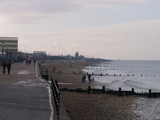
| image_caption | King's Lynn, known for both King's Lynn Minster and a statue to George Vancouver. The town is the administrative centre and largest settlement in the borough. |
| blank_emblem_type | Coat of Arms |
| image_map | King's Lynn and West Norfolk UK locator map.svg |
| map_caption | Shown within Norfolk |
| mapsize | frameless |
| subdivision_type | Sovereign state |
| subdivision_name | United Kingdom |
| subdivision_type1 | Constituent country |
| subdivision_name1 | England |
| subdivision_type2 | Region |
| subdivision_name2 | East of England |
| subdivision_type3 | Administrative county |
| subdivision_name3 | Norfolk |
| seat_type | Admin. HQ |
| seat | King's Lynn |
| government_type | Borough Council |
| leader_title2 | MPs: |
| established_title | Founded |
| area_rank | [](list-of-english-districts-by-area) |
| area_total_km2 | |
| population_as_of | |
| population_total | |
| population_rank | Ranked |
| population_density_km2 | auto |
| timezone | Greenwich Mean Time |
| utc_offset | +0 |
| timezone_DST | British Summer Time |
| utc_offset_DST | +1 |
| postal_code_type | Postcode |
| postal_code | |
| blank_name | ISO 3166-2 |
| blank_info | |
| blank1_name | ONS code |
| blank1_info | 33UE (ONS) |
| E07000146 (GSS) | |
| blank2_name | OS grid reference |
| blank2_info | |
| blank3_name | NUTS 3 |
| blank3_info | |
| demographics_type1 | Ethnicity (2021) |
| demographics1_footnotes | |
| demographics1_title1 | Ethnic groups |
| demographics_type2 | Religion (2021) |
| demographics2_footnotes | |
| demographics2_title1 | Religion |
E07000146 (GSS) | 95.6% White | 1.9% Asian | 1.3% Mixed | 0.7% other | 0.5% Black | 52.4% Christianity | 39.5% no religion | 7.6% other | 0.5% Islam King's Lynn and West Norfolk is a local government district with borough status in Norfolk, England. Its council is based in the town of King's Lynn. The district also includes the towns of Downham Market and Hunstanton, along with numerous villages and surrounding rural areas. The population of the district at the 2021 census was 154,325.
Part of the borough lies within the Norfolk Coast Area of Outstanding Natural Beauty. The borough lies on the coast, facing both The Wash to the west and the North Sea to the north. The neighbouring districts are North Norfolk, Breckland, West Suffolk, East Cambridgeshire, Fenland and South Holland.
History
The district was created on 1 April 1974 under the Local Government Act 1972, covering seven former districts which were all abolished at the same time:
- Docking Rural District
- Downham Market Urban District
- Downham Rural District
- Freebridge Lynn Rural District
- Hunstanton Urban District
- King's Lynn Municipal Borough
- Marshland Rural District The new district was initially named "West Norfolk" reflecting its position in the wider county. The district was awarded borough status on 30 January 1981, allowing the chair of the council to take the title of mayor. The name of the borough was changed later that year, becoming "King's Lynn and West Norfolk" with effect from 14 May 1981.
Governance
Independent Independent ;Administration (20) : Independent (16) : : Green (1) ;Other parties (35) : Conservative (19) : Labour (8) : Reform UK (2) :
The Borough Council of King's Lynn and West Norfolk provides district-level services. County-level services are provided by Norfolk County Council. Much of the borough is also covered by civil parishes, which form a third tier of local government.
Political control
The council has been under no overall control since the 2023 election, being run by a coalition of most of the independent councillors, the Liberal Democrats and the Greens with informal support from Labour.
The first election to the council was held in 1973, initially operating as a shadow authority alongside the outgoing authorities until the new arrangements took effect on 1 April 1974. Political control of the council since 1974 has been as follows:
| Party in control | Years |
|---|---|
| 1974–1976 | |
| 1976–1991 | |
| 1991–1995 | |
| 1995–1999 | |
| 1999–2003 | |
| 2003–2023 | |
| 2023–present |
Leadership
The role of mayor is largely ceremonial in King's Lynn and West Norfolk, with political leadership instead provided by the leader of the council. The leaders since 2007 have been:
| Councillor | Party | From | To |
|---|---|---|---|
| Nick Daubney | 2007 | 12 May 2016 | |
| Brian Long | 12 May 2016 | 20 May 2021 | |
| Stuart Dark | 20 May 2021 | May 2023 | |
| Terry Parish | 18 May 2023 | May 2024 | |
| Alistair Beale | 16 May 2024 |
Composition
Following the 2023 election, and subsequent by-elections and changes of allegiance up to May 2025, the composition of the council was:
| Party | Councillors | Total | 55 |
|---|---|---|---|
| 19 | |||
| 8 | |||
| 3 | |||
| 2 | |||
| 1 | |||
| 22 |
Of the 22 independent councillors, 16 sit together as the 'Independent Partnership', which forms the council's administration with the Liberal Democrats and Green Party. Another two form the 'Progressive Group', and the other four do not belong to a group. The next election is due in 2027.
Elections
Since the last boundary changes in 2019 the council has comprised 55 councillors representing 35 wards, with each ward electing one, two or three councillors. Elections are held every four years.
;UK Youth Parliament
Although the UK Youth Parliament is an apolitical organisation, the elections are run in a way similar to that of the Local Elections. The votes come from 11 to 18 year olds and are combined to make the decision of the next, 2 year Member of Youth Parliament. The elections are run at different times across the country with King's Lynn and West Norfolk's typically being in early Spring and bi-annually.
Premises
The council generally meets at the Town Hall on the Saturday Market Place in King's Lynn, parts of which date back to the 1420s, having replaced an earlier guildhall on the site which burnt down in 1421. The council's main offices are at King's Court, on Chapel Street in King's Lynn, which had been built as speculative offices in 1975, initially being called Aspen House. The council bought the building in 1981.
Geography
The district comprises the urban area of King's Lynn itself, together with 102 surrounding parishes. At the time of the 2001 census, the district had an area of 1,473 km2, of which 28 km2 was in the urban area and 1,445 km2 in the surrounding parishes. The district had a population of 135,345 in 58,338 households, with 34,564 in 15,285 households living in the urban area, whilst 100,781 people in 43,053 households lived in the surrounding parishes.
Towns and parishes
The main part of the urban area of King's Lynn (roughly corresponding to the pre-1974 borough of King's Lynn) is an unparished area.
- Anmer
- Bagthorpe with Barmer
- Barton Bendish
- Barwick
- Bawsey
- Bircham
- Boughton
- Brancaster
- Burnham Market
- Burnham Norton
- Burnham Overy
- Burnham Thorpe
- Castle Acre
- Castle Rising
- Choseley
- Clenchwarton
- Congham
- Crimplesham
- Denver
- Dersingham
- Docking
- Downham Market
- Downham West
- East Rudham
- East Walton
- East Winch
- Emneth
- Feltwell
- Fincham
- Flitcham with Appleton
- Fordham
- Fring
- Gayton
- Great Massingham
- Grimston
- Harpley
- Heacham
- Hilgay
- Hillington
- Hockwold cum Wilton
- Holme next the Sea
- Houghton
- Hunstanton
- Ingoldisthorpe
- Leziate
- Little Massingham
- Marham
- Marshland St. James
- Methwold
- Middleton
- Nordelph
- North Creake
- North Runcton
- Northwold
- North Wootton
- Old Hunstanton
- Outwell
- Pentney
- Ringstead
- Roydon
- Runcton Holme
- Ryston
- Sandringham
- Sedgeford
- Shernborne
- Shouldham
- Shouldham Thorpe
- Snettisham
- South Creake
- Southery
- South Wootton
- Stanhoe
- Stoke Ferry
- Stow Bardolph
- Stradsett
- Syderstone
- Terrington St. Clement
- Terrington St. John
- Thornham
- Tilney All Saints
- Tilney St. Lawrence
- Titchwell
- Tottenhill
- Upwell
- Walpole
- Walpole Cross Keys
- Walpole Highway
- Walsoken
- Watlington
- Welney
- Wereham
- West Acre
- West Dereham
- West Rudham
- West Walton
- West Winch
- Wiggenhall St. Germans
- Wiggenhall St. Mary Magdalen
- Wimbotsham
- Wormegay
- Wretton
Arms
References
References
- "King's Lynn and West Norfolk Local Authority".
- (2022-06-28). "How the population changed in King's Lynn and West Norfolk: Census 2021". Office for National Statistics.
- {{cite legislation UK. (1972)
- {{cite legislation UK. (1973)
- (1982). "Alteration of Areas and Status of Local Authorities 1980–1982". Department of the Environment.
- "Council minutes, 15 May 2025".
- "Chief Executive".
- {{cite legislation UK. (1972)
- "Election Maps". Ordnance Survey.
- (19 May 2023). "Independent councillor Terry Parish named new leader of West Norfolk Council at 2023 annual meeting". Lynn News.
- "Compositions Calculator". University of Exeter.
- "King's Lynn & West Norfolk". [[BBC News Online]].
- (11 May 2018). "Former council leader becomes new mayor of West Norfolk". Eastern Daily Press.
- "Council minutes, 12 May 2016".
- (11 May 2021). "New leader for West Norfolk council". Eastern Daily Press.
- "Council minutes, 20 May 2021".
- (5 May 2023). "Local elections 2023: Future of the leadership of West Norfolk Council is up in the air". Lynn News.
- "Council minutes, 18 May 2023".
- (26 May 2024). "Norfolk's 'most cantankerous' council gets new leader". Eastern Daily Press.
- "Council minutes, 16 May 2024".
- "Local elections 2023: live council results for England". The Guardian.
- "King's Lynn and West Norfolk". Thorncliffe.
- "Your councillors by party".
- {{cite legislation UK. (2018)
- {{NHLE
- McAvoy, Liz Herbert. (2003). "The Book of Margery Kempe". D.S.Brewer.
- (11 February 1975). "Topping-out for Lynn office block". Lynn News and Advertiser.
- (21 August 1981). "Council moves to £¾m new hq". Lynn News and Advertiser.
- Office for National Statistics & Norfolk County Council (2001). ''[http://www.norfolk.gov.uk/consumption/groups/public/documents/general_resources/ncc017867.xls Census population and household counts for unparished urban areas and all parishes] {{webarchive. link. (2017-02-11 ''. Retrieved December 2, 2005.)
- "Parish council contact details".
- "East of England Region". Civic Heraldry of England.
This article was imported from Wikipedia and is available under the Creative Commons Attribution-ShareAlike 4.0 License. Content has been adapted to SurfDoc format. Original contributors can be found on the article history page.
Ask Mako anything about King's Lynn and West Norfolk — get instant answers, deeper analysis, and related topics.
Research with MakoFree with your Surf account
Create a free account to save articles, ask Mako questions, and organize your research.
Sign up freeThis content may have been generated or modified by AI. CloudSurf Software LLC is not responsible for the accuracy, completeness, or reliability of AI-generated content. Always verify important information from primary sources.
Report