From Surf Wiki (app.surf) — the open knowledge base
Keyhaven
Hamlet in Hampshire, England
Hamlet in Hampshire, England
| Field | Value |
|---|---|
| country | England |
| coordinates | |
| official_name | Keyhaven |
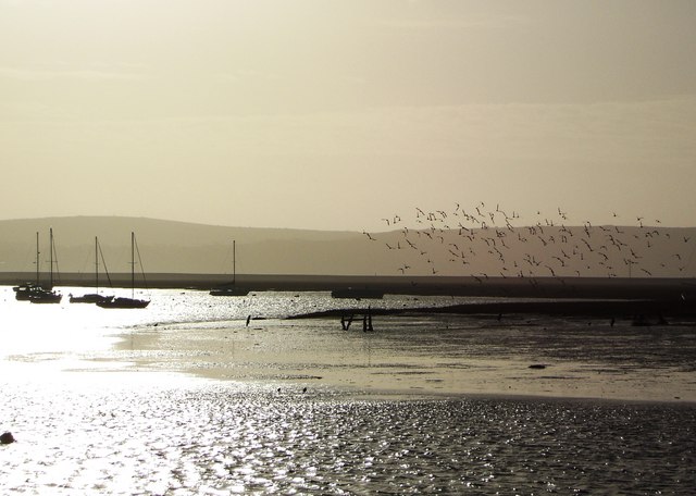
| static_image_name | Keyhaven harbour.jpg |
| static_image_caption | Keyhaven harbour |
| shire_district | New Forest |
| shire_county | Hampshire |
| region | South East England |
| constituency_westminster | New Forest West |
| post_town | LYMINGTON |
| postcode_district | SO41 |
| postcode_area | SO |
| dial_code | 01590 |
| os_grid_reference | SZ3049091559 |
Keyhaven is a hamlet on the south coast of England in the county of Hampshire. It is a fishing village, but the trade has been in decline for a period of years and its main draw now is tourism, especially sailing.
Overview
Keyhaven lies in the district of the New Forest and is just within the borders of the New Forest National Park. It is in the civil parish of Milford-on-Sea, and it lies at one end of the shingle bank known as Hurst Spit which leads to Hurst Castle. Keyhaven draws visitors through its outstanding natural beauty, from the views over the Solent to the abundance of open farm land. To the east of Keyhaven lies the nature reserve of Keyhaven marshes.
History
The name "Keyhaven" means ‘Harbour where cows are shipped’; OE cū (genitive cȳ) + hæfen. Cattle and sheep were transported from the Isle of Wight to the water meadows of the Avon around Christchurch.
Keyhaven was a port as early as 1206. There seem to have been two manorial estates here, one held by Bath Abbey, and the other by the Bishop of Salisbury. The lands of Bath Abbey were held by them until the time of the Dissolution, but in the 17th century it seems that the two manors were merged, and in 1802 the estate was purchased by Sir John D'Oyly. He subsequently sold it and by the 19th century it had passed, like other lands in the area, to William Cornwallis-West.
Like the rest of the West Solent area, a considerable salt industry developed soon after the Conquest. This had disappeared by 1400 but was revived in the 17th century with the introduction of new techniques.
| use_new_UK-LEG = | UK-LEG_title = In the 1930s a proposal was made to run a car ferry between Keyhaven and Fort Victoria on the Isle of Wight.
In 1976 there was a fire on the marshes to east of the Keyhaven River. The fire nearly destroyed two bungalows on the marshes, but was held back by the efforts of locals and the Lymington fire brigade.
Notes
References
- Mills, D.. (2003). "A Dictionary of British Place-Names". Oxford University Press.
- (1912). "A History of the County of Hampshire". Victoria County History.
- Greenwood, J.. (2010). "Post Medieval Salt Production in Southeast Hampshire".
- Easdown, Martin. (2011). "Piers Of Hampshire & The Isle Of Wight". Amberley.
This article was imported from Wikipedia and is available under the Creative Commons Attribution-ShareAlike 4.0 License. Content has been adapted to SurfDoc format. Original contributors can be found on the article history page.
Ask Mako anything about Keyhaven — get instant answers, deeper analysis, and related topics.
Research with MakoFree with your Surf account
Create a free account to save articles, ask Mako questions, and organize your research.
Sign up freeThis content may have been generated or modified by AI. CloudSurf Software LLC is not responsible for the accuracy, completeness, or reliability of AI-generated content. Always verify important information from primary sources.
Report