From Surf Wiki (app.surf) — the open knowledge base
Kentfield, California
Community in California, US
Community in California, US
| Field | Value |
|---|---|
| official_name | Kentfield, California |
| settlement_type | Unincorporated community |
| Census-designated place | |
| image_map | Marin_County_California_Incorporated_and_Unincorporated_areas_Kentfield_Highlighted.svg |
| mapsize | 250x200px |
| map_caption | Location in Marin County and the state of California |
| pushpin_map | USA |
| pushpin_map_caption | Location in the United States |
| coordinates | |
| subdivision_type | Country |
| subdivision_name | United States |
| subdivision_type1 | State |
| subdivision_name1 | California |
| subdivision_type2 | County |
| subdivision_name2 | Marin |
| leader_title | County Board |
| leader_name | District 2 |
| Brian Colbert | |
| leader_title1 | Senate |
| leader_name1 | Mike McGuire (D) |
| leader_title2 | Assembly |
| leader_name2 | |
| leader_title3 | U. S. Congress |
| leader_name3 | |
| unit_pref | US |
| area_footnotes | |
| area_total_sq_mi | 3.046 |
| area_land_sq_mi | 3.027 |
| area_water_sq_mi | 0.019 |
| area_water_percent | 0.62 |
| elevation_footnotes | |
| elevation_m | 35 |
| elevation_ft | 115 |
| population_footnotes | |
| population_total | 6808 |
| population_as_of | 2020 |
| population_density_sq_mi | 2249.1 |
| timezone | PST |
| utc_offset | −8 |
| timezone_DST | PDT |
| utc_offset_DST | −7 |
| postal_code_type | ZIP codes |
| postal_code | 94904, 94914 (PO boxes) |
| area_code_type | Area codes |
| area_code | 415/628 |
| blank_name | FIPS code |
| blank_info | 06-38114 |
| blank1_name | GNIS feature ID |
| blank1_info | 1658892 |
Census-designated place Brian Colbert Kentfield (formerly Ross Landing, Tamalpais, and Kent) at an elevation of 115 feet (35 m). For statistical purposes, the United States Census Bureau has defined Kentfield as a census-designated place (CDP). The population was 6,808 at the 2020 census. The ZIP codes are 94904 for street addresses, and 94914 for PO boxes, and are shared with the neighboring community of Greenbrae.
History
In 1857, James Ross (1812–1862) bought Rancho Punta de Quentin. Ross, a Scot who had arrived in San Francisco from Australia in 1848 and made his fortune in the wholesale liquor business, set up a trading post called "Ross Landing". Steamers would come up Corte Madera Creek to the landing there. Kent built an estate called Tamalpais, later applied to the nearby railroad station. His son, William Kent, was a US Congressman, philanthropist and founder of Muir Woods.
The name of the railroad station was changed to Kent in the 1890s, and finally to Kentfield with the opening of the first post office in 1905.
Geography
Kentfield is located on the eastern slopes of Mount Tamalpais. It is at It is bordered to the north by Ross, to the northeast by San Rafael, and to the south by Larkspur.
According to the United States Census Bureau, the CDP has a total area of 3.0 sqmi, of which 0.02 sqmi, or 0.62%, are water.
Climate
The National Weather Service reports that Kentfield's warmest month is July, with an average high of 82.7 F and an average low of 53.0 F. December is the coolest month, with an average high of 54.8 F and an average low of 41.3 F. The highest temperature on record was 112 F on July 11, 1913. The lowest temperature recorded was 17 F on December 31, 1915. Annually, there are an average of 19.6 days with highs of 90 °F or higher and 1.3 days with highs of 100 °F or more. Freezing temperatures (32 °F or below) occur an average of 3.8 days each year.
Kentfield has one of the highest average rainfall totals of any community in the San Francisco Bay Area; normally 47.98 in of rain falls each year on an average of 68.9 days. The most rainfall in a month was 26.95 in in February 1986 and the most in 24 hours was 11.56 in on January 21, 1967. Although heavy snow sometimes falls on nearby Mount Tamalpais, snow is rare in Kentfield; however, trace amounts were reported on January 28 and December 13, 1972.
| Jan record high F = 79 | Feb record high F = 84 | Mar record high F = 91 | Apr record high F = 97 | May record high F = 102 | Jun record high F = 110 | Jul record high F = 112 | Aug record high F = 106 | Sep record high F = 110 | Oct record high F = 101 | Nov record high F = 89 | Dec record high F = 79 | Jan avg record high F = 66.3 | Feb avg record high F = 72.0 | Mar avg record high F = 77.6 | Apr avg record high F = 85.3 | May avg record high F = 90.3 | Jun avg record high F = 97.8 | Jul avg record high F = 97.5 | Aug avg record high F = 98.0 | Sep avg record high F = 97.3 | Oct avg record high F = 90.2 | Nov avg record high F = 75.8 | Dec avg record high F = 65.3 | year avg record high F = 102.2 | Jan avg record low F = 32.2 | Feb avg record low F = 33.8 | Mar avg record low F = 36.1 | Apr avg record low F = 38.5 | May avg record low F = 43.4 | Jun avg record low F = 46.5 | Jul avg record low F = 48.5 | Aug avg record low F = 48.7 | Sep avg record low F = 46.6 | Oct avg record low F = 41.9 | Nov avg record low F = 35.3 | Dec avg record low F = 31.7 | year avg record low F = 29.9 | Jan record low F = 18 | Feb record low F = 21 | Mar record low F = 24 | Apr record low F = 29 | May record low F = 33 | Jun record low F = 37 | Jul record low F = 37 | Aug record low F = 37 | Sep record low F = 34 | Oct record low F = 28 | Nov record low F = 25 | Dec record low F = 17
Demographics
2020
The 2020 United States census reported that Kentfield had a population of 6,808. The population density was 2,249.1 PD/sqmi. The racial makeup of Kentfield was 82.7% White, 0.6% African American, 0.2% Native American, 4.7% Asian, 0.1% Pacific Islander, 2.2% from other races, and 9.7% from two or more races. Hispanic or Latino of any race were 6.7% of the population.
The census reported that 99.7% of the population lived in households, 18 people (0.3%) lived in non-institutionalized group quarters, and 2 people (0.0%) were institutionalized.
There were 2,540 households, out of which 36.5% included children under the age of 18, 62.4% were married-couple households, 4.1% were cohabiting couple households, 21.5% had a female householder with no partner present, and 11.9% had a male householder with no partner present. 21.2% of households were one person, and 11.8% were one person aged 65 or older. The average household size was 2.67.
The age distribution was 25.6% under the age of 18, 6.6% aged 18 to 24, 15.5% aged 25 to 44, 30.7% aged 45 to 64, and 21.7% who were 65years of age or older. The median age was 46.5years. For every 100 females, there were 92.9 males.
There were 2,674 housing units at an average density of 883.4 /mi2, of which 2,540 (95.0%) were occupied. Of these, 75.6% were owner-occupied, and 24.4% were occupied by renters.
In 2023, the US Census Bureau estimated that 13.1% of the population were foreign-born. Of all people aged 5 or older, 85.6% spoke only English at home, 5.6% spoke Spanish, 5.1% spoke other Indo-European languages, 3.0% spoke Asian or Pacific Islander languages, and 0.7% spoke other languages. Of those aged 25 or older, 99.0% were high school graduates and 77.2% had a bachelor's degree.
The median household income in 2023 was $231,875, and the per capita income was $136,840. About 1.9% of families and 3.7% of the population were below the poverty line.
2010
The 2010 United States census reported that Kentfield had a population of 6,485. The population density was 2,132.6 PD/sqmi. The racial makeup of Kentfield was 5,908 (91.1%) White, 35 (0.5%) African American, 10 (0.2%) Native American, 224 (3.5%) Asian, 7 (0.1%) Pacific Islander, 95 (1.5%) from other races, and 206 (3.2%) from two or more races. Hispanic or Latino of any race were 299 persons (4.6%).
The Census reported that 6,463 people (99.7% of the population) lived in households, 13 (0.2%) lived in non-institutionalized group quarters, and 9 (0.1%) were institutionalized.
There were 2,572 households, out of which 893 (34.7%) had children under the age of 18 living in them, 1,562 (60.7%) were opposite-sex married couples living together, 200 (7.8%) had a female householder with no husband present, 78 (3.0%) had a male householder with no wife present. There were 83 (3.2%) unmarried opposite-sex partnerships, and 25 (1.0%) same-sex married couples or partnerships. 600 households (23.3%) were made up of individuals, and 285 (11.1%) had someone living alone who was 65 years of age or older. The average household size was 2.51. There were 1,840 families (71.5% of all households); the average family size was 2.97.
The population was spread out, with 1,660 people (25.6%) under the age of 18, 265 people (4.1%) aged 18 to 24, 1,092 people (16.8%) aged 25 to 44, 2,206 people (34.0%) aged 45 to 64, and 1,262 people (19.5%) who were 65 years of age or older. The median age was 47.0 years. For every 100 females, there were 91.1 males. For every 100 females age 18 and over, there were 86.0 males.
There were 2,758 housing units at an average density of 907.0 /sqmi, of which 1,948 (75.7%) were owner-occupied, and 624 (24.3%) were occupied by renters. The homeowner vacancy rate was 0.8%; the rental vacancy rate was 8.1%. 5,202 people (80.2% of the population) lived in owner-occupied housing units and 1,261 people (19.4%) lived in rental housing units.
Educational institutions
Most of Kentfield is in the Kentfield Elementary School District, while portions are in the Larkspur Elementary School District and the Ross Elementary School District. All of Kentfield is in the Tamalpais Union High School District.
Anthony G. Bacich Elementary School
A.G. Bacich Elementary School is a California Distinguished School that hosts grades TK-4. During the 2009–2010 school year, Bacich Elementary School served approximately 600 children. The school is racially homogeneous, with 91% white. The next largest ethnicity is Asian, at 5%. As of 2010, there were 41 teachers. As of 2009, Bacich has an Academic Performance Index of 946 out of 1000, putting it in the top ranking in the state of California.
Adeline E. Kent Middle School
Adeline E. Kent Middle School is a co-ed California Distinguished School and a California Gold Ribbon School that hosts grades 5–8. As of 2014 it enrolled 522 students. The school is racially homogeneous, with over 90% white. The next largest ethnicity is Asian, at 3%. The school consists of 38 classrooms, as well as a multipurpose room, a gym, and a library. As of 2003, there were 32 teachers. As of 2009, Kent has an Academic Performance Index of 944 out of 1000, putting it in the top ranking in the state of California.
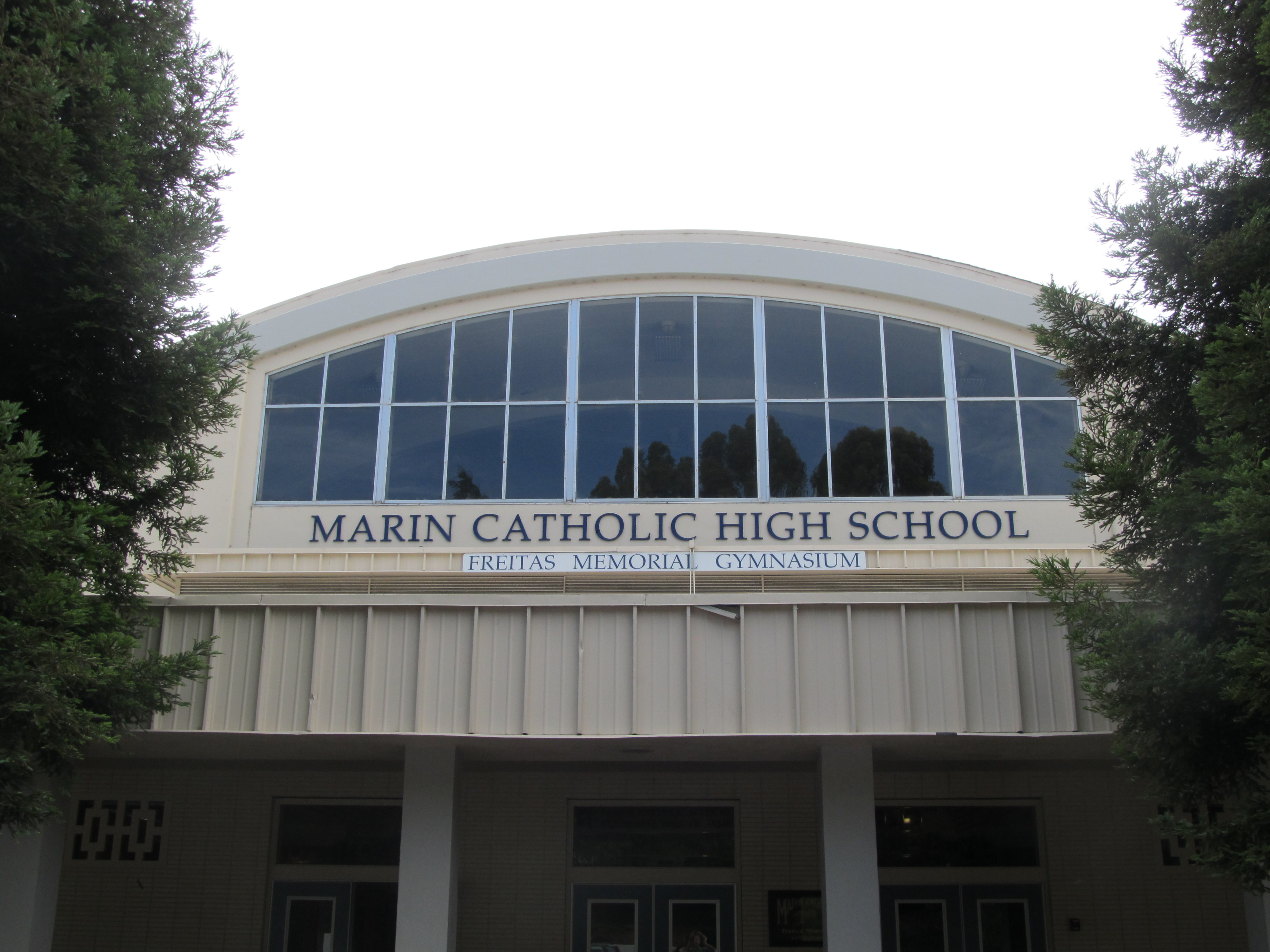
Marin Catholic High School
Marin Catholic High School, a Roman Catholic college preparatory, serves young boys and girls in the Catholic tradition. The student population currently numbers around 725. The school is owned by the Archdiocese of San Francisco.
College of Marin

The main campus for the College of Marin is in Kentfield, and is across the street from Kent Middle School. College of Marin is well known for its theatre department, with the highest transfer acceptance to Juilliard of any junior college in the state.
Notable people
- Frederic Lister Burk, educator and university president, lived many years in Kentfield.
- Jared Goff, NFL quarterback for the Detroit Lions and the Los Angeles Rams, attended Marin Catholic High School.
- Charles S. Kilburn, U.S. Army brigadier general
- Brian McCall, outfielder for Chicago White Sox
- Gavin Newsom, 42nd mayor of San Francisco and 40th governor of California
References
References
- "District 2". Marin County, CA.
- {{Cite GovTrack. CA. 2
- "2021 U.S. Gazetteer Files: California". United States Census Bureau.
- {{gnis. 1658892
- "P1. Race – Kentfield CDP, California: 2020 DEC Redistricting Data (PL 94-171)". U.S. Census Bureau.
- is an [[Unincorporated area#United States. unincorporated community]] in [[Marin County, California]], United States, just north of [[San Francisco]]. Kentfield is located {{convert. 2. mi. 0 southwest of downtown [[San Rafael, California. 648
- "NOWData – NOAA Online Weather Data". National Weather Service, San Francisco Bay Area/Monterey.
- "Summary of Monthly Normals 1991–2020". National Oceanic and Atmospheric Administration.
- "Kentfield CDP, California; DP1: Profile of General Population and Housing Characteristics - 2020 Census of Population and Housing".
- "Kentfield CDP, California; P16: Household Type - 2020 Census of Population and Housing".
- "Kentfield CDP, California; CP02: Comparative Social Characteristics in the United States - 2023 ACS 5-Year Estimates Comparison Profiles".
- "Kentfield CDP, California; DP03: Selected Economic Characteristics - 2023 ACS 5-Year Estimates Comparison Profiles".
- "2010 Census Interactive Population Search: CA - Kentfield CDP". U.S. Census Bureau.
- "2020 CENSUS - SCHOOL DISTRICT REFERENCE MAP: Marin County, CA". [[U.S. Census Bureau]].
- (February 1, 2019). "Jared Goff remains close friends with Marin Catholic High School teammates".
- (May 22, 1957). "700 Volunteers Ask Fund For Salvation Army". [[San Rafael Independent-Journal]].
This article was imported from Wikipedia and is available under the Creative Commons Attribution-ShareAlike 4.0 License. Content has been adapted to SurfDoc format. Original contributors can be found on the article history page.
Ask Mako anything about Kentfield, California — get instant answers, deeper analysis, and related topics.
Research with MakoFree with your Surf account
Create a free account to save articles, ask Mako questions, and organize your research.
Sign up freeThis content may have been generated or modified by AI. CloudSurf Software LLC is not responsible for the accuracy, completeness, or reliability of AI-generated content. Always verify important information from primary sources.
Report