From Surf Wiki (app.surf) — the open knowledge base
Kent County, Texas
County in Texas, United States
County in Texas, United States
| Field | Value |
|---|---|
| county | Kent County |
| state | Texas |
| founded | 1892 |
| seat wl | Jayton |
| largest city wl | Jayton |
| area_total_sq_mi | 903 |
| area_land_sq_mi | 903 |
| area_water_sq_mi | 0.4 |
| area percentage | 0.05 |
| population_as_of | 2020 |
| population_total | 753 |
| pop_est_as_of | 2024 |
| population_est | 703 |
| density_sq_mi | auto |
| web | www.co.kent.tx.us |
| named for | Andrew Kent |
| ex image | Kent County Courthouse September 2020.jpg |
| ex image size | 250 |
| ex image cap | Kent County Courthouse in Jayton |
| time zone | Central |
| district | 19th |
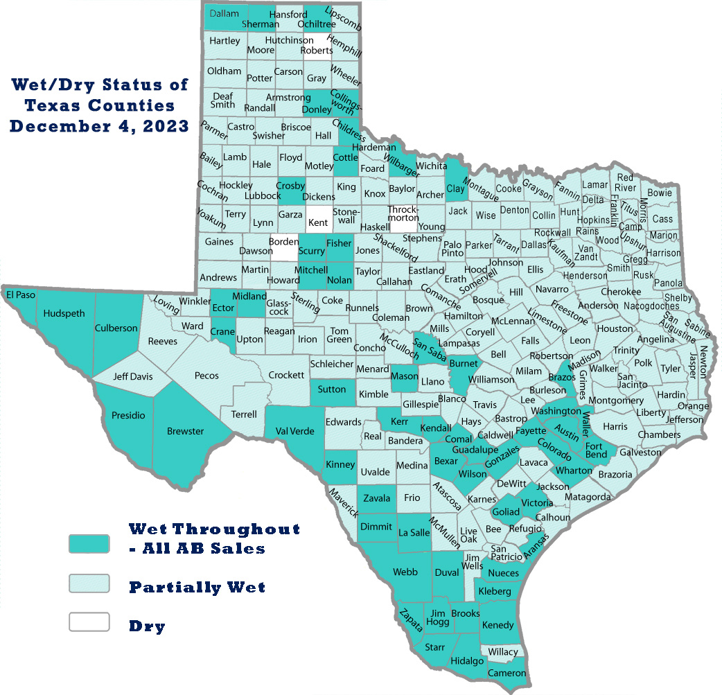
Kent County is a county located in the U.S. state of Texas. As of the 2020 census, its population was 753, making it the sixth-least populous county in Texas. Its county seat is Jayton. The county was created in 1876 and later organized in 1892. It is named for Andrew Kent, who died at the Battle of the Alamo. Kent County is a prohibition or entirely dry county, one of three remaining in the state.
History timeline
- 8000 BC Paleo-Indians were the first inhabitants. Later Native American inhabitants included the Wanderers band of Comanche.
- 1872 Ranald S. Mackenzie and his soldiers trounced the Comanches at Treasure Butte, southeast of Clairemont.
- 1876 The Texas legislature formed Kent County from Young and Bexar districts. The new county is named after Alamo defender Andrew Kent.
- 1888 Cattleman R. L. Rhomberg settled in the new county and named a settlement Clairemont for his daughter, Claire.
- 1890 The county census recorded 324 residents.
- 1891 A conflict arose between cattle ranchers and farmers who tried to fence their farms against cattle.
- 1892 Kent County was organized, with Clairemont as the county seat.
- 1900 The county population was 899.
- 1909 The Stamford and Northeastern Railway built a line across the county's northeast corner. The railroad, which connected Stamford and Spur, later became part of the Wichita Valley Railroad. The Jayton community was founded.
- 1930 The county's population peaked at 3,851.
- 1946-1991 Oil was discovered in Kent County in 1946. From 1946 to 1991, more than 448448000 oilbbl of oil have been produced in the county.
Geography
According to the United States Census Bureau, the county has a total area of 903 sqmi, of which 0.4 sqmi (0.05%) is covered by water.
Major highways
- [[Image:US 380.svg|25px]] U.S. Highway 380
- [[Image:Texas 70.svg|20px]] State Highway 70
- [[Image:Texas 208.svg|20px]] State Highway 208
Adjacent counties
- Dickens County (north)
- Stonewall County (east)
- Fisher County (southeast)
- Scurry County (south)
- Garza County (west)
- King County (northeast)
- Crosby County (northwest)
Demographics
|align-fn=center 1850–2010 2010-2020
Racial and ethnic composition
| Race / Ethnicity (NH = Non-Hispanic) | title=P004: Hispanic or Latino, and Not Hispanic or Latino by Race – 2000: DEC Summary File 1 – Kent County, Texas | url=https://data.census.gov/table?g=0500000US48263&tid=DECENNIALSF12000.P004 | website=United States Census Bureau | access-date= }} | title=P2 Hispanic or Latino, and Not Hispanic or Latino by Race – 2010: DEC Redistricting Data (PL 94-171) – Kent County, Texas | url=https://data.census.gov/cedsci/table?q=p2&g=0500000US48263&tid=DECENNIALPL2010.P2 | website=United States Census Bureau}} | % 2000 | % 2010 |
|---|---|---|---|---|---|---|---|---|---|
| White alone (NH) | 777 | 669 | 657 | 90.45% | |||||
| Black or African American alone (NH) | 2 | 6 | 2 | 0.23% | |||||
| Native American or Alaska Native alone (NH) | 1 | 5 | 3 | 0.12% | |||||
| Asian alone (NH) | 0 | 0 | 0 | 0.00% | |||||
| Pacific Islander alone (NH) | 0 | 0 | 0 | 0.00% | |||||
| Other race alone (NH) | 0 | 0 | 3 | 0.00% | |||||
| Mixed or multiracial (NH) | 1 | 8 | 7 | 0.12% | |||||
| Hispanic or Latino (any race) | 78 | 120 | 81 | 9.08% | |||||
| Total | 859 | 808 | 753 | 100.00% |
2020 census
As of the 2020 census, the county had a population of 753. The median age was 52.8 years; 19.3% of residents were under the age of 18 and 31.6% of residents were 65 years of age or older. For every 100 females there were 96.6 males, and for every 100 females age 18 and over there were 93.0 males age 18 and over.
The racial makeup of the county was 89.8% White, 0.3% Black or African American, 0.8% American Indian and Alaska Native, 0.1% Asian,
There were 312 households in the county, of which 31.7% had children under the age of 18 living in them. Of all households, 50.6% were married-couple households, 19.2% were households with a male householder and no spouse or partner present, and 27.9% were households with a female householder and no spouse or partner present. About 28.5% of all households were made up of individuals and 16.0% had someone living alone who was 65 years of age or older.
There were 522 housing units, of which 40.2% were vacant. Among occupied housing units, 80.4% were owner-occupied and 19.6% were renter-occupied. The homeowner vacancy rate was 1.2% and the rental vacancy rate was 12.9%.
2000 census
As of the 2000 census, 859 people, 353 households, and 247 families resided in the county. The population density was less than 1 /km2. The 551 housing units averaged about 0.6 /mi2. The racial makeup of the county was 95.46% White, 0.23% Black or African American, 0.35% Native American, 3.73% from other races, and 0.23% from two or more races. About 9% of the population were Hispanic or Latino of any race.
Of the 353 households, 26.1% had children under 18 living with them, 61.2% were married couples living together, 5.9% had a female householder with no husband present, and 30.0% were not families. About 28.0% of all households were made up of individuals, and 14.2% had someone living alone who was 65 or older. The average household size was 2.33 and the average family size was 2.83.
In the county, the population was distributed as 20.6% under 18, 5.4% from 18 to 24, 21.8% from 25 to 44, 26.8% from 45 to 64, and 25.5% who were 65 or older. The median age was 47 years. For every 100 females, there were 91.7 males. For every 100 females 18 and over, there were 91.6 males.
The median income for a household in the county was $30,433, and for a family was $35,568. Males had a median income of $23,875 versus $20,000 for females. The per capita income for the county was $17,626. About 9.20% of families and 10.40% of the population were below the poverty line, including 13.10% of those under age 18 and 6.10% of those age 65 or over.
Communities
City
- Jayton (county seat)
Other communities
- Clairemont (ghost town)
- Girard (census-designated place)
Politics
In the 2024 Texas Republican presidential primary, Kent County was the only county in Texas that Donald Trump lost.
Throughout the 20th century, Kent County was a reliably Democratic county, having only voted for a Republican three times from 1912 until 2000. Kent County has realigned into a Republican stronghold since George W. Bush won the county in 2000. As of 2024, Kent County has not selected a Democrat in a presidential election since 1996, when then Democratic incumbent Bill Clinton won it.
Education
School districts include:
- Jayton-Girard Independent School District
- Post Independent School District
- Rotan Independent School District
- Snyder Independent School District
- Spur Independent School District
The Texas Legislature designated the county as being in the Western Texas College district.
References
References
- "State & County QuickFacts". United States Census Bureau.
- "Find a County". National Association of Counties.
- (2008). "Texas: Individual County Chronologies". [[Newberry Library.
- "Texas counties wet/dry status as of May 2020".
- (June 1, 2023). "We/Dry Status of Texas Counties".
- Hunt, William R. (June 15, 2010). "Kent County, Texas". Texas State Historical Association.
- Davis, Charles G. (June 12, 2010). "Clairmont". Texas State Historical Association.
- "Clairemont, Texas". Texas Escapes - Blueprints For Travel, LLC.
- Davis, Charles G. (June 15, 2010). "Jayton, Texas". Texas State Historical Association.
- (August 22, 2012). "2010 Census Gazetteer Files". United States Census Bureau.
- "U.S. Decennial Census". United States Census Bureau.
- "Texas Almanac: Population History of Counties from 1850–2010". Texas Almanac.
- "P004: Hispanic or Latino, and Not Hispanic or Latino by Race – 2000: DEC Summary File 1 – Kent County, Texas".
- "P2 Hispanic or Latino, and Not Hispanic or Latino by Race – 2010: DEC Redistricting Data (PL 94-171) – Kent County, Texas".
- "P2 Hispanic or Latino, and Not Hispanic or Latino by Race – 2020: DEC Redistricting Data (PL 94-171) – Kent County, Texas".
- (2021). "2020 Decennial Census Demographic Profile (DP1)".
- (2021). "2020 Decennial Census Redistricting Data (Public Law 94-171)".
- (2023). "2020 Decennial Census Demographic and Housing Characteristics (DHC)".
- "U.S. Census website". [[United States Census Bureau]].
- Leip, David. "Dave Leip's Atlas of U.S. Presidential Elections".
- (November 5, 2024). "2024 Senate Election (Official Returns)".
- "2020 CENSUS - SCHOOL DISTRICT REFERENCE MAP: Kent County, TX". [[U.S. Census Bureau]].
- "Sec. 130.210. WESTERN TEXAS COLLEGE DISTRICT SERVICE AREA.".
This article was imported from Wikipedia and is available under the Creative Commons Attribution-ShareAlike 4.0 License. Content has been adapted to SurfDoc format. Original contributors can be found on the article history page.
Ask Mako anything about Kent County, Texas — get instant answers, deeper analysis, and related topics.
Research with MakoFree with your Surf account
Create a free account to save articles, ask Mako questions, and organize your research.
Sign up freeThis content may have been generated or modified by AI. CloudSurf Software LLC is not responsible for the accuracy, completeness, or reliability of AI-generated content. Always verify important information from primary sources.
Report