From Surf Wiki (app.surf) — the open knowledge base
Kent County, Delaware
County in Delaware, United States

County in Delaware, United States
| Field | Value |
|---|---|
| county | Kent County |
| state | Delaware |
| type | County of Delaware |
| flag | Flag of Kent County, Delaware.svg |
| flag size | 110 |
| seal | Seal of Kent County, Delaware.jpg |
| seal size | 90 |
| founded year | 1683 |
| founded date | August 8 |
| seat wl | Dover |
| largest city wl | Dover |
| area_total_sq_mi | 798 |
| area_land_sq_mi | 586 |
| area_water_sq_mi | 212 |
| area percentage | 26.6% |
| population_total | 181851 |
| pop_est_as_of | 2024 |
| pop_est_footnotes | |
| population_est | 192690 |
| density_sq_mi | 310.33 |
| web | https://www.kentcountyde.gov |
| district | At-large |
| time zone | Eastern |
| ex image | Kent County Courthouse Dover.jpg |
| ex image cap | The Kent County Courthouse in Dover in 2006 |
| named for | Kent, England |
| census yr | 2020 |
Kent County is a county located in the central part of the U.S. state of Delaware. As of the 2020 census, the population was 181,851, making it the least populous county in Delaware, but the most populous county in the United States to be the least populous in its state. The county seat is Dover, the state capital of Delaware. It is named for Kent, an English county.
Kent County comprises the Dover metropolitan area, which is included in the Philadelphia-Reading-Camden, PA-NJ-DE-MD combined statistical area.
History
In about 1670 the English began to settle in the valley of the St. Jones River, earlier known as Wolf Creek. On June 21, 1680, the Duke of York chartered St. Jones County, which was carved out of New Amstel/New Castle and Hoarkill/Sussex counties. St. Jones County was transferred to William Penn on August 24, 1682, and became part of Penn's newly chartered Delaware Colony.
Penn ordered a court town to be laid out, and the courthouse was built in 1697. The town of Dover, named after the town of Dover in England's Kent, was finally laid out in 1717, in what was then known as the Lower Counties. It was designated as the capital of Delaware in 1777. In 1787 Delaware was first state to ratify the U.S. Constitution, and became "the First State." Through much of the late 18th century, the economy of Kent County was based on small grain farms. As a result, farmers did not need as many slaves as did owners of tobacco plantations. Delaware had a high proportion of free blacks among its African-American population by the early 19th century.

In the 1960s, Dover was a center of manufacturing of spacesuits worn by NASA astronauts in the Apollo moon flights by ILC Dover, now based in the small town of Frederica. The suits, dubbed the "A7L," was first flown on the Apollo 7 mission in October 1967, and was the suit worn by Neil Armstrong and Buzz Aldrin on the Apollo 11 mission. The company still manufactures spacesuits to this day—the present-day Space Shuttle "soft" suit components (the arms and legs of the suit).
Geography
According to the U.S. Census Bureau, the county has a total area of 798 sqmi, of which 586 sqmi is land and 212 sqmi (26.6%) is water.
Kent County, like all of Delaware's counties, is subdivided into Hundreds. There are several explanations given for how the Hundreds were arrived at, either being an area containing 100 families, an area containing 100 people, or an area that could raise 100 militiamen. Kent County was originally apportioned into six Hundreds: Duck Creek, Little Creek, Dover, Murderkill, Milford and Mispillion. In 1867, the Delaware legislature split Murderkill Hundred into North Murderkill Hundred and South Murderkill Hundred. In 1869, the legislature formed Kenton Hundred from parts of Little Creek and Duck Creek Hundred. Today the county contains eight Hundreds.
Adjacent counties
- New Castle County - north
- Salem County, New Jersey - northeast
- Cumberland County, New Jersey - east
- Cape May County, New Jersey - east
- Sussex County - south
- Caroline County, Maryland - southwest
- Queen Anne's County, Maryland - west
- Kent County, Maryland - northwest
National protected area
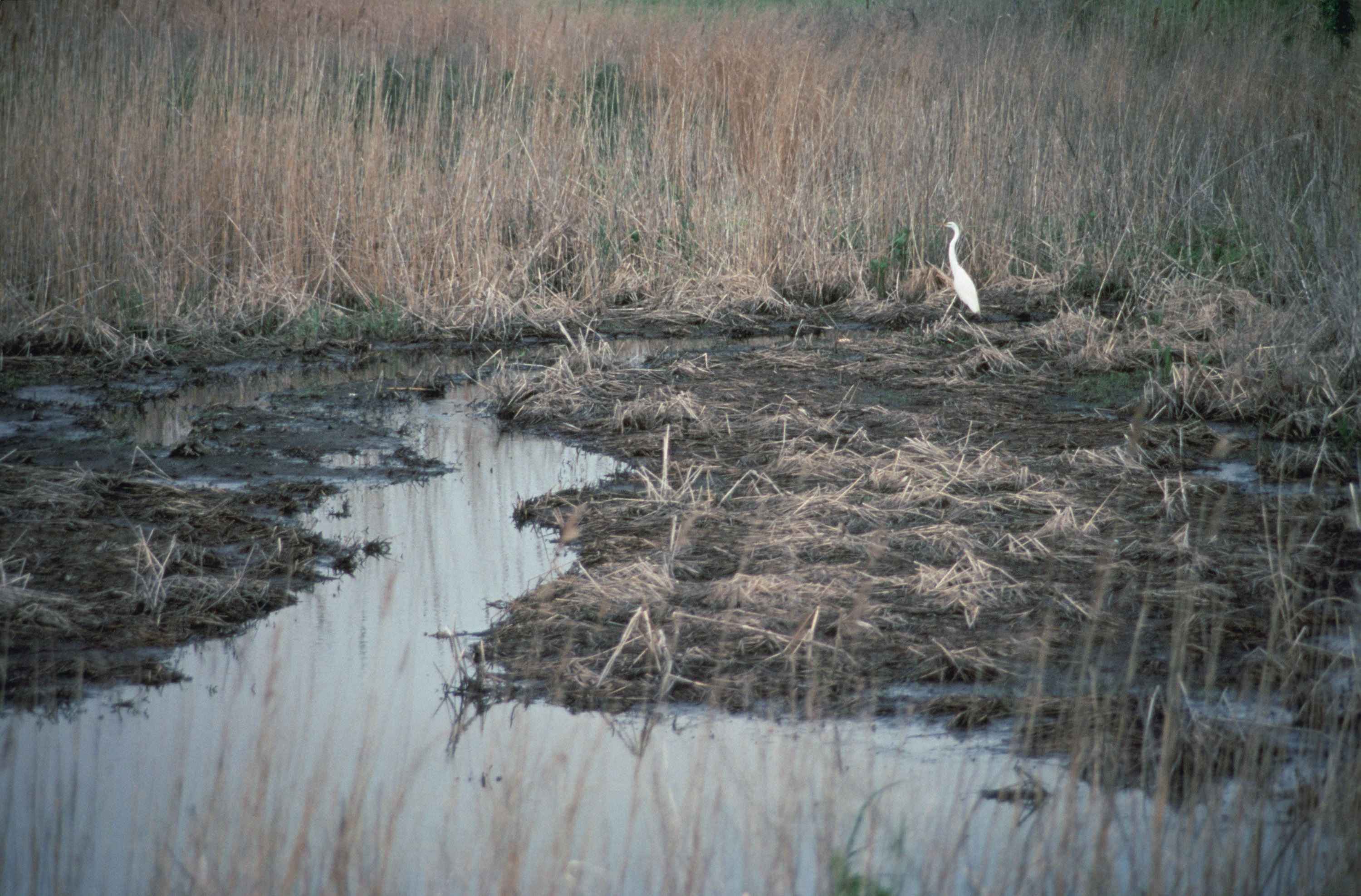
- Bombay Hook National Wildlife Refuge
Climate
Kent County has a humid subtropical climate (Cfa) according to the Köppen climate classification. The Trewartha climate classification considers the climate oceanic (Do) because only seven months average above 50 °F (above 10 °C.) All months average above freezing and Dover has three months averaging above 22 °C. The hardiness zone is 7b. https://planthardiness.ars.usda.gov/
| Jan record high F = 77 | Feb record high F = 80 | Mar record high F = 88 | Apr record high F = 97 | May record high F = 98 | Jun record high F = 101 | Jul record high F = 104 | Aug record high F = 102 | Sep record high F = 99 | Oct record high F = 95 | Nov record high F = 85 | Dec record high F = 75 | year record high F = 104 | Jan avg record high F = 65.7 | Feb avg record high F = 65.4 | Mar avg record high F = 73.5 | Apr avg record high F = 83.0 | May avg record high F = 88.1 | Jun avg record high F = 93.1 | Jul avg record high F = 95.4 | Aug avg record high F = 93.1 | Sep avg record high F = 89.0 | Oct avg record high F = 82.8 | Nov avg record high F = 73.9 | Dec avg record high F = 66.1 | year avg record high F = 96.1 | Jan avg record low F = 10.8 | Feb avg record low F = 13.3 | Mar avg record low F = 20.5 | Apr avg record low F = 31.1 | May avg record low F = 40.7 | Jun avg record low F = 51.0 | Jul avg record low F = 59.5 | Aug avg record low F = 58.4 | Sep avg record low F = 47.7 | Oct avg record low F = 34.4 | Nov avg record low F = 24.0 | Dec avg record low F = 17.8 | year avg record low F = 8.8 | Jan record low F = −7 | Feb record low F = −11 | Mar record low F = 7 | Apr record low F = 14 | May record low F = 28 | Jun record low F = 41 | Jul record low F = 45 | Aug record low F = 35 | Sep record low F = 30 | Oct record low F = 25 | Nov record low F = 11 | Dec record low F = −3 | year record low F = -11 | access-date = June 18, 2021}} | access-date = June 18, 2021 | archive-url = https://web.archive.org/web/20230806064941/https://www.ncei.noaa.gov/access/services/data/v1?dataset=normals-monthly-1991-2020&startDate=0001-01-01&endDate=9996-12-31&stations=USC00072730&format=pdf | archive-date = August 6, 2023}} | access-date = July 4, 2019 | archive-url = https://web.archive.org/web/20190629142419/https://www.weather-us.com/en/delaware-usa/dover-climate | archive-date = June 29, 2019 |url-status=live }}
Transportation
Major highways
_from_the_overpass_for_Smyrna-Leipsic_Road_in_Smyrna,_Kent_County,_Delaware.jpg)
The following state highways are located in Kent County:
Railroads
The Delmarva Central Railroad operates two freight lines through Kent County. The Delmarva Subdivision runs north–south along the US 13 corridor through Farmington, Harrington, Felton, Wyoming, Dover, Cheswold, and Clayton and the Indian River Subdivision branches from the Delmarva Subdivision at Harrington and runs east to Houston and Milford along the DE 14 corridor. There is no passenger rail service in the county.
Public transportation
DART First State operates bus service within Kent County. There are several local bus routes that serve the Dover area. In addition, DART First State operates inter-county service to Wilmington, Newark, Georgetown, and Lewes, along with seasonal service to Lewes and Rehoboth Beach.
Airports
Kent County contains the following public-use and military airports:
- Chandelle Estates Airport in Dover
- Chorman Airport in Farmington
- Dover Air Force Base in Dover
- Delaware Airpark in Cheswold
- Henderson Aviation Airport in Felton
- Jenkins Airport in Wyoming
- Smyrna Airport in Smyrna
Government and politics
Kent County is governed by the Kent County Levy Court, which consists of seven members, six of whom are elected by district and the seventh who is elected at-large. The current members of the Kent County Levy Court are:
- Joanne Masten (D) - 1st district
- Jeffrey W. Hall (D) - 2nd district
- Allan F. Angel (D) - 3rd district (Vice President)
- Robert J. Scott (R) - 4th district
- George Jody Sweeney (D) - 5th district
- Paul Hertz - (R) 6th district
- Terry L. Pepper (D) - At-Large (President)
The county row offices are held by:
- Eugenia Thornton - Recorder of Deeds
- Harold K. Brode (D) - Register of Wills
- Brenda A. Wootten (D) - Clerk of the Peace
- Norman Barlow - (R) Sheriff
Politically, Kent County is a swing county in local, state, and federal elections. The county is often used in state politics to determine a party or candidate's strength in statewide elections and is often considered a bellwether county, having voting for the winner of the national presidential election in 17 out of the last 19 presidential elections. In the 2016 general elections, Republican Presidential Nominee Donald Trump won Kent County with 49.81% of the vote compared to Democratic Nominee Hillary Clinton's 44.91% out of 74,260 votes cast. In the 2020 presidential election, Delaware resident Joe Biden took 51.19% of the vote compared to Trump's 47.12%, out of 87,025 votes cast. Trump lost the county in 2024, making him the first Republican in 100 years to win the presidency without the county.
| Year | Republican | Democratic | Third parties |
|---|---|---|---|
| 2024 | 49.75% 42,750 | 50.25% 43,179 | 0.0% 0 |
| 2020 | 46.05% 39,332 | 51.93% 44,352 | 2.02% 1,731 |
| 2016 | 48.05% 34,777 | 49.68% 35,955 | 2.27% 1,646 |
| 2012 | 36.04% 23,846 | 61.5% 40,696 | 2.46% 1,628 |
In the Delaware General Assembly, 8 of the 41 seats in the Delaware State House of Representatives. As of March 2020, Democrats held 4 seats and Republicans held 4 seats. In the Delaware State Senate, 5 senate districts represent parts of Kent County. As of March 2020 there were 3 Republican seats and 2 Democratic seats.
| Kent County Voter Registration and Party Affiliations as of March 30, 2020 | Political Party | Total Voters | Percentage | Total | 127,517 | 100.00% |
|---|---|---|---|---|---|---|
| Democratic | 55,270 | 43.34% | ||||
| Republican | 38,073 | 29.85% | ||||
| No Party | 31,763 | 24.91% | ||||
| Third Parties | 2,411 | 1.90% |
Demographics
|align-fn=center 1790-1960 1900-1990 1990-2000 2010-2020
| Race (NH = Non-Hispanic) | 2010 | 2000 | 1990 | 1980 |
|---|---|---|---|---|
| White alone (NH) | 57.7% | |||
| (104,845) | 65.2% | |||
| (105,891) | 72.1% | |||
| (91,325) | 77.5% | |||
| (86,071) | ||||
| Black alone (NH) | 25.2% | |||
| (45,737) | 23.3% | |||
| (37,812) | 20.3% | |||
| (25,770) | 18.3% | |||
| (20,316) | ||||
| American Indian alone (NH) | 0.5% | |||
| (864) | 0.6% | |||
| (916) | 0.6% | |||
| (763) | 0.5% | |||
| (596) | ||||
| Asian alone (NH) | 2.4% | |||
| (4,362) | 2% | |||
| (3,266) | 1.7% | |||
| (2,104) | 1.2% | |||
| (1,354) | ||||
| Pacific Islander alone (NH) | 0.1% | |||
| (107) | 0% | |||
| (74) | 0% | |||
| (41) | ||||
| Other race alone (NH) | 0.6% | |||
| (1,028) | 0.2% | |||
| (347) | 0.2% | |||
| (234) | 0.1% | |||
| (116) | ||||
| Multiracial (NH) | 6% | |||
| (10,927) | 2.9% | |||
| (4,658) | 1.9% | |||
| (2,391) | — | |||
| Hispanic/Latino (any race) | 7.7% | |||
| (13,981) | 5.8% | |||
| (9,346) | 3.2% | |||
| (4,069) | 2.3% | |||
| (2,540) |
2020 census
As of the 2020 census, the county had a population of 181,851. Of the residents, 23.1% were under the age of 18 and 18.0% were 65 years of age or older; the median age was 38.5 years. For every 100 females there were 92.1 males, and for every 100 females age 18 and over there were 89.1 males. 73.5% of residents lived in urban areas and 26.5% lived in rural areas.
The racial makeup of the county was 59.2% White, 25.8% Black or African American, 0.6% American Indian and Alaska Native, 2.4% Asian, 3.1% from some other race, and 8.7% from two or more races. Hispanic or Latino residents of any race comprised 7.7% of the population.
There were 68,290 households in the county, of which 32.7% had children under the age of 18 living with them and 29.0% had a female householder with no spouse or partner present. About 24.8% of all households were made up of individuals and 11.3% had someone living alone who was 65 years of age or older.
There were 72,708 housing units, of which 6.1% were vacant. Among occupied housing units, 71.0% were owner-occupied and 29.0% were renter-occupied. The homeowner vacancy rate was 1.4% and the rental vacancy rate was 5.9%.The most reported ancestries were:
- African American (16.2%)
- English (14.9%)
- Irish (14.1%)
- German (12.9%)
- Italian (6.1%)
- Puerto Rican (3.2%)
- Polish (2.7%)
- Scottish (2.3%)
- Mexican (1.8%)
- French (1.7%)
2010 census
As of the 2010 census, there were 162,310 people, 60,278 households, and 42,290 families living in the county.{{cite web |access-date=January 12, 2016 |archive-url=https://archive.today/20200213022658/http://factfinder.census.gov/bkmk/table/1.0/en/DEC/10_DP/DPDP1/0500000US10001 |archive-date=February 13, 2020 |access-date=January 12, 2016 |archive-url=https://archive.today/20200213183927/http://factfinder.census.gov/bkmk/table/1.0/en/DEC/10_SF1/GCTPH1.CY07/0500000US10001 |archive-date=February 13, 2020 |access-date=January 12, 2016 |archive-url=https://archive.today/20200213031008/http://factfinder.census.gov/bkmk/table/1.0/en/ACS/10_5YR/DP02/0500000US10001 |archive-date=February 13, 2020
Of the 60,278 households, 35.6% had children under the age of 18 living with them, 50.1% were married couples living together, 14.9% had a female householder with no husband present, 29.8% were non-families, and 23.6% of all households were made up of individuals. The average household size was 2.62 and the average family size was 3.09. The median age was 36.6 years.{{The median income for a household in the county was $53,183 and the median income for a family was $60,949. Males had a median income of $43,418 versus $35,603 for females. The per capita income for the county was $24,194. About 9.3% of families and 12.5% of the population were below the poverty line, including 21.0% of those under age 18 and 7.7% of those age 65 or over.{{cite web |access-date=January 12, 2016 |archive-url=https://archive.today/20200213015328/http://factfinder.census.gov/bkmk/table/1.0/en/ACS/10_5YR/DP03/0500000US10001 |archive-date=February 13, 2020
2000 census
As of the census of 2000, there were 126,697 people, 47,224 households, and 33,623 families living in the county. The population density was 215 /mi2. There were 50,481 housing units at an average density of 86 /mi2. The racial makeup of the county was 73.49% White, 20.66% Black or African American, 0.64% Native American, 1.69% Asian, 0.04% Pacific Islander, 1.27% from other races, and 2.22% from two or more races. 3.21% of the population were Hispanic or Latino of any race. 13.3% were of German, 11.3% United States or American, 10.9% Irish, 10.0% English and 5.4% Italian ancestry. 92.5% spoke English and 3.3% Spanish as their first language.
There were 47,224 households, out of which 35.50% had children under the age of 18 living with them, 52.90% were married couples living together, 13.80% had a female householder with no husband present, and 28.80% were non-families. 23.00% of all households were made up of individuals, and 8.40% had someone living alone who was 65 years of age or older. The average household size was 2.61 and the average family size was 3.06.
In the county, the population was spread out, with 27.30% under the age of 18, 10.10% from 18 to 24, 29.80% from 25 to 44, 21.20% from 45 to 64, and 11.70% who were 65 years of age or older. The median age was 34 years. For every 100 females there were 93.10 males. For every 100 females age 18 and over, there were 89.60 males.
The median income for a household in the county was $40,950, and the median income for a family was $46,504. Males had a median income of $32,660 versus $24,706 for females. The per capita income for the county was $18,662. About 8.10% of families and 10.70% of the population were below the poverty line, including 14.80% of those under age 18 and 8.80% of those age 65 or over.
2021 American Community Survey estimates
In 2021, there were 66,720 households and an average of 2.63 people per household; 88.2% of residents had been living in the same residence one year earlier. The median household income for the county was $63,715; the county had a per capita income of $30,804. An estimated 12.2% of the population lived at or below the poverty line.
Amish community
Kent County is home to an Amish community residing to the west of Dover, consisting of 9 church districts and about 1,650 people. The Amish first settled in Kent County in 1915 after migrations from Wisconsin, Montana, Alabama, and Ohio.
Communities
Cities


- Dover
- Harrington
- Milford (partly in Sussex County)
Towns

- Bowers
- Camden
- Cheswold
- Clayton (partly in New Castle County)
- Farmington
- Felton
- Frederica
- Hartly
- Houston
- Kenton
- Leipsic
- Little Creek
- Magnolia
- Smyrna (partly in New Castle County)
- Viola
- Woodside
- Wyoming
Census-designated places
- Dover Air Force Base
- Highland Acres
- Kent Acres
- Rising Sun-Lebanon
- Riverview
- Rodney Village
- Woodside East
Unincorporated localities
-
Andrewville
-
Berrytown
-
Little Heaven
-
Marydel
-
Woodland Beach
Education
School districts include:
- Caesar Rodney School District
- Capital School District
- Lake Forest School District
- Milford School District
- Smyrna School District
- Woodbridge School District
In 2010, 14.8% of the county students enrolled in K-12 schools were in private institutions. St. Thomas More Academy was formerly in the county.
In the period of de jure educational segregation in the United States, K-12 students of black African descent attended segregated schools. William W. M. Henry Comprehensive High School District 133 housed high school students of black African descent during the period 1952 to 1966. Desegregation occurred after 1966.
Tertiary institutions:
- Delaware State University (DSU)
Wesley College merged into DSU in 2021.
References
References
- "Annual Estimates of the Resident Population for Counties: April 1, 2020 to July 1, 2024". United States Census Bureau.
- "Census - Geography Profile: Kent County, Delaware". [[United States Census Bureau]].
- "Find a County". National Association of Counties.
- Gannett, Henry. (1905). "The Origin of Certain Place Names in the United States". Govt. Print. Off..
- "Archived copy". [[Office of Management and Budget]].
- ''NEW YORK: Atlas of Historical County Boundaries'' by John H. Long and Kathryn Ford Thorne
- (February 12, 2011). "US Gazetteer files: 2010, 2000, and 1990". [[United States Census Bureau]].
- [http://www.hsd.org/DHE/DHE_where_hundreds.htm Delaware History Online - Geography - Hundreds] {{webarchive. link. (July 16, 2012 . Hsd.org. Retrieved on August 17, 2013.)
- [http://delgensoc.org/delhund.htm Delaware Hundreds] {{webarchive. link. (July 16, 2012 . Delgensoc.org (July 16, 2010). Retrieved on August 17, 2013.)
- {{Delaware road map. (2008)
- (November 8, 2016). "Delmarva Central Railroad". Carload Express.
- "Routes and Schedules". DART First State.
- "Dave Leip's Atlas of United States Presidential Elections".
- "Our Campaigns".
- "Levy Court". Kent County.
- "State of Delaware - Department of Elections · Office of the State Election Commissioner".
- Leip, David. "Dave Leip's Atlas of U.S. Presidential Elections – Sate Data".
- Leip, David. "Dave Leip's Atlas of U.S. Presidential Elections – Sate Data".
- Leip, David. "Dave Leip's Atlas of U.S. Presidential Elections – Sate Data".
- "State of Delaware - Department of Elections · Office of the State Election Commissioner".
- "Annual Estimates of the Resident Population for Counties: April 1, 2020 to July 1, 2024". United States Census Bureau.
- "U.S. Decennial Census". United States Census Bureau.
- "Historical Census Browser". University of Virginia Library.
- "Population of Counties by Decennial Census: 1900 to 1990". United States Census Bureau.
- "Census 2000 PHC-T-4. Ranking Tables for Counties: 1990 and 2000". United States Census Bureau.
- "State & County QuickFacts". United States Census Bureau.
- "HISPANIC OR LATINO, AND NOT HISPANIC OR LATINO BY RACE (2020)". U.S. Census Bureau.
- "HISPANIC OR LATINO, AND NOT HISPANIC OR LATINO BY RACE (2010)". U.S. Census Bureau.
- "Delaware: 2000". U.S. Census Bureau.
- "Delaware: 1990".
- "General Social and Economic Characteristics: Delaware".
- (2023). "2020 Decennial Census Demographic and Housing Characteristics (DHC)". United States Census Bureau.
- (2021). "2020 Decennial Census Redistricting Data (Public Law 94-171)". United States Census Bureau.
- (2021). "2020 Decennial Census Demographic Profile (DP1)". United States Census Bureau.
- "TOTAL POPULATION". U.S. Census Bureau.
- "American Community Survey 5-Year Estimates for Kent County, Delaware (Table DP02)". United States Census Bureau.
- "American Community Survey 5-Year Estimates for Kent County, Delaware (Table DP03)". United States Census Bureau.
- "Amish Population, 2018". Elizabethtown College, the Young Center for Anabaptist and Pietist Studies.
- "Amish Countryside". Kent County & Greater Dover, Delaware Convention and Visitors Bureau.
- "Delaware Amish". Amish America.
- "2020 CENSUS - SCHOOL DISTRICT REFERENCE MAP: Kent County, DE". [[U.S. Census Bureau]].
- (2010-12-16). "Private schools increasing financial aid to retain students". [[Delaware Public Media]].
- Mowery, Roger. (1974). "Delaware School District Organization and Boundaries". [[Delaware State Department of Instruction]].
- "Delaware State University will acquire Wesley College, a first for HBCUs".
This article was imported from Wikipedia and is available under the Creative Commons Attribution-ShareAlike 4.0 License. Content has been adapted to SurfDoc format. Original contributors can be found on the article history page.
Ask Mako anything about Kent County, Delaware — get instant answers, deeper analysis, and related topics.
Research with MakoFree with your Surf account
Create a free account to save articles, ask Mako questions, and organize your research.
Sign up freeThis content may have been generated or modified by AI. CloudSurf Software LLC is not responsible for the accuracy, completeness, or reliability of AI-generated content. Always verify important information from primary sources.
Report