From Surf Wiki (app.surf) — the open knowledge base
Kenora District

| Field | Value |
|---|---|
| official_name | Kenora District |
| native_name | |
| settlement_type | District |
| image_map | Map of Ontario KENORA.svg |
| map_caption | Location of Kenora District in Ontario |
| coordinates | |
| subdivision_type | Country |
| subdivision_name | Canada |
| subdivision_type1 | Province |
| subdivision_type2 | Region |
| subdivision_name1 | Ontario |
| subdivision_name2 | Northwestern Ontario |
| established_title | Created |
| established_date | 1907 |
| established_title2 | |
| established_title3 | |
| leader_title | MPs |
| leader_name | Eric Melillo (CPC), Gaétan Malette (CPC), Patty Hajdu (LPC) |
| leader_title1 | MPPs |
| leader_name1 | Greg Rickford (PC), Guy Bourgouin (NDP), Sol Mamakwa (NDP) |
| area_footnotes | |
| area_land_km2 | 395432.07 |
| elevation_footnotes | |
| elevation_min_m | 0 |
| elevation_max_m | 505 |
| population_total | 66,000 |
| population_as_of | 2021 |
| population_footnotes | |
| population_density_km2 | 0.2 |
| timezone1 | Central (CST) |
| utc_offset1 | -6 |
| timezone1_DST | Central Daylight (CDT) |
| utc_offset1_DST | -5 |
| timezone1_location | West of 90° west |
| timezone2 | Eastern (EST) |
| utc_offset2 | -5 |
| timezone2_DST | Eastern Daylight (EDT) |
| utc_offset2_DST | -4 |
| timezone2_location | East of 90° west |
| timezone3 | Eastern (EST) |
| utc_offset3 | -5 |
| timezone3_location | Pickle Lake/ Mishkeegogamang |
| postal_code_type | Postal Code FSA |
| postal_code | P0V, P0X, P0Y, P8N, P8T, P9N |
| area_code | 807 |
| blank_name | Largest communities |
| blank_info | Kenora (15,177) |
| Dryden (8,195) | |
| Sioux Lookout (5,183) |
Dryden (8,195) Sioux Lookout (5,183)
Kenora District is a district and census division in Northwestern Ontario, Canada. The district seat is the City of Kenora.
It is geographically the largest division in Ontario: at 407213.01 km2, it covers 38 percent of the province's area, making it larger than Newfoundland and Labrador, and slightly smaller than Sweden or roughly the land size of California. Kenora District also has the lowest population density of any of Ontario's census divisions (it ranks 37th out of 50 by total population).
The district was created in 1907 from parts of Rainy River District. The northern part (north of the Albany River) only became part of Ontario in 1912 (transferred from the Northwest Territories). The separate Patricia District upon transfer, it was in 1937 annexed to Kenora District and known sometimes as the Patricia Portion.
Politics
As with the other districts of Northern Ontario, the Kenora District does not have an organized government like those of counties or regional municipalities in Southern Ontario. All government services in the district are instead provided by the local municipalities, by local services boards in some unincorporated communities, or directly by the provincial government.
Geography
The climate is very harsh because of the influence of the cold waters of Hudson and James Bays: most of the region is taiga characterized by discontinuous permafrost, but on the extreme northern coast there are – remarkably for a latitude of only 54°N – patches of true Arctic tundra and continuous permafrost. This is the southernmost point in the Northern Hemisphere reached by the circumpolar line of continuous permafrost on any continent.
Kenora District is geographically extensive enough to share borders with both the contiguous United States (the boundary between it and the Northwest Angle is located in the Lake of the Woods) and the Canadian Arctic waters (Hudson Bay), the only district in Canada to do so.
The District contains the Sturgeon Lake Caldera, which is one of the world's best preserved Neoarchean caldera complexes and is some 2.7 billion years old.
Subdivisions
Cities:
- Dryden
- Kenora
Towns:
- Red Lake
- Sioux Lookout
Townships:
- Ear Falls
- Ignace
- Machin
- Pickle Lake
- Sioux Narrows-Nestor Falls
Unorganized areas:
- Kenora, Unorganized (including the local services boards of Greater Oxdrift, Melgund, Minaki, Redditt, Round Lake, and Wabigoon)
First Nations reserves
- Attawapiskat
- Bearskin Lake
- Cat Lake
- Deer Lake
- Eabametoong
- Eagle Lake 27
- English River 21
- Fort Albany 67 (part)
- Fort Severn 89
- Islington 29
- Kasabonika
- Keewaywin
- Kenora 38B
- Kingfisher Lake
- Kitchenuhmaykoosib Inninuwug
- Lac Seul
- Lake of the Woods 31G
- Lake of the Woods 37
- Marten Falls
- Mishkeegogamang
- Muskrat Dam Lake
- Neskantaga
- Northwest Angle 33
- North Spirit Lake
- Pikangikum
- Poplar Hill
- Rat Portage 38A
- Sabaskong Bay 35D
- Sachigo Lake
- Sandy Lake
- Shoal Lake 39A (part)
- Shoal Lake 40 (part)
- Shoal Lake 34B2
- The Dalles 38C
- Wabauskang 21
- Wabaseemoong Independent Nations
- Wabigoon Lake
- Wapekeka
- Wawakapewin
- Weagamow Lake 87
- Whitefish Bay 32A
- Whitefish Bay 33A
- Whitefish Bay 34A
- Wunnumin Lake
Patricia Portion
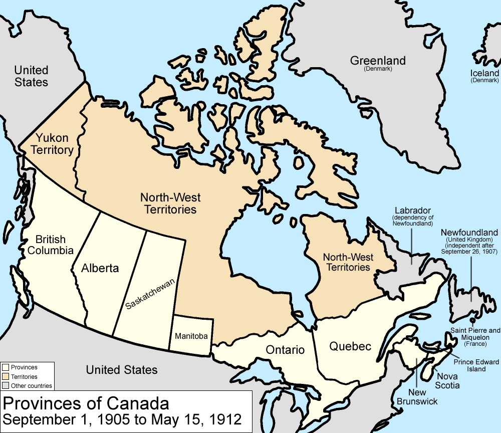
The Patricia Portion is the part of the Kenora District lying north of the Albany River, which was transferred from the Northwest Territories to Ontario on May 15, 1912, in The Ontario Boundaries Extension Act. This area was originally a separate division, Patricia District, but became part of Kenora District in 1937.
With the exception of a few communities along the northernmost ends of Highway 599 and the Highway 105/Highway 125 corridor, the Patricia Portion consists almost entirely of remote First Nations communities that are only accessible by float plane or winter road. Accordingly, the term "Patricia Portion" is still sometimes used to distinguish the region from the relatively more populated and road-accessible southern portion.
Demographics
As a census division in the 2021 Census of Population conducted by Statistics Canada, the Kenora District had a population of living in of its total private dwellings, a change of from its 2016 population of . With a land area of 395432.07 km2, it had a population density of in 2021.
| 1921 |19139 | 1931 |25919 | 1941 |33372 | 1951 |39212 | 1956 |47156 | 1961 |51474 | 1966 |53995 | 1971 |53230 | 1976 |57980 | 1981 |59421 | 1986 |52834 | 1991 |58748 | 1996 |63335 | 2001 |61802 | 2006 |64419 | 2011 |57607 | 2016 |65533 | 2021 |66000
Economy
Most of the population is concentrated in the district's extreme south where some agriculture is possible: the main crop is barley. Traditional native activities such as hunting and fishing dominate the north of the district outside of mining settlements.
Mining
The area near Lake Minnehaha saw a gold rush between 1902 and 1909. The settlement of Gold Rock served 14 area mines, which included the Big Master, Laurentian, Detola and Elora. According to Barnes, "Approximately 180,000 ounces of gold was won from 27 mines in the Kenora district from 1880 to 1976," with "over 331 known gold occurrences." The more successful mines included the Bully Boy, Cameron Island, Champion, Combined, Cornucopia, Gold Hill, Golden Horn, Kenricia, Mikado, Oliver, Olympia, Ophyr, Regina, Scramble, Severn, Stella, Sultana, Treasure and Wendigo.
Mining is currently extremely extensive in northern Kenora District, which contains some of the world's largest and highest-grade reserves of uranium and some of the world's major producers of nickel. A major mining exploration project is currently underway in the Ring of Fire region, centred on the district's isolated McFaulds Lake.
Transportation

Permanent roads (Highway 599) only reach about halfway to the northernmost point of Kenora district, with the provincial highway network ending at Pickle Lake. Some more northerly communities connect seasonally through an ice/winter road network to the Northern Ontario Resource Trail.
Year-round air and summertime river transport are the only means of reaching the most remote parts of the district.
The major railroad lines between Toronto and British Columbia pass through the south of the district. The district is served by Via Rail's Canadian at Rice Lake, Copelands Landing, Malachi, Ottermere, Minaki, Redditt, Farlane station, Canyon, Red Lake Road, Richan, and Sioux Lookout stations.
References
References
- "Kenora, District (DIS) Census Profile, 2021 Census of Population". Government of Canada - Statistics Canada.
- Highest elevation from MapArt 2003 Edition Ontario Provincial Map – G4 south of Willard Lake. [[Hudson Bay]] is at [[Mean sea level. MSL]]
- [https://web.archive.org/web/20110519194148/https://spreadsheets.google.com/pub?key=p-3CCzuDoD3NjJ2aGAOTbGA Compilation of Northwestern Ontario's 2006 census data]
- ''The Ontario Boundaries Extension Act'', S.C. 1912 (CA), 2 Geo. V, c. 40.
- [http://digitalcommons.osgoode.yorku.ca/cgi/viewcontent.cgi?article=3558&context=rso Patricia Act, RSO 1937, c 5] (retrieved March 26, 2016).
- [http://www.d.umn.edu/~rmorton/ronshome/Volcanoes/calderas.html Caldera Volcanoes] Retrieved on July 20, 2007
- (July 1973). "1971 Census of Canada - Population Census Subdivisions (Historical)". Statistics Canada.
- (1995). "Gold in Ontario". The Boston Mills Press.
- "Rice Lake train station {{!}} VIA Rail".
- "Copelands Landing train station {{!}} VIA Rail". [[Via Rail]].
This article was imported from Wikipedia and is available under the Creative Commons Attribution-ShareAlike 4.0 License. Content has been adapted to SurfDoc format. Original contributors can be found on the article history page.
Ask Mako anything about Kenora District — get instant answers, deeper analysis, and related topics.
Research with MakoFree with your Surf account
Create a free account to save articles, ask Mako questions, and organize your research.
Sign up freeThis content may have been generated or modified by AI. CloudSurf Software LLC is not responsible for the accuracy, completeness, or reliability of AI-generated content. Always verify important information from primary sources.
Report