From Surf Wiki (app.surf) — the open knowledge base
Kenitra
City in Rabat-Salé-Kénitra, Morocco
City in Rabat-Salé-Kénitra, Morocco
| Field | Value | |
|---|---|---|
| <!-- Basic info ----------------> | name | Kenitra |
| native_name | القنيطرة | |
| image_skyline | {{multiple image | |
| border | infobox | |
| total_width | 290 | |
| perrow | 1 | |
| align | center | |
| caption_align | center | |
| image1 | Gare des trains kénitra.jpg | |
| border | infobox | |
| total_width | 290 | |
| perrow | 3 | |
| align | center | |
| caption_align | center | |
| image1 | Avenue Mohammed V à Kénitra.jpg | |
| image2 | Un immeuble de Kenitra port lyautey opération Torch.jpg | |
| image3 | Une autre photo de jardin a Kenitra ouled oujih.jpg | |
| border | infobox | |
| total_width | 290 | |
| perrow | 1 | |
| align | center | |
| caption_align | center | |
| image1 | واد سبو مدينة القنيطرة.jpg | |
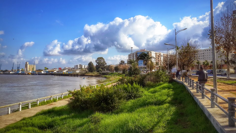
| image_caption | Scenes from Kenitra | |
| image_flag | Flag of Kenitra province.svg | |
| image_seal | Blason de la ville de Kénitra.svg | |
| seal_size | 120px | |
| motto | ||
| pushpin_map | Morocco#Africa | |
| pushpin_relief | yes | |
| pushpin_label_position | bottom | |
| pushpin_mapsize | 300 | |
| pushpin_map_caption | Location in Morocco | |
| <!-- Location ------------------> | coordinates | |
| subdivision_type | Country | |
| subdivision_name | Morocco | |
| subdivision_type1 | Region | |
| subdivision_type2 | Province | |
| subdivision_name1 | Rabat-Salé-Kénitra | |
| subdivision_name2 | Kenitra | |
| established_title | Founded | |
| established_date | 1681 | |
| leader_title1 | ||
| unit_pref | metric | |
| area_total_km2 | 112 | |
| area_land_km2 | ||
| <!-- Population -----------------------> | elevation_footnotes | |
| elevation_m | 26 | |
| elevation_ft | ||
| population_total | 507736 | |
| population_as_of | 2024 | |
| population_footnotes | ||
| population_rank | 8th in Morocco | |
| population_density_blank1_sq_mi | ||
| postal_code_type | ||
| postal_code | 2900 | |
| website | http://www.kenitra.ma/ar/ | |
| footnotes | ||
| demographics_type1 | GDP (PPP, constant 2015 values) | |
| demographics1_title1 | Year | |
| demographics1_info1 | 2024 | |
| demographics1_title2 | Total (Metro) | |
| demographics1_info2 | $5.1 billion | |
| demographics1_title3 | Per capita | |
| demographics1_info3 | $9,800 | |
| timezone | CET | |
| utc_offset | +1 |
the city in Morocco
Kenitra (, al-qunayṭara, , ) is a city in northwestern Morocco. It is a port on the Sebou River with a population of 507,736 as of 2024. It is one of the three main cities of the Rabat-Salé-Kénitra region and the capital of the similarly named Kénitra Province. During the Cold War, the US Naval Air Station Port Lyautey served as a stopping point in North Africa.
History
Ancient history
The history of the city begins with the foundation of a trading post by Carthaginian explorer Hanno. It was known back then as Thamusida.
Colonial and recent history
In March 1912 the French government and the Sultan of Morocco, Abd al-Hafid, signed the Treaty of Fez. Because of his growing unpopularity, the Sultan asked the French government for protection against the Berber rebel tribes surrounding Fez. France appointed Hubert Lyautey resident-general in Morocco.
General Lyautey restored peace and order to the country after crushing the tribal uprising. After safely moving the Sultan from Fez to the current capital city, Rabat, Lyautey began his task of civilian administration.
One of the first preoccupations of General Lyautey was to build ports along the inhabitable Atlantic coast where there were no natural harbors. He established Port Lyautey in 1912 as a French military fort and town. Its port, at the mouth of the Sebou river, was opened in 1913. It soon became the best river port in Morocco. Kenitra draws its name from a culvert built at Fouarat lake upstream of the kasbah. This culvert was destroyed in 1928. In 1933, the French officially named the locale "Port Lyautey".
It was renamed "Quneitra" in 1956 as Morocco gained its independence. The city has grown rapidly to be a shipping centre for agricultural produce (mainly fruit), fish, timber, and lead and zinc ores. The city's industrial area lies upstream of the port.
U.S. Naval Base

In November 1942, after Operation Torch, the Americans captured the Port Lyautey French fighter base as a military base, named Craw Field. For three months the 21st Engineer Aviation Regiment worked on the airfield. In February 1943 the Seabees of the 120th Naval Construction Battalion took over all construction activities. The Navy ran the base until 1947, when the State Department negotiated reversion of control to France. In 1950, a $23,000,000 expansion was authorized, but then the Korean War diverted resources. In the 1950s, nearly 10,000 people were on the base making it the largest aggregation of Americans in any one overseas base outside Japan. Later, the base in Kenitra was expanded to become a U.S. Naval Air Station.
The base was shared by both the US and Morocco through the Cold War. A small Navy communications out-station in Sidi Yahia closed in the late 1970s. The Air Station was closed in 1991.
Climate
Kenitra has a hot-summer Mediterranean climate (Köppen climate classification Csa). In summer, there are 27.4 days on average in which the maximum daily temperature is at 30.0 C or higher, and 1.6 days with max temperature above 40.0 C. Winters are mild and rainy, with sub-freezing temperatures occurring only 0.3 days per year on average. The highest recorded temperature was 47.7 C on 1 August 2003, and the coldest was -3.0 C on 13 February 2012. | Jan record high C =24.8 | Feb record high C =32.2 | Mar record high C =35.1 | Apr record high C =36.5 | May record high C =43.7 | Jun record high C =46.3 | Jul record high C =46.1 | Aug record high C =47.7 | Sep record high C =44.6 | Oct record high C =39.9 | Nov record high C =33.5 | Dec record high C =26.0 | year record high C = | Jan record low C =-1.0 | Feb record low C =-3.0 | Mar record low C =1.0 | Apr record low C =1.7 | May record low C =6.6 | Jun record low C =10.5 | Jul record low C =12.8 | Aug record low C =2.2 | Sep record low C =1.7 | Oct record low C =2.1 | Nov record low C =1.7 | Dec record low C =-0.5 | year record low C = | archive-url = https://web.archive.org/web/20211111000623/https://www.ncei.noaa.gov/pub/data/normals/WMO/1981-2010/RA-I/Morocco/WMO_Normals_ASCII_60120.csv | archive-date = 11 November 2021 | access-date = 10 November 2021}} | access-date = March 16, 2015 | archive-date = November 11, 2021 | archive-url = https://web.archive.org/web/20211111001021/https://www.ncei.noaa.gov/pub/data/normals/WMO/1961-1990/TABLES/REG__I/FM/60120.TXT | url-status = dead
| Climate data for Kenitra (1991-2020) | Month | Jan | Feb | Mar | Apr | May | Jun | Jul | Aug | Sep | Oct | Nov | Dec | Year | Mean number of days with thunder | Number of days with wind speed 10 m/s |
|---|---|---|---|---|---|---|---|---|---|---|---|---|---|---|---|---|
| 1.9 | 1.4 | 2.0 | 1.6 | 1.3 | 0.5 | 0.7 | 0.4 | 1.1 | 1.4 | 2.2 | 1.9 | 16.4 | ||||
| 9.6 | 10.5 | 16.7 | 20.7 | 24.4 | 24.1 | 22.5 | 21.8 | 20.3 | 14.2 | 10.3 | 9.7 | 204.8 |
Population
| 1982 | 1994 | 2004 | 2010 | 2014 |
|---|
Areas and neighbourhoods
- Mdina
- Khabazate
- The Cigogne
- La cite
- Modern city
- Mimosa
- La Ville Haute
- Popular districts
- Saknia
- Ouled Oujih
- Maghrib al Arabi
- Residential districts
- Bir Rami
- Ismailia
- Val fleuri
Education
Colleges and universities
- (UIT)
- ENCG Kénitra ()
- HECI Kénitra (Hautes Etudes Commerciales et Informatiques)
- ENSA Kénitra (École nationale des sciences appliquées de Kénitra)
- ENSC Kénitra ([École nationale supérieure de chimie de Kénitra]
Transportation
- The National Route 1 and the A1 motorway pass through Kenitra and connect it to Rabat-Salé in the south-west and to Larache in the north-east.
- The city is served by one railway station: Kenitra-Ville. A shuttle train, TNR, connects the city, every 30 minutes, to Rabat and Casablanca.
- A high-speed rail line to Tangier was completed in 2018. (See Kenitra–Tangier high-speed rail line.)
Sports
Kenitra Athletic Club, KAC
Main article: KAC Kenitra
In 1938, a group of Kenitra natives created KAC. This group of soccer lovers wanted to resist French domination in sports in Morocco. The team, made entirely of Kenitra natives, succeeded in reaching the premier Moroccan soccer league in 1956. In 1960, KAC won its first championship league of Morocco. KAC embarked in a journey of glories by winning the 1973-81-82 championship leagues and the 1961 throne cup. Ahmed Souiri was a long-time manager and coach. KAC has produced many international players. Noureddine Bouyahyaoui and Labid Khalifa were among the players who helped the Moroccan national soccer team qualify for the second round of the World Cup finals in Mexico in 1986. Mohammed Boussati still holds a national record of goals by scoring 25 goals in one soccer championship season in 1981–82.
Its home is the Kenitra Municipal Stadium which has a capacity of 15,000 people.
Basketball
The KAC Kénitra was a very successful basketball team during the 70s and 80s.
Notable people
Kenitra was the birthplace of:
- Amina Aït Hammou, Olympic athlete
- David Bitan, Israeli politician
- Ismaël Ferroukhi - Director and scriptwriter
- Margie Cox, American R&B Singer
- Mohamed Sijelmassi, writer and physician
- Nayef Aguerd – footballer
- Saïd Aouita, Olympic athlete
- Sofian Chakla – footballer
- Tariq Chihab - Former international footballer
- Youssef Chippo, International football player
- Zouhair Laaroubi - footballer
References
- (7 November 2024). "Population légale du Royaume du Maroc répartie par régions, provinces et préfectures et communes selon les résultats du Recensement général de la population et de l’habitat 2024". High Commission for Planning, Morocco.
- "TelluBase—Morocco Fact Sheet (Tellusant Public Service Series)". Tellusant.
- Team, Almaany. "ترجمة و معنى قنيطرة بالإنجليزي في قاموس المعاني. قاموس عربي انجليزي مصطلحات صفحة 1".
- (7 November 2024). "Population légale du Royaume du Maroc selon les résultats du Recensement Général de la Population et de l'Habitat de 2024". hcp.ma.
- "Hanno {{!}} Phoenician, Mediterranean, Navigator {{!}} Britannica".
- [http://www.carphaz.com/Kenitra_Historique.htm ''Kénitra depuis 1912''] {{Webarchive. link. (2003-10-03 {{in lang). fr
- ''In Morocco'' by Edith Wharton, New York: Charles Scribner's Sons 1920
- Port Lyautey, Chapter XX, The Mediterranean Area, Building the Navy's Bases in World War II, History of the Bureau of Yards and Docks and the Civil Engineer Corp, 1940-1946, Volume II, UNITED STATES GOVERNMENT PRINTING OFFICE, WASHINGTON, p. 80[https://www.ibiblio.org/hyperwar/USN/Building_Bases/bases-20.html]
- "''History of Port Lyautey''".
- "World Meteorological Organization Climate Normals for 1991-2020: Kenitra-60120". [[NCEI.
- "Kenitra, Morocco Metro Area Population 1950-2020 – macrotrends.com".
- (6 February 2006). "Univesité Ibn Tofail – Univesité Ibn Tofail".
- "'Africa's fastest train' steams ahead in Morocco".
- "Stade Municipal de Kénitra – StadiumDB.com".
This article was imported from Wikipedia and is available under the Creative Commons Attribution-ShareAlike 4.0 License. Content has been adapted to SurfDoc format. Original contributors can be found on the article history page.
Ask Mako anything about Kenitra — get instant answers, deeper analysis, and related topics.
Research with MakoFree with your Surf account
Create a free account to save articles, ask Mako questions, and organize your research.
Sign up freeThis content may have been generated or modified by AI. CloudSurf Software LLC is not responsible for the accuracy, completeness, or reliability of AI-generated content. Always verify important information from primary sources.
Report