From Surf Wiki (app.surf) — the open knowledge base
Kearney, Nebraska
City in the United States
City in the United States
| Field | Value | |
|---|---|---|
| name | Kearney, Nebraska | |
| settlement_type | City | |
| <!-- Images --> | image_skyline | GPRRAMKearney.jpg |
| imagesize | 250px | |
| image_caption | The Great Platte River Road Archway Monument, which spans Interstate 80 | |
| image_flag | KearneyNEflag.gif | |
| image_blank_emblem | Kearney, NE logo.png | |
| blank_emblem_type | Logo | |
| nickname | ||
| motto | "Heart of Nebraska" | |
| image_map | Buffalo_County_Nebraska_Incorporated_and_Unincorporated_areas_Kearney_Highlighted.svg | |
| mapsize | 250px | |
| map_caption | Location of Kearney within Nebraska and Buffalo County | |
| pushpin_map | USA | |
| pushpin_map_caption | Location within the United States | |
| <!-- Location --> | coordinates | |
| subdivision_type | Country | |
| subdivision_name | United States | |
| subdivision_type1 | State | |
| subdivision_name1 | Nebraska | |
| subdivision_type2 | County | |
| subdivision_name2 | Buffalo | |
| established_title | ||
| established_date | ||
| government_type | Council–manager | |
| leader_title | Mayor | |
| leader_name | Jonathan Nikkila | |
| <!-- Area --> | unit_pref | Imperial |
| area_footnotes | ||
| area_total_km2 | 39.25 | |
| area_total_sq_mi | 15.15 | |
| area_land_km2 | 38.53 | |
| area_land_sq_mi | 14.88 | |
| area_water_km2 | 0.72 | |
| area_water_sq_mi | 0.28 | |
| elevation_footnotes | ||
| elevation_ft | 2152 | |
| population_total | 33790 | |
| population_as_of | 2020 | |
| population_density_km2 | 876.95 | |
| population_density_sq_mi | 2271.29 | |
| <!-- General information --> | timezone | Central (CST) |
| utc_offset | −6 | |
| timezone_DST | CDT | |
| utc_offset_DST | −5 | |
| <!-- Area/postal codes & others --> | postal_code_type | ZIP codes |
| postal_code | 68845, 68847, 68848 (P.O. Box), 68849 UNK | |
| area_code | 308 | |
| blank_name | FIPS code | |
| blank_info | 31-25055 | |
| blank1_name | GNIS feature ID | |
| blank1_info | 838076 | |
| website |
Kearney ( ) | access-date = 2010-01-28 | url-status = dead | archive-url = https://web.archive.org/web/20100312013606/http://www.ap.org/nebraska/pronunciation.htm | archive-date = 2010-03-12 is a city and the county seat of Buffalo County, Nebraska, United States. |access-date=2011-06-07 |url-status=dead |archive-url=https://web.archive.org/web/20110531210815/http://www.naco.org/Counties/Pages/FindACounty.aspx |archive-date=2011-05-31 The population was 33,790 in the 2020 census, making it the 5th most populous city in Nebraska. It is home to the University of Nebraska at Kearney. The westward push of the railroad as the Civil War ended gave new birth to the community.
History
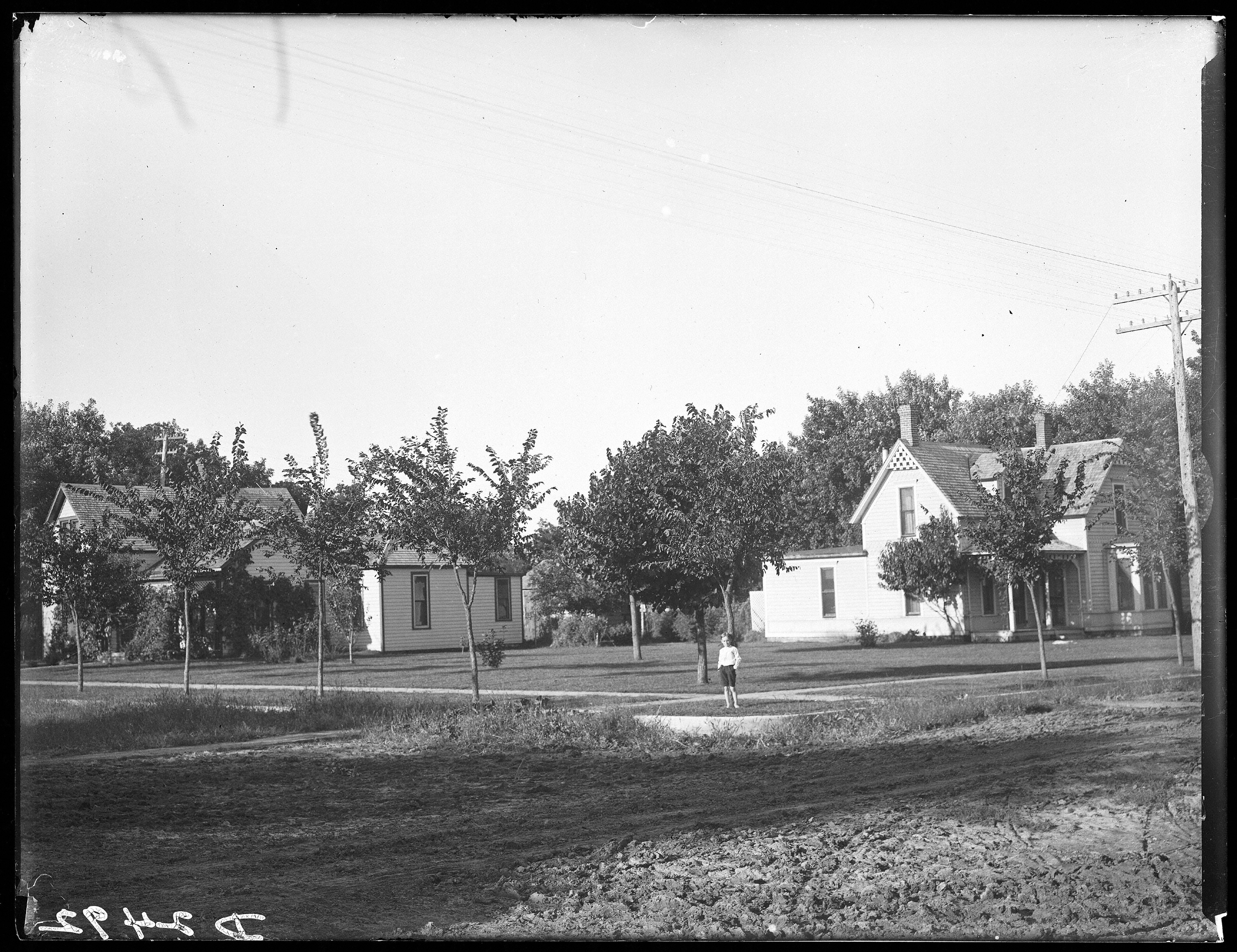
.jpg)
In the late 1840s, American settlers traveling westward arrived in significant numbers along the Mormon Trail and Overland Trails. This marked the beginning of Kearney's role as a crossroads on major east-west transportation arteries. In 1848, to safeguard westward migrants traveling through the region, the US Army established a military fort several miles southeast of the present city. Named after famed frontier military officer Stephen W. Kearny, Fort Kearny would become the namesake of the present city and serve as a stopping-point for gold prospectors, Pony Express riders, and Union Pacific Railroad workers until 1871. |access-date=2022-03-06}}
The first permanent settlement in the area was called Dobytown, located 2 mi southeast of the present-day Kearney. The "e" in Kearney was added by mistake sometime afterwards by postmen who consistently misspelled the town name; eventually the spelling became nomenclature.{{cite book The region expanded in 1866 with the arrival of the Union Pacific Railroad. The fixing of a junction point with the Burlington & Missouri River Railroad in 1871 anticipated the establishment of a townsite in the summer of that year. The city of Kearney was incorporated on December 3, 1873, the townsite being fixed a mille north of the Platte River. In 1874, Kearney was chosen to be the seat of Buffalo County, experiencing great population, economic, and infrastructural expansion in subsequent years that transformed the nascent city into the local business, education, and transportation center it remains to this day. This boom would be sustained through the next twenty-years, fueled by a post-Civil War period of frenzied economic expansion and wealth generation (Gilded Age) that was transforming the whole nation. Enterprising investors poured into the burgeoning community from the East and elsewhere, hoping to enrich themselves through ambitious speculative development schemes that, more often than not, turned out to be ill-conceived and economically unsustainable. An irrigation canal, electric street railway, and a five-story opera house were some of the projects to ultimately make it off the drawing board. These flush times would grind to a sudden halt as a result of the agricultural depression and economic crisis of the early 1890s. |access-date=2022-03-06}}
In 1912, the Catholic diocese of Kearney was centered here. The diocese was suppressed in 1917, with the creation of the diocese of Grand Island. |access-date=April 12, 2024 |access-date=2013-06-04 In 1997, the historical diocese of Kearney began to be used as a titular see by the Catholic Church.
Geography
Kearney is located on I-80 with access to the major markets of Omaha-Lincoln, Denver, Kansas City, Des Moines, Wichita and Cheyenne, Kearney is at the center of a seven-state region and 20 million people.
According to the United States Census Bureau, the city has a total area of 13.00 sqmi, of which 12.77 sqmi is land and 0.23 sqmi is water. |access-date=2012-06-24 |url-status=dead |archive-url=https://web.archive.org/web/20120702145235/http://www.census.gov/geo/www/gazetteer/files/Gaz_places_national.txt |archive-date=2012-07-02
Climate
| Jan record high F = 77 | Feb record high F = 79 | Mar record high F = 94 | Apr record high F = 100 | May record high F = 103 | Jun record high F = 108 | Jul record high F = 114 | Aug record high F = 111 | Sep record high F = 108 | Oct record high F = 95 | Nov record high F = 83 | Dec record high F = 77 | year record high F = 114
|Jan avg record high F = 59.6 |Feb avg record high F = 65.4 |Mar avg record high F = 77.4 |Apr avg record high F = 85.1 |May avg record high F = 90.8 |Jun avg record high F = 95.8 |Jul avg record high F = 98.5 |Aug avg record high F = 96.0 |Sep avg record high F = 93.1 |Oct avg record high F = 86.8 |Nov avg record high F = 74.0 |Dec avg record high F = 61.1 |year avg record high F = 99.3
|Jan avg record low F = -7.1 |Feb avg record low F = -3.0 |Mar avg record low F = 6.5 |Apr avg record low F = 21.1 |May avg record low F = 33.0 |Jun avg record low F = 46.2 |Jul avg record low F = 52.8 |Aug avg record low F = 50.1 |Sep avg record low F = 36.6 |Oct avg record low F = 21.3 |Nov avg record low F = 8.7 |Dec avg record low F = -2.2 |year avg record low F = -11.6
| Jan record low F = −28 | Feb record low F = −28 | Mar record low F = −21 | Apr record low F = 0 | May record low F = 19 | Jun record low F = 35 | Jul record low F = 42 | Aug record low F = 37 | Sep record low F = 19 | Oct record low F = 6 | Nov record low F = −13 | Dec record low F = −30 | year record low F = −30 | access-date = January 13, 2022}}
Demographics
:{{US Census population |align-fn=center
2018 Estimate Kearney is the principal city of the Kearney, Nebraska Micropolitan Statistical Area, which consists of Buffalo and Kearney counties.
2020 census
The 2020 United States census counted 33,867 people, 13,361 households, and 7,772 families in Kearney. The population density was 2,270.8 per square mile (877.0/km). There were 14,370 housing units at an average density of 965.7 per square mile (373.0/km). The racial makeup was 85.04% (28,734) white, 1.63% (551) black or African-American, 0.58% (196) Native American, 1.88% (634) Asian, 0.09% (30) Pacific Islander, 4.63% (1,563) from other races, and 6.16% (2,082) from two or more races. Hispanic or Latino of any race was 9.0% (3,200) of the population.
Of the 13,361 households, 26.6% had children under the age of 18; 44.2% were married couples living together; 29.2% had a female householder with no husband present. 32.3% of households consisted of individuals and 12.5% had someone living alone who was 65 years of age or older. The average household size was 2.4 and the average family size was 2.9.
20.9% of the population was under the age of 18, 19.4% from 18 to 24, 25.6% from 25 to 44, 19.3% from 45 to 64, and 14.7% who were 65 years of age or older. The median age was 32.1 years. For every 100 females, the population had 97.2 males. For every 100 females ages 18 and older, there were 94.1 males.
The 2016-2020 5-year American Community Survey estimates show that the median household income was $60,755 (with a margin of error of +/- $4,444) and the median family income $85,444 (+/- $4,564). Males had a median income of $36,227 (+/- $3,446) versus $23,904 (+/- $2,231) for females. The median income for those above 16 years old was $29,317 (+/- $3,191). Approximately, 7.5% of families and 14.7% of the population were below the poverty line, including 13.6% of those under the age of 18 and 10.1% of those ages 65 or over.
2010 census
As of the census of 2010, there were 30,787 people, 12,201 households, and 7,015 families residing in the city. The population density was 2410.9 PD/sqmi. There were 12,738 housing units at an average density of 997.5 /sqmi. The racial makeup of the city was 92.3% White, 1.0% African American, 0.3% Native American, 1.8% Asian, 3.1% from other races, and 1.4% from two or more races. Hispanic or Latino of any race were 7.3% of the population.
There were 12,201 households, of which 29.4% had children under the age of 18 living with them, 43.7% were married couples living together, 9.9% had a female householder with no husband present, 4.0% had a male householder with no wife present, and 42.5% were non-families. 30.4% of all households were made up of individuals, and 9% had someone living alone who was 65 years of age or older. The average household size was 2.36 and the average family size was 2.96 .
The median age in the city was 29 years. 22.2% of residents were under age 18; 20.5% were between ages 18 and 24; 25.6% were aged 25 to 44; 20.6% were aged 45 to 64; and 11.1% were aged 65 years or older. The gender makeup of the city was 48.9% male and 51.1% female.
2000 census
As of the census of 2000, there were 29,952 people, 10,549 households, and 6,160 families residing in the city. The population density was 2,498.5 PD/sqmi. There were 11,099 housing units at an average density of 1,010.9 /sqmi. The racial makeup of the city was 95.18% White, 0.63% African American, 0.38% Native American, 0.92% Asian, 0.04% Pacific Islander, 1.68% from other races, and 1.17% from two or more races. Hispanic or Latino of any race were 4.08% of the population.
There were 10,549 households, out of which 30.3% had children under the age of 18 living with them, 45.7% were married couples living together, 9.7% had a female householder with no husband present, and 41.6% were non-families. 28.7% of all households were made up of individuals, and 9.5% had someone living alone who was 65 years of age or older. The average household size was 2.37 and the average family size was 2.96 .
In the city, the population was spread out, with 22.2% under age 18, 23.9% from 18 to 24, 26.2% from 25 to 44, 17.1% from 45 to 64, and 10.6% who were 65 years of age or older. The median age was 27 years. For every 100 females, there were 92.6 males. For every 100 females aged 18 and over, there were 89.7 males.
The median income for a household in the city was $34,829, and the median income for a family was $46,650. Males had a median income of $30,150 versus $22,366 for females. The per capita income for the city was $17,713. About 7.4% of families and 13.4% of the population were below the poverty line, including 11.8% of those under age 18 and 8.9% of those age 65 or over.
Economy
Companies headquartered in Kearney include Citizens Telecommunications Company of Nebraska and The Buckle.
According to Buffalo County Economic Development, |access-date=2022-03-06
:{| class="wikitable"
| + Top non-manufacturing employers |
|---|
| ! # |
| ! Employer |
| ! Employees |
| - |
| 1 |
| Good Samaritan Hospital |
| - |
| 2 |
| University of Nebraska at Kearney |
| - |
| 3 |
| Kearney Public Schools |
| - |
| 4 |
| Buckle (clothing retailer) |
| - |
| 5 |
| Kearney Regional Medical Center |
| - |
| 6 |
| HyVee |
| - |
| 7 |
| Cash-Wa |
| - |
| 8 |
| Walmart |
| - |
| 9 |
| Cabela's |
| } |
The top manufacturing employers are: :{| class="wikitable"
| + Top manufacturing employers |
|---|
| ! # |
| ! Employer |
| ! Employees |
| - |
| 1 |
| Baldwin Filters |
| - |
| 2 |
| West Pharmaceutical Services |
| - |
| 3 |
| Eaton |
| - |
| 4 |
| Chief Industries |
| - |
| 5 |
| BluePrint Engines |
| - |
| 6 |
| Morris Printing Group |
| } |
Arts and culture
Kearney is home to several museums, many of which reflect its location on the California, Mormon, Oregon, and Pony Express trails, and the Lincoln Highway.
-
The Great Platte River Road Archway Monument spans Interstate 80 at mile marker 274 and contains exhibits that trace the history of the Great Platte River Road from the Oregon Trail days to the present. |access-date=2012-01-24 |url-status=dead |archive-url=https://web.archive.org/web/20111210010908/http://www.visitkearney.org/HISTORICAL |archive-date=2011-12-10 President Bill Clinton toured the Great Platte River Road Archway Monument on December 8, 2000, while on a visit to Kearney. Jack Nicholson was filmed in a scene at the Archway for the movie About Schmidt.
-
The Museum of Nebraska Art, the state's official art collection, houses artworks spanning 175 years, from the 19th century to the present. |access-date=2012-01-24 |url-status=dead |archive-url=https://web.archive.org/web/20111210011809/http://www.visitkearney.org/Article/MUSEUM-OF-NEBRASKA-ART-lprnMONArprn |archive-date=2011-12-10
-
The George W. Frank House is an 1890s historic mansion located at the University of Nebraska at Kearney. The Robert M. Merryman Performing Arts Center, located in the city's Central Elementary School, is a 750 seat theater completed in 2006. |archive-url=https://web.archive.org/web/20120121071334/http://blog.kearneypublic.org/merryman/ |url-status=dead |archive-date=January 21, 2012
-
The Trails & Rails Museum is home to many of the county's historic structures from the late 1800s-through the mid-1900s.
-
The 5,500 seat Viaero Event Center hosts concerts, events, and performances, and is home to the Tri-City Storm, a United States Hockey League team. |access-date=2012-01-24 |url-status=dead |archive-url=https://web.archive.org/web/20120113151337/http://www.kearneyevents.com/AboutUs/OurFacility/tabid/125/Default.aspx |archive-date=2012-01-13
-
In 2013, the Shrine Bowl State High School All-Star Football Game was moved from Lincoln to Kearney.
-
Two microbreweries, Thunderhead Brewing and the Platte Valley Brewery, are located in downtown Kearney. |access-date=2012-01-24 |url-status=dead |archive-url=https://web.archive.org/web/20111210005453/http://www.visitkearney.org/BAR-or-NIGHTLIFE |archive-date=2011-12-10
-
The Classic Car Collection is an automotive museum containing over 210 automobiles. |access-date=August 24, 2016
Sports
- Kearney Yankees, 1956–1959, minor league baseball team affiliated with the New York Yankees
- Tri-City Storm, Tier I junior ice hockey team in the West Division of the United States Hockey League (USHL)
Government
The council-manager form is used in Kearney. The City Council makes legislative and policy-making decisions. There are five members elected citywide to serve four-year terms which are staggered. The council manager form of government was adopted in 1950. Michael W. Morgan retired as city manager January 1, 2024 and Brenda Jensen took over as interim manager until she was appointed and made official city manager on May 1, 2024.
The council appoints a city manager to implement policies, prepare a budget, appoints department heads, and recommends areas that the council needs to attend. There are five members elected citywide serving staggered four-year terms. One member of the City Council is chosen by the council to be Mayor. Stanley Clouse served as Mayor from 2006-2024, with Jonathan Nikkila assuming the role in December 2024. |access-date=2009-08-13 |access-date=2009-08-13 |access-date=2024-12-11
Education
Primary and secondary schools
- Kearney Public Schools operates 3 preschools, 10 elementary schools, 2 middle schools, and Kearney High School |access-date=2009-11-05 |archive-url=https://web.archive.org/web/20110726214527/http://kearneypublicschools.org/modules/cms/pages.phtml?pageid=75916&sessionid=35101941a304947e78194b40c9010aa9 |archive-date=2011-07-26
- Zion Lutheran School
- Faith Christian School of Kearney
- Kearney West High School, at the Youth Rehabilitation and Treatment Center |access-date=2009-11-06 |url-status=dead |archive-url=https://web.archive.org/web/20110718192803/http://www.hhs.state.ne.us/jus/YRTC/AboutYRTCK.htm |archive-date=2011-07-18
- Kearney Catholic High School
Post-Secondary Schools
-
Central Community College has a branch campus in Kearney.
-
University of Nebraska at Kearney (UNK) is located in the city. The campus is a 235 acre residential campus with more than 37 buildings. It was founded in 1905 as Nebraska State Normal School at Kearney and became Nebraska State Teachers College in 1921. Between 1963 and 1991 the school was known as Kearney State College. The college's name was changed to University of Nebraska at Kearney in 1991, when it joined the University of Nebraska system.
Media
Main article: Media in Kearney, Nebraska
;Newspaper
-
- Kearney Hub* ;Radio
- KGFW AM 1340
- KXPN (AM) 1460
- KGFW FM 96.1
- KKPR-FM 98.9
- KRNY FM 102.3
- KQKY FM 105.9 ;Television
- KHGI-TV
Transportation
The city operates Kearney Regional Airport located east of the city. Commercial air service is available via United Express with twice-daily service to Denver International Airport, as well as a daily non-stop flight to O'Hare Airport in Chicago, IL. The Union Pacific Railroad east-west main line runs through Kearney. Greyhound Bus Lines stops to pick up or discharge passengers in Kearney at 112 W. Talmadge Rd.
Notable people
- Drew Anderson, MLB player
- George A. Beecher (1868–1951), bishop of Western Nebraska
- Jon Bokenkamp, writer and producer
- Cyrus Allen Black, taxidermist, decoy-maker and amateur baseball player
- Solomon Butcher, photographer of the Homestead era in Nebraska, lived in Kearney for about a decade, beginning in 1902
- Alexander H. Conner, politician
- Leslie Easterbrook, actress
- Tom Kropp, professional basketball player
- James A. Lake, evolutionary biologist
- Lorraine Langford, Nebraska politician
- Kyle Larson, NFL player
- Stephen R. Lawhead, author
- Brett Maher, NFL player
- David Martin, congressman
- Bill Milldyke, journalist and foreign correspondent
- Andy Pessoa, actor
- Peter George Peterson, U.S. Secretary of Commerce 1972–73, co-founder of the Blackstone Group
- Ryan Quincy, Emmy-winning animator, producer, and voice actor
- Tim Schlattmann, screenwriter
- Dan Schlissel, record producer and label founder (Stand Up! Records, -ismist Recordings)
- Kathy Lou Schultz, poet and scholar
- Isaiah Stalbird, NFL Player
- Charlie Tuna, radio personality
- Elizabeth T. Uldall, linguist
- Chuck Welch, artist
- Don Welch, American poet and academic, professor at the University of Nebraska at Kearney
- Dale E. Wolf, businessman and politician
In popular culture
- Dexter (season 6), episode 7 ("Nebraska", airdate November 13, 2011) was set in Kearney, Nebraska.
- The Echo Maker, book by Richard Powers. The events of the book partly take place in Kearney, Nebraska.
References
References
- "Government". City of Kearney.
- "ArcGIS REST Services Directory". United States Census Bureau.
- {{GNIS. 838076
- Buffalo County Economic Development{{full citation needed. (June 2021)
- "Explore Census Data".
- "Explore Census Data".
- "U.S. Census website". [[United States Census Bureau]].
- (September 18, 2023). "Long-serving Kearney city manager Michael Morgan announces retirement".
- (September 19, 2023). "Kearney City Manager Announces Retirement".
- (1951-06-19). "Bishop beecher is Dead; Served Here". The Sidney Telegraph.
- Andreeva, Nellie. (2021-06-24). "'The Blacklist' Creator Jon Bokenkamp Exits NBC Series After 8 Seasons".
- "Kyle Larson Stats, Height, Weight, Position, Draft, College".
- "Brett Maher Stats, Height, Weight, Position, Draft, College".
- "The Echo Maker".
This article was imported from Wikipedia and is available under the Creative Commons Attribution-ShareAlike 4.0 License. Content has been adapted to SurfDoc format. Original contributors can be found on the article history page.
Ask Mako anything about Kearney, Nebraska — get instant answers, deeper analysis, and related topics.
Research with MakoFree with your Surf account
Create a free account to save articles, ask Mako questions, and organize your research.
Sign up freeThis content may have been generated or modified by AI. CloudSurf Software LLC is not responsible for the accuracy, completeness, or reliability of AI-generated content. Always verify important information from primary sources.
Report