From Surf Wiki (app.surf) — the open knowledge base
Kayenta, Arizona
CDP in Navajo County, Arizona
CDP in Navajo County, Arizona
| Field | Value |
|---|---|
| name | Kayenta, Arizona |
| other_name | Tó Dínéeshzheeʼ |
| settlement_type | CDP |
| image_flag | Flag of Kayenta, Arizona.svg |
| image_skyline | {{photomontage |
| photo1a | Kayenta 3.jpg |
| photo2a | Kayentatown2.jpg |
| photo2b | Kayentabashas.jpg |
| photo2c | Kayentacomschool.jpg |
| photo3a | Kayentapanorama.jpg |
| spacing | 1 |
| color_border | white |
| color | white |
| size | 315 |
| image_caption | A panorama of Kayenta, downtown Kayenta in 2011, a Bashas' Diné store, the Kayenta Community School, the outskirts of Kayenta |
| image_map | Navajo_County_Incorporated_and_Unincorporated_areas_Kayenta_highlighted.svg |
| map_caption | Location in Navajo County and the U.S. state of Arizona |
| subdivision_type | Country |
| subdivision_name | |
| subdivision_type1 | State |
| subdivision_name1 | Arizona |
| subdivision_type2 | County |
| subdivision_name2 | Navajo |
| unit_pref | Imperial |
| area_footnotes | |
| area_total_km2 | 34.28 |
| area_total_sq_mi | 13.24 |
| area_land_km2 | 34.12 |
| area_land_sq_mi | 13.17 |
| area_water_km2 | 0.16 |
| area_water_sq_mi | 0.06 |
| elevation_footnotes | |
| elevation_ft | 5712 |
| population_as_of | 2020 |
| population_total | 4670 |
| population_density_km2 | 136.89 |
| population_density_sq_mi | 354.54 |
| timezone | MST |
| utc_offset | -7 |
| timezone_DST | MDT |
| utc_offset_DST | -6 |
| coordinates | |
| postal_code_type | ZIP code |
| postal_code | 86033 |
| area_code | 928 |
| blank_name | FIPS code |
| blank_info | 04-36990 |
| blank1_name | GNIS feature ID |
| blank1_info | 2408461 |
Kayenta ( meaning "Fingers of Water" because of how water runs down the rocks when it rains) is a U.S. town which is part of the Navajo Nation and is in Navajo County, Arizona, United States. Established November 13, 1986, the Kayenta Township is unique in currently being the only "township" existing under the laws of the Navajo Nation.
The population was 5,189 at the 2010 census. Kayenta is located 25 mi south of Monument Valley and contains a number of hotels and motels which serve visitors to Monument Valley. Like other places on the Navajo Nation, it is illegal to serve alcohol. Arizona does not observe Daylight Time; however, the Navajo Nation does.
Kayenta Township is the only municipal-style government on the Navajo Nation. It is regarded as a political sub-division of the Navajo Nation. It is managed by a five-member elected town board, which hires the township manager.
Kayenta is the name for the Chapter, as well as the township. Kayenta Chapter (a political division within the Navajo Nation that is analogous to a county within a state) encompasses land in both Utah and Arizona. Thus, the Navajo Nation's census figures for Kayenta Chapter are significantly different from those of Kayenta proper.
Geography
According to the United States Census Bureau, the CDP has a total area of 13.2 sqmi, all land.
Climate
According to the Köppen Climate Classification system, Kayenta has a semi-arid climate, abbreviated "BSk" on climate maps.
|Jan record high F = 61 |Feb record high F = 69 |Mar record high F = 76 |Apr record high F = 90 |May record high F = 94 |Jun record high F = 101 |Jul record high F = 100 |Aug record high F = 98 |Sep record high F = 96 |Oct record high F = 93 |Nov record high F = 70 |Dec record high F = 78 |year record high F = | Jan avg record high F = 51.8 | Feb avg record high F = 55.9 | Mar avg record high F = 65.6 | Apr avg record high F = 74.1 | May avg record high F = 82.8 | Jun avg record high F = 91.3 | Jul avg record high F = 93.5 | Aug avg record high F = 90.7 | Sep avg record high F = 86.0 | Oct avg record high F = 77.0 | Nov avg record high F = 64.4 | Dec avg record high F = 54.1 |year avg record high F = 94.5 | Jan avg record low F = 7.3 | Feb avg record low F = 10.3 | Mar avg record low F = 16.6 | Apr avg record low F = 20.4 | May avg record low F = 29.3 | Jun avg record low F = 41.0 | Jul avg record low F = 51.0 | Aug avg record low F = 49.0 | Sep avg record low F = 38.4 | Oct avg record low F = 25.4 | Nov avg record low F = 13.8 | Dec avg record low F = 7.8 |year avg record low F = 2.8 |Jan record low F = -11 |Feb record low F = -14 |Mar record low F = 2 |Apr record low F = 0 |May record low F = 19 |Jun record low F = 28 |Jul record low F = 31 |Aug record low F = 33 |Sep record low F = 23 |Oct record low F = 7 |Nov record low F = -2 |Dec record low F = -14 |year record low F =
Demographics
As of the census of 2010, there were 5,189 people. The population density was 393.1 PD/sqmi with a total of 1,375 housing units. The racial makeup of the CDP was 92.3% Native American, 4.6% White, 0.2% Black or African American, 0.2% Asian,
In the CDP, the population was spread out, with 38.9% under the age of 18, 11.4% from 18 to 24, 11.9% from 25 to 34, 33.2% from 35 to 64, and 4.7% who were 65 years of age or older. The median age was 22 years. For every 100 females, there were 90.7 males.
Events
The Kayenta Fourth of July Rodeo is an annual multi-day event taking place from July 1–4. Various events take place daily, while the "Best of the Best" and a fireworks show take place on the fourth. The Kayenta Fourth of July Rodeo has been recognized six times as the Rodeo of the Year and twice as the Outstanding Rodeo by the All Indian Rodeo Cowboys Association, making it one of the premier rodeos to attend in the Southwest.
Education
Kayenta is served by the Kayenta Unified School District. The Kayenta Unified School District operates several schools serving the communities of Kayenta, Chilchinbeto, Dennehotso, and Shonto. These include Debbie Braff Elementary School (formerly Kayenta Intermediate School and Kayenta Elementary School), Baker Middle School (formerly Kayenta Middle School), Monument Valley High School, and the ABC Preschool (formerly Kayenta Primary School). Recent decisions to rename some schools have been made to honor specific individuals from the community. While the school board has cited community support for these changes, some public discussion and debate continue.
The Kayenta Unified School District #27 is governed by a five-member board of trustees elected by popular vote. The Governing Board consists of a President, Board Clerk, and three members operating within the laws of the Arizona State Legislature, rules and regulations of the Arizona State Board of Education and Navajo County Superintendent of Schools to sets policies for management of the school district.
Iverna Parrish-John is the President of the governing board for the Kayenta Unified School District.
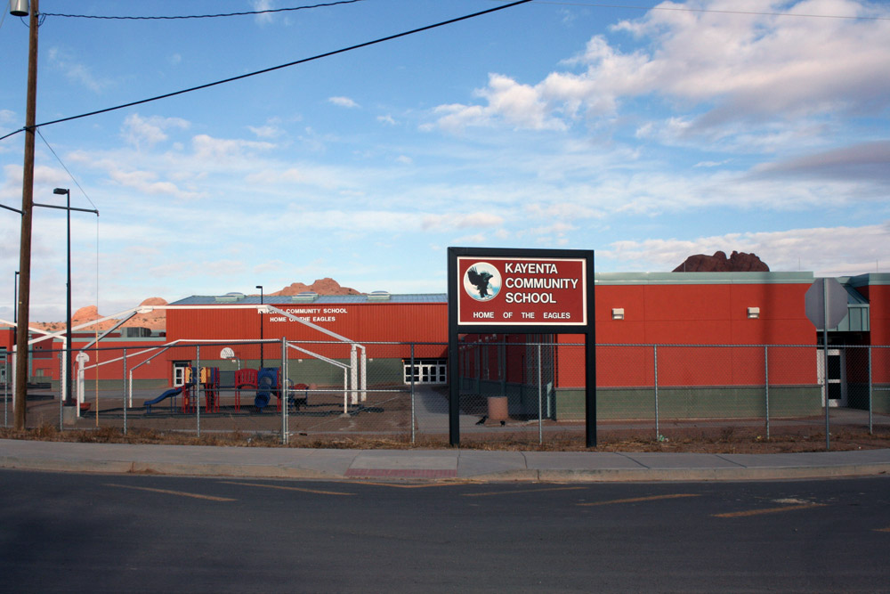
Kayenta Community School, a K-8 school operated by the Bureau of Indian Education, This facility, also known as Kayenta Boarding School, is a boarding school serving both day and dormitory students.
Community
Local facilities
Kayenta has a large recreation center dedicated to serving the local community. Just outside the Recreation Center is a skating park, as well as an outdoor park with several playgrounds for children. On the east side of the community is a paved landing strip that can handle small single engine and twin engine aircraft used for air tours and air ambulance services.
Churches
Many religious organizations are represented in Kayenta. There are churches for Baptists, Presbyterian Church, Lamb of God Pentecostal Church, Potter's House Christian Church, Kayenta Church of Christ, The Living Word Assembly of God Church Assemblies of God, Catholic Church (Our Lady of Guadalupe), a meetinghouse for the Church of Jesus Christ of Latter-day Saints, and a Kingdom Hall for Jehovah's Witnesses. Also there is a Bible church located on the hill of Kayenta.
References
References
- "2020 U.S. Gazetteer Files". United States Census Bureau.
- {{GNIS. 2408461
- Yurth, Cindy. (June 13, 2013). "The chapter with a town".
- [https://kayentatownship-nsn.gov/ Kayenta Township website]
- [https://kayentatownship-nsn.gov/township-history/#1639601982107-9bc8f6e8-6f0b Kayenta Township website-- history section]
- [http://www.weatherbase.com/weather/weather-summary.php3?s=875420&cityname=Kayenta%2C+Arizona%2C+United+States+of+America&units= Climate Summary for Kayenta, Arizona]
- "NOWData - NOAA Online Weather Data". [[National Oceanic and Atmospheric Administration]].
- "Census of Population and Housing". Census.gov.
- "U.S. Census website". [[United States Census Bureau]].
- (May 29, 2009). "Kayenta Fourth of July Rodeo Set To Become Premier Southwest Event". Kayenta Township.
- "2020 Census - School District Reference Map: Navajo County, AZ". [[U.S. Census Bureau]].
- "Debbie Braff Elementary School {{!}} Home".
- "Baker Middle School {{!}} Home".
- "ABC Preschool".
- "Arizona Legislature".
- "Home".
- "Superintendent of Schools".
- "Governing Board – Kayenta Unified School District". [[Kayenta Unified School District]].
- "Kayenta Community School". [[Bureau of Indian Education]].
- "Home".
This article was imported from Wikipedia and is available under the Creative Commons Attribution-ShareAlike 4.0 License. Content has been adapted to SurfDoc format. Original contributors can be found on the article history page.
Ask Mako anything about Kayenta, Arizona — get instant answers, deeper analysis, and related topics.
Research with MakoFree with your Surf account
Create a free account to save articles, ask Mako questions, and organize your research.
Sign up freeThis content may have been generated or modified by AI. CloudSurf Software LLC is not responsible for the accuracy, completeness, or reliability of AI-generated content. Always verify important information from primary sources.
Report