From Surf Wiki (app.surf) — the open knowledge base
Kaveri
River in southern India

River in southern India
| Field | Value | |
|---|---|---|
| name | Kaveri | |
| name_other | Cauvery | |
| <!---------------------- IMAGE & MAP --> | image | {{Photomontage |
| photo1a | Thalakkaveri_Temple,_Karnataka.jpg | |
| photo1b | Kaveri_View_Rail_Bridge_Srirangapatna_Jul22_A7C_02120.jpg | |
| photo2a | Barahachukki.jpg | |
| photo2b | Hogenakkal_Falls_Close.jpg | |
| photo3a | Bhavani-Kaveri-Sangamam.JPG | |
| photo3b | Grand Anaicut.jpg | |
| foot_montage | Clockwise from top left: Talakaveri; Kaveri at Srirangapatna; Hogenakkal Falls; Kallanai Dam; Confluence with Bhavani; and Shivanasamudra Falls | |
| size | 250 | |
| position | center | |
| map_size | 250px | |
| map | Cauvery River Basin.png | |
| map_caption | Kaveri River basin | |
| pushpin_map_caption | ||
| subdivision_type1 | Country | |
| subdivision_name1 | India | |
| subdivision_type2 | Region | |
| subdivision_name2 | South India | |
| subdivision_type3 | States | |
| subdivision_name3 | Karnataka, Tamil Nadu, Kerala, Puducherry | |
| <!---------------------- PHYSICAL CHARACTERISTICS --> | length | 800 km |
| discharge1_location | Lower Anaicut (58.5 km upstream of mouth) | |
| discharge1_min | 144 m3/s | |
| discharge1_avg | 919 m3/s (1998-2024) | |
| discharge1_max | 4,075 m3/s | |
| discharge2_location | Grand Anicut (140 km upstream of mouth) | |
| discharge2_min | 78 m3/s | |
| discharge2_avg | 400.716 m3/s (1976-1979) | |
| 1,131 m3/s (1998-2024) | ||
| discharge2_max | 4,916 m3/s | |
| <!---------------------- BASIN FEATURES --> | source1 | Western Ghats |
| source1_location | Talakaveri, Kodagu district, (Coorg) Karnataka | |
| source1_coordinates | ||
| source1_elevation | 1,341 m | |
| mouth | Bay of Bengal | |
| mouth_location | Poompuhar, Mayiladuthurai district, Tamil Nadu | |
| mouth_elevation | 0 m | |
| basin_size | 81,155 km2 | |
| tributaries_left | Harangi, Hemavati, Shimsha, Arkavati, Sarabanga, Thirumanimutharu | |
| tributaries_right | Lakshmana Tirtha, Kabini, Bhavani, Noyyal, Amaravati, Moyar |
the river
1,131 m3/s (1998-2024) The Kaveri (anglicized as Cauvery), also known as Ponni (), is a major river flowing across Southern India. It is the third largest river in the region after Godavari and Krishna. The catchment area of the Kaveri basin is estimated to be 81155 km2 and encompasses the states of Tamil Nadu, Karnataka, Kerala, and the union territory of Puducherry.
The river rises at Talakaveri in the Brahmagiri range in the Western Ghats. The source is located at an elevation of 1,341 m in the Kodagu district of Karnataka. The river flows for about 320 km through the Deccan Plateau in Karnataka before entering Tamil Nadu. It flows further eastward in Tamil Nadu for 416 km before flowing into the Bay of Bengal near Poompuhar in Mayiladuthurai district of Tamil Nadu. The river flows for a total length of about 800 km. The major tributaries include Amaravati, Arkavati, Bhavani, Harangi, Hemavati, Kabini, Lakshmana Tirtha, Shimsha and Noyyal.
There are a number of dams on the river which form part of an extensive irrigation system and are used for the generation of hydroelectric power. The river has supported agriculture for centuries and has served as the lifeline of several kingdoms in the past. Access to the river's waters has been a cause of dispute among the states of Karnataka and Tamil Nadu for decades. The Kaveri basin is a densely populated region, with several towns and cities located on its banks.
The river is considered as sacred by the people of Southern India and is considered to be among the seven holy rivers of India. The river is often personified and worshiped as the goddess Kaveri. The river is mentioned in various Hindu religious texts including the Mahabharata and the Puranas. In ancient Tamil literature, the river is referenced to as Ponni meaning "the golden one".
Etymology
Kaveri is mentioned in Sanskrit as a holy river in various Hindu religious texts including the Mahabharata and the Puranas. The name itself might have had different etymologies. As per Skanda Purana, the river arose after Ganesha took a form of a crow and toppled sage Agastya's kamandala. The river then took its name from the Tamil language words kā meaning "crow" and viri meaning "spread" literally translating to "spread by a crow". It might also mean a river with wide spread banks as viri can also be translated as wide spread. The etymology of the river might have also been derived from kāviri, the Sankethi word for "river" from the language spoken by the Sankethi people, who live along its waters. Cauvery is the anglicized version of the original name.
The river is also known by other names. In ancient Tamil literature, the river was called Ponni meaning "the golden one" in reference to the fine silt it deposits. It is known as Daksina gaṅgā meaning the "Ganges of the South" indicating its geographical location and its significance. It is also mentioned as Ardha gaṅgā meaning Half Ganga in Mahabharata and other literature, due to its purported mythology of having arisen from the Ganges. Marudvṛdhā is another hypothesised name for this river, meaning "the beloved of the Maruts" in Sanskrit.
Course
The river arises at Talakaveri in Kodagu district of Karnataka. The source of the river is located at an altitude of 1,341 m in the Brahmagiri Hills of the Western Ghats. Its follows a rough upper course consisting of rocky beds and high banks. Once it leaves the Kodagu hills, it flows eastwards and forms a series of rapids and falls. It flows through a narrow gorge onto the Deccan Plateau and drops about 18-24 m at Chunchanakatte Falls. The river forms the island of Srirangapatna and widens to 900-1200 ft before flowing south-east. At Shivanasamudra, the river drops 91 m and forms the Shivanasamudra Falls, one of the largest waterfalls in the country. After forming the island of Shivanasamudra, the river converges and passes through the Mekedatu gorge. After flowing for 320 km in Karnataka, the river flows for about 64 km along the Karnataka-Tamil Nadu border.
The river enters Tamil Nadu and forms the Hogenakkal Falls. After the falls, the river flows southwards towards Mettur Dam and joins its main right bank tributary Bhavani at Kooduthurai. The river flows eastwards through Erode and Karur, and widens further before entering the Tiruchirappalli district. It splits into two branches with the northern part called as Kollidam River and the southern part of the river retaining the name Kaveri. After flowing for 16 km, the two branches converge around the Srirangam island. The river further branches off into 36 different channels before emptying into the Bay of Bengal near Poompuhar in Mayiladuthurai district. The river traverses for about 416 km in Tamil Nadu for a total length of about 800 km.
Tributaries
The Kaveri River has 21 major tributaries. The largest tributary Hemavati, and Lakshmana Tirtha join the river at Krishna Raja Sagara. Kabini is another major contributor to the flow of Kaveri and joins the river in Karnataka. It meets with its second largest tributary Bhavani at Kooduthurai in Bhavani and two other tributaries Noyyal, and Amaravati join further down the stream in Tamil Nadu. Other tributaries of Kaveri include Shimsha, Arkavati, Sarabanga, and Thirumanimutharu.
Discharge
Source:
| Year | Grand Anicut | Lower Anicut | (m3/s) | (m3/s) | Min | Mean | Max | Min | Mean | Max | Overall | 78 | 1,151 | 4,916 | 144 | 928 | 4,075 |
|---|---|---|---|---|---|---|---|---|---|---|---|---|---|---|---|---|---|
| 1998 | 170 | 1,099 | 3,454 | 161 | 885 | 2,540 | |||||||||||
| 1999 | 289 | 1,131 | 3,778 | 285 | 864 | 2,845 | |||||||||||
| 2000 | 343 | 1,287 | 4,903 | 233 | 1,011 | 3,335 | |||||||||||
| 2001 | 258 | 1,080 | 3,348 | 309 | 948 | 3,115 | |||||||||||
| 2002 | 139 | 772 | 2,392 | 144 | 867 | 2,423 | |||||||||||
| 2003 | 78 | 667 | 2,297 | 216 | 646 | 2,100 | |||||||||||
| 2004 | 103 | 895 | 3,303 | 217 | 839 | 3,160 | |||||||||||
| 2005 | 179 | 1,012 | 3,354 | 240 | 991 | 3,873 | |||||||||||
| 2006 | 268 | 1,072 | 2,495 | 473 | 1,091 | 3,187 | |||||||||||
| 2007 | 118 | 993 | 3,308 | 324 | 1,126 | 4,075 | |||||||||||
| 2008 | 132 | 1,094 | 3,677 | 398 | 1,103 | 3,167 | |||||||||||
| 2009 | 227 | 1,040 | 3,238 | 290 | 965 | 3,301 | |||||||||||
| 2010 | 373 | 1,080 | 3,141 | 411 | 1,022 | 3,626 | |||||||||||
| 2011 | 171 | 1,163 | 3,815 | 296 | 928 | 3,014 | |||||||||||
| 2012 | 190 | 874 | 3,342 | 177 | 711 | 2,149 | |||||||||||
| 2013 | 82 | 1,043 | 3,281 | 229 | 856 | 3,127 | |||||||||||
| 2014 | 279 | 1,148 | 3,663 | 409 | 980 | 2,533 | |||||||||||
| 2015 | 559 | 1,422 | 3,816 | 407 | 913 | 2,177 | |||||||||||
| 2016 | 490 | 1,129 | 2,890 | 276 | 728 | 1,733 | |||||||||||
| 2017 | 216 | 931 | 3,586 | 154 | 671 | 1,832 | |||||||||||
| 2018 | 341 | 1,571 | 4,439 | 266 | 934 | 3,427 | |||||||||||
| 2019 | 331 | 1,473 | 4,559 | 173 | 966 | 3,070 | |||||||||||
| 2020 | 591 | 1,590 | 4,373 | 209 | 983 | 2,944 | |||||||||||
| 2021 | 478 | 1,502 | 3,935 | 257 | 988 | 3,136 | |||||||||||
| 2022 | 548 | 1,713 | 4,916 | 407 | 1,172 | 3,385 |
Geology and ecology
The Kaveri basin was formed in the Late Jurassic to Early Cretaceous period during Gondwana breakup and opening of the Indian Ocean. Most of the basin is made up of Precambrian rocks and the two major rock types that are found are metamorphic and igneous rocks. Closepet granite is found in the upper parts of the Kaveri basin and Charnockite rocks are only found in the central part. A 2017 paper proposed that an impact structure was present in the vicinity of the Kaveri river. The run-off from the river does not drain off quickly because of the shape of the river basin, which limits the occurrence of floods. It is a perennial river fed mostly by monsoons. Four distinct seasons occur in the basin with hot and cold seasons sandwiching the monsoon seasons. The river basin is fed by South-West monsoon in Karnataka, and North-East monsoon in Tamil Nadu.
The Kaveri basin is made up of two sub-zones, forest and agro-ecosystem. The forest vegetation consists of a mix of dry deciduous, evergreen forests, and grasslands. As per a study, about 12,850 km2 of natural vegetation was lost in the river basin between 1965 and 2016. The basin has a variety of flora with major species including Terminalia arjuna, Tamarindus indica, Pongamia pinnata, Salix tetrasperma, Ficus benghalensis, Ficus religiosa, Eucalyptus torticornis, and Diospyros montana.
There are many protected areas spread across the river basin including significant tiger and elephant habitats. The basin provides habitat to a range of animal species such as gaur, leopard, sloth bear, Bengal tiger, Indian elephant, Nilgiri tahr, grizzled giant squirrel, and various species of deer, wild boar and reptiles. The river also hosts a variety of avifauna including the painted stork (Mycteria leucocephala), spot-billed pelican (Pelecanus philippensis), and black-headed ibis (Threskiornis melanocephalus). It is also home to the mugger crocodile (Crocodylus palustris), smooth-coated otter (Lutrogale perspicillata), and hump-backed mahseer (Tor remadevii).
Riparian zone
The total watershed of the basin is 81,155 km2 and the riparian zone of the river consists of 43,856 km2 in Tamil Nadu, 34,273 km2 in Karnataka, 2,866 km2 in Kerala, and 160 km2 in the union territory of Puducherry. Over half of the Kaveri basin is arable and the most cultivated crops are rice and sugarcane. An estimate at the time of the first Five Year Plan put the total flow of the river at 12000000 acre.ft, of which 60% was used for irrigation. The river is also used for drinking water and hydroelectric power generation.
The Grand Anicut was constructed by a Chola King in 2nd century CE. The hydroelectric plant built on the Sivanasamudra Falls in 1902 was the first hydroelectric plant in Asia. The Mettur Dam in Tamil Nadu was constructed in 1934 and the Stanley Reservoir formed by the dam has a capacity of 93.4 tmc ft. Krishna Raja Sagara in Karnataka is the second largest dam on the river and has a capacity of 49.5 tmc ft. Bhavanisagar Dam (32.8 tmc ft) on the Bhavani River in Tamil Nadu, Gorur dam (37.1 tmc ft) on the Hemavathi River, Kabini Dam (18.5 tmc ft) on the Kabini River, and Harangi Dam (9.5 tmc ft) on the Harangi River in Karnataka are major dams on the tributaries of Kaveri.
Water dispute
The dispute over the sharing of Kaveri waters began in 1807 when the Madras Presidency objected to the plans of the Mysore kingdom to develop irrigation projects. After initial discussions failed, the British Raj intervened and a six rule agreement called the General Agreement of 1892 was signed. After Indian Independence, article 262 of the Constitution of India provided powers to the Government of India to adjudicate on inter-state disputes on water sharing. The Government of India constituted the Cauvery Water Disputes Tribunal (CWDT) on 2 June 1990 to adjudicate the water dispute between the riparian states and territories in the river basin. In an order passed in June 1991, the CWDT directed Karnataka to release 205 tmc ft of water per year to Tamil Nadu based on a specific schedule. The water was to be released in four equal installments in a particular month and any shortfall would need to be covered in the subsequent week. Tamil Nadu was directed to provide 6 tmc ft of water to Puducherry.
In July 1991, the President of India asked the Supreme Court of India to rule on the validity and legality of the tribunal under the Constitution. In November 1991, the Supreme Court opined that the order needs to be published by the central government in the Official Gazette, which was done on 1 December 1991. In May 1992, the Government of Tamil Nadu filed a case in the Supreme Court to direct the Indian Government to pass necessary orders to ensure the implementation of the provisions of the tribunal order. In April 1997, the Attorney General of India reverted that the central government has prepared a scheme under the Inter-State Water Disputes Act, 1956 for the implementation of the tribunal award and the Cauvery Water Authority (CRA) and Cauvery Monitoring Committee (CMC) were formed subsequently as a part of the Cauvery Water (Implementation of Interim Orders of 1991 and all subsequent Tribunal Orders) Scheme, 1998. The CRA is headed by the Prime Minister of India and consists of the Chief Ministers of the riparian states as its constituent members.
On 16 February 2018, the Supreme Court ruled that Karnataka will get 284.75 tmc ft, Tamil Nadu will get 404.25 tmc ft, Kerala will get 30 tmc ft and Puducherry will get 7 tmc ft of water from the river. An additional 10 tmc ft was reserved for environmental protection and 4 tmc ft was reserved for wastage into the sea. The court directed the government to form a Cauvery Water Management Authority (CWMA) within six weeks and acting on the Supreme Court's direction, the central government constituted the CMWA in June 2018.
Religious significance
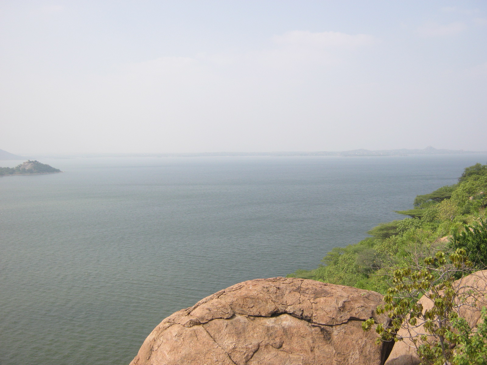
_-_img_48_(cropped).jpg)
In Hinduism, the river is considered one of seven holy rivers in India. The river is personified and worshiped as the river goddess Kaveri Amma. Kaveri is mentioned as both a river and a goddess in various Hindu texts such as the Mahabharata and the Puranas. The river is mentioned as one of the seven holy Gangas and bathing in the river is said to grant one's desired as per the Sivapurana. The Varaha Purana states that the river flows from the five great mountains and gives longevity to those who drink the waters of the river. The Skanda Purana narrates the various origins of the river. Shiva filled Agastya's bowl with Kaveri, who flowed as a river with the help of Ganesha.
In another legend, Lopamudra becomes Agastya's wife and takes on a form of water during a severe drought in South India. Agastya carries her in his small brass water pot and Ganesha, in the form of crow, knocks the water pot down. The spilled water runs down the hill and onto the drought-stricken land. Another story narrates that during the Samudra Manthana, or churning of the Ocean of Milk, Mohini and Lopamudra retrieved the nectar of immortality for the gods. Afterwards, Brahma took care of Lopamudra as his daughter and later offered her to king Kavera, who renamed her as Kaveri. When Kaveri grew up she prayed to Brahma to transform her into a purifying river.
As per the Tamil literature Manimekalai, Agastya drank the Ganges River in anger, when the floods destroyed his tapas and later released it in South India. Silapathikaram mentions Kaveri as the daughter of Kavera. In Theravada Buddhism, Kaveri is mentioned as a water channel. It is part of the twenty canal-systems associated with the reservoir Parakkamasamudda that existed in the Polonnaruwa region during the reign of king Parakramabahu I.
Kaveri Pushkaram is a Hindu festival dedicated to the river. It is generally observed once every 12 years, with a "Maha Pushkaram" held every 144 years. The key pilgrimage sites includes Srirangam and Thula Kattam at Mayiladuthurai near the mouth of the river. The festival is celebrated for 12 days, and includes ceremonial observations such as homam, yagnam, chanting of the Vedas, ritual feeding, and tharpanam accompanied by cultural activities such as music, dance, and spiritual speeches.
Notes
References
References
- "Integrated Hydrological Data Book". [[Central Water Commission]].
- "River Discharge and Reservoir Storage Changes - Area 2043". Flood observatory, [[Colorado University]].
- "River Discharge and Reservoir Storage Changes - Area 2042". Flood observatory, [[Colorado University]].
- "Gauging Station - Data Summary". RivDis.
- "Cauvery Water". [[Ministry of Jal Shakti]], [[Government of India]].
- (1938). "Journal of the Madras Geographical Association". [[Indian Geographical Society]].
- (2007). "South India Heritage: An Introduction". East West Books.
- "Kaveri". Wisdom library.
- (9 September 2021). "River Kaveri Story". Samayam.
- (4 January 2024). "Cauvery flows, thanks to a crow!". E-pao.
- (5 November 2022). "How the Rivers of India Descended From the Heavens: Kaveri". [[Outlook (Indian magazine).
- Civarāman̲, Akilā. (1900). "Kandha Puranam". GIRI Trading.
- (27 April 2014). "Daughter of Ponni". [[The Indian Express]].
- (8 February 2020). "Cauvery Chronicles II: Ponni's Perish". Newslaundry.
- (11 June 2019). "The death of a river". Millennium Post.
- "Kaveri River".
- "Marudvṛdhā". Sanskrit Lexicon.
- (2007). "Hydrology and Water Resources of India". [[Springer Science]].
- Singh, Dhruv Sen. (2018). "The Indian rivers : scientific and socio-economic aspects". [[Springer Science]].
- (2015). "Environmental Management of River Basin Ecosystems". [[Springer Science]].
- (2017). "Major geologic events of the Cauvery Basin, India and their correlation with global signatures – A review". Journal of Palaeogeography.
- (October 2017). "Kaveri crater – An impact structure in the Precambrian terrain of southern India". Journal of the Geological Society of India.
- (11 December 2023). "Natural vegetation on nearly 12,850 sq. km in the Cauvery basin has been lost, says a research paper". [[The Hindu]].
- (2010-11-01). "Riparian vegetation assessment of Cauvery River Basin of South India". Environmental Monitoring and Assessment.
- (November 2021). "National Parks and Wildlife Sanctuaries in India". [[Ministry of Environment, Forest and Climate Change]], [[Government of India]].
- "Ranganathittu Bird Sanctuary". Ramsar Sites Information Service.
- "Chapter 26: Irrigation and power". [[Planning Commission of India]].
- "Archived copy". TCE.
- "World Waterfall Database".
- "Reservoir levels". [[Government of Tamil Nadu]].
- (26 March 2006). "Corporation urged to chalk out water policy for Mysore city". [[The Hindu]].
- (2002). "Historical Background Of The Cauvery Water Dispute". Proceedings of the Indian History Congress.
- "Article 262 of Indian Constitution". Indiakanoon.
- "Archived copy".
- Rajagopal, Krishnadas. (16 February 2018). "Supreme Court curtails Tamil Nadu's share of Cauvery water". [[The Hindu]].
- "Cauvery Water Management Scheme, 2018". [[Ministry of Jal Shakti]], [[Government of India]].
- (23 June 2018). "Cauvery dispute". News Minute.
- Warrier, Shrikala. (2014). "Kamandalu: The Seven Sacred Rivers of Hinduism". Mayur University.
- Eck, Diana L.. (2012). "India: A Sacred Geography". Harmony Books.
- (19 September 2019). "Cauvery Pushkaram: Celebration of rivers". [[The Indian Express]].
- (12 September 2017). "Kaveri Maha Pushkaram 2017 Celebration in Srirangam and Mayiladuthurai: Tamil Nadu Set for Holy Festival along Cauvery". India.com.
- (11 September 2017). "Mayiladuthurai ready for Cauvery Maha Pushkaram". [[The Hindu]].
This article was imported from Wikipedia and is available under the Creative Commons Attribution-ShareAlike 4.0 License. Content has been adapted to SurfDoc format. Original contributors can be found on the article history page.
Ask Mako anything about Kaveri — get instant answers, deeper analysis, and related topics.
Research with MakoFree with your Surf account
Create a free account to save articles, ask Mako questions, and organize your research.
Sign up freeThis content may have been generated or modified by AI. CloudSurf Software LLC is not responsible for the accuracy, completeness, or reliability of AI-generated content. Always verify important information from primary sources.
Report