From Surf Wiki (app.surf) — the open knowledge base
Kassala
Town in Kassala State, Sudan
Town in Kassala State, Sudan
| Field | Value | |
|---|---|---|
| <!-- Basic info ----------------> | official_name | Kassala |
| native_name | كسلا (Arabic) | |
| ከሰላ (Tigrinya) | ||
| settlement_type | City | |
| motto | ||
| image_skyline | Kassala center Totil.jpg | |
| image_caption | Overlooking Kassala | |
| pushpin_map | Sudan | |
| pushpin_label_position | left | |
| pushpin_map_caption | Location in Sudan | |
| pushpin_relief | yes | |
| <!-- Location ------------------> | subdivision_type | Country |
| subdivision_name | [[Image:Flag of Sudan.svg | 25px]] Sudan |
| subdivision_type1 | State | |
| subdivision_name1 | Kassala State | |
| subdivision_name4 | ||
| leader_title1 | ||
| established_title | ||
| established_title2 | ||
| established_title3 | ||
| established_date3 | ||
| unit_pref | Imperial | |
| area_total_km2 | ||
| area_land_km2 | ||
| area_blank1_sq_mi | ||
| population_as_of | 2025 | |
| population_total | 411,574 | |
| population_blank1_title | Ethnicities | |
| population_blank2_title | Religions | |
| population_density_blank1_sq_mi | ||
| timezone | CAT | |
| utc_offset | +02:00 | |
| coordinates | ||
| elevation_footnotes | ||
| elevation_ft | 1,665 | |
| postal_code_type |
ከሰላ (Tigrinya)
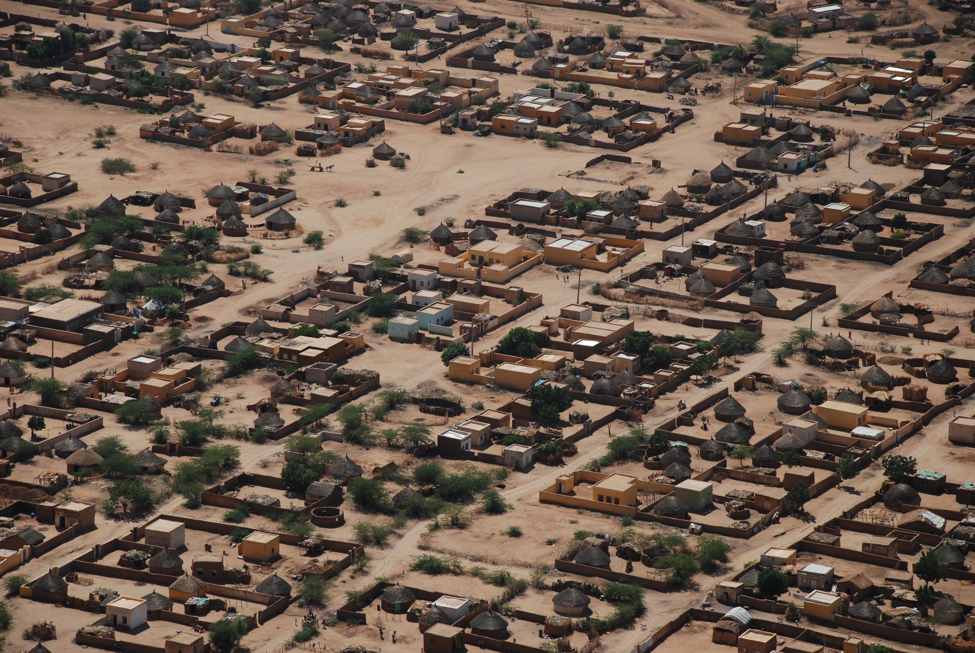
Kassala (, ) is the capital of the state of Kassala in eastern Sudan. In 2003 its population was recorded to be 530,950. Built on the banks of the Gash River, it is a market city and is famous for its fruit gardens. Many of its inhabitants are from the Hadendawa sub-tribe of the Beja ethnic group.
The city was formerly a railroad hub, however, as of 2006 there was no operational railway station in Kassala and much of the track leading to and from the city has been salvaged or fallen into disrepair. Kassala's location along the main Khartoum-Port Sudan highway makes it an important trade center.
History
In 1834, the Egyptian Army established Kassala as a garrison town following its conquest of Sudan in 1821. When the Mahdist state was established, the Egyptian garrison in Kassala found itself besieged by Mahdist forces. Under the terms of the 1884 Hewett Treaty, Abyssinian forces led by Ras Alula attempted to rescue the Egyptians. Although Ras Alula successfully defeated the Mahdists at the Battle of Kufit, he was unable to breach Kassala’s defenses and liberate the Egyptians. In 1886, after prolonged resistance, the Egyptian garrison finally surrendered to the Mahdists under Osman Digna.
On July 17, 1894, Italy annexed Kassala to Italian Eritrea. The Italians fortified the town and brought stability to the region by pacifying the Beja, the dominant local population. However, Italy's defeat at the Battle of Adwa in 1896 changed Kassala's fate. Italy was forced to evacuate the town after failing to hold it until the arrival of advancing Anglo-Egyptian forces, who re-occupied Kassala and incorporated it into Anglo-Egyptian Sudan.
In the early 1900s, a railway was constructed, first linking Kassala to the Red Sea port of Port Sudan—built in 1906 to replace Suakin—and later, in 1929, extending to Sennar on the southern frontiers of the Gezira Cotton Scheme. When the Anglo-Egyptian forces re-established control over Sudan, Kassala developed into a thriving trade center serving the Ethiopian hinterlands. Horticulture was introduced in the fertile lands near the Gash and Barka rivers, and the British later introduced cotton cultivation. The Kassala Cotton Company, a subsidiary of the Sudan Plantations Syndicate, played a role in these developments.
In July 1940, during the East African Campaign, Italian forces advancing from Italian East Africa forced the local British garrison to withdraw from Kassala. The Italians then occupied the city with brigade-sized units: on July 4, 1940 the Italians started their offensive with 2,500 men (and one brigade of cavalry) supported by 24 tanks, while to defend Kassala for Britain there were 1,300 colonial soldiers with their British officers who -after some initial heavy fighting- were easily defeated. The Italians later appointed as mayor of Kassala the future hero of Eritrean independence, Hamid Idris Awate. In mid-January 1941, the Italians withdrew from the city and a British garrison returned.
In 2003, Kassala's population was estimated at 530,950 inhabitants. The town is ethnically diverse, comprising groups such as the Beja, Beni-Amer, Amarar, Bishari, Rashaida, and Halanga, as well as significant immigrant communities from northern and western Sudan, including the Fula and Nuba peoples. The Ethiopian-Eritrean War (1998–2000) displaced an estimated 110,000 Eritreans refugees to the Kassala area, particularly from the border towns of Barentu and Teseney, which were overrun by the Ethiopian Army.
In 2025, during the Sudanese civil war (2023-present), Kassala had been involved in conflict for the first time since the war began 2 years ago. The RSF attacked Kassala with drones on 3 May 2025. The attack targeted the fuel storage area at the Kassala Airport. This attack marks the second furthest drone attack by the RSF from controlled areas by the RSF. RSF later attacked Port Sudan.
Climate

Kassala has a hot desert climate (Köppen climate classification BWh) characterized by high temperatures, low precipitation, and abundant sunshine. April through June marks the hottest period of the year, followed by the wet season from July through September, marked by higher humidity levels and intermittent rainfall. The rest of the year is very dry, with nearly no precipitation from November to March.
| Jan record high C = 41.7 | Feb record high C = 44.5 | Mar record high C = 45.5 | Apr record high C = 46.5 | May record high C = 47 | Jun record high C = 47.6 | Jul record high C = 43 | Aug record high C = 41.6 | Sep record high C = 43 | Oct record high C = 47 | Nov record high C = 42.7 | Dec record high C = 40.5 | year record high C = | Jan record low C = 5.0 | Feb record low C = 5 | Mar record low C = 8.9 | Apr record low C = 11.1 | May record low C = 16.2 | Jun record low C = 18.5 | Jul record low C = 17 | Aug record low C = 17.2 | Sep record low C = 17.5 | Oct record low C = 15.7 | Nov record low C = 11.1 | Dec record low C = 6.4 | year record low C = 5 |access-date = January 21, 2024}}{{Cite FTP | url = ftp://ftp.atdd.noaa.gov/pub/GCOS/WMO-Normals/RA-I/SU/62730.TXT | access-date = January 18, 2016}} | access-date = 22 October 2016}}
Current status

The Kassala region had a child mortality rate of 62 deaths per 1,000 live births in 2014, slightly higher than the national average of 52 child deaths per 1,000.
The Khatmiyya Mosque, built in 1840 by the Egyptians and damaged during the Mahdist War, is the city's most important cultural site. It is an important site for the Sufi Khatmiyya order.

Education
The city is home to Kassala University, a public university established in 1990 to replace the East University, and an important institution for development in the east of Sudan.{{cite web |access-date=2011-09-17 |archive-date=2011-09-28 |archive-url=https://web.archive.org/web/20110928195143/http://www.sudanvisiondaily.com/modules.php?name=News&file=article&sid=17521 |url-status=dead Including Faculty of Medicine and Health Sciences, Faculty of Education,Faculty of Economic and Administration, Faculty of Computer science and IT and more.
Notable people
- Bushara Abdel-Nadief (footballer)
- Aisha Musa Ahmad (singer)
- Hassan Al-Turabi (politician)
- Muhannad El Tahir (footballer)
- Nizar Hamid (footballer)
- Noor Uthman Muhammed
References
References
- "Wad Medani Population 2025".
- "GeoHive".
- (2003). "Encyclopaedia Aethiopica: Volume 3: He-N".
- "Map showing in detail the Kassala occupation by Italians (within a green line)".
- "MICS survey – Table CM.2".
This article was imported from Wikipedia and is available under the Creative Commons Attribution-ShareAlike 4.0 License. Content has been adapted to SurfDoc format. Original contributors can be found on the article history page.
Ask Mako anything about Kassala — get instant answers, deeper analysis, and related topics.
Research with MakoFree with your Surf account
Create a free account to save articles, ask Mako questions, and organize your research.
Sign up freeThis content may have been generated or modified by AI. CloudSurf Software LLC is not responsible for the accuracy, completeness, or reliability of AI-generated content. Always verify important information from primary sources.
Report