From Surf Wiki (app.surf) — the open knowledge base
Kasai River
Tributary of the Congo River; part of the DR Congo-Angola border
Tributary of the Congo River; part of the DR Congo-Angola border
| Field | Value |
|---|---|
| name | Kasai River |
| image | Sunset view from Kalonda.jpg |
| map | Kasai watershed.png |
| map_size | 250 |
| map_caption | Kasai River watershed (Interactive map) |
| pushpin_map_size | 300 |
| mapframe | yes |
| mapframe-zoom | 4 |
| subdivision_type1 | Countries |
| subdivision_name1 | |
| source1_location | Bié Plateau |
| source1_coordinates | |
| source1_elevation | 1,300 m |
| mouth | Congo River |
| mouth_location | Kwamouth, DRC |
| mouth_coordinates | |
| mouth_elevation | 272 m |
| length | 2,272 km |
| basin_size | 884,376 km2 |
| discharge3_location | Ilebo |
| discharge3_avg | (1950–1959)2,240 m3/s |
| discharge2_location | Kutu-Moke |
| discharge2_avg | (Period: 1948–2012)8,070 m3/s |
| discharge1_location | Lediba |
| discharge1_avg | (Period: 1922–2014)10,457 m3/s |
| progression | Kasai → Congo → Atlantic Ocean |
| river_system | Congo River |
| tributaries_left | Luembe, Longatshimo, Tshikapa, Lovua, Loange, Lubue, Piopio, Kamtsha, Kwango, Buma |
| tributaries_right | Munyango, Luau, Kasangeshi, Lueta, Lulua, Lutshuadi, Sankuru, Fimi |
| mapframe-zoom = 4
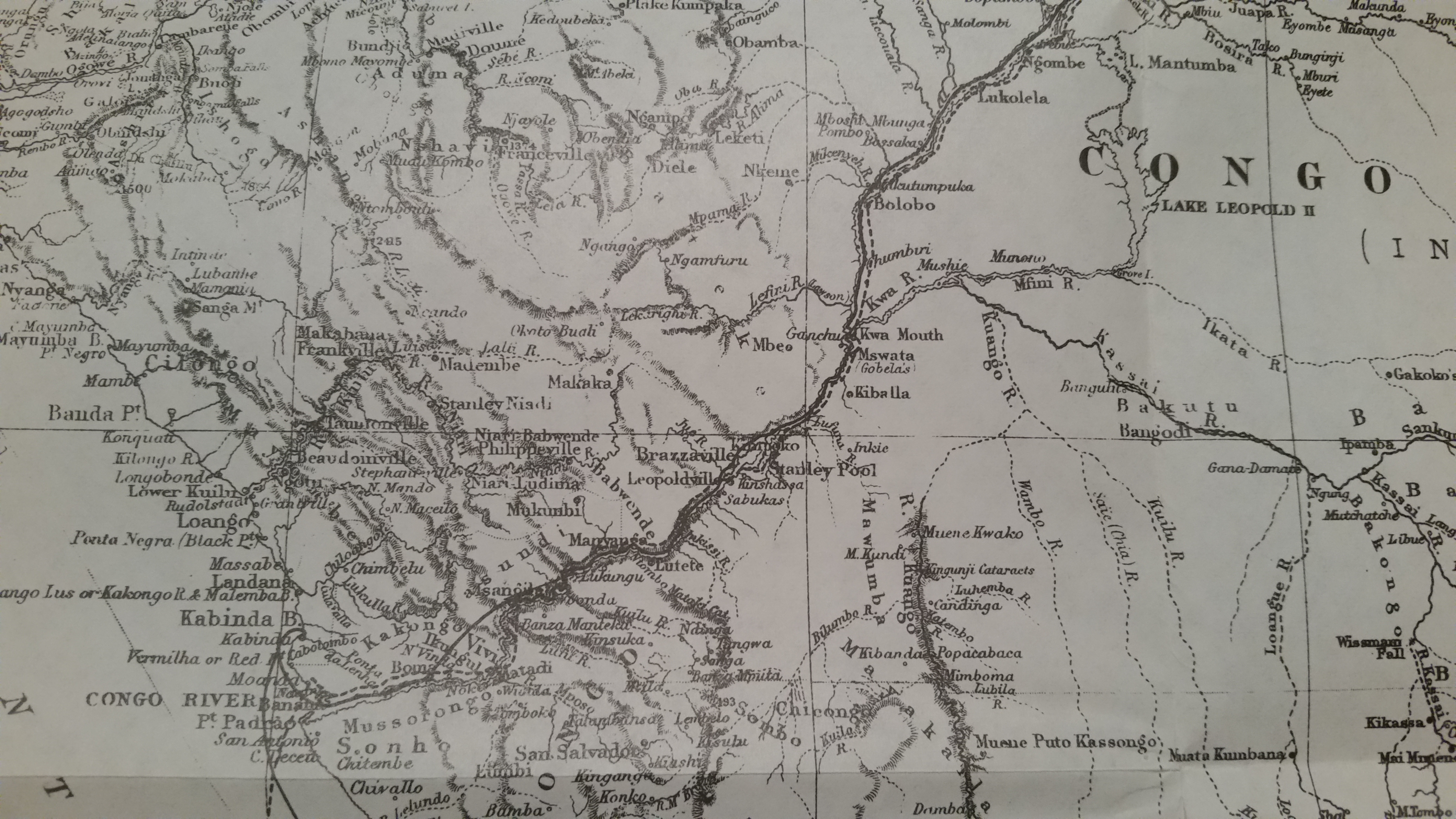
The Kasai River (, ; called Cassai in Angolan Portuguese) is a left bank tributary of the Congo River, located in Central Africa. The river begins in central Angola and flows to the east until it reaches the border between Angola and the Democratic Republic of the Congo, where it turns north and serves as the border until it flows into the DRC. From Ilebo, between the confluences with Lulua river and Sankuru river, the Kasai river turns to a westerly direction. The lower stretch of the river, from the confluence with Fimi river until it joins the Congo at Kwamouth northeast of Kinshasa, is also known as the Kwa(h) River.
The Kasai basin consists mainly of equatorial rainforest areas, which provide an agricultural land in a region noted for its infertile, sandy soil. It is a tributary of Congo river and diamonds are found in it. Around 60% of diamonds in Belgium go from Kasai river for cutting and shaping.
Discharge
| Year | Lediba | Kutu- | Average discharge |
|---|---|---|---|
| 2016 | 9,350 | ||
| 2015 | 8,090 | ||
| 2014 | 9,040 | ||
| 2013 | 9,520 | ||
| 2012 | 8,870 | 6,800 | |
| 2011 | 7,940 | 6,093 | |
| 2010 | 7,320 | 5,614 | |
| 2009 | 8,820 | 6,764 | |
| 2008 | 10,400 | 7,976 | |
| 2007 | 13,180 | 10,110 | |
| 2006 | 10,740 | 8,236 | |
| 2005 | 9,017 | 6,917 | |
| 2004 | 8,130 | 6,235 | |
| 2003 | 11,520 | 8,837 | |
| 2002 | 11,150 | 8,552 | |
| 2001 | 9,290 | 7,125 | |
| 2000 | 8,310 | 6,496 | |
| 1999 | 7,030 | 5,463 | |
| 1998 | 7,010 | 5,480 | |
| 1997 | 9,800 | 7,659 | |
| 1996 | 8,950 | 7,000 | |
| 1995 | 7,620 | 5,960 | |
| 1994 | 7,430 | 5,810 | |
| 1993 | 8,580 | 6,705 | |
| 1992 | 7,790 | 6,089 | |
| 1991 | 10,410 | 8,136 | |
| 1990 | 11,150 | 8,717 | |
| 1989 | 12,810 | 9,988 | |
| 1988 | 11,450 | 8,953 | |
| 1987 | 11,120 | 8,694 | |
| 1986 | 9,980 | 7,804 | |
| 1985 | 9,550 | 7,463 | |
| 1984 | 8,800 | 6,879 | |
| 1983 | 10,340 | 8,084 | |
| 1982 | 10,100 | 7,897 | |
| 1981 | 9,500 | 7,427 | |
| 1980 | 9,230 | 7,213 | |
| 1979 | 11,710 | 9,153 | |
| 1978 | 10,730 | 8,385 | |
| 1977 | 12,450 | 9,731 | |
| 1976 | 11,760 | 9,194 | |
| 1975 | 10,720 | 8,383 | |
| 1974 | 10,080 | 7,878 | |
| 1973 | 9,970 | 7,796 | |
| 1972 | 10,540 | 8,236 | |
| 1971 | 11,360 | 8,880 | |
| 1970 | 12,040 | 9,232 | |
| 1969 | 13,020 | 9,986 | |
| 1968 | 13,100 | 10,050 | |
| 1967 | 11,510 | 8,832 | |
| 1966 | 12,340 | 9,466 | |
| 1965 | 10,970 | 8,417 | |
| 1964 | 11,950 | 9,167 | |
| 1963 | 11,960 | 9,173 | |
| 1962 | 13,510 | 10,360 | |
| 1961 | 12,440 | 9,543 | |
| 1960 | 11,430 | 8,764 | |
| 1959 | 9,960 | 7,638 | |
| 1958 | 9,850 | 7,552 | |
| 1957 | 11,810 | 9,060 | |
| 1956 | 11,580 | 8,882 | |
| 1955 | 11,360 | 8,717 | |
| 1954 | 11,390 | 8,735 | |
| 1953 | 10,220 | 7,837 | |
| 1952 | 10,490 | 8,646 | |
| 1951 | 11,260 | 8,640 | |
| 1950 | 11,240 | 8,619 | |
| 1949 | 11,560 | 8,870 | |
| 1948 | 11,360 | 8,716 | |
| Notes: | |||
| Source: |
Exploration
Henry Morton Stanley reached the confluence on 9 March 1877, calling the river Nkutu, a "powerful and deep river", but recognizing it as originating from David Livingstone's Kwango.
Tributaries
The Kasai's main tributaries upstream from the confluence with the Congo:
- Fimi (right – Fimi with Lukenie 1,120 km)
- Kwilu–Kwango (left – 1,702 km)
- Loange (left – 865 km)
- Sankuru (right – Sankuru–Lubilanji 1,280 km)
- Lulua (right – 1,184 km)
- Tshikapa (left – 630 km)
- Longatshimo (left – 550 km)
- Luembe (left – 780 km)
- Lueta (right – 395 km)
| Left tributary | Right tributary | Length (km) | Basin size (km2) | Average discharge (m3/s)* |
|---|---|---|---|---|
| Kwa–Kasai | 2,272 | 894,486.6 | 10,457.3 | |
| Kwa | ||||
| Mbala | 57.5 | 1,100.1 | 14.9 | |
| Fimi ¹ | 1,120 | 136,174.7 | 2,252.9 | |
| Lower Kasai | ||||
| Lekulu | 57.5 | 793.5 | 9.3 | |
| Buma | 138 | 3,354.7 | 42.3 | |
| Kwango | 1,702 | 270,904.3 | 3,317.4 | |
| Kamtsha | 250 | 8,887.4 | 106.4 | |
| Piopio | 165 | 3,169.1 | 34.8 | |
| Liau | 1,231.6 | 14.4 | ||
| Lubue | 227 | 8,611.7 | 103.5 | |
| Loange | 865 | 41,799.5 | 489.1 | |
| Middle Kasai | ||||
| Lumbudji | 137 | 2,876.8 | 25.4 | |
| Lubudi | 153 | 1,999.2 | 17 | |
| Sankuru ² | 1,280 | 149,479.5 | 1,738.1 | |
| Lutshuadi | 177 | 4,596.5 | 39.2 | |
| Lulua | 1,184 | 70,612.5 | 798 | |
| Upper Kasai | ||||
| Yeye | 47 | 1,379.3 | 8.9 | |
| Kabambaie | 77 | 2,083.7 | 10.8 | |
| Lovua | 297 | 8,262.4 | 73.9 | |
| Tshikapa | 630 | 19,512.1 | 179.5 | |
| Longatshimo | 550 | 19,847.3 | 198.5 | |
| Luenda | 69 | 1,791.4 | 10.1 | |
| Luembe | 780 | 46,648.8 | 453.4 | |
| Lueta (Kaungej) | 395 | 13,000.1 | 87.6 | |
| Kasangeshi | 206 | 3,610.2 | 22.1 | |
| Luele | 1,173.3 | 7.9 | ||
| Dembo | 87 | 1,924.8 | 13.1 | |
| Luau | 105 | 4,294.4 | 38.5 | |
| Lualo | 1,532.8 | 14.6 | ||
| Lutshima | 166 | 1,616.6 | 11.5 | |
| Munyango | 3,133.1 | 20.9 | ||
| Notes: | ||||
| Source: |
Economic importance
The tributaries of River Kasai are clear of obstacles like cataracts and river weed, making them very navigable. They facilitate the transport sector and form an important trade artery. The river's role in transport and trade was more prominent during the pre-colonial period when the slave trade was legal. Slave traders used one of its major tributaries, the Kwango River, to navigate the equatorial rain forest, capture slaves and find their way back to the Atlantic Ocean where they had docked their ships. It is greatly controversial that some of the local kingdoms that were along the Kasai River supported the slave trade. The Rund kingdom for instance, readily provided slaves for the most notorious slave traders like John Matthews, a renowned British slave vendor. These activities, though they occurred between the 18th and 19th centuries, left a lasting impact in the regions where they were most prominent, such as between the Kwango and the Kwilu rivers. The population has never recovered fully, with the population density lower than that of areas that did not experience the slave trade. The most probable trigger to British and Portuguese great interests in the Kasai River was the presence of alluvial diamonds lying in rich deposit beds, especially at the river's mouth. More deposits lie along the beds of a major tributary, the Kwango River. In fact, it is common to hear the phrase “the diamond heartland of North Eastern Angola” used in reference to the Kwango River valley. This is because the diamond alluvial beds found in this region are the richest in Angola.
References
References
- "Le cours de la rivière Kasaï".
- (2018). "Satellite-based estimates of surface water dynamics in the Congo River Basin". International Journal of Applied Earth Observation and Geoinformation.
- "Zaire". BGS, British Geological Survey.
- (2020). "Recent Budget of Hydroclimatology and Hydrosedimentology of the Congo River in Central Africa". Water.
- Dr. Raphael, M. Tshimanga. (2019). "Centre de Recherche en Ressources en Eau du Bassin du Congo".
- (2023). "Improved modeling of Congo's hydrology for floods and droughts analysis and ENSO teleconnections". Regional Studies.
- Stanley, H.M., 1899, Through the Dark Continent, London: G. Newnes, Vol. One {{ISBN. 0486256677, Vol. Two {{ISBN. 0486256685
- Eric, Tilman. "Congo River".
- Broadhead, Susan. (1992). "Historical dictionary of Angola". Scarecrow Press.
This article was imported from Wikipedia and is available under the Creative Commons Attribution-ShareAlike 4.0 License. Content has been adapted to SurfDoc format. Original contributors can be found on the article history page.
Ask Mako anything about Kasai River — get instant answers, deeper analysis, and related topics.
Research with MakoFree with your Surf account
Create a free account to save articles, ask Mako questions, and organize your research.
Sign up freeThis content may have been generated or modified by AI. CloudSurf Software LLC is not responsible for the accuracy, completeness, or reliability of AI-generated content. Always verify important information from primary sources.
Report