From Surf Wiki (app.surf) — the open knowledge base
Karaj
City in Alborz province, Iran
City in Alborz province, Iran
| Field | Value |
|---|---|
| name | Karaj |
| native_name | کرج |
| settlement_type | City |
| image_skyline | {{multiple image |
| perrow | 1/2/2/2 |
| border | infobox |
| total_width | 300 |
| image1 | Azimieh Aerial View.jpg |
| caption1 | View of the city |
| image2 | Pearl Palace -Kakh e Morvarid- Karaj Iran.jpg |
| caption2 | Pearl Palace |
| image3 | کاخ سلیمانیه دیواره شرقی.jpg |
| caption3 | Soleymaniyeh Palace |
| image4 | Amir kabir Dam.jpg |
| caption4 | Amir Kabir Dam lake |
| image5 | Emam zadeh Taher 01 امامزاده طاهر- کرج.jpg |
| caption5 | Emamzadeh Taher |
| image6 | ورودی کاروانسرای شاه عباسی کرج.jpg |
| caption6 | Shah Abbasi Caravansarai |
| image7 | Aderan Karaj.jpg |
| caption7 | Karaj River in Adaran |
| image_size | 300px |
| image_seal | Karaj government logo.svg |
| mapsize | 150px |
| pushpin_map | Iran |
| coordinates | |
| coordinates_footnotes | |
| subdivision_type | Country |
| subdivision_name | Iran |
| subdivision_type1 | Province |
| subdivision_type2 | County |
| subdivision_type3 | District |
| subdivision_name1 | Alborz |
| subdivision_name2 | Karaj |
| subdivision_name3 | Central |
| leader_title | Mayor |
| leader_name | Mehrdad Kiani |
| leader_title1 | City Council Chairman |
| leader_name1 | Javid Chapardar |
| area_total_km2 | 250 |
| elevation_m | 1312 |
| population_footnotes | |
| population_urban | 1973470 |
| population_metro | 3,000,000 |
| population_as_of | 2025 |
| population_total | 1,973,470 |
| population_density_km2 | auto |
| population_blank1_title | Population Rank in Iran |
| population_blank1 | 4th |
| area_code | 026 |
| registration_plate | IRAN 68 38 21 30 |
| blank_name | Climate |
| blank_info | BSk |
| website | karaj.ir |
| timezone | IRST |
| utc_offset | +3:30 |
Karaj (; ) is a city in the Central District of Karaj County, Alborz province, Iran, serving as capital of the province, the county, and the district. Earliest evidence of inhabitation in Karaj can be dated to the Bronze Age at Tepe Khurvin. The city was developed under the rule of the Safavid and Qajar Empire and is home to historical buildings and memorials from those eras. This city has a unique climate due to access to natural resources such as many trees, rivers, and green plains. After Tehran, Karaj is the largest immigrant-friendly city in Iran, so it has been nicknamed "Little Iran."
Although the county hosts a population around 1.97 million, as recorded in the 2016 census, most of the 1,419 km2 county is rugged mountain. The urban area is the fourth-largest in Iran, after Tehran, Mashhad, and Isfahan. Eshtehard County and Fardis County were split off from Karaj County since the previous census.
History
The area around Karaj has been inhabited for thousands of years, as shown by the Bronze Age site of Tepe Khurvin and the Iron Age site of Kalak. However, the present-day city of Karaj is mostly the result of modern industrial development in the 20th century.
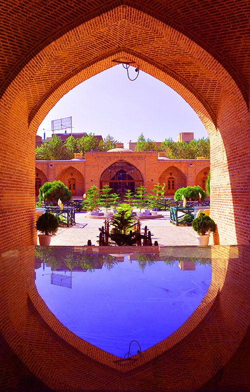
Karaj was mostly significant as a stage on the road between Tehran and Qazvin. In Safavid times, a stone bridge was built that served as the main crossing into the town. The large Shah-Abbasi Caravansarai, located at the southeast of Towhid Square, was built in the same era, under the rule of Šāh Esmāil.
In 1810, the Qajar prince Soleyman Mirza built the Soleymaniyeh Palace at Karaj to serve as a summer resort. The palace had four towers and was surrounded by gardens. Its reception room featured a pair of paintings by Abdallah Khan Naqqashbandi. By 1860, however, the palace was described as abandoned and only used as a shelter for travelers. Naser al-Din Shah Qajar later renovated the palace. In 1917, a School of Farming was established on the site, replacing the earlier Mozaffari Agricultural School in Tehran. Later, Reza Pahlavi granted it to the University of Tehran's new Faculty of Agriculture.
In the 1930s, plans were drawn up for a large industrial complex covering 216 hectares on the south side of the village. This "Industrial Model Town of Karaj" was intended to be the site of the country's first steel mills, capitalizing on easy access to water and coal from the Alborz. However, the construction equipment imported from Germany was impounded by the British going through the Suez Canal in 1940, and the planned complex was never built.
A major industrial complex, the first privately owned one in Karaj, was built in the 1960s by Mohammad-Sadeq Fateh. This complex, called Shahrak-e Jahanshahr, included oil, tea, and textile factories as well as housing for the workers.

The Morvārid Palace was constructed in the nearby Mehršahr district, during the Pahlavi era. It was designed by the Frank Lloyd Wright Foundation (Taliesin Associated Architects) on instructions from Shams Pahlavi, elder sister of Mohammad Reza Pahlavi. In this period, it was a transit and industrial town.
Majority of the structure is now controlled by the Basij Organization, and some sections of it are open to public under the operation of Cultural Heritage Organization of Iran.
Other historical sites of the city include the Mausoleum of Šāhzāde Soleymān, Emāmzāde Rahmān, Emāmzāde Zeyd, and Palang Ābād e Eštehārd.
As part of the regime's violent crackdown during the 2025–2026 Iranian protests, demonstrators were shot by regime security forces while marching in the city.
Demographics
Ethnicity
The majority of the residents of Karaj are Persians, with Azerbaijanis making up the second major ethno-linguistic group of the city. Kurds, Gilak, Tabari and Lurs include the other ethnicities among the population of Karaj.
| Male | Female | Total | Ref. |
|---|---|---|---|
| 890,824 | 886,570 | 1,759,394 |
| age (0–14 years) | age (15–29 years) | age (30–64 years) | age (65 years and older) |
|---|---|---|---|
| 20.3% | 23.6% | 50.2% | 6.0% |
Population
At the time of the 2006 National Census, the city's population was 1,377,450 in 385,955 households, when it was in Tehran province. The 2016 census measured the population of the city as 1,592,492 people in 508,420 households, by which time the county had been separated from the province in the establishment of Alborz province.
Geography
Regions
thumb|Azimiyeh Karaj The downtown of Karaj is usually referred to Karaj Square, located hundred of meters to the west of Karaj River and the old Karaj Bridge. The villages Hesārak, Gowhar Dašt, and Šahrak e Azimie are located in the northern Greater Karaj.
Meškin Dašt, a large agricultural area between Mehršahr and Fardis, is near Karaj.
The following table includes the major districts of the city:
| Golŝahr Villā | Zibā Daŝt | Zoube Āhan | Sāsāni | Homāyun Villā | Mehrānŝahr | Mehdi Ābād | Ŝahrake Xātam | Miān Jādde | Heydar Ābād | Sāwoj Bolāq | Bahārestān |
|---|
Open space recreational areas of Karaj include Irānzamin Park, Pārk e Xānvāde, Tennis Park, Pārk e Mādar, Tāleqān Gardens, Kordān Gardens, Jahānšahr Gardens, Pardis e Golhā, and the Tulip Garden of Gačsār.
Climate
The climate of Karaj is a bit cooler than Tehran's, and it receives 250 mm of rain annually (and like Tehran, the precipitation pattern is similar to those of Mediterranean climates). The Köppen-Geiger climate classification system classifies the city's climate as cold semi-arid (BSk).
|Jan record high C = 18.2 |Feb record high C = 19.8 |Mar record high C = 27.4 |Apr record high C = 33.0 |May record high C = 34.6 |Jun record high C = 39.2 |Jul record high C = 42.0 |Aug record high C = 40.2 |Sep record high C = 37.2 |Oct record high C = 31.8 |Nov record high C = 25.0 |Dec record high C = 20.0 |year record high C = 42.0 |Jan record low C = -19.0 |Feb record low C = -15.6 |Mar record low C = -10.5 |Apr record low C = -3.5 |May record low C = -0.4 |Jun record low C = 7.2 |Jul record low C = 10.6 |Aug record low C = 12.0 |Sep record low C = 7.0 |Oct record low C = -0.5 |Nov record low C = -6.0 |Dec record low C = -14.6 |year record low C = -19.0
- (temperatures),
- (precipitation),
- (humidity),
- (days with precipitation and snow),
- (sunshine)
Amir Kabir Dam and some other small lakes are based in Karaj. The city is a starting point for a drive along road forced north through the Alborz mountain to the Caspian Sea.
Economy
The economic base of Karaj is its proximity to Tehran. It is due to the transportation of products between Tehran and the Caspian Sea. Chemicals, fertilizers and processed agricultural goods are also produced in the city.
Zowb Āhan, the avenue leading to an industrial plant, is located at the south of Ostandar Square. Zowb e Āhan or Zowb Āhan, literally "steel mill", was a contract between the Pahlavi government and a consortium from Nazi Germany. The establishment of the factory Zowb Āhan e Karaj was halted by the beginning of the Second World War, and it was never launched.
Šahrak-e Jahānšahr was the first modern private industrial and housing complex of Karaj, built in the 1960s. The factories Jahān Čit (textile factory), Rowqan Nabāti e Jahān (oil factory), and Čāy e Jahān (tea factory), were established at the complex. It is one of the largest industrial zones of the nation, with a 20% share of the national GDP.
The special economic zone of Payam, with an area about 3600 ha within the territory of Payam International Airport, was established in Karaj for development of air cargo and postal transportation, cold store, and packing services, as well as perishable and time sensitive exports. It is the only SEZ in the region with the privilege of its own airline.
Women's clothing
Small and medium women's clothing companies in Karaj produce all kinds of daily clothes and leather boots. Karaj was one of the few Iranian cities in the 2010s that controlled the damage to the environment in the process of producing women's clothing. Karaj women's over-the-knee boots are exported to the whole country and have a significant contribution to the city's economy.
Transport

Railway
Karaj is connected by railway and highways to Tehran 40 km east and Qazvin 100 km northwest, and by commuter rail to the subway system of Tehran.
Metro
The city is served Karaj Metro with 2 lines and 10 stations. Karaj urban railway organization established on 21 December 2001.

| Line | Line Route | Length | Stations |
|---|---|---|---|
| [](karaj-metro-line-1) | Germdareh – new city of Mehestan | 43 km (26.7 mi) | 7 |
| [](karaj-metro-line-2) | Kamalshahr–Mallard | 27 km (16 mi) | 23 |
| [](karaj-metro-line-3) | Karaj–Azimiyeh | 14 km (9 mi) | 12 |
| [](karaj-metro-line-4) | Baghestan – Karaj (Payam) Airport | 18 km (11.1 mi) | 19 |
| [](karaj-metro-line-5) | Shahid Moazen Boulevard – Mohamadshahr | 12 km (7.5 mi) | 10 |
| [](karaj-metro-line-6) | Esteghlal Boulevard – Shahid Soltani Square | 9 km (6 mi) | 8 |
| Total: | 97 km (60 mi) | 76 |
Road
The highway system of Karaj includes Tehran–Karaj Highway, Karaj Special Road, and the old road of Karaj (Fath Highway). Bākeri Expressway is one of the main north-to-south routes in west Tehran, which is connected to the Tehran–Karaj Highway. Tehran–Karaj Highway is one of the busiest sections in Iran with AADT of 217084. Karaj–Qazvin has an AADT of 79606.
The aerial transport of Karaj is served by the Payam International Airport, which was established in 1990, and was officially opened in 1997.
Bus
Currently, the total number of buses in Karaj and the suburbs are 1,600 units. More than 80 lines serve citizens.
Preparing Alborz Card can reduce the cost of travel tickets.

Metro
The Karaj Metro consists of two lines. Line One travels from west to east through the city (from Karaj Station to Golshahr Station). It continues eastward to become Line Five of the Tehran Metro. On its way to Tehran, it stops at Chitgar park and Azadi stadium. The second line of Karaj metro (north to south) is under construction and opened for limited service in February 2023.
Air
Payam International Airport, is an international airport located in Karaj, 40 kilometers (25 mi) from Tehran, in the Alborz Province of Iran. The airport was established in 1990, but was not opened officially until 1997. Payam Aviation Services Co. operates the airport as part of Payam Special Economic Zone. Payam Air previously operated an airmail hub at the airport. Currently, this airport and its special area are used for purposes such as cargo transit, commercial transportation, and goods mail in the development of the country's communication and information technology industries.
Sports

Karaj was formerly home of the Persian Gulf Pro League club Saipa for several years, and this club won its first league championship in this city; in 2014 the team relocated to Tehran. Currently the only professional football team in city is Oxin Alborz that play in the Azadegan League. The Home stadium of Oxin Alborz F.C. is Enghelab Stadium that located in Karaj Enghelab sport complex and has a capacity of 15,000 people. The stadium held a match between Iran and Indonesia in June 2009. The stadium also held an international match, on May 1, 2012, where Iran's National Football team played Mozambique.
Saipa volleyball team lost to Kalleh in this stadium in 2011–12 and became the runner-up in the final match of the country's volleyball premier league. Saipa has won the runner-up title of Iran Super League seven times.
One of the international ski resorts of Iran The, Dizin ski resort, is located a few kilometers north-east of the city, in the Alborz. In Dizin, along with skiing facilities, there are tennis courtyards, a slope for skiing on turf, some altitudes for mountain climbing and walking as well as riding and some routes for cycling. Karaj also has an international tennis complex which is used to training and tournaments. Jahanshahr International Tennis Complex is located in Bagh Fateh. This park has eight practice courts and one competition court with a capacity of 1,200 people. It is the only tennis complex in Iran that has covered courts.
Education


Educational and research centers of the city include:
- University of Tehran (Agriculture and Natural Resources College)
- Kharazmi University (Karaj Campus)
- Iran University of Art (Karaj Campus)
- Payame Noor University (Karaj Center)
- National University of Skill (Alborz Province)
- University of Applied Science and Technology (Alborz Province)
- Farhangian University (Alborz Province)
- Alborz University of Medical Sciences
- Islamic Azad University, Karaj Branch
- Razi Vaccine and Serum Research Institute
- Agricultural Research, Education and Extension Organization
- Materials and Energy Research Center
- Standard Research Institute
- Nuclear Science and Technology Research Institute (Center of Agriculture and Nuclear Medicine)
Notable people
Academia and scholars
- Saied Reza Ameli (b. 1961), a scholar of communication
- Abū Bakr Muḥammad ibn al Ḥasan al-Karajī (Persian: ابو بکر محمد بن الحسن الکرجی; c. 953 – c. 1029) was a 10th-century Persian mathematician and engineer who flourished at Baghdad
Actors
- Mehran Rajabi (b. 1962), actor
- Mehraneh Mahin Torabi (b. 1957), actress
Politicians and political activists
- Armita Abbasi (born 2001), protester, arrested and assaulted
- Shadi Amin (b. 1964), political activist, researcher
- Fatemeh Ajorlou (b. 1966), politician
- Mahmoud Bahmani (b. 1947), politician
- Mohammad Reza Pourshajari (1963? – 2021), blogger, political prisoner
Writers
- Hossein Sanapour (b. 1960), writer
- Saeed Kamali Dehghan (b. 1985), journalist
Athletes
- Ali Kiaei (b. 1987), futsal player
- Milad Farahani (b. 1988), football player
- Afshin Kazemi (b. 1986), futsal player
- Ahmad Sanjari (b. 1960), football coach
- Alireza Heidari (b. 1976), Olympic wrestler
- Mehdi Mahdavi (b. 1984), volleyball player
- Mojtaba Taghavi (b. 1968), football player
- Leila Esfandyari (1970–2011), mountain climber
- Ali Mohammadi (b. 1984), wrestler
- Ebrahim Sadeghi (b. 1979), football player
- Ebrahim Masoudi (b. 1982), futsal player
- Reza Mohammadi (b. 1986), football player
- Amin Manouchehri (b. 1986), football player
- Rouhollah Dadashi (1982–2011), powerlifter
- Mohammad Nosrati (b. 1981), football player
- Navid Abdolmaleki (b. 1990), mixed martial artist
- Farshad Falahatzadeh (b. 1967), football player
- Behnaz Shafiei (b. 1989), racing driver and motorcycle racer
Notes
References
References
- ((OpenStreetMap contributors)). (18 February 2025). "District 8, Karaj, Karaj Central District, Karaj County, Alborz Province, Iran".
- "RXH9+M26 Karaj, Alborz Province, Iran".
- [https://web.archive.org/web/20200721082816/https://alborz.mporg.ir/FileSystem/View/File.aspx?Mode=Download&FileId=e459d90c-57f7-48bb-b0f9-16620e16d768 Alborz downloaded document]
- {{GEOnet3. -3069644
- Ali. Larijani. fa. تاریخ تصویب (Approval date) 1389/04/02 (Iranian Jalali calendar). (23 June 2010 ). link. fa. لام تا کام [Lam ta Kam]. {{lang. fa. وزارت کشور [Ministry of the Interior]. fa. مجلس شورای اسلامی [Islamic Consultative Assembly]. fa. نامه شماره [Letter Number] 30588/412.
- Hassan. Habibi. fa. تاریخ تصویب (Approval date) 1369/06/21 (Iranian Jalali calendar). (12 September 1990 ). link. fa. لام تا کام [Lam ta Kam]. {{lang. fa. وزارت کشور [Ministry of the Interior]. fa. کمیسیون سیاسی دفاعی هیأت دولت [Political Defense Commission of the Government Board]. fa. شناسه [ID] B559F46F-4863-4D87-ACAB-5274C02BA3C5. {{lang. fa. شماره دوره [Course number] 69, {{lang. fa. شماره جلد [Volume number] 3.
- Foundation, Encyclopaedia Iranica. "Welcome to Encyclopaedia Iranica".
- Muscarella, Oscar White. (1974). "The Iron Age at Dinkha Tepe, Iran". Metropolitan Museum Journal.
- fa. مرکز آمار ایران [Statistical Centre of Iran]. link
- City Population: ''[http://www.citypopulation.de/Iran-MajorCities.html IRAN: Major Cities]''
- Mohammad Reza. Rahimi. fa. ۱۷/۳/۱۳۹۱ تاریخ ابلاغ (Notification date 17/3/1391) (Iranian Jalali calendar). (6 June 2012 ). link. fa. مرکز پژوهشهای مجلس شورای اسلامی ایران [Research Center of the Islamic Consultative Assembly of Iran]. {{lang. fa. وزارت کشور [Ministry of the Interior]. fa. هیات وزیران [Council of Ministers]. fa. 50868/ت46965ه شماره ابلاغیه [Notification Number 50868/T46965H].
- Mohammad Reza. Rahimi. fa. ۱۰/۴/۱۳۹۲ تاریخ ابلاغ (Notification date 10/4/1392) (Iranian Jalali calendar). (1 July 2013 ). link. fa. مرکز پژوهشهای مجلس شورای اسلامی ایران [Research Center of the Islamic Consultative Assembly of Iran]. {{lang. fa. وزارت کشور [Ministry of the Interior]. fa. هیات وزیران [Council of Ministers]. fa. ۸۴۹۱۷/ت۴۹۱۷۳ه شماره ابلاغیه [Notification Number 84917/T49173H].
- L. van den Berghe, ''La nécropole de Khūrvīn'', Istanbul, Nederlands Historisch-Archaeologisch Instituut in het Nabije Oosten, 1964.
- "KARAJ i. Modern City".
- www.sirang.com, Sirang Rasaneh. "Karaj city in Alborz province, travel to iran, Visit Iran".
- Fassihi, Farnaz. (25 January 2025). "How Iran Crushed a Citizen Uprising With Lethal Force". The New York Times.
- "Pars".
- "درگاه ملی آمار".
- fa. مرکز آمار ایران [Statistical Centre of Iran]. link
- "Climate: Karaj - Climate graph, Temperature graph, Climate table". Climate-Data.org.
- ''[https://books.google.com/books?id=PNYLJakw1SQC&pg=PA117 Iran. Ediz. Inglese]'' by Andrew Burke, Mark Elliott, and Kamin Mohammadi, 2004
- (2019). "Karaj Atlas (اطلس کلانشهر کرج)". شهرداری کرج.
- "Karaj Urban Railway History".
- "Iran Railways Map".
- "Main Bridges on Tehran-Karaj Highway Commissioned".
- "تردد بیش از یک میلیون خودرو از آزادراه تهران -کرج".
- "البرزکارت | البرزکارت: کارت بلیت الکترونیکی کرج".
- "Second Karaj metro line opened for limited service".
- "UrbanRail.Net -> Karaj".
- "ITTO: Dizin Ski Slope".
This article was imported from Wikipedia and is available under the Creative Commons Attribution-ShareAlike 4.0 License. Content has been adapted to SurfDoc format. Original contributors can be found on the article history page.
Ask Mako anything about Karaj — get instant answers, deeper analysis, and related topics.
Research with MakoFree with your Surf account
Create a free account to save articles, ask Mako questions, and organize your research.
Sign up freeThis content may have been generated or modified by AI. CloudSurf Software LLC is not responsible for the accuracy, completeness, or reliability of AI-generated content. Always verify important information from primary sources.
Report