From Surf Wiki (app.surf) — the open knowledge base
Kanpur Dehat district
| Field | Value |
|---|---|
| name | Kanpur Dehat district |
| settlement_type | District of Uttar Pradesh |
| total_type | Total |
| image_skyline | {{Photomontage |
| size | 250 |
| photo1a | Akbarpur kanpur dehat temple and places 5.jpg |
| photo1b | Dharma Garh Temple Rasulabad.jpg |
| photo2b | Parhul Devi Temple (west view).jpg |
| photo3a | Rind River.JPG |
| image_caption | Clockwise from top-left: Temple in Akbarpur, Dharmagarh Temple in Rasulabad, Parhul Devi Temple, Rind River, Kali Devi Mandir in Arahriyamau Bhognipur, Dehat |
| image_map | India Uttar Pradesh districts 2012 Kanpur Dehat.svg |
| map_caption | Location of Kanpur Dehat district in Uttar Pradesh |
| coordinates | |
| coor_pinpoint | Akbarpur, Kanpur Dehat |
| subdivision_type | Country |
| subdivision_name | India |
| subdivision_type1 | State |
| subdivision_name1 | Uttar Pradesh |
| subdivision_type2 | Division |
| subdivision_name2 | Kanpur |
| established_title | Established |
| seat_type | Headquarters |
| seat | Akbarpur |
| parts_type | Tehsils |
| parts_style | para |
| p1 | 1. Akbarpur, 2. Bhognipur, 3. Rasulabad, 4. Derapur, 5. Sikandara, |
| area_total_km2 | 3021 |
| population_as_of | 2011 |
| population_total | 1,796,184 |
| population_footnotes | |
| population_urban | 173,423 |
| population_density_km2 | auto |
| demographics_type1 | Demographics |
| demographics1_title1 | Literacy |
| demographics1_info1 | 65.15% |
| demographics1_title2 | Sex ratio |
| leader_title1 | Lok Sabha constituencies |
| leader_name1 | 1. Akbarpur (Lok Sabha constituency)- Akbarpur-Raniya |
| 2. Kannauj (Lok Sabha constituency)- Rasulabad | |
| 3. Etawah (Lok Sabha constituency)- Sikandra | |
| 4. Jalaun (Lok Sabha constituency)- Bhognipur | |
| leader_title2 | Vidhan Sabha constituencies |
| leader_name2 | 1. Rasulabad |
| 2. Akbarpur-Raniya | |
| 3. Sikandra | |
| 4. Bhognipur | |
| timezone1 | IST |
| utc_offset1 | +05:30 |
| registration_plate | UP-77 |
| website |
- Kannauj (Lok Sabha constituency)- Rasulabad
- Etawah (Lok Sabha constituency)- Sikandra
- Jalaun (Lok Sabha constituency)- Bhognipur
- Akbarpur-Raniya
- Sikandra
- Bhognipur
Kanpur Dehat district is a district in Uttar Pradesh state in northern India. The administrative headquarters of the district are at Mati-Akbarpur. This district is part of Kanpur division. Kanpur was formerly spelled Cawnpore.
History
The Battle of Madarpur, which occurred in 1528 CE, was fought between the Bhuinhar Brahman zamindars and the Mughal Empire. It took place in what is now the Greater Kanpur district. This land is home to the patriotic Sachan community, who provided both blood and wealth in support of Nana Saheb and Tatya Tope during the 1857 Revolt. They willingly relinquished their zamindaries in the name of the struggle for independence. Sachan people are predominantly located in the Bhognipur Tehsil and its surrounding areas.
Kanpur District was divided into two districts, namely Kanpur and Greater Kanpur in year 1977. The two were reunited again in 1979 and again separated in 1981. Uttar Pradesh government decided to rename Kanpur Dehat district as Ramabai Nagar district on 1 July 2010. In July 2012, it was returned to Kanpur Dehat.
Administrative Subdivisions
Tehsils in Kanpur Dehat district
- Akbarpur
- Bhognipur
- Derapur
- Rasulabad
- Sikandara
Block in Kanpur Dehat district
- Akbarpur
- Maitha
- Sarvankheda
- Derapur
- Jhinjhak
- Rasulabad
- Amraudha
- Malasa
- Sandalpur
- Rajpur
Political representatives
Legislative Council
| Name | Member | Party |
|---|---|---|
| Kanpur Graduate Constituency | Arun Pathak | Bharatiya Janata Party |
Legislative Assembly
| Name | Member | Party |
|---|---|---|
| Akbarpur-Raniya | Pratibha Shukla | Bharatiya Janta Party |
| Bhognipur | Rakesh Sachan | Bharatiya Janta Party |
| Sikandra | Ajit Singh Pal | Bharatiya Janta Party |
| Rasulabad | Poonam Sankhwar | Bharatiya Janta Party |
Parliamentary constituencies
| Name | Member | Party |
|---|---|---|
| Akbarpur | Devendra Singh Bhole | Bharatiya Janta Party |
| Kannauj | Akhilesh Yadav | Samajwadi party |
| Etawah | Jitendra Kumar Dohare | Samajwadi party |
| Jalaun | Narayan Das Ahirwar | Samajwadi party |
Transport
The second track is Kanpur to Jhansi railway line. The railway stations on this route are Binaur, Rasulpur Gogumau, Tilaunchi, Paman, Lalpur, Malasa, Pukhrayan and Chaunrah. This broad gauge railway track is electrified also belongs to North Central zone.
The third railway line converted to broad gauge belongs to North Eastern Railway zone. The track runs parallel to the Ganges river. This track is also electrified.
Greater Kanpur is also equipped with Metro station corridor having Red, Orange,Silver in Bhaupur, Akbarpur,Maitha etc. of UPMRC
Notable residents
- Ram Nath Kovind, former governor of Bihar and former President of India
Locations
Religious

- Waneshwar Mahadev Temple:Banipara
- Kapaleshwar Temple:Derapur
- Parhul Devi Temple:near Rura
- Mukta Devi Temple:near Musanagar
- Katyani Devi (Kathari Devi) Temple: 6 km towards south of village Shahjahanpur in uneven land
- Durvasa Rishi Ashram: In near village NIGOHI Bank of segur river
- Jageshwar Temple:Shivli
- Dharma Garh Baba Temple:Rasulabad, Kanpur Dehat
- Shri Ram Janki Temple:Lohari name="kanpurdehat.nic.in"/
Villages
- Dharau
- Durrajpur
- Arahriyamau
- Lohari
Educational institutions
- RSGU Post Graduate College Pukhrayan
- Akbarpur Degree College Akbarpur Kanpur Dehat [[File:Akbarpur Degree College.jpg|thumb|Akbarpur Degree College]]
- Govt.Degree College, Akbarpur, Kanpur Dehat
- R P S Inter College, Rura
- Akbarpur Inter College Akbarpur
- Kendriya Vidyalaya, Mati
- Jawahar Navodaya Vidyalaya Kanpur Dehat
- Patel Vidyapeeth Inter College Baraur
- Gram Vikas Inter College Budhauli
- Akbarpur Girls Inter College Akbarpur
- Shri Ram Janki Sanskrit Mahavidyalaya Gauriyapur
- Malviya Inter College mungisapur Kanpur dehat
- Mayank Shekhar Mahavidyalaya Kaurauwa kanpur Dehat
Demographics
According to the 2011 census Kanpur Dehat district has a population of 1,795,092, roughly equal to the nation of The Gambia{{cite web | author = US Directorate of Intelligence | title = Country Comparison:Population | url = https://www.cia.gov/library/publications/the-world-factbook/rankorder/2119rank.html | archive-url = https://web.archive.org/web/20070613004507/https://www.cia.gov/library/publications/the-world-factbook/rankorder/2119rank.html | url-status = dead | archive-date = 13 June 2007 | access-date = 1 October 2011 | quote = Gambia, The 1,797,860 July 2011 est. |access-date=30 September 2011 |url-status=dead |archive-url=https://web.archive.org/web/20110817034911/http://2010.census.gov/2010census/data/apportionment-pop-text.php |archive-date=17 August 2011
At the time of the 2011 Census of India, 98.97% of the population in the district spoke Hindi (or a related language) and 0.94% Urdu as their first language.
Kos Minars
Since the Mughal Road passes through Greater Kanpur district, there are many Kos Minar (mile pillars) in the district. Some of them are protected monuments, notable ones are at Bhognipur, Chapar Ghata, Deosar, Gaur, Halia, Jallapur Sikandara, Pailwaru, Pitampur, Raigawan, Rajpur, Sankhiln Buzurg, Sardarpur.
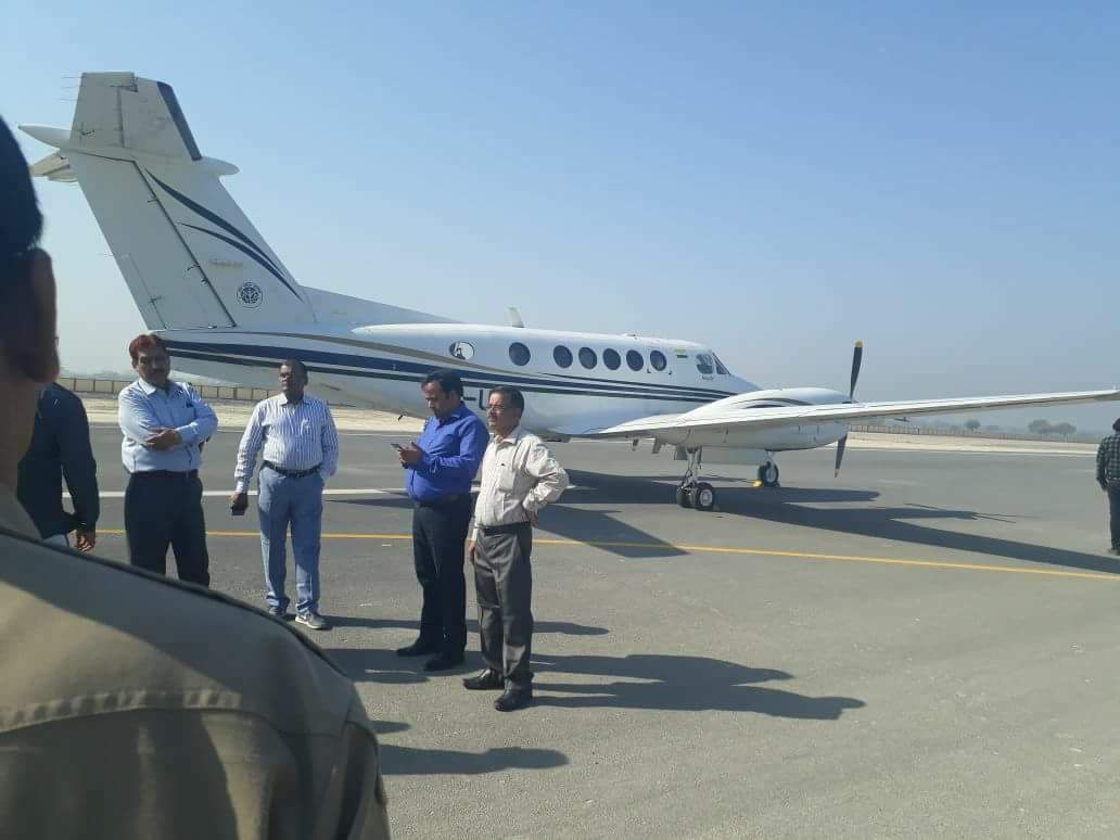
International airport proposal
An international airport named Rasoolabad International Airport was proposed in 2015 to be constructed in Kanpur Dehat district about 50 km from Kanpur. The airport will serve the region from Agra division, Jhansi division, Kanpur division, Aligarh division, Allahabad division, Banda division and Lucknow division. It would have direct link road with Agra Lucknow Expressway.
References
References
- Shri Janta Book Stall, Kanpur. "Kanya Kubja Vanshavali ( Devanagari) By Sri Pt. Lalmani Dharma Shastri Ji Shri Janta Book Stall, Kanpur".
- "सैयद वंश व मुगलकालीन खंडहरों के ध्वंसावशेष -".
- "Kanpur Dehat". District administration.
- link. [[Dainik Jagran]]
- "STATISTICAL REPORT ON GENERAL ELECTION, 2012 TO THE LEGISLATIVE ASSEMBLY OF UTTAR PRADESH". [[Election Commission of India]].
- "Pratibha Shukla(Bharatiya Janata Party(BJP)):Constituency- AKBARPUR-RANIYA(KANPUR DEHAT) - Affidavit Information of Candidate".
- "Vinod Kumar Katiyar(Bharatiya Janata Party(BJP)):Constituency- BHOGNIPUR(KANPUR DEHAT) - Affidavit Information of Candidate".
- "Mathura Prasad Pal(Bharatiya Janata Party(BJP)):Constituency- SIKANDRA(KANPUR DEHAT) - Affidavit Information of Candidate".
- "Poonam Sankhwar(Bharatiya Janata Party(BJP)):Constituency- RASULABAD (SC)(KANPUR DEHAT) - Affidavit Information of Candidate".
- "Sixteenth Lok Sabha". [[Lok Sabha]].
- "Ram Nath Kovind elected Indias 14th President, to take oath on July 25".
- "Profile of Kanpur-Dehat".
- (December 2024)
- [http://www.censusindia.gov.in/2011census/PCA/A2_Data_Table.html Decadal Variation In Population Since 1901]
- (2011). "Table C-01 Population by Religion: Uttar Pradesh". [[Registrar General and Census Commissioner of India]].
- (2011). "District Census Handbook: Kanpur Dehat". [[Registrar General and Census Commissioner of India]].
- "Table C-16 Population by Mother Tongue: Uttar Pradesh". [[Registrar General and Census Commissioner of India]].
- (7 February 2015). "International airport proposed near Kanpur | Kanpur News - Times of India".
- "शासन स्तर पर प्रस्ताव को मंजूरी मिलने के बाद रसूलाबाद मे एयरपोर्ट स्थापना का रास्ता साफ".
- "Archived copy".
This article was imported from Wikipedia and is available under the Creative Commons Attribution-ShareAlike 4.0 License. Content has been adapted to SurfDoc format. Original contributors can be found on the article history page.
Ask Mako anything about Kanpur Dehat district — get instant answers, deeper analysis, and related topics.
Research with MakoFree with your Surf account
Create a free account to save articles, ask Mako questions, and organize your research.
Sign up freeThis content may have been generated or modified by AI. CloudSurf Software LLC is not responsible for the accuracy, completeness, or reliability of AI-generated content. Always verify important information from primary sources.
Report