From Surf Wiki (app.surf) — the open knowledge base
Joshua Tree, California

| Field | Value |
|---|---|
| name | Joshua Tree, California |
| settlement_type | Census-designated place |
| image_skyline | Joshua Tree, California 01.jpg |
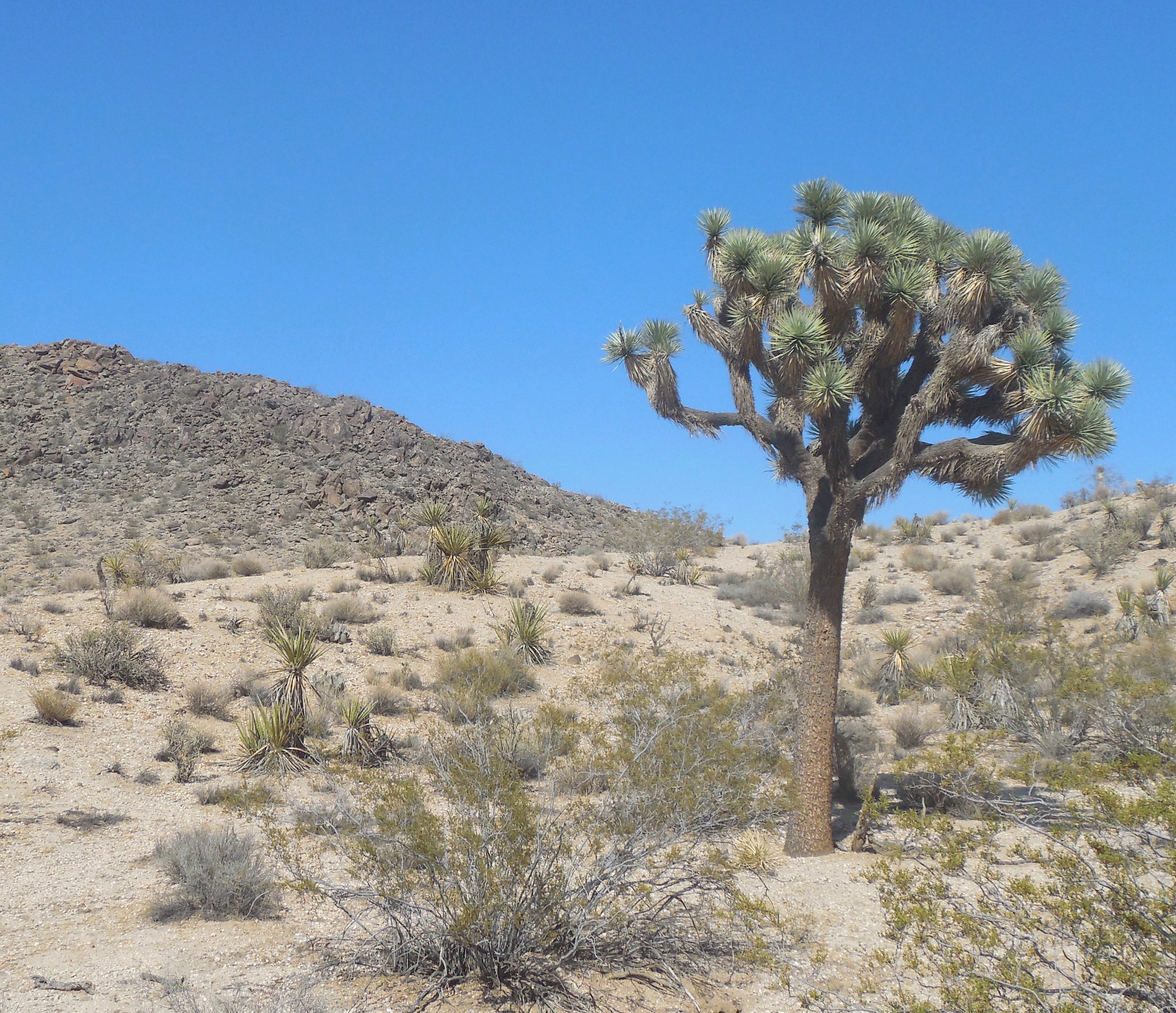
| image_caption | Central Joshua Tree in 2013 |
| image_map | San Bernardino County California Incorporated and Unincorporated areas Joshua Tree Highlighted.svg |
| mapsize | 250x200px |
| map_caption | Location in San Bernardino County and the state of California |
| subdivision_type | Country |
| subdivision_name | United States |
| subdivision_type1 | State |
| subdivision_name1 | California |
| subdivision_type2 | County |
| subdivision_name2 | San Bernardino |
| pushpin_map | USA |
| pushpin_map_caption | Location in the United States |
| unit_pref | US |
| area_footnotes | |
| area_total_sq_mi | 36.086 |
| area_land_sq_mi | 36.086 |
| area_water_sq_mi | 0 |
| area_total_km2 | 93.462 |
| area_land_km2 | 93.462 |
| area_water_km2 | 0 |
| area_water_percent | 0 |
| elevation_footnotes | |
| elevation_ft | 2923 |
| population_as_of | 2020 |
| population_footnotes | |
| population_total | 6489 |
| population_density_km2 | auto |
| population_density_sq_mi | auto |
| timezone | PST |
| utc_offset | −08:00 |
| coordinates | |
| timezone_DST | PDT |
| utc_offset_DST | −07:00 |
| postal_code_type | ZIP Code |
| postal_code | 92252 |
| area_code_type | Area codes |
| area_code | 442/760 |
| blank_name | FIPS code |
| blank_info | |
| blank1_name | GNIS feature ID |
| blank1_info | 2408454 |
the city of Joshua Tree
Joshua Tree is a census-designated place (CDP) in San Bernardino County, California, United States. The population was 6,489 at the 2020 census. At approximately 2700 ft above sea level, Joshua Tree and its surrounding communities are located in the High Desert of California. The center of the business district in Joshua Tree is on California State Route 62.
Geography
Joshua Tree is located in the Mojave Desert.
According to the United States Census Bureau, the CDP has a total land area of 93.5 km (36.1 mi2).
Joshua Tree is home to Joshua Tree National Park. Joshua Tree shares its eastern border with Twentynine Palms, its western border with Yucca Valley, and its northwestern border with Landers; it is bordered on the south by the Coachella Valley. The Bartlett Mountains are northwest of the community.
Demographics
|align-fn=center 1850–1870 1880-1890 1900 1910 1920 1930 1940 1950 1960 1970 1980 1990 2000 2010
Joshua Tree was first listed as an unincorporated place in the 1970 U.S. census; and then as a census designated place in the 1980 U.S. census.
2020
The 2020 United States census reported that Joshua Tree had a population of 6,489. The population density was 179.8 PD/sqmi. The racial makeup of Joshua Tree was 72.2% White, 3.4% African American, 1.5% Native American, 2.1% Asian, 0.3% Pacific Islander, 7.1% from other races, and 13.3% from two or more races. Hispanic or Latino of any race were 20.0% of the population.
The census reported that 96.9% of the population lived in households, 0.6% lived in non-institutionalized group quarters, and 2.5% were institutionalized.
There were 2,783 households, out of which 21.7% included children under the age of 18, 34.9% were married-couple households, 10.0% were cohabiting couple households, 31.2% had a female householder with no partner present, and 23.9% had a male householder with no partner present. 35.9% of households were one person, and 15.7% were one person aged 65 or older. The average household size was 2.26.
The age distribution was 18.6% under the age of 18, 6.0% aged 18 to 24, 25.3% aged 25 to 44, 27.2% aged 45 to 64, and 22.9% who were 65years of age or older. The median age was 45.1years. For every 100 females, there were 93.8 males.
There were 3,745 housing units at an average density of 103.8 /mi2, of which 2,783 (74.3%) were occupied. Of these, 60.4% were owner-occupied, and 39.6% were occupied by renters.
In 2023, the US Census Bureau estimated that 7.6% of the population were foreign-born. Of all people aged 5 or older, 88.5% spoke only English at home, 8.2% spoke Spanish, 2.3% spoke other Indo-European languages, 0.5% spoke Asian or Pacific Islander languages, and 0.6% spoke other languages. Of those aged 25 or older, 91.9% were high school graduates and 25.0% had a bachelor's degree.
The median household income in 2023 was $64,036, and the per capita income was $33,512. About 14.6% of families and 22.6% of the population were below the poverty line.
2010
At the 2010 census Joshua Tree had a population of 7,414. The population density was 200.1 PD/sqmi. The racial makeup of Joshua Tree was 6,176 (83.3%) White (73.9% Non-Hispanic White), 234 (3.2%) African American, 84 (1.1%) Native American, 104 (1.4%) Asian, 18 (0.2%) Pacific Islander, 368 (5.0%) from other races, and 430 (5.8%) from two or more races. Hispanic or Latino of any race were 1,308 persons (17.6%).
The census reported that 7,263 people (98.0% of the population) lived in households, 30 (0.4%) lived in non-institutionalized group quarters, and 121 (1.6%) were institutionalized.
There were 3,088 households, 862 (27.9%) had children under the age of 18 living in them, 1,209 (39.2%) were opposite-sex married couples living together, 431 (14.0%) had a female householder with no husband present, and 162 (5.2%) had a male householder with no wife present. There were 237 (7.7%) unmarried opposite-sex partnerships, and 30 (1.0%) same-sex married couples or partnerships. 1,018 households (33.0%) were one person and 358 (11.6%) had someone living alone who was 65 or older. The average household size was 2.35. There were 1,802 families (58.4% of households); the average family size was 2.97.
The age distribution was 1,626 people (21.9%) under the age of 18, 813 people (11.0%) aged 18 to 24, 1,756 people (23.7%) aged 25 to 44, 2,056 people (27.7%) aged 45 to 64, and 1,163 people (15.7%) who were 65 or older. The median age was 38.8 years. For every 100 females, there were 96.9 males. For every 100 females age 18 and over, there were 94.3 males.
There were 3,808 housing units at an average density of 102.8 per square mile, of the occupied units 1,872 (60.6%) were owner-occupied and 1,216 (39.4%) were rented. The homeowner vacancy rate was 3.9%; the rental vacancy rate was 9.8%. 4,178 people (56.4% of the population) lived in owner-occupied housing units and 3,085 people (41.6%) lived in rental housing units.
According to the 2010 United States Census, Joshua Tree had a median household income of $39,492, with 21.8% of the population living below the federal poverty line.
Government
In the California State Legislature, Joshua Tree is in , and in .
In the United States House of Representatives, Joshua Tree is located in California's 23rd congressional district, which has a Cook PVI of R+10 and is represented by .
Joshua Tree is represented by San Bernardino County 3rd District Supervisor Dawn Rowe.
Attractions
The Joshua Tree Visitor Center for Joshua Tree National Park is located at the junction of Highway 62 and Park Boulevard in downtown Joshua Tree and the park's west entrance is located 5 mi south. The community of Joshua Tree is unincorporated and is represented by the Joshua Tree Municipal Advisory Counsel (MAC) as the official liaison between the community and the San Bernardino County government.
Noah Purifoy Desert Art Museum of Assemblage Art is 10 acres of sculptures, assemblages, and installations mostly made from found material by Noah Purifoy. The World Famous Crochet Museum is also located in the area.
Wildlife
The Joshua Tree National Park is home to a diverse range of wildlife, featuring 57 types of mammals, including elusive bighorn sheep and common coyotes, alongside 46 reptile species, like the increasingly rare desert tortoise. The park is also a key spot on the Pacific Flyway, recording over 250 bird species, making it a hotspot for birdwatching, from common ravens to migrating warblers. Within the city of Joshua Tree itself, animals like cottontail rabbits, coyotes, roadrunners and quails can be frequently seen.
Notable people
Natives
People born in Joshua Tree:
- Less Bells, musician
- Brent Bolthouse, entrepreneur
- Josh Homme (born 1973), musician
- Phillip Carl Jablonski (1946–2019), serial killer
Inhabitants
People who live/lived in Joshua Tree:
- Alma Allen (born 1970), sculptor
- Tara Beier, singer
- Marjorie Cameron (1922–1995), actress
- Joey Castillo (born 1966), musician
- Dave Catching (born 1961), musician
- Edie Fake (born 1980), artist
- Lou Harrison (1917–2003), composer
- Conrad Lambert, musician known as "Merz"
- Cate Le Bon, musician and artist
- Myshkin, singer
- Johnette Napolitano, musician and artist
- Simon Rex (born 1974), actor
- Wayne Static (1965–2014), musician
- John Whooley, musician
- Charles M. Wysocki (1928–2002), painter
Deaths
People who died in Joshua Tree:
- Charles H. Gray (1921–2008), actor
- Ish Kabibble (1908–1994), comedian
- Art Kunkin (1928–2019), journalist
- John F. Logan (1946–2013), musician known as "Juke"
- Gram Parsons (1946–1973), musician
- Noah Purifoy (1917–2004), artist
- Tera Wray (1982–2016), pornographic actress
Gallery
File:Joshua_Tree_Welcome_Sign.jpg|Joshua Tree Welcome sign off Highway 62 File:Joshua Tree CA 20170907.jpg|Southward view of Joshua Tree Town Center in front of the mountains of Joshua Tree National Park File:Twenty-Nine Palms Highway in Joshua Tree, CA.jpg|Southwesterly view of the San Bernardino Mountains from Twenty-Nine Palms Highway (CA Route 62) File:Joshua_Tree_Downtown_2017.jpg|Downtown Joshua Tree looking southwest File:Joshua Tree Visitor Center - 12.jpg|Joshua Tree National Park Visitor Center File:JTCA RetreatCtr2 20140905.jpg|Southwesterly view of the Joshua Tree Retreat Center File:Copper Mountain College 2016.jpg|Copper Mountain College File:JTCA 2 20140905.jpg|Backcountry road off of Olympic Road in Joshua Tree
Climate
|Jan record high F = 79 |Feb record high F = 86 |Mar record high F = 90 |Apr record high F = 99 |May record high F = 102 |Jun record high F = 113 |Jul record high F = 115 |Aug record high F = 110 |Sep record high F = 105 |Oct record high F = 102 |Nov record high F = 86 |Dec record high F = 78 |year record high F = 115 |Jan record low F = 18 |Feb record low F = 18 |Mar record low F = 29 |Apr record low F = 32 |May record low F = 36 |Jun record low F = 40 |Jul record low F = 55 |Aug record low F = 52 |Sep record low F = 46 |Oct record low F = 37 |Nov record low F = 26 |Dec record low F = 17 |year record low F = 17
References
References
- "2020 U.S. Gazetteer Files". United States Census Bureau.
- "US Census Bureau".
- {{GNIS. 2408454
- (2011-02-12). "US Gazetteer files: 2010, 2000, and 1990". [[United States Census Bureau]].
- "Decennial Census by Decade".
- "1870 Census of Population - Population of Civil Divisions less than Counties - California - Almeda County to Sutter County".
- "1870 Census of Population - Population of Civil Divisions less than Counties - California - Tehama County to Yuba County".
- "1890 Census of Population - Population of California by Minor Civil Divisions".
- "1900 Census of Population - Population of California by Counties and Minor Civil Divisions".
- "1910 Census of Population - Supplement for California".
- "1920 Census of Population - Number of Inhabitants - California".
- "1930 Census of Population - Number and Distribution of Inhabitants - California".
- "1940 Census of Population - Number of Inhabitants - California".
- "1950 Census of Population - Number of Inhabitants - California".
- "1960 Census of Population - Number of Inhabitants - California".
- "1970 Census of Population - Number of Inhabitants - California".
- "1980 Census of Population - Number of Inhabitants - California".
- "1990 Census of Population - Population and Housing Unit Counts - California".
- "2000 Census of Population - Population and Housing Unit Counts - California".
- "2010 Census of Population - Population and Housing Unit Counts - California".
- "Joshua Tree CDP, California; DP1: Profile of General Population and Housing Characteristics - 2020 Census of Population and Housing".
- "Joshua Tree CDP, California; P16: Household Type - 2020 Census of Population and Housing".
- "Joshua Tree CDP, California; CP02: Comparative Social Characteristics in the United States - 2023 ACS 5-Year Estimates Comparison Profiles".
- "Joshua Tree CDP, California; DP03: Selected Economic Characteristics - 2023 ACS 5-Year Estimates Comparison Profiles".
- (2020). "Trimming of western Joshua trees and removal of dead western Joshua trees". California Department of Fish and Wildlife: Habitat Conservation Planning Branch.
- Binkley, Jude. (December 21, 2021). "Joshua trees are first plant to get California protections because of climate change". Cronkite News: Arizona PBS.
- (28 May 2015). "Joshua Tree CDP, California". United States Census Bureau: State and County QuickFacts.
- "2010 Census Interactive Population Search: CA - Joshua Tree CDP". U.S. Census Bureau.
- "Final Maps {{!}} California Citizens Redistricting Commission".
- "Current Status of Commission's Final Certified District Maps". [[California Citizens Redistricting Commission]].
- "Partisan Voting Index, Districts of the 113th Congress". [[The Cook Political Report]].
- {{Cite GovTrack. CA. 8
- "District Map - Dawn Rowe Third District Supervisor".
- "Visitor Centers - Joshua Tree National Park (U.S. National Park Service)".
- Williams, Maxwell. (February 22, 2021). "What to Plan for on a Trip to Joshua Tree".
- Palms, Mailing Address: 74485 National Park Drive Twentynine. "Animals - Joshua Tree National Park (U.S. National Park Service)".
- Jones, Nate. (2021-11-08). "Simon Rex Doesn't Want to Be That Guy Anymore".
This article was imported from Wikipedia and is available under the Creative Commons Attribution-ShareAlike 4.0 License. Content has been adapted to SurfDoc format. Original contributors can be found on the article history page.
Ask Mako anything about Joshua Tree, California — get instant answers, deeper analysis, and related topics.
Research with MakoFree with your Surf account
Create a free account to save articles, ask Mako questions, and organize your research.
Sign up freeThis content may have been generated or modified by AI. CloudSurf Software LLC is not responsible for the accuracy, completeness, or reliability of AI-generated content. Always verify important information from primary sources.
Report