From Surf Wiki (app.surf) — the open knowledge base
Jindalee, Queensland
| Field | Value |
|---|---|
| name | Jindalee |
| city | Brisbane |
| state | qld |
| image | Jindalee Boat Ramp (7162648724).jpg |
| caption | Jindalee Boat Ramp, 2010 |
| alternative_location_map | Australia Queensland metropolitan Brisbane |
| pushpin_map_caption | Location in metropolitan Brisbane |
| coordinates | |
| local_map | yes |
| zoom | 12 |
| pop | 5320 |
| pop_year | |
| pop_footnotes | |
| postcode | 4074 |
| area | 3.1 |
| timezone | AEST |
| utc | +10:00 |
| lga | City of Brisbane |
| (Jamboree Ward) | |
| stategov | Mount Ommaney |
| fedgov | Oxley |
| dist1 | 15.2 |
| dir1 | SW |
| location1 | Brisbane CBD |
| near-n | Kenmore |
| near-ne | Fig Tree Pocket |
| near-e | Sinnamon Park |
| near-se | Sinnamon Park |
| near-s | Mount Ommaney |
| near-sw | Mount Ommaney |
| near-w | Pinjarra Hills |
| near-nw | Kenmore |
(Jamboree Ward) | near-n = Kenmore | near-ne = Fig Tree Pocket | near-e = Sinnamon Park | near-se = Sinnamon Park | near-s = Mount Ommaney | near-sw = Mount Ommaney | near-w = Pinjarra Hills | near-nw = Kenmore Jindalee is a south-western residential suburb in the City of Brisbane, Queensland, Australia. In the , Jindalee had a population of 5,320 people.
Geography
Jindalee is 15.2 km by road south-west of the Brisbane CBD, and is a part of the Centenary suburbs. It is bordered by the Brisbane River to the north.
The Centenary Motorway enters the suburb from the north (Kenmore), crossing the river on the Centenary Bridge (), and forms the south-eastern boundary of the suburb before exiting on the south-east corner of the suburb into Mount Ommaney / Sinnamon Park.
The older part of the suburb is to the west of the motorway and is predominantly residential in character with individual houses. The Jindalee Golf Course is immediately west of the motorway (). To the east of the motorway are two large retail centres, separated by Sinnamon Road (). Also to the east of the motorway is a more recent townhouse estate between the retail precinct and the river ().
The north-western boundary with the river has a riverside park with boat ramp () provided by the Brisbane City Council.
History
Wolston Estate was the property of M. B. Goggs, whose father obtained the land forty years previously in the 1860s and after whom Goggs Road is named.
In 1879, the local government area of Yeerongpilly Division was created. In 1891, parts of Yeerongpilly Division were excised to create Sherwood Division, which contained the area of Wolston Estate.
A small portion of Jindalee comes from the Wolston Estate, consisting of fifty-four farms on an area of three thousand acres, offered for auction at Centennial Hall, Brisbane, on 16 October 1901. Only three of the farms sold at the original auction.
In 1903, the Sherwood Division became the Shire of Sherwood.
In 1925, the Shire of Sherwood was amalgamated into the City of Brisbane.
The Aboriginal meaning for Jindalee is "bare hills". Jindalee was the first of a series of suburbs originally called the "Centenary" suburbs, as planning for them commenced in 1959, the year of Queensland's centenary.
Prior to development, the area had been largely used for grazing and dairy farming; however, it was developed as part of the Hooker Centenary Project, beginning in 1960. The 8th Australian Scout Jamboree was held in the southwestern corner of Jindalee, which was subdivided and became Jamboree Heights, a suburb in its own right.
Jindalee State School opened on 24 January 1966.
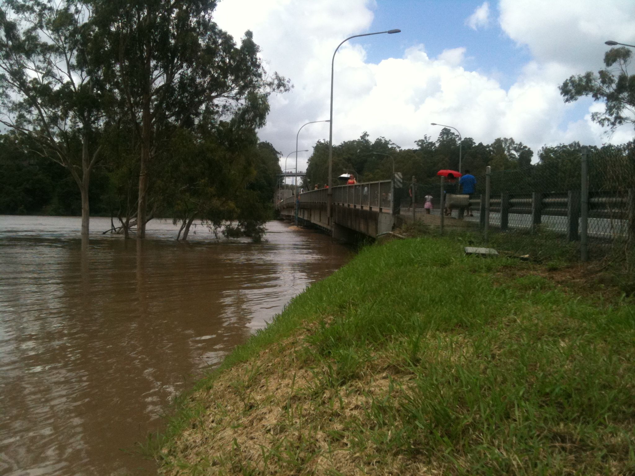
The 1974 floods caused extensive damage to Jindalee, including inundation of many houses, as well as severe damage to the Centenary Bridge. A gravel barge rammed into the upstream side, blocking the floodwaters and raising real fears that the bridge would collapse. The barge was partly sunk using explosives to reduce pressure on the bridge. When the floodwater receded, the barge was refloated and beached downstream to be cut up for scrap. The damage sustained by the bridge required its partial closure for repairs. For two years after the floods, the bridge was reduced to a single lane. The bridge was duplicated in 1980, providing two lanes each way.
In 1987 Our Lady of the Sacred Heart School in Darra opened a pre-school in Jindalee, renaming the school Darra-Jindalee Catholic School. In 2003 the facility in Jindalee closed and on 14 July 2008 the school returned to the name of the Our Lady of the Sacred Heart School operating only at Darra.
Centenary State High School opened in January 1999.
The 2011 floods badly affected the suburb.
Demographics
In the , Jindalee had a population of 5,320 people.
In the , Jindalee had a population of 5,320 people.
Education
Jindalee State School is a government primary (Prep–6) school for boys and girls at 114 Burrendah Road (). In 2017, the school had an enrolment of 820 students with 65 teachers (54 full-time equivalent) and 36 non-teaching staff (22 full-time equivalent). It includes a special education program.
Centenary State High School is a government secondary (7–12) school for boys and girls at 1 Moolanda Street (). In 2017, the school had an enrolment of 1,484 students with 119 teachers (113 full-time equivalent) and 48 non-teaching staff (35 full-time equivalent). It includes a special education program.
Transport
Jindalee is accessible via the Centenary Highway. Some Transport for Brisbane bus routes service the suburb, namely:
- 450 – City – Riverhills: CityXpress via Cultural Centre, Toowong, Indooroopilly, Jindalee, Mount Ommaney, Middle Park and Westlake (Weekends)
- 453 – City – Mount Ommaney: CityXpress via Cultural Centre, Toowong, Indooroopilly and Jindalee (Weekdays)
- 456 – City – Mount Ommaney: Rocket via Milton, Western Freeway and Jindalee (Weekdays - Peak Hours only)
- 457 – City – Riverhills: City Precincts via Coronation Drive, Western Freeway, Jindalee, Mount Ommaney, Middle Park and Westlake (Weekdays - Peak Hours only)
- 458 – City – Mount Ommane: City Precincts via Coronation Drive, Western Freeway and Jindalee. (Weekdays – Peak Hours only)
References
References
- "Jamboree Ward".
- {{cite QPN. 41946. Jindalee. suburb in City of Brisbane
- {{Queensland Globe
- "Boating facilities in Queensland listed by district and local government area". [[Queensland Government]].
- (12 October 1901). "SALE OF WOLSTON ESTATE.". [[The Brisbane Courier]].
- {{cite archive. . . (1901)
- (26 October 1901). "LATEST NEWS IN BRIEF.". [[The Queenslander]].
- Fones, Ralph. (1 January 2020). "Suburban conservatism in the Sherwood Shire 1891-1920".
- "Town To Be Built", [[The Sydney Morning Herald]], 11 November 1961. Retrieved 25 November 2017.
- (2010). "Queensland schools past and present". [[Queensland Family History Society]].
- (2011-01-12). "Havoc as flood peak hits Brisbane". ABC News.
- "Brisbane floods: Before and after".
- Calligeros, Marissa. (2011-01-13). "Brisbane flood victims to confront the destruction".
- {{Census 2016 AUS
- {{Census 2021 AUS
- (9 July 2018). "State and non-state school details". [[Queensland Government]].
- "Jindalee State School".
- "ACARA School Profile 2017".
- "Centenary State High School".
- {{Queensland Timetables. 450
- {{Queensland Timetables. 453
- {{Queensland Timetables. P456
- {{Queensland Timetables. P457
- {{Queensland Timetables. P458
This article was imported from Wikipedia and is available under the Creative Commons Attribution-ShareAlike 4.0 License. Content has been adapted to SurfDoc format. Original contributors can be found on the article history page.
Ask Mako anything about Jindalee, Queensland — get instant answers, deeper analysis, and related topics.
Research with MakoFree with your Surf account
Create a free account to save articles, ask Mako questions, and organize your research.
Sign up freeThis content may have been generated or modified by AI. CloudSurf Software LLC is not responsible for the accuracy, completeness, or reliability of AI-generated content. Always verify important information from primary sources.
Report