From Surf Wiki (app.surf) — the open knowledge base
Jamestown, California

| Field | Value |
|---|---|
| name | Jamestown, California |
| settlement_type | unincorporated community |
| census-designated place | |
| image_skyline | 2009-0724-CA-Jamestown.jpg |
| image_caption | Main Street |
| image_map | Tuolumne_County_California_Incorporated_and_Unincorporated_areas_Jamestown_Highlighted.svg |
| mapsize | 250x200px |
| map_caption | Location in Tuolumne County and the state of California |
| pushpin_map | USA |
| pushpin_map_caption | Location in the United States |
| subdivision_type | Country |
| subdivision_name | |
| subdivision_type1 | State |
| subdivision_name1 | California |
| subdivision_type2 | County |
| subdivision_name2 | Tuolumne |
| unit_pref | Imperial |
| area_footnotes | |
| area_total_sq_mi | 3.005 |
| area_land_sq_mi | 3.003 |
| area_water_sq_mi | 0.002 |
| area_total_km2 | 7.783 |
| area_land_km2 | 7.778 |
| area_water_km2 | 0.005 |
| area_water_percent | 0.07 |
| population_as_of | 2020 |
| population_footnotes | |
| population_total | 3478 |
| population_density_km2 | auto |
| population_density_sq_mi | auto |
| timezone | Pacific (PST) |
| utc_offset | -8 |
| timezone_DST | PDT |
| utc_offset_DST | -7 |
| coordinates | |
| elevation_footnotes | |
| elevation_ft | 1621 |
| postal_code_type | ZIP code |
| postal_code | 95327 |
| area_code | 209 |
| blank_name | FIPS code |
| blank_info | 06-37106 |
| blank1_name | GNIS feature ID |
| blank1_info | 2408437 |
| footnotes |
census-designated place
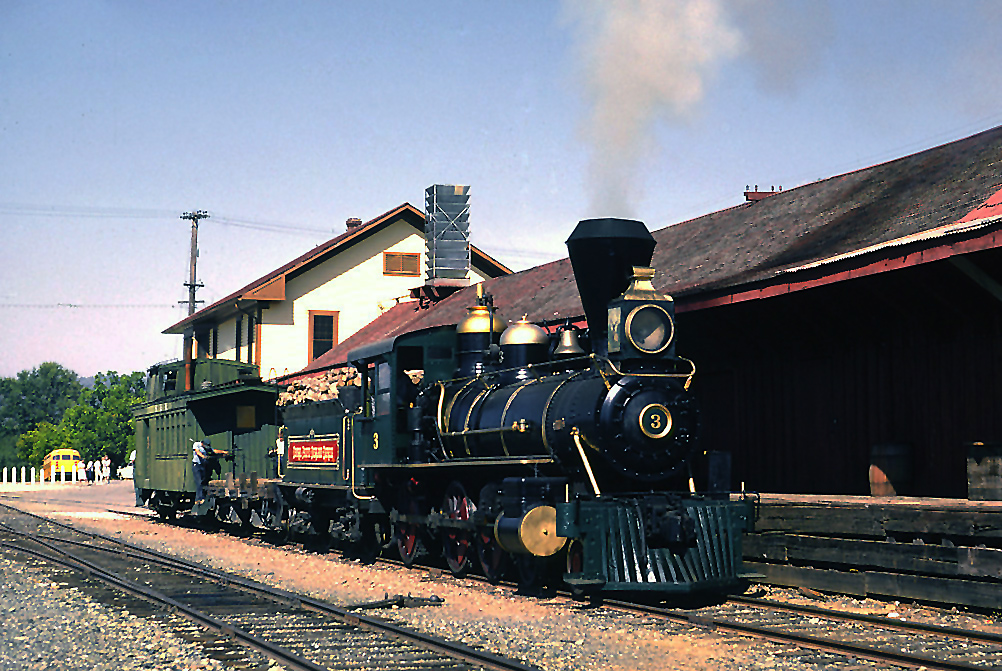
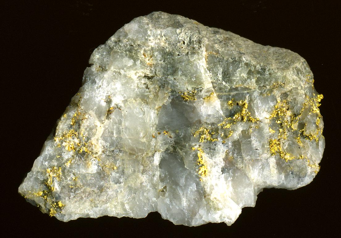
Jamestown is an unincorporated community in Tuolumne County, California, United States. Formerly a California Gold Rush town, Jamestown was designated a California Historical Landmark on March 16, 1949. It is the home of Railtown 1897 State Historic Park and the Sierra Railway, which operates steam passenger trains. For statistical purposes, the United States Census Bureau has defined the community as a census-designated place (CDP). The population was 3,478 at the 2020 census, up from 3,433 at the 2010 census.
Geography
According to the United States Census Bureau, the CDP has a total area of 3.0 sqmi, 99.93% of it land and 0.07% of it water.
Demographics
1990 2000 2010
2020
The 2020 United States census reported that Jamestown had a population of 3,478. The population density was 1,158.2 PD/sqmi. The racial makeup of Jamestown was 78.9% White, 0.7% African American, 2.5% Native American, 1.1% Asian, 0.1% Pacific Islander, 4.9% from other races, and 11.8% from two or more races. Hispanic or Latino of any race were 14.9% of the population.
The census reported that 98.2% of the population lived in households, 63 people (1.8%) lived in non-institutionalized group quarters, and no one was institutionalized.
There were 1,546 households, out of which 23.0% included children under the age of 18, 35.8% were married-couple households, 9.4% were cohabiting couple households, 35.6% had a female householder with no partner present, and 19.2% had a male householder with no partner present. 37.2% of households were one person, and 23.0% were one person aged 65 or older. The average household size was 2.21.
The age distribution was 19.6% under the age of 18, 5.3% aged 18 to 24, 20.6% aged 25 to 44, 25.4% aged 45 to 64, and 29.1% who were 65years of age or older. The median age was 50.4years. For every 100 females, there were 91.5 males.
There were 1,660 housing units at an average density of 552.8 /mi2, of which 1,546 (93.1%) were occupied. Of these, 63.7% were owner-occupied, and 36.3% were occupied by renters.
In 2023, the US Census Bureau estimated that the median household income was $51,886, and the per capita income was $38,507. About 2.4% of families and 8.6% of the population were below the poverty line.
2010
At the 2010 census, Jamestown had a population of 3,433. The population density was 1,145.7 PD/sqmi. The racial makeup of Jamestown was 2,948 (85.9%) White, 20 (0.6%) African American, 96 (2.8%) Native American, 27 (0.8%) Asian, 4 (0.1%) Pacific Islander, 135 (3.9%) from other races, and 203 (5.9%) from two or more races. Hispanic or Latino of any race were 511 people (14.9%).
The census reported that 3,423 people (99.7% of the population) lived in households, 10 (0.3%) lived in non-institutionalized group quarters, and no one was institutionalized.
There were 1,501 households, 399 (26.6%) had children under the age of 18 living in them, 592 (39.4%) were opposite-sex married couples living together, 209 (13.9%) had a female householder with no husband present, 80 (5.3%) had a male householder with no wife present. There were 100 (6.7%) unmarried opposite-sex partnerships, and 4 (0.3%) same-sex married couples or partnerships. 513 households (34.2%) were one person and 299 (19.9%) had someone living alone who was 65 or older. The average household size was 2.28. There were 881 families (58.7% of households); the average family size was 2.89.
The age distribution was 752 people (21.9%) under the age of 18, 289 people (8.4%) aged 18 to 24, 686 people (20.0%) aged 25 to 44, 938 people (27.3%) aged 45 to 64, and 768 people (22.4%) who were 65 or older. The median age was 44.7 years. For every 100 females, there were 90.2 males. For every 100 females age 18 and over, there were 84.1 males.
There were 1,645 housing units at an average density of 549.0 per square mile, of the occupied units 885 (59.0%) were owner-occupied and 616 (41.0%) were rented. The homeowner vacancy rate was 3.4%; the rental vacancy rate was 9.5%. 1,857 people (54.1% of the population) lived in owner-occupied housing units and 1,566 people (45.6%) lived in rental housing units.
Government
In the California State Legislature, Jamestown is in , and .
In the United States House of Representatives, Jamestown is in .
Jamestown is the headquarters for the Chicken Ranch Rancheria of Me-Wuk Indians of California, a federally recognized tribe of Miwok people.
In popular culture
Scenes from Back to the Future Part III, the final installment of the Back to the Future trilogy, were filmed in Jamestown. A scene from the 2004 movie Hidalgo was also filmed there. Exterior scenes from the TV series Petticoat Junction, The Wild Wild West, and Green Acres were filmed in and near Jamestown, as well as parts of the Little House on the Prairie TV series, and the 1985 Clint Eastwood film Pale Rider.
Jamestown was featured by Huell Howser in Road Trip Episode 153.
References
References
- "2020 U.S. Gazetteer Files". United States Census Bureau.
- "US Census Bureau".
- {{GNIS. 2408437
- {{cite ohp. 431. Jamestown. 2012-10-18
- [https://www.waterboards.ca.gov/academy/courses/ard/day2/day2_sec6d_harvardmine_ra.pdf Geology of the Jamestown mine, Mother Lode gold district], USGS, 2005
- "Census of Population and Housing". Census.gov.
- "1980 Census of Population - Number of Inhabitants - California".
- "1990 Census of Population - Population and Housing Unit Counts - California".
- "2000 Census of Population - Population and Housing Unit Counts - California".
- "2010 Census of Population - Population and Housing Unit Counts - California".
- "Jamestown CDP, California; DP1: Profile of General Population and Housing Characteristics - 2020 Census of Population and Housing".
- "Jamestown CDP, California; P16: Household Type - 2020 Census of Population and Housing".
- "Jamestown CDP, California; DP03: Selected Economic Characteristics - 2023 ACS 5-Year Estimates Comparison Profiles".
- "2010 Census Interactive Population Search: CA - Jamestown CDP". U.S. Census Bureau.
- "Final Maps {{!}} California Citizens Redistricting Commission".
- {{Cite GovTrack. CA. 5
- [http://www.ncai.org/tribal-directory?letter=C "Tribes: C."] ''National Congress of American Indians.'' Retrieved 29 May 2012.
- "Jamestown- Road Trip with Huell Howser (153) – Huell Howser Archives at Chapman University".
This article was imported from Wikipedia and is available under the Creative Commons Attribution-ShareAlike 4.0 License. Content has been adapted to SurfDoc format. Original contributors can be found on the article history page.
Ask Mako anything about Jamestown, California — get instant answers, deeper analysis, and related topics.
Research with MakoFree with your Surf account
Create a free account to save articles, ask Mako questions, and organize your research.
Sign up freeThis content may have been generated or modified by AI. CloudSurf Software LLC is not responsible for the accuracy, completeness, or reliability of AI-generated content. Always verify important information from primary sources.
Report