From Surf Wiki (app.surf) — the open knowledge base
Interstate 85 in Georgia
Section of Interstate Highway in Georgia, United States

Section of Interstate Highway in Georgia, United States
| Field | Value | ||||||||
|---|---|---|---|---|---|---|---|---|---|
| state | GA | ||||||||
| type | I | ||||||||
| route | 85 | ||||||||
| map | |||||||||
| map_custom | yes | ||||||||
| map_notes | I-85 highlighted in red | ||||||||
| length_mi | 179.90 | ||||||||
| length_ref | |||||||||
| established | 1960 | ||||||||
| direction_a | South | ||||||||
| terminus_a | at the Alabama state line | ||||||||
| junction | {{plainlist | 1= | |||||||
| *{{Jct | state | GA | I | 185}} near LaGrange | |||||
| *{{Jct | state | GA | I | 285 | SR-Conn | 14 | dab2=Red Oak–College Park | SR | 279}} in College Park |
| *{{Jct | state | GA | I | 75}} through Atlanta | |||||
| *{{Jct | state | GA | I | 20}} in Atlanta | |||||
| *{{Jct | state | GA | SR | 400}} in Atlanta | |||||
| *{{Jct | state | GA | I | 285}} near Norcross | |||||
| *{{Jct | state | GA | SR | 316}} near Lawrenceville | |||||
| *{{Jct | state | GA | I | 985}} in Suwanee}} | |||||
| direction_b | North | ||||||||
| terminus_b | at the South Carolina state line | ||||||||
| counties | Harris, Troup, Meriwether, Coweta, Fulton, Clayton, DeKalb, Gwinnett, Barrow, Jackson, Banks, Franklin, Hart | ||||||||
| previous_type | SR | ||||||||
| previous_route | 84 | ||||||||
| next_type | SR | ||||||||
| next_route | 85 | ||||||||
| browse |
- near LaGrange
- in College Park
- through Atlanta
- in Atlanta
- in Atlanta
- near Norcross
- near Lawrenceville
- in Suwanee}} Interstate 85 (I-85) is a major Interstate Highway that travels northeast–southwest in the US state of Georgia. It enters the state at the Alabama state line near West Point, and Lanett, Alabama, traveling through the Atlanta metropolitan area and to the South Carolina state line, where it crosses the Savannah River near Lake Hartwell. I-85 connects North Georgia with Montgomery, Alabama, to the southwest, and with South Carolina, North Carolina, and Virginia to the northeast. Within Georgia, I-85 is also designated as the unsigned State Route 403 (SR 403).
I-85 in Georgia usually travels roughly parallel with the route of US Route 29 (US 29). However, from Atlanta northeast to South Carolina, I-85 ventures away from that route, traveling about halfway between US 29 and the combination of US 23 and US 123.
Within the city of Atlanta, I-85 has a concurrency with I-75 known as the "Downtown Connector". After splitting from Downtown Connector, it is known as Northeast Expressway until its junction with I-285 (The Perimeter).
Route description==
Alabama state line to I-185
I-85 enters the state of Georgia from Alabama via twin bridges over the Chattahoochee River, and then it immediately skirts the town of West Point, with Kia's multibillion-dollar plant located adjacent to the freeway just east of West Point. After leaving West Point, I-85 enters the LaGrange area, the first large town in Georgia on its route to the northeast. Northeast of LaGrange, I-85 has an interchange with the long spur freeway, I-185, to the Columbus metropolitan area. This is the only connection between Columbus and the Interstate Highway System.
An 18 mi stretch between the Alabama line and exit 18 in LaGrange is serving as an environmental and technological testbed for a project called The Ray, a partnership involving federal and state officials, the private sector, academia and philanthropic organizations. Among the projects are a solar-paved roadway, enhanced road striping for autonomous vehicles, and plantings along the right-of-way to improve runoff and possibly serve as a harvestable crop.
From I-185 to Atlanta
_near_Exit_246_in_Atlanta,_Georgia.jpg)
From LaGrange, I-85 heads northeastward toward Atlanta. Before reaching Atlanta, the highway crosses the CSX Transportation A&WP Subdivision twice (in the Grantville area) and passes through the suburbs of Moreland, Newnan, Fairburn, and Union City. The highway then intersects I-285 at its southwest end in College Park. This interchange is one of the most complex interchanges in the country, as I-285 and I-85 stay side by side through the interchange, which actually has two parts. The interchange also features many other, less important local access roads at the same time; meanwhile providing access to Hartsfield–Jackson Atlanta International Airport. I-85 then runs along the northwestern boundary of the airport in East Point, providing access to the domestic terminal.
At the southwestern edge of Atlanta's city limits, I-85 merges with I-75 to form the Downtown Connector, which is 12 to 14 lanes wide. At the southern edge of Downtown Atlanta, this freeway has an interchange with the major east–west Interstate Highway, I-20. The two freeways then skirt the eastern edge of downtown, running due north, passing through the Georgia Tech campus and the Atlantic Station section of Atlanta before the two highways split, with I-75 exits via the right three lanes and then heads northwest while I-85 uses the left three lanes and then heads northeast.
Atlanta to South Carolina state line

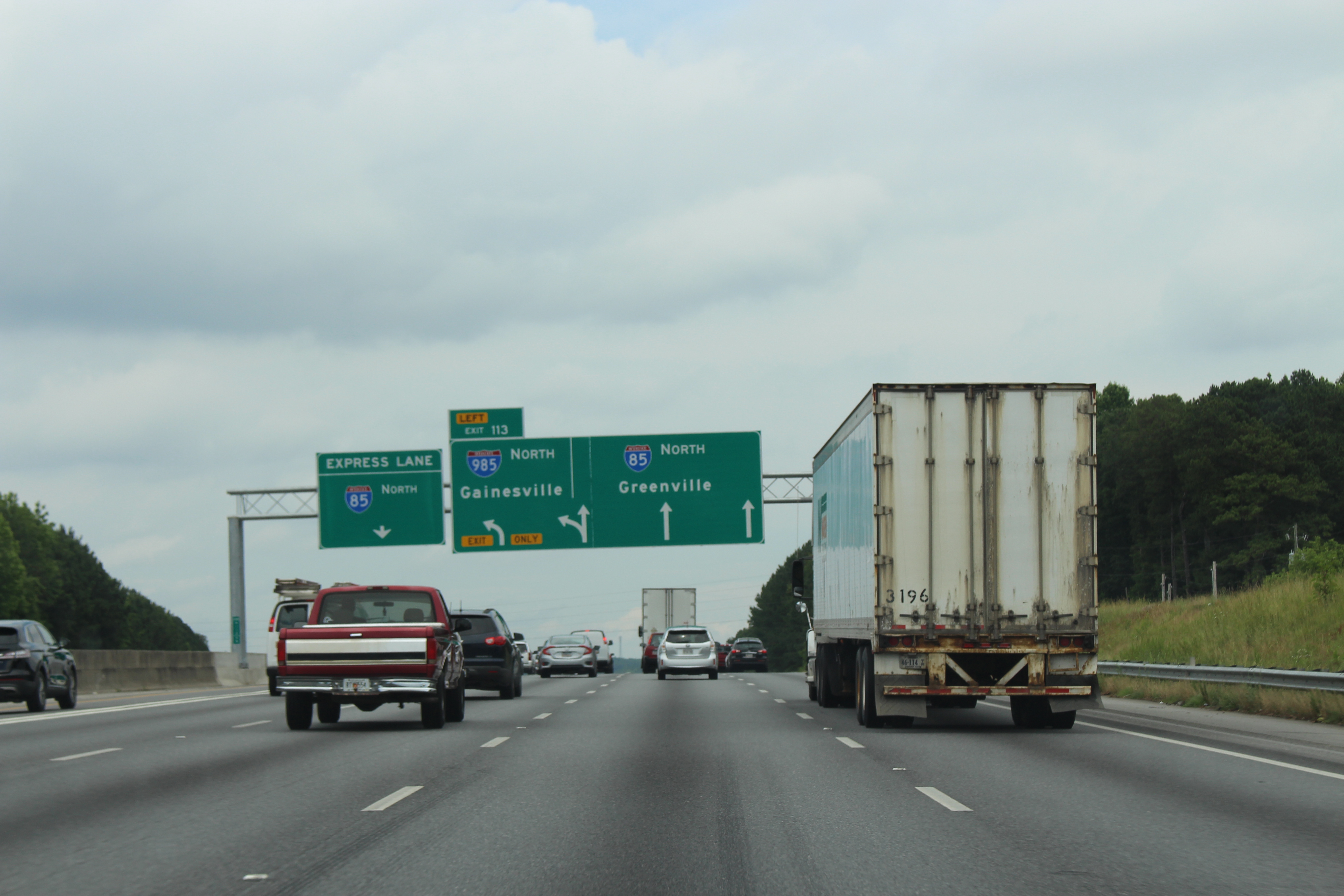
Heading northbound after the Brookwood Interchange with I-75, I-85 is routed along a 10-lane-wide viaduct from the Buford Highway Connector (exit 86) to SR 400 (exit 87). Continuing northeast of Atlanta, I-85 continues through the northeastern suburbs, bypassing Chamblee and Doraville, where there is another intersection with I-285 (nicknamed Spaghetti Junction). The Interstate then travels through the northeastern suburbs of Atlanta, including Lilburn, Duluth, Lawrenceville, and Buford. The Interstate has freeway interchanges with SR 316 in Duluth and I-985 in Suwanee, which provides a link to Gainesville. Satellite Boulevard within Gwinnett County parallels I-85 to the west as an arterial frontage road.
I-85 eventually leaves the Atlanta metropolitan area and narrows down to four lanes (two in each direction) past exit 149 as the highway continues into the rural parts of northeast Georgia. At Lake Hartwell, which was formed by the damming of the Savannah River, I-85 crosses the Savannah River into South Carolina.
Express lanes
I-85 has the first express lanes in Georgia, located in Gwinnett and DeKalb counties; they were originally high-occupancy vehicle lanes (HOV lanes). From Chamblee–Tucker Road (exit 94) to Old Peachtree Road (exit 109), travelers that utilize the converted 15.5 mi lanes will be charged a toll varying from 10 to(-), depending on traffic conditions and usage. Though not signed on the freeway, they are high-occupancy toll lanes (HOT lanes), which means registered transport vehicles, carpools with three or more occupants, motorcycles, and busses are exempt from toll charges as long as they are registered as such. Tolls are collected using an electronic toll collection system. All travelers that use the lane must have a Peach Pass sticker to avoid fines. Starting in November 2014, SunPass (Florida) and NC Quick Pass (North Carolina) are interoperable with Peach Pass, allowing motorists with those transponders to use the express lanes.
On November 3, 2018, an extension to the express lanes opened, from its former ending at Old Peachtree Road to Hamilton Mill Road (exit 120). After this extension, four more northbound exit points were added: at SR 317 (exit 111), I-985 (exit 113), SR 20 (exit 115), and at its end at Hamilton Mill Road (exit 120). In addition, four new access points were added to the southbound express lanes: at SR 20, SR 317, Old Peachtree Road, and at the connection to the preexisting express lanes. The project costed $178 million (equivalent to $ in ). The express lanes extension will incur a separate charge from the existing express lanes. This is to decrease the impact of high congestion on the existing express lanes on the dynamic pricing of the express lanes extension, since lower congestion is expected on the new extension of the express lanes.
Funds generated from the express lanes will be used to defray the costs of construction, operations, and maintenance of the lanes. Long-term revenue allocation is being studied and a decision about future excess revenues will be made later in the project process.
Proponents for the express lanes say it is to provide commuters with a more reliable, free-flow commute option; complement the state's multimodal approach to managing traffic demand; and establish the vision for a future system of HOT lanes in the region. Detractors point out that existing infrastructure was reused for the express lanes and that commute times on the nonpaying travel lanes have doubled since implementation.
History

Originally constructed as a four- to six-lane expressway in the 1950s, the stretch of I-85 between the southern merge with I-75 and North Druid Hills Road was reconstructed as part of the Georgia Department of Transportation (GDOT)'s Freeing the Freeways program. This project included rebuilding all overpasses, new HOV-ready ramps (with the system implemented in 1996), and a widening of freeway capacity. Concurrent with this project was the construction of the Civic Center station as part of the West Peachtree Street overpass, which opened in December 1981.
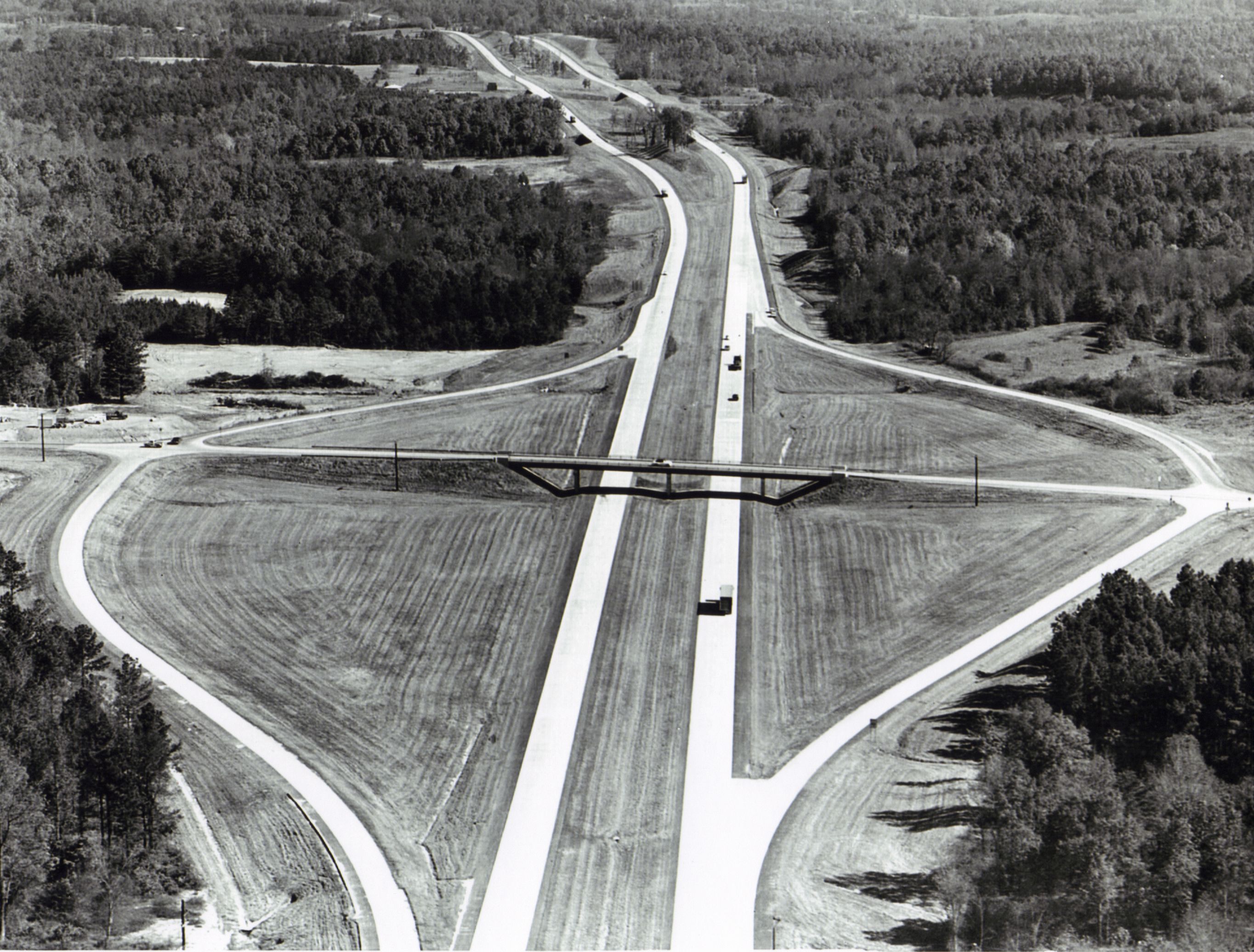
The 30 mi section between LaGrange and Newnan was incomplete for a much-longer time that the rest of I-85 in Georgia and required a two-lane detour on US 27 and US 29 between those cities. The northern section between Newnan and Grantville was completed first, then the stretch further south to LaGrange was completed in 1977.
The portion of the highway from the Buford Highway Connector to SR 400 was constructed during the early 1980s and was designed as a replacement for the original four-lane routing of I-85 (now SR 13). In addition, the new viaduct was designed to accommodate connections to the SR 400 tollway (then in planning), HOV lanes, and a bridge carrying the North Line (then under construction, now the Red Line).
Until 2000, the state of Georgia used the sequential exit numbering system on all of its Interstate Highways. The first exit on each highway would begin with the number 1 and increase numerically with each exit. In 2000, GDOT switched to a mileage-based exit system, in which the exit number corresponded to the nearest milepost.
On October 1, 2011, GDOT converted the 16 mi HOV lanes in northern Atlanta into express/HOT lanes.
From Atlanta, I-85 north was originally slated to be built through the city of Athens to provide an easy link between the capital city and the University of Georgia. However, then-Governor Ernest Vandiver worked to make sure the highway traversed his home county of Franklin, a stretch that now bears his name. At the time, he promised equivalent access for Athens and Gainesville. It was not until the completion of SR 316 in the 1990s that there was finally a relatively quick, multilane expressway connecting Athens and Atlanta, (US 78 is also multilane between Athens and Atlanta but it is not expressway-grade) although SR 316 still is largely at-grade.
On March 30, 2017, a fire started at approximately 6:15 pm in a storage area under the highway along Piedmont Road in the Piedmont Heights area of Midtown Atlanta. This caused the collapse of a 100 ft section of I-85 northbound. The highway in both directions needed to be demolished and replaced. According to GDOT, the work was completed ahead of schedule. Both the north and south bound portions of the Interstate were open by May 15, 2017, a month ahead of expectations.
In May 2017, the Gwinnett County Board of Commissioners voted to accept about $6 million (equivalent to $ in ) in federal funds, to be used to acquire land to build a new diamond interchange on I-85 at SR 324/Gravel Springs Road between the interchanges for SR 20, and Hamilton Mill Road/Hamilton Mill Parkway. The board voted in July 2019 to accept about $20 million (equivalent to $ in ) in federal and state grants to pay for the construction of the new interchange. E.R. Snell Contractors was chosen to complete the work. Since an overpass already existed for SR 324, the entrance and exit ramps, deceleration lanes on I-85, traffic signals, and turn lanes were the main aspects of the interchange to be added. The main purpose of the new interchange was to provide another access point from I-85 to Mall of Georgia. Construction of the interchange began in early 2018 and was completed on November 23, 2021.
Exit list
|old
Auxiliary routes
There are three auxiliary Interstate Highways of I-85 within Georgia and a fourth that was proposed, and then cancelled. I-185 (SR 411) is a spur from LaGrange to Columbus. It mainly provides a freeway between the Columbus and Atlanta metropolitan areas. I-285 (SR 407) is a heavily traveled beltway around Atlanta, which helps I-75 and I-85 drivers to bypass the city. I-485 was a short freeway in Atlanta (now Freedom Parkway) that was incomplete for many years and then decommissioned due to local opposition. I-985 (SR 419) is a spur from I-85 to Gainesville.
References
References
- Starks, Edward. (January 27, 2022). "Table 1: Main Routes of the Dwight D. Eisenhower National System Of Interstate and Defense Highways". [[Federal Highway Administration]].
- {{cite GDOT map. (1960)
- "Exploring The Ray, An Interview with Allie Kelly". American Association of State Highway and Transportation Officials.
- Georgia Department of Public Safety. "I-85 Express Lanes (HOT Lanes)". Georgia Department of Public Safety.
- Georgia Department of Transportation. "I-85 Express Lanes". Georgia Department of Transportation.
- "100,000th Peach Pass Issued for Controversial HOT Lanes". [[The Atlanta Journal-Constitution]].
- Yeomans, Curt. "Georgia set to open I-85 toll lane extension Saturday".
- "Fact Sheet: I-85 Express Lanes Extension". [[State Road and Tollway Authority]].
- "I-85 Express Lanes Extension".
- "I-85 Express Lanes Extension".
- Georgia Department of Transportation. "I-85 Express Lanes: FAQ". Georgia Department of Transportation.
- McKee, Don. "Commuters getting hot about HOT lanes in metro Atlanta". The Marietta Daily Journal.
- "HOT Lane Unhappiness: Some Drivers Say Congestion Worse". The Atlanta Journal-Constitution.
- (October 7, 1977). "I-85 completed between LaGrange & Grantville". The Daily Times-News.
- (May 2016). "State Route 13 Page". Peach State Roads.
- Georgia Department of Transportation. "Georgia's Interstate Exit Numbers". Georgia Department of Transportation.
- Georgia Department of Transportation. "Interstate 20 Exit Renumbering Page". Georgia Department of Transportation.
- Lavender, Rick. "Interstate 85 Through Hall? It Very Nearly Was Gov. Ernest Vandiver Redirected Highway Plans in 1950s". The Times.
- Georgia Department of Transportation. (April 4, 2017). "Georgia DOT Aims to Reopen I-85 by June 15". Georgia Department of Transportation.
- Estep, Tyler. (n.d.). "More funding approved for new I-85 interchange in Gwinnett". The Atlanta Journal-Constitution.
- Estep, Tyler. (July 17, 2019). "That new I-85 interchange near Buford could be under construction soon". The Atlanta Journal-Constitution.
- McCarley, Billy J.. "Phase I Archaeological Survey of I-85 at SR 324 Interchange {{!}} Georgia Archaeological Site File".
- Huppertz, Karen. (November 22, 2021). "Gwinnett opens new I-85 interchange at Gravel Springs Road in Buford". The Atlanta Journal-Constitution.
This article was imported from Wikipedia and is available under the Creative Commons Attribution-ShareAlike 4.0 License. Content has been adapted to SurfDoc format. Original contributors can be found on the article history page.
Ask Mako anything about Interstate 85 in Georgia — get instant answers, deeper analysis, and related topics.
Research with MakoFree with your Surf account
Create a free account to save articles, ask Mako questions, and organize your research.
Sign up freeThis content may have been generated or modified by AI. CloudSurf Software LLC is not responsible for the accuracy, completeness, or reliability of AI-generated content. Always verify important information from primary sources.
Report