From Surf Wiki (app.surf) — the open knowledge base
Interstate 40 in Tennessee
Interstate Highway in Tennessee, United States

Interstate Highway in Tennessee, United States
| Field | Value | |||||||||||||
|---|---|---|---|---|---|---|---|---|---|---|---|---|---|---|
| state | TN | |||||||||||||
| route | 40 | |||||||||||||
| type | I | |||||||||||||
| map | ||||||||||||||
| map_custom | yes | |||||||||||||
| map_notes | I-40 highlighted in red | |||||||||||||
| length_mi | 455.28 | |||||||||||||
| length_ref | ||||||||||||||
| direction_a | West | |||||||||||||
| established | August 14, 1957 | |||||||||||||
| history | *Original route completed September 12, 1975 | |||||||||||||
| *Present-day route completed March 28, 1980<ref>{{cite news | last | Buser | first = Lawrence | date = March 22, 1980 | title = Ceremony On Friday To Open I-240 North | url = https://www.newspapers.com/clip/88551437/ceremony-on-friday-to-open-i-240-north/ | page = 1 | work = The Commercial Appeal | location = Memphis | access-date = November 8, 2021 | via = Newspapers.com | archive-date = November 8, 2021 | archive-url = https://web.archive.org/web/20211108064051/https://www.newspapers.com/clip/88551437/ceremony-on-friday-to-open-i-240-north/ | url-status = live }} |
| terminus_a | at the Arkansas state line | |||||||||||||
| junction | ||||||||||||||
| *{{Jct | state | TN | I | 240}} / Sam Cooper Boulevard in Memphis | ||||||||||
| *{{Jct | state | TN | I | 269}} in Arlington | ||||||||||
| *{{Jct | state | TN | I | 840}} near Burns | ||||||||||
| *{{Jct | state | TN | I | 440}} in Nashville | ||||||||||
| *{{Jct | state | TN | I | 65}} in Nashville | ||||||||||
| *{{Jct | state | TN | I | 24}} in Nashville | ||||||||||
| *{{Jct | state | TN | I | 840}} in Lebanon | ||||||||||
| *{{Jct | state | TN | I | 140}} in Knoxville | ||||||||||
| *{{Jct | state | TN | I | 75 | I | 640}} in Knoxville | ||||||||
| *{{Jct | state | TN | I | 81}} near Dandridge | ||||||||||
| direction_b | East | |||||||||||||
| terminus_b | at the North Carolina state line | |||||||||||||
| counties | Shelby, Fayette, Haywood, Madison, Henderson, Carroll, Decatur, Benton, Humphreys, Hickman, Dickson, Williamson, Cheatham, Davidson, Wilson, Smith, Putnam, Cumberland, Roane, Loudon, Knox, Sevier, Jefferson, Cocke | |||||||||||||
| previous_type | TN | |||||||||||||
| previous_route | 39 | |||||||||||||
| next_type | TN | |||||||||||||
| next_route | 40 |
- Present-day route completed March 28, 1980
- / Sam Cooper Boulevard in Memphis
- in Arlington
- near Burns
- in Nashville
- in Nashville
- in Nashville
- in Lebanon
- in Knoxville
- in Knoxville
- near Dandridge
Interstate 40 (I-40) is part of the Interstate Highway System that runs 2556.61 mi from Barstow, California, to Wilmington, North Carolina. The highway crosses the state of Tennessee from west to east, from the Mississippi River at the Arkansas state line to the Blue Ridge Mountains at the North Carolina state line. At 455.28 mi, the Tennessee segment of I-40 is the longest of the eight states through which it passes and the state's longest Interstate Highway.
I-40 passes through Tennessee's three largest cities—Memphis, Nashville, and Knoxville—and serves the Great Smoky Mountains National Park, the most-visited national park in the United States. It crosses all of Tennessee's physiographic regions and Grand Divisions—the Mississippi embayment and Gulf Coastal Plain in West Tennessee, the Highland Rim and Nashville Basin in Middle Tennessee, and the Cumberland Plateau, Cumberland Mountains, Ridge-and-Valley Appalachians, and Blue Ridge Mountains in East Tennessee. Landscapes on the route vary from flat, level plains and swamplands in the west to irregular rolling hills, cavernous limestone bluffs, and deep river gorges in the central part of the state, to plateau tablelands, broad river valleys, narrow mountain passes, and mountain peaks in the east.
The Interstate parallels the older U.S. Route 70 (US 70) corridor for its entire length in the state. It has interchanges and concurrencies with four other mainline Interstate Highways, and has five auxiliary routes: I-140, I-240, I-440, I-640, and I-840. I-40 in Tennessee was mostly complete by the late 1960s, having been constructed in segments. The stretch between Memphis and Nashville, completed in 1966, was the state's first major Interstate segment to be finished. The last planned section was completed in 1975, and much of the route has been widened and reconstructed since then.
The I-40 corridor between Memphis and Nashville is known as Music Highway because it passes through a region which was instrumental in the development of American popular music. In Memphis, the highway is also nationally significant due to a 1971 U.S. Supreme Court case which established the modern process of judicial review of infrastructure projects. Community opposition to the highway's proposed routing through Overton Park led to a nearly-25-year activist campaign which culminated in the case. This resulted in the state abandoning the highway's original alignment and relocating it onto what was originally a section of I-240.
Route description
I-40 runs for 455.28 mi through Tennessee, making it the second-longest stretch of Interstate Highway within a single state east of the Mississippi River. It is the only Interstate Highway to pass through all three of the state's Grand Divisions and all nine physiographic regions. The lowest daily traffic volume that year was 26,985 vehicles at the North Carolina state line.
West Tennessee
Memphis
I-40 enters Tennessee from Arkansas in a direct east–west alignment via the six-lane Hernando de Soto Bridge, a tied-arch bridge which spans the Mississippi River and has a total length of about 1.8 mi. Entering the city of Memphis (Tennessee's second-largest city), the Interstate crosses the southern half of Mud Island before crossing the Wolf River Harbor and Mississippi Alluvial Plain into Downtown Memphis, where the bridge ends next to the Memphis Pyramid.
A few miles later, I-40 reaches a complex four-level stack interchange with US 64/70/79 (Summer Avenue) and the eastern ends of I-240 and Sam Cooper Boulevard; a pair of overpasses carries its traffic northeast. Entering a straightaway, the Interstate crosses the Wolf River for a third (and final) time; over the next several miles, it passes through the suburban neighborhoods of East Memphis and Cordova and the incorporated suburb of Bartlett in eastern Shelby County. The highway then intersects US 64 and narrows to four lanes. After passing through Lakeland, the Interstate reaches a cloverleaf interchange with the eastern ends of I-269 and SR 385 near the suburb of Arlington.
Gulf coastal plain

Leaving the Memphis area, I-40 enters Fayette County east of Arlington; about 5 mi later, it crosses the Loosahatchie River and adjacent wetlands. Over the next 30 mi, the Interstate crosses a level expanse of farmland and some woodlands and swamplands in a straight alignment, bypassing most cities and communities. An interchange with SR 59 is at exit 35, which provides access to Covington and Somerville. The highway enters Haywood County near the site of Ford Motor Company's Blue Oval City manufacturing facility. Beyond this point, it turns north and enters Hatchie National Wildlife Refuge; the highway crosses the Hatchie River and a number of streams and swamps in a long straightaway. I-40 turns east after the refuge and passes southeast of Brownsville, where it intersects SR 76, SR 19, and US 70. The highway then enters Madison County.
Crossing a mix of level farmland and swamplands, I-40 enters Jackson beyond this point and crosses the South Fork of the Forked Deer River. Passing through northern Jackson, the Interstate widens to six lanes and has six urban interchanges. In quick succession, the highway intersects US 412, which connects to Alamo and Dyersburg; the US 45 Bypass (US 45 Byp.); and US 45 (North Highland Avenue), which also provides access to Humboldt and Milan. The Interstate passes through a residential area and reaches US 70, which connects to Huntingdon. I-40 then shrinks back to four lanes.
The highway continues east-northeast through farmland and woodlands with low, rolling hills. After entering Henderson County, I-40 crosses the Middle Fork of the Forked Deer River.
Middle Tennessee
Western Highland Rim

Crossing the Tennessee River into Humphreys County, I-40 exits the refuge after a few miles and traverses vast woodlands in the rugged hills of the Western Highland Rim. This section is characterized by several ascents and descents, with the route roughly following a crooked stream valley. About 6 mi beyond the river, the highway crosses the Buffalo River and intersects SR 13, which connects to Linden and Waverly. It then descends another steep grade, again with a westbound truck-climbing lane, and crosses into Hickman County. It soon reaches SR 50, which connects to Centerville, and crosses the Duck River. The highway enters Dickson County several miles later, where it reaches SR 48 and access to Centerville and Dickson. I-40 then crosses the Piney River.
Several miles beyond this point is an interchange with SR 46, the primary exit for Dickson, which also provides access to Centerville and Columbia. Near the town of Burns, I-40 reaches the western terminus of I-840, the outer southern beltway around Nashville. The highway continues through woodlands and rugged terrain and, crossing into Williamson County, ascends steeply for a short distance with an eastbound truck-climbing lane. Along this ascent is an interchange with SR 96, which connects to the Nashville suburbs of Fairview and Franklin. The Interstate enters Cheatham County a few miles later, and gradually descends into the Nashville Basin. It then passes the towns of Kingston Springs and Pegram, and crosses the Harpeth River twice in quick succession.
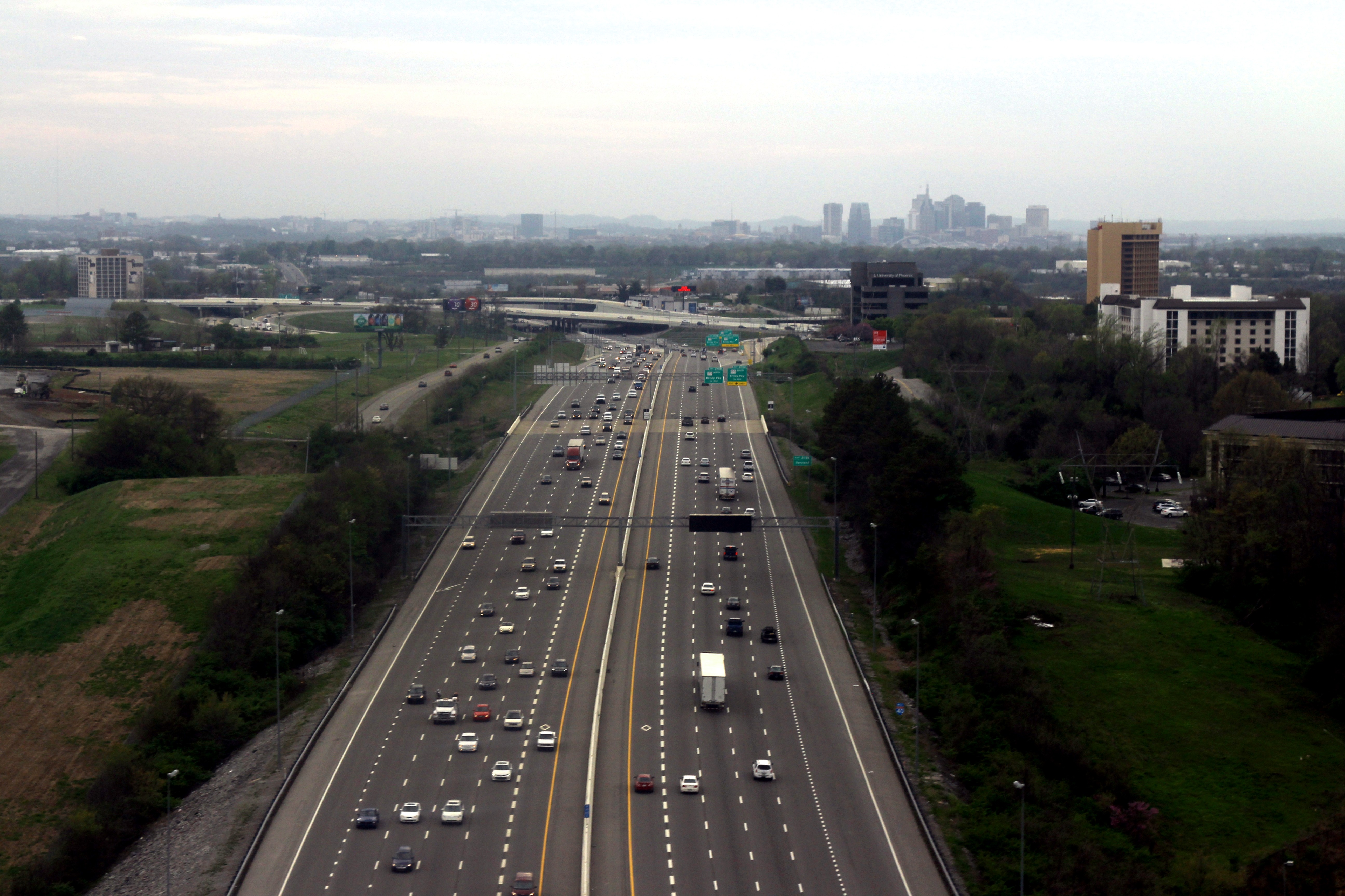
Nashville
Around milepost 191, I-40 enters Davidson County and crosses the Harpeth River for the third time a few miles later.
The highway briefly passes through the Jefferson Street neighborhood before entering downtown Nashville near Fisk University, where it begins a brief concurrency with I-65 and turns southeast. As part of the Inner Loop encircling downtown Nashville, the two concurrent Interstates have interchanges in quick succession with US 70 (Charlotte Avenue), US 70S/431 (Broadway), Church Street, and Demonbreun Street. Next they shift east-northeast near Music Row and the neighborhoods of The Gulch and SoBro, where I-65 turns south toward Huntsville, Alabama. Briefly independent for about 1 mi, I-40 crosses a viaduct and intersects US 31A/US 41A (4th Avenue, 2nd Avenue) before beginning a brief concurrency with I-24. The concurrent Interstates turn southeast, expanding back to eight lanes. I-24 then turns southeast towards Chattanooga, and I-40 shifts eastward. The eastern terminus of I-440 and a connector road to US 41/70S (Murfreesboro Road) are accessible from the westbound lanes of I-40 at this interchange.
Entering the Donelson neighborhood, I-40 intersects SR 155 (Briley Parkway) near Nashville International Airport.
Eastern Nashville Basin, Eastern Highland Rim, and Cumberland Plateau
The highway continues primarily across farmland for about 25 mi, passing a number of small communities. East of Lebanon, it enters Smith County and begins a steep ascent with an eastbound truck-climbing lane. Beyond this point is an interchange with SR 53 in Gordonsville and near Carthage. Between mileposts 263 and 266, the highway crosses the meandering Caney Fork River five times before entering Putnam County. I-40 then again intersects SR 96 in Buffalo Valley, where it shifts southeast and begins climbing out of the Nashville Basin onto the Eastern Highland Rim. The highway then curves northeast and begins a concurrency with SR 56, which connects to Smithville and McMinnville to the south.
I-40 then gradually shifts eastward for several miles before reaching Baxter, where SR 56 splits off and heads north toward Gainesboro. The Interstate has five interchanges in Cookeville, including one with SR 111 (a major north–south connector to Chattanooga) and another with US 70N. It then crosses Falling Water River and begins a steep, approximately 5 mi ascent onto the Cumberland Plateau, reaching an elevation of nearly 2000 ft at the top. The speed limit along this section reduces to 65 mph55 mph for trucks on the westbound descent. The Interstate then continues through a wooded area before reaching Monterey and turning southeast. Here it has two interchanges with US 70N, the first of which has a concurrency with SR 84. After a few miles, the highway reaches an elevation of 2000 ft just before crossing into Cumberland County and East Tennessee.
East Tennessee
Cumberland Plateau and Tennessee Valley

After climbing the Cumberland Plateau, I-40 remains moderately flat and straight as it continues east through a mix of wooded areas and farmland. The highway crosses the Tennessee Valley Divide, where the Cumberland and Tennessee river watersheds meet, at mile marker 308. The Interstate reaches Crossville, where it crosses the Obed River, about 10 mi later. This city has three interchanges, including one with US 127 to Jamestown. East of Crossville, the Crab Orchard Mountains (the southern range of the Cumberland Mountains) come into view; the road descends several hundred feet, and the westbound highway has a truck-climbing lane.
After a few miles, I-40 intersects a connector road to US 70 near the town of Crab Orchard. It winds through Crab Orchard Gap, a narrow pass at the base of the Cumberland Mountains which was once prone to rockslides. I-40 then shifts eastward between Harriman and Rockwood, interchanging with US 27.
The highway then crosses a series of parallel ridges and valleys characteristic of the region's topography. It intersects SR 29 and crosses the Clinch River, with the Kingston Fossil Plant and its 1000 ft twin smokestacks dominating the view to the north. After an interchange with SR 58 southbound in Kingston, the Interstate begins a brief concurrency with this route. It climbs a short, relatively-steep ridge out of the Clinch River Valley, and SR 58 splits off to the north toward Oak Ridge. Continuing through rugged terrain and across additional ridges, the Interstate enters Loudon County and intersects US 321/SR 95 near Lenoir City before reaching I-75.
Knoxville
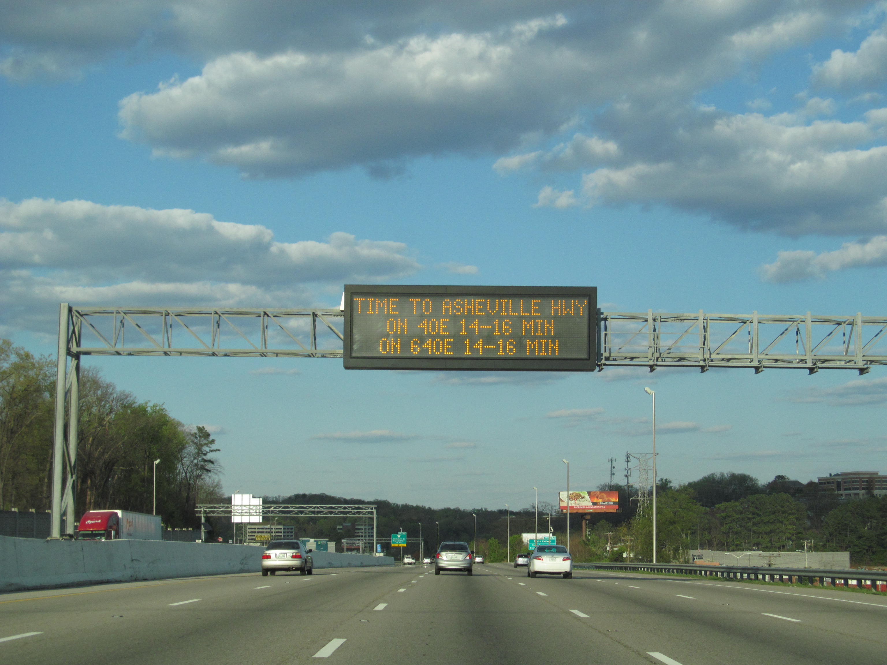
I-40 merges with I-75, which continues southwest to Chattanooga, about 20 mi west-southwest of downtown Knoxville. The two routes turn east-northeast, carrying six through lanes, and enter Knox County. After climbing a ridge, the Interstates have a long straightaway and pass through the Knoxville suburb of Farragut. The road widens to eight lanes at SR 131 (Lovell Road) and intersects the Pellissippi Parkway (SR 162 northbound, I-140 eastbound), which connects to Oak Ridge and Maryville respectively. Proceeding through West Knoxville, the two routes intersect local roads before reaching a connector to US 11/70 (Kingston Pike) near the West Hills neighborhood. An interchange with SR 332 (Northshore Drive) and Papermill and Weisgarber Roads follows. The routes reach the western terminus of I-640, a beltway which bypasses downtown to the north, 2 mi later. Here I-75 splits off from I-40 onto a brief concurrency with I-640 to Lexington, Kentucky. The Interstate then enters downtown Knoxville with six through lanes and several short segments of auxiliary lanes between exits.
Passing near the main campus of the University of Tennessee and several residential neighborhoods, the Interstate intersects the northern terminus of US 129 (Alcoa Highway), a controlled-access highway accessing McGhee Tyson Airport and Great Smoky Mountains National Park. Next is an exit for SR 62 (Western Avenue), followed by a three-level interchange with the southern terminus of I-275; the eastbound lanes also have access to US 441 southbound (Henley Street). The highway crosses a long viaduct over a rail yard before reaching an interchange with SR 158 (James White Parkway) westbound, a controlled-access spur which accesses downtown Knoxville and the University of Tennessee to the south. I-40 then curves north and northeast before an interchange with a connector to US 441. It enters a predominantly-residential area, passing Zoo Knoxville, and reaches an interchange with US 11W (Rutledge Pike). The Interstate then reaches the eastern terminus of I-640, shifting eastward and beginning a brief, unsigned concurrency with US 25W and SR 9. These routes split off at an interchange with US 11E/70 (Asheville Highway). Leaving Knoxville, the Interstate crosses the Holston River.
Smoky Mountains and Pigeon River gorge
Continuing east as a six-lane highway, I-40 travels through Strawberry Plains before entering Sevier County several miles later. Gradually turning northeast, the highway enters Jefferson County. After a gradual ascent of about 5 mi, the highway intersects US 25W/70 near Dandridge, where SR 66 also splits off. It then enters northern Dandridge, where it meets SR 92. I-40 intersects the southern terminus of I-81, which runs into northeast Tennessee to the Tri-Cities of Bristol, Kingsport, and Johnson City. Here, I-40 reduces to four lanes and turns 90 degrees southeast.
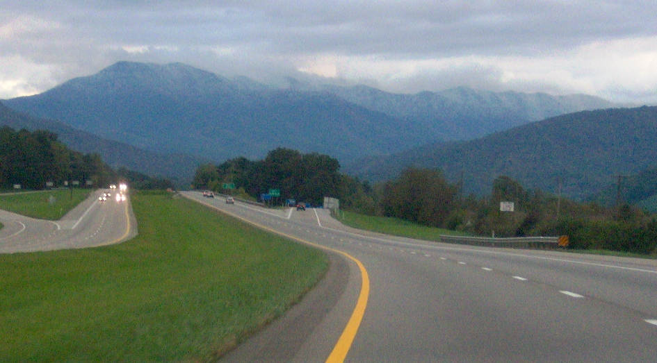
Beginning a moderate descent, the highway crosses the Douglas Lake reservoir of the French Broad River a few miles later and enters Cocke County after a gradual climb. Near Newport is an interchange with US 25W/70, near the northern terminus of US 411. Traversing the northern foothills of English Mountain, the Interstate turns south to an interchange with US 321. After leaving Newport, the road crosses the Pigeon River, intersects SR 73 near Cosby, and again turns south for a view of 4928 ft Mount Cammerer at the northeastern end of the Great Smoky Mountains. Due to hazardous curves, the speed limit is reduced to 55 mph and trucks are prohibited from using the left lane. This stretch is also prone to rockslides, and has mesh nets along some of the cliff slopes. The route gradually curves southeast near Hartford and, after several miles, crosses the Appalachian Trail and enters North Carolina.
"Music Highway" and honorary designations
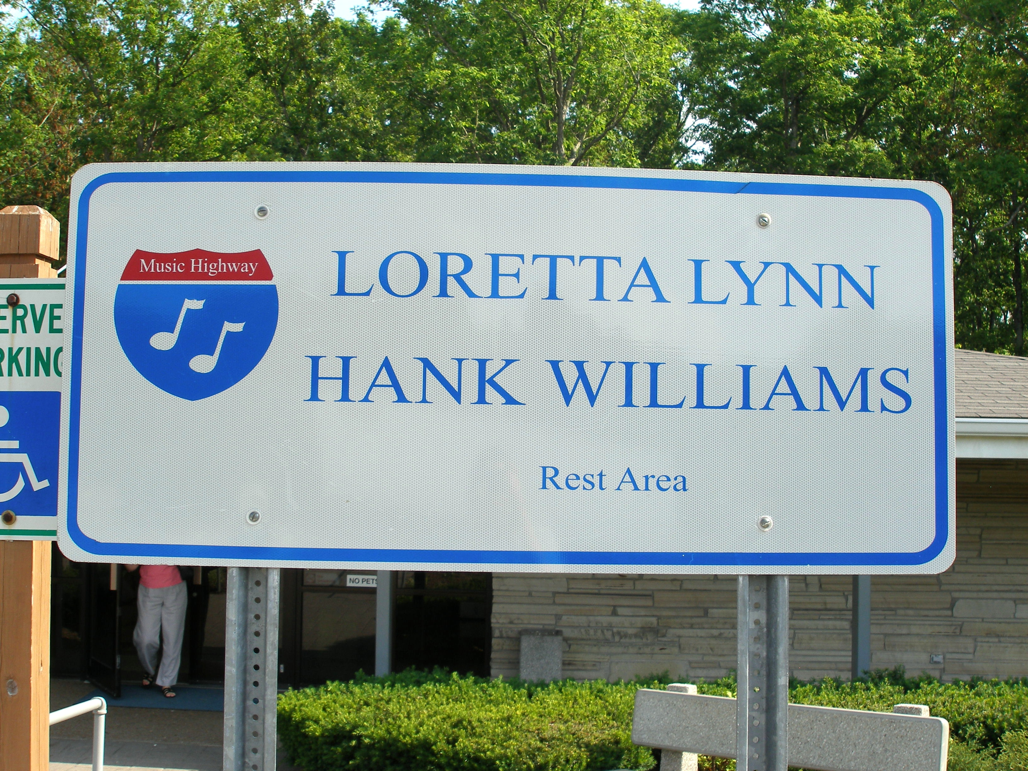
"Music Highway" refers to the section of I-40 between Memphis and Nashville, which was designated as such by the Tennessee General Assembly in 1997. The designation is "from the eastern boundary of Davidson County to the Mississippi River in Shelby County", a distance of about 222 mi. It commemorates the roles played by Memphis, Nashville, and the areas in between in the development of American popular music. Memphis is known as "the Home of the Blues and the Birthplace of Rock and Roll", and Nashville is known as "Music City" for its influence on country music. Several cities and towns between the cities, including Jackson, Brownsville, Nutbush, and Waverly, were birthplaces (or homes) of singers and songwriters. Signs with the words "Music Highway" and musical notes are along I-40 in both directions throughout this section, and rest areas are named for associated musicians or bands.
Several sections of I-40 also bear honorary names in Tennessee. In Memphis, the freeway was designated as "Dr. Martin Luther King Jr. Expressway" in 1971 after the civil rights leader who was assassinated there in 1968. The stretch in eastern Shelby County was named "Isaac Hayes Memorial Highway" in 2010 after a singer-songwriter who was one of the creative forces behind Stax Records in Memphis. The stretch between Nashville and Crossville was named "Senator Tommy Burks Memorial Highway" in 1999 after a state senator who was assassinated the previous year and commonly drove the route between the state capitol and his home in Cookeville. In 1990, the segment from near Farragut to the North Carolina line was named "Troy A. McGill Memorial Highway" after a Knoxville-born U.S. Army soldier who posthumously received the Medal of Honor for his actions during the Admiralty Islands campaign in World War II. The name was changed to "Troy A. McGill Medal of Honor Memorial Highway" in 2022. In 2023, the stretch through Cocke County was named "Charles L. McGaha Medal of Honor Memorial Highway" after a soldier from Cosby who won the Medal of Honor for service in the 1944–1945 Philippines campaign in World War II. A number of short sections, bridges, and interchanges are named for state troopers and TDOT employees killed in the line of duty, as well as local politicians and other prominent citizens. On September 24, 2008, a monument at the Smith County Rest Area that lists the names of each TDOT worker killed in the line of duty since 1948 was dedicated.
Several major bridges on I-40 also have honorary names. The "Hernando de Soto Bridge" is named for the 16th century Spanish explorer and conquistador who was the first European to cross the Mississippi River. The "Jimmy Mann Evans Memorial Bridge" is named for a TDOT commissioner who served from 1987 until his death in 1992. The "Samuel T. Rayburn Memorial Bridge" over the Clinch River is named for a Texas congressman who was the longest serving Speaker of the US House of Representatives. The "Frances Burnett Swann Memorial Bridge" across the French Broad River was designated in 1963 for the wife of Alfred Swann, who served in the Confederate Army during the American Civil War.
History
Predecessor highways

Before the settlement of Tennessee by European Americans, a series of Native American trails existed in what is now the I-40 corridor. The Cumberland Trace (also known as Tollunteeskee's Trail) was a Cherokee trail which passed through the central Cumberland Plateau, and was first used by settlers and explorers in the 1760s. The North Carolina General Assembly (which controlled present-day Tennessee) authorized in 1787 construction of a trail between the southern end of Clinch Mountain (near present-day Knoxville) and the Cumberland Association, which included modern-day Nashville. Completed the following year, the trail became known as Avery's Trace and followed several Native American trails. After the creation of the Southwest Territory, the territorial legislature on July 10, 1795, authorized a wagon trail to be constructed between Knoxville and Nashville. The trail, officially named the Cumberland Turnpike, became popularly known as the Walton Road for one of its surveyors: William Walton, an American Revolutionary War veteran. Built from 1799 to 1801 at a cost of $1,000 (equivalent to $ in ), it was constructed from portions of Tollunteeskee's Trail, Avery's Trace, and the Emery Road (an earlier trail cleared by settlers) and passed through Kingston, Carthage, and Gallatin.
In 1911, a series of Tennessee businesspeople formed the Memphis to Bristol Highway Association to encourage the state to improve the roads which ran between Memphis and Bristol. When the United States Numbered Highway System was formed in 1926, the route connecting Memphis and Knoxville became part of US 70 and US 70S; the route from Knoxville to Bristol was designated as part of US 11 and US 11W. The highway became part of the Broadway of America auto trail linking California and New York in the late 1920s.
Planning

The first segment included in Tennessee's I-40 was a 1.09 mi controlled-access highway in Knoxville, the state's first, which was constructed by state and local governments. Known initially as the Magnolia Avenue Expressway and later renamed the Frank Regas Expressway, the highway originated from a 1945 plan which recommended that a number of expressways be constructed in Knoxville to relieve congestion on surface streets. Planners intended these highways to be integrated into the proposed nationwide highway network that became the Interstate Highway System, which was expected to be authorized by Congress. The highway's location and design was finalized in a 1948 plan, and construction began on October 1, 1951. The first segment, between Unaka Street and Tulip Avenue, was completed on November 14, 1952; the second segment, joining Tulip Avenue and Gay Street, was completed on December 10, 1955. The Magnolia Avenue Expressway had a cloverleaf interchange which was reused for the intersection with I-75 (now I-275) and US 441.
The general location of the highway which became I-40 was included in the National Interregional Highway Committee's 1944 report, "Interregional Highways", and a 1947 plan produced by the Public Roads Administration of the Federal Works Agency. The only area which presented a challenge to planners was the Blue Ridge Mountains, with residents of Western North Carolina divided over whether the Interstate should follow the Pigeon River or the French Broad River to the north. Surveys for both routes were authorized in 1945, and the first survey for the former was made in 1948. After additional studies, the North Carolina Highway Commission recommended the Pigeon River gorge route in 1955; this was approved by the Bureau of Public Roads (predecessor to the Federal Highway Administration) on April 12, 1956. The Tennessee leg of I-40 was among 1047.6 mi of Interstate Highways authorized for the state by the Federal-Aid Highway Act of 1956, commonly known as the Interstate Highway Act. Its numbering was approved by the American Association of State Highway Officials on August 14, 1957. At 451.8 mi long, I-40 in Tennessee was initially the longest segment of Interstate Highway in a single state east of the Mississippi River until an extension of I-75 in Florida was authorized by the Federal-Aid Highway Act of 1968. The first design contract for I-40 in Tennessee was awarded on March 4, 1956, for a short section in Davidson County. Within a year, design contracts had been awarded for sections in Davidson, Knox, Roane, Haywood, Madison, Jefferson, and Cocke counties. By 1958, design work was underway for most of the entire Tennessee route.
Earlier construction

The first contract for construction of I-40 in Tennessee as part of the Interstate Highway System was awarded on August 2, 1957, for a 4.8 mi section in Roane County near Kingston, between the Clinch River and SR 58; construction began the following month. Construction of I-40 between Memphis and Nashville began on September 18, 1958, in Madison County near Jackson. On October 19, 1961, the bridge over the Clinch Riverconstructed at a cost of $2.4 million (equivalent to $ in )was dedicated and opened to traffic by Governor Buford Ellington. The 21.5 mi section linking US 70 east of Brownsville and US 70 in Jackson, known at the time as the Jackson Bypass, was opened to traffic on December 1, 1961. The following day, the 31 mi segment opened between the Clinch River bridge in Kingston and Papermill Road in Knoxville. On October 31, 1962, the section connecting SR 113 near Dandridge and US 25W/70 in Newport opened. The first section of I-40 in Middle Tennessee to be completed was the 14.5 mi stretch from SR 96 in Williamson County and US 70S in Bellevue, which opened on November 1, 1962. The following day, the 16.5 mi segment joining SR 56 near Silver Point and US 70N in Cookeville saw its first traffic. The segment from US 70S in Bellevue and US 70 in western Nashville opened on November 15, 1962.
In Memphis, the segment between I-240/Sam Cooper Boulevard and US 64/70/79then part of I-240was dedicated on October 9, 1963, by Governor Frank G. Clement and opened to traffic 14 days later. That same month, contracts for the last sections between Memphis and Nashville were let. Clement opened and dedicated the 31 mi stretch linking SR 59 near Braden and US 70 east of Brownsville on December 17, 1963. Four days later, the 15 mi segment from SR 53 in Gordonsville to SR 56 near Silver Point opened. On June 2, 1964, the 9 mi segment connecting SR 46 in Dickson and SR 96 in Williamson County was completed. The opening of the Knoxville stretch linking Papermill Road and Liberty Street was announced on September 4, 1964. Two non-contiguous sectionsbetween US 27 in Harriman and the Clinch River Bridge in Kingston, and from Liberty to Unaka Street in downtown Knoxvillewere opened on December 4, 1964. Two separate stretches, 23 mi linking I-240 in Memphis and SR 59 in Braden, and 21 mi connecting US 70 in Jackson and SR 22 in Parkers Crossroads, were dedicated by Clement 10 days later. In Nashville, the link between Fesslers and Spence Lanes (including the eastern interchange with I-24) was declared complete on January 11, 1965. The adjacent link to the west, between the western interchange with I-24 and Fesslers Lane, was partially opened in late December 1963 with the nearby Silliman Evans Bridge; it fully opened on April 19, 1965.
Work began on the bridge over the Tennessee River on November 29, 1962, and was completed on July 21, 1965, at a cost of $4.62 million (equivalent to $ in ). Several segments of the western portion of the 26 mi stretch connecting Spence Lane in Nashville and US 70 in Lebanon were opened to local traffic in 1963; the entire stretch was dedicated by Clement on August 26, 1965. The 10.5 mi segment from SR 13 in Humphreys County and SR 230 in Hickman County was completed on November 24, 1965. On July 24, 1966, I-40 was completed between Memphis and Nashville with the opening of the 64 mi segment from SR 22 in Parkers Crossroads to SR 46 near Dickson after seven months of weather-related delays. The Nashville section between US 70 and 46th Avenue was also completed. A dedication ceremony, officiated by Clement and US Senator Albert Gore Sr., was held on the Tennessee River Bridge.
Later construction
The section joining US 25W/70 to SR 113 in Jefferson County, including the interchange with I-81, was completed in December 1966. On April 11, 1967, the segment in Knoxville from Gay Street to US 11W opened. The 16 mi segment linking US 70N in Monterey and US 127 in Crossville opened to traffic on December 1 of that year. The final section of I-40 in Knoxville to be completed was the segment connecting US 11W and US 11E/25W/70, which opened on December 19, 1967, to eastbound traffic and on June 21, 1968, to westbound traffic. The 12 mi segment from US 127 in Crossville to US 70 in Crab Orchard opened on September 12, 1968. The adjacent section, extending to SR 299 near the eastern escarpment of the Cumberland Plateau, followed on September 26, 1969. The section through the Pigeon River Gorge in Cocke County into North Carolina was initially believed by some engineers to be impossible to build and was among the nation's most difficult and laborious highway projects, requiring thousands of tons of earth and rock to be moved. It was one of the most expensive highway construction projects per mile, at a cost of $19 million (equivalent to $ in ). Work began in 1961; On October 24, 1968, the 37 mi stretch between US 321/SR 32 in Newport and US 276 in Haywood County, North Carolina, was opened to traffic by both states with a dedication ceremony.

In Nashville, the segment linking 46th Avenue with I-65 opened to traffic on March 15, 1971. The Memphis section from US 51 to Chelsea Avenue, including the Midtown interchange with I-240 (then I-255), opened on July 14 of that year. Work on the final segment between Memphis and Knoxville, approximately 5.5 mi from the interchange with I-65 to the western split with I-24 southeast of downtown Nashville (including the concurrency with I-65), began in May 1969 and opened on March 3, 1972. This completed all of I-40 from Memphis to SR 299, near Rockwood, and the last stretch in Middle Tennessee. The last segment of the planned I-40 in West Tennessee to be completed was the Hernando de Soto Bridge in Memphis; construction began on May 2, 1967, and the bridge opened to traffic on August 2, 1973. The bridge, which cost $57 million (equivalent to $ in ), was dedicated by Tennessee Governor Winfield Dunn and Arkansas Governor Dale Bumpers on August 17, 1973.
The 9 mi segment from SR 299 to US 27 near Harriman and Rockwood, including the descent down Walden Ridge, was the last section of I-40 completed between Memphis and Knoxville, and was repeatedly delayed by geological problems. The westbound lanes opened to two-way traffic on November 18, 1972, and the complete section opened on August 19, 1974. Work started on this section in early 1966, and was originally expected to be completed by late 1968. The final segment of the planned route of I-40 in Tennessee, 21.5 mi connecting US 11E/25W/70 east of Knoxville to US 25W/70 in Dandridge, was dedicated by Dunn and partially opened to traffic on December 20, 1974; it fully opened on September 12, 1975. Initially planned with four lanes, engineers chose to expand this segment to six lanes in 1972 after construction had begun, based on studies projecting a higher-than-average traffic volume. This segment, one of the nation's first rural six-lane highways, was also dedicated on the same day that the last sections of I-75 and I-81 in Tennessee were opened. The last section of I-40 in Tennessee to be completed linked Chelsea Avenue and US 64/70/79 in Memphis, and was originally part of I-240. Due to its location within a floodplain, an artificial fill of 23 e6cuyd of sand and silt was required for the roadbed, most of which was dredged and pumped from the bottom of the Mississippi River via a pipeline. Contracts for this work were let in May and July 1974. Dredging and fill work was complete by the end of 1977, and the section was opened to traffic by Governor Lamar Alexander on March 28, 1980.
Controversies

I-40 was originally planned to pass through Overton Park in Memphis, a 342 acre public park. This location was announced in 1955, and was approved by the Bureau of Public Roads in November 1956. The movement was also backed by environmentalists, who feared that the Interstate's construction would upset the park's ecological balance; the wooded area had become an important stopover for migratory birds.
The organization filed a lawsuit in the US District Court for the Western District of Tennessee in December 1969 after the Secretary of Transportation John A. Volpe authorized the state to solicit bids the previous month. The suit was dismissed on February 26, 1970, by Judge Bailey Brown, which was subsequently upheld by the Sixth Circuit Court of Appeals on September 29, 1970. The case was then appealed to the US Supreme Court, which reversed the lower-court rulings in the landmark decision of Citizens to Preserve Overton Park v. Volpe on March 2, 1971. The court found that Volpe had violated clauses of the Department of Transportation Act of 1966 and the Federal-Aid Highway Act of 1968, which prohibit the approval of federal funding for highway projects through public parks with feasible alternative routes. Tennessee continued exploring options to route I-40 through Overton Park for many years after this decision including tunneling under the park or constructing the highway below grade, but concluded that the alternatives were too expensive. On January 9, 1981, Governor Alexander submitted a request to Secretary of Transportation Neil Goldschmidt to cancel the route through Overton Park, which was approved seven days later.
On June 28, 1982, the American Association of State Highway and Transportation Officials approved an application by TDOT to redesignate the northern portion of I-240 as the remainder of I-40; this added about 3.4 mi to the route. About 4 mi of a controlled-access highway was built within the I-240 loop east of the park before the cancellation; this portion of highway was named Sam Cooper Boulevard in December 1986, and terminates at East Parkway in the Binghampton neighborhood near the park. Right-of-way was also acquired west of the park, and many structures were demolished to make way for the Interstate; some of these empty lots have since been built on. When the route was canceled, about $280 million (equivalent to $ in ) had been budgeted by the federal government for its construction; these funds were then diverted for other transportation improvements in the Memphis metropolitan area.
I-40 passes through the Jefferson Street community in western Nashville, a predominantly Black neighborhood which contains three historically Black colleges and was home to a large African American middle class in the early-to-mid-20th century. Planners considered placing this section near Vanderbilt University, but settled on the current alignment by the mid-1950s. Before construction began, many residents believed that the Interstate would lead to the economic decline of their neighborhood and divide it from the rest of the city. Some also believed that the routing was an act of racial discrimination, and criticized the state for a lack of transparency about its plans. In October 1967, several residents of Jefferson Street formed the I-40 Steering Committee and filed a lawsuit against the state in the US District Court for the Middle District of Tennessee in the hope forcing a reroute of the Interstate. Judge Frank Gray Jr. ruled against the committee on November 2, saying that there was no feasible alternate route. Gray conceded, however, that the methods used by the state to notify residents about the project were unsatisfactory and the route would have an adverse effect on their community. The organization appealed the decision to the Sixth Circuit, which unanimously upheld the lower court's decision on December 18; and to the Supreme Court, which refused to hear the case on January 29, 1968. The construction of I-40 through Jefferson Street resulted in many Black residents being displaced to the Bordeaux area of North Nashville, and led to the predicted economic downturn in the neighborhood.
Major projects and expansions
{{anchor|Memphis}}Memphis projects

The first high-occupancy vehicle (HOV) lanes in the Memphis area opened on September 15, 1997, on the 7.5 mi section between I-240 and US 64 in Bartlett with the completion of a project widening the section from four to eight lanes. The cancellation of the section of I-40 through Overton Park rendered both interchanges with I-240 inadequate to handle the unplanned traffic patterns, necessitating their reconstruction; both interchanges also contained ramps with hazardously sharp curves. The eastern interchange was reconstructed with two projects. The first, which began in January 2001 and finished in October 2003, constructed a two-lane overpass from I-40 westbound to I-240 westbound; this replaced a one-lane loop ramp and widened the approach of I-240 south of the interchange. I-40 north of the interchange was also reconstructed in preparation for the second project, and the interchanges with US 64/70/79 (Summer Avenue) and White Station Road were modified.
The second project, initially scheduled to begin in January 2004, was delayed until October 2013 due to funding and redesign complications. A two-lane overpass was built to carry I-40 eastbound traffic through the interchange, replacing a one-lane ramp. The single-lane ramp carrying I-40 westbound traffic through the interchange was repurposed as the exit ramp for Summer Avenue, and was replaced with a two-lane overpass connecting to the overpass constructed in the first project. This project also widened the ramp connecting I-240 eastbound and I-40 eastbound to three lanes, widened both approaches to the interchange on I-40, which required a new 14-lane bridge over the Wolf River, widened the approach on I-240 south of the interchange, added through lanes to Sam Cooper Boulevard, and reconfigured the SR 204 (Covington Pike) interchange. It cost $109.3 million (equivalent to $ in ), the most expensive contract in state history at the time,
The interchange with the western terminus of I-240 near midtown Memphis was reconstructed between June 2003 and December 2006. This project converted the interchange into a directional T configuration, which required the demolition of several unused ramps and bridges which had been built in the expectation that I-40 would continue east of the interchange. The nearby cloverleaf interchange with SR 14 (Jackson Avenue) was reduced to a partial cloverleaf interchange, and several additional auxiliary lanes and slip ramps were constructed. The northern merge point between I-40 and I-240 was moved north of the SR 14 interchange.
Nashville area

In November 1977, TDOT installed a system to detect tailgating vehicles in the westbound lanes of the concurrent segment with I-24: sensors embedded in the roadway which were connected to overhead warning signs with flashing lights and horns. The system (the first of its kind in the country) experienced technical problems, was criticized as ineffective, and was decommissioned in July 1980. This segment of I-40 was widened from six to eight lanes between July 1979 and January 1980 by removing the right shoulders, narrowing the lanes by 1 ft, and shifting traffic slightly to the left.
The short segment of I-40 from east of the split with I-24/I-440 and east of SR 255 (Donelson Pike) in eastern Nashville was widened to six lanes from August 1986 to December 1987. From October 1987 to November 1989, the 4.7 mi segment from east of SR 255 to east of SR 45 was widened from four to eight lanes. West of downtown Nashville, the 3 mi section between SR 155 (Briley Parkway/White Bridge Road) and US 70 (Charlotte Pike) was expanded to six lanes from February 1988 to December 1989. From April 1991 to December 1992, the 5.9 mi section in Bellevue linking US 70 and US 70S was widened to six lanes.
The first HOV lanes on I-40 in Tennessee were opened to traffic on November 14, 1996, with the completion of a project which widened the 8 mi section between west of SR 45 (Old Hickory Boulevard) in eastern Nashville and east of SR 171 in Mount Juliet from four to eight lanes. They were Tennessee's second set of HOV lanes. The project, which began in early 1995, was the state's first to use split Jersey barriers in the median every few miles to allow police enforcement from the left shoulder. The short stretch between SR 155 (Briley Parkway/White Bridge Road) and the western terminus of I-440 was modified from November 2002 to July 2005; it was widened to eight through lanes, auxiliary lanes were added, access to local thoroughfares was improved and expanded, and two overpasses provided partial access control to the southern end of Briley Parkway. The second phase (from July 2009 to August 2011) constructed an overpass between I-40 and Briley Parkway, converting the interchange to full access control, modified the White Bridge Road interchange, and widened a short stretch of I-40 west of the interchange.
A project from January 2004 to January 2007 widened the 3 mi section connecting I-24/440 to SR 255 from six to eight through lanes, added auxiliary lanes between interchanges, and reconstructed the interchange with SR 155 (Briley Parkway) for controlled access. Work to widen 6 mi of I-40 from four to eight lanes from east of SR 171 to east of SR 109 in Lebanon began in July 2012 and was completed in July 2014. The 4 mi stretch from east of SR 109 to east of I-840 in Lebanon was widened from four to eight lanes between April 2019 and September 2021.
{{anchor|Knoxville}}Knoxville projects

Beginning in early May 1980, the segment of I-40 in Knoxville between Papermill Road and Gay Street was modified in a project which modified the interchanges with 17th Street, Western Avenue, and Gay Street; widened the segment to a minimum of six through lanes; added frontage roads; and reconstructed the gridlock-prone cloverleaf interchange with I-75 known as "Malfunction Junction" into a stack interchange with overpasses. The non-contiguous segment between US 11W (Rutledge Pike) and US 11E/25W/70 (Asheville Highway) was also widened to six lanes. Work was completed on March 30, 1982, with a ceremony officiated by Governor Alexander. While these projects were underway, the concurrent part of I-75 on this segment was rerouted around the western leg of I-640 (completed in December 1980) and the short segment of I-75 north of this segment became I-275. These projects were part of a $250 million (equivalent to $ in ) multi-phase improvement project for area roads which was accelerated in preparation for the 1982 World's Fair. They were followed by widening I-40 to six lanes between Broadway and US 11W from July 1990 to October 1991.
By the mid-1970s, the concurrent segment of I-40 with I-75 between Lenoir City and western Knoxville was congested. The FHWA authorized TDOT in 1978 to widen the section from the I-75 interchange near Lenoir City to the Pellissippi Parkway to six lanes and the segment from the Pellissippi Parkway to I-640 to eight lanes, and to reconstruct interchanges along this section. TDOT announced plans to proceed with the project in May 1981, initially choosing to widen the entire segment to six lanes due to the need for immediate congestion relief and additional right-of-way required by the larger project. The remainder of the project, located between the Pellissippi Parkway and the I-75 split, was done from June 1985 to July 1986.
On October 9, 1986, the FHWA approved an environmental impact statement (EIS) for the remainder of the I-40/I-75 improvement project. The first phase, between August 1990 and August 1994, widened the section from east of the Pellissippi Parkway to east of Cedar Bluff Road and reconstructed the Cedar Bluff Road interchange. In preparation for the second phase, Gallaher View Road was extended north to the Interstate between April 1994 and July 1996 with a new overpass and on-ramp. The second phase, from May 1996 to December 1999, widened the section from east of Cedar Bluff Road to east of Gallaher View Road and extended Bridgewater Road to the Interstate. The interchange with Walker Springs Road was replaced, providing access to all three roads via collector–distributor frontage roads. The third phase, from early 2000 to late 2002, widened the segment linking Papermill Road to I-640 from six to 10 lanes. The fourth phase, from September 2000 to July 2003, improved the interchange with SR 131 and widened the section to the Pellissippi Parkway. The final phase, from January 2003 to December 2006, widened the section connecting Gallaher View Road to Papermill Road and reconfigured the interchanges with the US 11/70 connector and Papermill Road. A collector–distributor facility serving the westbound ramps was built along the Papermill interchange, and ramps to Weisgarber Road and SR 332 were constructed.
In 1989, TDOT began preliminary planning work to widen the four-lane section from east of I-275 to Broadway/Hall of Fame Drive, and reconstruct the accident-prone interchange with SR 158 (James White Parkway), which contained left-hand entrance and exit ramps. Preliminary engineering began in 1995, and the FHWA approved an EIS for the project on February 28, 2002. On June 14, 2004, the two-phase project was unveiled to the public with the name SmartFIX40. The first phase, from July 6, 2005, to September 21, 2007, rebuilt and realigned the interchanges with SR 158, Broadway/Hall of Fame Drive, and Cherry Street; and built collector–distributor ramps between these interchanges. For the second phase, I-40 between SR 158 and Broadway/Hall of Fame Drive was closed between May 1, 2008, and June 12, 2009. This allowed crews to widen this section to six lanes with additional auxiliary lanes and rebuild the SR 158 interchange on an accelerated timeline. Through traffic used I-640 or surface streets during the closure, and inbound and outbound ramps connecting I-40 and I-640 at both interchanges were temporarily widened to three lanes to accommodate the extra volume. Both phases of SmartFIX40 received an America's Transportation Award from the AASHTO in 2008 and 2010. At a cost of $203.7 million (equivalent to $ in ), SmartFIX40 was the largest project ever coordinated by TDOT at the time and the second of its kind in the US.
Other projects

Between July 1997 and November 1999, the 6 mi section from US 25W/70 to I-81 in Jefferson County was widened to six lanes. A 2008 TDOT study of the I-40 and I-81 corridors identified a number of steep grades which were difficult for trucks to climb, causing congestion and safety hazards, and the department constructed truck climbing lanes throughout the corridor in response. In 2018, three westbound truck lanesa 2 mi lane immediately west of the Tennessee River in Benton County, a 2 mi lane in Humphreys and Hickman counties, and a 1 mi lane east of Crossvillewere completed. Two additional projects, a 4 mi lane in Dickson and Williamson counties and a 3 mi lane in western Smith County (both eastbound), were completed the following year.
In Jackson, I-40 was widened to six lanes and interchanges were improved in three phases. The first phase, which began on October 2, 2017, widened I-40 between west of US 45 Byp. and east of US 45, a distance of about 2.9 mi; added auxiliary lanes between these interchanges and the interchange with US 412; converted the cloverleaf interchange with the US 45 Byp. into a partial cloverleaf interchange and the cloverleaf with US 70 into a single-point urban interchange (SPUI); and replaced bridges and improved intersections on both routes near the interchanges. The first phase finished in early July 2021. The second phase, which began on November 4, 2020, widened I-40 from east of US 45 to east of US 70/412, a distance of about 5.5 mi, added auxiliary lanes, and replaced bridges. It was completed on November 7, 2022. The final phase, which began on July 10, 2022, and was completed ahead of schedule on December 13, 2023, widened the 1.2 mi segment from west of US 412 to west of US 45 Byp.
Geological difficulties
East Tennessee's rugged terrain presented a number of challenges to I-40 construction crews and engineers. Rockslides, especially along the eastern Cumberland Plateau and in the Pigeon River gorge, have been a persistent problem during and since the road's construction.
Crab Orchard and Walden Ridge area
On December 17, 1986, a truck driver was killed when his truck struck a boulder which had fallen across the road just east of Crab Orchard. In response to the incident, between January 1987 and December 1988, workers flattened the cut slopes along this stretch of the Interstate and moved a 1,000 ft section of the road 60 ft from the problematic cliffside.
While I-40 was under construction, 20 rockslides occurred along the Walden Ridge section (miles 341–346) of the eastern plateau in 1968. This prompted remedial measures throughout the 1970s, including rock buttresses, gabion walls, and horizontal drains.
Pigeon River gorge

The Pigeon River gorge is prone to rockslides, especially near the Tennessee–North Carolina state line. This stretch of I-40 was repeatedly shut down by rockslides during the 1970s, sometimes for weeks at a time. In the late 1970s and early 1980s, workers dug over 24000 ft of horizontal drains, blasted out a large number of unstable rocks, and installed mesh catchment fences. Additional stabilization measures were implemented, including the blasting of loose rock, the installation of rock bolts, and improved drainage. Another rockslide in the gorge on October 26, 2009, blocked all lanes just across the border at North Carolina mile 3; the section was closed to traffic in both directions until April 25, 2010. On January 31, 2012, the westbound lanes of I-40 were closed for a few weeks because of a rockslide near the North Carolina border. Torrential flooding in the Pigeon River from the aftermath of Hurricane Helene washed away a small section of the eastbound shoulder and embankment near the state line on September 27, 2024, closing the roadway to all traffic.
Sinkholes
Sinkholes are a consistent issue along highways in East Tennessee. One particularly problematic stretch is a section of I-40 between miles 365 and 367 in Loudon County, which is underlain by cavernous rock strata. TDOT employed a number of stabilization measures in this area during the 1970s and 1980s, including backfilling existing sinkholes with limestone, collapsing potential sinkholes, and paving roadside ditches to prevent surface water from seeping into unstable soil.
{{anchor|Other history, incidents, and closures}}Incidents and closures
On December 23, 1988, a tanker truck hauling liquified propane overturned on a one-lane ramp carrying I-40 traffic through the Midtown interchange with I-240 in Memphis, poking a small hole in the front of the tank. The leaking gas ignited in a boiling liquid expanding vapor explosion (BLEVE), producing a fireball that set nearby vehicles and structures on fire and instantly killed five motorists (including the truck driver). The tank was propelled from the crash site by the remaining combusting gas, striking a nearby overpass and crashing into a duplex apartment about 125 yd away. One occupant was killed, and additional fires spread to other buildings. A total of seven additional cars were destroyed, and 10 cars, six houses, and a residential complex were damaged. Another truck driver was killed when he crashed into a traffic jam caused by the accident. This event, one of Tennessee's deadliest and most destructive motor-vehicle accidents, spurred the eventual reconstruction of the interchange.

Inspectors discovered a crack on a tie girder of the Hernando de Soto Bridge on May 11, 2021, resulting in the closure of the bridge. A subsequent investigation indicated that the crack had existed since at least May 2019, and reports later surfaced that the crack had probably existed since August 2016. TDOT awarded an emergency repair contract for the bridge on May 17, 2021, and the repair was made in two phases. In the first phase, completed on May 25, 2021, fabricated steel plates were attached to both sides of the fractured beam. The second phase consisted of the installation of additional steel plating and removal of part of the damaged beam. The bridge's eastbound lanes reopened on July 31, 2021, and the westbound lanes reopened two days later. A report released later that year concluded that the crack resulted from a welding flaw during the beam's fabrication.
Exit list
10 (WB)
Notes
References
References
- Starks, Edward. (January 27, 2022). "Table 1: Main Routes of the Dwight D. Eisenhower National System of Interstate and Defense Highways". [[Federal Highway Administration]].
- Public Roads Administration. (August 14, 1957). "Official Route Numbering for the National System of Interstate and Defense Highways as Adopted by the American Association of State Highway Officials". Public Roads Administration.
- Buser, Lawrence. (March 22, 1980). "Ceremony On Friday To Open I-240 North". [[The Commercial Appeal]].
- [[Tennessee Department of Transportation]]. (2014). "Brief History of TDOT". Tennessee Department of Transportation.
- Maertens, Thomas Brock. (June 10, 1980). "The Relationship of Maintenance Costs to Terrain and Climate on Interstate 40 in Tennessee". The University of Tennessee.
- "Transportation Data Management System". MS2.
- King, Tom. (February 22, 2021). "Carrie Hagen: Adventures at the Weigh Scales". KnoxTNToday.com.
- (January 17, 2023). "Knox Co. Commission Takes Up Proposal to Ask TDOT to Build New Highway Bypass Around Knoxville". [[WBIR-TV]].
- Hickman, Matt. (May 13, 2021). "Memphis's Hernando de Soto Bridge Shuttered After Major Fracture Discovered". [[The Architect's Newspaper]].
- DeLorme. (2017). "Tennessee Atlas & Gazetteer". DeLorme.
- Long Range Planning Division Office of Data Visualization. (2018). "Shelby County". Tennessee Department of Transportation.
- . ["High Occupancy Vehicle Lane"](https://www.tn.gov/tdot/traffic-operations-division/traffic-engineering-office/high-occupancy-vehicle-hov-lane.html). *Tennessee Department of Transportation*.
- (February 2022). "I-40/81 Multimodal Corridor Study: Executive Summary". Tennessee Department of Transportation.
- . (). ["Tennessee Property Viewer"](https://tnmap.tn.gov/assessment/). *Tennessee Department of Finance & Administration*.
- United States Geological Survey. (2022). "Denmark, TN". United States Geological Survey.
- United States Geological Survey. (2022). "Adair, TN". United States Geological Survey.
- Long Range Planning Division Office of Data Visualization. (2018). "Madison County". Tennessee Department of Transportation.
- (July 2020). "I-40/81 Multimodal Corridor Study: Technical Memorandum: Existing and Future Conditions". Tennessee Department of Transportation.
- United States Geological Survey. (2022). "Hurricane Mills, TN". United States Geological Survey.
- United States Geological Survey. (2022). "Spot, TN". United States Geological Survey.
- United States Geological Survey. (2022). "White Bluff, TN". United States Geological Survey.
- {{harvp. Moore. 1994
- Long Range Planning Division Office of Data Visualization. (2018). "Davidson County". Tennessee Department of Transportation.
- . (2019). ["Downtown Nashville Interstate Loop Concepts Study"](https://www.solvethistogether.org/_files/ugd/d8585c_fbd34a5740eb4b02a705f9b9e706b950.pdf). *Greater Nashville Regional Council*.
- United States Geological Survey. (2022). "Silver Point, TN". United States Geological Survey.
- United States Geological Survey. (2022). "Campbell Junction, TN". United States Geological Survey.
- {{harvp. Moore. 1994
- Long Range Planning Division Office of Data Visualization. (2018). "Cumberland County". Tennessee Department of Transportation.
- United States Geological Survey. (2022). "Dorton, TN". United States Geological Survey.
- . (February 7, 2017). ["TDOT Closes I-40 Shoulder for Construction"](https://www.crossville-chronicle.com/news/local_news/tdot-closes-i-40-shoulder-for-construction/article_ed530fea-e989-11e6-8ad0-fbbac1ed6bdf.html). *[[Crossville Chronicle]]*.
- United States Geological Survey. (2022). "Cardiff, TN". United States Geological Survey.
- United States Geological Survey. (2022). "Harriman, TN". United States Geological Survey.
- Vásquez Russell, Melanie. (January 13, 2021). "TVA Releases Video of Kingston Fossil Plant Stacks Inspection". [[WATE-TV]].
- United States Geological Survey. (2022). "Cave Creek, TN". United States Geological Survey.
- United States Geological Survey. (2022). "Lenoir City, TN". United States Geological Survey.
- Long Range Planning Division Office of Data Visualization. (2018). "Knox County". Tennessee Department of Transportation.
- McAlee, Hope. (March 8, 2023). "History of Exit 407: Gateway to the Great American Vacation". WATE-TV.
- Long Range Planning Division Office of Data Visualization. (2018). "Sevier County". Tennessee Department of Transportation.
- United States Geological Survey. (2022). "Douglas Dam, TN". United States Geological Survey.
- United States Geological Survey. (2022). "Jefferson City, TN". United States Geological Survey.
- Long Range Planning Division Office of Data Visualization. (2018). "Jefferson County". Tennessee Department of Transportation.
- United States Geological Survey. (2022). "White Pine, TN". United States Geological Survey.
- United States Geological Survey. (2022). "Newport, TN". United States Geological Survey.
- United States Geological Survey. (2022). "Waterville, NC". United States Geological Survey.
- (February 6, 2008). "Mountain Roads Cited as Among the State's Most Dangerous". [[Smoky Mountain News]].
- Long Range Planning Division Office of Data Visualization. (2018). "Cocke County". Tennessee Department of Transportation.
- Duzak, Warren. (January 11, 1998). "Even Highway Carries a Tune Near Music City". The Tennessean.
- . (March 3, 1999). ["New Guide Explores Musical Heritage Along Stretch of I-40"](https://www.newspapers.com/article/johnson-city-press-new-guide-explores-mu/125034561/). *Johnson City Press*.
- . (March 31, 1971). ["Midtown Expressway Named for Dr. King"](https://www.newspapers.com/article/the-memphis-press-scimitar-midtown-expre/129577338/). *Memphis Press-Scimitar*.
- (August 16, 2010). "Stretch of I-40 to Be Renamed in Honor of Isaac Hayes on Friday". The Commercial Appeal.
- . (February 27, 1999). ["Sundquist Signs Burks Memorial Highway Bill"](https://www.newspapers.com/article/bristol-herald-courier-sundquist-signs-b/129117877/). *[[Bristol Herald Courier]]*.
- Elliott, Stephen. (August 16, 2018). "The Death of a Senator: Tommy Burks and Byron (Low Tax) Looper". [[Nashville Scene]].
- Maples, Bill. (July 1, 1990). "Portion of highway to Honor War Hero McGill". The Knoxville News-Sentinel.
- (May 3, 2022). "Troy McGill Highway to be Rededicated on May 10". [[PR Newswire]].
- Luther, Sam. (November 3, 2023). "Medal of Honor recipient and Cocke County native honored once again". [[WVLT-TV]].
- . (September 17, 2007). ["Highways Dedicated To Fallen Troopers"](https://www.tn.gov/news/2007/9/17/highways-dedicated-to-fallen-troopers.html). *[[Tennessee Department of Safety and Homeland Security]]*.
- Terada, Souichi. (July 14, 2018). "Memorial Highway Named After TDOT Worker James Rogers Struck on I-40 on Christmas Eve 2016". The Tennessean.
- . (September 23, 2008). ["TDOT Unveils Highway Workers Memorial"](https://www.tn.gov/news/2008/9/23/tdot-unveils-highway-workers-memorial1.html). *Tennessee Department of Transportation*.
- (August 17, 1973). "Tireless Gold-Seeker Gave Name". The Commercial Appeal.
- . (). ["TDOT Commissioner History"](https://www.tn.gov/tdot/about/commissioner-history.html). *Tennessee Department of Transportation*.
- Julian, Harold. (July 26, 1992). "Knox I-40 Bridge Honored Both Living and Dead". The Knoxville News-Sentinel.
- . (April 7, 1963). ["Swann, Wife Both Honored by 2 Bridges"](https://www.newspapers.com/article/the-knoxville-news-sentinel-swann-wife/129119677/). *The Knoxville News-Sentinel*.
- Smith, David Ray. (October 8, 2017). "Historic Trails". Tennessee Encyclopedia of History and Culture.
- Finger, John R.. (2001). "Tennessee Frontiers: Three Regions in Transition". Indiana University Press.
- (2014). "Transportation Milestones in Tennessee History". Tennessee Department of Transportation.
- (1925). "Biennial Report of the Commissioner of the Department of Highways and Public Works State of Tennessee for the Years 1923 and 1924". Tennessee Department of Highways and Public Works.
- Memphis-Nashville-Bristol Highway Association. (1911). "Route of Memphis-Nashville-Bristol Highway, Tennessee's First State Road". Tennessee State Library and Archives.
- (November 11, 1926). "United States System of Highways Adopted for Uniform Marking by the American Association of State Highway Officials". [[United States Geological Survey]].
- Weingroff, Richard. (June 27, 2017). "U.S. 11 – Rouses Point, New York, to New Orleans, Louisiana". Federal Highway Administration.
- . (August 18, 1928). ["Plan to Spend $8,000,000 on Route 1, Tennessee's Broadway of America"](https://www.newspapers.com/clip/69837346/plan-to-spend-8000000-on-route-1/). *Johnson City Chronicle*.
- Ferguson, Don K.. (May 18, 2008). "Ferguson: First Downtown Expressway Spurred Malfunction Junction". The Knoxville News-Sentinel.
- Range, Wayne. (August 9, 1953). "Overpass Design Needed To Speed Completion of Magnolia Link; State Still Waiting for Plans on Span". The Knoxville News-Sentinel.
- Smith, Walter. (November 1945). "Major Street System". City of Knoxville, Tennessee.
- . (February 17, 1949). ["$3¼ Million Needed To Start Expressways; U.S. and State Officials Hear Lochner Plan"](https://www.newspapers.com/clip/100014611/3-14-million-needed-to-start/). *The Knoxville News-Sentinel*.
- (October 4, 1951). "Grading Set To Start On Expressway". The Knoxville Journal.
- . (November 30, 1952). ["Expressway's First Link Completed"](https://www.newspapers.com/clip/57640672/expressways-first-link-completed/). *The Knoxville Journal*.
- . (December 10, 1955). ["Short Ceremony Opens Expressway Link"](https://www.newspapers.com/clip/122270553/short-ceremony-opens-expressway-link/). *The Knoxville News-Sentinel*.
- Lakin, Matt. (August 26, 2012). "Junction for Malfunction". [[Knoxville News Sentinel.
- Weingroff, Richard F.. "Designating the Urban Interstates". Federal Highway Administration.
- [[Public Roads Administration]]. (August 2, 1947). "National System of Interstate Highways". Public Roads Administration.
- Campbell Jr., Robert F.. (September 26, 1948). "Dissent Is Voiced On N.C.-Tenn. Route". Asheville Citizen-Times.
- Boyle, John. (November 1, 2009). "I-40 Path Spelled Trouble; Route 'Nothing But Fractured Rock Waiting to Fall Off'". Asheville Citizen-Times.
- . (July 1, 1955). ["North Carolina Picks Pigeon River Route"](https://www.newspapers.com/clip/123433717/north-carolina-picks-pigeon-river-route/). *The Knoxville News-Sentinel*.
- . (April 12, 1956). ["Pigeon River Route Chosen; Links Knoxville and Asheville"](https://www.newspapers.com/clip/123431374/pigeon-river-route-chosen/). *The Knoxville News-Sentinel*.
- (1959). "History of the Tennessee Highway Department". Tennessee State Highway Department.
- . (2010). ["Eisenhower Interstate Highway System, Previous Facts of the Day"](https://highways.dot.gov/highway-history/interstate-system/50th-anniversary). *Federal Highway Administration*.
- {{harvp. Moore. 1994
- (January 24, 1962). "Notice To Contractors Of State Highway Construction Bids To Be Received, February 16, 1962". The Nashville Tennessean.
- . (August 19, 1957). ["Contract Let For Parts Of Superhighway"](https://www.newspapers.com/clip/110496822/contract-let-for-parts-of-superhighway/). *The Nashville Banner*.
- . (September 22, 1957). ["Superhighway Link Work Begins"](https://www.newspapers.com/clip/110497225/superhighway-link-work-begins/). *The Knoxville News-Sentinel*.
- Veazey, Walter. (July 24, 1966). "I-40 Is Story Of A Road Made Good". The Commercial Appeal.
- . (October 20, 1961). ["Clinch River Bridge Opening Draws 700"](https://www.newspapers.com/clip/56546078/clinch-river-bridge-opening-draws-700/). *The Knoxville Journal*.
- . (November 30, 1961). ["Interstate Highway To Open Friday"](https://www.newspapers.com/clip/56529269/interstate-highway-to-open-friday/). *[[The Jackson Sun]]*.
- . (December 3, 1961). ["I-40 Traffic Is Without Incident"](https://www.newspapers.com/clip/122270162/i-40-traffic-is-without-incident/). *The Knoxville News-Sentinel*.
- . (November 26, 1961). ["Vol-Vandy Highroad (Image)"](https://www.newspapers.com/clip/122269968/vol-vandy-highroad/). *The Knoxville News-Sentinel*.
- . (November 8, 1962). "Traffic Travels Over New Roadway". *The Newport Plain Talk and Tribune*.
- (November 1, 1962). "Davidson's First Link Included". The Nashville Banner.
- Hollabaugh, Julie. (November 4, 1962). "Superroad Sample Awaits Nashvillians". [[The Tennessean.
- . (November 4, 1962). "Local Happenings (Column)". *The Cookeville Citizen*.
- . (October 5, 1963). ["Expressway Link Will Be Opened Next Wednesday"](https://www.newspapers.com/clip/88400820/expressway-link-will-be-opened-next/). *The Commercial Appeal*.
- . (October 24, 1963). ["Summer Section of Expressway Open to Traffic"](https://www.newspapers.com/clip/88401585/summer-section-of-expressway-open-to/). *The Commercial Appeal*.
- . (October 10, 1963). ["Interstate Highway Bids To Be Opened"](https://www.newspapers.com/article/the-knoxville-news-sentinel-interstate-h/132485067/). *The Knoxville News-Sentinel*.
- Morrell, Ken. (October 11, 1963). "Road Bids Total $16.5 Million". The Nashville Banner.
- Parish, John. (December 18, 1963). "Growing Interstate Gets 30 New Miles". The Jackson Sun.
- . (December 22, 1963). "Interstate Highway Segment Now Complete". *The Tennessee Pictorial Dispatch*.
- (1964). "Report of the State Highway Commissioner of Tennessee for the Biennium Ending June 30, 1964". Tennessee Department of Highways.
- (September 4, 1964). "Expressway Section in Use; Now In Partial Use (Photos)". The Knoxville Journal.
- . (December 5, 1964). ["Interstate 40 Section Opens"](https://www.newspapers.com/clip/56545509/interstate-40-section-opens/). *The Knoxville Journal*.
- . (November 7, 1964). ["West Expressway Slated To Be Opened Dec. 4"](https://www.newspapers.com/clip/57642088/west-expressway-slated-to-be-opened/). *The Knoxville Journal*.
- Parish, John. (December 15, 1964). "Clement Leaves Tax Cut For People To Decide". The Jackson Sun.
- (January 12, 1965). "Second Access To I-40 Opens". The Nashville Tennessean.
- Kovach, Bill. (December 29, 1963). "Evans Bridge Handling 10,000 Cars a Day". The Nashville Tennessean.
- . (April 16, 1965). ["Sections To Open On I-40, I-65"](https://www.newspapers.com/clip/88906739/sections-to-open-on-i-40-i-65/). *The Nashville Tennessean*.
- Tennessee Department of Highways. (1966). "Tennessee Interstate: 1,049 Miles of Modern Highways to Serve the Motoring Public". Tennessee Department of Highways.
- (April 2, 1963). "Full-Scale Timetable Schedules Road Work". The Nashville Banner.
- Daughtrey, Larry. (August 27, 1965). "Clement Opens I-40, Hits Press". The Nashville Tennessean.
- (August 18, 1965). "Nashville-Lebanon I-40 Leg Opened". The Knoxville News-Sentinel.
- . (December 21, 1965). ["State Now Has 450 Miles of Interstate"](https://www.newspapers.com/clip/56529918/state-now-has-450-miles-of-interstate/). *[[Clarksville Leaf-Chronicle]]*.
- . (December 23, 1965). "Another Interstate Link Opens". *The Newport Plain Talk*.
- Veazey, Walter. (July 25, 1966). "A Giant Of Progress Grows 195 Miles". The Commercial Appeal.
- . (July 25, 1966). ["I-40 Opened in Cuba Landing Bridge Ceremony"](https://www.newspapers.com/clip/56530007/i-40-opened-in-cuba-landing-bridge/). *The Jackson Sun*.
- . (July 21, 1966). "Motorcade to Attend I-40 Dedication". *The Nashville Banner*.
- Aden, Tom. (July 24, 1966). "New Interstate Link Alters a Few Things". The Jackson Sun.
- . (December 18, 1966). "Traffic May Utilize New Interstate Highway Segment". *The Dandridge Banner*.
- . (October 22, 1966). ["Interstate Highways to be Opened"](https://www.newspapers.com/clip/56527490/interstate-highways-to-be-opened/). *Johnson City Press-Chronicle*.
- . (April 10, 1967). ["I-40 to Open, Gay to Cherry"](https://www.newspapers.com/clip/88891255/i-40-to-open-gay-to-cherry/). *The Knoxville News-Sentinel*.
- . (April 11, 1967). "Expressway Opening Set Today". *The Knoxville Journal*.
- . (December 3, 1967). ["I-40 Link Snarls Traffic"](https://www.newspapers.com/clip/56530416/i-40-link-snarls-traffic/). *The Nashville Tennessean*.
- . (December 19, 1967). ["Interstate 40 Lanes To Open"](https://www.newspapers.com/clip/88890136/interstate-40-lanes-to-open/). *The Knoxville News-Sentinel*.
- . (June 21, 1968). ["Last I-40 Knox Section Opens Today"](https://www.newspapers.com/clip/88890299/last-i-40-knox-section-opens-today/). *The Knoxville News-Sentinel*.
- . (September 10, 1968). ["New I-40 Section Ready for UT Tilt"](https://www.newspapers.com/clip/56530630/new-i-40-section-ready-for-ut-tilt/). *The Nashville Tennessean*.
- . (September 26, 1969). ["New I-40 Stretch Will Be Open Today"](https://www.newspapers.com/clip/56530677/new-i-40-stretch-will-be-open-today/). *The Nashville Tennessean*.
- Miller, Mike. (September 22, 1963). "Cocke County Road Job Is State's Roughest". The Knoxville News-Sentinel.
- . (October 24, 1968). ["I-40 Link Dedication Set Today"](https://www.newspapers.com/clip/56530827/i-40-link-dedication-set-today/). *The Asheville Citizen*.
- . (October 24, 1968). ["Two Governors To Dedicate I-40 Link"](https://www.newspapers.com/clip/56530883/two-governors-to-dedicate-i-40-link/). *The Jackson Sun*.
- . (January 2, 1966). ["Dandridge-Newport I-40 Use Due in '66"](https://www.newspapers.com/article/the-knoxville-news-sentinel-dandridge-ne/125646791/). *The Knoxville News-Sentinel*.
- Parris, John. (October 25, 1968). "Interstate 40 Link Opened". [[Asheville Citizen-Times.
- . (March 12, 1971). ["Interstate Sections To Open Monday"](https://www.newspapers.com/clip/56531207/interstate-sections-to-open-monday/). *The Nashville Tennessean*.
- . (July 14, 1971). ["Open At Last (Illustration)"](https://www.newspapers.com/clip/88385337/open-at-last-illustration/). *The Commercial Appeal*.
- . (March 3, 1972). ["The Loop Opens Today"](https://www.newspapers.com/clip/8871353/the-tennessean/). *The Nashville Tennessean*.
- (August 3, 1973). "Bridge Gets 'Ho-Hum' Opening". The Commercial Appeal.
- Kofoed, Richard. (August 5, 1973). "Span Rekindles Westward Ho". The Commercial Appeal.
- . (August 18, 1973). ["I-40 Bridge Dedicated After Political Disclaimers"](https://www.newspapers.com/clip/56531801/i-40-bridge-dedicated-after-political/). *[[The Tennessean]]*.
- (June 3, 2021). "A Death, a Redesign, a Funding Feud: Story of the Road to the Hernando de Soto I-40 Bridge". The Commercial Appeal.
- . (November 6, 1972). ["Dunn Says Leg of I-40 Will Open Nov. 18"](https://www.newspapers.com/article/the-knoxville-news-sentinel-dunn-says-le/132665512/). *The Knoxville News-Sentinel*.
- . (August 7, 1974). ["Roane I-40 Link To Open Aug. 19"](https://www.newspapers.com/article/the-tennessean-roane-i-40-link-to-open-a/132665504/). *The Tennessean*.
- . (August 20, 1974). ["Slide-Plagued I-40 Link Finally Opens"](https://www.newspapers.com/clip/56531866/slide-plagued-i-40-link-finally-opens/). *The Tennessean*.
- . (August 19, 1974). ["I-40 Section Opened"](https://www.newspapers.com/clip/56531992/i-40-section-opened/). *Clarksville Leaf-Chronicle*.
- (December 21, 1974). "All Interstates in ET Open; Dunn Dedicates New Sections". The Knoxville News-Sentinel.
- . (December 18, 1974). ["Two Interstate Links in East Open Friday"](https://www.newspapers.com/clip/56526484/two-interstate-links-in-east-open-friday/). *The Tennessean*.
- . (September 11, 1975). ["I-40 Link Opening Near Knoxville"](https://www.newspapers.com/clip/56532090/i-40-link-opening-near-knoxville/). *The Tennessean*.
- Vines, Georgiana. (May 14, 1972). "Portion of I-40 To Be Expanded To Six Lanes". The Knoxville News-Sentinel.
- . (December 21, 1974). ["Dunn Opens 96 Interstate Miles"](https://www.newspapers.com/clip/56526535/dunn-opens-96-interstate-miles/). *The Tennessean*.
- (December 12, 1974). "Work To Begin Soon On I-240 Loop Route". Memphis Press-Scimitar.
- (January 16, 1977). "The Big Link". The Commercial Appeal.
- (May 7, 1974). "State Accepts Bid on I-240". Memphis Press-Scimitar.
- (July 20, 1974). "Bid To Finish Interstate Let". Memphis Press-Scimitar.
- (April 16, 1977). "Finishing I-240 Loop Will Close City's Traffic Gap". Memphis Press-Scimitar.
- (April 4, 1978). "Bids To Be Taken On Paving Northern Leg Of Interstate". Memphis Press-Scimitar.
- Dawson, William. (March 29, 1980). "Flow Of Compliments, Traffic Marks Opening Of I-240 Link". The Commercial Appeal.
- McNichol, Dan. (2006). "The Roads that Built America: The Incredible Story of the U.S. Interstate System". [[Sterling Publishing]].
- {{harvp. Moore. 1994
- Trotter, Wayne. (December 11, 1969). "Lawsuit Delays Expressway Link". The Commercial Appeal.
- Evans, Bill. (February 26, 1970). "Overton X-Way Suit Dismissed; Judge Rules for State and the U.S.". [[Memphis Press-Scimitar]].
- . (September 30, 1970). ["Pack 'Pleased' But Says Appeal May Delay I-40"](https://www.newspapers.com/clip/93774742/pack-pleased-but-says-appeal-may/). *The Commercial Appeal*.
- {{cite court. (1971). link
- Adams, Brock. (April 19, 1978). "Proposed Highway Construction Through Overton Park, Memphis, Tenn.: Hearing Before the Subcommittee on Transportation, of the Committee on Environment and Public Works, United States Senate, Ninety-Fifth Congress, Second Session". [[United States Senate Committee on Environment and Public Works]], [[U.S. Government Printing Office]].
- Doupé, Adam C.. (2006). "Challenging the Urban Lifestyle: Memphis, Overton Park, and the Interstate 40 Controversy". [[Rhodes College]].
- Brosnan, James W.. (January 10, 1981). "State Seeks To Withdraw I-40 Segment". The Commercial Appeal.
- (January 17, 1981). "I-40 Funds Diverted, Park Route Canceled". The Commercial Appeal.
- {{AASHTO minutes. (1982S)
- . (December 18, 1986). ["Corrections & Amplifications"](https://www.newspapers.com/clip/120117774/corrections-amplifications/). *The Commercial Appeal*.
- (June 24, 2004). "Jefferson Street was 'Mecca' for Sit-In Movement". The Tennessean.
- (December 18, 2017). "Reviving Nashville's Jefferson Street R&B Scene in Museums Small and Large". [[WMOT]].
- Houston, Benjamin. (2012). "The Nashville Way: Racial Etiquette and the Struggle for Social Justice in a Southern City". [[University of Georgia Press]].
- {{cite court. (January 29, 1968). link
- (June 24, 2004). "Footpath Became Heart of City's Black Middle Class. From the '40s to '60s, Jefferson Street was Among the Best-Known Music Districts in the Nation". The Tennessean.
- Whittington, Maranda. (February 2, 2023). "How Interstate 40 Changed the Face of Jefferson Street". WKRN-TV.
- . (September 15, 1997). ["High-Occupancy Vehicle Lanes Open"](https://www.newspapers.com/clip/89192885/high-occupancy-vehicle-lanes-open/). *The Commercial Appeal*.
- Risher, Wayne. (June 28, 1998). "I-40 vs. the Park: Who Was Right? Overton Decision Brought Tradeoff". The Commercial Appeal.
- (December 27, 1988). "Memphis City Council Wants Quick Redesign of Ramp Where Tanker Exploded". Associated Press.
- (2001). "I-40/I-240 Project". Tennessee Department of Transportation.
- Adams, Tracy. (June 26, 2003). "Honk If You Like I-40 Relief". The Commercial Appeal.
- (October 17, 2003). "TDOT Sharpens Listening Skills". The Commercial Appeal.
- Reese, Michelle. (October 8, 2013). "Construction Set To Begin On I-240/I-40 Interchange". [[WREG-TV]].
- . (2013). ["I-40/I-240 Interchange"](http://www.tdot.state.tn.us/i40-240memphis/). *Tennessee Department of Transportation*.
- . (2016). ["I-40 / I-240 Interchange – Phase II"](https://dementconstruction.com/i-40-i-240-interchange-phase-ii/). *Dement Construction Company*.
- . (July 19, 2017). ["Haslam Marks Completion of Memphis Interstate Project"](https://wreg.com/news/haslam-marks-completion-of-memphis-interstate-project/). *WREG-TV*.
- Charlier, Tom. (December 10, 2006). "Midtown I-40/240 Project Wraps Up; Dangerous Curves Led to Deaths of 8 in 1988". The Commercial Appeal.
- . (2003). ["I-40/I-240 Midtown Interchange"](http://www.tdot.state.tn.us/information-office/hotprojects/midtown/). *Tennessee Department of Transportation*.
- . (2003). ["I-40/240 Midtown Interchange – Project Facts"](http://www.tdot.state.tn.us/information-office/hotprojects/midtown/facts.htm). *Tennessee Department of Transportation*.
- Gibson, Frank. (November 26, 1977). "Sensors Lurk On Interstates For Tailgaters". The Tennessean.
- (December 1, 1977). "Checking On Tailgaters". The Tennessean.
- Travis, Fred. (October 14, 1980). "Another Expensive Boondoggle". The Leaf-Chronicle.
- (May 28, 1979). "Motorists Face I-40 Disruption". The Tennessean.
- (July 12, 1979). "Work To Widen I-24-40 Lanes Scheduled To Begin Today". The Tennessean.
- . (July 18, 1986). ["Legals (Column)"](https://tennessean.newspapers.com/clip/88281541/legals-column/). *The Tennessean*.
- . (October 26, 1987). ["Road Work (Column)"](https://tennessean.newspapers.com/clip/87064123/road-work/). *The Tennessean*.
- Tennessee Department of Transportation. "1987–1991 Contract Awards". Tennessee Department of Transportation.
- Donsky, Paul. (November 13, 1996). "Late for Work? Pick Up a Friend". The Tennessean.
- . (November 14, 1996). ["HOV Lanes Open on I-40 East"](http://www.state.tn.us/transport/oldpress/press03.htm). *Tennessee Department of Transportation*.
- Cheek, Duren. (November 26, 1995). "Work Helps Police Patrol HOV Lanes". The Tennessean.
- (April 3, 2003). "I-40/Robertson Work Taking Shape; $43.6 Million First Phase Set for 2005 Completion". The Tennessean.
- (August 12, 2005). "Many on West Side Await I-40 Project Phase Two Startup". The Tennessean.
- (July 1, 2009). "Bredesen Breaks Ground on Recovery Act Project in Nashville". Tennessee Government Newsroom.
- "I-40 Interchange at Robertson Rd. (Phase II)". Tennessee Department of Transportation.
- Stults, Rachel. (August 22, 2004). "Blasting Blocks Interstate for 12½ Hours". The Tennessean.
- . (January 22, 2007). ["Interstate 40 Widening Project in Nashville Completed Five Months Early"](https://www.tn.gov/news/2007/1/22/interstate-40-widening-project-in-nashville-completed-five-months-early.html). *Tennessee Department of Transportation*.
- . (July 26, 2012). ["I-40 Widening Project in Wilson County Is Underway"](https://www.tn.gov/news/2012/7/26/i-40-widening-project-in-wilson-county-is-underway.html). *Tennessee Department of Transportation*.
- Horton, Jennifer. (July 11, 2014). "Is I-40 Widening Project Complete?". [[The Wilson Post]].
- Frio, Alan. (April 3, 2019). "State Widening I-40 in Wilson County". [[WSMV-TV]].
- Smith, Xavier. (September 2, 2021). "Interstate 40 Widening Project Nears Completion". The Wilson Post.
- (December 1982). "1982 World's Fair Transportation System Evaluation". Office of Planning Assistance, Urban Mass Transportation Administration.
- . (February 27, 1980). ["Notice to Contractors of State Highway Bids to Be Received March 14, 1980 (Legal Notice)"](https://tennessean.newspapers.com/clip/88274658/notice-to-contractors-of-state-highway/). *The Tennessean*.
- (April 29, 1980). "Interstate Work Ahead of Schedule; 3 Contracts Signed". The Knoxville News-Sentinel.
- . (March 31, 1982). ["Junction Bottleneck Officially Broken"](https://www.newspapers.com/clip/89194354/junction-bottleneck-officially-broken/). *The Knoxville News-Sentinel*.
- . (December 21, 1980). ["Governor to Open West Leg of I-640/75"](https://www.newspapers.com/clip/89194503/governor-to-open-west-leg-of-i-64075/). *The Knoxville News-Sentinel*.
- Hunt, Keel. (2018). "Crossing the Aisle: How Bipartisanship Brought Tennessee to the Twenty-First Century and Could Save America". Vanderbilt University Press.
- Stiles, John M.. (March 7, 1982). "Interstate Works Stays on Schedule Despite Weather". The Knoxville News-Sentinel.
- (September 12, 1991). "Closed I-40 Lanes To Open For Game". The Knoxville News-Sentinel.
- Stiles, John H.. (October 13, 1985). "Third Lane of I-40/75 May Open This Week". The Knoxville News-Sentinel.
- . (May 11, 1985). ["I-40 Expansion Set at $9.4 Million"](https://www.newspapers.com/clip/90063966/i-40-expansion-set-at-94-million/). *The Knoxville News-Sentinel*.
- . (1986). ["Proposed Improvements for Interstate 40/75 and Interchanges from East of Pellissippi Parkway (I-40 Mile Marker 377) to East of Papermill Road (I-40 Mile Marker 383) in Knoxville, Knox County, Tennessee: Final Environmental Impact Statement"](https://books.google.com/books?id=xqg1AQAAMAAJ). *Federal Highway Administration, Tennessee Department of Transportation*.
- Parish, Joe. (October 3, 1990). "Cedar Bluff Merchants Welcome Work on Interstate". The Knoxville News-Sentinel.
- Lackey, Skip. (July 26, 1994). "Repaving Job to Snarl I-40 for 2–3 Weeks". The Knoxville News-Sentinel.
- . (July 22, 1996). ["Gallaher View Overpass, On-Ramp Open to Public"](https://www.newspapers.com/clip/90007691/gallaher-view-overpass-on-ramp-open-to/). *The Knoxville News-Sentinel*.
- Womack, Bob. (May 22, 1996). "Access Alternatives; Project to Close Bridgewater to Through Traffic". The Knoxville News-Sentinel.
- . (December 13, 1999). ["Street Beat"](https://www.newspapers.com/clip/90007431/street-beat/). *The Knoxville News-Sentinel*.
- Lackey, Skip. (July 6, 1997). "Walker Springs Construction Inconvenient". The Knoxville News-Sentinel.
- Kovac, Rachel. (July 23, 2003). "Barrels Gone at Lovell Road; Longtime Construction Project Finally Finished". The Knoxville News-Sentinel.
- Jacobs, Don. (December 27, 2004). "Interstate Project Shifts Into High Gear". The Knoxville News-Sentinel.
- Jacobs, Don. (November 24, 2006). "I-40, Kingston Pike Lanes Open in Time for Holiday Traffic". The Knoxville News-Sentinel.
- . (2003). ["I-40/I-75 Knoxville Interchange Improvement Project"](http://www.tdot.state.tn.us/information-office/HotProjects/knox/default.htm). *Tennessee Department of Transportation*.
- (February 28, 2002). "Interstate 40 from I-275 to Cherry Street in Knoxville, Knox County: Environmental Impact Statement". U.S. Government Printing Office.
- . (June 14, 2004). ["TDOT Launches SmartFIX40"](https://www.knoxvilletn.gov/archived_news_stories/2004/tdot_launches_smartfix40). *City of Knoxville*.
- . (September 21, 2007). ["James White Parkway Reopens"](http://www.tdot.state.tn.us/news/2007/092107.htm). *Tennessee Department of Transportation*.
- . (May 2005). ["Accelerating Highway Construction (Brochure)"](http://www.tdot.state.tn.us/smartfix/brochure/SmartFIX40acc05-04.pdf). *Tennessee Department of Transportation*.
- . (September 2006). ["Better Roads Faster, Better City Now (Brochure)"](http://www.tdot.state.tn.us/smartfix/brochure/SmartFix40brochure.pdf). *Tennessee Department of Transportation*.
- (June 12, 2009). "Interstate 40 Reopens in Knoxville 18 Days Ahead of Schedule". Tennessee Government Newsroom.
- Jacobs, Don. (June 1, 2008). "I-40 Closure Going Smoothly as Traffic Adjusts to Changes". The Knoxville News-Sentinel.
- Jacobs, Don. (April 13, 2008). "Downtown's 14-Month I-40 Shutdown Will Mean New Routes, Potential Surprises". The Knoxville News-Sentinel.
- . (2008). ["TN: SmartFix40"](https://americastransportationawards.org/2008-2/tn-smartfix40/). *American Association of State Highway and Transportation Officials*.
- . (2010). ["TN: SmartFIX40 Phase 2 Knoxville Project"](https://americastransportationawards.org/past-projects/2010-2/tn-smartfix40-phase-2-knoxville-project/). *American Association of State Highway and Transportation Officials*.
- "I-40 SmartFix 40 Phase I, II, III and IV". Wilson and Associates Engineering.
- (December 15, 1999). "I-40 Widening Project Wraps Up". The Standard Banner.
- . (October 30, 2017). ["TDOT Says Truck Climbing Lane in Benton Co. Will Make I-40 Safer"](https://www.wbbjtv.com/2017/10/30/tdot-says-truck-climbing-lane-benton-co-will-make-40-safer/). *[[WBBJ-TV]]*.
- Gadd, Chris. (May 16, 2018). "What's I-40 Roadwork on Dickson-Nashville Commute? 'Truck Climbing' Lane". The Tennessean.
- . (September 25, 2019). ["Construction of Truck Climbing Lane Ongoing on I-40 in Cumberland Co."](http://1057news.com/2019/09/25/07/24/58/construction-of-truck-climbing-lane-ongoing-on-i-40-in-cumberland-co/). *[[WIHG*.
- Tennessee Department of Transportation. (October 2, 2017). "Governor to Break Ground on I-40 Widening and Casey Jones Project in Jackson". Tennessee Department of Transportation.
- Stephenson, Cassandra. (August 21, 2019). "Building Bridges Takes Time: What to Expect from Continuing North Highland Construction". The Jackson Sun.
- . (July 1, 2021). ["West Tennessee Weekly Construction June 30 – July 7, 2021"](https://www.tn.gov/tdot/news/2021/7/1/west-tennessee-weekly-construction-june-30-july-7--2021.html). *Tennessee Department of Transportation*.
- Fernandez, Stephanie. (November 4, 2020). "TDOT Announces Construction Plans for Interstate Widening, Bridge Repair". [[WBBJ-TV]].
- Shields, Brandon. (December 21, 2022). "I-40 Widening Enters Final Phase at Exit 79". The Jackson Post.
- . (July 7, 2022). ["TDOT Awards Contract to Continue Widening I-40"](https://www.tn.gov/tdot/news/2022/7/7/tdot-awards-contract-to-continue-widening-i-40-.html). *Tennessee Department of Transportation*.
- (December 17, 1986). "Trucker Killed, One Hurt, in I-40 Rockslide; Road Shut". The Tennessean.
- {{harvp. Moore. 1994
- (January 11, 1987). "Rock Slide Scene (Photo)". The Knoxville News-Sentinel.
- (May 7, 2013). "TDOT: I-40 Should be Clear of Rock Slide Debris in Roane Today". The Knoxville News-Sentinel.
- (July 16, 2019). "The Inside Story of Why Rockslides on Interstate 40 Will Never Stop". The Knoxville News-Sentinel.
- (1999). "I-40 Rockslide Causes Mountains of Problems". Complete Abstracts of the ISEE Proceedings.
- Hickman, Hayes. (April 25, 2010). "Section of I-40 Closed Since Oct. Rockslide Reopens". The Knoxville News-Sentinel.
- (January 31, 2012). "Tennessee Rock Slide Closes I-40 Near Asheville". [[WRAL-TV]].
- Torres, Madalyn. (September 30, 2024). "TDOT: 14 Tennessee bridges closed, 5 destroyed from flooding". WBIR-TV.
- Charlier, Tom. (December 24, 1988). "Fiery Tanker Crash Kills 6; Cars, Homes Enveloped by Inferno Along I-240". The Commercial Appeal.
- Beifuss, John. (December 24, 1988). "Even Witnesses Seem Scorched by Fire's Havoc". The Commercial Appeal.
- Isner, Michael S.. (February 6, 1990). "Fire Investigation Report: Propane Tank Truck Incident, Eight People Killed, Memphis, Tennessee, December 23, 1988". National Fire Protection Association.
- (December 24, 1988). "Propane Truck Blows Up; 8 Die, 10 Hurt". [[Los Angeles Times]].
- Baird, Woody. (December 24, 1988). "Tanker Exploded 'Like An Unguided Missile'; Eight Dead". Associated Press.
- (December 25, 1988). "Death Toll at 9 in Memphis Tanker Explosion". The New York Times.
- (December 23, 1988). "7 Die As Propane Truck Explodes and Traffic Backup Causes 2nd Wreck". The Washington Post.
- (May 11, 2021). "I-40 Bridge Closed Indefinitely After Crack Discovered in Structure". [[WMC-TV]].
- (May 14, 2021). "Yes, There Was Damage to the I-40 Hernando de Soto Bridge at the Time of 2019 Inspection". [[WATN-TV]].
- (May 19, 2021). "Photos Show I-40 Bridge Damage in 2016". WMC-TV.
- (May 17, 2021). "Interstate 40 Hernando DeSoto Bridge – Timeline". Tennessee Department of Transportation.
- (June 3, 2021). "Repairs to Cracked Mississippi River Interstate Bridge Will Stretch on for Weeks". The Washington Post.
- (May 25, 2021). "First Phase of Two-Part I-40 Bridge Repair Complete". The Commercial Appeal.
- Finton, Lucas. (August 1, 2021). "The Hernando DeSoto Bridge Reopens Eastbound Lanes, 2 Days Ahead of Plans". The Commercial Appeal.
- Burnside, Tina. (August 2, 2021). "A Vital Memphis Bridge Shut Down Since May Due to a Structural Crack Has Fully Reopened". CNN.
- . (November 12, 2021). ["I-40 Bridge Crack Likely Went Undetected Since the Span was Fabricated in 1970s, Report Finds"](https://www.commercialappeal.com/story/news/local/2021/11/12/hernando-de-soto-bridge-opened-with-crack-report/8586858002/). *The Commercial Appeal*.
- Bureau of Transportation Statistics. (June 13, 2022). "National Transportation Atlas Database". United States Department of Transportation.
- Moore, Harry. (1994). "A Geologic Trip Across Tennessee by Interstate 40". University of Tennessee Press.
- "State Route 194 Extension / Exit 39".
- Wooten, Rya. (July 7, 2022). "TDOT Set to Preview I-40 Extension Plans for Newly Coming Blue Oval City Ford Plant". [[WATN-TV]].
- . (June 14, 2003). ["New Exit (Photo)"](https://www.newspapers.com/clip/112566096/campbell-street/). *The Jackson Sun*.
- Meisel, Jay. (December 13, 1987). "Christmasville Interchange to Open, Easing Traffic Snarls". The Jackson Sun.
- Humbles, Andy. (October 17, 2002). "City Expects Relief As I-40 Exit Opens". The Tennessean.
- . (June 20, 2018). ["TDOT Celebrates Completion of New I-40 Interchange at Academy Road in Cookeville"](https://www.tn.gov/tdot/news/2018/6/21/tdot-celebrates-completion-of-new-i-40-interchange-at-academy-road-in-cookeville.html). *Tennessee Department of Transportation*.
- Fowler, Bob. (October 9, 2008). "Roane Celebrates Access to Industrial Park via I-40". The Knoxville News-Sentinel.
- . (June 17, 2015). ["Sevierville I-40 Exit 407 Diverging Diamond Interchange to Open June 30"](https://www.seviernewsmessenger.com/2015/06/17/i-40-exit-407-diverging-diamond-interchange/). *Sevier News Messenger*.
- . (). ["Interstate 40 Exit 408"](https://www.tn.gov/tdot/projects/projects-region-1/interstate-40-exit-408.html). *Tennessee Department of Transportation*.
This article was imported from Wikipedia and is available under the Creative Commons Attribution-ShareAlike 4.0 License. Content has been adapted to SurfDoc format. Original contributors can be found on the article history page.
Ask Mako anything about Interstate 40 in Tennessee — get instant answers, deeper analysis, and related topics.
Research with MakoFree with your Surf account
Create a free account to save articles, ask Mako questions, and organize your research.
Sign up freeThis content may have been generated or modified by AI. CloudSurf Software LLC is not responsible for the accuracy, completeness, or reliability of AI-generated content. Always verify important information from primary sources.
Report