From Surf Wiki (app.surf) — the open knowledge base
Interstate 20 in Texas
Section of Interstate Highway in Texas
Section of Interstate Highway in Texas
| Field | Value | |||||
|---|---|---|---|---|---|---|
| state | TX | |||||
| route | 20 | |||||
| type | I | |||||
| map | ||||||
| map_custom | yes | |||||
| map_notes | I-20 highlighted in red | |||||
| length_mi | 636.08 | |||||
| length_round | 2 | |||||
| length_ref | ||||||
| established | 1959 | |||||
| direction_a | West | |||||
| terminus_a | in Reeves County | |||||
| *{{Jct | state | TX | I | 820}} in Benbrook and Kennedale | ||
| *{{Jct | state | TX | I | 30}} near Fort Worth | ||
| *{{Jct | state | TX | Toll | CTP}} in Fort Worth | ||
| *{{Jct | state | TX | I | 35W}} in Fort Worth | ||
| *{{Jct | state | TX | Toll | PGBT}} in Grand Prairie | ||
| *{{Jct | state | TX | US | 67}} in Dallas | ||
| *{{Jct | state | TX | I | 35E | US | 77}} in Dallas |
| *{{Jct | state | TX | I | 45}} in Dallas | ||
| *{{Jct | state | TX | I | 635}} in Balch Springs | ||
| *{{jct | state | TX | Future | 369 | US | 59}} in Marshall |
| direction_b | East | |||||
| terminus_b | near Greenwood, LA | |||||
| counties | Reeves, Ward, Crane, Ector, Midland, Martin, Howard, Mitchell, Nolan, Taylor, Callahan, Eastland, Erath, Palo Pinto, Parker, Tarrant, Dallas, Kaufman, Van Zandt, Smith, Gregg, Harrison | |||||
| previous_type | TX | |||||
| previous_route | 19 | |||||
| next_type | TX | |||||
| next_route | 20 |
- in Benbrook and Kennedale
- near Fort Worth
- in Fort Worth
- in Fort Worth
- in Grand Prairie
- in Dallas
- in Dallas
- in Dallas
- in Balch Springs
- in Marshall Interstate 20 (I-20) is a major east–west Interstate Highway in Texas, running east from a junction with I-10 east of Kent, Texas, through the Dallas–Fort Worth metroplex to the Louisiana state line near Waskom, Texas. The original distance of I-20 was 647 mi from I-10 to the Louisiana state line, reduced to the current distance of 636 mi with the rerouting of I-20 in the 1980s and 1990s. I-20 is known as the Ronald Reagan Memorial Highway within the Dallas–Fort Worth metroplex.
History
I-20 in Texas was designated in 1959, and was to replace or run parallel to U.S. Route 80 (US 80). Initial construction began from east to west and as bypass loops around larger cities. By 1967, the highway was complete from the Louisiana state line to the western side of Fort Worth on a route to the south of US 80, with slower construction in the lesser populated areas of West Texas concurrent with US 80. On December 2, 1971, I-20 was rerouted across the southern side of the Dallas–Fort Worth metroplex, with the old section through downtown Dallas and Fort Worth being redesignated as I-30. In 1991, the entire concurrent designation of US 80 was removed from the I-10 interchange to Dallas.
Route description
West Texas
I-20 begins its eastward journey at a junction with I-10 in a desolate region of West Texas about 6 mi east of the town of Kent. I-20 leaves the interchange with I-10 with a speed limit of 80 mph until milemarker 89. I-20 also generally heads to the east-northeast passing by the cities of Odessa and Midland while transitioning from the West Texas desert to the prairie. I-20 runs concurrently with the La Entrada al Pacífico corridor from its junction with US 385 in Odessa to its junction with Farm to Market Road 1788 (FM 1788) near Midland International Airport. Near Sweetwater, I-20 begins to head east as it heads toward the city of Abilene. In Abilene, I-20 curves toward the north and transverses the northern part of the city while also forming the northern arc of the loop around the city. I-20 continues heading east from Abilene until the town of Eastland when I-20 takes a more northeasterly route toward Weatherford while transitioning from the West Texas prairie to the central plains of North Texas as the terrain grows hilly. In Weatherford, I-20 again heads back toward the east as it heads toward the Dallas–Fort Worth metroplex.
Dallas–Fort Worth area
I-20 interchanges with I-30 west of Fort Worth with I-30 heading east and I-20 to the southeast. I-20 heads back toward the east when it interchanges with I-820. I-20 forms the southern arc of the complete loop around the city of Fort Worth, and serves as the southernmost west–east freeway in the Dallas–Fort Worth metroplex. Interchanging with I-35W south of downtown Fort Worth, I-20 heads east toward Dallas passing through Arlington, where it is also known as the Ronald Reagan Memorial Highway. From Arlington, I-20 passes into Dallas County at Grand Prairie and heads east in to Dallas, interchanging with I-35E south of downtown and I-45 shortly after. I-20 intersects with I-635 (where it completes a three-quarter loop around the city) on Dallas' southeast side before heading east toward East Texas. The Interstate varies from 4 to 10 lanes from its I-30 junction near Aledo to its US 80 junction near Terrell.
East Texas
I-20 leaves the Dallas–Fort Worth metroplex and heads generally to the east-southeast through East Texas. I-20 begins heading to the east as it passes to the north of the city of Canton. The intersection of I-20 at US 69 in Lindale just north of Tyler is the highest traffic count intersection on I-20 east of Terrell to the Louisiana state line. From Lindale, I-20 continues east, going through the piney woods region of East Texas intersecting US 259 with Kilgore to the south and Longview to the north and US 59 future I-369 with Marshall just to the north and Texarkana further north along US 59 future I-369. I-20 leaves the state of Texas near Waskom and just west of the Shreveport, Bossier City, Louisiana area.
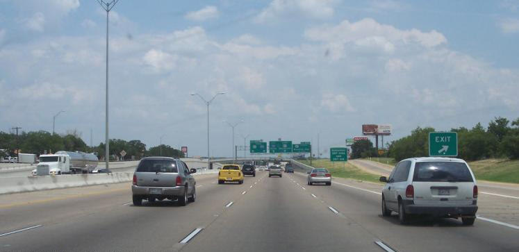
Exit list
Interstate 820
Main article: Interstate 820
Interstate 820 is an auxiliary route of I-20 in Fort Worth, Texas, of approximately 35.173 mi around the city. Exit numbers begin at its interchange with I-20 in southwest Fort Worth and continue in a clockwise direction around the city until it ends at its interchange with I-20 in southeast Fort Worth. A portion of I-820 in the northeast quadrant is cosigned with State Highway 121 (SH 121) as well as SH 183.
Business routes
All of the business loops within Texas are maintained by the Texas Department of Transportation (TxDOT). I-20 has 15 business loops in the state, all located in western Texas. Along I-20, TxDOT identifies each business route as Business Interstate 20 (Bus. I-20) followed by an alphabetic suffix. Along Texas Interstates, the alphabetic suffixes on business route names ascend eastward and northward. There are gaps in the alphabetic values to allow for future system expansion. The alphabetic naming suffixes are included as small letters on the bottom of route shields.
State Highway Loop 254 (Loop 254) takes the place of a business route in Ranger, Texas, and follows the original route of US 80.
I-20 business routes in Texas generally follow the path of the former US 80 through the central portions of towns now bypassed by the Interstate route.
Notes
References
References
- {{TxDOT. IH. 20
- Transportation Planning and Programming Division. (n.d.). "Highway Designations Glossary". Texas Department of Transportation.
- But see also [[U.S. Route 190. US 190]], another road which has been designated the Ronald Reagan Memorial Highway.
- Duforat, Amanda. (2020-08-05). "N. U.S. Hwy 87 Relief Route ribbon cutting ceremony took place Wednesday". Big Spring Herald.
- {{TxDOT. IH. 820
- Starks, Edward. (January 27, 2022). "Table 2: Auxiliary Routes of the Dwight D. Eisenhower National System of Interstate and Defense Highways". [[Federal Highway Administration]].
This article was imported from Wikipedia and is available under the Creative Commons Attribution-ShareAlike 4.0 License. Content has been adapted to SurfDoc format. Original contributors can be found on the article history page.
Ask Mako anything about Interstate 20 in Texas — get instant answers, deeper analysis, and related topics.
Research with MakoFree with your Surf account
Create a free account to save articles, ask Mako questions, and organize your research.
Sign up freeThis content may have been generated or modified by AI. CloudSurf Software LLC is not responsible for the accuracy, completeness, or reliability of AI-generated content. Always verify important information from primary sources.
Report