From Surf Wiki (app.surf) — the open knowledge base
Huron County, Ohio
County in Ohio, United States
County in Ohio, United States
| Field | Value |
|---|---|
| county | Huron County |
| state | Ohio |
| flag | Flag of Huron County, Ohio.svg |
| seal | Huron County oh seal.jpg |
| founded | April 1, 1815 |
| seat wl | Norwalk |
| largest city | Norwalk |
| area_total_sq_mi | 495 |
| area_land_sq_mi | 491 |
| area_water_sq_mi | 3.3 |
| area percentage | 0.7% |
| census yr | 2020 |
| pop | 58565 |
| pop_est_as_of | 2024 |
| density_sq_mi | auto |
| time zone | Eastern |
| web | http://www.huroncounty-oh.gov/ |
| named for | Huron tribe |
| ex image | Ohio - Huron Cnty Courthouse.jpg |
| ex image cap | Huron County Courthouse |
| district | 5th |
Huron County ( ) is a county located in the U.S. state of Ohio. As of the 2020 census, the population was 58,565. Its county seat is Norwalk. The county was created in 1809 and later organized in 1815. Huron County is included in the Norwalk, OH Micropolitan Statistical Area, which is also included in the Cleveland-Akron-Canton, OH Combined Statistical Area.
History
Huron County was named in honor of the Huron Indians (more correctly called the Wyandot), an Iroquoian-speaking tribe who occupied large areas in the Great Lakes region. The word "Huron" may be French, although this origin is disputed.
In the late 18th century, this area was in the U.S. Northwest Territory, part of the Connecticut Western Reserve in a sub-region called the Firelands. Connecticut had originally claimed the land as part of its original colony, then afterward wanted to use it to grant land to veterans in lieu of cash payment for their service in the war. In 1795, the Connecticut Land Company purchased this land for resale and development. Later, it was solely administered by the "Fire Land Company". Many of the townships in Huron County are named for places in Connecticut.
Geography
According to the U.S. Census Bureau, the county has a total area of 495 sqmi, of which 491 sqmi is land and 3.3 sqmi (0.7%) is water.
Adjacent counties
- Erie County (north)
- Lorain County (east)
- Ashland County (southeast)
- Richland County (south)
- Crawford County (southwest)
- Seneca County (west)
- Sandusky County (northwest)
Demographics
|align-fn=center 1790-1960 1900-1990 1990-2000 2020
2020 census
As of the 2020 census, the county had a population of 58,565 and a median age of 41.0 years. The age distribution included 23.5% of residents under the age of 18 and 18.4% aged 65 or older, with 97.0 males per 100 females overall and 94.4 males per 100 females age 18 and over.
As of the 2020 census, the racial makeup of the county was 89.5% White, 1.0% Black or African American, 0.3% American Indian and Alaska Native, 0.4% Asian,
As of the 2020 census, 48.6% of residents lived in urban areas, while 51.4% lived in rural areas.
As of the 2020 census, there were 23,406 households in the county, of which 29.8% had children under the age of 18 living in them. Of all households, 48.3% were married-couple households, 17.9% were households with a male householder and no spouse or partner present, and 25.4% were households with a female householder and no spouse or partner present. About 27.5% of all households were made up of individuals and 12.5% had someone living alone who was 65 years of age or older.
As of the 2020 census, there were 25,499 housing units, of which 8.2% were vacant. Among occupied housing units, 68.9% were owner-occupied and 31.1% were renter-occupied, with a homeowner vacancy rate of 1.3% and a rental vacancy rate of 7.2%.
Racial and ethnic composition
| Race / Ethnicity (NH = Non-Hispanic) | title=1980 Census of Population - General Social and Economic Characteristics - Ohio- Table 59 - Persons by Spanish Origin, Race, and Sex: 1980 AND Table 58 - Race by Sex: 1980 | url=https://www2.census.gov/library/publications/decennial/1980/volume-1/ohio/1980censusofpopu80137un_bw.pdf | website=United States Census Bureau | page=49-67 and 27-47}} | Pop 1990 | title=P004: Hispanic or Latino, and Not Hispanic or Latino by Race – 2000: DEC Summary File 1 – Huron County, Ohio | url=https://data.census.gov/table?g=050XX00US39077&tid=DECENNIALSF12000.P004 | website=United States Census Bureau | access-date= }} | title=P2: Hispanic or Latino, and Not Hispanic or Latino by Race – 2010: DEC Redistricting Data (PL 94-171) – Huron County, Ohio | url=https://data.census.gov/cedsci/table?q=p2&g=050XX00US39077&tid=DECENNIALPL2010.P2 | website=United States Census Bureau | access-date= }} | Pop 2020 | % 1980 | % 1990 | % 2000 | % 2010 | % 2020 |
|---|---|---|---|---|---|---|---|---|---|---|---|---|---|---|---|---|---|---|---|
| White alone (NH) | 53,191 | 54,390 | 56,057 | 54,649 | 51,242 | 97.41% | 96.71% | 94.23% | 91.65% | 87.50% | |||||||||
| Black or African American alone (NH) | 571 | 589 | 557 | 560 | 562 | 1.05% | 1.05% | 0.94% | 0.94% | 0.96% | |||||||||
| Native American or Alaska Native alone (NH) | 43 | 84 | 96 | 116 | 139 | 0.08% | 0.15% | 0.16% | 0.19% | 0.24% | |||||||||
| Asian alone (NH) | 94 | 148 | 149 | 170 | 216 | 0.17% | 0.26% | 0.25% | 0.29% | 0.37% | |||||||||
| Native Hawaiian or Pacific Islander alone (NH) | x | x | 4 | 10 | 12 | x | x | 0.01% | 0.02% | 0.02% | |||||||||
| Other race alone (NH) | 28 | 23 | 38 | 22 | 106 | 0.05% | 0.04% | 0.06% | 0.04% | 0.18% | |||||||||
| Mixed race or Multiracial (NH) | x | x | 469 | 766 | 2,204 | x | x | 0.79% | 1.28% | 3.76% | |||||||||
| Hispanic or Latino (any race) | 681 | 1,006 | 2,117 | 3,333 | 4,084 | 1.25% | 1.79% | 3.56% | 5.59% | 6.97% | |||||||||
| Total | 54,608 | 56,240 | 59,487 | 59,626 | 58,565 | 100.00% | 100.00% | 100.00% | 100.00% | 100.00% |
2010 census
As of the 2010 United States census, there were 59,626 people, 22,820 households, and 16,141 families living in the county.{{cite web |access-date=December 27, 2015 |archive-url=https://archive.today/20200213012226/http://factfinder.census.gov/bkmk/table/1.0/en/DEC/10_DP/DPDP1/0500000US39077 |archive-date=February 13, 2020 |url-status=dead |access-date=December 27, 2015 |archive-url=https://archive.today/20200213184432/http://factfinder.census.gov/bkmk/table/1.0/en/DEC/10_SF1/GCTPH1.CY07/0500000US39077 |archive-date=February 13, 2020 |url-status=dead |access-date=December 27, 2015 |archive-url=https://archive.today/20200213014313/http://factfinder.census.gov/bkmk/table/1.0/en/ACS/10_5YR/DP02/0500000US39077 |archive-date=February 13, 2020 |url-status=dead
Of the 22,820 households, 35.0% had children under the age of 18 living with them, 53.5% were married couples living together, 12.2% had a female householder with no husband present, 29.3% were non-families, and 24.4% of all households were made up of individuals. The average household size was 2.59 and the average family size was 3.05. The median age was 38.4 years.
The median income for a household in the county was $47,058 and the median income for a family was $53,887. Males had a median income of $41,566 versus $30,967 for females. The per capita income for the county was $21,743. About 10.9% of families and 14.5% of the population were below the poverty line, including 23.3% of those under age 18 and 7.0% of those age 65 or over.{{cite web |access-date=December 27, 2015 |archive-url=https://archive.today/20200213010041/http://factfinder.census.gov/bkmk/table/1.0/en/ACS/10_5YR/DP03/0500000US39077 |archive-date=February 13, 2020 |url-status=dead
2000 census
As of the census of 2000, there were 59,487 people, 22,307 households, and 16,217 families living in the county. The population density was 121 PD/sqmi. There were 23,594 housing units at an average density of 48 /mi2. The racial makeup of the county was 95.98% White, 0.97% Black or African American, 0.18% Native American, 0.25% Asian, 0.01% Pacific Islander, 1.63% from other races, and 0.99% from two or more races. 3.56% of the population were Hispanic or Latino of any race.
There were 22,307 households, out of which 36.30% had children under the age of 18 living with them, 58.50% were married couples living together, 10.40% had a female householder with no husband present, and 27.30% were non-families. 23.10% of all households were made up of individuals, and 9.70% had someone living alone who was 65 years of age or older. The average household size was 2.64 and the average family size was 3.11.
In the county, the population was spread out, with 28.30% under the age of 18, 8.50% from 18 to 24, 28.90% from 25 to 44, 21.90% from 45 to 64, and 12.40% who were 65 years of age or older. The median age was 35 years. For every 100 females there were 96.10 males. For every 100 females age 18 and over, there were 92.90 males.
The median income for a household in the county was $40,558, and the median income for a family was $46,911. Males had a median income of $35,760 versus $22,785 for females. The per capita income for the county was $18,133. About 6.50% of families and 8.50% of the population were below the poverty line, including 11.00% of those under age 18 and 7.70% of those age 65 or over.
Politics
Huron County has almost always been a Republican stronghold. However, in the election of 1996, Bill Clinton narrowly carried the county by a margin of 0.5%.
|}
Government==
Officials
**Commissioner - **Bradley R. Mesenburg
Commissioner - Harry Brady
**Commissioner - ** Tom Dunlap
**Auditor - **Roland Tkach
**Clerk of Courts - **Gina Hartman
**Coroner - **Jeffery Harwood
**Engineer - **Lee Tansey
**Prosecutor - **Joel Sitterly
**Recorder - **Jan Tkach
**Treasurer - **Megan Bursley
**Sheriff - **Todd Corbin
**Judge of Court of Common Pleas - **James Conway
**Court Secretary (non-elected position) - **Julie Wise
Education
Main article: School Districts of Huron County, Ohio
Infrastructure
Major highways
- [[Image:US 20.svg|20px]] US Route 20
- [[Image:US 224.svg|25px]] US Route 224
- [[Image:US 250.svg|25px]] US Route 250
- [[Image:OH-4.svg|20px]] State Route 4
- [[Image:OH-13.svg|20px]] State Route 13
- [[Image:OH-18.svg|20px]] State Route 18
- [[Image:OH-60.svg|20px]] State Route 60
- [[Image:OH-61.svg|20px]] State Route 61
- [[Image:OH-99.svg|20px]] State Route 99
- [[Image:OH-103.svg|25px]] State Route 103
- [[Image:OH-113.svg|25px]] State Route 113
- [[Image:OH-162.svg|25px]] State Route 162
- [[Image:OH-269.svg|25px]] State Route 269
- [[Image:OH-303.svg|25px]] State Route 303
- [[Image:OH-547.svg|25px]] State Route 547
- [[Image:OH-598.svg|25px]] State Route 598
- [[Image:OH-601.svg|25px]] State Route 601
- [[Image:OH-603.svg|25px]] State Route 603
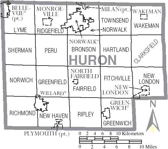
Communities
Cities
- Bellevue
- Norwalk (county seat)
- Willard
Villages
- Greenwich
- Milan
- Monroeville
- New London
- North Fairfield
- Plymouth
- Wakeman
Townships
- Bronson
- Clarksfield
- Fairfield
- Fitchville
- Greenfield
- Greenwich
- Hartland
- Lyme
- New Haven
- New London
- Norwalk
- Norwich
- Peru
- Richmond
- Ridgefield
- Ripley
- Sherman
- Townsend
- Wakeman
Census-designated places
- Celeryville
- Collins
- Holiday Lakes
- New Haven
Unincorporated communities
- Boughtonville
- Centerton
- Clarksfield
- Delphi
- East Townsend
- Fitchville
- Havana
- Hunts Corners
- New Pittsburgh
- North Monroeville
- Olena
- Steuben
Notable people
- Phillip Johnson, American Architect
- Laura Owens, American Painter
- Ezekiel S. Sampson, two-term Republican Congressman from Iowa's 6th congressional district; born in Huron County.
- Paul Brown, American college and professional football coach; member of the Pro Football Hall of Fame
- Lefty Grove, American baseball player, member of the Baseball Hall of Fame
References
References
- [https://www.census.gov/library/visualizations/interactive/2020-population-and-housing-state-data.html 2020 census]
- "Find a County". National Association of Counties.
- (2007). "Ohio: Individual County Chronologies". The Newberry Library.
- "Huron County data". [[Ohio State University]] Extension Data Center.
- 'Firelands Pioneer' series of publications (Firelands Historical Society) beginning in 1858-
- (August 22, 2012). "2010 Census Gazetteer Files". United States Census Bureau.
- "U.S. Decennial Census". United States Census Bureau.
- "Historical Census Browser". University of Virginia Library.
- (March 27, 1995). "Population of Counties by Decennial Census: 1900 to 1990". United States Census Bureau.
- (April 2, 2001). "Census 2000 PHC-T-4. Ranking Tables for Counties: 1990 and 2000". United States Census Bureau.
- (2021). "2020 Decennial Census Demographic Profile (DP1)".
- (2021). "2020 Decennial Census Redistricting Data (Public Law 94-171)".
- (2023). "2020 Decennial Census Demographic and Housing Characteristics (DHC)".
- "1980 Census of Population - General Social and Economic Characteristics - Ohio- Table 59 - Persons by Spanish Origin, Race, and Sex: 1980 AND Table 58 - Race by Sex: 1980".
- "1990 Census of Population - General Population Characteristics - Ohio: Table 6 - Race and Hispanic Origin".
- "P004: Hispanic or Latino, and Not Hispanic or Latino by Race – 2000: DEC Summary File 1 – Huron County, Ohio".
- "P2: Hispanic or Latino, and Not Hispanic or Latino by Race – 2010: DEC Redistricting Data (PL 94-171) – Huron County, Ohio".
- "P2: Hispanic or Latino, and Not Hispanic or Latino by Race – 2020: DEC Redistricting Data (PL 94-171) – Huron County, Ohio".
- included in the Asian category in the 1980 Census
- included in the Asian category in the 1990 Census
- not an option in the 1980 Census
- not an option in the 1990 Census
- "U.S. Census website". [[United States Census Bureau]].
- Leip, David. "Dave Leip's Atlas of U.S. Presidential Elections".
- (November 5, 2024). "2024 Senate Election (Official Returns)".
- "Welcome". Hccommissioners.com.
- "Huron County, Ohio: Online Auditor - Home". Huroncountyauditor.org.
- "Homepage". Huron County Clerk of Courts.
- [http://www.huroncountyema.com/LEPC.htm] {{webarchive. link. (September 29, 2008)
- "Huron County Engineers Official Site". Huroncountyengineer.org.
- "Huron County Commissioners". Hccommissioners.com.
- "Huron County Recorder's Office". Huroncountyrecorder.org.
- "Treasurer". Huron County.
- "Huron County". Buckeye State Sheriff's Association.
- "Common Pleas Court". Huron County Clerk of Courts.
- "Court Staff". Huroncountyclerk.com.
This article was imported from Wikipedia and is available under the Creative Commons Attribution-ShareAlike 4.0 License. Content has been adapted to SurfDoc format. Original contributors can be found on the article history page.
Ask Mako anything about Huron County, Ohio — get instant answers, deeper analysis, and related topics.
Research with MakoFree with your Surf account
Create a free account to save articles, ask Mako questions, and organize your research.
Sign up freeThis content may have been generated or modified by AI. CloudSurf Software LLC is not responsible for the accuracy, completeness, or reliability of AI-generated content. Always verify important information from primary sources.
Report