From Surf Wiki (app.surf) — the open knowledge base
Hunedoara County
County of Romania

County of Romania
| Field | Value | |
|---|---|---|
| <!-- See Template:Infobox settlement for additional fields and descriptions --> | name | Hunedoara County |
| native_name | Județul Hunedoara | |
| native_name_lang | ro | |
| settlement_type | County | |
| image_skyline | {{multiple image | |
| total_width | 300px | |
| perrow | 2/2/2/2 | |
| border | infobox | |
| caption_align | center | |
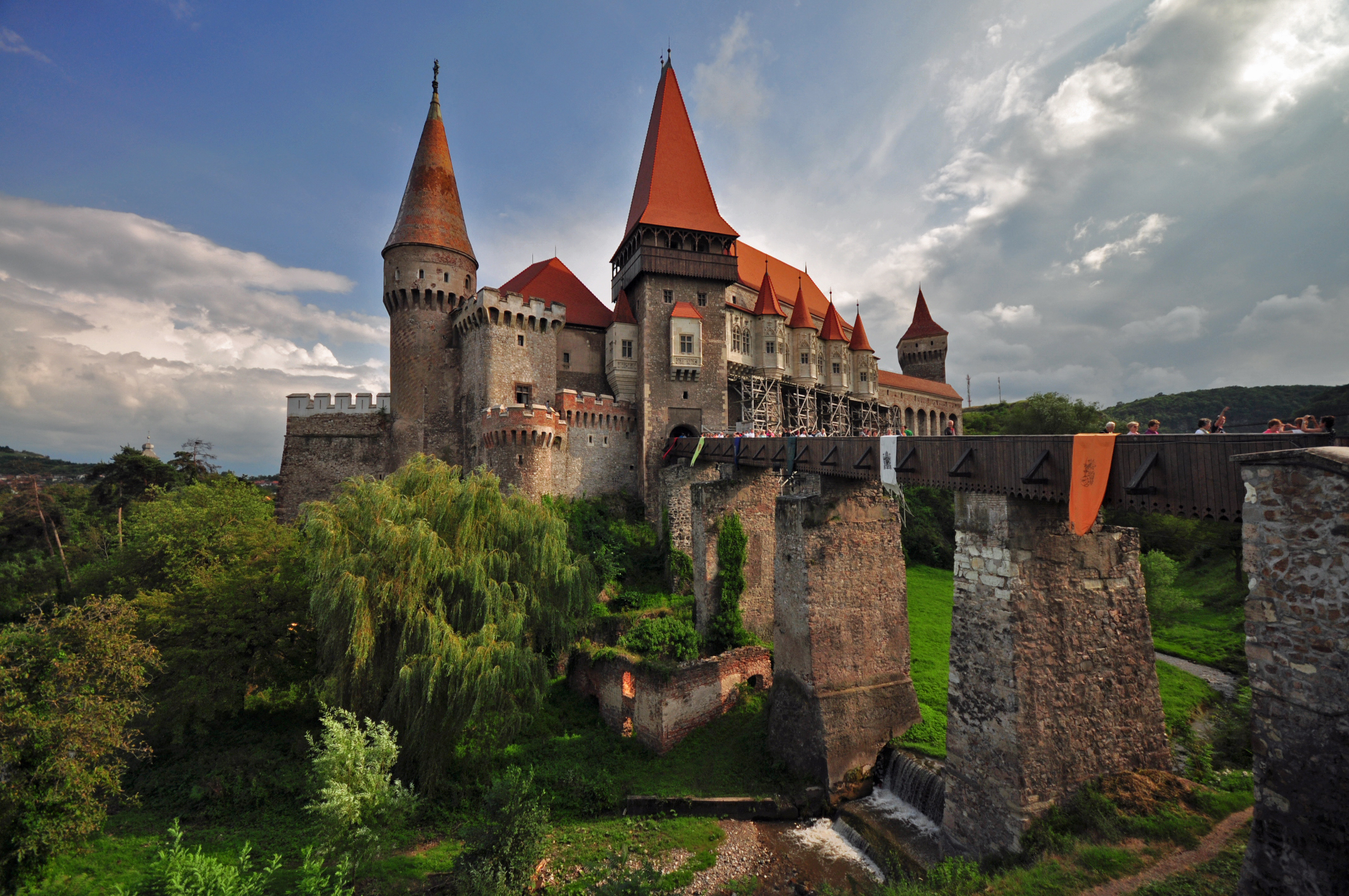
| image1 | Castelul Corvinestilor - vedere lateral stanga frontala de langa podul de acces.JPG | |
| caption1 | Corvin Castle | |
| image2 | Déva vára - légi felvétel.jpg | |
| caption2 | Fortress of Deva | |
| image5 | Aerial photographs of Ulpia Traiana Sarmizegetusa-0182.jpg | |
| caption5 | Ulpia Traiana Sarmizegetusa | |
| image3 | Sarmizegetusa Regia (Grigore Roibu).jpg | |
| caption3 | Sarmizegetusa Regia | |
| image4 | XIII century church from Densuş.jpg | |
| caption4 | Densuș Church | |
| image6 | Retezat View over Bucura lake.jpg | |
| caption6 | Bucura Lake | |
| image_flag | Hunedoara flag.webp | |
| image_shield | [[File:Actual Hunedoara county CoA.svg | 65px]] |
| image_map | Hunedoara in Romania.svg | |
| map_alt | Administrative map of Romania with Hunedoara county highlighted | |
| coordinates | ||
| subdivision_type | Country | |
| subdivision_name | Romania | |
| subdivision_type1 | Development region | |
| subdivision_name1 | Vest | |
| subdivision_type2 | Historical region | |
| subdivision_name2 | Transylvania | |
| government_type | County Board | |
| leader_party | PSD | |
| leader_title | President of the County Board | |
| leader_name | ||
| leader_title1 | Prefect | |
| leader_name1 | Florina-Doris Visirin | |
| seat_type | Capital | |
| seat | Deva | |
| unit_pref | Metric | |
| area_total_km2 | 7,063 | |
| area_rank | 9th | |
| population_total | ||
| population_as_of | ||
| population_footnotes | ||
| population_density_km2 | auto | |
| population_rank | 20th | |
| area_code_type | Telephone code | |
| area_code | (+40) 254 or (+40) 354 | |
| iso_code | RO-HD | |
| website | County Council | |
| Prefecture | ||
| blank1_name | GDP (nominal) | |
| blank1_info | US$ 5.980 billion (2025) | |
| blank2_name | GDP per capita | |
| blank2_info | US$ 16,535 (2025) |
Hunedoara County () is a county (județ) of Romania, in Transylvania, with its capital city at Deva. The county is part of the Danube–Criș–Mureș–Tisa Euroregion.
Name
In Hungarian, it is known as Hunyad megye, in German as Kreis Hunedoara, and in Slovak as Huňadská župa. The county got its name from the city of Hunedoara (), which is the Romanian transliteration of the Hungarian Hunyadvár (, archaic: Hwnyadwar), old name of the municipality. That most likely originated from the Hungarian huny verb meaning 'to close' or 'to die', but may also come from wear the name of the Huns, who were headquartered near for a time and were the first to establish solid rule over the land since the Dacians.
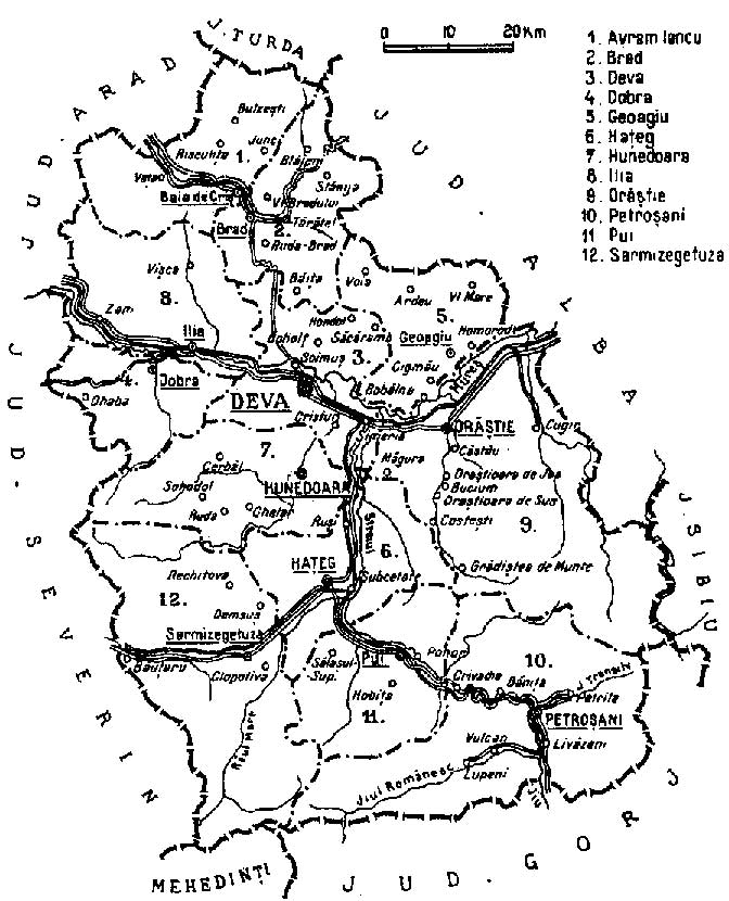
Geography
This county has a total area of 7,063 km2.
Mainly, the relief is made up of mountains, divided by the Mureș River valley which crosses the county from East to West. To the North side there are the Apuseni Mountains and to the South side there are mountains from the Southern Carpathians group, Parâng Mountains group and Retezat-Godeanu Mountains group: Orastie and Surianu Mountains (South-East), Retezat Mountains (South), Poiana Ruscai Mountains (South-West).
Except from the Mureș River with its tributaries Strei, Râul Mare and Cerna which forms wide valleys, in the North side Crișul Alb River also forms a valley in the Apuseni Mountains - Zarand region. In the South side along the Jiu River with its two branches Jiul de Vest and Jiul de Est, there is a large depression, and an accessible route towards Southern Romania - Oltenia..
Neighbours
- Alba County in the East and North.
- Arad County, Timiș County and Caraș-Severin County in the West.
- Gorj County in the South.
- Vâlcea County in the South-East.
Economy

Hunedoara County was one of the most industrialised areas during the communist period, and was very negatively affected when the industry collapsed after the fall of the communist regime.
The industry in the Hunedoara county is linked with the mining activity in the region. In the mountains, from ancient times, metals and coal have been exploited.
Energy-related enterprises are located in the county - one of the biggest thermoelectric plant is located at Mintia.
The Jiu Valley, located in the south of the country, has been a major mining area throughout the second half of the 19th century and the 20th century, but many mines were closed down in the years following the collapse of the communist regime.
The city of Hunedoara has also suffered significantly from the 1990s onwards - under communism it contained the largest steel works in Romania (until Galați took the lead), but activity gradually diminished after the fall of communism due to the loss of the market. This was a blow to the overall prosperity of the town, which is now recovering through new investments.
Agricultural activities also take place in Hunedoara county, which include livestock raising, and fruit and cereal cultivation. The county also has touristic potential, especially through the Dacian Fortresses of the Orăștie Mountains and the Corvin Castle.
The predominant industries in the county are:
- Metallurgy.
- Construction materials.
- Textile industry.
- Mining equipment.
- Food industry.
In the 1990s, a large number of mines were closed down, leaving Hunedoara county with the highest unemployment rate in Romania, of 9.6%, in comparison to the national average of 5.5%.
Tourism


Retezat National Park and other picturesque regions makes it one of the most beautiful counties in Romania. Also there can be found Dacian and Roman complexes in the Orăştie Mountains.
The main tourist attractions in the county are:
- The Dacian Fortresses of the Orăștie Mountains - nowadays part of UNESCO World Heritage.
- Colonia Augusta Ulpia Traiana Dacica Sarmizegetusa - the capital of the Roman province of Dacia.
- The medieval edifices of Densuș, Deva, Hunedoara, Santămaria-Orlea, Strei.
- The Medieval Castle from Hunedoara
- The Medieval Guard Tower from Crivadia
- The Via Transilvanica long-distance hiking and biking trail, which crosses the county
Demographics
According to the 2021 census, the county had a population of 361,657 and the population density was .
The population of Hunedoara county is the second eldest of all Romanian counties, with an average age of the residents of 45.5 years, only behind Teleorman County (46.3 years). Hunedoara's Jiu River Valley is traditionally a coal-mining region, and its high level of industrialisation drew many people from other regions of Romania in the period before the fall of the communist regime.
| Year | County population | 1948 | 1956 | 1966 | 1977 | 1992 | 2002 | 2011 | 2021 |
|---|---|---|---|---|---|---|---|---|---|
| 306,955 | |||||||||
| 381,902 | |||||||||
| 474,602 | |||||||||
| 514,436 | |||||||||
| 547,993 | |||||||||
| 485,712 | |||||||||
| 396,253 | |||||||||
| 361,657 |
Politics
The Hunedoara County Council, renewed at the 2024 local elections, consists of 32 councilors, with the following party composition:
| Party | Seats | Current County Council | |
|---|---|---|---|
| Social Democratic Party (PSD) | 16 | ||
| National Liberal Party (PNL) | 9 | ||
| Alliance for the Union of Romanians (AUR) | 7 |
Administrative divisions


Hunedoara County has 7 municipalities, 7 towns and 55 communes. Although Hunedoara County is the most urbanized county in Romania (75% of the population is urban - in 2011) it does not contain any city of more than 100,000 people. Also, following the de-industrialization after the communism fall, the major urban centres in the county, particularly Hunedoara and Petroșani, suffered significant population decline.
- Municipalities
- Brad - population: 12,690 ()
- Deva - capital city; population: 53,113 ()
- Hunedoara - population: 50,457 ()
- Lupeni - population: 18,699 ()
- Orăștie - population: 16,825 ()
- Petroșani - population: 31,044 ()
- Vulcan - population: 19,772 ()
- Towns
- Aninoasa
- Călan
- Geoagiu
- Hațeg
- Petrila
- Simeria
- Uricani
- Communes
- Baia de Criș
- Balșa
- Bănița
- Baru
- Băcia
- Băița
- Bătrâna
- Beriu
- Blăjeni
- Boșorod
- Brănișca
- Bretea Română
- Buceș
- Bucureșci
- Bulzeștii de Sus
- Bunila
- Burjuc
- Cerbăl
- Certeju de Sus
- Cârjiți
- Crișcior
- Densuș
- Dobra
- General Berthelot
- Ghelari
- Gurasada
- Hărău
- Ilia
- Lăpugiu de Jos
- Lelese
- Lunca Cernii de Jos
- Luncoiu de Jos
- Mărtinești
- Orăștioara de Sus
- Pestișu Mic
- Pui
- Rapoltu Mare
- Răchitova
- Ribița
- Râu de Mori
- Romos
- Sarmizegetusa
- Sălașu de Sus
- Sântămăria-Orlea
- Șoimuș
- Teliucu Inferior
- Tomești
- Toplița
- Totești
- Turdaș
- Vața de Jos
- Vălișoara
- Vețel
- Vorța
- Zam
Historical county
Historically, the county was located in the central-western part of Greater Romania, in the southwestern part of Transylvania. It included a large part of the present Hunedoara County.
After the administrative unification law in 1925, the name of county remained as it was, but the territory was reorganized. It was bordered on the west by the counties of Severin and Arad, to the north by Turda County, to the east by the counties of Sibiu and Alba, and to the south by the counties of Gorj and Mehedinți.
Administration
The county originally consisted of ten districts (plăși):
- Plasa Avram Iancu, headquartered at Avram Iancu
- Plasa Brad, headquartered at Brad
- Plasa Deva, headquartered at Deva
- Plasa Geoagiu, headquartered at Geoagiu
- Plasa Hațeg, headquartered at Hațeg
- Plasa Hunedoara, headquartered at Hunedoara
- Plasa Ilia, headquartered at Ilia
- Plasa Orăștie, headquartered at Orăștie
- Plasa Petroșani, headquartered at Petroșani
- Plasa Pui, headquartered at Pui
Subsequently, two other districts were established: Plasa Dobra, headquartered at Dobra Plasa Sarmizegetusa, headquartered at Sarmizegetusa
Population
According to the census data of 1930, the county's population was 332,118, of which 82.0% were Romanians, 11.3% Hungarians, 2.5% Germans, 1.5% Romanies, 1.4% Jews, as well as other minorities. In the religious aspect, the population consisted of 64.2% Eastern Orthodox, 18.5% Greek Catholic, 9.1% Roman Catholic, 4.5% Reformed, as well as other minorities.
Urban population
In 1930, the urban population of the county was 41,234, of which 52.8% were Romanians, 30.4% Hungarians, 6.7% Germans, 6.6% Jews, 1.6% Romanies, as well as other minorities. From the religious point of view, the urban population was made up of 42.0% Eastern Orthodox, 25.7% Roman Catholic, 10.5% Greek Catholic, 9.9% Reformed, 6.9% Jewish, 3.5% Lutheran, 1.0% Unitarian, as well as other minorities.
References
References
- The number used depends on the numbering system employed by the phone companies on the market.
- (1902). "Hunyadvármegye története". Irodalmi Szemle.
- (29 April 2014). "Mărirea şi declinul industriei în Hunedoara. Ce soartă au avut după 1990 cele mai mari întreprinderi din judeţ".
- "Rezultate definitive: Caracteristici etno-culturale demografice".
- "Institutul Naţional de Statistică: Fenomenul de îmbătrânire s-a accentuat în România".
- National Institute of Statistics, ''[http://www.insse.ro/rpl2002rezgen/18.pdf "Populația la recensămintele din anii 1948, 1956, 1966, 1977, 1992 și 2002"] {{webarchive. link. (September 22, 2006 '')
- "Componența Consiliului Judetean".
- "Rezultate definitive ale Recensământului Populaţiei şi al Locuinţelor – 2011".
- Edu, Aspera Pro. "Judeţul Hunedoara".
- Recensământul general al populației României din 29 decemvrie 1930, Vol. II, pag. 633-639
This article was imported from Wikipedia and is available under the Creative Commons Attribution-ShareAlike 4.0 License. Content has been adapted to SurfDoc format. Original contributors can be found on the article history page.
Ask Mako anything about Hunedoara County — get instant answers, deeper analysis, and related topics.
Research with MakoFree with your Surf account
Create a free account to save articles, ask Mako questions, and organize your research.
Sign up freeThis content may have been generated or modified by AI. CloudSurf Software LLC is not responsible for the accuracy, completeness, or reliability of AI-generated content. Always verify important information from primary sources.
Report