From Surf Wiki (app.surf) — the open knowledge base
Houston County, Alabama
County in Alabama, United States
County in Alabama, United States
| Field | Value |
|---|---|
| county | Houston County |
| state | Alabama |
| type | County |
| seal | Seal of Houston County, Alabama.png |
| founded year | 1903 |
| founded date | February 9 |
| seat wl | Dothan |
| largest city wl | Dothan |
| area_total_sq_mi | 582 |
| area_land_sq_mi | 580 |
| area_water_sq_mi | 1.8 |
| area percentage | 0.3 |
| population_as_of | 2020 |
| population_total | 107202 |
| pop_est_as_of | 2024 |
| population_est | 109366 |
| population_density_sq_mi | auto |
| time zone | Central |
| web | https://houstoncountyal.gov/ |
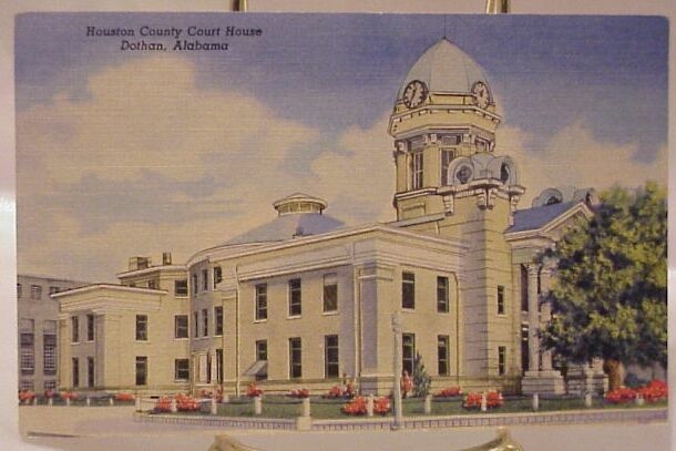
| ex image | Houston County Courthouse.jpg |
| ex image cap | Houston County Courthouse in Dothan |
| district | 1st |
| named for | George S. Houston |
- County Number 38 on Alabama Licence Plates
Houston County is a county located in the southeastern corner of the U.S. state of Alabama. As of the 2020 census the population was 107,202. Its county seat is Dothan, which is located on the border and partially in adjacent Henry County.
Houston County is part of the Dothan, Alabama metropolitan area.
History
Houston County was established on February 9, 1903, from parts of Dale, Geneva, and Henry counties. It was named after George Smith Houston, the 24th Governor of Alabama. This area of the state was historically developed for the pine timber and turpentine industries, as well as cotton plantations. The latter, especially, depended on enslaved African Americans for labor.
Because of this history, African Americans predominated in the population until after the early 20th century, when many migrated to northern and midwestern cities for better economic opportunities and to escape Jim Crow discrimination. They were essentially disenfranchised after the turn of the 20th century because of constitutional amendments and other laws that made voter registration nearly impossible. Many poor whites were disenfranchised at the same time.
Geography
According to the United States Census Bureau, the county has a total area of 582 sqmi, of which 580 sqmi is land and 1.8 sqmi (0.3%) is water. The county is located in the Wiregrass region of southeast Alabama. It is the only Alabama county is the borders both Georgia and Florida
Major highways
Adjacent counties
- Henry County (north)
- Early County, Georgia (east)
- Seminole County, Georgia (southeast)
- Jackson County, Florida (south)
- Geneva County (west)
- Dale County (northwest)
Demographics
|align-fn=center 1790–1960 1900–1990 1990–2000 2010–2020
2020 census
As of the 2020 census, the county had a population of 107,202. The median age was 40.8 years. 22.9% of residents were under the age of 18 and 18.9% of residents were 65 years of age or older. For every 100 females there were 91.2 males, and for every 100 females age 18 and over there were 86.7 males age 18 and over.
The racial makeup of the county was 64.6% White, 26.5% Black or African American, 0.5% American Indian and Alaska Native, 1.2% Asian, 0.1% Native Hawaiian and Pacific Islander, 2.0% from some other race, and 5.2% from two or more races. Hispanic or Latino residents of any race comprised 4.2% of the population.
65.7% of residents lived in urban areas, while 34.3% lived in rural areas.
There were 44,368 households in the county, of which 29.6% had children under the age of 18 living with them and 32.8% had a female householder with no spouse or partner present. About 30.2% of all households were made up of individuals and 13.4% had someone living alone who was 65 years of age or older.
There were 49,282 housing units, of which 10.0% were vacant. Among occupied housing units, 62.7% were owner-occupied and 37.3% were renter-occupied. The homeowner vacancy rate was 1.9% and the rental vacancy rate was 8.3%.
Racial and ethnic composition
| Race / Ethnicity (NH = Non-Hispanic) | title=P004 Hispanic or Latino, and Not Hispanic or Latino by Race – 2000: DEC Summary File 1 – Houston County, Alabama | url=https://data.census.gov/table?q=p004&g=050XX00US01069&tid=DECENNIALSF12000.P004 | website=United States Census Bureau}} | title=P2 Hispanic or Latino, and Not Hispanic or Latino by Race – 2010: DEC Redistricting Data (PL 94-171) – Houston County, Alabama | url=https://data.census.gov/table?q=p2&g=050XX00US01069&tid=DECENNIALPL2010.P2 | website=United States Census Bureau}} | % 2000 | % 2010 |
|---|---|---|---|---|---|---|---|---|
| White alone (NH) | 64,312 | 69,731 | 68,251 | 72.43% | ||||
| Black or African American alone (NH) | 21,703 | 26,038 | 28,232 | 24.44% | ||||
| Native American or Alaska Native alone (NH) | 318 | 393 | 321 | 0.36% | ||||
| Asian alone (NH) | 548 | 806 | 1,260 | 0.62% | ||||
| Pacific Islander alone (NH) | 13 | 43 | 59 | 0.01% | ||||
| Other race alone (NH) | 55 | 96 | 354 | 0.06% | ||||
| Mixed race or Multiracial (NH) | 716 | 1,445 | 4,244 | 0.81% | ||||
| Hispanic or Latino (any race) | 1,122 | 2,995 | 4,481 | 1.26% | ||||
| Total | 88,787 | 101,547 | 107,202 | 100.00% |
2010 census
As of the census of 2010, there were 101,547 people, 40,969 households, and 28,041 families living in the county. The population density was 175 /mi2. There were 45,319 housing units at an average density of 77.9 /mi2. The racial makeup of the county was 70.0% White, 25.8% Black or African American, 0.4% Native American, 0.8% Asian, 0.0% Pacific Islander, 1.2% from other races, and 1.7% from two or more races. 2.9% of the population were Hispanic or Latino of any race.
There were 40,969 households, out of which 29.2% had children under the age of 18 living with them, 47.9% were married couples living together, 16.2% had a female householder with no husband present, and 31.6% were non-families. 27.2% of all households were made up of individuals, and 9.7% had someone living alone who was 65 years of age or older. The average household size was 2.44 and the average family size was 2.96.
In the county, the population was spread out, with 24.5% under the age of 18, 8.3% from 18 to 24, 25.7% from 25 to 44, 27.0% from 45 to 64, and 14.5% who were 65 years of age or older. The median age was 38.5 years. For every 100 females, there were 92.3 males. For every 100 females age 18 and over, there were 92.5 males.
The median income for a household in the county was $41,022, and the median income for a family was $51,741. Males had a median income of $41,021 versus $28,240 for females. The per capita income for the county was $22,725. About 12.7% of families and 16.8% of the population were below the poverty line, including 25.8% of those under age 18 and 11.5% of those age 65 or over.
2000 census
As of the census of 2000, there were 88,787 people, 35,834 households, and 25,119 families living in the county. The population density was 153 /mi2. There were 39,571 housing units at an average density of 68 /mi2. The racial makeup of the county was 73.08% White, 24.60% Black or African American, 0.37% Native American, 0.62% Asian, 0.02% Pacific Islander, 0.39% from other races, and 0.92% from two or more races. 1.26% of the population were Hispanic or Latino of any race.
There were 35,834 households, out of which 33.00% had children under the age of 18 living with them, 52.50% were married couples living together, 14.10% had a female householder with no husband present, and 29.90% were non-families. 26.40% of all households were made up of individuals, and 10.10% had someone living alone who was 65 years of age or older. The average household size was 2.45 and the average family size was 2.95.
In the county, the population was spread out, with 25.90% under the age of 18, 8.20% from 18 to 24, 28.70% from 25 to 44, 23.50% from 45 to 64, and 13.70% who were 65 years of age or older. The median age was 37 years. For every 100 females, there were 95.0 males. For every 100 females age 18 and over, there were 86.20 males.
The median income for a household in the county was $34,431, and the median income for a family was $42,437. Males had a median income of $32,092 versus $21,409 for females. The per capita income for the county was $18,759. About 11.80% of families and 15.00% of the population were below the poverty line, including 21.10% of those under age 18 and 16.30% of those age 65 or over.
Government
, the County Chairman is Brandon Shoupe, while Peter Covert is the Chief Administrative Officer. The County Commission is:
- District 1, Curtis Harvey
- District 2, Tracy Adams
- District 3, Rickey Herring
- District 4, James Ivey Donald Valenza serves as Sheriff, Probate Judge is Patrick Davenport, Revenue Commissioner is Starla Moss, and Coroner is Robert Byrd. The county engineer is Barkley Kirkland. The District Attorney serves as prosecutor for cases in both Houston and Henry Counties.
Houston County is located in Alabama's 1st congressional district; its current Representative () is Barry Moore (R).
Houston County is reliably Republican at the presidential level. The last Democrat to win the county in a presidential election was Adlai Stevenson, who won it by a majority in 1956.
Communities
City
- Dothan (county seat; partly in Dale County and Henry County)
Towns
- Ashford
- Avon
- Columbia
- Cottonwood
- Cowarts
- Gordon
- Kinsey
- Madrid
- Rehobeth
- Taylor (partly in Geneva County)
- Webb
Unincorporated communities
- Ardilla
- Big Creek
- Crosby
- Grangeburg
- Love Hill
- Lucy
- Pansey
- Peterman
- Pleasant Plains
- Wicksburg
Education
There are two school districts including parts of the county: Dothan City School District and Houston County School District.
References
References
- "State & County QuickFacts". United States Census Bureau.
- "Find a County". National Association of Counties.
- (August 22, 2012). "2010 Census Gazetteer Files". United States Census Bureau.
- "County Population Totals and Components of Change: 2020-2024". United States Census Bureau.
- "U.S. Decennial Census". United States Census Bureau.
- "Historical Census Browser". University of Virginia Library.
- (March 24, 1995). "Population of Counties by Decennial Census: 1900 to 1990". United States Census Bureau.
- (April 2, 2001). "Census 2000 PHC-T-4. Ranking Tables for Counties: 1990 and 2000". United States Census Bureau.
- (2021). "2020 Decennial Census Demographic Profile (DP1)".
- (2021). "2020 Decennial Census Redistricting Data (Public Law 94-171)".
- (2023). "2020 Decennial Census Demographic and Housing Characteristics (DHC)".
- "P004 Hispanic or Latino, and Not Hispanic or Latino by Race – 2000: DEC Summary File 1 – Houston County, Alabama".
- "P2 Hispanic or Latino, and Not Hispanic or Latino by Race – 2010: DEC Redistricting Data (PL 94-171) – Houston County, Alabama".
- "P2 Hispanic or Latino, and Not Hispanic or Latino by Race – 2020: DEC Redistricting Data (PL 94-171) – Chilton County, Alabama".
- "U.S. Census website". [[United States Census Bureau]].
- "U.S. Census website". [[United States Census Bureau]].
- "Dave Leip's Atlas of U.S. Presidential Elections".
- "2020 CENSUS - SCHOOL DISTRICT REFERENCE MAP: Houston County, AL". [[U.S. Census Bureau]].
This article was imported from Wikipedia and is available under the Creative Commons Attribution-ShareAlike 4.0 License. Content has been adapted to SurfDoc format. Original contributors can be found on the article history page.
Ask Mako anything about Houston County, Alabama — get instant answers, deeper analysis, and related topics.
Research with MakoFree with your Surf account
Create a free account to save articles, ask Mako questions, and organize your research.
Sign up freeThis content may have been generated or modified by AI. CloudSurf Software LLC is not responsible for the accuracy, completeness, or reliability of AI-generated content. Always verify important information from primary sources.
Report