From Surf Wiki (app.surf) — the open knowledge base
Hotan

| Field | Value | |||
|---|---|---|---|---|
| name | Hotan | |||
| official_name | ||||
| native_name | ||||
| other_name | Khotan, Hetian | |||
| settlement_type | County-level city | |||
| pushpin_map | Xinjiang#China#Continental Asia | |||
| pushpin_relief | yes | |||
| pushpin_map_caption | Location in Xinjiang | |||
| coordinates | ||||
| image_skyline | Kurban Tulum with Mao Zedong, Hotan, China.jpg | |||
| image_caption | Tuanjie Square | |||
| subdivision_type | Country | |||
| subdivision_name | China | |||
| subdivision_type1 | Autonomous region | |||
| subdivision_name1 | Xinjiang | |||
| subdivision_type2 | Prefecture | |||
| subdivision_name2 | Hotan | |||
| subdivision_type3 | Township-level divisions | |||
| seat_type | Municipal seat | |||
| seat | Nurbagh Subdistrict | |||
| area_footnotes | ||||
| area_total_km2 | 465.84 | |||
| elevation_m | 1382 | |||
| population_footnotes | ||||
| population_total | 501,028 | |||
| population_as_of | 2020 | |||
| population_density_km2 | auto | |||
| population_demonym | Hotanese, Khotanese | |||
| demographics_type1 | Demographics | |||
| demographics1_title1 | Ethnic groups | |||
| demographics1_info1 | {{ubl | 90.3% Uyghur | 9.4% Han Chinese | |
| demographics1_title2 | Spoken languages | |||
| demographics1_info2 | Uyghur, Mandarin Chinese | |||
| timezone1 | China Standard | |||
| utc_offset1 | +8 | |||
| postal_code_type | Postal code | |||
| postal_code | 839000 | |||
| area_code | 0903 | |||
| website | ||||
| blank_name | GDP (Nominal) | |||
| blank_info | 2018 | |||
| blank1_name | – Total | |||
| blank1_info | ¥8.274 billion | |||
| $1.247 billion | ||||
| blank2_name | – Per Capita | |||
| blank2_info | ¥20,399 | |||
| $3,076 | ||||
| blank3_name | – Growth | |||
| blank3_info | 7.1% | |||
| blank4_name | License plate prefix | |||
| blank4_info | 新R |
$1.247 billion $3,076 | ibox-order = ug, zh Хотан қаласы Hotan qalasy
Хотан шаары Hotan shaary
Hotan (; ) is a major oasis town in southwestern Xinjiang, an autonomous region in Northwestern China. The city proper of Hotan broke off from the larger Hotan County to become an administrative area in its own right in August 1984. It is the seat of Hotan Prefecture.
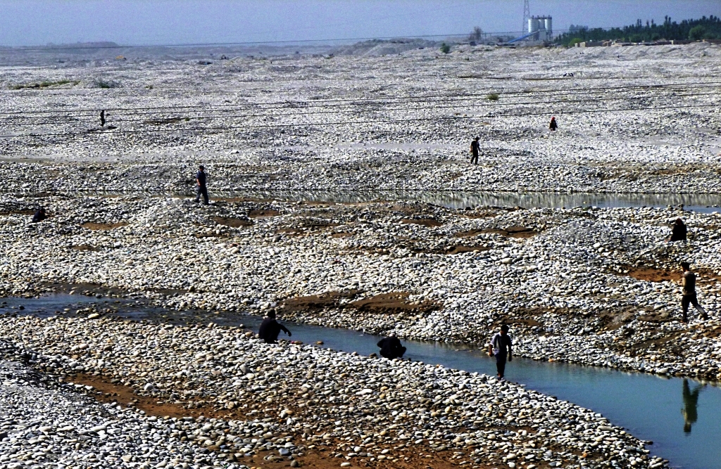
With a population of 408,900 (2018 census), Hotan is situated in the Tarim Basin some 1500 km southwest of the regional capital, Ürümqi. It lies just north of the Kunlun Mountains, which are crossed by the Sanju, Hindutash and Ilchi passes. The town, located southeast of Yarkant County and populated almost exclusively by Uyghurs, is a minor agricultural center. An important station on the southern branch of the historic Silk Road, Hotan has always depended on two strong rivers, the Karakash River and the White Jade River, to provide the water needed to survive on the southwestern edge of the vast Taklamakan Desert. The White Jade River still provides water and irrigation for the town and oasis.
Etymology
Hotan and its surrounding area were originally known as Godana in ancient Sanskrit cosmological texts. The Chinese transcribed the name as 于窴, pronounced Gudana in Middle Chinese (Yutian in modern Standard Chinese); the pronunciation eventually morphed into Khotan. In the 7th century, the Chinese Buddhist monk and scholar Xuanzang attempted to remedy this lexical change. Xuanzang, who was well-versed in Sanskrit, proposed that the traditional name was in fact Kustana (गौस्तन) and asserted it meant "breast of the earth". However, this was likely borrowed from the Tibetan name for the region, Gosthana, which means "land of cows". It is therefore most likely that the original name of Hotan was Sanskritic in origin, a consequence of ancient Indian settlement in the region.
An alternative etymology is proposed by Harold Walter Bailey, an expert in the Khotanese language. He believes the oldest indigenous name to be Hvatana.
Hotan was known to 19th-century European explorers as Ilchi.
The official Uyghur-to-Latin transliteration, and therefore English spelling, of the modern city's name is "Hotan" according to the Register of Chinese Geographic Places. The Hanyu pinyin romanization Hetian has been used on some maps and by some airports. The city's former Chinese name was written with a different character for tian ().
History

The oasis of Hotan is strategically located at the junction of the southern (and most ancient) branch of the Silk Road joining China and the West with one of the main routes from ancient India and Tibet to Central Asia and distant China. It provided a convenient meeting place where not only goods, but technologies, philosophies, and religions were transmitted from one culture to another.
Tocharians lived in this region over 2000 years ago. Several of the Tarim mummies were found in the region. At Sampul, east of the city of Hotan, there is an extensive series of cemeteries scattered over an area about 1 km wide and 23 km long. The excavated sites range from about 300 BCE to 100 CE. The excavated graves have produced a number of fabrics of felt, wool, silk and cotton and even a fine bit of tapestry, the Sampul tapestry, showing the face of a Caucasoid man which was made of threads of 24 shades of color. The tapestry had been cut up and fashioned into trousers worn by one of the deceased. An Anthropological study of 56 individuals showed a primarily Caucasoid population. A study in 2010 showed that an Eastern Eurasian lineage common in Siberia dominates the mitochondrial DNA of the mummies from the Xiaohe Cemetery. Their Y chromosome is distributed throughout Eastern Europe, South Asia, Central Asia, and Siberia.
There is a relative abundance of information on Hotan readily available for study. The main historical sources are to be found in the Chinese histories (particularly detailed during the Han and early Tang dynasties) when China was interested in control of the Western Regions, the accounts of several Chinese pilgrim monks, a few Buddhist histories of Hotan that have survived in Classical Tibetan and a large number of documents in the Iranian Saka language and other languages discovered, for the most part, early this century at various sites in the Tarim Basin and from the hidden library at the Mogao Caves near Dunhuang.Additionally, Khotanese materials from the Dunhuang library cave provide insight into the region's interactions with its neighbors, particularly Dunhuang and the Tang dynasty. However, Cave 17 at Dunhuang does not record the fall of Khotan—overnight, it ceased being a Buddhist stronghold and became predominantly Islamic, marking a dramatic and largely undocumented shift in its religious landscape.
Indo-Greek Khotan
In the Hellenistic period, there was an Indo-Greek colony in Khotan. Hellenism in this region, as also in some parts of India, left a lasting mark with Greco-Buddhist art. Govett Ernest wrote an article on a Chinese Greco-Buddhist bronze head, giving an example of this lasting impact.
Buddhist Khotan
Main article: Kingdom of Khotan}}[[File:于闐國 Yutian Khotan in Wanghuitu circa 650 CE (with portrait).jpg, thumb, Ambassador from Khotan ({{lang, zh-hant, 于闐國}} ''Yutian'') to the [[Tang dynasty]], in ''[[Wanghuitu]]'' ({{lang, zh-hant, 王會圖

The ancient Kingdom of Khotan was one of the earliest Buddhist states in the world and a cultural bridge across which Buddhist culture and learning were transmitted from India to China. Its capital was located to the west of the modern city of Hotan. The inhabitants of the Kingdom of Khotan, like those of early Kashgar and Yarkant, spoke Saka, one of the Eastern Iranian languages. Khotan's indigenous dynasty (all of whose royal names are Indian in origin) governed a fervently Buddhist city-state boasting some 400 temples in the late 9th/early 10th century—four times the number recorded by Xuanzang around 630. The kingdom was independent but was intermittently under Chinese control during the Han and Tang dynasties.
After the Tang dynasty, Khotan formed an alliance with the rulers of Dunhuang. Khotan enjoyed close relations with the Buddhist centre at Dunhuang: the Khotanese royal family intermarried with Dunhuang élites, visited and patronized Dunhuang's Buddhist temple complex, and donated money to have their portraits painted on the walls of the Mogao grottos. Through the 10th century, Khotanese royal portraits were painted in association with an increasing number of deities in the caves. Besides this, a particular site, Melikawat functioned as a major Buddhist center in the Kingdom of Khotan.
In the 10th century, Khotan began a struggle with the Kara-Khanid Khanate, a Turkic state. The Kara-Khanid ruler, Sultan Satuq Bughra Khan, had converted to Islam:
Some Khotanese Buddhist works were unearthed.
The rulers of Khotan were aware of the menace they faced since they arranged for the Mogao grottoes to paint a growing number of divine figures along with themselves. Halfway in the 10th century Khotan came under attack by the Qarakhanid ruler Musa, and in what proved to be a pivotal moment in the Turkification and Islamification of the Tarim Basin, the Karakhanid leader Yusuf Qadir Khan conquered Khotan around 1006.
Islamic Khotan
Yūsuf Qadr Khān was a brother or cousin of the Muslim ruler of Kashgar and Balasagun, Khotan lost its independence and between 1006 and 1165, became part of the Kara-Khanid Khanate. Later it fell to the Kara-Khitan Khanate, after which it was ruled by the Mongols.
When Marco Polo visited Khotan in the 13th century, he noted that the people were all Muslim. He wrote that:
Qing period


The Qing dynasty of China conquered the Dzungar Khanate during the final stage of the Dzungar–Qing Wars in the late 1750s. By 1760, Hotan became the territory of the Qing dynasty along with the rest of Xinjiang. The town suffered severely during the Dungan Revolt (1862–1877) against the Qing rule and again a few years later when Yaqub Beg of Kashgar made himself master of Kashgaria, ruling the newly founded Turkic state known at the time as Yettishar. However, Xinjiang was reconquered by the Qing dynasty by 1877 and was converted into a province in 1884.
Post-Qing

Qing imperial authority collapsed in 1912. During the Republican era in China, warlords and local ethnic self-determination movements wrestled over control of Xinjiang. Abdullah Bughra, Nur Ahmad Jan Bughra, and Muhammad Amin Bughra declared themselves Emirs of Khotan during the Kumul Rebellion. Tunganistan was an independent administered region in the southern part of Xinjiang from 1934 to 1937. The territory included the oases of the southern Tarim Basin; the centre of the region was Khotan. Beginning with the Islamic rebellion in 1937, Hotan and the rest of the province came under the control of warlord Sheng Shicai. Sheng was later ousted by the Kuomintang.
People's Republic of China
Shortly after the Communists won the civil war in 1949, Hotan was incorporated into the People's Republic of China.
In 1983/4, the urban area of Hotan was administratively split from the larger Hotan County, and from then on governed as a county-level city.
On July 11, 2006, the townships of Jiya and Yurungqash (Yulongkashi) in Lop County and Tusalla (Tushala) in Hotan County were transferred to Hotan City.
Following the July 2009 Ürümqi riots, ethnic tensions rose in Xinjiang and in Hotan in particular. As a result, the city has seen occasional bouts of violence. In June 2011, Hotan opened its first passenger-train service to Kashgar, which was established as a special economic zone following the riots. In July of the same year, a bomb and knife attack occurred on the city's central thoroughfare. In June 2011, authorities in Hotan Prefecture sentenced Uyghur Muslim Hebibullah Ibrahim to ten years imprisonment for selling "illegal religious materials". In June 2012, Tianjin Airlines Flight 7554 was hijacked en route from Hotan to Ürümqi.
In a report from the Uyghur American Association, in June 2012, notice was said to be given that police planned to undertake a search of every residence in Gujanbagh (Gujiangbage), Hotan. Hotan is the last municipality in Xinjiang with a majority Ugyhur presence in the core of the city. The UAA viewed this as an attempt to systematically intimidate the Uyghur population in Hotan.
The Sultanim Cemetery () in central Hotan was a historical Uyghur graveyard that also included a religious shrine. According to a 2019 interview by the Uyghur Human Rights Project, the cemetery entombed four commanders of Sultan Satuq Bughra Khan, who conquered the city around 960 CE and spread Islam. Due to space limitations after over a thousand years of burials, multiple bodies had to reuse the same grave, and additionals layers were dug underneath old ones. Between 2018 and 2019, the cemetery was demolished and the western part of the land turned into a parking lot.
Geography and climate
Hotan has a temperate zone, cold desert climate (Köppen BWk), with a mean annual total of only 36.5 mm of precipitation falling on 17.3 days of the year. Due to its southerly location in Xinjiang just north of the Kunlun Mountains, during winter it is one of the warmest locations in the region, with average high temperatures remaining above freezing throughout the year. The monthly 24-hour average temperature ranges from −3.9 °C in January to 25.8 °C in July, and the annual mean is 13.03 °C. The diurnal temperature variation is not large for a desert, averaging 11.8 C-change annually. Although no month averages less than half of possible sunshine, the city only receives 2,587 hours of bright sunshine annually, which is on the low end for Xinjiang; monthly percent possible sunshine ranges from 50% in March to 75% in October.
| Jan record high C = 20.5 | Jan record low C = -21.0 | Feb record high C = 22.0 | Feb record low C = -19.3 | Mar record high C = 31.4 | Mar record low C = -7.0 | Apr record high C = 35.4 | Apr record low C = -0.2 | May record high C = 37.6 | May record low C = 4.3 | Jun record high C = 39.8 | Jun record low C = 9.5 | Jul record high C = 41.4 | Jul record low C = 12.2 | Aug record high C = 40.2 | Aug record low C = 10.2 | Sep record high C = 35.9 | Sep record low C = 4.3 | Oct record high C = 31.1 | Oct record low C = -2.1 | Nov record high C = 25.4 | Nov record low C = -12.3 | Dec record high C = 18.3 | Dec record low C = -19.3 NOAA{{cite web
Administrative divisions
The city includes four subdistricts, three towns, five townships and two other areas:
| Name | Simplified Chinese | Hanyu Pinyin | Uyghur (UEY) | Uyghur Latin (ULY) | Administrative division code | Notes |
|---|---|---|---|---|---|---|
| Subdistricts | ||||||
| Nurbagh Subdistrict | ||||||
| (Nurbag) | 努尔巴格街道 | |||||
| (奴尔巴格街道) | zh | نۇرباغ كوچا باشقارمىسى | ug | 653201001 | ||
| Gujanbagh Subdistrict | 古江巴格街道 | zh | گۇجانباغ كوچا باشقارمىسى | ug | 653201002 | |
| Gulbagh Subdistrict | 古勒巴格街道 | zh | گۈلباغ كوچا باشقارمىسى | ug | 653201003 | |
| Narbagh Subdistrict | 纳尔巴格街道 | zh | نارباغ كوچا باشقارمىسى | ug | 653201004 | |
| Towns | ||||||
| Laskuy Town | 拉斯奎镇 | zh | لاسكۇي بازىرى | ug | 653201100 | |
| Yurungqash Town | 玉龙喀什镇 | zh | يۇرۇڭقاش بازىرى | ug | 653201101 | |
| Tusalla Town | 吐沙拉镇 | zh | تۇساللا بازىرى | ug | 653201102 | formerly Tusalla Township (تۇساللا يېزىسى, 吐沙拉乡) |
| Townships | ||||||
| Shorbagh Township | 肖尔巴格乡 | zh | شورباغ يېزىسى | ug | 653201200 | |
| Ilchi Township | 伊里其乡 | zh | ئىلچى يېزىسى | ug | 653201201 | |
| Gujanbagh Township | 古江巴格乡 | zh | گۇجانباغ يېزىسى | ug | 653201202 | |
| Jiya Township | 吉亚乡 | zh | جىيا يېزىسى | ug | 653201204 | |
| Aqchal Township | 阿克恰勒乡 | zh | ئاقچال يېزىسى | ug | 653201205 |
Others:
- Beijing Industrial Park (北京工业园区), Hotan City Jinghe Logistics Park (和田市京和物流园区)
Demographics
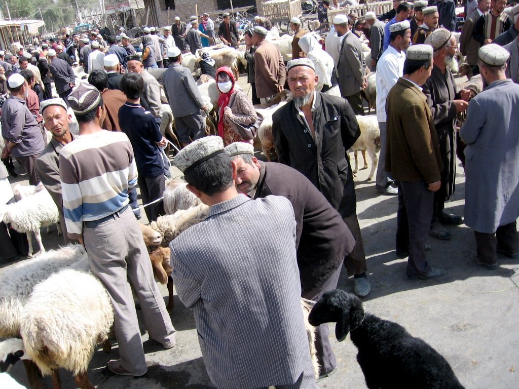
Hotan is largely dominated by the Uyghurs, and as of 2015, 311,050 of the 348,289 residents of the county were Uyghur, 35,897 were Han Chinese and 1,342 were from other ethnic groups.
In 1940, Owen Lattimore quoted the population of Khotan to be estimated as 26,000.
In 1998 the urban population was recorded at 154,352, 83% of which were Uyghurs, and 17% were Han Chinese.
In 1999, 83.01% of the population was Uyghur and 16.57% of the population was Han Chinese.
In the 2000 census, the population was recorded as 186,123. In the 2010 census figure, the figure had risen to 322,300. The increase in population is partly due to boundary changes.
Transportation
Air
Hetian Kungang Airport (IATA: HTN) serves the city. It serves regional flights to Ürümqi. Originally a military use airport, it was expanded significantly in 2002 to accommodate higher passenger volumes. It is located 12 km south of the city proper.
Road
Rail
Hotan is connected to the rest of China's rail network via the Kashgar–Hotan Railway, which opened to freight traffic in December 2010, and passenger service in June 2011. The railway station was constructed by a company under the Xinjiang Production and Construction Corps, and is located in the town of Lasqi (拉斯奎) northwest of the city proper. Passenger train service on this line is limited, with only one train per day, local service 5828/5825, linking the city with Kashgar (8~ hours) and Ürümqi (~34 hours).
Buses
Regular bus services link Hotan with Kashgar. There is also an express bus to Aksu via the 430 km 'Hotan-Aksu Cross-Desert Highway' which was opened in 2007, travels alongside the intermittent Hotan River, and which takes about 5 or 6 hours. This same bus then goes on to Urumchi taking a total of about 21 hours from Hotan.
Economy

, there was about 100,000 acres (662,334 mu) of cultivated land in Khotan.
Nephrite jade
Chinese historical sources indicate that Hotan was the main source of the nephrite jade used in ancient China. For several hundred years, until they were defeated by the Xiongnu in 176 BCE, the trade of Khotanese jade into China was controlled by the nomadic Yuezhi. The Chinese still refer to the Yurungkash as the White Jade River, alluding to the white jade recovered from its alluvial deposits. The light-colored jade is called "Mutton fat" jade. Most of the jade is now gone, with only a few kilos of good quality jade found yearly. Some is still mined in the Kunlun Mountains to the south in the summer, but it is generally of poorer quality than that found in the rivers.
Fabrics and carpets

Khotanese textiles were mentioned by Xuanzang, who visited the oasis in 644 CE. In his Biography it is stated: "It produced carpets and fine felt, and the felt-makers also spun coarse and fine silk."
Ancient Chinese-Khotanese relations were so close that the oasis emerged as one of the earliest centres of silk manufacture outside China. There are good reasons to believe that the silk-producing industry flourished in Hotan as early as the 5th century. According to one story, a Chinese princess given in marriage to a Khotan prince brought to the oasis the secret of silk-manufacture, "hiding silkworms in her hair as part of her dowry", probably in the first half of the 1st century CE. It was from Khotan that the eggs of silkworms were smuggled to Iran, reaching Justinian I's Constantinople in 551.[[File:Khotanese silks on display in shop.jpg|thumb|Khotanese silks on display in shop|left]]Silk production is still a major industry employing more than a thousand workers and producing some 150 million metres of silk annually. Silk weaving by Uyghur women is a thriving cottage industry, some of it produced using traditional methods.
Atlas is the fabric used for traditional Uyghur clothing worn by Uyghur women. It is soft, light and graceful tie-dyed silk fabric. It comes various colors, the brighter and rich colors are for small children to young ladies. The gray and dark colors are for elderly women.
The oldest piece of kilim which we have any knowledge was obtained by the archaeological explorer Aurel Stein; a fragment from an ancient settlement near Hotan, which was buried by sand drifts about the fourth century CE. The weave is almost identical with that of modern kilims.
Hotanese pile carpets are still highly prized and form an important export.
Notable persons
- Islam Akhun
- Muhammad Amin Bughra
- Nur Ahmadjan Bughra
- Abdullah Bughra
- Scribe Elder Ho-Tan
Gallery
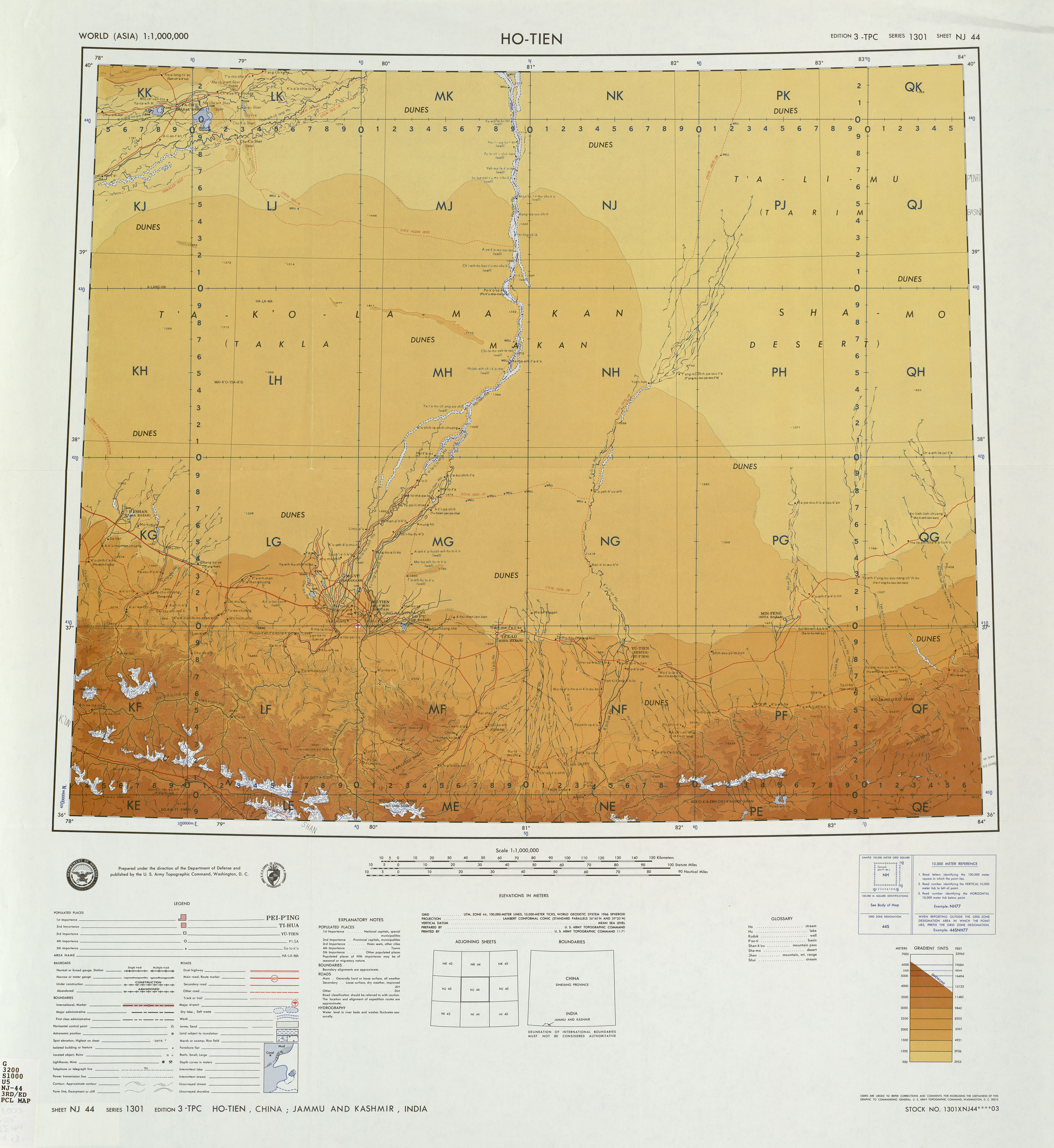
File:Khotan-mercado-d49.jpg|Market in Hotan File:Khotan-mercado-gente-uigur-d01.jpg|Uyghur people at Sunday market File:Khotan-fabrica-alfombras-d12.jpg|Carpet weaving in Hotan File:Entrance to the Khotan Jade Market Center.jpg|Entrance to the Khotan Jade Market Center File:Photo of the front of the Hotan Museum.jpg|Entrance to the Hotan Cultural Museum File:Large mutton fat jade displayed in Hotan Cultural Museum lobby.jpg|Local jade displayed in the Hotan Cultural Museum lobby. File:Plate 23. Sect. II- Chinese Turkistan, Kashmir & Jamu of maps of Constables 1893 hand atlas.jpg|Map of the region including Khotan (Ilchi) (1893) File:NJ-44-10 Khotan, China.jpg|Map including Hotan (Ho-t'ien, Khotan) (DMA, 1983)
Notes
References
Citations
Sources
- Harper, Damian et al. (2009). Lonely Planet China: 11th Edition. Lonely Planet. .
- Updated version of this article is available for free download (with registration) at: independent.academia.edu
- Hulsewé, A. F. P. (1979). China in Central Asia: The Early Stage 125 BC − AD 23: an annotated translation of chapters 61 and 96 of the History of the Former Han Dynasty. E. J. Brill, Leiden. .
- Legge, James 1886. A Record of Buddhistic Kingdoms: Being an account by the Chinese Monk Fa-Hien of his travels in India and Ceylon (A.D. 399-414) in search of the Buddhist Books of Discipline. Oxford, Clarendon Press. Reprint: New York, Paragon Book Reprint Corp. 1965.
- Mallory, J. P. and Mair, Victor H. 2000. The Tarim Mummies: Ancient China and the Mystery of the Earliest Peoples from the West. Thames & Hudson. London. 2000.
- Montell, Gösta, Sven Hedin's Archaeological Collections from Khotan: Terra-cottas from Yotkan and Dandan-Uiliq, The Bulletin of the Museum of Far Eastern Antiquities 7 (1936), pp. 145–221.
- Montell, Gösta, Sven Hedin's Archaeological Collections from Khotan II (appendix by Helmer Smith (pp. 101–102)), The Bulletin of the Museum of Far Eastern Antiquities 10 (1938), pp. 83–113.
- Puri, B. N. Buddhism in Central Asia, Motilal Banarsidass Publishers Private Limited, Delhi, 1987. (2000 reprint).
- Stein, Aurel M. 1907. Ancient Khotan: Detailed report of archaeological explorations in Chinese Turkestan, 2 vols. Clarendon Press. Oxford. dsr.nii.ac.jp 1907. Ancient Khotan: Detailed report of archaeological explorations in Chinese Turkestan, 2 vols. Clarendon Press. Oxford. M. A. Stein – Digital Archive of Toyo Bunko Rare Books at dsr.nii.ac.jp Ancient Khotan : vol.1 Ancient Khotan : vol.2
- Stein, Aurel M. 1921. Serindia: Detailed report of explorations in Central Asia and westernmost China, 5 vols. London & Oxford. Clarendon Press. Reprint: Delhi. Motilal Banarsidass. 1980. dsr.nii.ac.jp
- 1904 Sand-Buried Ruins of Khotan, London, Hurst and Blackett, Ltd. Reprint Asian Educational Services, New Delhi, Madras, 2000 Sand-Buried Ruins of Khotan : vol.1
- Watters, Thomas 1904–1905. On Yuan Chwang's Travels in India. London. Royal Asiatic Society. Reprint: Delhi. Mushiram Manoharlal. 1973.
- Yu, Taishan. 2004. A History of the Relationships between the Western and Eastern Han, Wei, Jin, Northern and Southern Dynasties and the Western Regions. Sino-Platonic Papers No. 131 March 2004. Dept. of East Asian Languages and Civilizations, University of Pennsylvania.
References
- "China: Xīnjiāng (Prefectures, Cities, Districts and Counties) - Population Statistics, Charts and Map".
- (12 November 2019). "(新疆)2018年和田市国民经济和社会发展统计公报".
- China Population: Xinjiang: Hotan: Hetian City https://www.ceicdata.com/en/china/population-county-level-region/population-xinjiang-hotan-hetian-city
- [[Marc Aurel Stein]]. (1907) ''Ancient Khotan: Detailed Report of Archaeological Explorations in Eastern Turkestan.'' Oxford. Pages 123-126.
- Bonavia, Judy. ''The Silk Road: Xi'an to Kashgar.'' Revised by Christopher Baumer (2004), pp. 306-319. Odyssey Publications. {{ISBN. 962-217-741-7.
- (November 1962). "The Philippines. Public Policy and National Economic Development. By Frank Golay. Ithaca: Cornell University Press, 1961. Xviii, 455. Map, Tables, Index, Bibliographic Essay". The Journal of Asian Studies.
- (2011). "India and China: Interactions through Buddhism and Diplomacy: A Collection of Essays by Professor Prabodh Chandra Bagchi". Anthem Press.
- Puri, Baij Nath. (1987). "Buddhism in Central Asia". Motilal Banarsidass.
- Bailey, Harold W.. (1982). "The Culture of the Sakas in Ancient Iranian Khotan". Caravan Books.
- (中国地名录, published in Beijing, ''[[SinoMaps Press]]'' {{lang. zh-hans. 中国地图出版社 1997; {{ISBN. 7-5031-1718-4; p. 312.)
- Mallory, J. P. and Mair, Victor H. 2000. ''The Tarim Mummies: Ancient China and the Mystery of the Earliest Peoples from the West'', pp. 132, 155-156. Thames & Hudson. London. {{ISBN. 0-500-05101-1.
- Bonavia, Judy. ''The Silk Road: Xi'an to Kashgar.'' Revised by Christopher Baumer (2004), p. 317. Odyssey Publications. {{ISBN. 962-217-741-7.
- (2010). "Evidence that a West-East admixed population lived in the Tarim Basin as early as the early Bronze Age". BMC Biology.
- Hill (2015), Vol. I, "The Kingdom of Yutian 于窴 (Khotan)", pp. 17-19 and nn.
- "《大唐大慈恩寺三藏法師傳》".
- Hansen, Valerie. (2017). "The Silk Road : A New History with Documents.". New York: Oxford University Press.
- Christopoulos, Lucas. (August 2021). "Hellenes and Romans in Ancient China". Sino-Platonic Papers.
- (1919). "Chinese Greco - Buddhist Bronze Head". The Lotus Magazine.
- "Khotan - Britannica Online Encyclopedia". Britannica.com.
- "Error".
- Page55 Eurasian crossroads By James A. Millward
- Mark J. Dresden, The Jatakastava or 'Praise of the Buddha's Former Births' Philadelphia, 1955
- Gippert, Jost. "TITUS Texts: Corpus of Khotanese Saka Texts: Frame".
- "賢愚經".
- James A. Millward. (2007). "Eurasian Crossroads: A History of Xinjiang". Columbia University Press.
- Latham, Ronald. (1958). "Marco Polo: the travels".
- Wood, Frances. (2002). "The Silk Road: two thousand years in the heart of Asia". University of California Press.
- S. Frederick Starr. (2015). "Xinjiang: China's Muslim Borderland". Taylor & Francis.
- Stein, Aurel M.. (1907). "Ancient Khotan: Detailed report of archaeological explorations in Chinese Turkestan, 2 vols., p. 180. Clarendon Press. Oxford".
- Bonavia, Judy. ''The Silk Road: Xi'an to Kashgar.'' Revised by Christopher Baumer (2004), p. 309. Odyssey Publications. {{ISBN. 962-217-741-7.
- Samah Ibrahim. (29 January 2019). "China's Uighur Strategy and South Asian Risk".
- Alexandre Andreyev. (2003). "Soviet Russia and Tibet: The Debarcle of Secret Diplomacy, 1918-1930s". BRILL.
- (September 2009). 上海辞书出版社. [[Shanghai Lexicographical Publishing House]].. zh-hans. 和田地区行署驻此。{...}1983年由和田县析置。
- "CHINA (INCLUDES TIBET, HONG KONG, AND MACAU) 2012 INTERNATIONAL RELIGIOUS FREEDOM REPORT". [[International Religious Freedom Act of 1998.
- (19 June 2012). "Uyghur Jailed Over Religious Materials". [[Radio Free Asia]].
- (18 June 2012). "Notice informs locals of mandatory residence searches in Hotan community; police reserve the right to "use force" to enter homes".
- Bahram K. Sintash. (October 2019). "Demolishing Faith: The Destruction and Desecration of Uyghur Mosques and Shrines".
- Matt Rivers. (3 January 2020). "More than 100 Uyghur graveyards demolished by Chinese authorities, satellite images show".
- Fred Hiatt. (3 November 2019). "In China, every day is Kristallnacht". [[Washington Post]].
- (1 May 2020). "Xinjiang Authorities Construct Parking Lot Atop Historic Uyghur Cemetery".
- Asim Kashgarian. (1 December 2019). "US: China Targets Uighur Mosques to Eradicate Minority's Faith".
- link. [[China Meteorological Administration]]
- link. [[China Meteorological Administration]]
- (2025-03-12). "With 13 of 20 most polluted cities, India ranks 5th globally". The Times of India.
- link. XZQH.org. (2 December 2014). zh-hans. 1984年和田县析置和田市。{...}2003年,和田市总面积155.04平方千米,{...}2006年7月11日,洛浦县吉亚乡、玉龙喀什镇与和田县吐沙拉乡正式划归和田市管辖。两乡一镇划归和田市管辖后,和田市管辖区域变为五乡、两镇、一个管理区、一个工业园区和四个街道办事处。和田市的行政区域面积由155.04平方千米扩大至465.84平方千米,{...}2010年第六次人口普查,和田市常住总人口322300人,其中:奴尔巴格街道24134人,古江巴格街道34567人,古勒巴格街道27919人,纳尔巴格街道37338人,拉斯奎镇25231人,玉龙喀什镇22614人,肖尔巴格乡39331人,伊里其乡22646人,古江巴格乡13680人,吐沙拉乡48468人,吉亚乡22071人,阿合恰管理区4301人。
- link. [[National Bureau of Statistics of the People's Republic of China]]. (2018). zh-hans. 统计用区划代码 名称 653201001000 努尔巴格街道办事处 653201002000 古江巴格街道办事处 653201003000 古勒巴格街道办事处 653201004000 纳尔巴格街道办事处 653201100000 拉斯奎镇 653201101000 玉龙喀什镇 653201102000 吐沙拉镇 653201200000 肖尔巴格乡 653201201000 伊里其乡 653201202000 古江巴格乡 653201204000 吉亚乡 653201205000 阿克恰勒乡 653201401000 北京工业园区 653201402000 和田市京和物流园区
- link. (12 December 2018). zh-hans. 辖6乡2镇,4个街道办事处和1个工业园区. zh-hans. 和田市人民政府网
- link. (25 September 2017). zh-hans. 和田市人民政府网
- (17 September 2020). "Full Text: Employment and Labor Rights in Xinjiang".
- (15 March 2017). link. {{lang. ug. شىنجاڭ ئۇيغۇر ئاپتونوم رايونى {{lang. zh-hans. 新疆维吾尔自治区统计局 Statistic Bureau of Xinjiang Uygur Autonomous Region
- Owen Lattimore. (1940). "Inner Asian frontiers of China". [[American Geographical Society]].
- Stanley W. Toops. (15 March 2004). "Xinjiang: China's Muslim Borderland". Routledge.
- (2004). "Governing China's Multiethnic Frontiers". [[University of Washington Press]].
- "HÉTIÁN SHÌ (County-level City)". City Population.
- Harper et al. (2009), p. 840.
- Herold J. Wiens. (November 1966). "Cultivation Development and Expansion in China's Colonial Realm in Central Asia". [[The Journal of Asian Studies]].
- Bonavia, Judy. ''The Silk Road: Xi'an to Kashgar.'' Revised by Christopher Baumer (2004), pp. 307-308. Odyssey Publications. {{ISBN. 962-217-741-7.
- [[Marc Aurel Stein]]. (1907) ''Ancient Khotan: Detailed Report of Archaeological Explorations in Eastern Turkestan.'' Oxford. Pages 132-133.
- Laufer, Berthold. ''Jade: A Study in Chinese Archaeology & Religion''. (1912) Reprint: Dover Publications, New York, N.Y. (1974), pp. 24, 26, 291-293, 324. {{ISBN. 0-486-23123-2.
- ''A Biography of the Tripiṭaka Master of the great Ci'en Monastery of the Great Tang Dynasty''. Śramaṇa Huili and Shi Yancong. Translated by Li Rongxi. Numata Center for Buddhist Translation and Research. (1995), p. 163. {{ISBN. 1-886439-00-1.
- [[Susan Whitfield. Whitfield, Susan]]. ''The Silk Road: Trade, Travel, War and Faith''. Serindia Publications Inc., 2004. {{ISBN. 1-932476-12-1. Page 47.
- Hill (2015), Vol. II, pp. 1-2. "Appendix A: Introduction of Silk Cultivation to Khotan."
- Sarah Underhill Wisseman, Wendell S. Williams. ''Ancient Technologies and Archaeological Materials ''. Routledge, 1994. {{ISBN. 2-88124-632-X. Page 131.
- "From Khotan, silk culture is believed to have passed by way of [[Kashmir]] to India and then westwards into central Asia and Persia". Quoted from Chambers's Encyclopaedia, Oxford University Press, 1950, article "Silk".
- Bennett, Ian. Rugs & Carpets of the World. (1978). Ferndale Edition (1981). Quarto Publishing, London, pp.182-189. {{ISBN. 0-905746-24-4.
- "Khotan rug - Britannica Online Encyclopedia". Britannica.com.
This article was imported from Wikipedia and is available under the Creative Commons Attribution-ShareAlike 4.0 License. Content has been adapted to SurfDoc format. Original contributors can be found on the article history page.
Ask Mako anything about Hotan — get instant answers, deeper analysis, and related topics.
Research with MakoFree with your Surf account
Create a free account to save articles, ask Mako questions, and organize your research.
Sign up freeThis content may have been generated or modified by AI. CloudSurf Software LLC is not responsible for the accuracy, completeness, or reliability of AI-generated content. Always verify important information from primary sources.
Report