From Surf Wiki (app.surf) — the open knowledge base
Hot Spring County, Arkansas
County in Arkansas, United States
County in Arkansas, United States
| Field | Value |
|---|---|
| county | Hot Spring County |
| state | Arkansas |
| type | County |
| official_name | County of Hot Spring |
| ex image | Hot Spring County Courthouse 001.jpeg |
| ex image cap | Hot Spring County Courthouse in Malvern |
| coordinates | |
| founded | |
| founded title | Established |
| named for | hot springs at Hot Springs, Arkansas, which were formerly in the county. |
| seat wl | Malvern |
| largest city wl | Malvern |
| area_footnotes | |
| area_total_sq_mi | 622.16 |
| area_land_sq_mi | 614.94 |
| area_water_sq_mi | 7.22 |
| area percentage | 1.16% |
| population_as_of | 2020 |
| population_total | 33040 |
| pop_est_as_of | 2024 |
| population_est | 33313 |
| density_sq_mi | auto |
| ZIP codes | 71901, 71913, 71921, 71923, 71929, 71933, 71941, 71943, 71964, 72084, 72104, 72167 |
| district | 4th |
| time zone | Central |
| web | hotspringcounty.org |
Hot Spring County, officially the County of Hot Spring, is a county located in the U.S. state of Arkansas. As of the 2020 census, the population was 33,040. The county seat is Malvern. Established on November 2, 1829, in the Arkansas Territory from a part of Clark County; it was named after the hot springs at Hot Springs, Arkansas, which were formerly in the county. The creation of Garland County in 1873 detached the town of Hot Springs to the newly created county.
For nearly 80 years, Hot Spring County was an alcohol prohibition or dry county, though attempts in recent years to locate the county prohibition ordinance were unsuccessful. In November 2022, voters overturned the prohibition, approving a measure to allow countywide retail alcohol sales.
Hot Spring County comprises the Malvern, AR Micropolitan Statistical Area, which is included in the Hot Springs-Malvern, AR Combined Statistical Area.
Geography
Hot Spring County is located in Southwest Arkansas, a region composed of the Ouachita Mountains, deep valleys, and the Arkansas Timberlands. Hot Spring County is mostly within the mountainous segment of the region, mostly covered in hardwood and pine forests. One of the six primary geographic regions of Arkansas, the Ouachitas are a mountainous subdivision of the U.S. Interior Highlands. The Ouachita River roughly divides the county. According to the U.S. Census Bureau, the county has a total area of 622.16 sqmi, of which 614.94 sqmi is land and 7.22 sqmi (1.16%) is water.
The county is located approximately 47 mi southwest of Little Rock, 170 mi northeast of Shreveport, Louisiana, and 277 mi northeast of Dallas, Texas.{{#tag:ref|Mileages from Hot Spring County to Little Rock, Shreveport, and Dallas are based on highway miles using county seat Malvern for Hot Spring County.{{cite web |access-date= January 8, 2017 }}
Protected areas
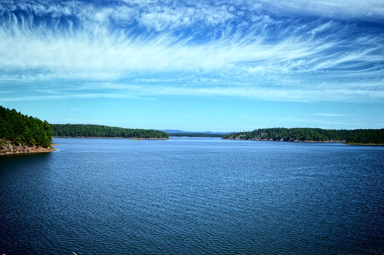
Hot Spring County contains two state parks, DeGray Lake Resort State Park and Lake Catherine State Park, and two Wildlife Management Area (WMA), DeGray Lake WMA, and Jack Mountain WMA maintained by the Arkansas Game and Fish Commission. The county also contains 320 acre of Ouachita National Forest managed by the National Forest Service.
DeGray Lake Resort State Park is a 984 acre in southwest Hot Spring County, and Arkansas's only resort state park. The 94-room DeGray Lodge and Convention Center includes a restaurant and 18-hole championship rated golf course. Traditional state park amenities for camping, hiking, fishing, boating, picnic tables, and horseback riding are also offered. The park is owned and operated by the Arkansas Department of Parks and Tourism (ADPT). DeGray Lake WMA essentially bounds the portions of lake shoreline not bounded by the state park. The land is owned by the United States Army Corps of Engineers (USACE) and extends into Clark County.
Near Malvern, Lake Catherine State Park is a small state park on the west side of Lake Catherine. The park offers 20 cabins, including five Civilian Conservation Corps cabins of natural wood and stone built in the 1930s, and 70 campsites. In summer, the parks offers a marina, boat rental, visitor center, guided tours, nature center and horseback trail rides.
Demographics
From 2000 to 2010, Hot Spring County saw significant population and income growth. The population increased from 30,353 to 32,923, a gain of 8.5%, with incomes rising and poverty declining for almost every demographic.
| align-fn = center 1790–1960 1900–1990 1990–2000 2010
2020 Census
As of the 2020 census, the county had a population of 33,040. The median age was 42.1 years. 21.2% of residents were under the age of 18 and 19.4% of residents were 65 years of age or older. For every 100 females there were 110.4 males, and for every 100 females age 18 and over there were 111.2 males age 18 and over.
The racial makeup of the county was 80.3% White, 10.5% Black or African American, 0.6% American Indian and Alaska Native, 0.3% Asian,
26.8% of residents lived in urban areas, while 73.2% lived in rural areas.
There were 12,473 households in the county, of which 30.2% had children under the age of 18 living in them. Of all households, 48.8% were married-couple households, 18.8% were households with a male householder and no spouse or partner present, and 26.2% were households with a female householder and no spouse or partner present. About 27.6% of all households were made up of individuals and 12.8% had someone living alone who was 65 years of age or older.
There were 14,179 housing units, of which 12.0% were vacant. Among occupied housing units, 74.8% were owner-occupied and 25.2% were renter-occupied. The homeowner vacancy rate was 1.5% and the rental vacancy rate was 7.6%.
2010 Census
As of the 2010 census, there were 32,923 people, 12,664 households, and 8,969 families residing in the county. The population density was 53.5 /mi2. There were 14,332 housing units at an average density of 23.3 /mi2. The racial makeup of the county was 85.6% White, 10.8% Black or African American, 0.5% Native American, 0.3% Asian, 0.1% Pacific Islander, 1.0% from other races, and 1.7% from two or more races. 2.8% of the population were Hispanic or Latino of any race.
There were 12,664 households, out of which 32.0% had children under the age of 18 living with them, 53.6% were married couples living together, 12.3% had a female householder with no husband present, and 29.2% were non-families. 25.2% of all households were made up of individuals, and 10.6% had someone living alone who was 65 years of age or older. The average household size was 2.48 and the average family size was 2.94.
In the county, the population was spread out, with 23.3% under the age of 18, 8.4% from 18 to 24, 24.3% from 25 to 44, 28.3% from 45 to 64, and 15.7% who were 65 years of age or older. The median age was 40.1 years. For every 100 females there were 95.8 males. For every 100 females age 18 and over, there were 102.5 males age 18 and over.
The median income for a household in the county was $37,150, and the median income for a family was $46,090. Males had a median income of $34,111 versus $27,127 for females. The per capita income for the county was $18,248. About 8.2% of families and 12.3% of the population were below the poverty line, including 13.0% of those under age 18 and 8.9% of those age 65 or over.
2000 Census
As of the 2000 census, there were 30,353 people, 12,004 households, and 8,834 families residing in the county. The population density was 49 /mi2. There were 13,384 housing units at an average density of 22 /mi2. The racial makeup of the county was 87.33% White, 10.26% Black or African American, 0.45% Native American, 0.22% Asian, 0.04% Pacific Islander, 0.44% from other races, and 1.26% from two or more races. 1.27% of the population were Hispanic or Latino of any race.
There were 12,004 households, out of which 31.80% had children under the age of 18 living with them, 59.20% were married couples living together, 10.60% had a female householder with no husband present, and 26.40% were non-families. 23.50% of all households were made up of individuals, and 11.10% had someone living alone who was 65 years of age or older. The average household size was 2.50 and the average family size was 2.94.
In the county, the population was spread out, with 25.10% under the age of 18, 8.20% from 18 to 24, 26.50% from 25 to 44, 24.50% from 45 to 64, and 15.80% who were 65 years of age or older. The median age was 38 years. For every 100 females there were 95.50 males. For every 100 females age 18 and over, there were 93.00 males.
The median income for a household in the county was $31,543, and the median income for a family was $37,077. Males had a median income of $27,800 versus $19,461 for females. The per capita income for the county was $15,216. About 10.30% of families and 14.00% of the population were below the poverty line, including 19.00% of those under age 18 and 14.20% of those age 65 or over.
Human resources
Education
Educational attainment in Hot Spring County is typical for a rural Arkansas county, with a 2011-2015 American Community Survey study finding 84.8% of Hot Spring County residents over age 25 held a high school degree. This ratio is in line with the state average of 84.8% and slightly below the national average of 86.7%. The county's percentage of residents holding a bachelor's degree or higher is 13.0%, significantly below state and national averages of 21.1% and 29.8%, respectively.
Primary and secondary education

Five public school districts are based in Hot Spring County: Malvern School District is the largest school district in Hot Spring County, with the Bismarck School District serving the western portion of the county, Ouachita School District serving a small area around Donaldson, Glen Rose School District serving the northeastern area of the county, and Magnet Cove School District around Magnet Cove. Successful completion of the curriculum of these schools leads to graduation from Malvern High School, Bismarck High School, Ouachita High School, Glen Rose High School, and Magnet Cove High School respectively. All five high schools offer Advanced Placement (AP) courses and are accredited by the Arkansas Department of Education (ADE).
Residents outside the five Hot Spring County-based districts are within either the Centerpoint School District or Poyen School District.
Higher education
Hot Spring County contains one institution of higher education, ASU Three Rivers, a public community college in Malvern. Other higher education institutions in the region include National Park College, a public two-year college in Hot Springs, and two four-year liberal arts universities in Arkadelphia, Henderson State University and Ouachita Baptist University.
Library system
The Malvern-Hot Spring County Library at 202 East Third Street in downtown Malvern was founded in 1928 and became a member library of the Mid-Arkansas Regional Library System in 1974. The facility offers books, e-books, media, reference, youth, business and genealogy services.
Public safety
The Hot Spring County Sheriff's Office is the primary law enforcement agency in the county. The agency is led by the Hot Spring County Sheriff, an official elected by countywide vote every two years.
The county is under the jurisdiction of the Hot Spring County District Court, a state district court. State district courts in Arkansas are courts of original jurisdiction for criminal, civil (up to $25,000), small claims, and traffic matters. State district courts are presided over by a full-time District Judge elected to a four-year term by a districtwide election. Hot Spring County District Court is located at 410 Locust Street in Malvern.
Superseding district court jurisdiction is the 7th Judicial Circuit Court, which covers Hot Spring and Grant counties. The 7th Circuit contains two circuit judges, elected to six-year terms circuitwide. Circuit courts have the right to refer some matters to state district court at their discretion.
Hot Spring County 911 is the local PSAP operating system for the entire county area. Hot Spring County 911 is run by Director Regina Shearin.
Government
The county government is a constitutional body granted specific powers by the Constitution of Arkansas and the Arkansas Code. The quorum court is the legislative branch of the county government and controls all spending and revenue collection. Representatives are called justices of the peace and are elected from county districts every even-numbered year. The number of districts in a county vary from nine to fifteen, and district boundaries are drawn by the county election commission. The Hot Spring County Quorum Court has eleven members. Presiding over quorum court meetings is the county judge, who serves as the chief operating officer of the county. The county judge is elected at-large and does not vote in quorum court business, although capable of vetoing quorum court decisions.
| Position | Officeholder | Party |
|---|---|---|
| County Judge | Dennis Thornton | Republican |
| County Clerk | Patty Griggs | Republican |
| Circuit Clerk | Teresa Pilcher | Republican |
| Sheriff | Richard Tolleson | (Unknown) |
| Treasurer | Glorie Thornton | Republican |
| Collector | Sheri Oden | Republican |
| Assessor | Blake Riggan | Republican |
| Coroner | Jason Chenault | Republican |
The composition of the Quorum Court following the 2024 elections is 10 Republicans and 1 Democrat. Justices of the Peace (members) of the Quorum Court following the elections are:
- District 1: James Bryant (D)
- District 2: Brian Coston (R)
- District 3: Ralph V. Williams (R)
- District 4: Darrin Hardy (R)
- District 5: Mike Scarbrough (R)
- District 6: Don Hilyard (R)
- District 7: Jennifer Corley (R) (position now Vacant)
- District 8: Tony Shnaekel (R)
- District 9: Jimmy R. Rogers (R)
- District 10: Wylie Whitley (R)
- District 11: Jay Sheets (R)
Additionally, the townships of Hot Spring County are entitled to elect their own respective constables, as set forth by the Constitution of Arkansas. Constables are largely of historical significance as they were used to keep the peace in rural areas when travel was more difficult. The township constables as of the 2024 elections are:
- Big Creek: Jimmy Finley (R)
- Butterfield: Steve Cook (R)
- Harrison: Martin R. DeVore (R)
- Magnet: Mark Woodfield (R)
- Midway: Scott Whitehead (R)
- Prairie: Ron Brown (R)
- Saline: Waylon Corley (R)
Politics
Hot Spring County is represented in the Arkansas State Senate by Republican Alan Clark, a Hot Springs businessman. In the Arkansas House of Representatives, it is represented by a Republican as well, Laurie Rushing, a real estate broker from Hot Springs.
Until 2004, Hot Spring County was a typical "Solid South" Democratic county in presidential elections. There were, however, 3 exceptions. Republicans Herbert Hoover and Richard Nixon won the county in 1928 and 1972, respectively, while American Independent candidate George Wallace won the county in 1968. In 2004, Republican candidate George W. Bush won the county by just 59 votes. However, since 2008, the county has given over 60 percent of its vote to the Republican candidate.
Taxation
Property tax is assessed by the Hot Spring County Assessor annually based upon the fair market value of the property and determining which tax rate, commonly called a millage in Arkansas, will apply. The rate depends upon the property's location with respect to city limits, school district, and special tax increment financing (TIF) districts. This tax is collected by the Hot Spring County Collector between the first business day of March of each year through October 15 without penalty. The Hot Spring County Treasurer disburses tax revenues to various government agencies, such as cities, county road departments, fire departments, libraries, and police departments in accordance with the budget set by the quorum court.
Sales and use taxes in Arkansas are voter approved and collected by the Arkansas Department of Finance and Administration. Arkansas's statewide sales and use tax has been 6.5% since July 1, 2013. Hot Spring County has an additional sales and use tax of 1.50%, which has been in effect since January 1, 2009. Within Hot Spring County, the City of Malvern has had an additional 1% sales and use tax since January 1, 2009, City of Rockport an additional 2% since January 1, 2012, and the Town of Perla an additional 1% sales and use tax since January 1, 1984. The Arkansas State Treasurer disburses tax revenue to counties and cities in accordance with tax rules.
Communities
Two incorporated cities, four incorporated towns, and one census designated place (CDP) are located within the county. The largest city and county seat, Malvern, is located in the northeast part of the county on I-30. Malvern's population in 2010 was 10,318, and has been increasing since the 2000 Census. Rockport and Perla are adjacent to Malvern, with populations of 755 and 291 in 2010, respectively. The remaining communities are in the south part of the county near the Ouachita River, each with a population under 400 as of 2010: Donaldson, Friendship and Midway. Magnet Cove is a former town, suspending incorporation in 2006.
Hot Spring County has dozens of unincorporated communities and ghost towns within its borders. This is due to early settlers in Arkansas tending to settle in small clusters rather than incorporated towns. For example, communities like Jones Mill have a post office or a collection of buildings. Other communities are simply a few dwellings at a crossroads that have adopted a common place name over time. Some are officially listed as populated places by the United States Geological Survey, and others are listed as historic settlements.
Cities
- Malvern (County Seat)
- Rockport
Towns
- Donaldson
- Friendship
- Midway
- Perla
Census Designated Places
- Bismarck
- Jones Mill
- Magnet Cove
Other unincorporated communities
- Abco
- Antioch
- Beaton
- Bonnerdale
- Brown Springs
- Butterfiield
- Caney
- Central
- De Roche
- Diamondhead
- Faber
- Gifford
- Glen Rose
- Harp
- Lambert
- Landers
- Lono
- Morning Star
- Mount Moriah
- Oak Bower
- Oak Grove
- Old De Roche
- Oma
- Point Cedar
- Rolla
- Saginaw
- Shorewood Hills
- Social Hill
- Whittington
- Witherspoon
Historical communities
- Cove Creek
- Duffie
- Durian
- Elmore
- Etta
- Fleming
- Sanders
- Twin Oak
- Walco
- Wayside
- Wyandotte
Townships

- Antioch
- Big Creek
- Bismarck
- Brown Springs
- Butterfield (part of Rockport and Malvern)
- Clear Creek
- De Roche
- Dover
- Fenter (Perla, most of Malvern, part of Rockport)
- Gifford
- Harrison
- Henderson
- Lone Hill (part of Midway)
- Magnet (Magnet Cove)
- Midway
- Montgomery
- Ouachita (Donaldson)
- Prairie (Friendship, most of Midway)
- Saline
- Valley
Infrastructure
Aviation
Hot Spring County contains one public owned/public use general aviation airport, Malvern Municipal Airport southeast of Malvern. For the twelve-month period ending July 31, 2015, the facility saw 11,850 general aviation operations and 150 military operations. The nearest commercial service airport is Clinton National Airport in Little Rock.
Major highways
- [[Image:I-30 (AR).svg|20px]] Interstate 30
- [[Image:US 67.svg|20px]] U.S. Highway 67
- [[Image:US 70.svg|20px]] U.S. Highway 70
- [[Image:US 270.svg|25px]] U.S. Highway 270
- [[Image:Arkansas 7.svg|20px]] Highway 7
- [[Image:Arkansas 9.svg|20px]] Highway 9
- [[Image:Arkansas 51.svg|20px]] Highway 51
- [[Image:Arkansas 84.svg|20px]] Highway 84
- [[Image:Arkansas 128.svg|25px]] Highway 128
- [[Image:Arkansas 171.svg|25px]] Highway 171
- [[Image:Arkansas 222.svg|25px]] Highway 222
- [[Image:Arkansas 283.svg|25px]] Highway 283
- [[Image:Arkansas 347.svg|25px]] Highway 347
Notes
References
Cited works
References
- (October 16, 2014). "Arkansas County Polygons". Arkansas GIS Office.
- "Census - Geography Profile: Hot Spring County, Arkansas". [[United States Census Bureau]].
- "Find a County". National Association of Counties.
- Waddles, Joshua. (August 9, 2017). "The liquor prohibition law is missing".
- (November 9, 2022). "Alcohol sales now legal in Hot Spring County". Tegna Inc..
- Atkins-Gordeeva, Jennifer. (July 20, 2016). "Hot Spring County". Butler Center for Arkansas Studies at the Central Arkansas Library System.
- (May 12, 2008). "General Highway Map, Hot Spring County, Arkansas". Arkansas State Highway and Transportation Department.
- (2017). "Wildlife Management Area Details". Arkansas Game and Fish Commission.
- "Annual Estimates of the Resident Population for Counties: April 1, 2020 to July 1, 2023". United States Census Bureau.
- "U.S. Decennial Census". United States Census Bureau.
- "Historical Census Browser". University of Virginia Library.
- (March 27, 1995). "Population of Counties by Decennial Census: 1900 to 1990". United States Census Bureau.
- (April 2, 2001). "Census 2000 PHC-T-4. Ranking Tables for Counties: 1990 and 2000". United States Census Bureau.
- "State & County QuickFacts". United States Census Bureau.
- (2021). "2020 Decennial Census Demographic Profile (DP1)".
- (2021). "2020 Decennial Census Redistricting Data (Public Law 94-171)".
- (2023). "2020 Decennial Census Demographic and Housing Characteristics (DHC)".
- "U.S. Census website". [[United States Census Bureau]].
- (2011–2015). "American Community Survey". United States Census Bureau.
- {{harvp. Directory. 2016
- Staff of the Arkansas Judiciary. (September 2, 2014). "Arkansas Court Structure". Arkansas Judiciary.
- {{harvp. Directory. 2016
- Teske, Steven. (March 24, 2014). "Quorum Courts". [[Butler Center for Arkansas Studies]] at the [[Central Arkansas Library System]].
- Goss, Kay C.. (August 28, 2015). "Office of County Judge". Butler Center for Arkansas Studies at the Central Arkansas Library System.
- "Home".
- "Hot Spring {{!}} Association of Arkansas Counties".
- (June 27, 2022). "2022 General Election: County, District Officials". Association of Arkansas Counties.
- "Justices of the Peace".
- "Hot Spring County, Arkansas, elections, 2024".
- "What is a Constable?".
- "Dave Leip's Atlas of U.S. Presidential Elections".
- "State Tax Rates". Arkansas Department of Finance and Administration.
- (October–December 2017). "List of Cities and Counties with Local Sales and Use Tax". Arkansas Department of Finance and Administration.
- Pennington, Helen. (August 8, 2017). "Magnet Cove (Hot Spring County)". [[Butler Center for Arkansas Studies]] at the [[Central Arkansas Library System]].
- "2011 Boundary and Annexation Survey (BAS): Hot Spring County, AR". U. S. Census Bureau.
- "Arkansas: 2010 Census Block Maps - County Subdivision". [[United States Census Bureau]].
- {{FAA-airport
This article was imported from Wikipedia and is available under the Creative Commons Attribution-ShareAlike 4.0 License. Content has been adapted to SurfDoc format. Original contributors can be found on the article history page.
Ask Mako anything about Hot Spring County, Arkansas — get instant answers, deeper analysis, and related topics.
Research with MakoFree with your Surf account
Create a free account to save articles, ask Mako questions, and organize your research.
Sign up freeThis content may have been generated or modified by AI. CloudSurf Software LLC is not responsible for the accuracy, completeness, or reliability of AI-generated content. Always verify important information from primary sources.
Report