From Surf Wiki (app.surf) — the open knowledge base
High Rhine
Part of the river Rhine in Switzerland and Germany

Part of the river Rhine in Switzerland and Germany
| Field | Value | |||
|---|---|---|---|---|
| name | High Rhine (Hochrhein) | |||
| image | 2018-04-29 12-00-50 Schweiz Dörflingen Dörflingen, Laag 550.6.jpg | |||
| image_caption | Upper part of the High Rhine near Dörflingen | |||
| map | [[File:Rhein-Karte2.png | center | 250px | upright=1.2]] |
| map_caption | Sections of the Rhine: | |||
| subdivision_type1 | Country | |||
| subdivision_name1 | Germany | |||
| subdivision_type2 | State | |||
| subdivision_name2 | Baden-Württemberg | |||
| subdivision_type3 | Districts | |||
| subdivision_name3 | Konstanz, Lörrach, Waldshut | |||
| subdivision_type4 | Country | |||
| subdivision_name4 | Switzerland | |||
| subdivision_type5 | Cantons | |||
| subdivision_name5 | Aargau, Basel-Landschaft, Basel-Stadt, Schaffhausen, Thurgau, Zürich | |||
| length | 165 km | |||
| source1_location | Lower Lake Constance (Untersee) in Stein am Rhein | |||
| source1_coordinates | ||||
| source1_elevation | 395 m | |||
| mouth_location | Basel, continues as the Upper Rhine (Oberrhein) | |||
| mouth_coordinates | ||||
| mouth_elevation | 252 m | |||
| basin_size | 24900 km2 | |||
| tributaries_left | Aare, Birs, Ergolz, Glatt, Möhlinbach, Sissle, Thur, Töss | |||
| tributaries_right | Alb, Biber, Durach, Murg, Wehra, Wutach |
High Rhine (, ; kilometres 0 to 167 of the Rhine) is the section of the Rhine between Lake Constance (Bodensee) and the city of Basel, flowing in a general east-to-west direction and forming mostly the Germany–Switzerland border. It is the first of four named sections of the Rhine (High Rhine, Upper Rhine, Middle Rhine, Lower Rhine) between Lake Constance and the river delta at the North Sea.
Name
The term High Rhine was introduced by scientists in the 19th century. Above all geologists tried to differentiate the High Rhine () linguistically from the Upper Rhine (, ). Until the 19th century, it was also known as the 'Badisch-Swiss Rhine'. It lends its name to the High Rhine Railway line, which to a great extent follows the river to the north of it.
Geography
Course
The High Rhine begins at the outflow of the Rhine from the Untersee (Lower Lake Constance) in Stein am Rhein and turns into the Upper Rhine at the Rhine knee (Rheinknie) in Basel (more precisely at the Middle Bridge). It is marked by Rhine-kilometers 0 to 167, with the measurements beginning at the outflow from the Obersee (Upper Lake Constance) at the Old Rhine Bridge in Konstanz (Constance), although the part between the Upper and Lower Lake Constance is distinguished as the Seerhein () and the part of Lower Lake Constance through which the Rhine flows is known as the Rheinsee. Therefore, the High Rhine begins at Rhine-kilometer 25.45.
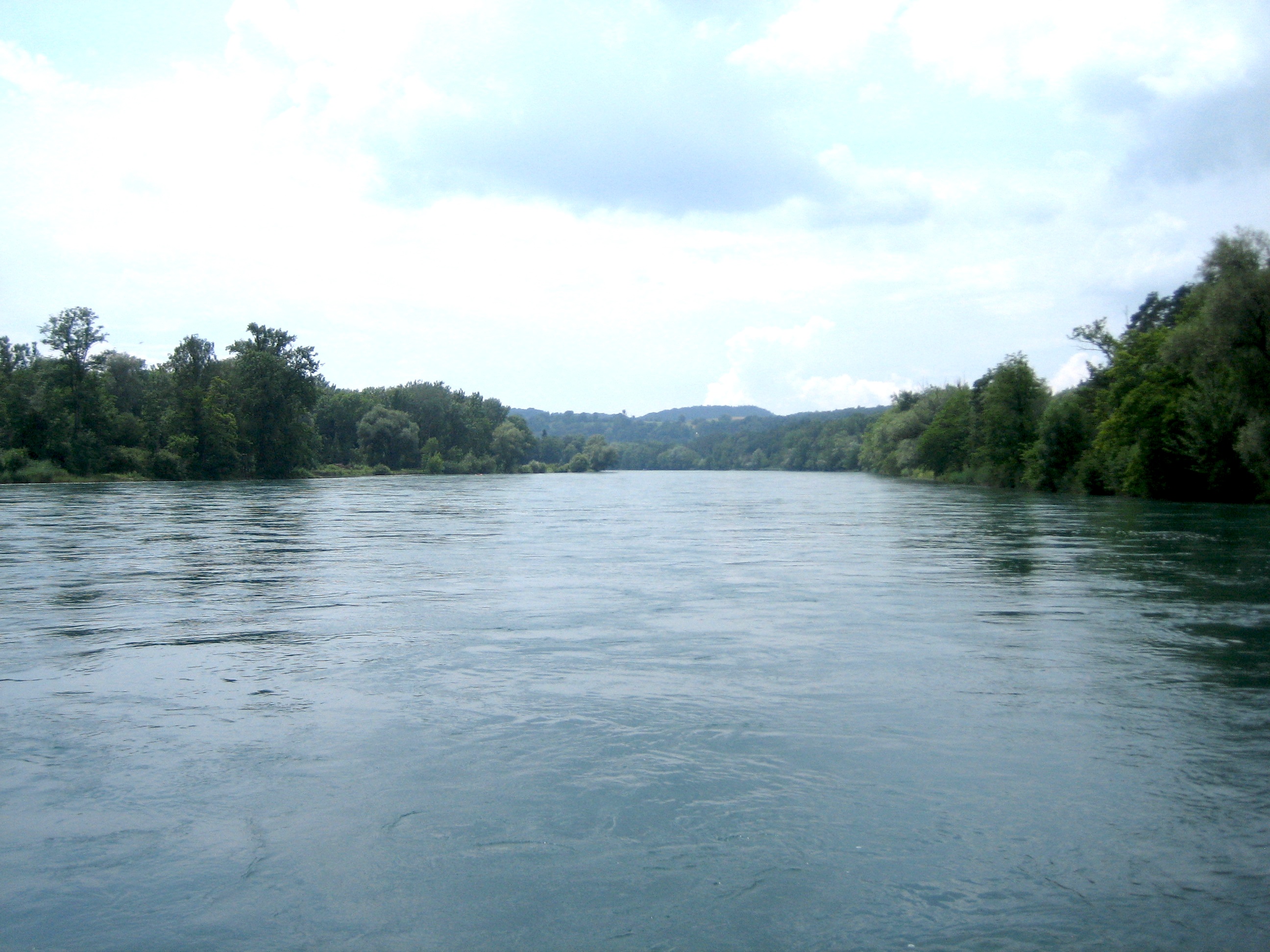
In contrast to the Alpine Rhine (the main tributary of Lake Constance) and Upper Rhine, which both flow mainly in a south-to-north direction, the High Rhine flows mostly from east to west. Between Schaffhausen and the confluence with the Töss, it flows from north to south for about 20 km, with a distinct meander at Rheinau. In its eastern portion, the river passes through the Molasse basin (passing south of the Hegau region), while in its western part it traverses the Table Jura before entering the Upper Rhine Plain at Basel, where it turns northwards.
In its western section, the High Rhine mostly marks the border between Germany and Switzerland except in the Swiss canton of Basel-Stadt. In the eastern part, there are several disconnected areas of Switzerland to the north of the river (canton of Schaffhausen and Rafzerfeld of the canton of Zurich). The German enclave of Büsingen am Hochrhein is located on the northern bank of the High Rhine, surrounded by Swiss territory.
Tributaries
Apart from many creeks, larger tributaries of the High Rhine are, in the order of their confluences, the Biber, Durach, Thur, Töss, Glatt, Wutach, Aare, Alb, Murg, Sissle, Wehra, Ergolz and Birs. The High Rhine's drainage basin measures 24900 km2.
With 557 m3/s, the Aare has a larger discharge than the Rhine (439 m3/s). From a hydrological point of view, therefore, the Rhine is a tributary of the Aare, not vice versa. The Rhine is, however, generally considered the main stream, because it is slightly longer than the Aare.
Waterfalls and rapids
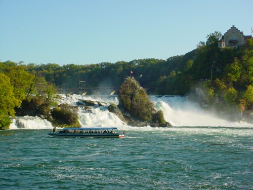
The Rhine Falls (Rheinfall), which are the largest plain waterfalls of Europe, are in the municipalities of Neuhausen am Rheinfall and Laufen-Uhwiesen, near the town of Schaffhausen. They are 150 m wide and 23 m high. In the winter months, the average water flow is 250 m3/s, while in the summer, the average water flow is 600 m3/s.
The rapids in the High Rhine should be viewed in the context of the relatively high slope—from 395 to a.s.l. in just 165 km—and the change of the river's course during the Würm ice age. In Neuhausen am Rheinfall, the river falls into a previously buried stream channel, forming the Rhine Falls at Schaffhausen. The next rapids are the Kadelburg Rapids at Koblenz. Near Laufenburg, the post-glacial Rhine failed to find the old silted-up channel and hit a spur of Black Forest crystal. The river cut itself a gorge, containing the Laufenburg Rapids. The Laufenburg and Schwörstadt Rapids have been artificially eliminated by blowing up the rocks and raising the water level with dams.
Interventions

The character of the river has been changed over long distances by the construction of hydropower stations. The Laufenburg and Schwörstadt rapids were removed by blowing up rocks, originally to improve navigation, and later flooded due to the hydropower dams.
Between Stein am Rhein and Diessenhofen, the High Rhine is not dammed. The first power plant along the Rhine is located in Schaffhausen; it has a damming effect to slightly above Diessenhofen. The next power plant (Kraftwerk Reckingen) is located at Rekingen and Küssaberg. After Rekingen, the High Rhine flows freely through the Koblenz Rapids to the confluence with the Aare. The next hydropower plant (the Kraftwerk Albbruck-Dogern), is at Leibstadt and Dogern. There are seven more power plants between here and Basel. Altogether, the High Rhine has eleven dams and twelve hydropower plants (there are two plants at the Augst/Wyhlen Dam.
Towns and organizations
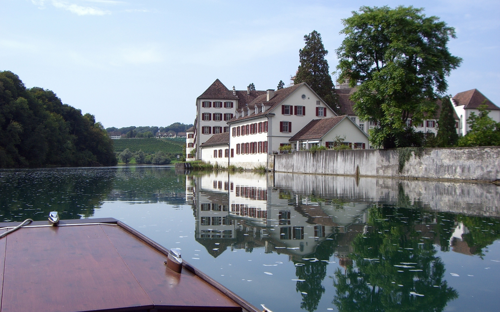
Some parts of the High Rhine valley are fairly wide, while others are more gorge-like. The population density varies accordingly. Prominent towns on the High Rhine include Stein am Rhein, Schaffhausen, Neuhausen am Rheinfall, Waldshut, Laufenburg, Bad Säckingen, Rheinfelden and Basel. Some towns on the lower section of the river, which here corresponds to the Germany–Switzerland border, are located on both banks, such as Laufenburg (Aargau) and Laufenburg (Baden) and Rheinfelden (Aargau) and Rheinfelden (Baden).
The most important organizations for cross-border cooperation on the High Rhine are High Rhine Commission and High Rhine Agency.
Authorities on the Baden-Württemberg side of the river are organized in a framework called Regionalverband Hochrhein-Bodensee ("Regional cooperation High Rhine — Lake Constance").
Bridges
Main article: List of bridges over the Rhine
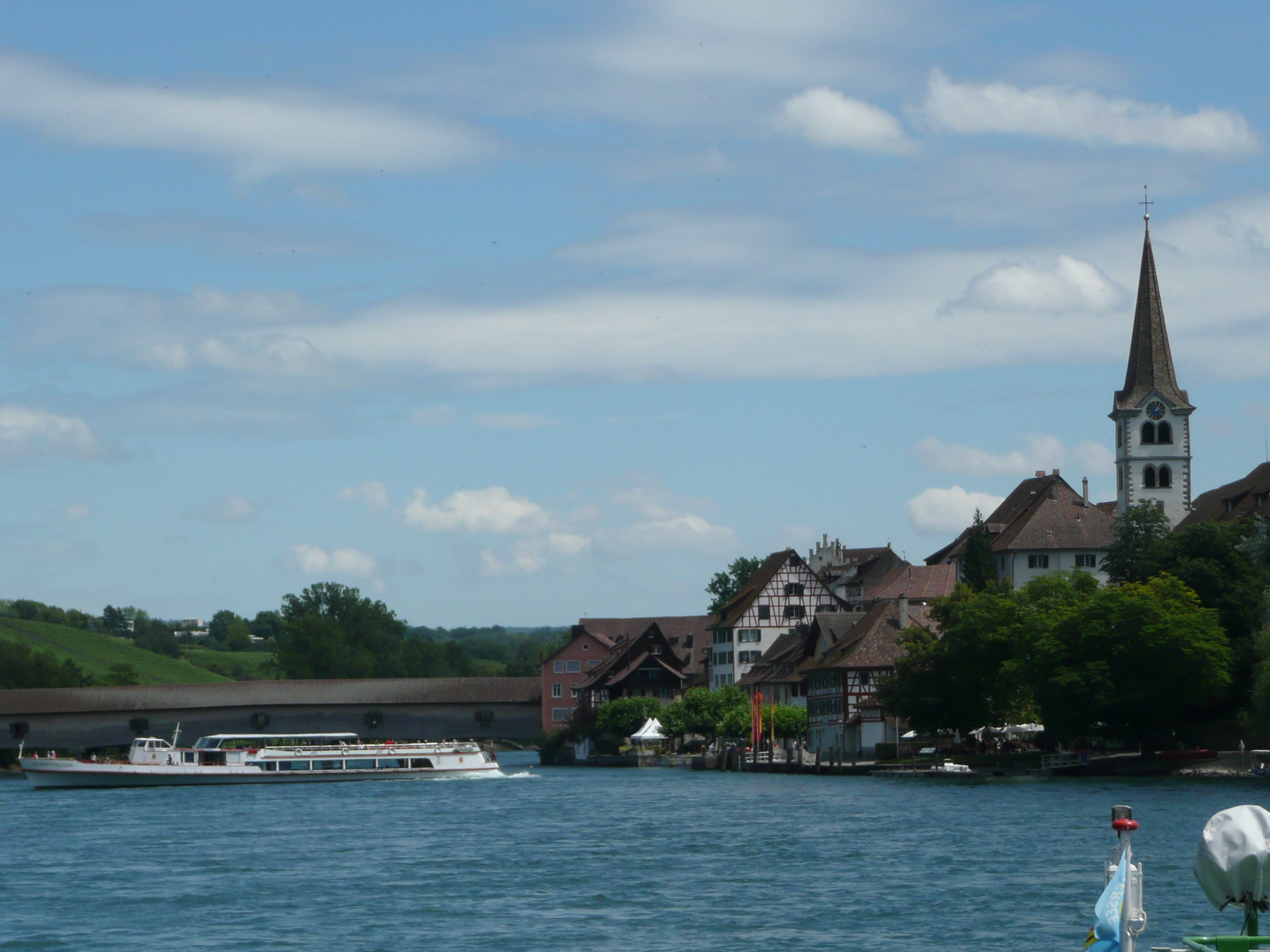
Several bridges cross the High Rhine, including a few historic ones. Examples are (in direction of waterflow): Eglisau railway bridge in Eglisau, Waldshut–Koblenz Rhine Bridge between Koblenz and Waldshut-Tiengen, the wooden bridge between Stein and Bad Säckingen or the Middle Bridge in Basel. The old wooden bridge between Gailingen and Diessenhofen is low so that during times when the water level of the river is high, large ships can no longer pass underneath it.
Important regions
Numerous areas along the High Rhine are currently, or were historically considered important. From west to east, they are Dinkelberg, Augstgau, Fricktal, Table Jura, Albgau, Aargau, Hotzenwald, Klettgau, Zurzibiet, Zürichgau, Hegau and Thurgau.
Transportation
Shipping
There are passenger boat lines on the lower High Rhine (Rheinfelden–Basel), between Eglisau and Ellikon am Rhein (municipality of Marthalen) and on the upper High Rhine and Untersee (URh navigation company: Schaffhausen–Konstanz). There are also boat tours between Eglisau and the Rhine Falls (Rheinfall), including the Rhine Falls Rock, and between the Rhine Falls and Rekingen.
Railway
The High Rhine Railway line follows the lower section of the river (between Basel Bad Bf and ) along its northern banks, but then runs further north to it in its upper section (except in Schaffhausen).
On the Swiss side, the river is followed by (from west to east) the Bözberg railway line (between and ) the Koblenz–Stein-Säckingen railway line (section between Laufenburg and Koblenz is closed to passenger trains), the Winterthur–Bülach–Koblenz railway line (between Koblenz and ), the Eglisau–Neuhausen railway line between and (briefly venturing through German territory crossing the Jestetter Point), the Rheinfall Railway line (between and ), and the Lake Line between Schaffhausen and .
The High Rhine is crossed by (from west to east) the Basel Connecting Line (between and Basel Bad Bf), the Turgi–Koblenz–Waldshut railway line between Koblenz and Waldshut, the Eglisau–Neuhausen railway line (between and ), the Rheinfall Railway line (between and Neuhausen), the Lake Line between and Schaffhausen, and the Etzwilen–Singen railway line (between and , used as a heritage railway only).
Notes
References
References
- "''Rheinkilometrierung'' [Rhine kilometrage]".
- "''Der Hochrhein'' [The High Rhine]".
- (2020-12-10). "Überblicksbericht der Flussgebietsgemeinschaft Rhein zur Bewirtschaftungsplanung nach Wasserrahmenrichtlinie für den 3. Bewirtschaftungszeitraum". FGG Rhein.
- Valenta, Reinhard. (1997). "Der Hochrhein". G. Braun.
- "Geology of Switzerland". Nagra.
- "High Rhine". ICPR – International Commission for the Protection of the Rhine.
- "Home".
- "''Schifffahrt Rheinfelden – Basel'' [Boat trip Rheinfelden–Basel]".
- "''SZR (Schifffahrtsgesellschaft Züri-Rhy)''".
- "''Schifffahrtsgesellschaft Untersee und Rhein (URh)'' [Boat trip Schaffhausen–Konstanz]".
- "''Schiffmändli''". Ernst Mändli AG.
This article was imported from Wikipedia and is available under the Creative Commons Attribution-ShareAlike 4.0 License. Content has been adapted to SurfDoc format. Original contributors can be found on the article history page.
Ask Mako anything about High Rhine — get instant answers, deeper analysis, and related topics.
Research with MakoFree with your Surf account
Create a free account to save articles, ask Mako questions, and organize your research.
Sign up freeThis content may have been generated or modified by AI. CloudSurf Software LLC is not responsible for the accuracy, completeness, or reliability of AI-generated content. Always verify important information from primary sources.
Report