From Surf Wiki (app.surf) — the open knowledge base
Henry County, Ohio
County in Ohio, United States
County in Ohio, United States
| Field | Value |
|---|---|
| county | Henry County |
| state | Ohio |
| flag | Flag of Henry County, Ohio.png |
| seal | Seal of Henry County Ohio.svg |
| founded year | 1834 |
| founded date | December 26 |
| seat wl | Napoleon |
| largest city | Napoleon |
| area_total_sq_mi | 420 |
| area_land_sq_mi | 416 |
| area_water_sq_mi | 3.7 |
| area percentage | 0.9% |
| census yr | 2020 |
| pop | 27662 |
| pop_est_as_of | 2024 |
| density_sq_mi | auto |
| time zone | Eastern |
| web | www.henrycountyohio.gov |
| ex image | Henry County Courthouse — Napoleon, Ohio (cropped).jpg |
| ex image size | 250 |
| ex image cap | Henry County Courthouse |
| named for | Patrick Henry |
| district | 5th |
Henry County is a county located in the U.S. state of Ohio. As of the 2020 census, the population was 27,662. Its county seat is Napoleon. The county was created in 1820 and later organized in 1834. It is named for American Founding Father Patrick Henry, the Virginian famous for his "give me liberty or give me death!" speech.
Geography
According to the U.S. Census Bureau, the county has a total area of 420 sqmi, of which 416 sqmi is land and 3.7 sqmi (0.9%) is water.
Adjacent counties
- Fulton County (north)
- Lucas County (northeast)
- Wood County (east)
- Putnam County (south)
- Defiance County (west)
- Williams County (northwest)
- Hancock County (southeast)
Demographics
|align-fn=center 1790-1960 1900-1990 1990-2000 2020
2020 census
As of the 2020 census, the county had a population of 27,662. The median age was 42.3 years. 23.3% of residents were under the age of 18 and 19.7% of residents were 65 years of age or older. For every 100 females there were 99.2 males, and for every 100 females age 18 and over there were 98.2 males age 18 and over.
The racial makeup of the county was 91.3% White, 0.6% Black or African American, 0.4% American Indian and Alaska Native, 0.5% Asian,
32.1% of residents lived in urban areas, while 67.9% lived in rural areas.
There were 11,262 households in the county, of which 28.9% had children under the age of 18 living in them. Of all households, 52.4% were married-couple households, 18.5% were households with a male householder and no spouse or partner present, and 22.6% were households with a female householder and no spouse or partner present. About 28.7% of all households were made up of individuals and 13.7% had someone living alone who was 65 years of age or older.
There were 12,036 housing units, of which 6.4% were vacant. Among occupied housing units, 80.2% were owner-occupied and 19.8% were renter-occupied. The homeowner vacancy rate was 1.0% and the rental vacancy rate was 5.0%.
Racial and ethnic composition
| Race / Ethnicity (NH = Non-Hispanic) | title=1980 Census of Population - General Social and Economic Characteristics - Ohio- Table 59 - Persons by Spanish Origin, Race, and Sex: 1980 AND Table 58 - Race by Sex: 1980 | url=https://www2.census.gov/library/publications/decennial/1980/volume-1/ohio/1980censusofpopu80137un_bw.pdf | website=United States Census Bureau | page=49-67 and 27-47}} | Pop 1990 | title=P004: Hispanic or Latino, and Not Hispanic or Latino by Race – 2000: DEC Summary File 1 – Henry County, Ohio | url=https://data.census.gov/table?g=050XX00US39069&tid=DECENNIALSF12000.P004 | website=United States Census Bureau | access-date= }} | title=P2: Hispanic or Latino, and Not Hispanic or Latino by Race – 2010: DEC Redistricting Data (PL 94-171) – Henry County, Ohio | url=https://data.census.gov/cedsci/table?q=p2&g=050XX00US39069&tid=DECENNIALPL2010.P2 | website=United States Census Bureau | access-date= }} | Pop 2020 | % 1980 | % 1990 | % 2000 | % 2010 | % 2020 |
|---|---|---|---|---|---|---|---|---|---|---|---|---|---|---|---|---|---|---|---|
| White alone (NH) | 26,952 | 27,487 | 27,151 | 25,861 | 24,463 | 94.96% | 94.43% | 92.95% | 91.66% | 88.44% | |||||||||
| Black or African American alone (NH) | 93 | 147 | 166 | 103 | 155 | 0.33% | 0.51% | 0.57% | 0.37% | 0.56% | |||||||||
| Native American or Alaska Native alone (NH) | 23 | 44 | 46 | 73 | 49 | 0.08% | 0.15% | 0.16% | 0.26% | 0.18% | |||||||||
| Asian alone (NH) | 44 | 87 | 124 | 103 | 125 | 0.16% | 0.30% | 0.42% | 0.37% | 0.45% | |||||||||
| Native Hawaiian or Pacific Islander alone (NH) | x | x | 0 | 0 | 4 | x | x | 0.00% | 0.00% | 0.01% | |||||||||
| Other race alone (NH) | 39 | 11 | 9 | 10 | 43 | 0.14% | 0.04% | 0.03% | 0.04% | 0.16% | |||||||||
| Mixed race or Multiracial (NH) | x | x | 138 | 205 | 636 | x | x | 0.47% | 0.73% | 2.30% | |||||||||
| Hispanic or Latino (any race) | 1,232 | 1,332 | 1,576 | 1,860 | 2,187 | 4.34% | 4.58% | 5.40% | 6.59% | 7.91% | |||||||||
| Total | 28,383 | 29,108 | 29,210 | 28,215 | 27,662 | 100.00% | 100.00% | 100.00% | 100.00% | 100.00% |
2010 census
As of the 2010 United States census, there were 28,215 people, 10,934 households, and 7,883 families living in the county.{{cite web |access-date=December 27, 2015 |archive-url=https://archive.today/20200213020100/http://factfinder.census.gov/bkmk/table/1.0/en/DEC/10_DP/DPDP1/0500000US39069 |archive-date=February 13, 2020 |url-status=dead |access-date=December 27, 2015 |archive-url=https://archive.today/20200213183519/http://factfinder.census.gov/bkmk/table/1.0/en/DEC/10_SF1/GCTPH1.CY07/0500000US39069 |archive-date=February 13, 2020 |url-status=dead |access-date=December 27, 2015 |archive-url=https://archive.today/20200213031944/http://factfinder.census.gov/bkmk/table/1.0/en/ACS/10_5YR/DP02/0500000US39069 |archive-date=February 13, 2020 |url-status=dead
Of the 10,934 households, 33.3% had children under the age of 18 living with them, 58.2% were married couples living together, 9.3% had a female householder with no husband present, 27.9% were non-families, and 23.7% of all households were made up of individuals. The average household size was 2.55 and the average family size was 2.99. The median age was 39.8 years.
The median income for a household in the county was $48,367 and the median income for a family was $58,587. Males had a median income of $44,953 versus $32,127 for females. The per capita income for the county was $22,638. About 8.0% of families and 10.6% of the population were below the poverty line, including 13.5% of those under age 18 and 5.9% of those age 65 or over.{{cite web |access-date=December 27, 2015 |archive-url=https://archive.today/20200213033908/http://factfinder.census.gov/bkmk/table/1.0/en/ACS/10_5YR/DP03/0500000US39069 |archive-date=February 13, 2020 |url-status=dead
2000 census
As of the census of 2000, there were 29,210 people, 10,935 households, and 7,960 families living in the county. The population density was 70 /mi2. There were 11,622 housing units at an average density of 28 /mi2. The racial makeup of the county was 95.33% White, 0.58% Black or African American, 0.26% Native American, 0.42% Asian, 2.56% from other races, and 0.85% from two or more races. 5.40% of the population were Hispanic or Latino of any race. 94.3% spoke English, 3.7% Spanish and 1.7% German as their first language.
There were 10,935 households, out of which 35.20% had children under the age of 18 living with them, 61.10% were married couples living together, 8.10% had a female householder with no husband present, and 27.20% were non-families. 23.50% of all households were made up of individuals, and 10.40% had someone living alone who was 65 years of age or older. The average household size was 2.62 and the average family size was 3.10.
In the county, the population was spread out, with 27.60% under the age of 18, 8.20% from 18 to 24, 28.10% from 25 to 44, 22.10% from 45 to 64, and 14.00% who were 65 years of age or older. The median age was 36 years. For every 100 females there were 97.60 males. For every 100 females age 18 and over, there were 93.60 males.
The median income for a household in the county was $42,657, and the median income for a family was $49,881. Males had a median income of $35,901 versus $24,076 for females. The per capita income for the county was $18,667. About 5.30% of families and 7.00% of the population were below the poverty line, including 9.90% of those under age 18 and 4.20% of those age 65 or over.
Politics
Prior to 1912, Henry County was a stronghold Democratic county in presidential elections. From 1912 to 1936, it was a bellwether county, but starting with the 1940 election, it has become a Republican stronghold with Lyndon B. Johnson in 1964 being the lone Democrat to win since then. |}
Government
Henry County has a three-member Board of County Commissioners that oversee the various county departments, similar to 85 of the other 88 Ohio counties. The county commissioners are Lori Siclair, Glenn Miller, and Robert Hastedt.
Transportation
Airport
Henry County Airport is a public use airport located 3 nautical miles (6 km) east of the central business district of Napoleon, Ohio. It is owned by the Henry County Airport Authority.
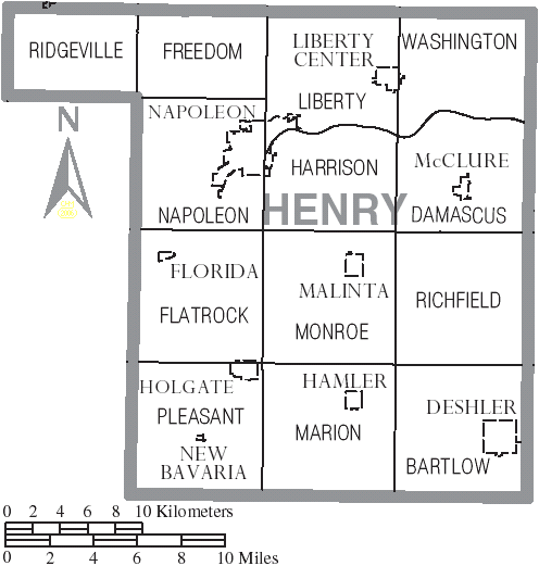
Communities
City
- Napoleon (county seat)
Villages
- Deshler
- Florida
- Hamler
- Holgate
- Liberty Center
- Malinta
- McClure
- New Bavaria
Townships
- Bartlow
- Damascus
- Flatrock
- Freedom
- Harrison
- Liberty
- Marion
- Monroe
- Napoleon
- Pleasant
- Richfield
- Ridgeville
- Washington
Census-designated place
- Ridgeville Corners
Unincorporated communities
- Colton
- Elery
- Gerald
- Grelton
- Okolona
- Pleasant Bend
- Texas
References
References
- [https://www.census.gov/library/visualizations/interactive/2020-population-and-housing-state-data.html 2020 census]
- "Find a County". National Association of Counties.
- (2007). "Ohio: Individual County Chronologies". The Newberry Library.
- Gannett, Henry. (1905). "The Origin of Certain Place Names in the United States". Govt. Print. Off..
- (August 22, 2012). "2010 Census Gazetteer Files". United States Census Bureau.
- "U.S. Decennial Census". United States Census Bureau.
- "Historical Census Browser". University of Virginia Library.
- (March 27, 1995). "Population of Counties by Decennial Census: 1900 to 1990". United States Census Bureau.
- (April 2, 2001). "Census 2000 PHC-T-4. Ranking Tables for Counties: 1990 and 2000". United States Census Bureau.
- (2021). "2020 Decennial Census Demographic Profile (DP1)".
- (2021). "2020 Decennial Census Redistricting Data (Public Law 94-171)".
- (2023). "2020 Decennial Census Demographic and Housing Characteristics (DHC)".
- "1980 Census of Population - General Social and Economic Characteristics - Ohio- Table 59 - Persons by Spanish Origin, Race, and Sex: 1980 AND Table 58 - Race by Sex: 1980".
- "1990 Census of Population - General Population Characteristics - Ohio: Table 6 - Race and Hispanic Origin".
- "P004: Hispanic or Latino, and Not Hispanic or Latino by Race – 2000: DEC Summary File 1 – Henry County, Ohio".
- "P2: Hispanic or Latino, and Not Hispanic or Latino by Race – 2010: DEC Redistricting Data (PL 94-171) – Henry County, Ohio".
- "P2: Hispanic or Latino, and Not Hispanic or Latino by Race – 2020: DEC Redistricting Data (PL 94-171) – Henry County, Ohio".
- included in the Asian category in the 1980 Census
- included in the Asian category in the 1990 Census
- not an option in the 1980 Census
- not an option in the 1990 Census
- "U.S. Census website". [[United States Census Bureau]].
- "Henry County Election Results".
- (November 5, 2024). "2024 Senate Election (Official Returns)".
- "Board of County Commissioners". Henry County Ohio Homepage.
- {{FAA-airport
This article was imported from Wikipedia and is available under the Creative Commons Attribution-ShareAlike 4.0 License. Content has been adapted to SurfDoc format. Original contributors can be found on the article history page.
Ask Mako anything about Henry County, Ohio — get instant answers, deeper analysis, and related topics.
Research with MakoFree with your Surf account
Create a free account to save articles, ask Mako questions, and organize your research.
Sign up freeThis content may have been generated or modified by AI. CloudSurf Software LLC is not responsible for the accuracy, completeness, or reliability of AI-generated content. Always verify important information from primary sources.
Report