From Surf Wiki (app.surf) — the open knowledge base
Haysville, Kansas
City in Sedgwick County, Kansas
City in Sedgwick County, Kansas
| Field | Value |
|---|---|
| name | Haysville, Kansas |
| settlement_type | City |
| image_flag | Flag of Haysville, Kansas.svg |
| image_map | Sedgwick_County_Kansas_Incorporated_and_Unincorporated_areas_Haysville_Highlighted.svg |
| map_caption | Location within Sedgwick County and Kansas |
| image_map1 | Map of Sedgwick Co, Ks, USA.png |
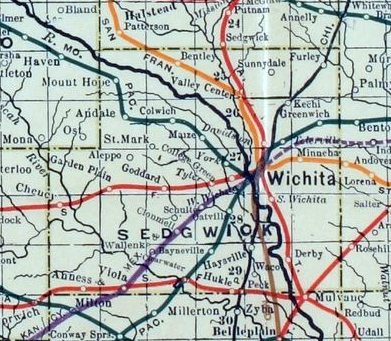
| map_caption1 | KDOT map of Sedgwick County (legend) |
| coordinates_footnotes | |
| coordinates | |
| subdivision_type | Country |
| subdivision_name | United States |
| subdivision_type1 | State |
| subdivision_name1 | Kansas |
| subdivision_type2 | County |
| subdivision_name2 | Sedgwick |
| subdivision_type3 | Township |
| established_title | Founded |
| established_date | 1891 |
| established_title1 | Platted |
| established_date1 | 1891 |
| established_title2 | Incorporated |
| established_date2 | 1951 |
| named_for | W.W. Hays |
| government_type | Mayor–Council |
| leader_title | Mayor |
| leader_name | Russ Kessler |
| leader_title1 | |
| area_footnotes | |
| area_total_sq_mi | 4.66 |
| area_land_sq_mi | 4.65 |
| area_water_sq_mi | 0.01 |
| area_total_km2 | 12.06 |
| area_land_km2 | 12.04 |
| area_water_km2 | 0.03 |
| unit_pref | Imperial |
| elevation_footnotes | |
| elevation_ft | 1260 |
| population_footnotes | |
| population_as_of | 2020 |
| population_total | 11262 |
| population_density_sq_mi | auto |
| population_density_km2 | auto |
| timezone | CST |
| utc_offset | -6 |
| timezone_DST | CDT |
| utc_offset_DST | -5 |
| postal_code_type | ZIP code |
| postal_code | 67060 |
| area_code_type | Area code |
| area_code | 316 |
| blank_name | FIPS code |
| blank_info | 20-31125 |
| blank1_name | GNIS ID |
| blank1_info | 481653 |
| website |
Haysville is a city in Sedgwick County, Kansas, United States, and a southern suburb of Wichita. As of the 2020 census, the population of the city was 11,262. Haysville was known as the "Peach Capital of Kansas".
History
W.W. Hays came to this area in the early 1870s. In 1891, he platted land that he owned so a town could be built. The Haysville State Bank was established in 1919. Truck farming supported a lot of the families in the area. In 1874 a grist mill was built on the bank of the Cowskin to process corn that was harvested in the area. Haysville's first school was built in 1876 at a location that may have been near what are now the Water Department facilities.
In 1887, the Chicago, Kansas and Nebraska Railway Company built a branch line north–south from Herington through Haysville to Caldwell. It was renamed in 1891 to Chicago, Rock Island and Pacific Railway which shut down in 1980, renamed in 1980 to Oklahoma, Kansas and Texas Railroad, merged in 1988 to Missouri Pacific Railroad, merged in 1997 to the current Union Pacific Railroad. Most locals still refer to this railroad as the "Rock Island". In 1903, a depot was opened and passenger trains shuttled people to and from Wichita.
On May 3, 1999, a tornado rated F4 on the Fujita scale struck Haysville, killing four people. Damage to structures included 150 homes and 27 businesses. The tornado continued into Wichita causing damage to the south side of the city, killing an additional two people in Wichita. All of Haysville's historic district was destroyed. The only thing left standing on the east side of Main Street was the original bank vault.
Geography
Haysville is located at (37.563787, -97.353044). According to the United States Census Bureau, the city has a total area of 4.62 sqmi, of which 4.61 sqmi is land and 0.01 sqmi is water.
Demographics
| align-fn = center 2010-2020 Haysville is part of the Wichita, KS Metropolitan Statistical Area.
2020 census
The 2020 United States census counted 11,262 people, 4,133 households, and 2,988 families in Haysville. The racial makeup was 84.64% (9,532) white or European American (81.81% non-Hispanic white), 0.99% (111) black or African-American, 1.47% (166) Native American or Alaska Native, 1.36% (153) Asian, 0.08% (9) Pacific Islander or Native Hawaiian, 1.74% (196) from other races, and 9.72% (1,095) from two or more races. Hispanic or Latino of any race was 7.49% (844) of the population.
Of the 4,133 households, 39.0% had children under the age of 18; 49.5% were married couples living together; 27.6% had a female householder with no spouse or partner present. 23.3% of households consisted of individuals and 10.8% had someone living alone who was 65 years of age or older. The percent of those with a bachelor's degree or higher was estimated to be 11.8% of the population.
28.9% of the population was under the age of 18, 8.2% from 18 to 24, 26.8% from 25 to 44, 21.7% from 45 to 64, and 14.4% who were 65 years of age or older. The median age was 34.8 years. For every 100 females, there were 106.5 males. For every 100 females ages 18 and older, there were 109.6 males.
The 2016-2020 5-year American Community Survey estimates show that the median household income was $54,982 (with a margin of error of +/- $7,358) and the median family income was $70,035 (+/- $10,246). Males had a median income of $42,998 (+/- $5,357) versus $27,050 (+/- $3,326) for females. The median income for those above 16 years old was $34,131 (+/- $5,149). Approximately, 3.4% of families and 10.0% of the population were below the poverty line, including 5.2% of those under the age of 18 and 21.9% of those ages 65 or over.
2010 census
As of the census of 2010, there were 10,826 people, 3,857 households, and 2,932 families living in the city. The population density was 2348.4 PD/sqmi. There were 4,087 housing units at an average density of 886.6 /sqmi. The racial makeup of the city was 92.7% White, 0.6% African American, 1.2% Native American, 0.9% Asian, 1.2% from other races, and 3.5% from two or more races. Hispanic or Latino of any race were 4.6% of the population.
There were 3,857 households, of which 44.0% had children under the age of 18 living with them, 56.0% were married couples living together, 13.9% had a female householder with no husband present, 6.2% had a male householder with no wife present, and 24.0% were non-families. 20.7% of all households were made up of individuals, and 9.8% had someone living alone who was 65 years of age or older. The average household size was 2.78 and the average family size was 3.20.
The median age in the city was 32.8 years. 30.4% of residents were under the age of 18; 8.8% were between the ages of 18 and 24; 26.9% were from 25 to 44; 21.7% were from 45 to 64; and 12.1% were 65 years of age or older. The gender makeup of the city was 48.0% male and 52.0% female.
Economics
- Norland Plastics
Area Events
- Haysville Fall Festival. The annual three-day event takes place in and around Riggs Park. The Fall Festival celebrates its 30th year on October 17–19 in 2014.
- Village Christmas. Each year in the beginning of December. Celebrated in the Historic District of Haysville. Hot cocoa, carriage rides, choir performances, Santa, and more.
- Community Expo is held in April at the Haysville Community Library or Haysville Activity Center (HAC).
- Springnanigans is a festival for kids held in May in the Haysville Historic District.
- Fourth of July Celebration is held in Riggs Park. Fireworks show in the evening.
Government
The Haysville government consists of a mayor and eight council members. The council meets the 2nd Monday of each month at 7PM.
- City Hall, 200 W Grand.
Education
Haysville is served by Haysville USD 261 public school district.
Public schools:
- Campus High School, located in Wichita, but serves as the High School of Haysville, Kansas USD 261.
- Haysville High School (formerly Haysville Alternative High School) also serves Haysville teens
- Haysville Middle School
- Haysville West Middle School
- Freeman Elementary
- Nelson Elementary
- Oatville Elementary
- Prairie Elementary
- Rex Elementary
- Ruth Clark Elementary
- Tri-City Day School
Transportation
The Chicago, Rock Island and Pacific Railroad formerly provided passenger rail service to Haysville on their mainline from Minneapolis to Houston until at least 1951. As of 2025, the nearest passenger rail station is located in Newton, where Amtrak's Southwest Chief stops once daily on a route from Chicago to Los Angeles.
References
References
- "2019 U.S. Gazetteer Files". United States Census Bureau.
- {{cite gnis2. 481653. Haysville, Kansas
- "Profile of Haysville, Kansas in 2020". United States Census Bureau.
- "QuickFacts; Haysville, Kansas; Population, Census, 2020 & 2010". United States Census Bureau.
- Brackman, Barbara. (1997). "Kansas Trivia". Thomas Nelson Inc..
- [http://www.haysvilleonline.com/hol/archives/669-A-Brief-History-Of-Haysville-With-Photos.html Brief History Of Haysville With Photos] {{webarchive. link. (2012-11-02)
- [http://haysvilleonline.com/hol/archives/669-A-Brief-History-Of-Haysville-With-Photos.html A Brief History Of Haysville With Photos] {{webarchive. link. (2015-02-01)
- "Rock Island Rail History".
- "Info on the May 3rd 1999 Haysville tornado". National Weather Service.
- (2021-07-08). "Friday: Haysville". KSN-TV.
- (2011-02-12). "US Gazetteer files: 2010, 2000, and 1990". [[United States Census Bureau]].
- "US Gazetteer files 2010". [[United States Census Bureau]].
- "Annual Estimates of the Resident Population for Counties: April 1, 2020 to July 1, 2023". United States Census Bureau.
- "US Census Bureau, Table P16: HOUSEHOLD TYPE".
- "US Census Bureau, Table DP1: PROFILE OF GENERAL POPULATION AND HOUSING CHARACTERISTICS".
- "Gazetteer Files".
- "US Census Bureau, Table P1: RACE".
- "US Census Bureau, Table P2: HISPANIC OR LATINO, AND NOT HISPANIC OR LATINO BY RACE".
- "US Census Bureau, Table S1501: EDUCATIONAL ATTAINMENT".
- "US Census Bureau, Table S1903: MEDIAN INCOME IN THE PAST 12 MONTHS (IN 2020 INFLATION-ADJUSTED DOLLARS)".
- "US Census Bureau, Table S2001: EARNINGS IN THE PAST 12 MONTHS (IN 2020 INFLATION-ADJUSTED DOLLARS)".
- "US Census Bureau, Table S1701: POVERTY STATUS IN THE PAST 12 MONTHS".
- "US Census Bureau, Table S1702: POVERTY STATUS IN THE PAST 12 MONTHS OF FAMILIES".
- "U.S. Census website". [[United States Census Bureau]].
- (April 2020}}{{cbignore). "2010 City Population and Housing Occupancy Status". U.S. Census Bureau.
- [http://HaysvilleFallFestival.com/ Haysville Fall Festival]
- [http://www.haysvilleonline.com/hol/categories/16-Events Haysville Annual Events] {{webarchive. link. (2012-04-26)
- link. (2011-05-05)
- "Rock Island 1951 Timetable".
- "Amtrak Southwest Chief".
This article was imported from Wikipedia and is available under the Creative Commons Attribution-ShareAlike 4.0 License. Content has been adapted to SurfDoc format. Original contributors can be found on the article history page.
Ask Mako anything about Haysville, Kansas — get instant answers, deeper analysis, and related topics.
Research with MakoFree with your Surf account
Create a free account to save articles, ask Mako questions, and organize your research.
Sign up freeThis content may have been generated or modified by AI. CloudSurf Software LLC is not responsible for the accuracy, completeness, or reliability of AI-generated content. Always verify important information from primary sources.
Report