From Surf Wiki (app.surf) — the open knowledge base
Harghita County
County of Romania

County of Romania
| Field | Value | |
|---|---|---|
| <!-- See Template:Infobox settlement for additional fields and descriptions --> | official_name | Harghita County |
| native_name | Județul Harghita | |
| other_name | Hargita megye | |
| settlement_type | County | |
| image_skyline | Jud Harghita.jpg | |
| image_flag | Flag of Harghita County.gif | |
| image_shield | [[File:Stema Harghita.svg | 75px]] |
| image_map | Harghita in Romania.svg | |
| map_caption | Harghita county, territorial location | |
| subdivision_type | Country | |
| subdivision_name | ||
| subdivision_type1 | Development region1 | |
| subdivision_name1 | Centru | |
| subdivision_type2 | Historic region | |
| subdivision_name2 | Transylvania | |
| subdivision_type3 | Capital city (Reședință de județ) | |
| subdivision_name3 | Miercurea Ciuc | |
| government_type | County Council | |
| leader_party | RMDSZ | |
| leader_title | President of the County Council | |
| leader_name | ||
| leader_title1 | Prefect2 | |
| leader_name1 | ||
| area_total_km2 | 6639 | |
| area_rank | 13th in Romania | |
| population_total | ||
| population_as_of | ||
| population_footnotes | ||
| population_rank | 33rd in Romania | |
| population_density_km2 | 46 | |
| timezone | EET | |
| utc_offset | +2 | |
| timezone_DST | EEST | |
| utc_offset_DST | +3 | |
| postal_code_type | Postal Code | |
| postal_code | 53wxyz3 | |
| area_code | +40 x664 | |
| blank_name | Car Plates | |
| blank_info | HR5 | |
| blank1_name | GDP | |
| blank1_info | US$4.450 billion (2025) | |
| blank2_name | GDP per capita | |
| blank2_info | US$15,242 (2025) | |
| footnotes | 1The developing regions of Romania have no administrative role. They were formed just to attract funds from the European Union | |
| 2 as of 2007, the Prefect is not a politician, but a public functionary. The Prefect is not allowed to be a member of a political party, and is banned from having any political activity in the first six months after the resignation (or exclusion) from the public functionary corps | ||
| 3w, x, y, and z are digits that indicate the city, the street, part of the street, or even the building of the address | ||
| 4x is a digit indicating the operator: 2 for the former national operator, Romtelecom, and 3 for the other ground telephone networks | ||
| 5used on both the plates of the vehicles that operate only in the county limits (like utility vehicles, ATVs, etc.), and the ones used outside the county | ||
| website | County Council | |
| County Prefecture |
2 as of 2007, the Prefect is not a politician, but a public functionary. The Prefect is not allowed to be a member of a political party, and is banned from having any political activity in the first six months after the resignation (or exclusion) from the public functionary corps 3w, x, y, and z are digits that indicate the city, the street, part of the street, or even the building of the address 4x is a digit indicating the operator: 2 for the former national operator, Romtelecom, and 3 for the other ground telephone networks 5used on both the plates of the vehicles that operate only in the county limits (like utility vehicles, ATVs, etc.), and the ones used outside the county County Prefecture
Harghita County (, and , ) is a county (județ) in the center of Romania, in eastern Transylvania, with the county seat at Miercurea Ciuc.
Demographics
2002 census
In 2002, Harghita County had a population of 326,222 and a population density of 52/km2.
- Hungarians – 84.62% (or 276,038)
- Romanians – 14.06% (or 45,870)
- Romani – 1.18% (or 3,835)
- Others – 0.14%
2011 census
In 2011, it had a population of 302,432 and a population density of 46/km2.
- Hungarians – 85.21% (or 257,707)
- Romanians – 12.96% (or 39,196)
- Romani
- Others – 1.76% (or 5,326).
2021 census
In 2021, it had a population of 291,950, and a population density of 43/km2.
- Hungarians – 85.67% (or 232,157)
- Romanians – 12.41% (or 33,634)
- Romani - 1.82% (or 4,928)
- Others – 0.1% (or 282).
Harghita county has the highest percentage of Hungarians in Romania, just ahead of Covasna county. The Hungarians form the majority of the population in most of the county's municipalities, with Romanians concentrated in the northern and eastern part of the county (particularly Toplița and Bălan), as well as in the enclave of Voșlăbeni.
The Székelys of Harghita are mostly Roman Catholic, with Reformed and Unitarian minorities, while the ethnic Romanians are primarily Orthodox. Catholicism is strongest in the east, in the former Csíkszék, while Protestants are concentrated in the south and west of Odorheiu Secuiesc. By religion, the county is divided roughly as follows:
- Roman Catholic (65%)
- Orthodox (13%)
- Reformed (13%)
- Unitarian (7%)
- Other (2%)
|graph-pos=right |1930|250194 |1948|258495 |1956|273964 |1966|282392 |1977|326310 |1992|347637 |2002|326222 |2011|304969 |2021|291950
Geography
Harghita County has a total area of 6,639 km2.
Harghita consists primarily of mountains, connected to the Eastern Carpathians, such as the Ciuc and Harghita Mountains; volcanic plateaux, foothills, and the more densely populated river valleys.
The mountains are volcanic in origin, and the region is known for its excellent hot mineral springs. Harghita is known as one of the coldest regions in Romania, although summers can be quite warm.
It is in this county that two of the most important rivers in Romania, the Mureș and the Olt, originate. These rivers' origins, near the villages of Izvoru Mureșului and Sândominic, are only a few miles apart; yet the Mureș flows west to the Tisza, while the Olt flows south to the Danube. In the western part of the county the two Târnava rivers (Târnava Mare and Târnava Mică) flow to the Târnava Plateau, which is part of the Transylvanian Plateau.
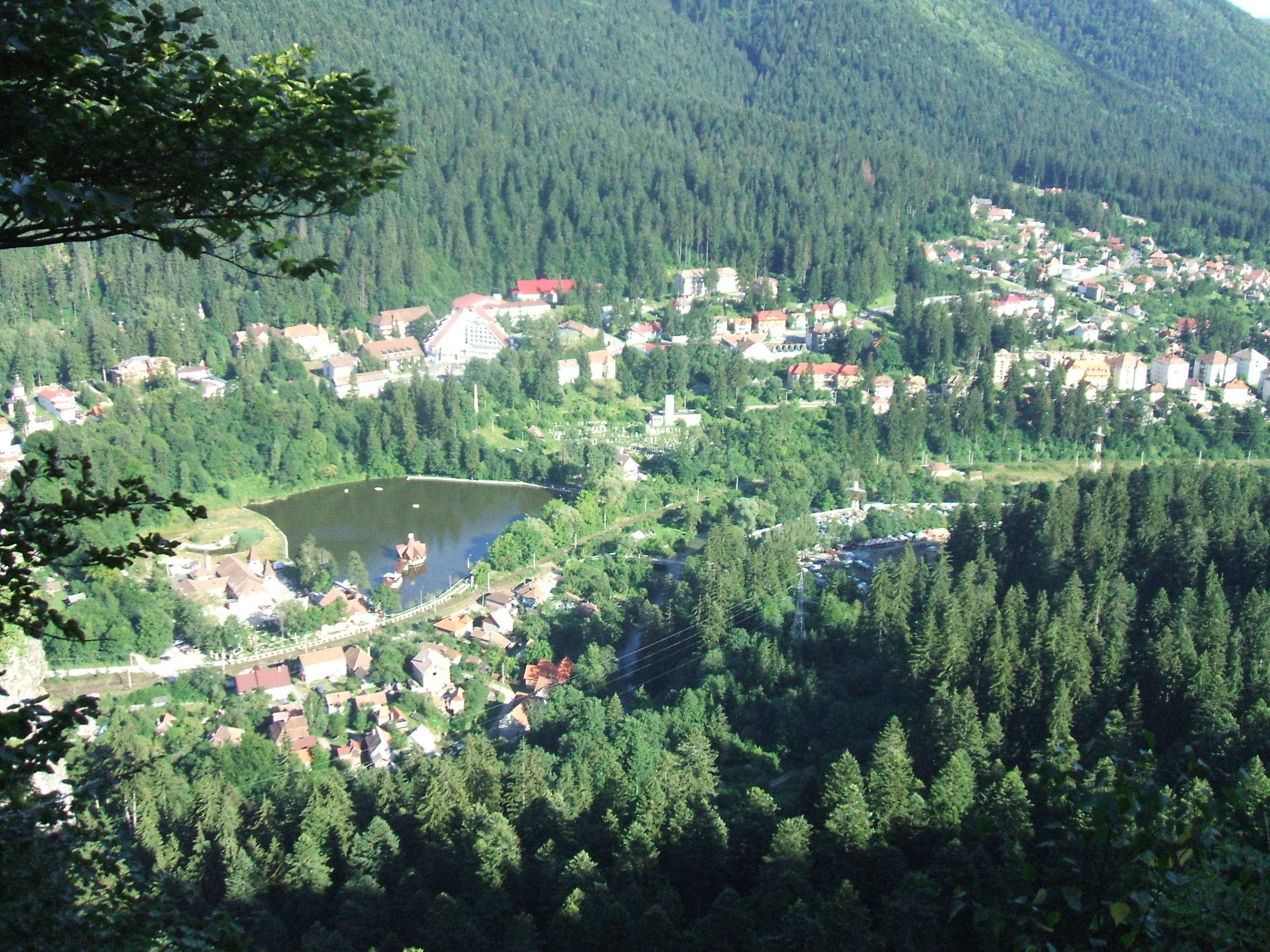
Harghita's spectacular natural scenery includes Sfânta Ana Lake, a volcanic crater lake near the town of Băile Tușnad; Lacul Roșu a mountain lake in the northeast near the town of Gheorgheni, and Cheile Bicazului, a dramatic, narrow canyon formed by the Bicaz stream. The county is renowned for its spa resorts and mineral waters.
Neighbours
- Neamț County and Bacău County to the East.
- Mureș County to the West.
- Suceava County to the North.
- Brașov County and Covasna County to the South.
Economy
The county's main industries:
- Wood industry – up to 30%;
- Foods and beverages industry;
- Textile and leather processing;
- Mechanical components.
Tourism
The main tourist attractions in Harghita county are
- The cities of Miercurea Ciuc, Odorheiu Secuiesc, Gheorgheni, Toplița.
- The mountain resorts of
- Băile Tușnad
- Borsec
- Lacul Roșu
- Izvorul Mureşului
- Harghita Băi
- Lake Sfânta Ana (crater lake)
- The Via Transilvanica long-distance hiking and biking trail, which crosses the county
Politics
The Harghita County Council, renewed at the 2024 local elections, consists of 30 councilors, with the following party composition:
| Party | Seats | Current Council | |
|---|---|---|---|
| Democratic Alliance of Hungarians in Romania (UDMR/RMDSZ) | 23 | ||
| Hungarian Alliance Of Transylvania | 4 | ||
| Social Democratic Party (PSD) | 2 | ||
| National Liberal Party (PNL) | 2 |
Administrative divisions

Harghita County has 4 municipalities, 5 towns and 58 communes
- Municipalities
- Gheorgheni
- Miercurea Ciuc – county seat; population: 37,980 (as of 2011)
- Odorheiu Secuiesc
- Toplița
- Towns
- Băile Tușnad
- Bălan
- Borsec
- Cristuru Secuiesc
- Vlăhița
- Communes
- Atid
- Avrămești
- Bilbor
- Brădești
- Căpâlnița
- Cârța
- Ciceu
- Ciucsângeorgiu
- Ciumani
- Corbu
- Corund
- Cozmeni
- Dănești
- Dârjiu
- Dealu
- Ditrău
- Feliceni
- Frumoasa
- Gălăutaș
- Joseni
- Lăzarea
- Leliceni
- Lueta
- Lunca de Jos
- Lunca de Sus
- Lupeni
- Mădăraș
- Mărtiniș
- Merești
- Mihăileni
- Mugeni
- Ocland
- Păuleni-Ciuc
- Plăieșii de Jos
- Porumbeni
- Praid
- Racu
- Remetea
- Săcel
- Sâncrăieni
- Sândominic
- Sânmartin
- Sânsimion
- Sântimbru
- Sărmaș
- Satu Mare
- Secuieni
- Siculeni
- Șimonești
- Subcetate
- Suseni
- Tomești
- Tulgheș
- Tușnad
- Ulieș
- Vărșag
- Voșlăbeni
- Zetea
References
References
- National Institute of Statistics, ''[http://www.insse.ro/rpl2002rezgen/18.pdf "Populația la recensămintele din anii 1948, 1956, 1966, 1977, 1992 și 2002"] {{Webarchive. link. (22 September 2006 '')
- National Institute of Statistics, ''[http://www.recensamant.ro/pagini/tabele/t40a.pdf "Populația după etnie"] {{webarchive. link. (16 August 2009 '' ("Population by ethnicity"))
- National Institute of Statistics, ''[http://www.harghita.insse.ro/phpfiles/Comunicat_DATE_PROVIZORII_RPL_2011_JUD_HR.pdf]{{dead link. (October 2017)
- "Recensamantul Populatiei si Locuintelor 2011: Populația stabilă după etnie – județe, municipii, orașe, comune".
- "Consiliul Județean Harghita".
This article was imported from Wikipedia and is available under the Creative Commons Attribution-ShareAlike 4.0 License. Content has been adapted to SurfDoc format. Original contributors can be found on the article history page.
Ask Mako anything about Harghita County — get instant answers, deeper analysis, and related topics.
Research with MakoFree with your Surf account
Create a free account to save articles, ask Mako questions, and organize your research.
Sign up freeThis content may have been generated or modified by AI. CloudSurf Software LLC is not responsible for the accuracy, completeness, or reliability of AI-generated content. Always verify important information from primary sources.
Report