From Surf Wiki (app.surf) — the open knowledge base
Hancock County, Ohio
County in Ohio, United States
County in Ohio, United States
| Field | Value |
|---|---|
| county | Hancock County |
| state | Ohio |
| flag | Hancock_County%2C_Ohio%2Cflag.svg |
| seal | Seal of Hancock County (Ohio).svg |
| founded year | 1828 |
| founded date | March 1 |
| seat wl | Findlay |
| largest city | Findlay |
| area_total_sq_mi | 534 |
| area_land_sq_mi | 531 |
| area_water_sq_mi | 2.3 |
| area percentage | 0.4% |
| census yr | 2020 |
| pop | 74920 |
| pop_est_as_of | 2024 |
| density_sq_mi | auto |
| time zone | Eastern |
| web | www.co.hancock.oh.us |
| named for | John Hancock |
| ex image | Hancock County Courthouse in downtown Findlay, Ohio.jpg |
| ex image cap | The Hancock County Courthouse in Findlay |
| district | 5th |
Hancock County is a county located in the U.S. state of Ohio. As of the 2020 census, the population was 74,920. Its county seat and largest city is Findlay. The county was created in 1820 and later organized in 1828. It was named for John Hancock, the first signer of the Declaration of Independence. Hancock County comprises the Findlay, Ohio Micropolitan Statistical Area.
History
Hancock County was established on January 21, 1828, by the Ohio General Assembly from the southern portions of Wood County. Originally containing only Findlay Township, the county would add Amanda and Welfare (now Delaware) townships later in April of that year. Additional townships were laid out as follows: Jackson in 1829; Liberty and Marion in December 1830; Big Lick, Blanchard, and Van Buren in 1831; Washington, Union, and Eagle in 1832; Cass and Portage in 1833; Pleasant in 1835; Orange in 1836; Madison in 1840, and finally Allen in 1850. Originally nearly 24 miles square, Hancock County would lose some of its southeast portion in 1845 to the new Wyandot County.
Geography
According to the U.S. Census Bureau, the county has a total area of 534 sqmi, of which 531 sqmi is land and 2.3 sqmi (0.4%) is water.
Adjacent counties
- Wood County (north)
- Seneca County (northeast)
- Wyandot County (southeast)
- Hardin County (south)
- Allen County (southwest)
- Putnam County (west)
- Henry County (northwest)
Demographics
|align-fn=center 1790–1960 1900–1990 1990–2000 2020
2020 census
As of the 2020 census, the county had a population of 74,920. The median age was 40.3 years. 22.0% of residents were under the age of 18 and 18.6% of residents were 65 years of age or older. For every 100 females there were 96.5 males, and for every 100 females age 18 and over there were 94.3 males age 18 and over.
The racial makeup of the county was 88.9% White, 1.9% Black or African American, 0.2% American Indian and Alaska Native, 1.9% Asian,
68.2% of residents lived in urban areas, while 31.8% lived in rural areas.
There were 31,107 households in the county, of which 27.2% had children under the age of 18 living in them. Of all households, 48.5% were married-couple households, 19.3% were households with a male householder and no spouse or partner present, and 25.0% were households with a female householder and no spouse or partner present. About 30.8% of all households were made up of individuals and 12.4% had someone living alone who was 65 years of age or older.
There were 33,655 housing units, of which 7.6% were vacant. Among occupied housing units, 70.2% were owner-occupied and 29.8% were renter-occupied. The homeowner vacancy rate was 1.5% and the rental vacancy rate was 10.2%.
Racial and ethnic composition
| Race / Ethnicity (NH = Non-Hispanic) | title=1980 Census of Population - General Social and Economic Characteristics - Ohio- Table 59 - Persons by Spanish Origin, Race, and Sex: 1980 AND Table 58 - Race by Sex: 1980 | url=https://www2.census.gov/library/publications/decennial/1980/volume-1/ohio/1980censusofpopu80137un_bw.pdf | website=United States Census Bureau | page=49-67 and 27-47}} | Pop 1990 | title=P004: Hispanic or Latino, and Not Hispanic or Latino by Race – 2000: DEC Summary File 1 – Hancock County, Ohio | url=https://data.census.gov/table?g=050XX00US39063&tid=DECENNIALSF12000.P004 | website=United States Census Bureau | access-date= }} | title=P2: Hispanic or Latino, and Not Hispanic or Latino by Race – 2010: DEC Redistricting Data (PL 94-171) – Hancock County, Ohio | url=https://data.census.gov/cedsci/table?q=p2&g=050XX00US39063&tid=DECENNIALPL2010.P2 | website=United States Census Bureau | access-date= }} | Pop 2020 | % 1980 | % 1990 | % 2000 | % 2010 | % 2020 |
|---|---|---|---|---|---|---|---|---|---|---|---|---|---|---|---|---|---|---|---|
| White alone (NH) | 62,299 | 62,808 | 66,733 | 67,888 | 65,107 | 96.47% | 95.84% | 93.60% | 90.78% | 86.90% | |||||||||
| Black or African American alone (NH) | 510 | 562 | 756 | 1,084 | 1,363 | 0.79% | 0.86% | 1.06% | 1.45% | 1.82% | |||||||||
| Native American or Alaska Native alone (NH) | 62 | 81 | 119 | 127 | 79 | 0.10% | 0.12% | 0.17% | 0.17% | 0.11% | |||||||||
| Asian alone (NH) | 191 | 383 | 865 | 1,258 | 1,393 | 0.30% | 0.58% | 1.21% | 1.68% | 1.86% | |||||||||
| Native Hawaiian or Pacific Islander alone (NH) | x | x | 11 | 11 | 26 | x | x | 0.02% | 0.01% | 0.03% | |||||||||
| Other race alone (NH) | 87 | 22 | 45 | 68 | 220 | 0.13% | 0.03% | 0.06% | 0.09% | 0.29% | |||||||||
| Mixed race or Multiracial (NH) | x | x | 579 | 983 | 2,534 | x | x | 0.81% | 1.31% | 3.38% | |||||||||
| Hispanic or Latino (any race) | 1,432 | 1,680 | 2,187 | 3,363 | 4,198 | 2.22% | 2.56% | 3.07% | 4.50% | 5.60% | |||||||||
| Total | 64,581 | 65,536 | 71,295 | 74,782 | 74,920 | 100.00% | 100.00% | 100.00% | 100.00% | 100.00% |
2010 census
As of the 2010 United States census, there were 74,782 people, 30,197 households, and 19,884 families living in the county.{{cite web |access-date=December 27, 2015 |archive-url=https://archive.today/20200213014236/http://factfinder.census.gov/bkmk/table/1.0/en/DEC/10_DP/DPDP1/0500000US39063 |archive-date=February 13, 2020 |url-status=dead |access-date=December 27, 2015 |archive-url=https://archive.today/20200213192255/http://factfinder.census.gov/bkmk/table/1.0/en/DEC/10_SF1/GCTPH1.CY07/0500000US39063 |archive-date=February 13, 2020 |url-status=dead |access-date=December 27, 2015 |archive-url=https://archive.today/20200213023301/http://factfinder.census.gov/bkmk/table/1.0/en/ACS/10_5YR/DP02/0500000US39063 |archive-date=February 13, 2020 |url-status=dead
Of the 30,197 households, 30.7% had children under the age of 18 living with them, 51.3% were married couples living together, 10.0% had a female householder with no husband present, 34.2% were non-families, and 27.9% of all households were made up of individuals. The average household size was 2.42 and the average family size was 2.94. The median age was 38.5 years.
The median income for a household in the county was $49,070 and the median income for a family was $59,600. Males had a median income of $42,479 versus $31,631 for females. The per capita income for the county was $25,158. About 8.5% of families and 11.4% of the population were below the poverty line, including 15.2% of those under age 18 and 5.7% of those age 65 or over.{{cite web |access-date=December 27, 2015 |archive-url=https://archive.today/20200213022303/http://factfinder.census.gov/bkmk/table/1.0/en/ACS/10_5YR/DP03/0500000US39063 |archive-date=February 13, 2020 |url-status=dead
2000 census
As of the census of 2000, there were 71,295 people, 27,898 households, and 19,138 families living in the county. The population density was 134 PD/sqmi. There were 29,785 housing units at an average density of 56 /mi2. The racial makeup of the county was 95.14% White, 1.11% Black or African American, 0.18% Native American, 1.22% Asian, 0.02% Pacific Islander, 1.22% from other races, and 1.12% from two or more races. 3.07% of the population were Hispanic or Latino of any race.
There were 27,898 households, out of which 32.60% had children under the age of 18 living with them, 56.40% were married couples living together, 8.70% had a female householder with no husband present, and 31.40% were non-families. 26.00% of all households were made up of individuals, and 9.80% had someone living alone who was 65 years of age or older. The average household size was 2.49 and the average family size was 3.01.
In the county, the population was spread out, with 25.70% under the age of 18, 9.70% from 18 to 24, 28.70% from 25 to 44, 22.60% from 45 to 64, and 13.20% who were 65 years of age or older. The median age was 36 years. For every 100 females there were 94.30 males. For every 100 females age 18 and over, there were 91.20 males.
The median income for a household in the county was $43,856, and the median income for a family was $51,490. Males had a median income of $37,139 versus $24,374 for females. The per capita income for the county was $20,991. About 5.20% of families and 7.50% of the population were below the poverty line, including 8.80% of those under age 18 and 6.10% of those age 65 or over.
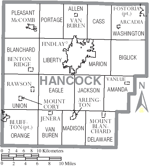
Communities
Cities
- Findlay (county seat)
- Fostoria
Villages
- Arcadia
- Arlington
- Benton Ridge
- Bluffton
- Jenera
- McComb
- Mount Blanchard
- Mount Cory
- Rawson
- Van Buren
- Vanlue
Townships
- Allen
- Amanda
- Biglick
- Blanchard
- Cass
- Delaware
- Eagle
- Jackson
- Liberty
- Madison
- Marion
- Orange
- Pleasant
- Portage
- Union
- Van Buren
- Washington
Unincorporated communities
- Cannonsburg
- Cordelia
- Deweyville
- Houcktown
- Mortimer
- New Stark
- Portage Center
- Shawtown
- West Independence
- Williamstown
Ghost town
Moffit
Government
_Auditor.svg)
Politics
Although in the period up to World War I Hancock County's German heritage caused it to lean Democratic, since that war – when German Americans were driven from the Democratic Party by Woodrow Wilson’s postwar settlement policies and James M. Cox’s refusal to accept German language instruction – the county has been powerfully Republican. Since 1920 no Democratic presidential candidate has obtained an absolute majority of Hancock County's vote – although Franklin D. Roosevelt did win narrow pluralities in his 1932 and 1936 landslides – and it was one of just five Ohio counties that voted for Barry Goldwater over Lyndon B. Johnson in 1964. Although Goldwater won by just sixty-three votes, no Democratic presidential nominee since has cracked three-eighths (37.5%) of the county's vote. |}
References
References
- [https://www.census.gov/library/visualizations/interactive/2020-population-and-housing-state-data.html 2020 census]
- "Find a County". National Association of Counties.
- (2007). "Ohio: Individual County Chronologies". The Newberry Library.
- Gannett, Henry. (1905). "The Origin of Certain Place Names in the United States". Govt. Print. Off..
- (1886). "History of Hancock County, Ohio". Warner. Beers & Co..
- (August 22, 2012). "2010 Census Gazetteer Files". United States Census Bureau.
- "U.S. Decennial Census". United States Census Bureau.
- "Historical Census Browser". University of Virginia Library.
- (March 27, 1995). "Population of Counties by Decennial Census: 1900 to 1990". United States Census Bureau.
- (April 2, 2001). "Census 2000 PHC-T-4. Ranking Tables for Counties: 1990 and 2000". United States Census Bureau.
- (2021). "2020 Decennial Census Demographic Profile (DP1)".
- (2021). "2020 Decennial Census Redistricting Data (Public Law 94-171)".
- (2023). "2020 Decennial Census Demographic and Housing Characteristics (DHC)".
- "1980 Census of Population - General Social and Economic Characteristics - Ohio- Table 59 - Persons by Spanish Origin, Race, and Sex: 1980 AND Table 58 - Race by Sex: 1980".
- "1990 Census of Population - General Population Characteristics - Ohio: Table 6 - Race and Hispanic Origin".
- "P004: Hispanic or Latino, and Not Hispanic or Latino by Race – 2000: DEC Summary File 1 – Hancock County, Ohio".
- "P2: Hispanic or Latino, and Not Hispanic or Latino by Race – 2010: DEC Redistricting Data (PL 94-171) – Hancock County, Ohio".
- "P2: Hispanic or Latino, and Not Hispanic or Latino by Race – 2020: DEC Redistricting Data (PL 94-171) – Hancock County, Ohio".
- included in the Asian category in the 1980 Census
- included in the Asian category in the 1990 Census
- not an option in the 1980 Census
- not an option in the 1990 Census
- "U.S. Census website". [[United States Census Bureau]].
- {{gnis. 1066281. Moffitt (historical)
- [[Kevin Phillips (political commentator). Phillips, Kevin P.]]; ''The Emerging Republican Majority'', pp. 381-382 {{ISBN. 9780691163246
- Phillips; ''The Emerging Republican Majority'', p. 40
- Benseler, David P.; Nickisch, Craig W. and Nollendorfs, Cora Lee (editors); ''Teaching German in Twentieth-century America'', p. 60 {{ISBN. 9780299168308
- "Hancock County Election Results".
- (November 5, 2024). "2024 Senate Election (Official Returns)".
This article was imported from Wikipedia and is available under the Creative Commons Attribution-ShareAlike 4.0 License. Content has been adapted to SurfDoc format. Original contributors can be found on the article history page.
Ask Mako anything about Hancock County, Ohio — get instant answers, deeper analysis, and related topics.
Research with MakoFree with your Surf account
Create a free account to save articles, ask Mako questions, and organize your research.
Sign up freeThis content may have been generated or modified by AI. CloudSurf Software LLC is not responsible for the accuracy, completeness, or reliability of AI-generated content. Always verify important information from primary sources.
Report