From Surf Wiki (app.surf) — the open knowledge base
Hancock County, Mississippi
County in Mississippi, United States
County in Mississippi, United States
| Field | Value |
|---|---|
| county | Hancock County |
| state | Mississippi |
| founded | 1812 |
| seat wl | Bay St. Louis |
| largest city wl | Bay St. Louis |
| area_total_sq_mi | 553 |
| area_land_sq_mi | 474 |
| area_water_sq_mi | 79 |
| area percentage | 14 |
| population_as_of | 2020 |
| population_total | 46053 |
| pop_est_as_of | 2024 |
| population_est | 46492 |
| density_sq_mi | auto |
| web | https://hancockcounty.ms.gov/ |
| ex image | HancockCountyCourthouse14Sept07.jpg |
| ex image cap | Hancock County Courthouse in Bay St. Louis |
| district | 4th |
| time zone | Central |
| named for | John Hancock |
Hancock County is the southernmost county of the U.S. state of Mississippi and is named for Founding Father John Hancock. As of the 2020 census, the population was 46,053. Its county seat is Bay St. Louis. Hancock County is part of the Gulfport–Biloxi, MS Metropolitan Statistical Area. It is situated along the Gulf of Mexico and the state line with Louisiana. The area is home to the John C. Stennis Space Center, NASA's largest rocket engine test facility. The county was severely damaged from Hurricane Katrina on August 29, 2005, which caused a huge storm surge and catastrophic damage.
History
This area of Mississippi was inhabited by indigenous peoples at the time of European colonization; the French were the first settlers and traders in the area. They imported African slaves as laborers, and in time a Creole class of free people of color developed.
After the United States conducted Indian Removal in the 1830s, more Protestant Americans migrated into this area, but it retained French and African Catholic influences. Located on the Gulf Coast, the county was regularly hit by hurricanes but its residents learned to handle these incidents.
In 2005, the county was the scene of the final landfall of the eye of Hurricane Katrina, and its communities and infrastructure suffered some of the most intense damage inflicted by that storm. Over the entire 7 mi beach front, not one building or home was left intact. Nearly the entire first block off the beach was destroyed for the entire 7 mi stretch.
Homes as far inland as 10 mi were flooded by the historic storm surge, which occurred during a full moon high tide. All rivers and waterways were inundated by the surge. Highway 603 south from Interstate 10 was completely submerged, and the Highway 90 - Bay St. Louis Bridge was left looking like a stack of dominoes.
Houses were floated off their foundations. In Waveland and Bay St. Louis, some homes were stranded atop the railroad tracks and others in the middle of streets. Towns like Pearlington, Waveland, Bay St. Louis, Diamondhead, and Kiln suffered catastrophic damage.
Recovery from Hurricane Katrina
A loosely knit group of hippies called the "Rainbow Family" arrived in Hancock County soon after Hurricane Katrina. From early September 2005 to early December 2005, they ran the "New Waveland Cafe and Clinic" located in the parking lot of Fred's Dept Store on Highway 90.
The café provided free hot meals three times a day. The clinic was staffed by volunteer doctors and nurses from around the United States who saw more than 5000 patients during the duration. They provided treatment free of charge and dispensed free medications. Donations of medications and supplies came from a multitude of sources, with International Aid arranging the most donations. This was the first experience of the Rainbow Family in running a disaster relief center. The Bastrop Christian Outreach Center also volunteered with the Rainbow Family.
Local churches were central points of recovery in Bay St. Louis, Waveland, and Diamondhead. Some churches provided shelter, meals, clothing, and various clean-up supplies. The churches also provided distribution points where supplies could be donated and easily passed on to those who needed help. Other disaster relief agencies that were active in Hancock County include Samaritan's Purse, Southern Baptist Convention Disaster Relief, Red Cross, Rotary International and Salvation Army.
Businesses became operational as quickly as possible. The Waveland Wal-Mart operated out of a tent for 3 months following the storm; Diamondhead Discount Drug was opened within 2 days following Katrina, although the owner's store and home were both severely damaged. Other business such as Dairy Queen and Subway donated their foodstuffs, before it could spoil, in order to feed survivors.
Geography
According to the U.S. Census Bureau, the county has a total area of 553 sqmi, of which 474 sqmi is land and 79 sqmi (14%) is water.
Major highways
- [[Image:I-10.svg|20px]] Interstate 10
- [[Image:US 90.svg|20px]] U.S. Highway 90
- [[Image:Circle sign 43.svg|20px]] Mississippi Highway 43
- [[Image:Circle sign 53.svg|20px]] Mississippi Highway 53
- [[Image:Circle sign 603.svg|20px]] Mississippi Highway 603
- [[Image:Circle sign 607.svg|20px]] Mississippi Highway 607
Adjacent counties and parishes
- Pearl River County (north)
- Harrison County (east)
- St. Bernard Parish, Louisiana (south)
- St. Tammany Parish, Louisiana (west)
Demographics
|align-fn=center 1790-1960 1900-1990 1990-2000 2010-2013 2019
| Race | Perc. |
|---|---|
| White | 82.2% |
| Black or African American | 8.6% |
| American Indian and Alaska Native | 0.6% |
| Asian | 0.9% |
| Native Hawaiian and Other Pacific Islander | |
| Some other race | 1.3% |
| Two or more races | 6.4% |
| Hispanic or Latino (of any race) | 4.2% |
2020 census
As of the 2020 census, the county had a population of 46,053. The median age was 44.5 years. 21.4% of residents were under the age of 18 and 20.8% of residents were 65 years of age or older. For every 100 females there were 96.8 males, and for every 100 females age 18 and over there were 93.5 males age 18 and over.
The racial makeup of the county was 82.2% White, 8.6% Black or African American, 0.6% American Indian and Alaska Native, 0.9% Asian,
61.7% of residents lived in urban areas, while 38.3% lived in rural areas.
There were 19,034 households in the county, of which 28.0% had children under the age of 18 living in them. Of all households, 45.2% were married-couple households, 19.3% were households with a male householder and no spouse or partner present, and 28.1% were households with a female householder and no spouse or partner present. About 29.4% of all households were made up of individuals and 13.9% had someone living alone who was 65 years of age or older.
There were 22,340 housing units, of which 14.8% were vacant. Among occupied housing units, 73.8% were owner-occupied and 26.2% were renter-occupied. The homeowner vacancy rate was 2.0% and the rental vacancy rate was 10.8%.
Religion
Hancock is the only county in Mississippi where Roman Catholics outnumber Baptists. Catholics comprise a plurality of residents of Hancock County, owing to the county's French colonial heritage and proximity to deeply Catholic Southern Louisiana.
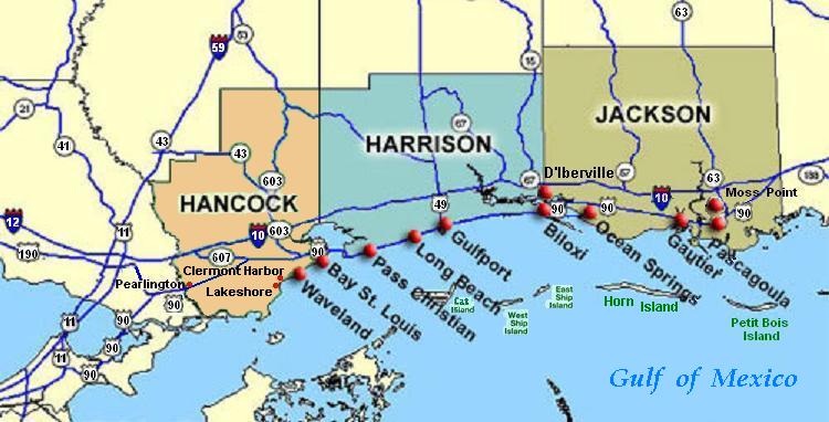
Communities
Cities
- Bay St. Louis (county seat)
- Diamondhead
- Waveland
Census-designated places
- Kiln
- Pearlington
Unincorporated communities
- Ansley
- Clermont Harbor
- Lakeshore
- Leetown
- Napoleon
- Necaise
- Shoreline Park (former CDP)
Ghost towns
- Gainesville
- Logtown
Politics
Hancock County, like most of the rest of the Gulf Coast, votes heavily Republican. The last Democrat to carry the county was Jimmy Carter in 1976 through a narrow 90-vote plurality, and Al Gore in 2000 was the last Democrat to manage even 30% of the county's vote.
Education
School districts include:
- Bay St. Louis School District
- Hancock County School District
- Picayune School District
References
References
- Gannett, Henry. (1905). "The Origin of Certain Place Names in the United States". Govt. Print. Off..
- "Census - Geography Profile: Hancock County, Mississippi". [[United States Census Bureau]].
- "Find a County". National Association of Counties.
- (July 1, 2015). "Pferdeerziehung im Fohlenalter".
- "Hippie Kitchens Serve Final Meal to Hurricane Victims".
- "International Aid".
- (August 22, 2012). "2010 Census Gazetteer Files". United States Census Bureau.
- "County Population Totals and Components of Change: 2020-2024". United States Census Bureau.
- "U.S. Decennial Census". United States Census Bureau.
- "Historical Census Browser". University of Virginia Library.
- "Population of Counties by Decennial Census: 1900 to 1990". United States Census Bureau.
- "Census 2000 PHC-T-4. Ranking Tables for Counties: 1990 and 2000". United States Census Bureau.
- "State & County QuickFacts". United States Census Bureau.
- "QuickFacts. Mississippi counties".
- (2021). "2020 Decennial Census Redistricting Data (Public Law 94-171)".
- (2021). "2020 Decennial Census Demographic Profile (DP1)".
- (2023). "2020 Decennial Census Demographic and Housing Characteristics (DHC)".
- Royal Berglee, PhD. (June 17, 2016). "4.3 United States: Population and Religion".
- "Dave Leip's Atlas of U.S. Presidential Elections".
- Leip, David. "Dave Leip's Atlas of U.S. Presidential Elections".
- "2020 CENSUS - SCHOOL DISTRICT REFERENCE MAP: Hancock County, MS". [[U.S. Census Bureau]].
This article was imported from Wikipedia and is available under the Creative Commons Attribution-ShareAlike 4.0 License. Content has been adapted to SurfDoc format. Original contributors can be found on the article history page.
Ask Mako anything about Hancock County, Mississippi — get instant answers, deeper analysis, and related topics.
Research with MakoFree with your Surf account
Create a free account to save articles, ask Mako questions, and organize your research.
Sign up freeThis content may have been generated or modified by AI. CloudSurf Software LLC is not responsible for the accuracy, completeness, or reliability of AI-generated content. Always verify important information from primary sources.
Report