From Surf Wiki (app.surf) — the open knowledge base
Hale Creek

| Field | Value |
|---|---|
| name | Hale Creek |
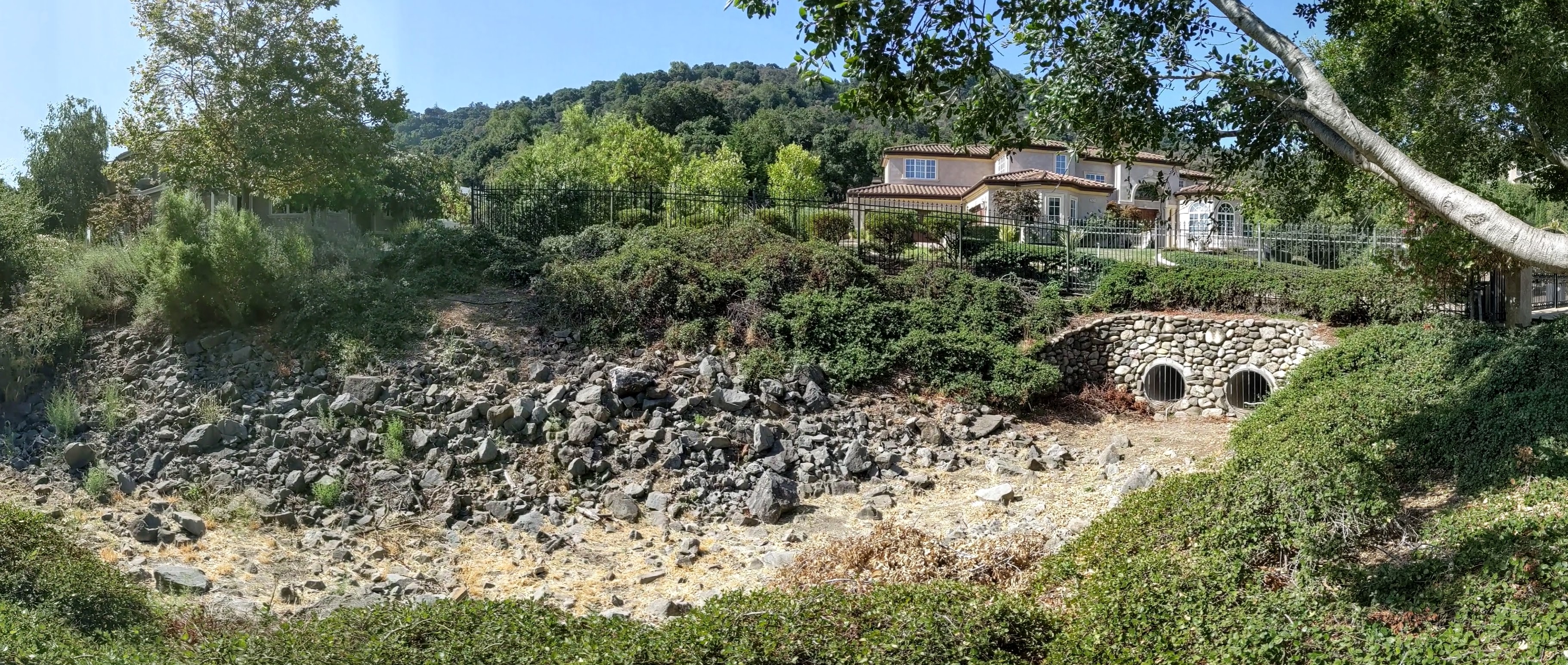
| image | Hale creek los altos.jpg |
| image_caption | Hale Creek in Los Altos, California |
| subdivision_type1 | Country |
| subdivision_name1 | United States |
| subdivision_type2 | State |
| subdivision_name2 | California |
| subdivision_type3 | Region |
| subdivision_name3 | Santa Clara County |
| source1 | Foothills in Rancho San Antonio Open Space Preserve |
| source1_location | Los Altos Hills, California |
| source1_coordinates | |
| source1_elevation | 950 ft |
| mouth | Permanente Creek |
| mouth_location | Mountain View, California |
| mouth_coordinates | |
| mouth_elevation | 108 ft |
| tributaries_left | Summerville Creek |
| tributaries_right | Magdalena Creek, Loyola Creek |
Hale Creek is a short stream originating in the foothills of the town of Los Altos Hills in Santa Clara County, California, United States. Its source is in the Rancho San Antonio Open Space Preserve, west of Neary Quarry. The creek flows northeasterly 4.6 mi through the cities of Los Altos Hills, Los Altos, and Mountain View before joining Permanente Creek.
History
Hale Creek is named for Joseph P. Hale, who at one time owned most of the Rancho San Antonio land grant.{{cite book Hale was an Irish immigrant who became one of the largest land owners in the west, thanks to marrying Catarina Castro, the daughter of a large Spanish grant holder in Mexico in 1859. He bought 2,000 acres of Juana Briones's original ranch and was one of Los Altos' earliest large land owners. He and four other families lived on the Hale Ranch.
In the 1930s, Neary Rock Quarry was dug on upper Hale Creek.{{cite news In 2006, Los Altos Hills approved the construction of the Quarry Hills subdivision, consisting of 22 upscale homes and an eleven-acre lake, by damming the outflow from the quarry to Hale Creek.
The Juan Prado Mesa Preserve in Los Altos Hills, along Hale Creek below Neary Quarry, was created in 1970 and named for the original holder of the Rancho San Antonio land grant, Juan Prado Mesa. The preserve's Mary Stutz Path that follows the creek can be accessed at the top from Stonebrook Road and at the bottom from Dawson Drive. Juan Prado Mesa was born in Santa Clara in 1806, grandson of Corporal José Valerio Mesa who came to California with the Anza Expedition, and served as a soldier at the San Francisco Presidio becoming Alférez in 1835. Governor Juan Alvarado granted the 7982 acre Rancho San Antonio to Juan Prado Mesa in 1839.
Watershed


Hale Creek drains an area of approximately 5 sqmi and has three minor tributaries.{{cite book The source is at about 950 ft elevation just north of the Chamise Trail in the Rancho San Antonio Open Space Preserve in the little valley that flows easterly down to the north side of Neary Quarry. According to the Oakland Museum's map Guide to San Francisco Bay Area Creeks, Hale Creek's tributaries (heading downstream) are Magdalena Creek on the right, then Summerville Creek on the left, then Loyola Creek on the right – all entering Hale Creek downstream of Interstate 280. Hale Creek terminates at its confluence with Permanente Creek between Mountain View Avenue in Los Altos and Valencia Avernue in Mountain View, south of McKelvey Park.
Hale Creek is part of the Santa Clara Valley Water District's (SCVWD) Permanente Creek Flood Protection Project which aims to install overflow basins along Hale and Permanente Creeks to catch one hundred year flood waters in order to protect 1,664 parcels (1,378 homes, 160 businesses and 4 schools/institutions) downstream of El Camino Real (saving potential damages in excess of $47.9 million) and prevent flooding of Middlefield Road and Central Expressway, by 12/30/2016 and also to identify opportunities for environmental enhancement such as stream restoration, as well as trails, parks, and open space.{{cite web |access-date= 2009-12-31 From its confluence with Permanente Creek upstream to Rose/Rosita Avenue, the channel has been set in a straight concrete channel to move storm flows – at Marilyn Drive it is dated 1952 and at Arboleda Drive it is dated 1960. The concrete sides transition smoothly from rectangle to trapezoid just over 30 feet north of Arboleda Drive. However the SCVWD in 2012 proposed widening and/or deepening this concrete channel.
Ecology

A fish distribution study found no Steelhead Trout (Oncorhynchus mykiss) at two locations sampled in August 1981. However, the fact that Hale Creek is a tributary to a historic trout stream (Permanente Creek) suggests that steelhead may have used the stream.
References
References
- {{gnis. 224788. Hale Creek
- U.S. Geological Survey. National Hydrography Dataset high-resolution flowline data. [http://viewer.nationalmap.gov/viewer/ The National Map], accessed September 25, 2011
- Donna M. Santistevan. (Fall 2022). "Two Streets, One Creek, and a Scoundrel". Los Altos History Museum.
- Patricia Leach. (April 2011). "City of Los Altos Historic Resources Inventory". City of Los Altos.
- (2007-04-26). "Los Altos Hills General Plan 4 Conservation – Conservation Element". Los Altos Hills.
- (1996-03-06). "Comment and Editorial". Los Altos Town Crier.
- (2004-11-01). "Peninsula trails: hiking & biking trails on the San Francisco Peninsula". Wilderness Press.
- "Los Altos Hills Open Space". Los Altos Hills, California.
- Numa Hubert. (1862). "Reports of Land Cases Determined in the United States District Court for the Northern District of California: June term, 1853, to June term, 1858, inclusive, Volume 1". N. Hubert.
- Claudia Cruz. (2011-09-15). "Water District: Two Alternatives For Flood Control Affect Los Altos and Los Altos Hills". Los Altos Patch.
- Leidy, R.A., G.S. Becker, B.N. Harvey. (2005). "Historical distribution and current status of steelhead/rainbow trout (Oncorhynchus mykiss) in streams of the San Francisco Estuary, California.". Center for Ecosystem Management and Restoration, Oakland, CA..
This article was imported from Wikipedia and is available under the Creative Commons Attribution-ShareAlike 4.0 License. Content has been adapted to SurfDoc format. Original contributors can be found on the article history page.
Ask Mako anything about Hale Creek — get instant answers, deeper analysis, and related topics.
Research with MakoFree with your Surf account
Create a free account to save articles, ask Mako questions, and organize your research.
Sign up freeThis content may have been generated or modified by AI. CloudSurf Software LLC is not responsible for the accuracy, completeness, or reliability of AI-generated content. Always verify important information from primary sources.
Report