From Surf Wiki (app.surf) — the open knowledge base
Hainaut Province
Province of Belgium
Province of Belgium
| Field | Value | |
|---|---|---|
| <!-- See Template:Infobox settlement for additional fields and descriptions --> | name | Hainaut |
| native_name | wa | |
| pcd | ||
| native_name_lang | ||
| other_name | Heynowes | |
| settlement_type | Province of Belgium | |
| image_flag | Flag of Hainaut (Belgian province).png | |
| flag_size | 150px | |
| image_shield | Wapen henegouwen (schild).png | |
| shield_size | 75px | |
| coordinates | ||
| image_map | ||
| subdivision_type | Country | |
| subdivision_name | ||
| subdivision_type1 | Region | |
| subdivision_name1 | ||
| seat_type | Capital | |
| seat | Mons | |
| seat1_type | Largest city | |
| seat1 | Charleroi | |
| leader_title | Governor | |
| leader_name | Tommy Leclercq | |
| area_total_km2 | 3813 | |
| area_footnotes | ||
| population_footnotes | ||
| population_total | 1,360,074 | |
| population_as_of | 1 January 2024 | |
| population_density_km2 | auto | |
| demographics_type1 | GDP | |
| demographics1_footnotes | ||
| demographics1_title1 | Total | |
| demographics1_info1 | €36.940 billion (2021) | |
| blank_name_sec2 | HDI (2021) | |
| blank_info_sec2 | 0.893 | |
| · 11th of 11 | ||
| iso_code | BE-WHT | |
| website | ||
| image_blank_emblem | Hainaut (new logo).png | |
| blank_emblem_type | Brandmark | |
| blank_emblem_size | 120px |
pcd · 11th of 11
Hainaut, historically also known as Heynault in English, is the westernmost province of Wallonia, the French-speaking region of Belgium.
To its south lies the French department of Nord, while within Belgium it borders (clockwise from the north) on the Flemish provinces of West Flanders, East Flanders, Flemish Brabant and the Walloon provinces of Walloon Brabant and Namur.
Its capital is Mons (Dutch: Bergen) and the most populous city is Charleroi, the province's urban, economic and cultural hub, the financial capital of Hainaut and the fifth largest city in the country by population. Hainaut is one of the two only Belgian provinces whose capital is not its largest city; the other one is Walloon Brabant. Hainaut has an area of 3831 km2 and as of January 2024 a population of over 1.36 million. Another notable city is Tournai (Dutch Doornik) on the Scheldt river, one of the oldest cities in Belgium and the first capital of the Frankish Empire.
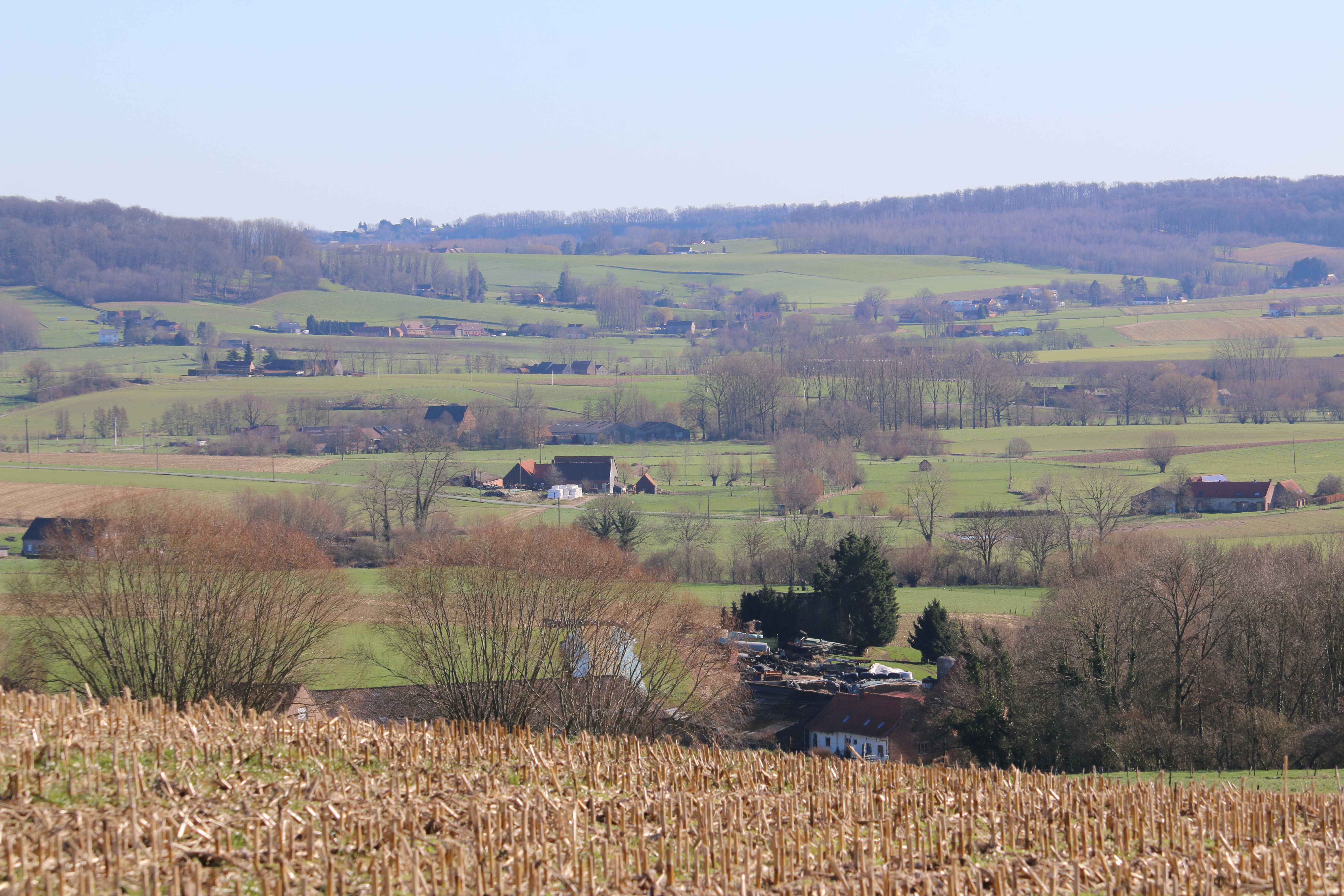
Hainaut province has a rolling landscape, except for the very southern part, the so-called Boot of Hainaut, which is quite hilly and belongs to the Ardennes and its foothills Fagne and the Condroz.
The village of L'Escaillère in the utmost southeastern corner, at an altitude of 365 metres, is the highest point of the province.
In the Boot of Hainaut on the border of Namur province the artificial five Eau d'Heure lakes are situated, the largest lake area of Belgium.
A well-known region is the Borinage, the old coal mining region around the city of Mons. Also well-known is the Pays des Collines (English: "Hill Country"), a low hilly area forming one natural region with the Flemish Ardennes in the East Flanders province.
Language
In addition to the main language French, Picard is spoken in the western and central parts of the province, while in the eastern part a mixture of Walloon and Picard is spoken (Wallo-Picard).
Some Flemish and Brabantic dialects of Dutch are spoken in the municipalities bordering the Flemish region.
History

The province derives from the French Revolutionary Jemmape department, formed in 1795 from part of the medieval County of Hainaut, the small territory of Tournai and the Tournaisis, a part of the county of Namur (Charleroi), and also a small part of the Prince-Bishopric of Liège (Thuin). (A large part of the historical county of Hainaut is now within France and sometimes referred to as French Hainaut.)
Subdivisions
Hainaut province is divided into 7 administrative districts (arrondissements), subdivided into a total of 69 municipalities. It has an area of 3831 km2.
Arrondissements
Arrondissement Ath Belgium Map.png|Ath Arrondissement Charleroi Belgium Map.png|Charleroi Arrondissement La Louvière Belgium Map.png|La Louvière Arrondissement Mons Belgium Map.png|Mons Arrondissement Soignies Belgium Map.png|Soignies Arrondissement Thuin Belgium Map.png|Thuin Arrondissement Tournai-Mouscron Belgium Map.png|Tournai-Mouscron
Municipalities

| Map no. | Municipality | Arrondissement |
|---|---|---|
| 1 | Aiseau-Presles | Charleroi |
| 2 | Anderlues | Thuin |
| 3 | Antoing | Tournai-Mouscron |
| 4 | Ath | Ath |
| 5 | Beaumont | Thuin |
| 6 | Belœil | Ath |
| 7 | Bernissart | Ath |
| 8 | Binche | La Louvière |
| 9 | Boussu | Mons |
| 10 | Braine-le-Comte | Soignies |
| 11 | Brugelette | Ath |
| 12 | Brunehaut | Tournai-Mouscron |
| 13 | Celles | Tournai-Mouscron |
| 14 | Chapelle-lez-Herlaimont | Charleroi |
| 15 | Charleroi | Charleroi |
| 16 | Châtelet | Charleroi |
| 17 | Chièvres | Ath |
| 18 | Chimay | Thuin |
| 19 | Colfontaine | Mons |
| 20 | Comines-Warneton | Tournai-Mouscron |
| 21 | Courcelles | Charleroi |
| 22 | Dour | Mons |
| 23 | Écaussinnes | Soignies |
| 24 | Ellezelles | Ath |
| 25 | Enghien | Ath |
| 26 | Erquelinnes | Thuin |
| 27 | Estaimpuis | Tournai-Mouscron |
| 28 | Estinnes | La Louvière |
| 29 | Farciennes | Charleroi |
| 30 | Fleurus | Charleroi |
| 31 | Flobecq | Ath |
| 32 | Fontaine-l'Évêque | Charleroi |
| 33 | Frameries | Mons |
| 34 | Frasnes-lez-Anvaing | Ath |
| 35 | Froidchapelle | Thuin |
| 36 | Gerpinnes | Charleroi |
| 37 | Ham-sur-Heure-Nalinnes | Thuin |
| 38 | Hensies | Mons |
| 39 | Honnelles | Mons |
| 40 | Jurbise | Mons |
| 41 | La Louvière | La Louvière |
| 42 | Le Rœulx | Soignies |
| 43 | Lens | Mons |
| 44 | Les Bons Villers | Charleroi |
| 45 | Lessines | Ath |
| 46 | Leuze-en-Hainaut | Tournai-Mouscron |
| 47 | Lobbes | Thuin |
| 48 | Manage | Soignies |
| 49 | Merbes-le-Château | Thuin |
| 50 | Momignies | Thuin |
| 51 | Mons | Mons |
| 52 | Mont-de-l'Enclus | Tournai-Mouscron |
| 53 | Montigny-le-Tilleul | Charleroi |
| 54 | Morlanwelz | La Louvière |
| 55 | Mouscron | Tournai-Mouscron |
| 56 | Pecq | Tournai-Mouscron |
| 57 | Péruwelz | Tournai-Mouscron |
| 58 | Pont-à-Celles | Charleroi |
| 59 | Quaregnon | Mons |
| 60 | Quévy | Mons |
| 61 | Quiévrain | Mons |
| 62 | Rumes | Tournai-Mouscron |
| 63 | Saint-Ghislain | Mons |
| 64 | Seneffe | Soignies |
| 65 | Silly | Ath |
| 66 | Sivry-Rance | Thuin |
| 67 | Soignies | Soignies |
| 68 | Thuin | Thuin |
| 69 | Tournai | Tournai-Mouscron |
Governors
- Jean-Baptiste Thorn (1836–1841)
- Charles Liedts (1841–1845)
- Édouard Mercier (1845–1847)
- Augustin Dumon-Dumortier (1847–1848)
- Adolphe de Vrière (1848–1849)
- Louis Troye (1849–1870)
- Joseph de Riquet de Caraman-Chimay (1870–1878)
- Auguste Wanderpepen (1878)
- Oswald de Kerchove de Denterghem (1878–1884)
- Auguste Vergote (1884–1885)
- Joseph d'Ursel (1885–1889)
- Charles d'Ursel (1889–1893)
- Raoul du Sart de Bouland (1893–1908)
- Maurice Damoiseaux (1908–1937)
- Henri Van Mol (1937–1940)
- Émile Cornez (1944–1967)
- Emilien Vaes (1967–1983)
- Michel Tromont (1983–2004)
- Claude Durieux (2004–2013)
- Tommy Leclercq (2013–present)
Economy
The gross domestic product (GDP) of the province was €34.2 billion in 2018, accounting for 7.4% of Belgium's economic output. GDP per capita adjusted for purchasing power was €22,500 or 75% of the EU27 average in the same year. Hainaut is the province with the second lowest GDP per capita.
Miscellaneous
The patron saint of the province Hainaut is Saint Waltrude.
Notes
References
References
- "Be.STAT".
- "Structuur van de bevolking | Statbel".
- "EU regions by GDP, Eurostat".
- "Sub-national HDI - Area Database - Global Data Lab".
- {{Cite American Heritage Dictionary. Hainaut
- "Hainaut". [[Oxford University Press]].
- {{Cite Merriam-Webster. Hainaut
- "Structuur van de bevolking | Statbel".
- "Regional GDP per capita ranged from 30% to 263% of the EU average in 2018".
- [http://saints.sqpn.com/saint-waltrude/ St. Waltrude at saints.sqpn.com]. Retrieved 26.March 2013.
This article was imported from Wikipedia and is available under the Creative Commons Attribution-ShareAlike 4.0 License. Content has been adapted to SurfDoc format. Original contributors can be found on the article history page.
Ask Mako anything about Hainaut Province — get instant answers, deeper analysis, and related topics.
Research with MakoFree with your Surf account
Create a free account to save articles, ask Mako questions, and organize your research.
Sign up freeThis content may have been generated or modified by AI. CloudSurf Software LLC is not responsible for the accuracy, completeness, or reliability of AI-generated content. Always verify important information from primary sources.
Report