From Surf Wiki (app.surf) — the open knowledge base
Gulf Shores, Alabama
City in Alabama, United States
City in Alabama, United States
| Field | Value | |
|---|---|---|
| official_name | Gulf Shores, Alabama | |
| settlement_type | City | |
| motto | Small Town, Big Beach | |
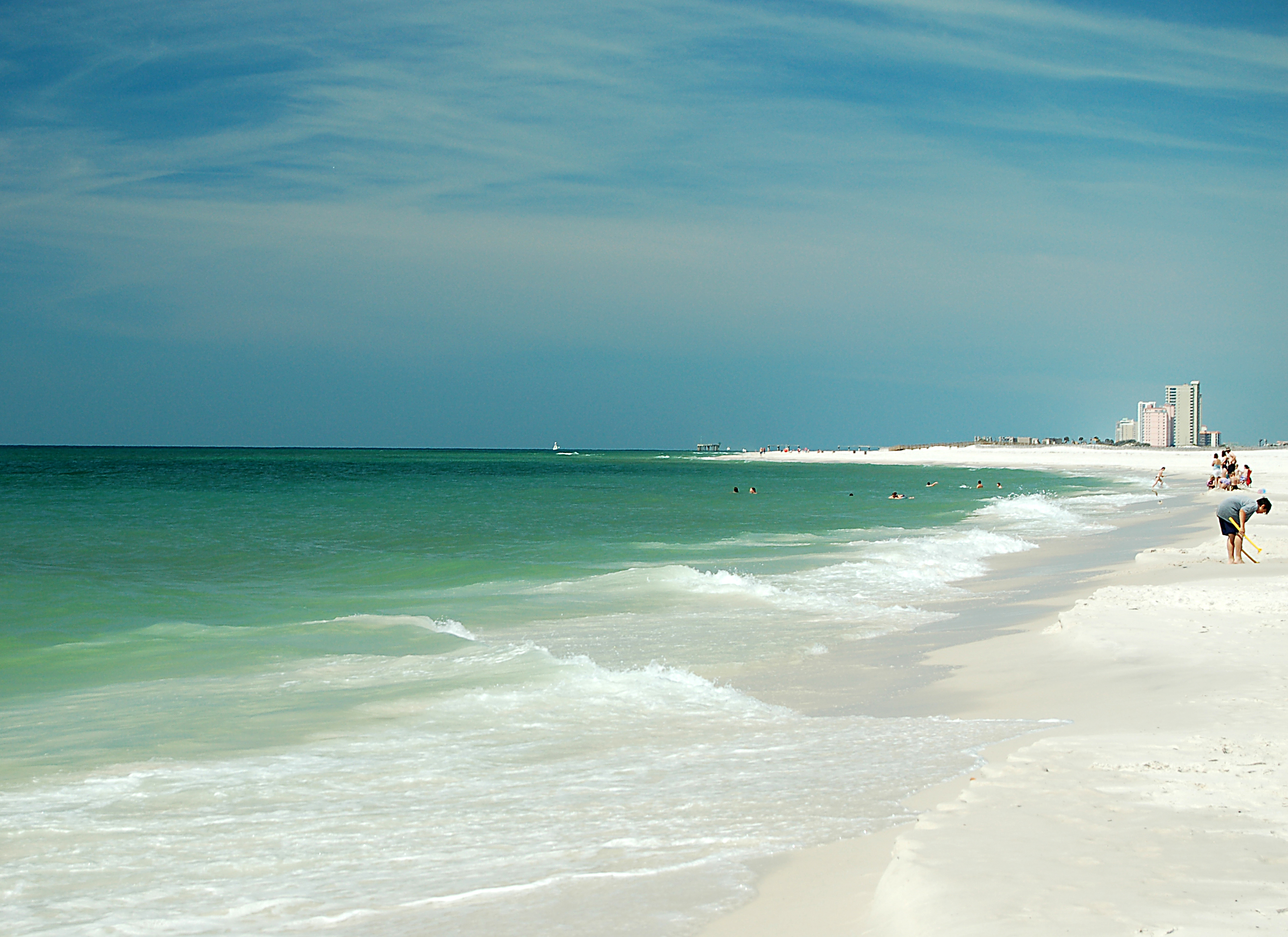
| image_skyline | Gulf Shores, Alabama (beach).jpg | |
| imagesize | 250px | |
| image_caption | Beach during Spring Break with condominiums and hotels in the background | |
| image_flag | Flag of Gulf Shores, Alabama.png | |
| image_blank_emblem | Logo of Gulf Shores, Alabama.png | |
| blank_emblem_type | Logo | |
| image_map | File:Baldwin County Alabama Incorporated and Unincorporated areas Gulf Shores Highlighted 0132272.svg | |
| mapsize | 250px | |
| map_caption | Location of Gulf Shores in Baldwin County, Alabama. | |
| <!-- Location --> | subdivision_type | Country |
| subdivision_name | United States | |
| subdivision_type1 | State | |
| subdivision_name1 | Alabama | |
| subdivision_type2 | County | |
| subdivision_name2 | Baldwin | |
| leader_title | Mayor | |
| leader_name | ||
| unit_pref | Imperial | |
| area_footnotes | ||
| area_total_km2 | 86.01 | |
| area_total_sq_mi | 33.21 | |
| area_land_km2 | 73.46 | |
| area_land_sq_mi | 28.36 | |
| area_water_km2 | 12.55 | |
| area_water_sq_mi | 4.84 | |
| <!-- Population --> | population_as_of | 2020 |
| population_total | 15014 | |
| population_density_km2 | 204.38 | |
| population_density_sq_mi | 529.35 | |
| <!-- General information --> | timezone | Central (CST) |
| utc_offset | −6 | |
| timezone_DST | CDT | |
| utc_offset_DST | −5 | |
| elevation_ft | 7 | |
| elevation_footnotes | ||
| coordinates | ||
| coordinates_footnotes | ||
| <!-- Area/postal codes and others --> | postal_code_type | ZIP Codes |
| postal_code | 36542, 36547 | |
| area_code | 251 | |
| blank_name | FIPS code | |
| blank_info | 01-32272 | |
| blank1_name | GNIS feature ID | |
| blank1_info | 2403770 | |
| website |
Gulf Shores is a resort city in Baldwin County, Alabama, United States. As of the 2020 census, the population was 15,014.
Geography
Gulf Shores is located on the Gulf of Mexico, and is the southernmost settlement in the state of Alabama. It is served by Alabama State Route 59 (Gulf Shores Parkway), which leads north to Foley. Route 182 (Beach Boulevard) runs east-west along the shore front, while Route 180 (Fort Morgan Road) runs parallel to it, north of Little Lagoon. Gulf State Park occupies a large eastern part of the city.
According to the U.S. Census Bureau, the city has a total area of 72.5 km2, of which 60.0 km2 is land and 12.5 km2, or 17.24%, is water.
Climate
Gulf Shores has a humid subtropical climate, with long, hot summers, and mild and sunny winters. Daily highs in winter are close to 60 F and nighttime lows are near 40 F. Daytime highs in summer are near 90 F and evening lows near 78 F. Ocean surf temperatures are quite warm from May through November, often well into the low 80s.
As a result of being located on the northern coast of the Gulf of Mexico, Gulf Shores is vulnerable to tropical cyclones. In September 1979, Hurricane Frederic caused massive destruction, leveling most of the town. On September 16, 2004, Hurricane Ivan made landfall in Gulf Shores, causing extensive wind and flooding damage. In 2005, while the city was still cleaning up from Ivan, Hurricane Katrina caused extensive damage and flooding. The area was then struck again on September 16, 2020, when Hurricane Sally made landfall on the 16 year anniversary of Ivan, causing extensive damage and widespread flooding.
|Jan record high F = 81 |Feb record high F = 77 |Mar record high F = 81 |Apr record high F = 88 |May record high F = 95 |Jun record high F = 96 |Jul record high F = 101 |Aug record high F = 98 |Sep record high F = 97 |Oct record high F = 93 |Nov record high F = 84 |Dec record high F = 84 |year record high F= |Jan record low F = 9 |Feb record low F = 20 |Mar record low F = 23 |Apr record low F = 30 |May record low F = 50 |Jun record low F = 55 |Jul record low F = 65 |Aug record low F = 64 |Sep record low F = 52 |Oct record low F = 37 |Nov record low F = 24 |Dec record low F = 11 |year record low F= | access-date = July 21, 2020}}
Demographics
|align-fn=center
2020 census
| Race | Num. | Perc. |
|---|---|---|
| White (non-Hispanic) | 13,062 | 87.0% |
| Black or African American (non-Hispanic) | 307 | 2.04% |
| Native American | 63 | 0.42% |
| Asian | 161 | 1.07% |
| Pacific Islander | 6 | 0.04% |
| Other/Mixed | 793 | 5.28% |
| Hispanic or Latino | 622 | 4.14% |
As of the 2020 United States census, there were 15,014 people, 5,810 households, and 3,347 families residing in the city.
2010 census
As of the census of 2010, there were 9,741 people living in the city. The population density was 274.3 /sqmi. There were 6,810 housing units at an average density of 370.4 /sqmi. The racial makeup of the city was 97.54% White, 0.22% Black or African American, 0.44% Native American, 0.30% Asian, 0.04% Pacific Islander, 0.40% from other races, and 1.07% from two or more races. Of the population 1.23% were Hispanic or Latino of any race.
There were 2,344 households, out of which 20.7% had children under the age of 18 living with them, 56.2% were married couples living together, 7.0% had a female householder with no husband present, and 34.1% were non-families. Of all households 26.7% were made up of individuals, and 10.0% had someone living alone who was 65 years of age or older. The average household size was 2.15 and the average family size was 2.56.
Of the population 16.4% was under the age of 18, 6.7% from 18 to 24, 24.8% from 25 to 44, 29.0% from 45 to 64, and 23.1% who were 65 years of age or older. The median age was 46 years. For every 100 females, there were 97.3 males. For every 100 females age 18 and over, there were 95.5 males. The median income for a household in the city was $41,826, and the median income for a family was $51,862. Males had a median income of $40,259 versus $22,467 for females. The per capita income for the city was $24,356. About 6.8% of families and 9.9% of the population were below the poverty line, including 6.4% of those under age 18 and 6.5% of those age 65 or over.
Since the year 2000, Baldwin County as a whole has experienced rapid population growth, second only to Shelby County in Alabama."Census 2000 Demographic Profile Highlights" (for Gulf Shores, AL), US Census Bureau, 2007, webpage: US-Census-GulfShoresAL .
Economy

Tourism
Tourism dominates the economy of Gulf Shores. The 2010 BP oil spill was expected to adversely affect both local real estate and beach tourism. After a year of decline, the tourism economy in Gulf Shores returned to pre-spill levels.
Attractions in Gulf Shores include Alabama Gulf Coast Zoo; Pelican Place at Craft Farms, a shopping mall; Waterville USA, a family amusement/waterpark; and 10 golf courses.
Hangout Music Festival is an annual three-day music festival on the beach each May.
Some residents opposed the building of a new hotel on state property, and the use of BP Oil spill funds to finance projects other than environmental repair.
In 2022, the city introduced a plan to make a $15 million revitalization of Gulf Place, a public beach area. Amenities will include a boardwalk, parking, green space, and restrooms. The project will involve sustainable and low-impact development strategies, including stormwater management, and beach dune restoration to provide animal habitat and protection from storm surge.
Education
Public education was originally administered by Baldwin County Public Schools. The Gulf Shores City School System was established in 2017. Schools include:
- Gulf Shores High School (grades 9–12)
- Gulf Shores Middle School (grades 7–8)
- Gulf Shores Elementary School (grades K–6)
Infrastructure
Jack Edwards National Airport is located in Gulf Shores and offers services from Gulf Air Center, Salt Air Aviation Center and Platinum Air Center.
Countywide dial-a-ride transit service is provided by BRATS, the Baldwin Regional Area Transit System.
References
References
- "2020 U.S. Gazetteer Files". United States Census Bureau.
- {{GNIS. 2403770
- (May 2, 2013). "EXTREME SETTLEMENTS: A COMPREHENSIVE LIST". Weekend Roady.
- (September 16, 2020). "Hurricane Sally blasts ashore in Alabama with punishing rain". yahoo.com.
- "U.S. Decennial Census". Census.gov.
- "Explore Census Data".
- "U.S. Census website". [[United States Census Bureau]].
- "Geographic Identifiers: 2010 Demographic Profile Data (G001): Gulf Shores city, Alabama". U.S. Census Bureau, American Factfinder.
- "Discover Alabama's Gulf Coast".
- 7thSpace. (October 1, 2011). "Last year's oil spill was predicted to lessen the interest in condos in Orange Beach and Gulf Shores". 7thspace.com.
- (July 14, 2011). "Alabama Gulf Coast Zoo". Encyclopedia of Alabama.
- "Things to do in Gulf Shores: Check out 16 Gulf Shores Attractions". TripAdvisor.
- "Gulf Shores Golf - Gulf Coast Golf Courses - Great Public Golf Courses". Golf.gulfshores.com.
- "Alabama State Parks". Alapark.com.
- Amy Bickers. "Hangout Music Festival". Time Inc. Lifestyle Group.
- "'Misunderstood' Gulf State Park Project on track for 2018 completion, executive director says".
- "Gulf Place Public Beach Master Plan".
- "Gulf Place Revitalization Project".
- "City Schools - Gulf Shores, AL - Official Website".
- "Resolution 5876 - Establishing a GS City School System".
- "gs-hs.com". gs-hs.com.
- "gsmsdolphins.com". gsmsdolphins.com.
- "gsesdolphins.com". gsesdolphins.com.
- "BRATS".
This article was imported from Wikipedia and is available under the Creative Commons Attribution-ShareAlike 4.0 License. Content has been adapted to SurfDoc format. Original contributors can be found on the article history page.
Ask Mako anything about Gulf Shores, Alabama — get instant answers, deeper analysis, and related topics.
Research with MakoFree with your Surf account
Create a free account to save articles, ask Mako questions, and organize your research.
Sign up freeThis content may have been generated or modified by AI. CloudSurf Software LLC is not responsible for the accuracy, completeness, or reliability of AI-generated content. Always verify important information from primary sources.
Report