From Surf Wiki (app.surf) — the open knowledge base
Gulf County, Florida
County in Florida, United States
County in Florida, United States
| Field | Value | ||||||
|---|---|---|---|---|---|---|---|
| county | Gulf County | ||||||
| state | Florida | ||||||
| seal | Gulf County Seal.png | ||||||
| founded year | 1925 | ||||||
| founded date | June 6 | ||||||
| seat wl | Port St. Joe | ||||||
| largest city wl | Port St. Joe | ||||||
| area_total_sq_mi | 756 | ||||||
| area_land_sq_mi | 564 | ||||||
| area_water_sq_mi | 192 | ||||||
| area percentage | 25.4% | ||||||
| census yr | 2020 | ||||||
| pop | 14192 | ||||||
| <!--population_footnote<ref>{{Cite web | url | https://www.census.gov/quickfacts/fact/table/gulfcountyflorida/PST045217 | title=U.S. Census Bureau QuickFacts: Gulf County, Florida | access-date=June 20, 2018 | archive-date=June 20, 2018 | archive-url=https://web.archive.org/web/20180620124811/https://www.census.gov/quickfacts/fact/table/gulfcountyflorida/PST045217 | url-status=dead }}-- |
| pop_est_as_of | 2023 | ||||||
| population_est | 15693 | ||||||
| density_sq_mi | auto | ||||||
| web | www.gulfcounty-fl.gov/ | ||||||
| time zone 1 | Eastern | ||||||
| tz note 1 | Southern portion | ||||||
| time zone 2 | Central | ||||||
| tz note 2 | Northern portion | ||||||
| ex image | PSJ FL new crths02.jpg | ||||||
| ex image cap | Gulf County Courthouse | ||||||
| district | 2nd | ||||||
| named for | Gulf of Mexico | ||||||
| leader_name | Michael Hammond | ||||||
| leader_title | County Administrator |
Gulf County is a county located in the panhandle of the U.S. state of Florida. As of the 2020 census, the population was 14,192. Its county seat is Port St. Joe. Gulf County is included in the Panama City, FL Metropolitan Statistical Area.
History
Gulf County, created in 1925, was named for the Gulf of Mexico. Wewahitchka was its first county seat and the 1927 Gulf County Courthouse is still in existence. In 1965 the county seat was moved to Port Saint Joe, which under its original name Saint Joseph, had been the site of Florida's first Constitutional Convention in 1838.
In 2018, Category 5 Hurricane Michael made landfall just miles north of the county line in Mexico Beach, severely damaging large parts of the region and its timber and shellfish industries. The area has largely recovered in the years since.
Geography
According to the U.S. Census Bureau, the county has a total area of 756 sqmi, of which 564 sqmi is land and 192 sqmi (25.4%) is water.
Communities
Cities
- Port St. Joe
- Wewahitchka
Unincorporated communities
Unincorporated areas include:
- Cape San Blas
- Dalkeith
- Highland View
- Honeyville
- Howard Creek
- Indian Pass
- Oak Grove
- Overstreet
- St. Joe Beach
- White City
- Simmons Bayou
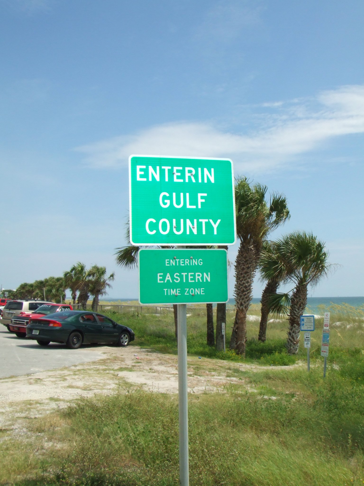
Time zones
By way of the Intracoastal Waterway, Gulf County is one of a small number of counties in the United States to be in two time zones, Eastern and Central in this case.
Adjacent counties
- Calhoun County, Florida — north
- Liberty County, Florida — northeast
- Franklin County, Florida — east
- Bay County, Florida — west
National protected area
- St. Vincent National Wildlife Refuge (part)
Demographics
|align-fn=center 1790-1960 1900-1990 1990-2000 2010-2019
Racial and ethnic composition
| Race | Pop 2010 | Pop 2020 | % 2010 | % 2020 | Total | 15,863 | 14,192 | 100.00% | 100.00% |
|---|---|---|---|---|---|---|---|---|---|
| White (NH) | 11,881 | 11,222 | 74.9% | 79.07% | |||||
| Black or African American (NH) | 2,937 | 1,692 | 18.51% | 11.92% | |||||
| Native American or Alaska Native (NH) | 59 | 66 | 0.37% | 0.47% | |||||
| Asian (NH) | 41 | 57 | 0.26% | 0.4% | |||||
| Pacific Islander (NH) | 3 | 0 | 0.02% | 0.0% | |||||
| Some Other Race (NH) | 8 | 34 | 0.05% | 0.24% | |||||
| Mixed/Multi-Racial (NH) | 256 | 566 | 1.61% | 3.99% | |||||
| Hispanic or Latino | 678 | 555 | 4.27% | 3.91% |

Non-Hispanic White
2020 census
As of the 2020 census, the county had a population of 14,192, 5,571 households, and 3,656 families. The population density was 25.6 per square mile (9.9/km). There were 8,796 housing units at an average density of 15.9 per square mile (6.1/km).
The racial makeup of the county was 80.32% (11,399) white or European American (79.07% non-Hispanic white), 12.0% (1,703) black or African-American, 0.54% (76) Native American or Alaska Native, 0.4% (57) Asian, 0.03% (4) Pacific Islander or Native Hawaiian, 1.66% (236) from other races, and 5.05% (717) from two or more races. Hispanic or Latino residents of any race comprised 3.91% (555) of the population.
There were 5,571 households in the county, of which 23.7% had children under the age of 18 living in them. Of all households, 49.0% were married-couple households, 19.7% were households with a male householder and no spouse or partner present, and 25.5% were households with a female householder and no spouse or partner present. About 28.2% of all households were made up of individuals and 15.0% had someone living alone who was 65 years of age or older.
The average household size was 2.1 and the average family size was 2.5.
There were 8,796 housing units, of which 36.7% were vacant. Among occupied housing units, 78.9% were owner-occupied and 21.1% were renter-occupied. The homeowner vacancy rate was 2.5% and the rental vacancy rate was 24.1%.
16.7% of the population was under the age of 18, 6.5% from 18 to 24, 22.2% from 25 to 44, 30.0% from 45 to 64, and 24.6% who were 65 years of age or older. The median age was 48.8 years; for every 100 females there were 87.3 males, and for every 100 females age 18 and older there were 86.0 males.
American Community Survey (2016–2020) estimates
The 2016-2020 5-year American Community Survey estimates show that the median household income was $50,640 (with a margin of error of +/- $3,582). The median family income was $60,978 (+/- $11,534). Males had a median income of $34,738 (+/- $4,577) versus $26,463 (+/- $5,198) for females. The median income for those above 16 years old was $31,055 (+/- $3,077). Approximately, 10.0% of families and 12.1% of the population were below the poverty line, including 13.9% of those under the age of 18 and 8.4% of those ages 65 or over.
2000 census
As of the census of 2000, there were 13,332 people, 4,931 households, and 3,535 families residing in the county. The population density was 24 PD/sqmi. There were 7,587 housing units at an average density of 14 /mi2. The racial makeup of the county was 79.89% White, 16.94% Black or African American, 0.65% Native American, 0.40% Asian, 0.05% Pacific Islander, 0.53% from other races, and 1.55% from two or more races. 2.03% of the population were Hispanic or Latino of any race.
There were 4,931 households, out of which 28.40% had children under the age of 18 living with them, 55.50% were married couples living together, 11.90% had a female householder with no husband present, and 28.30% were non-families. 25.50% of all households were made up of individuals, and 11.40% had someone living alone who was 65 years of age or older. The average household size was 2.42 and the average family size was 2.87.
In the county, the population was spread out, with 21.70% under the age of 18, 6.80% from 18 to 24, 29.40% from 25 to 44, 26.00% from 45 to 64, and 16.20% who were 65 years of age or older. The median age was 40 years. For every 100 females, there were 114.60 males. For every 100 females age 18 and over, there were 116.70 males.
The median income for a household in the county was $30,276, and the median income for a family was $36,289. Males had a median income of $27,539 versus $20,780 for females. The per capita income for the county was $14,449. About 13.70% of families and 16.70% of the population were below the poverty line, including 20.80% of those under age 18 and 14.10% of those age 65 or over.
Politics
Once heavily Democratic, Gulf County voted Republican at the presidential level for the first time in 1964 and has transitioned to a Republican stronghold at the presidential level. The county still supported conservative Democrats for local office until the 2000s. Republicans flipped most county offices in the 2010s and now consist of a strong majority of registered voters as of 2023.
The county is governed by a five-member Board of County Commissioners, elected in single-member districts. At the state level, Gulf County is represented by state senator Corey Simon (R) and state representative Jason Shoaf (R).
Gulf County is a part of Florida's 2nd Congressional District and is represented by Neal Dunn (R).
Education
Gulf County is served by Gulf County Schools.
Gulf Coast State College operates the Gulf/Franklin Campus in Port St. Joe.
Libraries
Gulf County is part of the Northwest Regional Library System (NWRLS), which serves Bay and Liberty Counties as well.
- Bay County Public Library
- Panama City Beach Public Library
- Parker Public Library
- Springfield Public Library
- Gulf County Public Library
- Charles Whitehead Public Library
- Harrell Memorial Library of Liberty County
- Jimmy Weaver Memorial Library
Transportation
Airports
- Costin Airport
Notes
References
References
- "U.S. Census Bureau QuickFacts: Gulf County, Florida".
- "State & County QuickFacts". United States Census Bureau.
- "Find a County". National Association of Counties.
- (February 12, 2011). "US Gazetteer files: 2010, 2000, and 1990". [[United States Census Bureau]].
- (September 23, 2000). "Tyndall Air Force Base (AFB), Florida, Conversion of Two F-15 Fighter Squadrons to F-22 Fighter Squadrons: Environmental Impact Statement".
- (September 23, 1981). "Florida Geographic Names". U.S.G.S. Topographic Division, Office of Research & Technical Standards, National Center.
- "U.S. Decennial Census". United States Census Bureau.
- "Historical Census Browser". University of Virginia Library.
- "Population of Counties by Decennial Census: 1900 to 1990". United States Census Bureau.
- "Census 2000 PHC-T-4. Ranking Tables for Counties: 1990 and 2000". United States Census Bureau.
- "Annual Estimates of the Resident Population for Counties: April 1, 2020 to July 1, 2023". United States Census Bureau.
- "Census.gov".
- "About the Hispanic Population and its Origin".
- "Explore Census Data".
- "Explore Census Data".
- (2021). "2020 Decennial Census Demographic Profile (DP1)".
- (2021). "2020 Decennial Census Redistricting Data (Public Law 94-171)".
- (2023). "2020 Decennial Census Demographic and Housing Characteristics (DHC)".
- "US Census Bureau, Table S1903: Median Income in the Past 12 Months (In 2020 Inflation-Adjusted Dollars)".
- "US Census Bureau, Table S2001: Earnings in the Past 12 Months (In 2020 Inflation-Adjusted Dollars)".
- "US Census Bureau, Table S1701: Poverty Status in the Past 12 Months".
- "US Census Bureau, Table S1702: Poverty Status in the Past 12 Months of Families".
- "U.S. Census website". [[United States Census Bureau]].
- Leip, David. "Dave Leip's Atlas of U.S. Presidential Elections".
- "Our Campaigns".
- "Gulf/Franklin Campus". [[Gulf Coast State College]].
This article was imported from Wikipedia and is available under the Creative Commons Attribution-ShareAlike 4.0 License. Content has been adapted to SurfDoc format. Original contributors can be found on the article history page.
Ask Mako anything about Gulf County, Florida — get instant answers, deeper analysis, and related topics.
Research with MakoFree with your Surf account
Create a free account to save articles, ask Mako questions, and organize your research.
Sign up freeThis content may have been generated or modified by AI. CloudSurf Software LLC is not responsible for the accuracy, completeness, or reliability of AI-generated content. Always verify important information from primary sources.
Report