From Surf Wiki (app.surf) — the open knowledge base
Guadiana
River in the Iberian peninsula
River in the Iberian peninsula
| Field | Value |
|---|---|
| name | Guadiana River |
| name_other | Rio Guadiana |
| name_etymology | Arabic derivative of Wādī + Ana, meaning "Anas (an Arabic name") |
| image | Guadiana river.jpg |
| image_size | 235 |
| image_caption | The Guadiana River in the area around Serpa, Portugal |
| map | Guadiana.png |
| map_size | 280px |
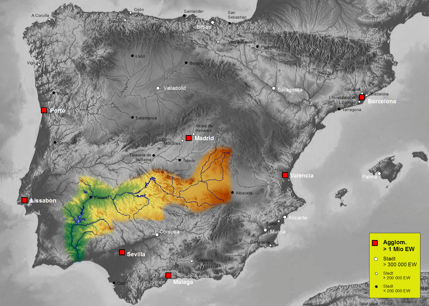
| map_caption | About 83 percent, 55000 km2, of the River Guadiana watershed is in Spain; the rest is in Portugal (interactive map) |
| subdivision_type1 | Country |
| subdivision_name1 | Spain and Portugal |
| length | 818 km |
| depth_min | 5 m |
| depth_max | 17 m |
| discharge1_min | 20 m3/s |
| discharge1_avg | 78.8 m3/s |
| discharge1_max | 1500 m3/s |
| source1 | Ojos del Guadiana |
| source1_location | Villarrubia de los Ojos, Castile–La Mancha, Spain |
| source1_coordinates | |
| source1_elevation | 608 m |
| mouth | Gulf of Cádiz |
| mouth_location | Vila Real de Santo António, Algarve, Portugal |
| mouth_coordinates | |
| mouth_elevation | 0 m |
| basin_size | 67733 km2 |
| tributaries_left | * Upper Guadiana |
| tributaries_right | * Cigüela / Záncara |
- Azuer
- Jabalón
- Zújar
- Matachel
- Ardila
- Chança River
- Bullaque
- Estena
- Degebe
- Ribeira do Vascão The Guadiana River ( , , , ) is an international river defining a long stretch of the Portugal-Spain border, separating Extremadura and Andalusia (Spain) from Alentejo and Algarve (Portugal). The river's basin extends from la Mancha and the eastern portion of Extremadura to the southern provinces of the Algarve; the river and its tributaries flow from east to west, then south through Portugal to the border towns of Vila Real de Santo António (Portugal) and Ayamonte (Spain), where it flows into the Gulf of Cádiz. With a course that covers a distance of 829 km, it is the fourth-longest in the Iberian Peninsula, and its hydrological basin extends over an area of approximately 68000 km2 (the majority of which lies within Spain).
Etymology
Ptolemy's Geography recorded the Celtiberian name as Anas, meaning a marshy area or bayou. The Romans adapted this name as Flumen Anās, which was etymolygised as the "River of Ducks." After the Muslim conquest of the Iberian Peninsula, the name was extended and referred to as Wadi Ana, later passed on to Portuguese and Spanish settlers as the Ouadiana, and later just Odiana. Since the 16th century, the name slowly evolved to take on the form Guadiana, a cognitive variation that developed from many Andalusi river place-names beginning in wadi using the prefix guad- such as the hydronyms Guadalquivir, Guadalete, and Guadarrama.
Watershed

The Guadiana flows east to west through Spain and south through Portugal, then forms the Spanish-Portuguese border; it flows into the Gulf of Cádiz, part of the Atlantic Ocean, between Vila Real de Santo António (Portugal) and Ayamonte (Spain). It is 818 km long, of which 578 km are within Spanish territory, 140 km within Portugal, while 100 km are shared between the two nations. About 82 percent, 55,444 km2, of its basin is in Spain, while about 17 percent, 11560 km2 is in Portugal.
Sources
The exact source of the river in Castilla-La Mancha is disputed, but it is generally believed to spring in the , Villarrubia de los Ojos municipal term, Ciudad Real Province, Castile–La Mancha, about 608 m in elevation.
A classic theory introduced by Pliny the Elder, was that the river originated from the Lagunas de Ruidera and divided into two branches: the Upper Guadiana () and the Guadiana, while separated by a subterranean course. This legend developed from a misguided belief (which persisted until the 19th century) that the river appeared and disappeared over time, because of its subterranean tributary. In fact, no subterranean course exists, and the belief that the Lagunas de Ruidera is the source is also controversial. toponymically and traditionally the Upper Guadiana, which runs from Viveros (Albacete) until Argamasilla de Alba (Ciudad Real) had been identified as the main branch of the Guadiana. But even hydro-geological characteristics indicate that the Upper Guadiana may not be the principal river within the system.
Another of the origin theories, postulated that the Cigüela and Záncara rivers were the sources of the Guadiana. Today, they are considered integral parts of the river's headwaters and important tributaries, but not necessarily the exact origin. The Ciguela's source is in Altos de Cabreras (Cuenca) and pertains to the Sistema Ibérico, at an elevation of 1080 m. Its course is 225 km long, receiving contributions from the rivers Jualón, Torrejón, Riánsares, Amarguillo and Záncara. The union of the rivers Ciguela and Záncara permits the replenishment of the waters in the Tablas de Daimiel National Park, a wetland that was designated for protection by the Spanish government in 1973 (situated in the municipalities of Villarrubia de los Ojos and Daimiel, in the province of Ciudad Real).
Course
From its origin/spring runs from the southern Iberian plain in a direction east to west, to near the town of Badajoz, where it begins to track south leading to the Gulf of Cádiz. The Guadiana marks the border of Spain and Portugal twice as it runs to the ocean: first, between the River Caia and Ribeira de Cuncos, then later from the River Chança until its mouth. The river is not used to completely mark the boundary between the two states; between the Olivença ravine and the Táliga ravine, the border still remains a disputed section claimed de jure by both countries and administered de facto by Spain (as part of the Spanish autonomous community of Extremadura).
For the most part, the Guadiana is navigable from the Atlantic Ocean until Mértola, a distance of 68 km. North of Mértola on the Guadiana is the highest waterfall is Southern Portugal called Pulo do Lobo.
The ecosystem has Mediterranean hydrological characteristics, including high variation in intra- and inter-annual discharge, large floods and severe droughts. This variability is a consequence of considerable variation in rainwater supply averaging around an annual mean of 400 to. The climate is semiarid with an average annual temperature of 14 to.
Estuary
The river empties into the Gulf of Cádiz between Ayamonte and Vila Real de Santo António, the two highly touristic regions of the Algarve and the sea-side of Andalusia. There it forms a saltmarsh estuary. The estuary has a maximum width of 550 m, and its depth ranges from 5 to. Tides are semi-diurnal, ranging from 0.8 to; their upriver propagation is limited by falls situated 76 km from the mouth at Moinho dos Canais. In the lower estuary there are nature reserves covering a total of 2089 ha; in Spain, the Marismas de Isla Cristina and, in Portugal, the Reserva Natural do Sapal de Castro Marim e Vila Real de Santo António (English: Castro Marim and Vila Real de Santo António Marsh Natural Reserve); they give a valued nature conservation character to the region.
Human impact
In Spain, three autonomous communities, (Castilla-La Mancha, Extremadura and Andalusia) (comprising the provinces of Ciudad Real, Badajoz, and Huelva) are crossed by the Guadiana. Meanwhile, in Portugal the river crosses the regions of Alentejo and Algarve, and the districts of Portalegre, Évora, Beja and Faro.
Dams
There are over 30 dams on the river basin. The following are the dams on the Guadiana river itself:
- Alqueva Dam, the largest dam, located near Moura, in the Beja District, responsible for the largest reservoir in Western Europe. (There are several larger ones in Russia and Ukraine.) The Alqueva Reservoir, occupies an area of 250 km2, with a capacity for 4150 hm3.
- García Sola Reservoir
- Cíjara Reservoir
- El Vicario Reservoir
- Orellana Reservoir
References
;Notes ;Sources
References
- "Guadiana". [[HarperCollins]].
- "Guadiana". [[Oxford University Press]].
- José Díaz-Pintado Carretón, 1997
- A. Cabo Alonso, 1991
- Chicharro, et al., 2007, p.109
- [http://www.embalses.net/cuenca-6-guadiana.html Dams on the Guadiana Basin.]
This article was imported from Wikipedia and is available under the Creative Commons Attribution-ShareAlike 4.0 License. Content has been adapted to SurfDoc format. Original contributors can be found on the article history page.
Ask Mako anything about Guadiana — get instant answers, deeper analysis, and related topics.
Research with MakoFree with your Surf account
Create a free account to save articles, ask Mako questions, and organize your research.
Sign up freeThis content may have been generated or modified by AI. CloudSurf Software LLC is not responsible for the accuracy, completeness, or reliability of AI-generated content. Always verify important information from primary sources.
Report