From Surf Wiki (app.surf) — the open knowledge base
Green River, Wyoming

| Field | Value |
|---|---|
| official_name | Green River, Wyoming |
| settlement_type | City |
| image_skyline | {{multiple image |
| perrow | 1/2/1 |
| border | infobox |
| total_width | 300 |
| caption_align | center |
| image1 | GreenRiverWY DowntownHD1.jpg |
| caption1 | Downtown Green River |
| image2 | Expedition Island Green River Wyoming.jpeg |
| caption2 | Expedition Island |
| image3 | Green brew 1900.jpg |
| caption3 | Sweetwater Brewery |
| image4 | GreenRiverWY SweetwaterCountyCourthouse.jpg |
| caption4 | Sweetwater County Courthouse |
| image_map | File:Sweetwater County Wyoming Incorporated and Unincorporated areas Green River Highlighted 5633740.svg |
| mapsize | 250px |
| map_caption | Location of Green River in Sweetwater County, Wyoming. |
| pushpin_map | USA |
| pushpin_map_caption | Location in the United States |
| subdivision_type | Country |
| subdivision_name | United States |
| subdivision_type1 | State |
| subdivision_name1 | Wyoming |
| subdivision_type2 | County |
| subdivision_name2 | Sweetwater |
| leader_title | Mayor |
| leader_name | Pete Rust |
| unit_pref | Imperial |
| area_footnotes | |
| area_total_km2 | 36.54 |
| area_land_km2 | 35.76 |
| area_water_km2 | 0.78 |
| area_total_sq_mi | 14.11 |
| area_land_sq_mi | 13.81 |
| area_water_sq_mi | 0.30 |
| population_as_of | 2020 |
| population_footnotes | |
| population_total | 11825 |
| population_density_km2 | 328.81 |
| population_density_sq_mi | 851.61 |
| timezone | Mountain (MST) |
| utc_offset | −7 |
| timezone_DST | MDT |
| utc_offset_DST | −6 |
| elevation_m | 1864 |
| elevation_ft | 6115 |
| coordinates | |
| postal_code_type | ZIP codes |
| postal_code | 82935, 82938 |
| area_code | 307 |
| blank_name | FIPS code |
| blank_info | 56-33740 |
| blank1_name | GNIS feature ID |
| blank1_info | 1589126 |
| website | City of Green River |
| pop_est_footnotes |
|
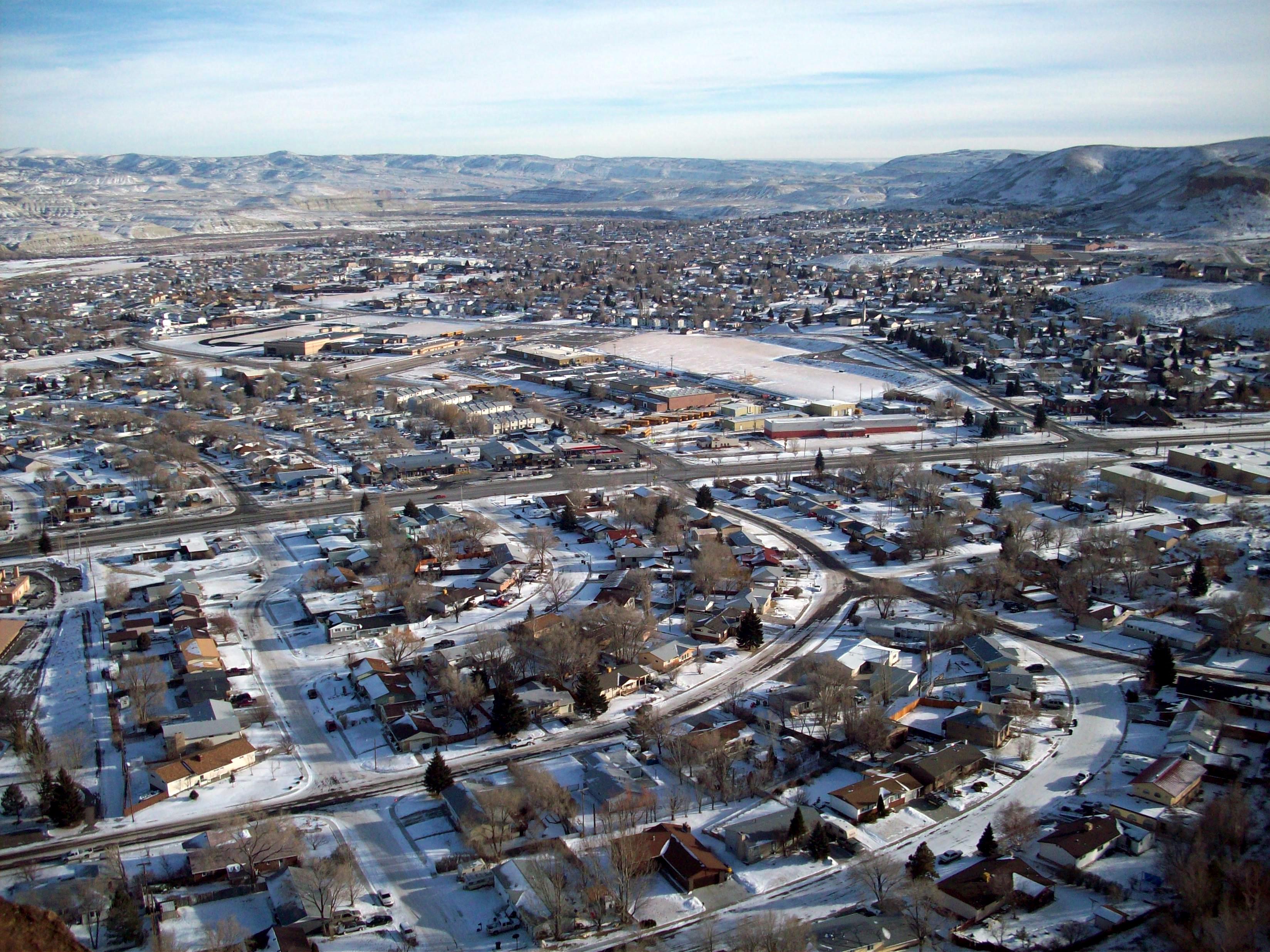
Green River is a city in and the county seat of Sweetwater County, Wyoming, United States, in the southwestern part of the state. The population was 11,825 at the 2020 census. It is the 7th most populous city in Wyoming.
History
The townsite of Green River, Dakota Territory was platted by the Union Pacific Railroad in 1867. Although the Territory of Wyoming was created on July 25, 1868, the Town of Green River was incorporated on August 21,1868 under the laws of the previous Territory of Dakota since the laws of the Wyoming Territory had yet to be written. The Town of Green River was re-incorporated on June 10, 1891 under the laws of the State of Wyoming to remove any ambiguity.
The Union Pacific Railroad reached Green River on October 1, 1868, and was supposed to be the site of a division point for the railroad. Railroad officials were surprised to find that a town of 2000 residents and permanent adobe buildings had been established there, likely requiring costly negotiations for railroad land. They moved the division point 12 mi west, creating the town of Bryan, on the Blacks Fork of the Green River. Just when Green River was on the verge of becoming a ghost town, Blacks Fork dried up during a drought and the railroad was forced to move the division point back to Green River to ensure adequate water for its steam locomotives. Bryan became the ghost town.
On May 24, 1869, John Wesley Powell launched the Powell Geographic Expedition from Green River.
On November 16, 1931, the Town of Green River passed the Green River ordinance that prohibited door-to-door selling. Other towns across the country would adopt the ordinance.
Geography
According to the United States Census Bureau, the city has a total area of 14.02 sqmi, of which 13.73 sqmi is land and 0.29 sqmi is water.
Climate
According to the Köppen Climate Classification system, Green River has a cold semi-arid climate, abbreviated "BSk" on climate maps. The hottest temperature recorded in Green River was 104 °F on July 8, 1954, while the coldest temperature recorded was -42 °F on December 31, 1978.
| Jan record high F = 59 | Feb record high F = 68 | Mar record high F = 77 | Apr record high F = 86 | May record high F = 94 | Jun record high F = 103 | Jul record high F = 104 | Aug record high F = 100 | Sep record high F = 98 | Oct record high F = 89 | Nov record high F = 73 | Dec record high F = 66 | Jan avg record high F = 47.9 | Feb avg record high F = 53.3 | Mar avg record high F = 64.6 | Apr avg record high F = 75.1 | May avg record high F = 83.7 | Jun avg record high F = 92.2 | Jul avg record high F = 96.2 | Aug avg record high F = 94.5 | Sep avg record high F = 89.6 | Oct avg record high F = 78.6 | Nov avg record high F = 63.6 | Dec avg record high F = 49.4 | year avg record high F = 96.8 | Jan avg record low F = -13.4 | Feb avg record low F = -9.0 | Mar avg record low F = 6.0 | Apr avg record low F = 17.9 | May avg record low F = 25.4 | Jun avg record low F = 34.2 | Jul avg record low F = 43.9 | Aug avg record low F = 40.4 | Sep avg record low F = 29.9 | Oct avg record low F = 14.8 | Nov avg record low F = 1.1 | Dec avg record low F = -7.9 | year avg record low F = -17.9 | Jan record low F = -40 | Feb record low F = -41 | Mar record low F = -26 | Apr record low F = -2 | May record low F = 13 | Jun record low F = 22 | Jul record low F = 31 | Aug record low F = 23 | Sep record low F = 4 | Oct record low F = -9 | Nov record low F = -19 | Dec record low F = -42 |access-date = August 18, 2022 |access-date = August 18, 2022
Demographics
2010 census
As of the census of 2010, there were 12,515 people, 4,642 households, and 3,406 families living in the city. The population density was 911.5 PD/sqmi. There were 5,002 housing units at an average density of 364.3 /sqmi. The racial makeup of the city was 92.1% White, 0.4% African American, 0.8% Native American, 0.5% Asian, 0.1% Pacific Islander, 4.1% from other races, and 2.0% from two or more races. Hispanic or Latino of any race were 13.4% of the population.
There were 4,642 households, of which 39.0% had children under the age of 18 living with them, 59.4% were married couples living together, 7.9% had a female householder with no husband present, 6.0% had a male householder with no wife present, and 26.6% were non-families. 21.6% of all households were made up of individuals, and 5.7% had someone living alone who was 65 years of age or older. The average household size was 2.68 and the average family size was 3.12.
The median age in the city was 33.9 years. 28.4% of residents were under the age of 18; 8.2% were between the ages of 18 and 24; 26.6% were from 25 to 44; 28.1% were from 45 to 64; and 8.6% were 65 years of age or older. The gender makeup of the city was 51.6% male and 48.4% female.
2000 census
As of the census of 2000, there were 11,808 people, 4,177 households, and 3,212 families living in the city. The population density was 861.5 people per square mile (332.5/km2). There were 4,426 housing units at an average density of 322.9 per square mile (124.6/km2). The racial makeup of the city was 92.13% White, 0.27% African American, 1.36% Native American, 0.32% Asian, 0.06% Pacific Islander, 4.23% from other races, and 1.63% from two or more races. Hispanic or Latino of any race were 10.21% of the population.
There were 4,177 households, out of which 42.5% had children under the age of 18 living with them, 64.4% were married couples living together, 8.4% had a female householder with no husband present, and 23.1% were non-families. 19.3% of all households were made up of individuals, and 6.0% had someone living alone who was 65 years of age or older. The average household size was 2.80 and the average family size was 3.22.
In the city, the population was spread out, with 31.1% under the age of 18, 8.8% from 18 to 24, 28.9% from 25 to 44, 24.8% from 45 to 64, and 6.5% who were 65 years of age or older. The median age was 34 years. For every 100 females, there were 102.8 males. For every 100 females age 18 and over, there were 100.7 males.
The median income for a household in the city was $53,164, and the median income for a family was $59,100. Males had a median income of $51,418 versus $24,306 for females. The per capita income for the city was $20,398. About 3.1% of families and 4.5% of the population were below the poverty line, including 6.0% of those under age 18 and 5.3% of those age 65 or over.
Economy

The Green River Basin contains the world's largest known deposit of trona ore. Soda ash mining from trona veins 900 and 1600 ft deep is a major industrial activity in the area, employing over 2000 persons at five mines. The mining operation is less expensive for production of soda ash in the United States than the synthetic Solvay process, which predominates in the rest of the world. The trona in Sweetwater County was created by an ancient body of water known as Lake Gosiute. Over time, the lake shrank. With the loss of outflows, highly alkaline water (salt brine) began to evaporate, depositing the beds of trona.
The four mines are run by these companies:
- Tata Chemicals Ltd.
- Genesis Alkali LLC
- Ciner Resources LP
- Solvay Chemicals Inc.
The Green River Basin also has large oil shale and natural gas reserves, which remain virtually untouched due to the high cost of extracting the oil from the hard shale formations. However, an increase in oil prices in 2008 and a national desire to become more energy independent led to an increase in well drilling and oil exploration. Expansion growth from Halliburton and Exxon, as well as other oil companies, created a mini-boom for Green River and its sister city, Rock Springs.
The 80MW Sweetwater Solar project near Green River is "the first utility-scale solar farm" in Wyoming. It was slated to come online in 2019. Concerns have been raised about its impact on antelope migration.
Arts and culture
Flaming Gorge Days

Every year, on the last full weekend of June, Green River hosts Flaming Gorge Days. The festival features concerts, 3-on-3 basketball, Red Desert Road Runner 5K race, Festival in the Park, among other activities. Past musical performances at the festival have included Poison, Tesla, Everclear, Head East, Neal McCoy, REO Speedwagon, Josh Gracin, Chris LeDoux and Trick Pony.
Government
Green River's government consists of a six-member city council, each of whom are elected from one of three wards. Each ward elects two members. The mayor is elected in a citywide vote. The city council was criticized in 2007 for its handling of a smoking ban, which caused several residents to question the council's motives.
The Mayor of Green River is Pete Rust, who was elected in November 2014.
Education
Public education in the City of Green River is provided by Sweetwater County School District #2. Schools serving the city include: Harrison Elementary, Truman Elementary, Washington Elementary, Monroe Intermediate School, Lincoln Middle School, and Green River High School. There is also one alternative high school campus - Expedition Academy.
Western Wyoming Community College is located in nearby Rock Springs and maintains an extension center in Green River.
Green River has a public library, a branch of the Sweetwater County Library System.
Media
Green River is served by two print publications: The Green River Star (a weekly newspaper published in Green River) and the Rock Springs Daily Rocket-Miner.
Four larger radio stations originate from Green River, three FM stations (KYCS, KZWB and KFRZ) as well as one AM station (KUGR). Stations from Rock Springs, Wyoming can also be heard in Green River.
Infrastructure
Transportation
Green River lies along Interstate 80 (I-80), a major transcontinental freeway that crosses southern Wyoming. It was designated in 1956 and constructed in phases to replace U.S. Route 30, the previous transcontinental highway on the corridor. The section around Green River was opened on October 28, 1966, and included the construction of the Green River Tunnel, a pair of tunnels that ran 1,135 ft. The tunnels closed on February 14, 2025, after a mass collision involving 26 vehicles started a fire that killed 3 people. Other highways in the city include Highway 530, which connects to Flaming Gorge, and Interstate 80 Business, which uses the old route of U.S. Route 30 through Green River.
The city government owns a Greater Green River Intergalactic Spaceport, a public use airstrip 5 mi south of the town on Highway 530. It was originally named Green River 48U for its Federal Aviation Administration identifier until 1994, when the city council passed a resolution to designate the airport as a spaceport. The same resolution included language with an "offer of sanctuary" to residents of Jupiter due to the impending collision of Comet Shoemaker–Levy 9. The airport has a 5,000 ft runway and a commemorative sign that has been replaced several times due to theft.
Notable people
- Heather Moody (born 1973), Olympic water polo silver and bronze medalist
- Curt Gowdy (1919–2006), sports announcer
- Justin Salas (born 1982), mixed martial artist who competed as a lightweight in Ultimate Fighting Championship from 2012 to 2016
- Nick Mamalis (born 1986), mixed martial artist who competed in the Bantamweight division
- Marlene Tromp (born 1966), English literature scholar and 7th president of Boise State University
References
References
- "2019 U.S. Gazetteer Files". United States Census Bureau.
- "U.S. Census website". [[United States Census Bureau]].
- {{gnis. 1589126. Green River
- (May 24, 2020). "Population and Housing Unit Estimates". United States Census Bureau.
- "Find a County". National Association of Counties.
- "Wyoming Has The Country’s Only Known Animal Shelter Gas Chambers".
- [http://www.cityofgreenriver.org/pages/165 City of Green River - Railroad Workers Demand Protection of Their Daytime Sleep] {{webarchive. link. (February 18, 2010)
- "US Gazetteer files 2010". [[United States Census Bureau]].
- "Historical Decennial Census Population for Wyoming Counties, Cities, and Towns". Wyoming Department of State / U.S. Census Bureau.
- "U.S. Census website". [[United States Census Bureau]].
- [http://www.cityofgreenriver.org/pages/161 City of Green River] {{webarchive. link. (November 18, 2008)
- (April 5, 2018). "Wyoming - Rock Springs FO - Sweetwater Solar Energy Project".
- Richards, Heather. (February 18, 2019). "With another solar development in the wings, is a new renewable coming for Wyoming?".
- Wyoming News Exchange. (December 11, 2019). "Antelope migration hindered by solar farm".
- "Flaming Gorge Days website". flaminggorgedayswy.com.
- (August 7, 2003). "2007: A memorable year for GR Council". Greenriverstar.com.
- "2020 CENSUS - SCHOOL DISTRICT REFERENCE MAP: Sweetwater County, WY". [[U.S. Census Bureau]].
- "Wyoming Public Libraries". PublicLibraries.com.
- Pyatt, Kayne. (September 9, 2021). "Museum event focuses on 'Snow Chi Minh Trail'". [[Uinta County Herald]].
- (November 3, 1966). "I-80 Tunnel Route Open to Traffic". [[Jackson Hole News&Guide.
- (February 16, 2025). "Investigators find 3rd victim from fiery Wyoming highway tunnel crash". [[ABC News (United States).
- Public Affairs Office. (2011). "Wyoming Highway Map". [[Wyoming Department of Transportation]].
- Johnson, Greg. (November 12, 2023). "Why The Heck...Does Green River, Wyoming, Have An Intergalactic Spaceport?". [[Cowboy State Daily]].
- Hancock, Laura. (November 7, 2013). "Wyoming 'spaceport' promoters want more landings, but county commissioner not thrilled". Casper Star-Tribune.
- [http://www.cityofgreenriver.org/minutes/view/159 City of Green River] {{webarchive. link. (November 18, 2008)
This article was imported from Wikipedia and is available under the Creative Commons Attribution-ShareAlike 4.0 License. Content has been adapted to SurfDoc format. Original contributors can be found on the article history page.
Ask Mako anything about Green River, Wyoming — get instant answers, deeper analysis, and related topics.
Research with MakoFree with your Surf account
Create a free account to save articles, ask Mako questions, and organize your research.
Sign up freeThis content may have been generated or modified by AI. CloudSurf Software LLC is not responsible for the accuracy, completeness, or reliability of AI-generated content. Always verify important information from primary sources.
Report