From Surf Wiki (app.surf) — the open knowledge base
Greater San Antonio

| Field | Value | |||||||
|---|---|---|---|---|---|---|---|---|
| name | Greater San Antonio | |||||||
| official_name | San Antonio–New Braunfels, Texas metropolitan statistical area | |||||||
| settlement_type | Metropolitan statistical area | |||||||
| image_skyline | SATX Downtown.jpg | |||||||
| imagesize | 300px | |||||||
| image_caption | Downtown San Antonio | |||||||
| image_map | {{maplink | frame=yes | plain=yes | frame-align=center | frame-width=290 | frame-height=240 | zoom=7 | frame-coord= |
| type1 | shape | id1=Q108372 | title1=Atascosa County | stroke-color1=#720000 | stroke-width1=0.5 | fill1=#720000 | fill-opacity1=0.4 | |
| type2 | shape | id2=Q108367 | title2=Bandera County | stroke-color2=#720000 | stroke-width2=0.5 | fill2=#720000 | fill-opacity2=0.4 | |
| type3 | shape | id3=Q16861 | title3=Bexar County | stroke-color3=#720000 | stroke-width3=0.5 | fill3=#720000 | fill-opacity3=0.4 | |
| type4 | shape | id4=Q109204 | title4=Comal County | stroke-color4=#720000 | stroke-width4=0.5 | fill4=#720000 | fill-opacity4=0.4 | |
| type5 | shape | id5=Q26610 | title5=Guadalupe County | stroke-color5=#720000 | stroke-width5=0.5 | fill5=#720000 | fill-opacity5=0.4 | |
| type6 | shape | id6=Q115428 | title6=Kendall County | stroke-color6=#720000 | stroke-width6=0.5 | fill6=#720000 | fill-opacity6=0.4 | |
| type7 | shape | id7=Q110421 | title7=Medina County | stroke-color7=#720000 | stroke-width7=0.5 | fill7=#720000 | fill-opacity7=0.4 | |
| type8 | shape | id8=Q156479 | title8=Wilson County | stroke-color8=#720000 | stroke-width8=0.5 | fill8=#720000 | fill-opacity8=0.4 | |
| type9 | shape | id9=Q26528 | title9=Kerr County | stroke-color9=#FF9200 | stroke-width9=0.5 | fill9=#FF9200 | fill-opacity9=0.4 | |
| type10 | shape | id10=Q27024 | title10=Gillespie County | stroke-color10=#1AA000 | stroke-width10=0.5 | fill10=#1AA000 | fill-opacity10=0.4 | |
| type11 | shape | id11=Q975 | title11=City of San Antonio | stroke-color11=#697100 | stroke-width11=0.5 | fill11=#697100 | fill-opacity11=0.5 | |
| type12 | shape | id12=Q574612 | title12=City of New Braunfels | stroke-color12=#0000FF | stroke-width12=0.5 | fill12=#0000FF | fill-opacity12=0.4 | |
| type13 | shape | id13=Q525007 | title13=City of Kerrville | stroke-color13=#00BCE4 | stroke-width13=0.5 | fill13=#00BCE4 | fill-opacity13=0.4 | |
| type14 | shape | id14=Q973923 | title14=City of Fredericksburg | stroke-color14=#BD000A | stroke-width14=0.5 | fill14=#BD000A | fill-opacity14=0.4 | |
| map_alt | Map of the San Antonio Metropolitan Area | |||||||
| map_caption | San Antonio–New Braunfels–Kerrville, TX CSA | |||||||
| subdivision_type | Country | |||||||
| subdivision_name | [[File:Flag of United States.svg | border | 23px]] United States | |||||
| subdivision_type1 | State | |||||||
| subdivision_name1 | [[File:Flag of Texas.svg | border | 23px]] Texas | |||||
| parts_type | Principal cities | |||||||
| parts_style | para | |||||||
| p1 | * San Antonio | |||||||
| established_title | ||||||||
| unit_pref | US | |||||||
| area_total_km2 | ||||||||
| area_land_km2 | ||||||||
| area_urban_sq_mi | 597.1 | |||||||
| area_blank1_title | MSA | |||||||
| area_blank1_sq_mi | 7,387 | |||||||
| population_as_of | 2020 | |||||||
| population_footnotes | ||||||||
| population_urban | 1,880,707 26th | |||||||
| population_density_urban_sq_mi | 2,944.6 | |||||||
| population_blank1_title | MSA | |||||||
| population_blank1 | 2,558,143 (24th) | |||||||
| population_density_blank1_sq_mi | 302.42 | |||||||
| demographics_type2 | GDP | |||||||
| demographics2_footnotes | ||||||||
| demographics2_title1 | MSA | |||||||
| demographics2_info1 | $182.139 billion (2023) | |||||||
| timezone | CST | |||||||
| utc_offset | -6 | |||||||
| timezone_DST | CDT | |||||||
| utc_offset_DST | -5 |
- New Braunfels
- Schertz
- Seguin
- Cibolo
Greater San Antonio, officially designated San Antonio–New Braunfels, is an eight-county metropolitan area in the U.S. state of Texas defined by the Office of Management and Budget (OMB). The metropolitan area straddles South Texas and Central Texas and is on the southwestern corner of the Texas Triangle. The official 2020 U.S. census showed the metropolitan area's population at 2,558,143—up from a reported 1,711,103 in 2000—making it the 24th largest metropolitan area in the United States. Downtown Austin and Downtown San Antonio are approximately 80. mi apart, and both fall along the Interstate 35 corridor. This combined metropolitan region of San Antonio–Austin has approximately 5.1 million people.
San Antonio–New Braunfels is the third-largest metro area in Texas, after Dallas–Fort Worth–Arlington and Houston–The Woodlands–Sugar Land.
Counties
There are eight counties that combine to form Greater San Antonio. The central county is Bexar.
| Census area | Estimated population | 2020 census | 2010 census | 2000 census | 1990 census | San Antonio–New Braunfels MSA | Atascosa | Bandera | Bexar | Comal | Guadalupe | Kendall | Medina | Wilson |
|---|---|---|---|---|---|---|---|---|---|---|---|---|---|---|
| 2,763,006 | 2,558,143 | 2,142,508 | 1,711,703 | 1,407,745 | ||||||||||
| 52,783 | 48,981 | 44,911 | 38,628 | 30,533 | ||||||||||
| 22,830 | 20,851 | 20,485 | 17,645 | 10,562 | ||||||||||
| 2,127,737 | 2,009,324 | 1,714,773 | 1,392,931 | 1,185,394 | ||||||||||
| 201,628 | 161,501 | 108,472 | 78,021 | 51,832 | ||||||||||
| 195,166 | 172,706 | 131,533 | 89,023 | 64,873 | ||||||||||
| 51,828 | 44,279 | 33,410 | 23,743 | 14,589 | ||||||||||
| 55,619 | 50,748 | 46,006 | 39,204 | 27,312 | ||||||||||
| 55,415 | 49,753 | 42,918 | 32,408 | 22,650 |
The MSA covers a total of 7,387 sqmi, of which 7,340 sqmi is land and 47 sqmi is water.
Communities
Greater San Antonio has a number of communities spread out across several counties and regions. It is centered on the city of San Antonio, the second largest city in Texas, second largest city in the Southern United States, and the seventh largest city in the USA, with roughly 1.5 million residents spread across approximately 500 square miles. Other regions include the Randolph Metrocom and the surrounding counties. The following are cities, towns, and villages categorized based on the United States Census Bureau 2024 population estimates. No population estimates are released for census-designated places (CDPs), which are marked with an asterisk (*). These places are categorized based on their 2020 Census population.


Places with more than 1,000,000 people
- San Antonio (Principal city) (1,526,656)
Places with 100,000 to 1,000,000 people
- New Braunfels (Principal city) (116,477)
Places with 25,000 to 100,000 people
- Canyon Lake* (31,124)
- Cibolo (37,816)
- Converse (31,400)
- Schertz (44,428)
- Seguin (38,789)
- Timberwood Park* (35,217)
Places with 10,000 to 25,000 people
- Boerne (22,712)
- Fair Oaks Ranch (11,744)
- Helotes (10,223)
- Leon Valley (11,424)
- Live Oak (16,218)
- Pleasanton (11,409)
- Scenic Oaks* (10,458)
- Selma (11,900)
- Universal City (20,267)
- Uvalde (15,589)
Places with 5,000 to 10,000 people
- Alamo Heights (7,557)
- Bulverde (7,198)
- Floresville (8,738)
- Hondo (8,969)
- Kirby (8,140)
- Lackland AFB* (9,467)
- Lakehills* (5,295)
- Luling (partial) (5,752)
- Sandy Oaks (5,698)
- Terrell Hills (5,142)
- Windcrest (5,782)
Places with 1,000 to 5,000 people
- Balcones Heights (2,707)
- Castle Hills (3,931)
- Castroville (3,201)
- Charlotte (1,620)
- China Grove (1,138)
- Comfort* (2,211)
- Cross Mountain* (3,944)
- Devine (4,622)
- Elmendorf (2,683)
- Garden Ridge (4,378)
- Geronimo* (1,097)
- Hollywood Park (3,128)
- Jourdanton (4,569)
- LaCoste (1,222)
- La Vernia (1,483)
- Lake Dunlap* (1,981)
- Lytle (3,325)
- Marion (1,098)
- McQueeney* (2,397)
- Natalia (1,356)
- Nixon (partial) (2,389)
- Olmos Park (2,155)
- Poteet (3,005)
- Poth (1,992)
- Randolph AFB* (1,280)
- Redwood* (4,003)
- Shavano Park (3,807)
- Somerset (1,843)
- St. Hedwig (2,377)
- Stockdale (1,488)
- Von Ormy (1,215)
Places with fewer than 1,000 people
- Bandera (891)
- Christine (365)
- Grey Forest (517)
- Hill Country Village (949)
- Kingsbury (143)
- New Berlin (711)
- Santa Clara (753)
- Spring Branch (254)
- Staples (190)
- Zuehl* (399)
Unincorporated places
- Adkins
- Amphion
- Atascosa
- Bandera Falls
- Bergheim
- Campbellton
- Carpenter
- D'Hanis
- Dunlay
- Fischer
- Kicaster
- Leesville (partial)
- Leming
- Leon Springs
- Losoya
- Macdona
- Medina
- Mico
- Pearson
- Pandora
- Pipe Creek
- Rio Medina
- Saspamco
- Sayers
- Sutherland Springs
- Tarpley
- Vanderpool
- Waring
- Welfare
- Yancey
Demographics
| align-fn = center 1790–1960 1900–1990 1990–2000
Bexar County is included in the San Antonio–New Braunfels, TX metropolitan statistical area. It is the 16th-most populous county in the nation and the fourth-most populated in Texas. Bexar County has a large Hispanic population with a significant growing African American population. With a population that is 59.3% Hispanic it is Texas' most populous majority-Hispanic county and the third-largest such nationwide.
As of the census of there were 2,558,143 people, 826,094 households, and 558,432 families residing within the MSA. The racial makeup of the MSA was 50.3% white (non-Hispanic white 32.7%), 6.5% African American, 1.1% Native American, 2.7% Asian, 0.1% Pacific Islander, 14% from other races, and 24.4% from two or more races; Hispanic or Latino residents of any race were 54.3% of the population. The median income for a household in the MSA was $40,764 and the median income for a family was $46,686. Males had a median income of $32,143 versus $24,007 for females. The per capita income for the MSA was $18,713.
| Year | Not Hispanic or Latino | Hispanic or Latino | Total | White | Black or African American | American Indian or Alaska Native | Asian | Native Hawaiian or Other Pacific Islander | Other Race | Two or More Races | Total | White | Black or African American | American Indian or Alaska Native | Asian | Native Hawaiian or Other Pacific Islander | Other Race | Two or More Races | Total |
|---|---|---|---|---|---|---|---|---|---|---|---|---|---|---|---|---|---|---|---|
| 2014 | 793,403 | 137,401 | 4,603 | 47,580 | 1,890 | 2,734 | 34,259 | 1,021,870 | 976,671 | 7,883 | 9,937 | 1,702 | 724 | 187,587 | 32,848 | 1,217,352 | 2,239,222 | ||
| 35.4% | 6.1% | 0.2% | 2.1% | 0.1% | 0.1% | 1.5% | 45.6% | 43.6% | 0.4% | 0.4% | 0.1% | 0.0% | 8.4% | 1.5% | 54.4% | 100% | |||
| 2013 | 783,712 | 133,710 | 4,391 | 45,049 | 1,947 | 3,246 | 31,742 | 1,003,797 | 930,034 | 7,827 | 11,054 | 1,915 | 742 | 205,365 | 31,990 | 1,188,927 | 2,192,724 | ||
| 35.7% | 6.1% | 0.2% | 2.1% | 0.1% | 0.1% | 1.4% | 45.8% | 42.4% | 0.4% | 0.5% | 0.1% | 0.0% | 9.4% | 1.5% | 54.2% | 100% | |||
| 2012 | 774,827 | 130,096 | 4,521 | 42,647 | 1,824 | 3,176 | 29,516 | 986,607 | 895,545 | 7,312 | 10,498 | 1,891 | 668 | 214,555 | 32,077 | 1,162,546 | 2,149,153 | ||
| 36.1% | 6.1% | 0.2% | 2.0% | 0.1% | 0.1% | 1.4% | 45.9% | 41.7% | 0.3% | 0.5% | 0.1% | 0.0% | 10.0% | 1.5% | 54.1% | 100% | |||
| 2011 | 767,349 | 128,069 | 4,666 | 40,356 | 1,860 | 3,178 | 27,143 | 972,621 | 834,874 | 7,095 | 10,069 | 1,832 | 403 | 248,054 | 30,514 | 1,132,841 | 2,105,462 | ||
| 36.4% | 6.1% | 0.2% | 2.0% | 0.1% | 0.2% | 1.3% | 46.2% | 39.7% | 0.3% | 0.5% | 0.1% | 0.0% | 11.8% | 1.5% | 53.8% | 100% | |||
| 2010 | 758,379 | 125,270 | 4,828 | 39,358 | 1,750 | 3,430 | 23,711 | 956,726 | 778,780 | 6,984 | 8,721 | 1,659 | 383 | 276,645 | 27,884 | 1,101,056 | 2,057,782 | ||
| 36.9% | 6.1% | 0.2% | 2.0% | 0.1% | 0.2% | 1.2% | 46.5% | 37.8% | 0.3% | 0.4% | 0.1% | 0.0% | 13.4% | 1.4% | 53.5% | 100% |
Economy
San Antonio–New Braunfels is home to five Fortune 1000 companies. Valero Energy Corp, iHeartMedia, USAA, and NuStar Energy are located in San Antonio. [Rush Enterprises] is located in New Braunfels.
San Antonio is often referred to as "Military City, USA" due to the heavy military presence. Currently, San Antonio is home to the largest concentrations of military bases in the U.S. The following military bases are in the San Antonio area: Lackland Air Force Base, Brooke Army Medical Center, Randolph Air Force Base, and Fort Sam Houston.
Culture
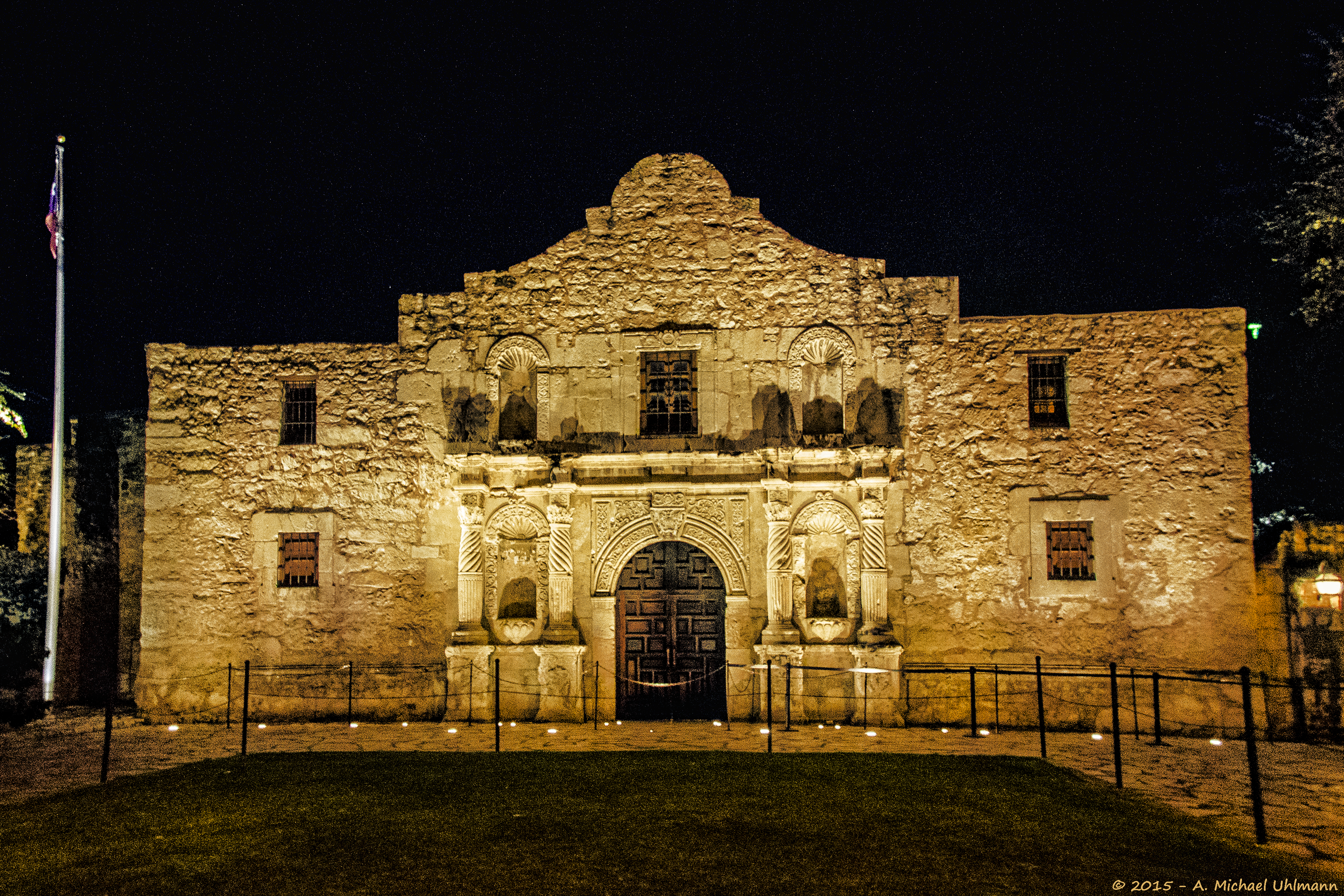
San Antonio enjoys a vibrant culture which it is known for being a popular tourist destination. San Antonio is known as the "Alamo City", due to the Alamo being located near downtown San Antonio. Other major attractions in San Antonio include the following: River Walk, SeaWorld, San Antonio Zoo, San Antonio Aquarium, and Six Flags. New Braunfels is home to a very popular water park known as Schlitterbahn. San Antonio's Spanish influence can be seen in the many historic sites across the city, such as the Alamo Mission, Mission Concepción, San Antonio River Walk, Mission San Francisco de la Espada, and Cathedral of San Fernando (San Antonio). Bandera just 40 miles northwest of San Antonio, hosts a three-day Cowboy Mardi Gras that attracts over 15 thousand people from all over the world to the town of 829 residents.
Politics
| Year | DEM | GOP | Others |
|---|---|---|---|
| 2024 | 46.8% 493,030 | 52.2% 550,283 | 1.1% 11,241 |
| 2020 | 50.8% 529,607 | 47.5% 495,195 | 1.7% 17,424 |
| 2016 | 46.7% 317,623 | 47.8% 380,665 | 5.5% 43,402 |
| 2012 | 45.2% 311,695 | 53.2% 366,744 | 1.5% 10,632 |
| 2008 | 47.0% 324,480 | 52.0% 359,129 | 1.07% 7428 |
| 2004 | 39.7% 245,309 | 59.5% 367,271 | 0.75% 4637 |
| 2000 | 40.9% 216,271 | 56.3% 298,442 | 2.8% 14,991 |
| 1996 | 46.2% 210,846 | 47.5% 216,618 | 6.3% 28,637 |
| 1992 | 41.8% 211,605 | 39.3% 198,952 | 18.9% 95,524 |
| 1988 | 44.7% 202,397 | 53.8% 243,696 | 0.74% 3,362 |
| 1984 | 31.8% 118,843 | 68.0% 254,477 | 0.20% 738 |
| 1980 | 42.9% 158,412 | 53.7% 198,049 | 3.4% 12,575 |
| 1976 | 53.3% 171,295 | 45.4% 146,009 | 1.3% 4,136 |
| 1972 | 38.0% 103,190 | 61.6% 167,509 | 0.42% 1151 |
| 1968 | 49.8% 109,324 | 40.4% 88,524 | 9.8% 21,387 |
| 1964 | 66.7% 128,820 | 33.1% 63,969 | 0.22% 429 |
| 1960 | 52.9% 89,169 | 46.5% 78,247 | 0.59% 1000 |
The San Antonio metro area has leaned right in recent decades.
Sports
Main article: Sports in San Antonio
| Club | Sport | League | Founded | Venue (capacity) | Attendance | Titles | Championship | ||||||||
|---|---|---|---|---|---|---|---|---|---|---|---|---|---|---|---|
| years | |||||||||||||||
| [[File:UTSA_Inaugural_Football_Game.jpg | 120px]] | ||||||||||||||
| UTSA Roadrunners | American football | NCAA Division I | 2011 | Alamodome (65,000) | 27,576 | 0 | |||||||||
| [[File:Tony Parker, Nando de Colo.jpg | 120px]] | ||||||||||||||
| San Antonio Spurs | Basketball | NBA | 1967 | Frost Bank Center (18,580) | 18,418 | 5 | |||||||||
| [[File:San Antonio Missions (48116648172).jpg | 120px]] | ||||||||||||||
| San Antonio Missions | Baseball | Texas League | 1888 | Wolff Stadium (9,200) | 8,500 | 13 | |||||||||
| [[File:Toyota_Field_Soccer_Bowl_2014_(16534687093).jpg | 120px]] | ||||||||||||||
| San Antonio FC | Soccer | USL Championship | 2016 | Toyota Field (8,300) | 6,765 | 1 | 2022 | ||||||||
| Crossmen Drum and Bugle Corps | Drum Corps | Drum Corps International | 1975 | Varies | 0 |
The city of San Antonio is home to only one Major League sports team; the San Antonio Spurs of the NBA. The city's football team is the UTSA Roadrunners who compete at the NCAA FBS level. Multiple minor league teams play in San Antonio, including San Antonio Missions and San Antonio FC.
Education
The city of San Antonio is home to many public institutions. The San Antonio area's largest university is the University of Texas at San Antonio (UTSA). Other public institutions include the University of Texas Health Science Center at San Antonio, Texas A&M University–San Antonio, and the five colleges of the Alamo Community College District.
The city has many private institutions as well, such as Our Lady of the Lake University and St. Mary's University on the inner west side. Trinity University and the University of the Incarnate Word are in Midtown. The Culinary Institute of America maintains its third campus in downtown.
Texas Lutheran University in Seguin and Howard Payne University at New Braunfels, now offering classes at a local high school but will soon have a true campus in the Veramendi Development, are the only higher education institutions in the area outside of San Antonio city limits.
The San Antonio area has many public elementary and secondary schools sorted into the following independent school districts:
| County | Independent School Districts (ISDs) |
|---|---|
| Atascosa | Charlotte, Jourdanton, Karnes City, Lytle, Pleasanton, Poteet, Somerset |
| Bandera | Bandera, Medina, Northside, Utopia |
| Bexar County/City of San Antonio | Alamo Heights, Boerne, Comal, East Central, Edgewood, Fort Sam Houston, Harlandale, Judson, Lackland, Medina Valley, North East, Northside, Randolph Field, San Antonio, Schertz-Cibolo-Universal City, South San Antonio, Southside, Southwest, Somerset |
| Comal | New Braunfels, Comal, Boerne |
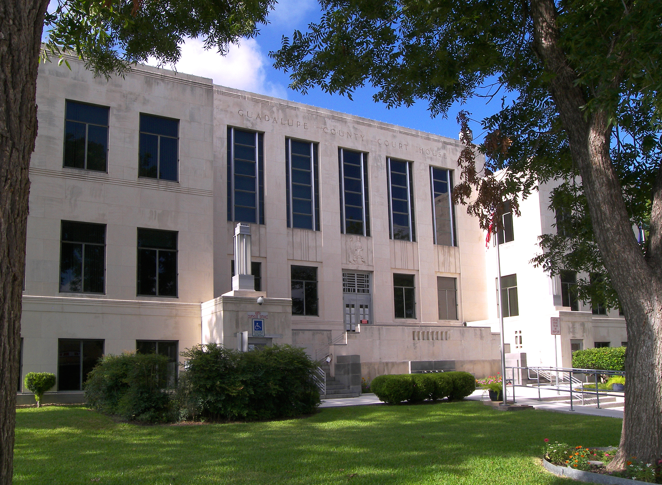
| Guadalupe | Seguin, Navarro, Comal, New Braunfels, Schertz-Cibolo-Universal City, Marion, San Marcos Consolidated, Nixon-Smiley Consolidated, Prairie Lea, Luling, La Vernia |
| Kendall | Boerne, Comfort, Blanco, Comal |
| Medina | Devine, Hondo, Medina Valley, Natalia, Lytle |
| Wilson | Floresville, La Vernia, Stockdale, Nixon-Smiley Consolidated, Poth, East Central |
Transportation
The San Antonio International Airport (SAT) is located in uptown San Antonio, approximately eight miles north of downtown. It has two terminals and is served by 21 airlines serving 44 destinations including six in Mexico and one in Canada.
VIA Metropolitan Transit is the metropolitan area's public transportation authority, serving the entire city of San Antonio and many of its suburbs throughout Bexar County.
San Antonio Station serves as the area's Amtrak train station.
Interstate highways
- [[Image:I-10.svg|20px]] I-10- West to El Paso, east to Houston
- [[Image:I-35.svg|20px]] I-35- North to Austin and the Dallas/Fort Worth area, south to Laredo
- [[Image:I-37.svg|20px]] I-37- South to Corpus Christi
- [[Image:I-410.svg|20px]] I-410- Inner loop around San Antonio, also passes through the following municipalities: Castle Hills, Balcones Heights, and Leon Valley
Other major highways
- [[Image:US 87.svg|20px]] US 87- South to Victoria, north to San Angelo
- [[Image:US 90.svg|20px]] US 90- West to Uvalde
- [[Image:US 181.svg|23px]] US 181- South to Beeville
- [[Image:US 281.svg|23px]] US 281- North to Wichita Falls, south to McAllen
- [[Image:Texas Loop 1604.svg|25px]] Loop 1604- Outer loop around San Antonio
References
References
- "Total Gross Domestic Product for San Antonio-New Braunfels, TX (MSA)".
- "U.S. Census website". [[United States Census Bureau]].
- (2010-03-23). "Table 1. Annual Estimates of the Population of Metropolitan and Micropolitan Statistical Areas: April 1, 2000 to July 1, 2009 (CBSA-EST2009-01)". [[United States Census Bureau]], Population Division.
- Egan, John. (6 September 2022). "Booming Texas region could rival Dallas-Fort Worth as 'next great U.S. metroplex,' mayor says". CultureMap.
- "Population and Housing Unit Estimates Tables". US Census Bureau.
- "San Antonio Was The First Southern City to integrate lunch counters".
- "City and Town Population Totals: 2020-2024". US Census Bureau.
- "U.S. Decennial Census". United States Census Bureau.
- "Historical Census Browser". University of Virginia Library.
- "Population of Counties by Decennial Census: 1900 to 1990". United States Census Bureau.
- "Census 2000 PHC-T-4. Ranking Tables for Counties: 1990 and 2000". United States Census Bureau.
- (2021-08-13). "Latinos, Blacks Show Strong Growth in San Antonio as White Population Declines".
- "P2: HISPANIC OR LATINO, AND NOT HISPANIC OR LATINO BY RACE". United States Census Bureau.
- "Population and Housing Unit Estimates".
- "Households and Families". United States Census Bureau.
- "[https://www.census.gov San Antonio-New Braunfels, TX Metro Area HISPANIC OR LATINO ORIGIN BY RACE] ". American Fact Finder. Retrieved 13 October 2016.
- [http://www.valero.com/NewsRoom/Pages/PR_20110311_1.aspx. link. (September 5, 2019 5, 2019)
- "Fortune 500". Fortune.
- "NuStar Energy ranked No. 15 : Fortune's 100 Best Companies to Work For 2011".
- Morgan, Jack. (October 22, 2024). "San Antonio's weekend Dia De Los Muertos events teem with vibrant life". Texas Public Radio.
- Associated Press. [http://www.yourhoustonnews.com/courier/news/world-heritage-status-for-the-alamo-japan-industrial-sites/article_cb2c8639-26aa-508d-bd3a-d9a6da286c1a.html World heritage status for The Alamo Mission, Japan industrial sites] {{Webarchive. link. (July 8, 2015 , ''Conroe Courier'', July 5, 2015.)
- "Hill Country town puts a Texas twist on Carnival season for 18th annual Cowboy Mardi Gras - CultureMap Austin".
- (December 4, 2020). "How Metro Areas Voted in the 2020 Election". Bloomberg.
- "Dave Leip's election atlas".
- "Office of the Secretary of State".
This article was imported from Wikipedia and is available under the Creative Commons Attribution-ShareAlike 4.0 License. Content has been adapted to SurfDoc format. Original contributors can be found on the article history page.
Ask Mako anything about Greater San Antonio — get instant answers, deeper analysis, and related topics.
Research with MakoFree with your Surf account
Create a free account to save articles, ask Mako questions, and organize your research.
Sign up freeThis content may have been generated or modified by AI. CloudSurf Software LLC is not responsible for the accuracy, completeness, or reliability of AI-generated content. Always verify important information from primary sources.
Report