From Surf Wiki (app.surf) — the open knowledge base
Great Bend, Kansas
City in Barton County, Kansas

City in Barton County, Kansas
| Field | Value |
|---|---|
| name | Great Bend, Kansas |
| settlement_type | City and County seat |
| image_skyline | Downtown Great Bend Kansas 5-5-2012.jpg |
| image_caption | Downtown Great Bend (2012) |
| image_map | Barton_County_Kansas_Incorporated_and_Unincorporated_areas_Great_Bend_Highlighted.svg |
| map_caption | Location within Barton County and Kansas |
| image_map1 | Map of Barton Co, Ks, USA.png |
| map_caption1 | KDOT map of Barton County (legend) |
| coordinates_footnotes | |
| coordinates | |
| subdivision_type | Country |
| subdivision_name | United States |
| subdivision_type1 | State |
| subdivision_name1 | Kansas |
| subdivision_type2 | County |
| subdivision_name2 | Barton |
| subdivision_type3 | Township |
| established_title | Founded |
| established_date | 1871 |
| established_title1 | Platted |
| established_title2 | Incorporated |
| established_date2 | 1872 |
| named_for | Bend in Arkansas River |
| government_type | |
| leader_title | Mayor |
| leader_title1 | |
| area_footnotes | |
| area_total_sq_mi | 10.63 |
| area_land_sq_mi | 10.50 |
| area_water_sq_mi | 0.13 |
| area_total_km2 | 27.54 |
| area_land_km2 | 27.19 |
| area_water_km2 | 0.35 |
| unit_pref | Imperial |
| elevation_footnotes | |
| elevation_ft | 1850 |
| population_footnotes | |
| population_as_of | 2020 |
| population_total | 14733 |
| population_density_sq_mi | auto |
| population_density_km2 | auto |
| timezone | CST |
| utc_offset | -6 |
| timezone_DST | CDT |
| utc_offset_DST | -5 |
| postal_code_type | ZIP code |
| postal_code | 67530 |
| area_code_type | Area code |
| area_code | 620 |
| blank_name | FIPS code |
| blank_info | 20-28300 |
| blank1_name | GNIS ID |
| blank1_info | 475650 |
| website |
Great Bend is a city in and the county seat of Barton County, Kansas, United States. It is named for its location at the point where the course of the Arkansas River bends east then southeast. It is home to Barton Community College.
History
Prior to American settlement of the area, the site of Great Bend was located in the northern reaches of Kiowa territory. Claimed first by France as part of Louisiana and later acquired by the United States with the Louisiana Purchase in 1803, it lay within the area organized by the U.S. as Kansas Territory in 1854. Kansas became a state in 1861, and the state government delineated the surrounding area as Barton County in 1867.
The first settlers of the area arrived in 1870. Living in sod houses and dugouts, they worked as buffalo hunters since trampling by bison herds precluded crop farming. In 1871, the Great Bend Town Company, anticipating the westward construction of the Atchison, Topeka and Santa Fe Railroad, founded Great Bend at a site roughly three miles west of Fort Zarah on the Santa Fe Trail. They named the settlement after its location at the "great bend" in the Arkansas River where the river's course turns eastward. The town began to grow as more settlers arrived over the following year and opened several businesses.
The railroad reached Great Bend in July 1872, and an election at about the same time declared the town the permanent county seat. Great Bend was incorporated as a city soon thereafter. The county courthouse and the city's first public school were built the following year.
In 1873, following the arrival of the railroad, Great Bend became a shipping point for cattle. This stimulated local business but also transformed the city into a rowdy, violent cowtown. In 1876, the Kansas Legislature extended the legal "dead line" restricting the presence of Texas cattle 30 miles west of Barton County. The cattle trade moved westward accordingly, and the city became more peaceful.
Over the following decades, Great Bend continued to grow and modernize, becoming a center of area commerce. This was despite two disasters which struck the city: a downtown fire in 1878 and a smallpox outbreak in 1882 which resulted in a brief quarantine. More than 3,000 wells produced during the 1930s, and the influx of workers dramatically increased the city's population.
The U.S. Army Air Forces opened Great Bend Army Airfield west of the city in 1943. The base served as training facility for B-29 bomber aircraft personnel during World War II. After the war, the City of Great Bend acquired the base and repurposed it for civilian use as Great Bend Municipal Airport.
The city continued to grow through the 1950s, its population peaking at almost 17,000 in 1960. In 1973, the Fuller Brush Company relocated its production facilities to Great Bend, becoming one of the city's major employers. Despite a modest decline in population in recent decades, Great Bend continues to serve as a commercial center for central Kansas.
Geography
Great Bend is located at the intersection of U.S. routes 56 and 281. Driving by highway, it is approximately 116 mi northwest of Wichita and 60 mi southwest of Hays.
Lying in the Great Bend Sand Prairie region of the Great Plains, the city is situated on the north side of the Arkansas River, where the river's course shifts from northeast to southeast. Dry Walnut Creek, a tributary of nearby Walnut Creek, flows east along the northern edge of the city. Cheyenne Bottoms, a large inland wetland, is located approximately 6 mi to the northeast.
According to the United States Census Bureau, the city has a total area of 10.71 sqmi, of which 10.60 sqmi is land and 0.11 sqmi is water.
Climate
Located near the convergence of North America's humid continental (Köppen: Dfa), humid subtropical (Köppen: Cfa), and semi-arid (Köppen: BSk) climate zones, Great Bend experiences hot summers and cold, dry winters. The hottest temperature recorded in Great Bend was 111 F on July 11–13, 1954, June 27, 1980, June 30, 1980, and July 14, 1980, while the coldest temperature recorded was -21 F on December 22, 1989.
The high temperature reaches or exceeds 90 °F an average of 69.7 days a year and reaches or exceeds 100 °F an average of 12 days a year. The minimum temperature falls below the freezing point 32 °F an average of 119.5 days a year.
|Jan record high F = 79 |Feb record high F = 88 |Mar record high F = 93 |Apr record high F = 101 |May record high F = 102 |Jun record high F = 111 |Jul record high F = 111 |Aug record high F = 110 |Sep record high F = 106 |Oct record high F = 98 |Nov record high F = 80 |Dec record high F = 79
|Jan avg record high F = 66.0 |Feb avg record high F = 72.9 |Mar avg record high F = 80.7 |Apr avg record high F = 88.3 |May avg record high F = 92.7 |Jun avg record high F = 98.8 |Jul avg record high F = 102.7 |Aug avg record high F = 100.8 |Sep avg record high F = 97.1 |Oct avg record high F = 89.3 |Nov avg record high F = 76.2 |Dec avg record high F = 65.6 |year avg record high F = 103.9
|Jan avg record low F = 2.4 |Feb avg record low F = 5.6 |Mar avg record low F = 13.3 |Apr avg record low F = 24.9 |May avg record low F = 37.7 |Jun avg record low F = 50.3 |Jul avg record low F = 57.4 |Aug avg record low F = 54.8 |Sep avg record low F = 40.6 |Oct avg record low F = 26.0 |Nov avg record low F = 14.4 |Dec avg record low F = 5.7 |year avg record low F = -2.8
|Jan record low F = -17 |Feb record low F = -19 |Mar record low F = -7 |Apr record low F = 14 |May record low F = 25 |Jun record low F = 39 |Jul record low F = 45 |Aug record low F = 45 |Sep record low F = 29 |Oct record low F = 10 |Nov record low F = -4 |Dec record low F = -21
|Jan snow depth inch = |Feb snow depth inch = |Mar snow depth inch = |Apr snow depth inch = |May snow depth inch = |Jun snow depth inch = |Jul snow depth inch = |Aug snow depth inch = |Sep snow depth inch = |Oct snow depth inch = |Nov snow depth inch = |Dec snow depth inch = |year snow depth inch =
|access-date = November 21, 2023 |access-date = November 21, 2023
Demographics
| align-fn = center 2010-2020
2020 census
The 2020 United States census counted 14,733 people, 6,136 households, and 3,690 families in Great Bend. The racial makeup was 77.34% (11,395) white or European American (70.47% non-Hispanic white), 1.55% (228) black or African-American, 0.64% (95) Native American or Alaska Native, 0.36% (53) Asian, 0.01% (1) Pacific Islander or Native Hawaiian, 10.96% (1,615) from other races, and 9.14% (1,346) from two or more races. Hispanic or Latino of any race was 23.5% (3,462) of the population.
Of the 6,136 households, 29.4% had children under the age of 18; 42.3% were married couples living together; 30.3% had a female householder with no spouse or partner present. 35.0% of households consisted of individuals and 15.4% had someone living alone who was 65 years of age or older. The percent of those with a bachelor’s degree or higher was estimated to be 14.8% of the population.
24.7% of the population was under the age of 18, 7.8% from 18 to 24, 24.4% from 25 to 44, 23.9% from 45 to 64, and 19.3% who were 65 years of age or older. The median age was 38.6 years. For every 100 females, there were 105.7 males. For every 100 females ages 18 and older, there were 106.9 males.
The 2016-2020 5-year American Community Survey estimates show that the median household income was $46,659 (with a margin of error of +/- $3,811) and the median family income was $64,453 (+/- $6,131). Males had a median income of $39,595 (+/- $4,131) versus $26,684 (+/- $4,324) for females. The median income for those above 16 years old was $32,273 (+/- $2,536). Approximately, 8.0% of families and 15.3% of the population were below the poverty line, including 18.0% of those under the age of 18 and 10.7% of those ages 65 or over.
2010 census
As of the 2010 census, there were 15,995 people, 6,483 households, and 4,038 families residing in the city. The population density was 1509.0 PD/sqmi. There were 7,113 housing units at an average density of 671.0 /sqmi. The racial makeup of the city was 84.0% White, 1.7% African American, 0.6% American Indian, 0.2% Asian, 0.1% Pacific Islander, 11.0% from other races, and 2.3% from two or more races. Hispanics and Latinos of any race were 19.8% of the population.
There were 6,483 households, of which 32.2% had children under the age of 18 living with them, 47.4% were married couples living together, 10.6% had a female householder with no husband present, 4.3% had a male householder with no wife present, and 37.7% were non-families. 32.6% of all households were made up of individuals, and 13.4% had someone living alone who was 65 years of age or older. The average household size was 2.41 and the average family size was 3.04.
The median age in the city was 36.7 years. 26.2% of residents were under the age of 18; 9.2% were between the ages of 18 and 24; 23.5% were from 25 to 44; 24.5% were from 45 to 64; and 16.6% were 65 years of age or older. The gender makeup of the city was 48.5% male and 51.5% female.
As of 2010, the median income for a household was $42,293, and the median income for a family was $46,969. Males had a median income of $33,623 versus $25,038 for females. The per capita income for the city was $24,529. About 10.2% of families and 13.7% of the population were below the poverty line, including 15.7% of those under age 18 and 7.7% of those age 65 or over.
Economy
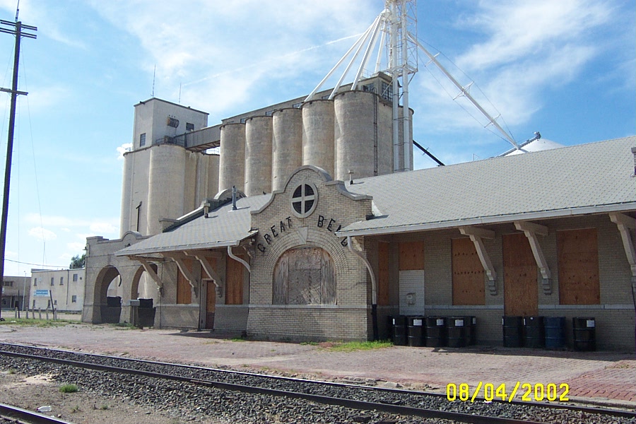
Agriculture is the predominant industry in Great Bend, and its grain elevators are visible from miles away. The oil industry flourished from about 1930–1960. There was even an oil well in the city park. But this industry has been on the decline for years. Cattle raising is also an important source of income for many people.
As of 2012, 66.5% of the population over the age of 16 were in the labor force. 0.0% were in the armed forces, and 66.5% were in the civilian labor force with 61.0% employed and 5.5% unemployed. The composition, by occupation, of the employed civilian labor force was: 30.2% in management, business, science, and arts; 27.8% in sales and office occupations; 19.2% in service occupations; 9.6% in natural resources, construction, and maintenance; 13.3% in production, transportation, and material moving. The four industries employing the largest percentages of the working civilian labor force were: educational services, health care, and social assistance (27.3%); retail trade (11.9%); manufacturing (9.8%); and arts, entertainment, recreation, and accommodation and food services (9.8%).
The cost of living in Great Bend is relatively low; compared to a U.S. average of 100, the cost of living index for the city is 79.4. As of 2012, the median home value in the city was $78,300, the median selected monthly owner cost was $979 for housing units with a mortgage and $400 for those without, and the median gross rent was $539.
Government

Great Bend is a city of the second class with a mayor-council form of government. The city council consists of eight members, two elected from each city ward for two-year terms. The mayor is elected at-large, also for a two-year term. The mayor and city council together constitute the city's Governing Body which sets goals, establishes policies, and approves all ordinances and resolutions. The council meets on the first and third Monday of each month.
As the county seat, Great Bend is the administrative center of Barton County. The county courthouse is located downtown, and most departments of the county government base their operations in the city.
Great Bend lies within Kansas's 1st U.S. Congressional District. For the purposes of representation in the Kansas Legislature, the city is located in the 33rd district of the Kansas Senate and the 112th district of the Kansas House of Representatives.
Education
Colleges
Barton Community College, a two-year public college, is located approximately three miles northeast of Great Bend.
Public schools
Great Bend USD 428 public school district serves approximately 3,000 students and operates eight schools in the city:
- Great Bend High School (9–12)
- Great Bend Middle School (7–8)
- Eisenhower Elementary School (K–6)
- Jefferson Elementary School (K–6)
- Lincoln Elementary School (K–6)
- Park Elementary School (K–6)
- Riley Elementary School (PreK-6)
- Helping Hands Preschool (PreK)
Private schools
The Roman Catholic Diocese of Dodge City oversees the Holy Family School (PreK–6). There is also one non-denominational Christian school in the city, Central Kansas Christian Academy (K-8).
Infrastructure
Transportation
Great Bend was located on the National Old Trails Road, also known as the Ocean-to-Ocean Highway, that was established in 1912. Currently, two U.S. Highways and two Kansas state highways pass through the city. U.S. Route 281 runs north–south through Great Bend, intersecting U.S. Route 56, K-96, and K-156, which run concurrently east–west through the city. K-96 splits from U.S. 56 and K-156 in western Great Bend, exiting the city to the northwest. U.S. 56 and K-156 continue concurrently west, then turn south and ultimately southwest.
Great Bend Municipal Airport is located approximately 2 mi west of the city
A Kansas and Oklahoma Railroad line runs east–west through the city with a second line branching off to the northwest, paralleled by K-96.
The city provides dial-a-ride transit on weekdays through CAB and Mini-Bus programs.
Utilities
The city government's Public Works Department is responsible for water distribution, waste water treatment, and sewer maintenance. One of the few cities in the area not to have a water treatment plant or water tower, Great Bend obtains its water supply directly from ten wells located throughout the city. Waste water is treated and recycled at the city's Wastewater Treatment Facility and then emptied into the Arkansas River. Two regional energy cooperatives, Midwest Energy, Inc. and Wheatland Electric, provide electric power. Local residents primarily use natural gas for heating fuel; Midwest Energy and Kansas Gas Service both provide natural gas service.
Health care
There is one primary medical facility in the city. Great Bend Regional Hospital, a 33-bed general medical and surgical facility, is the city's sole hospital. St. Rose Ambulatory & Surgery Center, formerly Central Kansas Medical Center, was an outpatient care facility affiliated with Catholic Health Initiatives. St. Rose Ambulatory & Surgery Center was closed and demolished in 2015.
Media
Main article: Media in Great Bend, Kansas
The Great Bend Tribune is the city's daily newspaper with a circulation of over 6,200 copies.
The Interrobang was the student newspaper at the Great Bend-based Barton Community College.
Great Bend is a center of broadcast media for central Kansas. Two AM and ten FM radio stations are licensed to and/or broadcast from the city.
Parks and recreation
The city government's Park Department maintains 10 parks in the city. The two largest are Brit Spaugh Park and Veteran's Memorial Park. Located in the north-central part of the city, Brit Spaugh Park includes the Great Bend Zoo, the Wetlands Aquatic Center, two softball fields, horseshoe courts, picnic areas, playgrounds, a skateboarding area, and a BMX track. Veteran's Park is located in the northwestern part of the city and includes an 18-hole disc golf course, a fishing lake with limited boating, sand volleyball, ballfields, a playground, and walking trails. The department also maintains hiking and biking trails along flood control levies around the city along with Stone Lake, a 43 acre fishing lake immediately south of the city.
The Club at StoneRidge, located on the northern edge of the city, includes a private, 18-hole golf course that opened in 1940. A second 18-hole course, the Lake Barton Golf Course, lies approximately 5 mi north of the city.
Culture
Arts and music
From 1947 to 1989, Great Bend was the home of the Argonne Rebels Drum and Bugle Corps. Under the direction of Glenn and Sandra Opie, the corps achieved national fame, most notably winning the American Legion national championships in 1971, 1972, and 1973. The Rebels were one of the thirteen founding member corps of Drum Corps International, finishing in 5th place in 1972 and 11th in 1973.
Points of interest
- The Barton County Historical Society Museum and Village is located in Great Bend.
- The Great Bend Zoo and Raptor Center, founded in 1952, contains over 60 species of animals.
Sports
Greyhound racing got its start in the United States in the bottoms in 1886 during a formal coursing event.
Great Bend was home to minor league baseball. The Great Bend Millers team was based in Great Bend in 1905 and from 1909 to 1914. The Millers played as members of the Class D level Kansas State League in 1905 and from 1909 to 1911, the Central Kansas League in 1912 and the Kansas State League in 1913 and 1914. Great Bend won three consecutive league championships from 1911 to 1913. In 2016, the Great Bend Boom played as members of the Independent level Pecos League.
The first nationwide NHRA sponsored event called "the Nationals" was held in 1955, in Great Bend, Kansas at the Great Bend Municipal Airport.
Notable people
Main article: List of people from Great Bend, Kansas
Notable individuals who were born in and/or have lived in Great Bend include jazz singer and pianist Karrin Allyson (1963– ), co-inventor of the integrated circuit (IC) and 2000 Nobel Prize laureate in physics Jack Kilby (1923–2005), and 1952 gold medal-winning U.S. Olympic basketball player John Keller (1928–2000).
References
References
- "2019 U.S. Gazetteer Files". United States Census Bureau.
- {{cite gnis2. 475650. Great Bend, Kansas
- "Profile of Great Bend, Kansas in 2020". United States Census Bureau.
- "QuickFacts; Great Bend, Kansas; Population, Census, 2020 & 2010". United States Census Bureau.
- Sturtevant, William C.. (1967). "Early Indian Tribes, Culture Areas, and Linguistic Stocks [Map]". [[Smithsonian Institution]].
- (Aug 2012). "Louisiana Purchase". [[Kansas Historical Society]].
- (Mar 2013). "Kansas Territory". Kansapedia.
- Weiser, Kathy. "Great Bend, Kansas – History and Information". Legends of Kansas.
- Cutler, William G.. (1883). "Barton County". A. T. Andreas.
- Kansas State Historical Society. (1916). "Biennial Report of the Board of Directors of the Kansas State Historical Society". Kansas State Printing Plant.
- Blackmar, Frank Wilson. (1912). "Kansas: A Cyclopedia of State History, Embracing Events, Institutions, Industries, Counties, Cities, Towns, Prominent Persons, Etc.". Standard Publishing Company.
- "History". Great Bend Convention & Visitors Bureau.
- (Summer 1959). "U.S. Army and Air Force Wings Over Kansas, Part One". [[Kansas Historical Society]].
- "Great Bend Municipal Airport – History". City of Great Bend.
- "Official Transportation Map". [[Kansas Department of Transportation]].
- (2001). "Ecoregions of Nebraska and Kansas".
- "Barton County, Kansas". [[Kansas Historical Society]].
- (September 1, 2009). "General Highway Map - Barton County, Kansas". [[Kansas Department of Transportation]].
- [http://www.cheyennebottoms.net/about_cheyenne_bottoms.html Cheyenne Bottoms: Jewel of the Prairie - cheyennebottoms.net - Retrieved February 10, 2009]
- "US Gazetteer files 2010". [[United States Census Bureau]].
- (2007). "Updated world map of the Köppen-Geiger climate classification". Hydrol. Earth Syst. Sci..
- "Annual Estimates of the Resident Population for Counties: April 1, 2020 to July 1, 2023". United States Census Bureau.
- "US Census Bureau, Table P16: HOUSEHOLD TYPE".
- "US Census Bureau, Table DP1: PROFILE OF GENERAL POPULATION AND HOUSING CHARACTERISTICS".
- "Gazetteer Files".
- "US Census Bureau, Table P1: RACE".
- "US Census Bureau, Table P2: HISPANIC OR LATINO, AND NOT HISPANIC OR LATINO BY RACE".
- "US Census Bureau, Table S1501: EDUCATIONAL ATTAINMENT".
- "US Census Bureau, Table S1903: MEDIAN INCOME IN THE PAST 12 MONTHS (IN 2020 INFLATION-ADJUSTED DOLLARS)".
- "US Census Bureau, Table S2001: EARNINGS IN THE PAST 12 MONTHS (IN 2020 INFLATION-ADJUSTED DOLLARS)".
- "US Census Bureau, Table S1701: POVERTY STATUS IN THE PAST 12 MONTHS".
- "US Census Bureau, Table S1702: POVERTY STATUS IN THE PAST 12 MONTHS OF FAMILIES".
- "U.S. Census website". [[United States Census Bureau]].
- "Great Bend Area Manufacturers & Major Employers". Great Bend Chamber of Commerce & Economic Development.
- "Great Bend, Kansas". City-Data.com.
- "Great Bend". The League of Kansas Municipalities.
- "Governing Body". City of Great Bend.
- "Offices/Departments". Barton County, Kansas.
- "Programs of Study". Barton Community College.
- "About Our Campuses". Barton Community College.
- "USD 428 Great Bend". USD 428 Great Bend Public Schools.
- "Holy Family School". [[Roman Catholic Diocese of Dodge City]].
- "Central Kansas Christian Academy". Central Kansas Christian Academy.
- "City of Great Bend (Map)". [[Kansas Department of Transportation]].
- "KGBD - Great Bend Municipal Airport". AirNav.com.
- "Great Bend Municipal Airport - FAQs". City of Great Bend.
- "Amtrak Southwest Chief".
- "Public Transportation".
- "Water Division". City of Great Bend.
- "Wastewater Treatment Facility". City of Great Bend.
- "Utilities". Great Bend Chamber of Commerce.
- "Great Bend Regional Hospital". [[U.S. News & World Report]].
- (January 3, 2011). "CKMC Announces New Direction". St. Rose Ambulatory & Surgery Center.
- "Great Bend Tribune". Mondo Times.
- "Radio Stations in Great Bend, Kansas". Radio-Locator.
- "Stations for Hays, Kansas". RabbitEars.Info.
- "Wichita-Hutchinson, Kansas TV market". EchoStar Knowledge Base.
- "Park Department". City of Great Bend.
- "Great Bend [Map]". Great Bend Chamber of Commerce.
- "Resource Directory". City of Great Bend.
- "Visitor Information". Great Bend Chamber of Commerce and Economic Development.
- "corpsreps.com - The Drum Corps Repertoire Database".
- "Home | Barton County Historical Society".
- "Britt Spaugh Park & Great Bend Zoo".
- Tim Horan. (February 2006). "History of the Greyhound and Greyhound Racing". National Greyhound Association.
- (2007). "The Encyclopedia of Minor League Baseball". [[Baseball America]].
- "Great Bend Boom minor league baseball Statistics and Roster on StatsCrew.com".
- "Welcome to Great Bend Boom Professional Baseball Team!".
- "NHRA History".
- "Karrin Allyson Electronic Press Kit". AMS Artists.
- "TI People - Jack Kilby". [[Texas Instruments]].
- "John Keller". [[University of Kansas]].
!["Early Indian Tribes, Culture Areas, and Linguistic Stocks [Map]"](http://www.lib.utexas.edu/maps/united_states/early_indian_west.jpg)
This article was imported from Wikipedia and is available under the Creative Commons Attribution-ShareAlike 4.0 License. Content has been adapted to SurfDoc format. Original contributors can be found on the article history page.
Ask Mako anything about Great Bend, Kansas — get instant answers, deeper analysis, and related topics.
Research with MakoFree with your Surf account
Create a free account to save articles, ask Mako questions, and organize your research.
Sign up freeThis content may have been generated or modified by AI. CloudSurf Software LLC is not responsible for the accuracy, completeness, or reliability of AI-generated content. Always verify important information from primary sources.
Report