From Surf Wiki (app.surf) — the open knowledge base
Gloucester Road, Hong Kong
Major highway in Hong Kong

Major highway in Hong Kong
| Field | Value |
|---|---|
| name | Gloucester Road |
| image | Gloucester Road, Hong Kong 1.jpg |
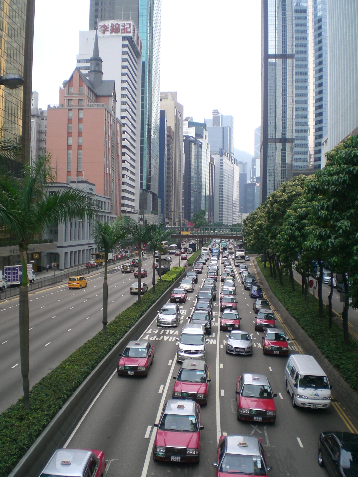
| caption | Gloucester Road as viewed from a pedestrian footbridge in August 2008 |
| native_name | yue |
| length | 2.2 km |
| location | Wan Chai, Hong Kong |
| direction_a | South |
| terminus_a | Causeway Road / Moreton Terrace |
| direction_b | West |
| terminus_b | Harcourt Road / Arsenal Street |
| mapframe-wikidata | yes |
| mapframe-zoom | 14 |
| mapframe-wikidata = yes | mapframe-zoom = 14

Gloucester Road ( ; ) is a major highway in Hong Kong. It is one of the few major roads in Hong Kong with service roads. It was named on 14 June 1929 after Prince Henry, Duke of Gloucester, to commemorate his visit to Hong Kong that year. The road is 2.2 km in length and has a speed limit of 70 km/h.
Location
Gloucester Road is in the north of Wan Chai and East Point on Hong Kong Island. It connects to Harcourt Road at its western end and in the east along the west side of Victoria Park it spit-ends into both Causeway Road and the Tai Hang Road flyover. It formed part of Hong Kong's Route 4 and connects to the Island Eastern Corridor via Victoria Park Road before completion of Central–Wan Chai Bypass. The road is connected to the Cross-Harbour Tunnel near the Canal Road Flyover. It runs almost parallel to Lockhart Road.
History

The road was built between 1922 and 1929 by reclamation as a two-lane road on the seafront. It then only connected the Royal Naval Arsenal Yard in Admiralty and Percival Street in Causeway Bay. It was extended to Cleveland Street after World War II. A canal west of Victoria Park Road is also reclaimed to form part of Gloucester Road.
The completion of Cross-Harbour Tunnel, Aberdeen Tunnel and other major thoroughfares around it increased traffic output, and thus a new road adjoined to Gloucester Road was built in the 1960s and opened in 1972, which was named "Waterfront Road"(海傍大道). Some locals also gave it a nickname of '新路', meaning 'New Road'. The original Gloucester Road was then converted to one sided traffic heading westbound only. A number of flyovers was built. In 1980, the two roads was unified under the same name of Gloucester Road. The original Gloucester Road has been since known as "Inner Gloucester Road" or "Gloucester Road service road".
Travelling time
Vehicles traveling on Gloucester Road can choose two separate routes: North Point and Cross-Harbour Tunnel. During peak hours, the average time required to travel to Western Kowloon is 5-8 minutes; the average time required to travel to North Point is 15-20 minutes.
Landmarks
- The Hong Kong Academy for Performing Arts, main campus (No. 1-3)
- Revenue Tower (No. 7-9)
- Telecom House (No. 4-6)
- Immigration Tower (No. 13-15)
- Wan Chai Tower (No. 10-12)
- Luk Kwok Hotel (No. 70-72)
- Wanchai Meetinghouse of the Church of Jesus Christ of Latter-day Saints (No.118)
- Old Wan Chai Police Station, built in 1932, a Grade II Historic Building (No. 123)
- Wan Chai Sports Ground
- The Gloucester (No. 211-216)
- Sino Plaza (Nos. 256-258)
- Elizabeth House (No. 241-255)
- World Trade Centre (No. 277-279)
- Police Officer Club (No. 259-261)
- The Excelsior hotel (No. 280-282)
- Windsor House (No. 313-315)
- Noonday Gun, across the road from the Excelsior
- China Resource Building
- Causeway Bay Typhoon Shelter
- Central Plaza (No. 16-18)
- Pico Tower (No. 64-66)
- Sun Hung Kai Centre (No. 25-27)
- Lamborghini Hong Kong Showroom (No. 66)
References
References
- (2009). "Signs of a Colonial Era". [[Hong Kong University Press]].
- [http://www.lcsd.gov.hk/ce/Museum/Monument/form/AAB-SM-chi.pdf List of the Historic Buildings in Building Assessment (as of 23 November 2011)] {{webarchive. link. (December 15, 2011)
This article was imported from Wikipedia and is available under the Creative Commons Attribution-ShareAlike 4.0 License. Content has been adapted to SurfDoc format. Original contributors can be found on the article history page.
Ask Mako anything about Gloucester Road, Hong Kong — get instant answers, deeper analysis, and related topics.
Research with MakoFree with your Surf account
Create a free account to save articles, ask Mako questions, and organize your research.
Sign up freeThis content may have been generated or modified by AI. CloudSurf Software LLC is not responsible for the accuracy, completeness, or reliability of AI-generated content. Always verify important information from primary sources.
Report