From Surf Wiki (app.surf) — the open knowledge base
Gilgit
Capital of Gilgit–Baltistan, Kashmir

Capital of Gilgit–Baltistan, Kashmir
| Field | Value |
|---|---|
| name | Gilgit |
| native_name | scl |
| ur | |
| settlement_type | City administered by Pakistan |
| image_skyline | {{Photomontage |
| photo1a | Gilgit City a View from Gilgit serena hotel.jpg |
| photo2a | The Central Imaamia Mosque Gilgit City, GB.jpg |
| photo2b | River Gilgit and the Gilgit City.jpg |
| photo3a | Gilgit waters.jpg |
| size | 270 |
| spacing | 1 |
| color_border | black |
| color | black |
| image_alt | photo3b = Passu, Gilgit Baltistan.jpg photo2b = View of Rakaposhi from Jutial.jpg |
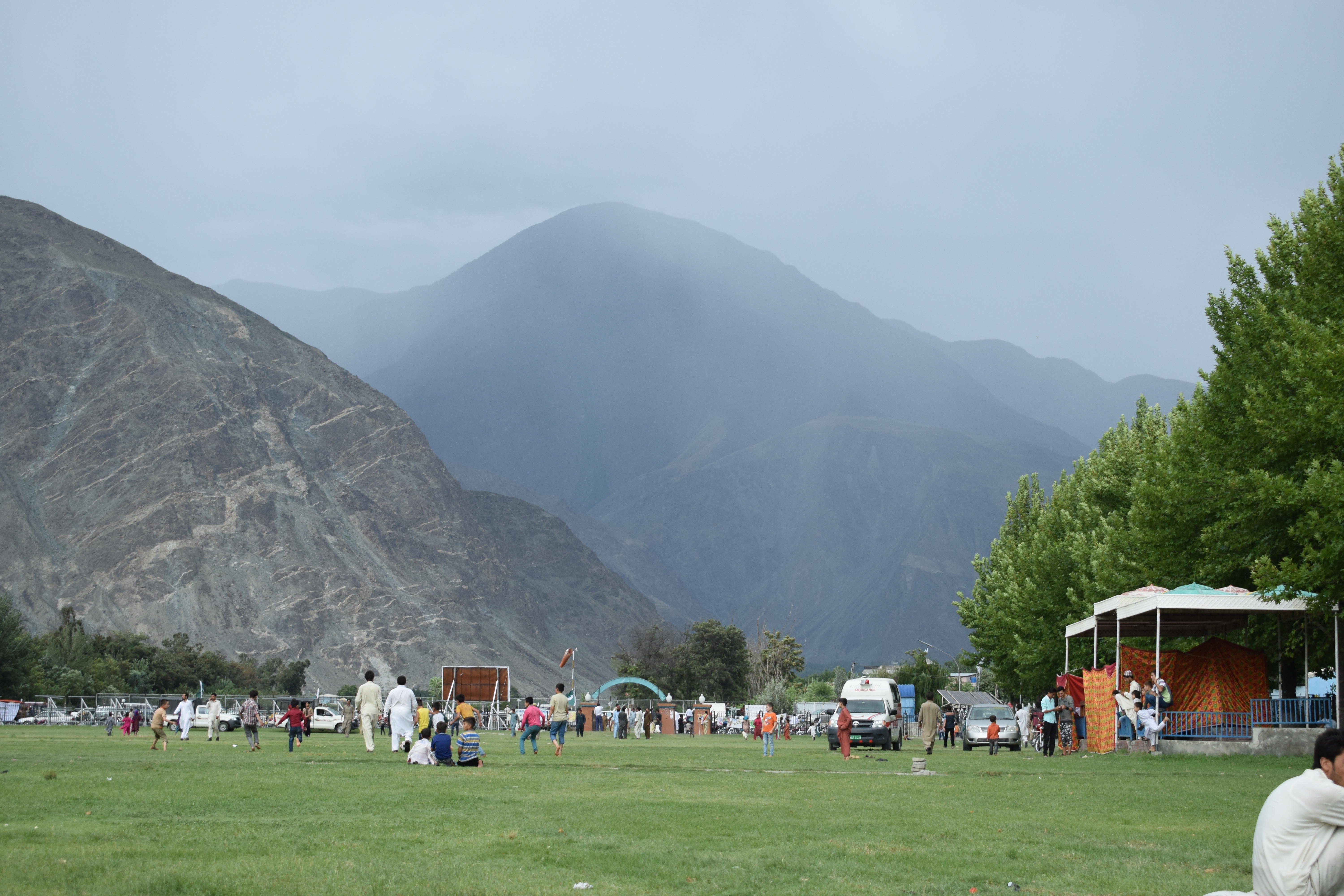
| image_caption | From top: |
| City of Gilgit, Central Imaamia Mosque, Gilgit River, Rakaposhi Mountain (South View) | |
| image_map1 | Kashmir region. LOC 2003626427 - showing sub-regions administered by different countries.jpg |
| map_caption1 | A map showing Pakistan-administered Gilgit-Baltistan shaded in sage in the disputed Jammu Kashmir region |
| coordinates | |
| subdivision_type | Administering country |
| subdivision_name | Pakistan |
| subdivision_type1 | Adm. Unit |
| subdivision_name1 | Gilgit–Baltistan |
| subdivision_type2 | District |
| subdivision_name2 | Gilgit District |
| leader_title | Commissioner |
| leader_name | Najeeb Alam (PAS) |
| government_type | Divisional Administration |
| unit_pref | Metric |
| elevation_footnotes | |
| elevation_m | 1500 |
| population_total | 261,440 |
| population_as_of | 2011 |
| population_density_km2 | auto |
| population_footnotes | |
| demographics_type1 | Demographics |
| demographics1_title1 | Language(s) |
| demographics1_info1 | Shina, Urdu |
| timezone1 | PST |
| utc_offset1 | +5:00 |
| postal_code_type | Postal code |
| postal_code | 1571 – 1xx |
| area_code | +92 |
| mapframe | yes |
| mapframe-wikidata | yes |
| leader_title1 | Deputy Inspector General (DIG) |
| leader_name1 | Hassan Raza Khan (PSP) |
ur City of Gilgit, Central Imaamia Mosque, Gilgit River, Rakaposhi Mountain (South View) | mapframe-wikidata = yes
Gilgit (; Shina: ; ) is the capital and most-populous city in Pakistani-administered Gilgit–Baltistan in the disputed Kashmir region.The application of the term "administered" to the various regions of Kashmir and a mention of the Kashmir dispute is supported by the tertiary sources (a) through (d), reflecting due weight in the coverage. Although "controlled" and "held" are also applied neutrally to the names of the disputants or to the regions administered by them, as evidenced in sources (f) through (h) below, "held" is also considered politicized usage, as is the term "occupied," (see (i) below).
(a) (subscription required) Quote: "Kashmir, region of the northwestern Indian subcontinent ... has been the subject of dispute between India and Pakistan since the partition of the Indian subcontinent in 1947. The northern and western portions are administered by Pakistan and comprise three areas: Azad Kashmir, Gilgit, and Baltistan, the last two being part of a territory called the Northern Areas. Administered by India are the southern and southeastern portions, which constitute the state of Jammu and Kashmir but are slated to be split into two union territories."; (b) (subscription required) Quote: "Aksai Chin, Chinese (Pinyin) Aksayqin, portion of the Kashmir region, at the northernmost extent of the Indian subcontinent in south-central Asia. It constitutes nearly all the territory of the Chinese-administered sector of Kashmir that is claimed by India to be part of the Ladakh area of Jammu and Kashmir state."; (c) C. E Bosworth, University of Manchester Quote: "KASHMIR, kash'mer, the northernmost region of the Indian subcontinent, administered partlv by India, partly by Pakistan, and partly by China. The region has been the subject of a bitter dispute between India and Pakistan since they became independent in 1947"; (d) Quote: "Jammu and Kashmir: Territory in northwestern India, subject to a dispute betw een India and Pakistan. It has borders with Pakistan and China." (e) Quote: "We move from a disputed international border to a dotted line on the map that represents a military border not recognized in international law. The line of control separates the Indian and Pakistani administered areas of the former Princely State of Jammu and Kashmir."; (f) (subscription required) Quote: "... China became active in the eastern area of Kashmir in the 1950s and has controlled the northeastern part of Ladakh (the easternmost portion of the region) since 1962."; (g) Quote: "J&K: Jammu and Kashmir. The former princely state that is the subject of the Kashmir dispute. Besides IJK (Indian-controlled Jammu and Kashmir. The larger and more populous part of the former princely state. It has a population of slightly over 10 million, and comprises three regions: Kashmir Valley, Jammu, and Ladakh.) and AJK ('Azad" (Free) Jammu and Kashmir. The more populous part of Pakistani-controlled J&K, with a population of approximately 2.5 million. AJK has six districts: Muzaffarabad, Mirpur, Bagh, Kodi, Rawalakot, and Poonch. Its capital is the town of Muzaffarabad. AJK has its own institutions, but its political life is heavily controlled by Pakistani authorities, especially the military), it includes the sparsely populated "Northern Areas" of Gilgit and Baltistan, remote mountainous regions which are directly administered, unlike AJK, by the Pakistani central authorities, and some high-altitude uninhabitable tracts under Chinese control." (h) Quote: "Kashmir’s identity remains hotly disputed with a UN-supervised “Line of Control” still separating Pakistani-held Azad (“Free”) Kashmir from Indian-held Kashmir."; (i) Quote:"Some politicised terms also are used to describe parts of J&K. These terms include the words 'occupied' and 'held'." It is located in a broad valley near the confluence of the Gilgit and the Hunza rivers. It is a major tourist destination in Pakistan, serving as a hub for trekking and mountaineering expeditions in the Karakoram mountain range of Northern Pakistan.
Gilgit was once a major centre for Buddhism; it was an important stop on the ancient Silk Road, and today serves as a major junction along the Karakoram Highway with road connections to China as well as the Pakistani cities of Skardu, Chitral, Peshawar, and Islamabad. The city's economic activity is mainly focused on agriculture, with wheat, maize, and barley as the main crops.
Etymology
The city's ancient name was Sargin, later to be known as Gilit, and it is still referred to as Gilit or Sargin-Gilit by the local people. The native Khowar and Wakhi-speaking people refer to the city as Gilt, and in Burushaski, it is called Geelt.
History
Main article: History of Gilgit-Baltistan
Early history
Brokpas trace their settlement from Gilgit into the fertile villages of Ladakh through a rich corpus of hymns, songs, and folklore that have been passed down through generations. The Dards and Shinas appear in many of the old Pauranic lists of people who lived in the region, with the former also mentioned in Ptolemy's accounts of the region.
Buddhist era
Main article: Patola Shahis
Gilgit was an important city on the Silk Road, along which Buddhism spread from South Asia to the rest of Asia. It is considered a Buddhism corridor, along which many Chinese monks came to Kashmir, to learn and to preach Buddhism. Two famous Chinese Buddhist pilgrims, Faxian and Xuanzang, traversed Gilgit, according to their accounts.


According to Chinese records, in the 600s and 700s, the city was governed by a Buddhist dynasty referred to as Little Balur or Lesser Bolü ().{{Cite book | access-date = 2017-02-19 | access-date = 2018-01-23 | access-date = 2017-02-19
In mid-600s, Gilgit came under Chinese suzerainty after the fall of the Western Turkic Khaganate to the Tang military campaigns in the region. In the late 600s CE, the rising Tibetan Empire wrested control of the region from the Chinese. However, faced with growing influence of the Umayyad Caliphate and then the Abbasid Caliphate to the west, the Tibetans were forced to ally themselves with the Islamic caliphates. The region was then contested by the Chinese and Tibetan forces, and their respective vassal states, until the mid-700s. Chinese records of the region continue until late the 700s, at which time the Tangs' western military campaign was weakened due to the An Lushan Rebellion.{{Cite book | author-link = Aurel Stein
Control of the region was left to the Tibetan Empire. They referred to the region as Bruzha, a toponym that is consistent with the ethnonym "Burusho" used today. Tibetan control of the region lasted until the late 800s CE.{{Cite journal | access-date = 2018-01-22
Gilgit manuscripts
This corpus of manuscripts was discovered in 1931 in Gilgit and contains numerous Buddhist texts, including four sutras from the Buddhist canon, most notably the Lotus Sutra. The manuscripts were written on birch bark in the Buddhist form of Sanskrit in the Sharada script. They cover a wide range of themes such as iconometry, folk tales, philosophy, medicine, and several related areas of life and general knowledge.
The Gilgit manuscripts{{cite web |access-date=6 February 2014 are included in the UNESCO Memory of the World register. They are among the oldest manuscripts in the world, and the oldest manuscript collection surviving in Pakistan, having major significance in Buddhist studies and the evolution of Asian and Sanskrit literature. The manuscripts are believed to have been written in the 5th to 6th centuries AD, though more manuscripts were discovered from the succeeding centuries, which were also classified as Gilgit manuscripts.
Many of the original manuscripts from Gilgit can be found in the National Archives of India and the Pratap Singh Museum in Srinagar. Two manuscripts collected by the orientalist Sir Aurel Stein are in the British Library in London. They include a rare paper version of the Lotus Sutra.
As of 6 October 2014, one source claims that the part of the collection deposited at the Sri Pratap Singh Museum in Srinagar was irrecoverably destroyed during the 2014 India–Pakistan floods.
Pre-Trakhàn

Trakhàn Dynasty
Main article: Trakhan dynasty

Gilgit was ruled for centuries by the local Trakhàn Dynasty, which ended about 1810 with the death of Raja Abas, the last Trakhàn Raja. The rulers of Hunza and Nager also claim origin with the Trakhàn dynasty. They claim descent from a heroic Kayani Prince of Persia, Azur Jamshid (also known as Shamsher), who secretly married the daughter of the king Shri Badat.
She conspired with him to overthrow her cannibal father. Sri Badat's faith is theorised as Hindu by some and Buddhist by others.
Prince Azur Jamshid succeeded in overthrowing King Badat who was known as the Adam Khor (literally "man-eater"), often demanding a child a day from his subjects, his demise is still celebrated to this very day by locals in traditional annual celebrations. In the beginning of the new year, where a Juniper procession walks along the river, in memory of chasing the cannibal king Sri Badat away.
Azur Jamshid abdicated after 16 years of rule in favour of his wife Nur Bakht Khatùn until their son and heir Garg, grew of age and assumed the title of Raja and ruled, for 55 years. The dynasty flourished under the name of the Kayani dynasty until 1421 when Raja Torra Khan assumed rulership. He ruled as a memorable king until 1475. He distinguished his family line from his stepbrother Shah Rais Khan (who fled to the king of Badakshan, and with whose help he gained Chitral from Raja Torra Khan), as the now-known dynastic name of Trakhàn. The descendants of Shah Rais Khan were known as the Ra'issiya Dynasty.
1800s
The area had been a flourishing tract but prosperity was destroyed by warfare over the next fifty years, and by the great flood of 1841 in which the river Indus was blocked by a landslip below the Hatu Pir and the valley was turned into a lake. After the death of Abas, Sulaiman Shah, Raja of Yasin, conquered Gilgit. Then, Azad Khan, Raja of Punial, killed Sulaiman Shah, taking Gilgit; then Tahir Shah, Raja of Buroshall (Nagar), took Gilgit and killed Azad Khan.
Tair Shah's son Shah Sakandar inherited, only to be killed by Gohar Aman, ethnic Kho Raja of Yasin of the Khushwakhte Dynasty when he took Gilgit. Then in 1842, Shah Sakandar's brother, Karim Khan, expelled Yasin rulers with the support of a Sikh army from Kashmir. The Sikh general, Nathu Shah, left garrison troops and Karim Khan ruled until Gilgit was ceded to Gulab Singh of Jammu and Kashmir in 1846 by the Treaty of Amritsar, and Dogra troops replaced the Sikh in Gilgit.
Nathu Shah and Karim Khan both transferred their allegiance to Gulab Singh, continuing local administration. When Hunza attacked in 1848, both of them were killed. Gilgit fell to the Hunza and their Yasin and Punial allies but was soon reconquered by Gulab Singh's Dogra troops. With the support of Raja Gohar Aman, Gilgit's inhabitants drove their new rulers out in an uprising in 1852. Raja Gohar Aman then ruled Gilgit until his death in 1860, just before new Dogra forces from Ranbir Singh, son of Gulab Singh, captured the fort and town.
In the 1870s Chitral was threatened by Afghans, Maharaja Ranbir Singh was firm in protecting Chitral from Afghans, the Mehtar of Chitral asked for help. In 1876 Chitral accepted the authority of Jammu Clan and in reverse get the protection from the Dogras who have in the past took part in many victories over Afghans during the time of Gulab Singh Dogra.
British Raj
Main article: Gilgit Agency
In 1877, in order to guard against the advance of Russia, the British India Government, acting as the suzerain power of the princely state of Jammu and Kashmir, established the Gilgit Agency. The Agency was re-established under control of the British Resident in Jammu and Kashmir. It comprised the Gilgit Wazarat; the State of Hunza and Nagar; the Punial Jagir; the Governorships of Yasin, Kuh-Ghizr and Ishkoman, and Chilas.
The Tajiks of Xinjiang sometimes enslaved the Gilgiti and Kunjuti Hunza.

In 1935, the British India government demanded from the Jammu and Kashmir state to lease them Gilgit town plus most of the Gilgit Agency and the hill-states Hunza, Nagar, Yasin and Ishkoman for 60 years.
Abdullah Sahib was an Arain and belonged to Chimkor Sahib village of Ambala district Punjab, British India. Abdullah Sahib was the first Muslim governor of the Gilgit in British time period and was close associate of Maharaja Partap Singh.
Khan Bahadur Kalay Khan, a Mohammed Zai Pathan, was the Governor of Gilgit Hunza and Kashmir before partition.
1947 Kashmir war
Main article: Indo-Pakistani war of 1947–1948, 1947 Gilgit rebellion
On 26 October 1947, Maharaja Hari Singh of Jammu and Kashmir, signed the Instrument of Accession, joining India. The tribal invasion by Pakistan was not simply a tribal invasion. Pakistani Major General Akbar Khan has given account of the invasion in his book Raiders in Kashmir. General Akbar Khan, then serving as a colonel in the Pakistan army, has described at least four meetings with Prime Minister Liaquat Ali Khan to discuss the planning and conduct of the operations. Justice Muhammad Yusuf Saraf, at the time a Muslim Conference activist, has pointed out that such a major operation could not have been launched without Jinnah's knowledge and approval. The 'Azad Forces' that were part of the so-called tribal invasion were led by Pakistan army officers, and the UNCIP report records Pakistan's admission that they were under Pakistan's 'tactical command'.
Gilgit's military leaders did not favour the State's accession to India. However, there was also written evidence of Gilgit troop leaders wanting to set up an independent Islamic state. Major William Brown in his book Gilgit Rebellion describes the Gilgit troop leaders stating, "We know of course that you are loyal to Pakistan-all Britishers are-but it is not our intention to join Pakistan. We intend to set up an independent Islamic State called the United States of Gilgit, and although we shall keep the friendliest relation with Pakistan we shall in no way owe allegiance to that dominion." The military leaders of the Frontier Districts Province (modern day Gilgit-Baltistan) wanted to join Pakistan. Sensing their discontent, Major William Brown, the Maharaja's commander of the Gilgit Scouts, mutinied on 1 November 1947, overthrowing the Governor Ghansara Singh. The bloodless coup d'etat was planned by Brown to the last detail under the code name "Datta Khel", which was also joined by a rebellious section of the Jammu and Kashmir 6th Infantry under Mirza Hassan Khan. Brown ensured that the treasury was secured and minorities were protected. A provisional government (Aburi Hakoomat) was established by the Gilgit locals with Raja Shah Rais Khan as the president and Mirza Hassan Khan as the commander-in-chief. However, Major Brown had already telegraphed Khan Abdul Qayyum Khan asking Pakistan to take over. The Pakistani political agent, Khan Mohammad Alam Khan, arrived on 16 November and took over the administration of Gilgit. Brown outmaneuvered the pro-Independence group and secured the approval of the mirs and rajas for accession to Pakistan. Browns's actions surprised the British Government.
The provisional government lasted 16 days. The provisional government lacked sway over the population. The Gilgit rebellion did not have civilian involvement and was solely the work of military leaders, not all of whom had been in favor of joining Pakistan, at least in the short term. Historian Ahmed Hasan Dani mentions that although there was lack of public participation in the rebellion, sentiments were intense in the civilian population and their anti-Kashmiri sentiments were also clear. According to various scholars, the people of Gilgit as well as those of Chilas, Koh Ghizr, Ishkoman, Yasin, Punial, Hunza and Nagar joined Pakistan by choice.
Geography


Gilgit is situated in a valley formed by the confluence of the Indus River, Hunza River, Astore River and Gilgit River.
Climate
Gilgit experiences a cold desert climate (Köppen climate classification BWk). Weather conditions for Gilgit are dominated by its geographical location, a valley in a mountainous area, southwest of Karakoram range.
Gilgit lacks significant rainfall, averaging in 120 to annually, as monsoon breaks against the southern range of Himalayas. Irrigation for land cultivation is obtained from the rivers, abundant with melting snow water from higher altitudes.
The summer season is brief and hot, with daily high temperatures occasionally peaking at over 40 C. As a result of this extremity in the weather, landslides and avalanches are frequent in the area.{{cite web |access-date=11 June 2009 |Jan record high C = 17.5 |Feb record high C = 22.0 |Mar record high C = 29.4 |Apr record high C = 37.2 |May record high C = 41.5 |Jun record high C = 43.5 |Jul record high C = 46.3 |Aug record high C = 43.8 |Sep record high C = 41.6 |Oct record high C = 36.0 |Nov record high C = 28.0 |Dec record high C = 24.5 |year record high C = 46.3 |Jan record low C = -10.0 |Feb record low C = -8.9 |Mar record low C = -3.0 |Apr record low C = 1.1 |May record low C = 3.9 |Jun record low C = 5.1 |Jul record low C = 10.0 |Aug record low C = 9.8 |Sep record low C = 3.0 |Oct record low C = -2.5 |Nov record low C = -8.5 |Dec record low C = -11.1 |year record low C = −11.1
Climate Change Effects
Main article: 2022 Gilgit-Baltistan floods
Climate change has adversely affected this region with more rains every year. On 26 August 2022, most villages in Ghizer district and Hunza were severely affected by the ongoing flooding displacing many people.
Administration
The city of Gilgit constitutes a tehsil within Gilgit District. Gilgit District itself is the part of the larger Gilgit Division which is headed by a Commissioner of BPS-20 belonging to Pakistan Administrative service. The Current Commissioner Gilgit Division is Mr Najeem Alam (PAS).
Transportation


Air
Gilgit is served by the nearby Gilgit Airport, with direct flights to Islamabad. Pakistan International Airlines (PIA) is the only airline operating in Gilgit. The Government of Pakistan is planning to build a new international standard airport in Gilgit to meet the requirements of international tourists and demand from domestic investors.{{Cite news |access-date =27 May 2021
Road

Gilgit is located approximately 10 km from the Karakoram Highway (KKH). The roadway is being upgraded as part of the China–Pakistan Economic Corridor. The KKH connects Gilgit to Chilas, Dasu, Besham, Mansehra, Abbottabad and Islamabad in the south. Gilgit is connected to Karimabad (Hunza) and Sust in the north, with further connections to the Chinese cities of Tashkurgan, Upal and Kashgar in Xinjiang. Gilgit is also linked to Chitral in the west, and Skardu to the east. The road to Skardu will be upgraded to a 4-lane road at a cost of $475 million.
Transport companies such as the Silk Route Transport Pvt, Masherbrum Transport Pvt and Northern Areas Transport Corporation (NATCO ), offer passenger road transport between Islamabad, Gilgit, Sust, and Kashgar and Tashkurgan in China.
The Astore-Burzil Pass Road, linking Gilgit to Srinagar was closed in 1978.
Rail
Gilgit is not served by any rail connections. Long-term plans for the China–Pakistan Economic Corridor call for construction of the 682 km long Khunjerab Railway, which is expected to be completed in 2030, that would also serve Gilgit.
File:KKH.png|Route of the Karakoram Highway File:Hunza Tunnel.jpg|Tunnels are common in Gilgit
Education

- Karakoram International University Gilgit
Basic facilities

Gilgit has not received a gas pipeline infrastructure since Pakistan's independence, unlike other cities. Through the importation of gas cylinders from other provinces, many private gas contractors offer gas cylinders. The LPG (Liquefied Petroleum Gas) Air Mix Plant project by Sui Northern Gas Pipelines Limited was unveiled in 2020, with the goal of bringing the gas facility to Gilgit. This will significantly reduce deforestation, as the public now uses wood from trees for heating and lighting purpose. The first head office has been built in Gilgit.
Severe flash floods in Gilgit-Baltistan have exposed critical infrastructure failures, with residents in Diamer, Danyor, and Ghanche districts facing acute shortages of drinking water, electricity, road access, and communication. Despite repeated appeals, local authorities have failed to restore basic services, prompting threats of public protests. The crisis underscores ongoing administrative neglect and inadequate disaster response in the area.
Sister cities
- Skardu, Baltistan
- Kashgar, China (since May 2009) File:Polo Statue Located near APSACS Gilgit.jpg|This statue is made to show the spirit of the Polo Sport located at Jutial; however, it has since been removed. Polo is played every year in the Shandoor Valley. File:I Love Gilgit Sign.jpg|I Love Gilgit sign made to show patriotism towards the region File:Dumplings of Gilgit.jpg|Dumplings a.k.a. manto, are a widely eaten dish in the region
References
Citations
General sources
References
- "Geography of Chitral". Chitralnews.com.
- (2014). "Strategic Environmental Assessment of the Master Plan for Gilgit City". IUCN Pakistan (National Impact Assessment Programme).
- "Post Codes". Pakistan Post Office.
- "Gilgit {{!}} Kashmir region, Indian subcontinent, Asia".
- paderbornersj. (2017-03-26). "Welcome to 'Happiness': In ancient times Gilgit was known as 'Sargin Gileet' which means the happy land of Gilgit in Shina language — Pamir Times Net".
- "Metropolitan Museum of Art".
- (3 May 2012). "BBC News – India: Rare Buddhist manuscript Lotus Sutra released". Bbc.co.uk.
- "Gilgit Manuscript {{!}} United Nations Educational, Scientific and Cultural Organization".
- "IDP Blog – International Dunhuang Programme".
- (3 October 2014). "Kashmir floods damage 2000-year-old Buddhist treasures".
- (2018). "Images of the Crowned Buddha along the Silk Road: Iconography and Ideology". Humanities.
- "Bronzes of the Ancient Buddhist Kingdom of Gilgit".
- (2017). "A Turk in the Dukhang? Comparative Perspectives on Elite Dress in Medieval Ladakh and the Caucasus". Austrian Academy of Science Press.
- [[Frederick Drew]] (1875) ''The Jummoo and Kashmir Territories: A Geographical Account'' E. Stanford, London, [https://worldcat.org/oclc/1581591 OCLC 1581591]
- Amar Singh Chohan (1984) ''The Gilgit Agency, 1877–1935'', Atlantic Publishers & Distributors, p. 4
- Reginald Charles (1976) ''Between the Oxus and the Indus'', Francis Schomberg, p. 249
- Henry Osmaston, [[Philip Denwood]] (1995) ''Recent Research on Ladakh 4 & 5: Proceedings of the Fourth and Fifth'', Motilal Banarsidass, p. 226
- Ahmad Hasan Dani (1989) ''History of Northern Areas of Pakistan'', Islamabad : National Institute of Historical and Cultural Research, p. 163
- ''Imperial Gazetteer of India. Provincial Series: Kashmir and Jammu'', {{ISBN. 0-543-91776-2, Adamant, p. 107
- Reginald Charles (1976) ''Between the Oxus and the Indus'', Francis Schomberg, p. 144
- [https://www.clas.ufl.edu/users/jneelis/dissertation/Chapter1.pdf]{{dead link. (November 2013)
- Henry Osmaston, [[Philip Denwood]] (1995) ''Recent Research on Ladakh 4 & 5'', Motilal Banarsidass Publ., p. 229
- Ahmad Hasan Dani (1999) ''History of Civilizations of Central Asia'', Motilal Banarsidass Publ, pp. 216–217
- John Bidduph (2004) ''Tribes of the Hindoo Koosh'', Adamant Media Corporation, {{ISBN. 1402152728, pp. 20–21
- (18 February 2013). "Imperial Gazetteer2 of India, Volume 12 – Imperial Gazetteer of India – Digital South Asia Library". Dsal.uchicago.edu.
- Prakash Nanda. (2007). "Rising India: Friends and Foes". Lancer Publishers.
- Sir Thomas Douglas Forsyth. (1875). "Report of a mission to Yarkund in 1873, under command of Sir T. D. Forsyth: with historical and geographical information regarding the possessions of the ameer of Yarkund". Printed at the Foreign department press.
- Srivastava, Dinkar P.. (2021). "Forgotten Kashmir: The Other Side of the Line of Control". [[HarperCollins India]].
- Snedden, Christopher. (2013). "Kashmir-The Untold Story". HarperCollins Publishers India.
- Victoria Schofield. (2000). "Kashmir in Conflict: India, Pakistan and the Unending War". I.B.Tauris.
- Bangash, Yaqoob Khan. (9 January 2016). "Gilgit-Baltistan—part of Pakistan by choice". The Express Tribune.
- Chitralekha Zutshi. (2004). "Languages of Belonging: Islam, Regional Identity, and the Making of Kashmir". C. Hurst & Co. Publishers.
- Sokefeld, Martin. (November 2005). "From Colonialism to Postcolonial Colonialism: Changing Modes of Domination in the Northern Areas of Pakistan". The Journal of Asian Studies.
- "Gilgit Climate Data". Pakistan Meteorological Department.
- (2015). "Historical Dictionary of Pakistan". Lowman & Littlefield.
- (24 November 2015). "PM announces construction of Skardu-Gilgit road". Samaa TV.
- Ibrahim Shahid (27 March 2004) [http://www.jammu-kashmir.com/archives/archives2004/kashmir20040327b.html Gilgit-Srinagar Road: Govt seeks NA admin's opinion] {{Webarchive. link. (4 March 2016 . ''The Daily Times'')
- (4 July 2017). "Havelian to Khunjerab railway track to be upgraded under China-Pakistan Economic Corridor". Sost Today.
- https://www.sngpl.com.pk/SNG_Megzines/112020/newsletter.pdf {{Bare URL PDF. (August 2022)
- (2018-11-21). "Decentralization and Local Public Goods: How does allocation of decision-making authority affect provision?".
This article was imported from Wikipedia and is available under the Creative Commons Attribution-ShareAlike 4.0 License. Content has been adapted to SurfDoc format. Original contributors can be found on the article history page.
Ask Mako anything about Gilgit — get instant answers, deeper analysis, and related topics.
Research with MakoFree with your Surf account
Create a free account to save articles, ask Mako questions, and organize your research.
Sign up freeThis content may have been generated or modified by AI. CloudSurf Software LLC is not responsible for the accuracy, completeness, or reliability of AI-generated content. Always verify important information from primary sources.
Report