From Surf Wiki (app.surf) — the open knowledge base
Gettysburg Battlefield
American Civil War battle-site
American Civil War battle-site
| Field | Value |
|---|---|
| name | Gettysburg Battlefield |
| image | Gettysburg-Open-Battlefield.svg |
| caption | The Battle of Gettysburg, which took place in and around Gettysburg, Pennsylvania between July 1 and July 3, 1863 |
| type | Battlefield |
| locmapin | Pennsylvania |
| coordinates | |
| location | Adams County, Pennsylvania, U.S. |
| website | Park Home (NPS.gov) |
| owner | private, federal |
The Gettysburg Battlefield is the area of the July 1–3, 1863, military engagements of the Battle of Gettysburg in and around Gettysburg, Pennsylvania. Locations of military engagements extend from the 4 acre site of the first shot & at Knoxlyn Ridge on the west of the borough, to East Cavalry Field on the east. A military engagement prior to the battle was conducted at the Gettysburg Railroad trestle over Rock Creek, which was burned on June 27.
Geography


Within 10 mi of the Maryland/Pennsylvania state line, the Gettysburg battlefield is situated in the Gettysburg-Newark Basin of the Pennsylvania Piedmont entirely within the Potomac River Watershed near the Marsh and Rock creeks' triple point, with the Susquehanna River Watershed (near Oak Hill) occupying an area 3.33 x. Military engagements occurred within and around the borough of Gettysburg (1863 pop. 2,400), which remains the population center for the battlefield area at the intersections of roads that connect the borough with 10 nearby Pennsylvania and Maryland towns (e.g., antebellum turnpikes to Chambersburg, York, and Baltimore.)
Topography

The battle began on the west at Lohr's, Whistler's, School-House,
Directly south of the town is the gently sloped Cemetery Hill named for the 1854 Evergreen Cemetery on its crest and where the 1863 Gettysburg Address dedicated the Gettysburg National Cemetery. Eastward are Culp's Hill and Steven's Knoll. Cemetery Hill and Culp's Hill were subjected to assaults throughout the battle by Richard S. Ewell's Second Corps. Cemetery Ridge extends about 1 mi south from Cemetery Hill.
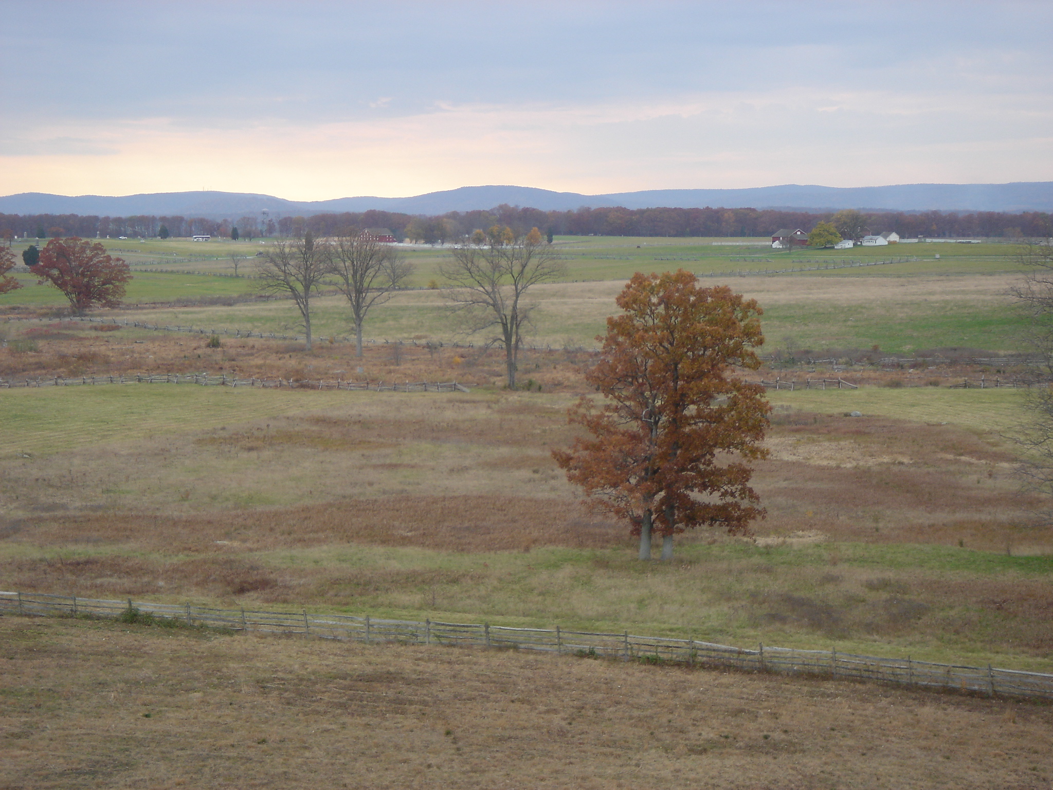
Southward from Cemetery Hill is Cemetery Ridge of only about 40 feet (12 m) above the surrounding terrain. The ridge includes The Angle's stone wall and the copse of trees at the High-water mark of the Confederacy during Pickett's Charge. The southern end of Cemetery Ridge is Weikert Hill, north of Little Round Top.
The two highest battlefield points are at Round Top to the south with the higher round summit of Big Round Top, the lower oval summit of Little Round Top, and a saddle between. The Round Tops are rugged and strewn with large boulders; as is Devil's Den to the west. [Big] Round Top, known also to locals of the time as Sugar Loaf, is 116 ft higher than its Little companion. Its steep slopes are heavily wooded, which made it unsuitable for siting artillery without a large effort to climb the heights with horse-drawn guns and clear lines of fire; Little Round Top was unwooded, but its steep and rocky form made it difficult to deploy artillery in mass. However, Cemetery Hill was an excellent site for artillery, commanding all of the Union lines on Cemetery Ridge and the approaches to them. Little Round Top and Devil's Den were key locations for General John Bell Hood's division in Longstreet's assault during the second day of battle, July 2, 1863. The Plum Run Valley between Houck's Ridge and the Round Tops earned the name Valley of Death on that day.
Borough areas of military engagements
The area of the military engagements during the battle included the majority of the 1863 town area Smaller engagements in the town included those with some federals remaining in/near structures after the retreat (e.g., wounded soldiers not willing to surrender). The largest engagement within the current borough was at Coster Avenue (north of the 1863 town) in which Early's division defeated Coster's brigade. The town was generally held by the Confederate provost and used by snipers after the dawn of July 2 (e.g., a brickyard behind the McCreary House, the John Rupp Tannery on Baltimore St, and a church belfry). A Confederate skirmish line at Breckenridge Street faced Federals on Cemetery Hill, and ~7 pm July 1, "the Confederate line of battle had been formed on East and West Middle Streets".
History

At the close of the battle, some of the ~22,000 wounded remained on the battlefield and were subsequently treated at the outlying Camp Letterman hospital or nearby field hospitals, houses, churches, and other buildings. Dead soldiers on the battlefield totaled 8,900; and contractors such as David Warren were hired to bury men and animals (the majority near where they fell). Samuel Weaver oversaw all of these reburials. The first excursion train arrived with battlefield visitors on July 5.
On July 10, Pennsylvania Governor Andrew Curtin visited Gettysburg and expressed the state's interest in finding the fallen veterans a resting place. Attorney David Wills arranged for the purchase of 17 acre of Cemetery Hill battlefield land for a cemetery. On August 14, 1863, attorney David McConaughy recommended a preservation association to sell membership stock for battlefield fundraising. By September 16, 1863, battlefield protection had begun with McConaughy's purchase of "the heights of Cemetery Hill and" Little Round Top, and his total purchased area of 600 acre included Culp's Hill land.
On November 19, 1863, Abraham Lincoln delivered his Gettysburg Address at the dedication of the Soldiers' National Cemetery, which was completed in March 1864 with the last of 3,512 Union reburied. From 1870 to 1873, upon the initiative of the Ladies Memorial Associations of Richmond, Raleigh, Savannah, and Charleston, 3,320 bodies were disinterred and sent to cemeteries in those cities for reburial, 2,935 being interred in Hollywood Cemetery, Richmond. Seventy-three bodies were reburied in home cemeteries. The cemetery was transferred to the United States government May 1872, and the last Battle of Gettysburg body was reburied in the national cemetery after being discovered in 1997.
Union Gettysburg veteran Emmor Cope was detailed to annotate the battlefield's troop positions and his "Map of the Battlefield of Gettysburg from the original survey made August to October, 1863" was displayed at the 1904 Louisiana Purchase Exposition. Also in 1863, John B. Bachelder escorted convalescing officers at Gettysburg to identify battlefield locations (during the next winter he interviewed Union officers about Gettysburg).
Memorial association era

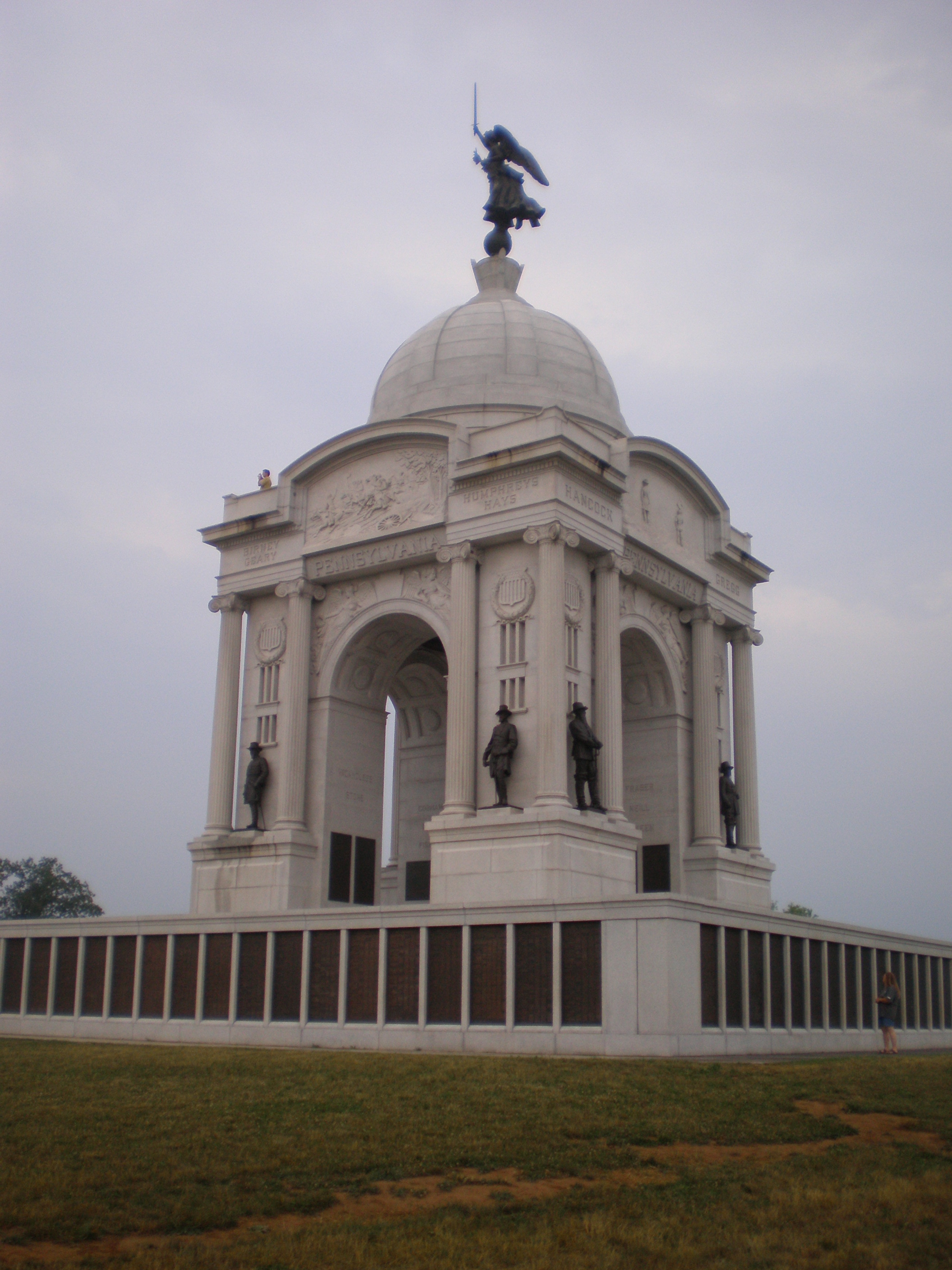
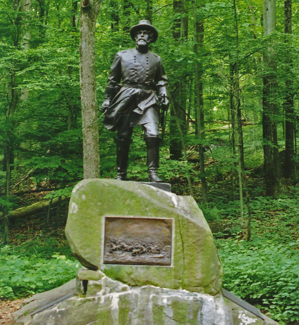
The 1864 Gettysburg Battlefield Memorial Association (GBMA) added to McConaughy's land holdings and operated a wooden observation tower on East Cemetery Hill from 1878 to 1895. (Gettysburg Compiler of July 30, 1895 ) Post-war, John Bachelder invited over 1,000 officers, including 49 generals, to revisit the field with him. By May 1887 there were 90 regimental and battery monuments on the battlefield, and the first bronze monument on the battlefield was Reynolds' 1872 statue in the cemetery. The only two Confederate monuments inside the Union areas of battle held are an 1887 plaque near The Angle commemorating Gen Armistead's farthest advance on July 3 and the 1884 2nd Maryland Infantry monument on Culp's Hill.
The battlefield was used by the 1884 Camp Gettysburg and other summer encampments of the PA National Guard. Commercial development in the 19th century included the 1884 Round Top Branch of railroad to Round Top, Pennsylvania, and after March 1892, Tipton Park operated in the Slaughter Pen—which was at a trolley station of the Gettysburg Electric Railway that operated from 1894 to 1916.
The federal Gettysburg National Park Commission was established on March 3, 1893; after which Congressman Daniel Sickles initiated a May 31, 1894, resolution “to acquire by purchase (or by condemnation) … such lands, or interests in lands, upon or in the vicinity of said battle field." The memorial association era ended in 1895 when the "Sickles Gettysburg Park Bill" (28 Stat. 651) designated the Gettysburg National Military Park (GNMP) under the War Department. Subsequent battlefield improvements included the October 1895 construction of the War Department's observation towers to replace the 1878 Cemetery Hill tower and an 1881 Big Round Top tower.
Commemorative era
:See also List of monuments of the Gettysburg Battlefield
For payment of the Gettysburg Battlefield Memorial Association's debts of $1960.46, on February 4, 1896, the War Department acquired 124 GBMA tracts totaling 522 acres, including 320 monuments and about 17 mi of roads. Commercial development after Tipton Park was abolished in the fall of 1901 included the July 1902 Hudson Park picnic grove north of Little Round Top (including a boxing arena). A dancing pavilion was erected at the Round Top Museum in 1902, and in the saddle area between the Round Tops, David Weikert operated an eating house moved from Tipton Park after it was seized in 1901 by eminent domain. Landscape preservation began in 1883 when peach trees were planted in the Peach Orchard, and 20,000 battlefield trees were planted in 1906 (trees are periodically removed from battlefield areas that had been logged prior to the battle.)
Battlefield visitors through the early 20th century typically arrived by train at the borough's 1884 Gettysburg & Harrisburg RR Station or the 1859 Gettysburg Railroad Station and used horse-drawn jitneys to tour the battlefield. The borough licensed automobile taxis first in 1913, and the War Department expanded the battlefield roads throughout the commemorative era. Early 20th century battlefield excursions included those by "The Hod Carriers Consolidated Union of Baltimore" and the annual "Topton Day" autumn foliage tours from near Berks County, Pennsylvania.
Veterans reunions included the 1888 25th battle anniversary, a 1906 ceremony to return Gen Armistead's sword to the South. and 53,407 civil war veterans attending the 1913 Gettysburg reunion for the 50th anniversary. The battlefield had a 1912 airfield at Camp Stuart and a WWI Tank Corps center at Brevet Lt. Col. Dwight D. Eisenhower's 1918 Camp Colt, and excursions to the Round Top Park brought alcohol and prostitution. The 1922 Camp Harding included a Marine Corps reenactment of Pickett's Charge observed by President Warren Harding and a next-day simulation of the same attack with modern weapons and tactics.
The battlefield's commemorative era ended in 1927, and use of the national park for military camps continued under an 1896 federal law (29 Stat. 120), e.g., a 1928 artillery and cavalry camp was held at Culp's Hill in conjunction with President Calvin Coolidge's Memorial Day address in the cemetery's rostrum.
Development era
In 1933, administration of the GNMP transferred to the 1916 National Park Service (NPS), which initiated Great Depression projects including 1933 Civil Works Administration improvements, and two Civilian Conservation Corps camps were subsequently built for battlefield maintenance and construction projects. After a 1933 comfort station had been built at The Pennsylvania State Memorial, and in April 1938, the Works Progress Administration added battlefield parking areas. Numerous commercial facilities were also developed on private battlefield land, particularly during the 1950s "Golden Age of Capitalism" in the United States (e.g., motels, eateries, & visitor attractions).
The battlefield's 2nd largest monument, the Eternal Light Peace Memorial, was accepted by President Franklin D. Roosevelt and unveiled at the 1938 Gettysburg reunion that attracted over 300,000 battlefield visitors. In 1939, the 1st of the Gettysburg National Museum's 14 expansions was completed (the electric map auditorium was added in 1963 and closed April 13, 2008). Pitzer Woods was the site of the World War II Camp Sharpe, and McMillan Woods had a German POW camp (the latter was used for post-war housing of migrant workers for local production). Heads-of-state at the battlefield included a 1943 Winston Churchill auto tour with President Roosevelt, President Eisenhower escorting President Charles De Gaulle (1960), and President Jimmy Carter hosting President Anwar Sadat and Prime Minister Menachem Begin (1978).
The 1956 Mission 66 plan for the 1966 NPS 50th anniversary included restoring battlefield houses, resurfacing 31 mi of avenues, replacing the railway cut bridge, and restoring the 1884 Gettysburg Cyclorama.
1962–present
As the Mission 66 Cyclorama Building at Gettysburg with a new battlefield observation deck was being completed in 1962, the nearby 1896 Zeigler's Grove observation tower was removed (the 1895 Big Round Top observation tower was removed in 1968). In 1967, the NPS purchased the 1921 Gettysburg National Museum, which the NPS operated from 1971-2008. until demolished 1982. The private Gettysburg National Tower of 393 ft was completed in 1974 to provide several observation levels for viewing the battlefield, but was purchased under eminent domain and demolished in 2000. In the Devil's Den area, trees were removed in 2007, and the comfort station was razed April 8, 2010. Similarly, the Gettysburg National Museum was demolished in 2008.
In 2008, the Gettysburg National Military Park had 1,320 monuments, 410 cannon, 148 historic buildings, 2½ observation towers, and 41 mi of avenues, roads, and lanes; (8 unpaved). "one of the largest collections of outdoor sculpture in the world."
In February 2013 the landmark modernist Cyclorama Building and Visitor Center, designed by renowned architect Richard Neutra, was destroyed. The 19th century Gettysburg Cyclorama depicting the battlefield had previously been removed for restoration, and was reinstalled in the new rustic style Gettysburg Museum and Visitor Center.
The Gettysburg National Military Park receives an annual 3 million visitors per year.
The American Battlefield Trust and its partners have acquired and preserved 1,231 acres of the overall battlefield in more than 35 separate transactions since 1997. Some of the land has been sold or conveyed to the National Park Service to be incorporated into the national park, but other land acquisitions are outside the official, federally established, current park boundary and thus cannot become part of the park. This includes the headquarters of Confederate Gen. Robert E. Lee, one of the Trust's most significant and expensive acquisitions. In 2015, the Trust paid $6 million for a four-acre parcel that included the stone house that Lee used as his headquarters during the battle. The Trust razed a motel, restaurant and other buildings within the parcel to restore the site to its wartime appearance, added interpretive signs and opened the site to the public in October, 2016.
References
;G. ;N.
References
- (June 21, 1882). "Another Reunion on the Battlefield". Gettysburg Compiler.
- "Voices of Gettysburg: Sarah Broadhead".
- Coddington, Edwin B. (1968). "The Gettysburg Campaign; a study in command". Scribner's.
- (1999). "Gettysburg Staff Ride Briefing Book". [[United States Army Center of Military History]].
- Inners, Jon D.. (2006). "Rifts, Diabase, and the Topographic "Fishhook": Terrain … of the Battle of Gettysburg". Pennsylvania Geological Survey.
- (April 2011}} and Union artillery on Cemetery Hill fired on the [[Railway cut of the Gettysburg Battlefield). "The Artillery of Gettysburg". Cumberland House.
- Trudeau, Noah Andre. (14 September 2010). "Gettysburg: Test of Courage". Harper Collins.
- "Gettysburg Foundation: Rupp House".
- Nasby, Dolly. (2008). "Gettysburg". Arcadia.
- (1960). "Meade of Gettysburg". University of Oklahoma Press.
- "Daniel Skelly and "A Boy's Experiences During the Battle of Gettysburg"".
- Cleaves, Freeman. (1960). "Meade at Gettysburg". University of Oklahoma Press.
- "Gettysburg Times - Google News Archive Search". google.com.
- (September 16, 1863). "More Exempts from the Draft". [[The Baltimore Sun]].
- (1874). "The Soldiers' National Cemetery at Gettysburg". google.com.
- "Google News". google.com.
- (2000). "A Grand Terrible Dramma". Fordham Univ Press.
- (March 30, 1904). "The Exhibit to Worlds Fair". Gettysburg Compiler.
- Hampton, Wade. (March 17, 1880). "Report of U.S. Senate Military Affairs Committee".
- "Gettysburg Times - Google News Archive Search". google.com.
- Vanderslice, John M. (2011-07-21 }} on Little Round Top.{{Citation). "Gettysburg: A History of the Gettysburg Battle-field Memorial Association With An Account of the Battle…". Gettysburg Battle Memorial Association (commissioned 1895).
- (11 June 1888). "NEW-YORK AT GETTYSBURG.". [[The New York Times]].
- Unrau, Harlan D. (1991). "Administrative History of Gettysburg National Military Park and Gettysburg National Cemetery, Pennsylvania". National Park Service.
- (2012-09-15). "Tipton Boundary Marker; (documented 2004)". [[National Park Service]].
- (2011-07-21). "Gettysburg National Military Park Marker". War Department.
- Hessler, James. "Dan Sickles: The Battlefield Preservationist". [[Civil War Trust]].
- (July 20, 1881). "New Observatory". The Star and Sentinel.
- Battlefield Memorial Association. (February 4, 1896). "Deed [to United States of America]; recorded June 25".
- "Gettysburg Compiler - Google News Archive Search". google.com.
- (July 2, 1902). "We Have Another Park". The Star and Sentinel.
- "Dr. E. D. Hudson Succumbs to Heart Attack". The Star and Sentinel.
- "Gettysburg Compiler - Google News Archive Search". google.com.
- (2023-06-29). "The Gettysburg Commission Reports".
- "Gettysburg Times - Google News Archive Search". google.com.
- "Gettysburg Times - Google News Archive Search". google.com.
- "Adams County News - Google News Archive Search". google.com.
- Frazier, John W. (1906). "Reunion of the Blue and Gray: Philadelphia Brigade and Pickett's Division". Ware Bros, Company, Printers.
- (December 31, 1913). "Report of the Pennsylvania Commission". Wm. Stanley Bay (state printer).
- (1918). "[inspecting officer's findings]".
- (November 20, 1933). "Re-employment Office Set Up". New Oxford Item.
- (May 21, 1937). "1 of 2 Entrance Stations Opens For Public Use".
- (April 18, 1938). "Gettysburg Area to Be Renovated for Reunion". Lawrence Journal-World.
- "homepage". SaveTheElectricMap.com.
- "Gettysburg Times - Google News Archive Search". google.com.
- (30 October 2009). "President Jimmy Carter at Gettysburg Part 2: Licensed Battlefield Guide Bob Prosperi". Gettysburg Daily.
- "Gettysburg Times - Google News Archive Search". google.com.
- Huntington, Tom. (Spring–Summer 2008). "Gettysburg Redux". American Heritage; History News.
- (December 28, 1971). "Nature Study Areas Are Set For Park Here".
- "Gettysburg Times - Google News Archive Search". google.com.
- "Restrooms On Gettysburg Battlefield Demolished". WGAL.
- [http://www.nps.gov/archive/gett/gettplan/gettdocuments/DIST2bpi_gett_final.pdf nps.gov]{{dead link. (June 2025)
- "Monument Preservation". GettysburgFoundation.org.
- "Gettysburg prepares for tourist spike during 150th anniversary". Pittsburgh Post-Gazette.
- [https://www.battlefields.org/preserve/saved-land] {{Webarchive. link. (2019-08-12 [[American Battlefield Trust]] "Saved Land" webpage. Accessed November 23, 2021.)
- [https://www.eveningsun.com/story/archives/2014/10/24/federal-grant-will-aid-purchase-lees-headquarters/75631274/] {{Webarchive. link. (2020-09-30 Evening Sun, Hanover, Pa., Oct. 24, 2014. Accessed May 30, 2018.)
- [https://www.washingtonpost.com/news/house-divided/wp/2016/09/15/lees-gettysburg-headquarters-restored-set-to-open-oct-28/] {{Webarchive. link. (2018-07-08 The Washington Post, "Lee's Gettysburg headquarters restored, set to open Oct. 28." Accessed May 24, 2018.)
This article was imported from Wikipedia and is available under the Creative Commons Attribution-ShareAlike 4.0 License. Content has been adapted to SurfDoc format. Original contributors can be found on the article history page.
Ask Mako anything about Gettysburg Battlefield — get instant answers, deeper analysis, and related topics.
Research with MakoFree with your Surf account
Create a free account to save articles, ask Mako questions, and organize your research.
Sign up freeThis content may have been generated or modified by AI. CloudSurf Software LLC is not responsible for the accuracy, completeness, or reliability of AI-generated content. Always verify important information from primary sources.
Report