From Surf Wiki (app.surf) — the open knowledge base
Gaya district
District in Bihar, India
District in Bihar, India
| Field | Value |
|---|---|
| name | Gaya district |
| settlement_type | District of Bihar |
| total_type | Total |
| image_skyline | Great Buddha Statue, Bodh Gaya 2017.jpg |
| image_caption | Great Buddha Statue in Bodh Gaya |
| image_map | Bihar district location map Gaya.svg |
| map_caption | Location of Gaya district in Bihar |
| coor_pinpoint | Gaya, India |
| subdivision_type | Country |
| subdivision_name | India |
| subdivision_type1 | State |
| subdivision_name1 | Bihar Government Banner.png Bihar |
| subdivision_type2 | Division |
| subdivision_name2 | Magadh |
| established_title | Established |
| seat_type | Headquarters |
| seat | Gaya |
| parts_type | Tehsils |
| parts_style | para |
| p1 | 24 |
| area_total_km2 | 4976 |
| population_as_of | 2011 |
| population_total | 4,359,700 |
| population_density_km2 | auto |
| demographics_type1 | Demographics |
| demographics1_title1 | Literacy |
| demographics1_info1 | 63.67% |
| demographics1_title2 | Sex ratio |
| demographics1_info2 | 932♀/1000♂ |
| leader_title | District magistrate |
| leader_name | Shri Shashank Shubhankar (IAS) |
| leader_title1 | Lok Sabha constituencies |
| leader_name1 | Gaya |
| leader_title2 | MP/Saansad |
| leader_name2 | Shri Jitan Ram Manjhi (HAM) |
| leader_title3 | MLA/Vidhayak(Gaya Town) |
| leader_name3 | (Shri)Dr. Prem Kumar (BJP) |
| timezone1 | IST |
| utc_offset1 | +05:30 |
| blank_name_sec1 | Major highways |
| blank_info_sec1 | NH 2, NH 82, NH 83 |
| website | |
| area_rank | 2nd in Bihar |
| postal_code_type | PIN Code |
| postal_code | 823001 |
the district
Gaya district is one of the thirty-eight districts of the Indian state of Bihar. It was officially established on 3 October 1865. The district has a common boundary with the state of Jharkhand to the south. Gaya city is both the district headquarters and the second-largest city in Bihar.
History
Gaya finds mention in the Hindu epics Ramayana and Mahabharata. Rama, along with Sita and Lakshmana, are stated to have visited Gaya for offering pinda-dana to their father Dasharatha. In the Mahabharata, the place has been identified as Gayapuri. In the Vayu Purana, it is stated that Gaya was the name of a demon (asura) whose body became pious after he performed rigid penance and secured blessings from Vishnu. It was said that the Gayasura's body would continue to be known as Gaya Kshetra.
Gaya has experienced the rise and fall of many dynasties in the Magadha Region. From the 6th century BC to the 18th century AD, about 2300–2400 years, Gaya has been occupying an important place in the cultural history of the region. It opened up with the Shaishunaga dynasty founded by Shishunaga, who exercised power over Patna and Gaya around 600 BC. Bimbisara, fifth in line, who lived and ruled around 519 BC, had projected Gaya to the outer world. The region was influenced by Gautama Buddha and Mahavira during the reign of Bimbisara. After a short spell of Nanda dynasty, Gaya and the entire Magadha region came under the Mauryan rule with Ashoka (272 BC – 232 BC) embracing Buddhism. He visited Gaya and built the first temple at Bodh Gaya to commemorate Prince Gautama's attainment of supreme enlightenment.
The period of Hindu revivalism commenced with the coming of the Guptas during the 4th and 5th century A.D. Samudragupta of Magadha helped to bring Gaya in limelight. It was the headquarters of the Behar district during the Gupta Empire.
Gaya then passed on to the Pala Empire with Gopala as the ruler. It is believed that the present temple of Bodh Gaya was built during the reign of Dharmapala, son of Gopala.
Gaya was in the 12th century invaded by Muhammad Bakhtiyar Khilji. The place finally passed on to the British after the battle of Buxar in 1764. Gaya district, along with other parts of the country, won freedom in 1947. Gaya is also the birthplace of eminent nationalist and the first Deputy Chief Minister of Bihar Dr. Anugrah Narain Sinha.
Gaya formed a part of the district of Behar and Ramgarh till 1864. It was given the status of independent district in 1865. Subsequently, in May 1981, Magadh Division was created by the Bihar State Government with the districts of Gaya, Nawada, Aurangabad and Jehanabad. All these districts were at the level of sub-division when the Gaya district was created in 1865.
Gaya has seen three districts partitioned off from its territory: Aurangabad and Nawada in 1976, and Jehanabad in 1988.
Geography
Gaya district occupies an area of 4976 km2, comparatively equivalent to the island of Trinidad.
Headquarters: Gaya
Area:Total 4,976 km2
- Rural: 4891.48
- Urban: 84.52 Temperature: minimum 0.8 (2002 AD) degree C – maximum 49.8 (1996) degree C
Rivers: Falgu
Politics
|}
Economy
The economy is majorly based on Tourism and Agriculture. However Gaya is also call the Manchester of Bihar , because of the textile industry.It is one of the 36 districts in Bihar currently receiving funds from the Backward Regions Grant Fund Programme (BRGF).
Divisions
Sub-divisions
Gaya District comprises 4 Sub-divisions and 24 Blocks:
| Sub-divisions | Blocks |
|---|---|
| Gaya Sadar | Sadar Gaya |
| Belaganj | |
| Wazirganj | |
| Manpur | |
| Bodh Gaya | |
| Tankuppa | |
| Fatehpur | |
| Tekari | Konch |
| Tekari | |
| Guraru | |
| Paraiya | |
| Neemchak Bhatani | Khizarsarai |
| Atri | |
| Bhatani | |
| Muhra | |
| Sherghati | Gurua |
| Amas | |
| Banke Bazar | |
| Imamganj | |
| Dumaria | |
| Sherghati | |
| Dobhi | |
| Mohanpur | |
| Barachatti |
Flora and fauna
In 1976 Gaya district became home to the Gautam Budha Wildlife Sanctuary, which has an area of 260 km2.
Demographics
According to the 2011 census Gaya district has a population of 4,391,418, roughly equal to the nation of Moldova or the US state of Kentucky.{{cite web |access-date=30 September 2011 |url-status=dead |archive-url=https://web.archive.org/web/20131019160532/http://2010.census.gov/2010census/data/apportionment-pop-text.php |archive-date=19 October 2013 }} This gives it a ranking of 42nd in India (out of a total of 640). The district has a population density of 880 PD/sqkm . Its population growth rate over the decade 2001–2011 was 26.08%. Gaya has a sex ratio of 932 females for every 1,000 males, and a literacy rate of 66.35%. 13.24% of the population lives in urban areas. Scheduled Castes and Scheduled Tribes make up 30.39% and 0.07% of the population respectively.
At the time of the 2011 Census of India, 51.36% of the population in the district spoke Hindi, 41.37% Magahi and 7.04% Urdu as their first language. The local language is Magahi.
Education
Main article: Education in India
Schools in Gaya are either government run schools or private schools. Schools mainly use Hindi or English as the medium of instruction. The schools are affiliated with the Bihar School Examination Board, the Central Board of Secondary Education (CBSE) or the National Institute of Open Schooling (NIOS). Under the 10+2+3/4 plan, after completing their secondary education, students typically enroll in a school with a higher secondary facility affiliated with the BSEB, the NIOS or the CBSE. Students usually choose from one of three streams — liberal arts, commerce, or science, though vocational streams are also available. Upon completing the required coursework, students may enroll in general or professional degree programmed.

Notable institutions of higher education include:
- Central University of South Bihar
- Indian Institute of Management Bodh Gaya
- Anugrah Narayan Magadh Medical College and Hospital
- Magadh University
- Officer's Training Academy,Gaya
- Institute of Hotel Management, BodhGaya
- Gaya College
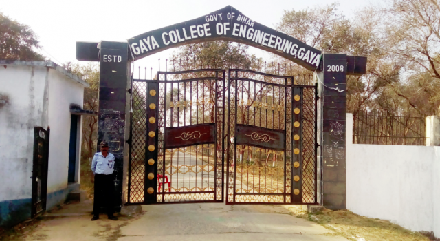
- Gaya College of Engineering
- Mirza Ghalib College
Notable schools:
- Nazareth Academy, Gaya
- PM Shri Kendriya Vidyalaya No.1, Gaya
- PM Shri Kendriya Vidyalaya No. 2, OTA, Paharpur Cantt., Gaya
- D. A. V. Public School, Manpur, Kaiya
- Crane Memorial High School, Katari Hill Road, Gaya
- Hansraj Public School, Cantt. Area, Kharanti, Gaya
- D. A. V. Public School,CR RC, Medical Road, Gaya
- Delhi Public School, Dubhal, Gaya
- Gyan Bharti Residencial Complex, Bodh Gaya
References
References
- "GAYA Tourist Guide| Tourist places near Gaya, Travel Guide".
- (4 October 2018). "Gaya celebrates 154th establishment day".
- Law, Gwillim. (25 September 2011). "Districts of India". Statoids.
- (2010). "India 2010: A Reference Annual". Additional Director General, Publications Division, [[Ministry of Information and Broadcasting (India)]], [[Government of India]].
- (18 February 1998). "Island Directory Tables: Islands by Land Area". [[United Nations Environment Program]].
- Ministry of Panchayati Raj. (8 September 2009). "A Note on the Backward Regions Grant Fund Programme". National Institute of Rural Development.
- "Subdivision and Blocks {{!}} Gaya {{!}} India".
- Indian Ministry of Forests and Environment. "Protected areas: Bihar".
- "Table A-02 Decadal Variation in Population Since 1901: Bihar". [[Registrar General and Census Commissioner of India]].
- (2011). "Table C-01 Population by Religion: Bihar". [[Registrar General and Census Commissioner of India]].
- (2011). "District Census Handbook: Gaya". [[Registrar General and Census Commissioner of India]].
- US Directorate of Intelligence. "Country Comparison:Population".
- (2011). "Table C-16 Population by Mother Tongue: Bihar". [[Registrar General and Census Commissioner of India]].
- (14 June 2016). "Bihar: Failed in Board exam, now students queue up at NIOS".
This article was imported from Wikipedia and is available under the Creative Commons Attribution-ShareAlike 4.0 License. Content has been adapted to SurfDoc format. Original contributors can be found on the article history page.
Ask Mako anything about Gaya district — get instant answers, deeper analysis, and related topics.
Research with MakoFree with your Surf account
Create a free account to save articles, ask Mako questions, and organize your research.
Sign up freeThis content may have been generated or modified by AI. CloudSurf Software LLC is not responsible for the accuracy, completeness, or reliability of AI-generated content. Always verify important information from primary sources.
Report