From Surf Wiki (app.surf) — the open knowledge base
Gasa District
District of Bhutan

District of Bhutan
| Field | Value |
|---|---|
| name | Gasa District |
| native_name | དགའ་ས་རྫོང་ཁག། |
| native_name_lang | dz |
| settlement_type | District |
| pushpin_map | Bhutan Gasa |
| pushpin_mapsize | 300 |
| pushpin_map_caption | Location of Gasa dzongkhag within Bhutan |
| pushpin_label_position | none |
| coordinates | |
| subdivision_type | Country |
| subdivision_name | Bhutan |
| seat_type | Capital |
| seat | Gasa Dzong |
| area_footnotes | |
| area_total_km2 | 3117.74 |
| elevation_max_footnotes | |
| elevation_max_m | 4500 |
| elevation_min_footnotes | |
| elevation_min_m | 1500 |
| population_footnotes | |
| population_as_of | 2005 |
| population_total | 3,116 |
| pop_est_as_of | 2010 |
| population_rank | 20th |
| population_est | 3,396 |
| population_density_km2 | auto |
| blank_name_sec2 | HDI (2019) |
| blank_info_sec2 | 0.536 |
| · 20th of 20 | |
| timezone | BTT |
| utc_offset | +6 |
| timezone_DST | not observed |
| utc_offset_DST | +6 |
| website | |
| official_name | Gasa District |
· 20th of 20
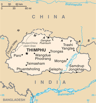
Gasa District (; , also མགར་ས་རྫོང་ཁག།) is one of the 20 dzongkhags (districts) comprising Bhutan. The capital of Gasa District is Gasa Dzong near Gasa. It is located in the far north of the county and spans the Middle and High regions of the Tibetan Himalayas. The dominant language of the district is Dzongkha, which is the national language. Related languages, Layakha and Lunanakha, are spoken by semi-nomadic communities in the north of the district. The People's Republic of China claims the northern part of Gasa District.
Gasa has an area of 3117.74 km2 , formerly 4409.30 km2 . |archive-url = https://web.archive.org/web/20050816112854/http://www.dop.gov.bt/fyp/09/Gasa.pdf |archive-date = 16 August 2005 It had a population of 3,116 as of the 2005 census, making it the largest, least populated, and thus least densely populated of all the dzongkhags; it is also the least developed district of Bhutan.
History
Gasa was formerly a drungkhag (sub-district) of the Punakha dzongkhag (district). It became a separate dzongkhag in 1992, the start of 7th Five Year Plan.
Administrative divisions
.png)
Gasa District is divided into four village blocks (or gewogs): |access-date=22 August 2011 |url-status=dead |archive-url=https://web.archive.org/web/20110825210256/http://www.nsb.gov.bt/pub/ads/gasa.pdf |archive-date=25 August 2011 |access-date = 28 July 2011 |archive-url = https://web.archive.org/web/20111002184138/http://www.election-bhutan.org.bt/2011/finaldelimitation/gasa.pdf |archive-date = 2 October 2011 |url-status = dead
- Khamaed Gewog, (formerly known as Goenkhamae)
- Khatoed Gewog (formerly known as Goenkaatoe)
- Laya Gewog
- Lunana Gewog
Geography
Gasa is bordered to the north by Tibet Autonomous Region of the People's Republic of China and by Thimphu, Punakha, and Wangdue Phodrang district to the south.
Economy
Gasa has become a tourist destination because of its pristine forests and the exceptionally scenic location of its Dzong. In 2008 a massive flood on the Mo Chhu (Female River) destroyed a popular hot spring complex, which is under restoration and was to re-open in late 2011. The high altitude makes farming difficult, although government programs seek to establish mustard and summer vegetable planting programs. Residents herd yaks and dzos, and a small number benefit from the nascent tourism industry. A narrow road from Punakha, which is mostly unpaved, reaches up to the Dzong and is now being extended up to Laya. The majority of the known herds of wild Takin occur in Gasa. Electricity is also being supplied to some of the gewogs and all electrification programs are expected to be completed by 2012.
Gasa is most famous for its Layap people and the Snowman Trek, one of the most challenging treks in the Himalayas.
Environment
All of Gasa is an environmentally protected area of Bhutan. Most parts of the dzongkhag lie within Jigme Dorji National Park (Khamaed, Khatoed, Laya, Lunana Gewogs), although the northeast reaches of Gasa are part of Wangchuck Centennial Park (Lunana Gewog). Several of Bhutan's glaciers are located in Gasa, namely in Lunana Gewog, which borders Tibet.
Tourism
Gasa Tashi Thongmön Dzong
Also known as Gasa Dzong was built in the 17th century by Zhabdrung as a defensive fortress against northern attacks in 1646.
Sabhi Goenpa
Tshechu Dra is a sacred cliff of longevity located in the Panikong village where Guru Rinpoche is said to have extracted longevity water from a cliff to benefit sentient beings.
Zabsel Drubdey Rawai Drubdey
Gasa Tshachu
Gasa Tshachu is a hot spring near the bank of the Mo Chhu River in Gasa at an elevation of 2100 meters, believed to cure 13 different types of diseases. It is one of the most popular hot springs in Bhutan.
Bjagay Menchu
Festivals
- Annual Gasa Tshechu
- Royal Highland Festival
- Laya Run
Climate
|Jan record high C = 18.5 |Feb record high C = 17.0 |Mar record high C = 23.5 |Apr record high C = 27.0 |May record high C = 26.0 |Jun record high C = 25.5 |Jul record high C = 30.0 |Aug record high C = 26.0 |Sep record high C = 25.0 |Oct record high C = 25.0 |Nov record high C = 21.0 |Dec record high C = 19.0 |Jan record low C = -7.0 |Feb record low C = -6.0 |Mar record low C = -5.0 |Apr record low C = -6.0 |May record low C = -6.0 |Jun record low C = 2.0 |Jul record low C = 4.0 |Aug record low C = 3.0 |Sep record low C = 6.0 |Oct record low C = -5.0 |Nov record low C = -6.0 |Dec record low C = -5.0
References
References
- "Sub-national HDI - Area Database - Global Data Lab".
- "Parks of Bhutan". Bhutan Trust Fund.
- (2011). "Chiwogs in Gasa". Election Commission, [[Government of Bhutan]].
- "Gasa Dzong, the Fortress that defended against Northern Invasions".
- (21 January 2023). "Tshechu Dra, Guru Rinpoche's Cliff of Longevity Water".
- "Gasa Tshachu, a Hot Spring that cures 13 different Diseases".
This article was imported from Wikipedia and is available under the Creative Commons Attribution-ShareAlike 4.0 License. Content has been adapted to SurfDoc format. Original contributors can be found on the article history page.
Ask Mako anything about Gasa District — get instant answers, deeper analysis, and related topics.
Research with MakoFree with your Surf account
Create a free account to save articles, ask Mako questions, and organize your research.
Sign up freeThis content may have been generated or modified by AI. CloudSurf Software LLC is not responsible for the accuracy, completeness, or reliability of AI-generated content. Always verify important information from primary sources.
Report