From Surf Wiki (app.surf) — the open knowledge base
Fruitville, Florida

| Field | Value |
|---|---|
| official_name | Fruitville, Florida |
| settlement_type | Census-designated place |
| image_map | Sarasota_County_Florida_Incorporated_and_Unincorporated_areas_Fruitville_Highlighted.svg |
| mapsize | 250x200px |
| map_caption | Location in Sarasota County and the state of Florida |
| subdivision_type | Country |
| subdivision_name | United States |
| subdivision_type1 | State |
| subdivision_name1 | Florida |
| subdivision_type2 | County |
| subdivision_name2 | Sarasota |
| established_title | |
| unit_pref | Imperial |
| area_footnotes | |
| area_total_km2 | 18.46 |
| area_land_km2 | 17.68 |
| area_water_km2 | 0.78 |
| area_total_sq_mi | 7.13 |
| area_land_sq_mi | 6.82 |
| area_water_sq_mi | 0.30 |
| area_water_percent | 4.21 |
| population_as_of | 2020 |
| population_total | 15484 |
| population_density_km2 | 876.04 |
| population_density_sq_mi | 2269.05 |
| timezone | Eastern Time Zone |
| utc_offset | −05 |
| timezone_DST | EDT |
| utc_offset_DST | −04 |
| coordinates | |
| coordinates_footnotes | |
| elevation_ft | 30 |
| elevation_footnotes | |
| postal_code_type | ZIP code |
| postal_code | 34232 |
| area_code | 941 |
| blank_name | FIPS code |
| blank_info | |
| blank1_name | GNIS feature ID |
| blank1_info | 2402510 |
Fruitville is a census-designated place (CDP) in Sarasota County, Florida, United States. The population was 15,484 at the 2020 census, up from 13,224 at the 2010 census. It is part of the North Port–Bradenton–Sarasota, Florida Metropolitan Statistical Area.
History
An 1857 map of the "Country in the Vicinity of Manatee" during the Third Seminole War shows settlers near what is now Fruitville. The area had a large sawgrass swamp that was bounded on the east by Tatum Ridge (named for the George Tatum Sr., 1822–1910), north and west by Phillippi Creek with its headwaters in the Meadows residential development through Circus Hammock and Bobby Jones municipal golf course and Bee Ridge to the south. This marshland was home to wild Florida Cracker cattle.
In 1923, the Sarasota-Fruitville drainage district was established (see also Bertha Palmer family). The new district provided around 8,000 acres of land for cultivation near the community of Fruitville. The farm land was formed by draining the historic wetland and dredging a drainage canal to Phillippi Creek, which drained roughly 26,000 acres. This area was later reclaimed as a wetland, and became the Celery Fields Regional Stormwater Facility.
After the Civil War, a new wave of pioneers began to settle in Florida thanks to a growing citrus industry. In 1876, Charles Reaves (1847–1931) settled in what is now considered Fruitville. According to some sources, he was the one who named the area Fruitville after the abundance of fruit in the area. In 1895, Reaves would go on to become the postmaster for the area's 115 residents.
The first church in what is now Sarasota County was the Friendship Baptist Church established by Reverend John Wright Hendry (1836–1907). The church was chartered in 1875 and a small pine log structure was used for the congregation until a new church was erected in 1876, using some of the original lumber from the first church. From 1877 to 1891, Isaac Alderman Redd (1835–1912) was pastor of the Friendship Baptist Church which first met in the Bee Ridge community. In 1887, the Florida Mortgage and Investment Company of Scotland donated land in Fruitville to the church for the establishment of the community's first cemetery.
Also in 1887, Charles and his wife Martha Tatum Reaves (daughter of George Tatum Sr.,1853-1935) converted their corncrib into Fruitville's first school for their three children and seven neighbors. They went on to hire Miss Josie Clower as the first teacher in the area. After citizens petitioned for a modern school building, funding was granted from the Works Progress Administration to build Fruitville Elementary in 1941. Rural schools in the nearby villages of Tatum Ridge and Old Miakka were closed, with their students bussed to the new school in Fruitville.
A map from 1902 shows Fruitville on the map as a community.
In May 1918, Franklin Field (named after then-mayor George Franklin) began operating as a military airfield during World War I. The Franklin airfield was located north of Fruitville Road and east of what is now Tuttle road. The airfield was an auxiliary landing station for the U.S. Army Air Service and housed, at the least, several Curtiss JN "Jenny" planes. With the war over, the airfield saw less and less traffic and was likely unused by 1920. In 1924 the land was developed for a new subdivision.
The first municipal airport in Sarasota county was located in Fruitville. It was dedicated in 1929, located on a 160-acre site near the intersection of 12th Street and Beneva Road (then named Oriente Avenue). The airport was renamed Lowe Field after Johnny Lowe purchased the land during World War II. After the war, most civilian air traffic moved to the Sarasota-Bradenton Airport. Lowe Field closed in 1961 and the land was sold.
Throughout the 1960s and 70s, there was a migrant camp called Sababo in Fruitville that supplied much of the labor force for area's farm industry. A major crop in the area was celery. In 1966, there was an estimated 2,000 migrant workers in Sarasota County. To provide healthcare and education to this population, on December 5, 1966, the Fruitville Area Medical and Educational (FAME) Center was opened.
In November 1990, Litchfield's Cinema 10 opened in the Sarasota Commons, the community's first modern movie theater. As a promotion, the theater offered tickets for only 50 cents during its opening. Some of the films shown for its pre-opening weekend were Pretty Woman and Back to the Future III.
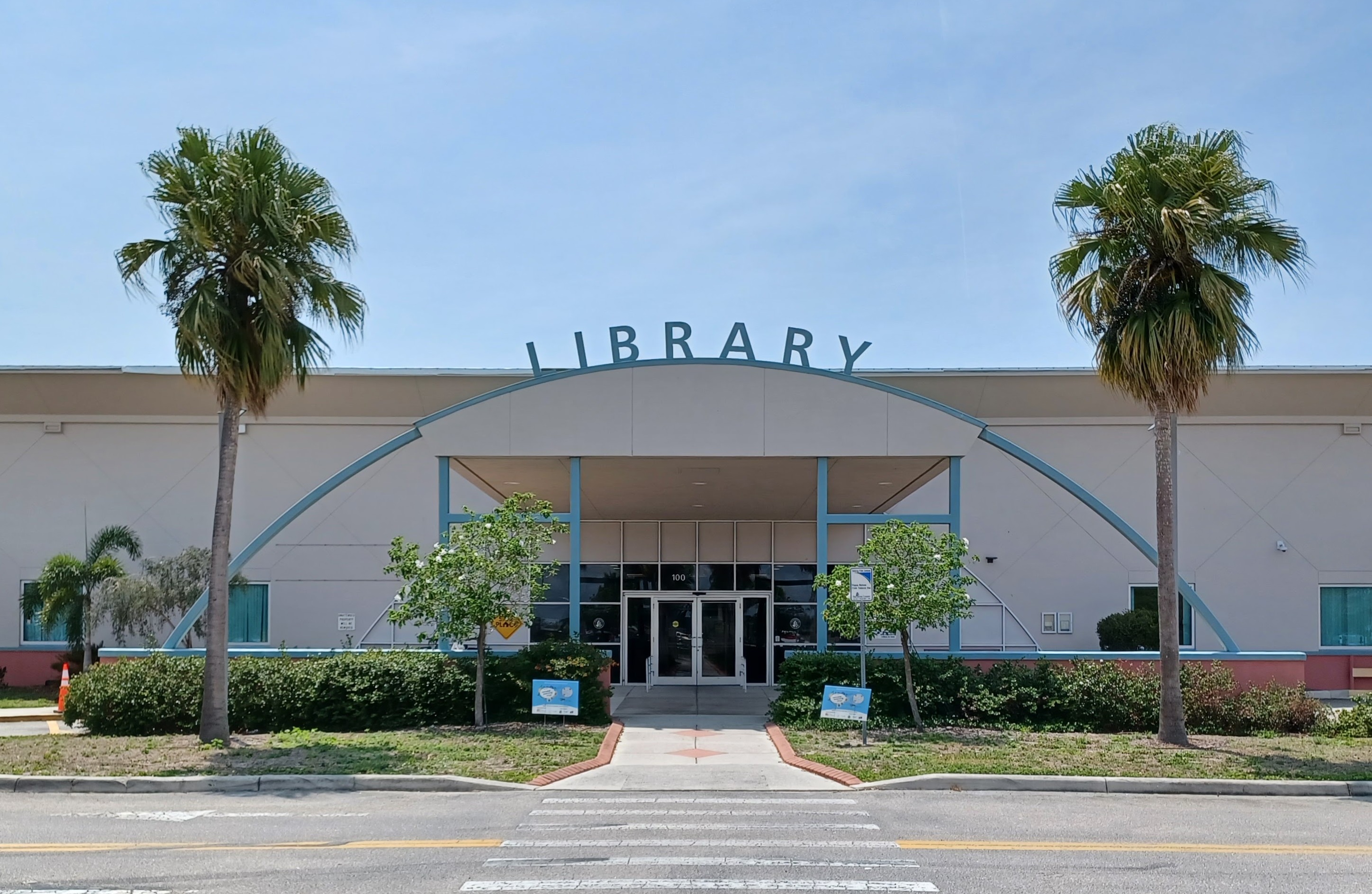
On December 8, 2001, the Fruitville Library was opened to serve the Fruitville community as a part of the Sarasota County Library System. The library was initially called East County Library throughout its land-use planning process before the Sarasota County Commission renamed the library a month prior to its opening.
Geography
According to the United States Census Bureau, the CDP has a total area of 18.46 km2, of which 17.68 sqkm is land and 0.78 sqkm, or 4.21%, is water.
Demographics
As of the 2020 United States census, there was a population of 15,484 people and 6,043 households. There were 2.32 persons per household.
In terms of age, 4% were under 5 years old, 15% were 18 years or younger, 45% were between 18 and 64, and %26 were 65 years or older. 80.9% of the population was white (non-Hispanic), 2.1% was black or African American, 2.4% was Asian, and 12.5% was Hispanic or Latino. There were 1,172 veterans living in Fruitville and 12.9% of the population was Foreign born.
The median value of owner-occupied housing units was $275,600 and the median gross rent was $1,639. Median household income was $72,512. 7.6% of the population lived below the poverty threshold. 92.6% of households had a computer and 88.1% had a broadband internet subscription.
Of the population 25 years and older, 91.0% had a high school degree or higher and 33.0% of that same population had a bachelor's degree or higher.
Of the population under 65 years old, 6.8% lived with a disability and 17.2% did not have health insurance.
Education
Fruitville is home to several public and private schools including:
- Fruitville Elementary
- Julie Rohr Academy
- Learning Academy of Sarasota
- McIntosh Middle School
- Sarasota Academy of the Arts
- Sarasota Christian School
- Saint Martha's Catholic School
- Saint Mary Academy
- Cardinal Mooney High School
It is also home to the Fruitville Library, a branch of the Sarasota County Library System.
References
References
- "2020 U.S. Gazetteer Files". United States Census Bureau.
- {{GNIS. 2402510
- U.S. Census Bureau (2020). Total Population in Fruitville CDP, Florida. Retrieved from https://data.census.gov/cedsci/all?q=Fruitville%20Florida
- Matthews, Janet Snyder. (1983). "Edge of Wilderness: A Settlement History of Manatee River and Sarasota Bay". Coastal Press, Sarasota, Florida.
- (1976). "A History of Agriculture of Sarasota County Florida". Sarasota County Agriculture Fair Association.
- (6 January 2026). "Palmer Farms Experimental Station".
- History & Preservation Coalition, http://historicpreservationsarasota.org/sarasotahistory/ {{Webarchive. link. (July 27, 2021)
- "Land of Sarasota A Settlement in the Wilderness".
- State Archives of Florida/Works Progress Administration. Retrieved from https://www.floridamemory.com/items/show/251255
- "Bee Ridge Community Historical Marker".
- The Genealogical Society of Sarasota (2007). Cemeteries of Sarasota County Florida A Record of Births, Deaths, and Burials. Retrieved from http://sites.rootsweb.com/~flgss/CemeteryFiles/FriendshipBaptistCemetery.pdf 12/17/2021
- "Overview / About Fruitville". Sarasota County Schools.
- "Sarasota's Journey from Depression to War | Sarasota History Alive!".
- (1902). "Cram's Florida, 1902". George F. Cram.
- (1918). "Army "Jenny" planes and observers at Franklin Field in Sarasota".
- Sunday Favorites: The Intrigue of Aviation, The Bradenton Times. Retrieved from https://thebradentontimes.com/sunday-favorites-the-intrigue-of-aviation-p21183-133.htm
- "First Municipal Airport Lowe Field".
- (27 January 1977). "Migrant Options There to Pick".
- "The Celery Fields". Sarasota County Fair and Sarasota County Historical Commission.
- Florida Migrant Health Project. Fourth Annual Progress Report, 1966-1967. Florida State Board of Health. Retrieved from https://files.eric.ed.gov/fulltext/ED013699.pdf on 5/26/2022. p. 252
- "Sarasota Crossings 10 in Sarasota, FL".
- "About Us".
- (November 8, 2001). "Commission votes to rename library". Sarasota Herald-Tribune.
- "Geographic Identifiers: 2010 Demographic Profile Data (G001): Fruitville CDP, Florida". U.S. Census Bureau, American Factfinder.
- "Census of Population and Housing". [[U.S. Census Bureau]].
- "Quick Facts: Fruitville CDP, Florida; United States".
- "Locations and Hours". Sarasota County.
This article was imported from Wikipedia and is available under the Creative Commons Attribution-ShareAlike 4.0 License. Content has been adapted to SurfDoc format. Original contributors can be found on the article history page.
Ask Mako anything about Fruitville, Florida — get instant answers, deeper analysis, and related topics.
Research with MakoFree with your Surf account
Create a free account to save articles, ask Mako questions, and organize your research.
Sign up freeThis content may have been generated or modified by AI. CloudSurf Software LLC is not responsible for the accuracy, completeness, or reliability of AI-generated content. Always verify important information from primary sources.
Report