From Surf Wiki (app.surf) — the open knowledge base
Fresno, Texas
| Field | Value | |
|---|---|---|
| official_name | Fresno, Texas | |
| settlement_type | Census-designated place | |
| motto | ||
| image_skyline | Fresno_TX_Post_Office.jpg | |
| imagesize | 280px | |
| image_caption | US Post Office, Fresno, Texas | |
| image_seal | ||
| image_map | FortBend County Fresno.svg | |
| mapsize | 250px | |
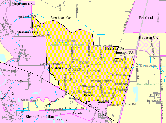
| map_caption | Location of Fresno, Texas | |
| <!-- Location --> | subdivision_type | Country |
| subdivision_name | United States | |
| subdivision_type1 | State | |
| subdivision_name1 | Texas | |
| subdivision_type2 | County | |
| subdivision_name2 | Fort Bend | |
| named_for | Fresno, CA | |
| established_date | ||
| unit_pref | Imperial | |
| area_total_km2 | 24.1 | |
| area_land_km2 | 23.8 | |
| area_water_km2 | 0.3 | |
| area_water_sq_mi | ||
| population_as_of | 2020 | |
| population_total | 24,486 | |
| population_density_km2 | 1,016 | |
| population_density_sq_mi | ||
| timezone | Central (CST) | |
| utc_offset | -6 | |
| timezone_DST | CDT | |
| utc_offset_DST | -5 | |
| elevation_m | 22 | |
| elevation_ft | 72 | |
| coordinates | ||
| postal_code_type | ZIP code | |
| postal_code | 77545 | |
| area_code | 281 | |
| blank_name | FIPS code | |
| blank_info | 48-27540 | |
| blank1_name | GNIS feature ID | |
| blank1_info | 1336203 |
Fresno is a part of Houston and an unincorporated community and census-designated place (CDP) in Fort Bend County, Texas, United States. The local population was 24,486 as of the 2020 census, an increase over the figure of 19,069 tabulated in 2010 census, and 6,603 at the 2000 census.
Fresno is located in the extra-territorial jurisdiction (ETJ) of Houston, which is the fourth largest city in the nation in population.
Fresno is located south of Houston, with the suburban Fort Bend County cities of Missouri City to the west and northwest, Arcola to the south and southwest, and the Brazoria County city of Pearland to the east.
Geography
Fresno is located in eastern Fort Bend County at (29.526728, -95.459849). The eastern edge of Fresno is the Brazoria County line. Downtown Houston is 17 mi to the north, the center of Missouri City is 11 mi to the northwest, the center of Pearland is 11 mi to the east, and Manvel is 9 mi to the southeast.
According to the United States Census Bureau, the Fresno CDP has a total area of 24.1 km2, of which 23.8 km2 is land and 0.3 sqkm, or 1.35%, is water.
History
A settler from Fresno, California, reportedly chose the name. The town is on land patented in 1880 once surrounded by cotton plantations. Fresno acquired a post office in 1910. In 1914 it had a telephone connection, a general store, a hardware store, and a population of 32. By 1933 the town had only ten inhabitants and one business. In 1936 it had three rows of dwellings on both sides of a paved highway (old Hwy 288, present day FM 521) and was served by the International-Great Northern Railroad. By 1946 the population had risen to 100, a level maintained throughout the 1960s. In 1970 the figure had increased to 120; two years later it had grown to 161. During the 1970s and 1980s the population of Fresno increased more rapidly as the area was affected by growth of Houston.
Growth in the 1990s and 2000s
With its prime location on FM 521 and north of State Highway 6 in unincorporated Fort Bend County, developers have recently built large bedroom communities over what was once forest and grazing land, and a number of first-time homeowners have made the Fresno area home.
The demographics in the Fresno area have changed dramatically since the last United States Census in 2000 due to a large increase in home building.
The area is heavily Democratic in nature, and due to population increases in the area, Fresno was switched from Fort Bend County Precinct Two jurisdiction in 2003 and is now located within Fort Bend County Precinct One, which is located primarily on the western side of Fort Bend County, some 25 to away from Fresno, which is located in far eastern Fort Bend County.
Among the largest communities in Fresno are the six neighborhoods that make up the Fort Bend MUD #23 area. Teal Run, the oldest of the neighborhoods, was originally started in the 1980s, and development stopped with the Houston oil crash in the late 1980s. Construction in the subdivision started again in 1992.
The Estates of Teal Run, located at the intersection of Raab and Sycamore Road, was started in 1999.
Teal Run North (Villages of Teal Run and Teal Run Meadows), located just off Teal Bend Boulevard, directly adjacent to both Teal Run and Teal Run Estates, was started in 2001. There are over 3,100 total homes in the Fort Bend MUD #23 area in 2006.
NewPoint Estates, located across from Teal Run on Highway 6 and Darby Road, is an area for acreage-type home sites, stables and expensive properties. Winfield Lakes, which is located on Trammel Fresno Road, was started in 2004. Andover Farms, which is located on Highway 6 and South Post Oak Road, was started in 2004. Cambridge Falls started with infrastructure additions (lights, gas, water, sewer lines, streets) in 2005.
The newly built Fort Bend Tollway has given eastern Fort Bend County residents another option of travel into the city of Houston, as the Tollway is 6.2 mi long from Highway 6 to U.S. Highway 90 in southwest Houston, and eventually will travel all the way to Loop 610. The average commute time for those living in eastern Fort Bend County using the full route from Highway 6 to Loop 610 (when it opens) should average 20 minutes. A typical trip down FM 521, which turns into Almeda in Houston, or State Highway 288 north into the Texas Medical Center, takes at least 30–45 minutes in rush hour traffic.
A Houston Chronicle article from February 25, 2007, titled "Straddling urban, rural in Fresno" highlights the unregulated nature of Fresno.
Demographics
|align-fn=center 1850–1900 1910 1920 1930 1940
1950 1960 1970 1980 1990 2000 2010
Fresno first appeared as a census designated place in the 1990 U.S. census.
| Race / Ethnicity (NH = Non-Hispanic) | title=P004 Hispanic or Latino, and Not Hispanic or Latino by Race – 2000: DEC Summary File 1 – Fresno CDP, Texas | url=https://data.census.gov/table/DECENNIALSF12000.P004?g=160XX00US4827540 | website=United States Census Bureau}} | title=P2 Hispanic or Latino, and Not Hispanic or Latino by Race – 2010: DEC Redistricting Data (PL 94-171) – Fresno CDP, Texas | url=https://data.census.gov/cedsci/table?q=p2&g=160XX00US4827540&tid=DECENNIALPL2010.P2 | website=United States Census Bureau}} | %2000 | %2010 |
|---|---|---|---|---|---|---|---|---|
| White (NH) | 1,428 | 1,011 | 898 | 21.63% | ||||
| Black or African American (NH) | 1,739 | 11,225 | 13,690 | 26.34% | ||||
| Native American or Alaska Native (NH) | 7 | 15 | 30 | 0.11% | ||||
| Asian (NH) | 65 | 181 | 289 | 0.98% | ||||
| Native Hawaiian or Pacific Islander alone (NH) | 0 | 2 | 11 | 0.00% | ||||
| Other race alone (NH) | 8 | 43 | 87 | 0.12% | ||||
| Mixed race or Multiracial (NH) | 62 | 274 | 524 | 0.94% | ||||
| Hispanic or Latino | 3,294 | 6,318 | 8,957 | 49.89% | ||||
| Total | 6,603 | 19,069 | 24,486 | 100.00% |
As of the 2020 United States census, there were 24,486 people, 7,247 households, and 5,789 families residing in the CDP.
As of the census of 2000, there were 6,603 people, 1,881 households, and 1,600 families residing in the CDP. The population density was 734.8 PD/sqmi. There were 2,002 housing units at an average density of 222.8 /sqmi. The racial makeup of the CDP was 44.36% White, 26.55% African American, 0.41% Native American, 1.08% Asian, 0.03% Pacific Islander, 25.23% from other races, and 2.35% from two or more races. Hispanic or Latino of any race were 49.89% of the population.
There were 1,881 households, out of which 54.1% had children under the age of 18 living with them, 68.6% were married couples living together, 12.0% had a female householder with no husband present, and 14.9% were non-families. 12.4% of all households were made up of individuals, and 2.8% had someone living alone who was 65 years of age or older. The average household size was 3.51 and the average family size was 3.83.
In the CDP, the population was spread out, with 36.1% under the age of 18, 9.0% from 18 to 24, 34.6% from 25 to 44, 16.0% from 45 to 64, and 4.4% who were 65 years of age or older. The median age was 28 years. For every 100 females, there were 102.2 males. For every 100 females age 18 and over, there were 99.7 males.
The median income for a household in the CDP was $46,290, and the median income for a family was $48,824. Males had a median income of $32,606 versus $30,527 for females. The per capita income for the CDP was $14,340. About 10.9% of families and 15.3% of the population were below the poverty line, including 20.6% of those under age 18 and 17.0% of those age 65 or over.
The Fresno area is patrolled by the Fort Bend County Sheriff's Office. The Teal Bend subdivision is also patrolled by contract deputies of the Precinct 1 Constable's Office. The Fresno Volunteer Fire Department provides fire protection. Fort Bend EMS provides emergency medical services to the area.
Government and infrastructure
The United States Postal Service operates the Fresno Post Office at 2723 Farm to Market Road 521.
Fort Bend County does not have a hospital district. OakBend Medical Center serves as the county's charity hospital which the county contracts with.
Education
School age children in Fresno attend schools in the Fort Bend Independent School District.
The community is within the East Division, controlling school board slots 5 through 7.
School zones are as follows: Some middle school students (grades 6–8) attend Lake Olympia Middle School in Missouri City, while other Fresno students attend Billy Baines Middle School. Most of Fresno is zoned to Hightower High School in Missouri City, while some of it is zoned to Willowridge High School in Houston.
Prior to the opening of Hightower, Elkins High School served Fresno. For a period, the majority of Fresno was in the Hightower zone. Prior to 2023, portions of Fresno were zoned to Ridge Point High School in Sienna (formerly Sienna Plantation).
The Texas Legislature specifies that the Houston Community College (HCC) boundary includes "the part of the Fort Bend Independent School District that is not located in the service area of the Wharton County Junior College District and that is adjacent to the Houston Community College System District." Wharton College's boundary within FBISD is defined only as the City of Sugar Land and the ETJ of Sugar Land, and Fresno is not in the Sugar Land ETJ.
File:FBISD Burton Elementary School.jpg|Walter Moses Burton Elementary School File:FBISD Goodman Elementary School.jpg|Lula Belle Goodman Elementary School File:FBISD Rosa Parks Elementary School.jpg|Rosa Parks Elementary School
Parks and recreation
Fort Bend County operates the Mustang Community Center in Fresno. The 5 acre community center includes one baseball field, benches, one meeting room, two pavilions, one play area, tables, and one walking trail.
References
References
- "U.S. Census website". [[United States Census Bureau]].
- (2007-10-25). "US Board on Geographic Names". [[United States Geological Survey]].
- "Decennial Census: 2020 Demographic Profile Data (G001): Fresno CDP, Texas". U.S. Census Bureau, American Factfinder.
- (April 2020}}{{cbignore). "Geographic Identifiers: 2010 Demographic Profile Data (G001): Fresno CDP, Texas". U.S. Census Bureau, American Factfinder.
- "2020 CENSUS - CENSUS BLOCK MAP: Fresno CDP, TX". [[U.S. Census Bureau]].
- "Fort Bend County Cities & ETJs". Fort Bend County.
- (2011-02-12). "US Gazetteer files: 2010, 2000, and 1990". [[United States Census Bureau]].
- {{Handbook of Texas
- Feldman, Claudia. (2007-02-25). "Fire highlights need in unincorporated Fresno". [[Houston Chronicle]].
- "Decennial Census by Decade". [[US Census Bureau]].
- "1900 Census of Population - Population of Texas By Counties And Minor Civil Divisions".
- "1910 Census of Population - Supplement for Texas".
- "1920 Census of Population - Number of Inhabitants - Texas".
- "1930 Census of Population - Number of Inhabitants - Texas".
- "1940 Census of Population - Number of Inhabitants - Texas".
- "1950 Census of Population - Number of Inhabitants - Texas".
- "1960 Census of Population - Number of Inhabitants - Texas".
- "1970 Census of Population - Number of Inhabitants - Texas".
- "1980 Census of Population - Number of Inhabitants - Texas".
- "1990 Census of Population - Population and Housing Unit Counts - Texas".
- "2000 Census of Population - Population and Housing Unit Counts - Texas".
- "2010 Census of Population - Population and Housing Unit Counts - Texas".
- "P004 Hispanic or Latino, and Not Hispanic or Latino by Race – 2000: DEC Summary File 1 – Fresno CDP, Texas".
- "P2 Hispanic or Latino, and Not Hispanic or Latino by Race – 2010: DEC Redistricting Data (PL 94-171) – Fresno CDP, Texas".
- "P2 Hispanic or Latino, and Not Hispanic or Latino by Race – 2020: DEC Redistricting Data (PL 94-171) – Fresno CDP, Texas".
- "[https://archive.today/20120715133629/http://usps.whitepages.com/service/post_office/5065?p=1&s=TX&service_name=post_office&z=Fresno Post Office Location - FRESNO]." ''[[United States Postal Service]]''. Retrieved on December 4, 2008.
- Knipp, Bethany. (2016-11-02). "Fort Bend County lacks hospital district". [[Community Impact Newspaper]].
- "2020 CENSUS - SCHOOL DISTRICT REFERENCE MAP: Fort Bend County, TX". [[U.S. Census Bureau]].
- "[http://www.fortbend.k12.tx.us/board/documents/electing.pdf 2007–2008 Operating Procedures] {{webarchive. link. (December 9, 2008 ." ''[[Fort Bend Independent School District]]''. Retrieved on December 8, 2008.)
- Two elementary schools, Lula Belle Goodman Elementary School and Burton Elementary School are located in Fresno's Teal Run neighborhood. A third elementary school, [[Rosa Parks]] Elementary School, is in Fresno. A small portion is zoned to Heritage Road Elementary School, outside of Fresno."[http://www.fortbendisd.com/cms/lib09/TX01917858/Centricity/Domain/103/ES%20Zone%20Maps%2016%2017.pdf Elementary School Attendance Zones]." [[Fort Bend Independent School District]]. Retrieved on April 15, 2017.
- "[http://www.fortbendisd.com/cms/lib09/TX01917858/Centricity/Domain/103/MS%20Zone%20Map%2016%2017.pdf Middle School Attendance Zones]." [[Fort Bend Independent School District]]. Retrieved on April 15, 2017.
- "2023-24 Boundaries Southeast Corridor". [[Fort Bend Independent School District]].
- "2022-2023". [[Fort Bend Independent School District]].
- "[https://web.archive.org/web/19970116230436/http://www.fortbend.k12.tx.us/schools/ehs.htm Elkins High School]." [[Fort Bend Independent School District]]. January 16, 1997. Retrieved on October 31, 2017.
- "Hightower High School Zone". [[Fort Bend Independent School District]].
- "[http://www.fortbendisd.com/cms/lib09/TX01917858/Centricity/Domain/103/HS%20Zone%20Map%2016%2017.pdf High School Attendance Zones]." [[Fort Bend Independent School District]]. Retrieved on April 15, 2017.
- "Sec. 130.182. HOUSTON COMMUNITY COLLEGE SYSTEM DISTRICT SERVICE AREA.".
- "Sec. 130.211. WHARTON COUNTY JUNIOR COLLEGE DISTRICT SERVICE AREA.".
- "HCC Single Member Districts 2023". [[Houston Community College]].
- link. (2011-06-04 ." Fort Bend County. Retrieved on October 11, 2009.)
This article was imported from Wikipedia and is available under the Creative Commons Attribution-ShareAlike 4.0 License. Content has been adapted to SurfDoc format. Original contributors can be found on the article history page.
Ask Mako anything about Fresno, Texas — get instant answers, deeper analysis, and related topics.
Research with MakoFree with your Surf account
Create a free account to save articles, ask Mako questions, and organize your research.
Sign up freeThis content may have been generated or modified by AI. CloudSurf Software LLC is not responsible for the accuracy, completeness, or reliability of AI-generated content. Always verify important information from primary sources.
Report