From Surf Wiki (app.surf) — the open knowledge base
Freedom, New Hampshire

| Field | Value |
|---|---|
| official_name | Freedom, New Hampshire |
| image_blank_emblem | Logo of Freedom, New Hampshire.png |
| blank_emblem_type | Logo |
| blank_emblem_size | 130px |
| image_skyline | CenterofFreedomNHAug2019.jpg |
| image_seal | Seal of Freedom, New Hampshire.png |
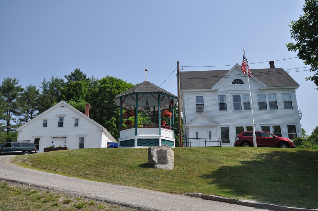
| image_caption | Houses along Old Portland Road in the town center |
| image_map | Carroll-Freedom-NH.png |
| mapsize | 250px |
| map_caption | Location in Carroll County, New Hampshire |
| settlement_type | Town |
| subdivision_type | Country |
| subdivision_name | United States |
| subdivision_type1 | State |
| subdivision_name1 | New Hampshire |
| subdivision_type2 | County |
| subdivision_name2 | Carroll |
| leader_title | Board of Selectmen |
| leader_name | |
| leader_title1 | Town Administrator |
| leader_name1 | Stacy Bolduc |
| established_title | Incorporated |
| established_date | 1831 |
| area_footnotes | |
| area_total_km2 | 98.2 |
| area_land_km2 | 90.0 |
| area_water_km2 | 8.2 |
| area_water_percent | 8.37 |
| population_as_of | 2020 |
| population_footnotes | |
| population_total | 1689 |
| population_density_km2 | 18.8 |
| timezone | Eastern |
| utc_offset | -5 |
| timezone_DST | Eastern |
| utc_offset_DST | -4 |
| coordinates | |
| elevation_m | 134 |
| elevation_ft | 439 |
| website | |
| postal_code_type | ZIP code |
| postal_code | 03836 |
| area_code | 603 |
| blank_name | FIPS code |
| blank_info | 33-27700 |
| blank1_name | GNIS feature ID |
| blank1_info | 0873601 |
Freedom is a town located in Carroll County, New Hampshire, United States. The population was 1,689 at the 2020 census, up from 1,489 at the 2010 census. The town's eastern boundary runs along the Maine state border. Ossipee Lake, with a resort and camps, is in the southwest of the town.
History
The town was once a part of Effingham called "North Effingham". Following an influx of new settlers from Maine, there was a conflict of culture and religion between them and people from the New Hampshire seacoast area who already populated Effingham. As a result, North Effingham separated into a town of its own. The community, incorporated in 1831, was named "Freedom" to commemorate its separation from Effingham.
Geography

Freedom is situated between the Lakes Region and the White Mountains. According to the United States Census Bureau, the town has a total area of 98.2 sqkm, of which 90.0 sqkm are land and 8.2 sqkm are water, comprising 8.37% of the town. The highest point in Freedom is the summit of Cragged Mountain in the northeastern corner of the town, at 1806 ft above sea level. Freedom is drained by the Ossipee River and lies fully within the Saco River watershed.
Freedom is one of several sites for Nature's Classroom. It is also home to one of the permanent campsites of the Luethi-Peterson Camps and to Cragged Mountain Farm, a co-ed summer camp on Cragged Mountain started by Dr. Henry Utter in 1927, and still owned by the Utter family.
Adjacent municipalities
- Eaton (northeast)
- Porter, Maine (east)
- Effingham (south)
- Ossipee (southwest)
- Madison (northwest)
Demographics

As of the census of 2010, there were 1,489 people, 699 households, and 457 families residing in the town. The population density was 42.5 PD/sqmi. There were 1,580 housing units at an average density of 45.1 /sqmi. The racial makeup of the town was 98.8% White, 0.1% African American, 0.3% Asian, 0.1% some other race, and 0.7% from two or more races.
There were 699 households, out of which 19.0% had children under the age of 18 living with them, 56.9% were headed by married couples living together, 5.7% had a female householder with no husband present, and 34.6% were non-families. 28.9% of all households were made up of individuals, and 14.5% were someone living alone who was 65 years of age or older. The average household size was 2.12, and the average family size was 2.57.

In the town, the population was spread out, with 15.6% under the age of 18, 4.9% from 18 to 24, 16.8% from 25 to 44, 35.9% from 45 to 64, and 26.9% who were 65 years of age or older. The median age was 53.1 years. For every 100 females, there were 101.5 males. For every 100 females age 18 and over, there were 97.8 males.
For the period 2007–2011, the estimated median annual income for a household in the town was $47,375, and the median income for a family was $50,769. Male full-time workers had a median income of $40,536 versus $33,958 for females. The per capita income for the town was $32,537. About 6.0% of families and 7.2% of the population were below the poverty line, including 13.4% of those under the age of 18 and 3.6% of those 65 and older.
The largest ancestry groups in Freedom as of 2007–2011 were:
- 29.8% English
- 27.2% Irish
- 22.0% French and French Canadian
- 9.6% Scottish
- 7.7% Swedish
- 7.5% German
- 5.7% Scotch-Irish
- 5.2% Italian
Sites of interest
- Allard House & Works Museum, Freedom Historical Society
Cultural references
- The town was the setting for the children's fantasy book The Enormous Egg by Oliver Butterworth, first published in 1956 but reissued years later.
- "House on Loon Lake", a 2001 episode of This American Life, depicted an abandoned house explored by young boys in town for summer camp at Loon Lake.
Notable person
· Only people who already have a Wikipedia article may appear here. This establishes notability. · The article must mention how they are associated with Freedom, whether born, raised, or residing. · The fact of their association should have a reliable source cited. · Alphabetical by last name please. · All others will be deleted.
- Frank S. Black (1853–1913), 32nd governor of New York
References
References
- "2021 U.S. Gazetteer Files – New Hampshire". United States Census Bureau.
- "Freedom town, Carroll County, New Hampshire: 2020 DEC Redistricting Data (PL 94-171)". U.S. Census Bureau.
- "Profile of General Population and Housing Characteristics: 2010 Demographic Profile Data (DP-1): Freedom town, Carroll County, New Hampshire". U.S. Census Bureau, American Factfinder.
- Foster, Debra H.. (1995). "Water Use in New Hampshire: An Activities Guide for Teachers". U.S. Department of the Interior and U.S. Geological Survey.
- "Census of Population and Housing". Census.gov.
- "Selected Economic Characteristics: 2007-2011 American Community Survey 5-Year Estimates (DP03): Freedom town, Carroll County, New Hampshire". U.S. Census Bureau, American Factfinder.
- "Selected Social Characteristics in the United States: 2007-2011 American Community Survey 5-Year Estimates (DP02): Freedom town, Carroll County, New Hampshire". U.S. Census Bureau, American Factfinder.
- "House on Loon Lake". WBEZ.
This article was imported from Wikipedia and is available under the Creative Commons Attribution-ShareAlike 4.0 License. Content has been adapted to SurfDoc format. Original contributors can be found on the article history page.
Ask Mako anything about Freedom, New Hampshire — get instant answers, deeper analysis, and related topics.
Research with MakoFree with your Surf account
Create a free account to save articles, ask Mako questions, and organize your research.
Sign up freeThis content may have been generated or modified by AI. CloudSurf Software LLC is not responsible for the accuracy, completeness, or reliability of AI-generated content. Always verify important information from primary sources.
Report