From Surf Wiki (app.surf) — the open knowledge base
Fort St. John, British Columbia
City in British Columbia

City in British Columbia
| Field | Value |
|---|---|
| name | Fort St. John |
| official_name | City of Fort St. John |
| nickname | FSJ |
| settlement_type | City |
| motto | The Energetic City |
| image_skyline | Flying over Fort St John, BC.jpg |
| image_caption | Aerial view of the city |
| image_flag | FSJ Flag.svg |
| image_blank_emblem | File:City of Fort St. John.png |
| blank_emblem_type | Logo |
| pushpin_relief | yes |
| pushpin_map | British Columbia#Canada#North America |
| pushpin_map_caption | Location of Fort St. John |
| subdivision_type | Country |
| subdivision_name | Canada |
| subdivision_type1 | Province |
| subdivision_name1 | British Columbia |
| subdivision_type2 | Regional District |
| subdivision_name2 | Peace River |
| leader_title | Mayor |
| leader_name | Lilia Hansen |
| leader_title1 | Governing Body |
| leader_name1 | Fort St. John City Council (Byron Stewart, Gord Klassen, Trevor Bolin, Tony Zabinsky, Sarah MacDougall, Jim Lequiere) |
| leader_title2 | MLA |
| leader_name2 | Jordan Kealy, Independent |
| leader_title3 | MP |
| leader_name3 | Bob Zimmer, Conservative |
| established_title | Incorporated |
| established_date | 31 Dec 1947 (village) |
| established_title2 | |
| established_title3 | |
| area_footnotes | |
| area_total_km2 | 22.69 |
| area_land_km2 | |
| area_metro_km2 | 620.80 |
| population_as_of | 2020 |
| population_footnotes | |
| population_total | 22,283 |
| population_density_km2 | 820.2 |
| population_metro | 28396 |
| population_density_metro_km2 | 42.5 |
| timezone | MST |
| utc_offset | −07:00 |
| coordinates | |
| elevation_footnotes | |
| elevation_m | 690 |
| postal_code_type | Forward sortation area |
| postal_code | V1J |
| area_codes | 250, 778, 236, 672 |
| website |
Fort St. John is a city located in northeastern British Columbia, Canada. The most populous municipality in the Peace River Regional District, the city encompasses a total area of about 22 km2 with 21,465 residents recorded in the 2021 Census. Located at Mile 47 of the Alaska Highway, it is one of the largest cities between Dawson Creek, British Columbia and Delta Junction, Alaska. Established in 1794 as a trading post, Fort St. John is the oldest European-established settlement in present-day British Columbia. The city is served by the Fort St. John Airport. The municipal slogan is Fort St. John: The Energetic City.
History
The first trading post built in the area was named Rocky Mountain Fort. It was south of Fort St. John, having been established by North West Company traders one year after Sir Alexander Mackenzie explored the area in 1793. The fort closed 1805, and Fort St. John's was established a year later. On March 26, 1821, the North West Company merged with the Hudson's Bay Company, changing ownership of Fort St John's. It operated until 1823, when a band of angry Northern Athapaskans killed several Hudson's Bay Company employees. According to historian Shepard Krech III, the incident represented an "impromptu reaction to inflexible trading policies of the [Hudson's Bay] Company." After a lapse of 37 years, Fort St. John was reopened in 1860. The site was designated a National Historic Site of Canada in 1958.
Frank Worth Beaton moved Fort St. John to Fish Creek in 1925, 1.6 km northwest of the current city. During World War II, the town was used as a station for the 341st General Service Regiment, which was assigned to build the Alaska Highway to Fort Nelson. The population of Fort St. John grew to a few thousand people, then after the Alaska Highway was completed, the population fell. The first census that recognized Fort St. John as a census subdivision took place in 1951 and recorded 884 people. The population rapidly increased, because of the booming oil and gas industry, doubling almost every 5 years for 15 years so that by 1966 there were 6,749 residents living in the community. In May 1971, Elizabeth II and Prince Philip, Duke of Edinburgh visited Fort St. John. They were greeted by an estimated 4,000 people.
Geography
Fort St. John is geographically on the western edge of the Canadian prairies that cover much of Alberta, Saskatchewan, and Manitoba, but is not politically included in the three Canadian Prairie provinces. The city sits between the Peace River and Beatton River, with Charlie Lake nearby.
Sitting at an elevation of 690 m, Fort St. John is situated within a low-lying valley near the eastern foothills of the Muskwa Ranges and Hart Ranges of the Northern Rockies. Prairies lie to the east and north, while to the west the Rocky Mountains form a rain shadow. The city is built on relatively flat, rolling hills.
Fort St. John, along with neighboring cities of Chetwynd, Tumbler Ridge, and Dawson Creek, are within Peace River Country, a large geographic area of British Columbia and Alberta. The Peace River valley provides opportunities for farming, in contrast to the rugged mountains to the west.
Climate
Fort St. John experiences a cold humid continental climate (Köppen: Dfb) closely bordering on a subarctic climate (Dfc), with cold winters and warm summers. Although winters can be frigid, the area has milder winters than much of the rest of Canada (especially considering its northerly latitude) due to the influence of the nearby Rocky Mountains. They tend to block arctic air masses coming in from the north/northwest, although they can certainly still penetrate the area. A predominantly southwesterly wind blows through town, with wind speeds averaging around 14.0 km/h. Fort St. John uses Mountain Standard Time all year (same as Pacific Daylight Time in summer), and because of its northerly latitude experiences short daylight hours in winter and long daylight hours in summer.
Fort St. John is east of the Rocky Mountains, and thus has a climate much more similar to the prairies than the British Columbia interior west of the mountains. The frost-free period is much longer east of the mountains than west, and thus the Peace River area including Fort St. John can grow crops that cannot be grown in most of the province such as wheat and canola.
Fort St. John is one of the sunniest places in the province, especially in the winter and spring. The city holds British Columbia's record for most sunshine ever recorded in March (247.4 hours in 1965), May (373.5 hours in 1972), and November (141.3 hours in 1976).
The highest temperature ever recorded in Fort St. John was 38.3 C on 16 July 1941. The coldest temperature ever recorded was -53.9 C on 11 January 1911.
Demographics
|2001|16051 |2006|17402 |2011|18609 |2016|20155
In the 2021 Census of Population conducted by Statistics Canada, Fort St. John had a population of 21,465 living in 8,777 of its 10,004 total private dwellings, a change of from its 2016 population of 20,260. With a land area of 32.67 km2, it had a population density of in 2021.
| Fort St. John | British Columbia |
|---|---|
| Median age | 32.0 years |
| Under 15 years old | 22.1% |
| Between 25 and 44 years old | 33.4% |
| Over 65 years old | 6.7% |
| Visible minority | 3% |
| Protestant | 38% |
Ethnicity
| Panethnic | ||||||||||||||||||||||||||||||||
|---|---|---|---|---|---|---|---|---|---|---|---|---|---|---|---|---|---|---|---|---|---|---|---|---|---|---|---|---|---|---|---|---|
| group | 2021 | 2016 | 2011 | 2006 | 2001 | 1996 | Pop. | % | Pop. | % | Pop. | % | Pop. | % | Pop. | % | Pop. | % | Total responses | 21,175 | 19,810 | 18,450 | 17,300 | 15,935 | 14,920 | Total population | 21,465 | 20,155 | 18,609 | 17,402 | 16,034 | 15,021 |
| European | 14,970 | 15,195 | 15,395 | 14,990 | 13,695 | 13,405 | ||||||||||||||||||||||||||
| Indigenous | 2,770 | 2,240 | 2,120 | 1,645 | 1,780 | 1,030 | ||||||||||||||||||||||||||
| Southeast Asian | 1,225 | 725 | 290 | 115 | 130 | 95 | ||||||||||||||||||||||||||
| South Asian | 1,120 | 595 | 160 | 150 | 45 | 80 | ||||||||||||||||||||||||||
| African | 435 | 375 | 140 | 100 | 90 | 50 | ||||||||||||||||||||||||||
| East Asian | 325 | 370 | 275 | 215 | 130 | 190 | ||||||||||||||||||||||||||
| Latin American | 85 | 90 | 0 | 50 | 10 | 0 | ||||||||||||||||||||||||||
| Middle Eastern | 50 | 120 | 35 | 20 | 20 | 10 | ||||||||||||||||||||||||||
| Other/Multiracial | 190 | 90 | 35 | 20 | 30 | 60 | ||||||||||||||||||||||||||
| Note: Totals greater than 100% due to multiple origin responses |
Religion
According to the 2021 census, religious groups in Fort St. John included:
- Irreligion (12,170 persons or 57.5%)
- Christianity (7,685 persons or 36.3%)
- Sikhism (490 persons or 2.3%)
- Hinduism (290 persons or 1.4%)
- Islam (250 persons or 1.2%)
- Indigenous Spirituality (60 persons or 0.3%)
- Buddhism (50 persons or 0.2%)
- Judaism (20 persons or 0.1%)
Economy
| Economy |
|---|
| Rate |
| Unemployment rate |
| Participation rate |
| Poverty rate |
| Average male income |
| Average female income |
As the urban centre for a rural and farming population of about 8,306 people and home to 18,609 people, Fort St. John is a retail, service and industrial centre. The province's oil and gas industry, including the provincial Oil and Gas Commission is centred in the city. Forestry has become more important to the city since the opening of an oriented strand board plant in 2005. Much wood is exported to the United States.
Fort St. John is a transportation hub and industrial centre serving BC Hydro's nearby hydro-electric facilities, the W.A.C. Bennett Dam, Peace Canyon Dam and Site C dam.
The 2001 Canadian census recorded 9,985 income-earners over the age of 15 residing in Fort St. John; of these, 4,500 worked full-time throughout the year. The high participation rate stems from the relatively young population, much of which was attracted by the area's high-paying oil and gas industry. Its male-female income gap is large.
Health
In 1963, Fort St. John became the tenth community in British Columbia to add fluoride to its water supply. Fort St. John has a hospital, which as of 2022, had 44 in-patient beds, 4 intensive care unit beds, and 7 delivery beds. It has a CT scanner and ultrasound.
Arts and culture

As the urban centre for approximately 20,000 people, much of the region's recreational and cultural facilities are located in town. Within the city, Centennial Park groups much of these facilities in a central location close to residences and businesses. This large park includes the Fort St. John North Peace Museum, the North Peace Leisure Pool, the North Peace Arena (home of the Fort St. John Huskies), a separate arena for children, an 8-sheet curling rink, as well as an outdoor water park and speed skating oval. Other parks in the area include the city-maintained Fish Creek Community Forest, and about 10 km northwest of town the Beatton Provincial Park and Charlie Lake Provincial Park. In the centre of town is the North Peace Cultural Centre which houses the Fort St. John Public Library, a theatre, and the Peace Gallery North art gallery.
Attractions
The city's main recreation centre is the Fort St. John Enerplex, now known as the Pomeroy Sport Centre, that opened in 2010. It is a three-storey public facility with two National Hockey League-sized ice rinks, a concession, 12 dressing rooms, public meeting rooms, a retail juice outlet, an indoor near-Olympic-sized long track speed skating oval, and a 340 meter long walking track (the "Northern Vac Track"). All ice surfaces can be removed to provide event space in excess of 140,000 square feet. The facility also houses the Energetic Learning Campus, a satellite campus of the nearby North Peace Secondary School.
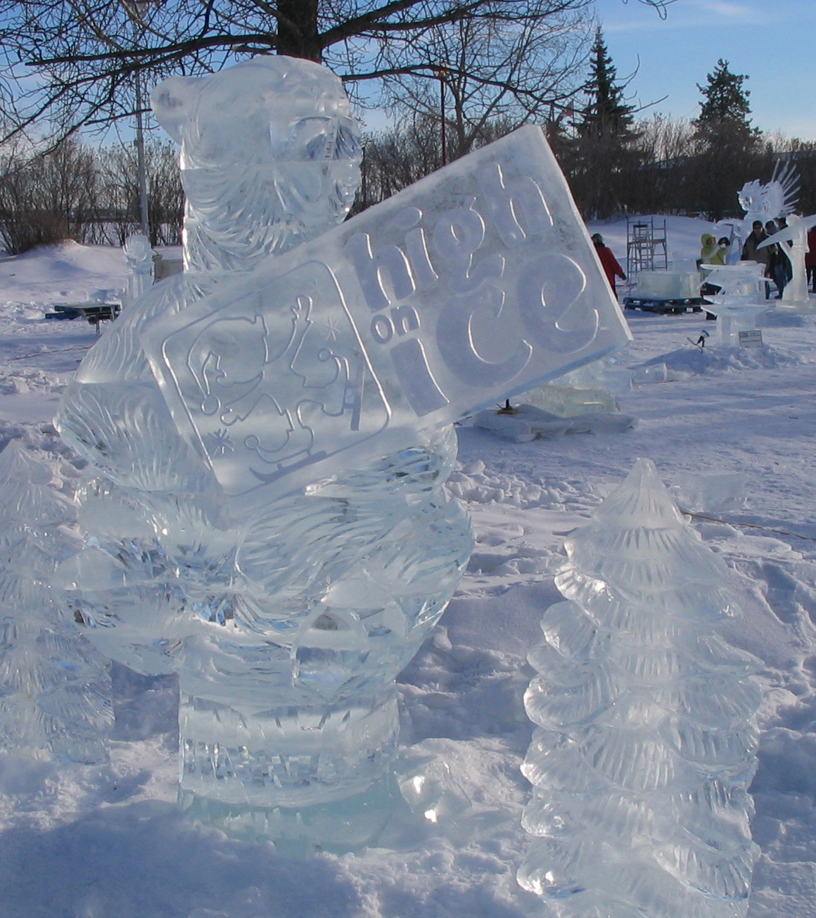
Fort St. John hosted the BC Winter Games in 1984 and 2020, and the Northern BC Winter Games in 1975, 1976, 1994, 2000, and 2007. Previously, the Great Canadian Welding Competition is held in Fort St. John, which sees welding artists fill Centennial Park creating statues on the year's given theme. In February, the annual Winter Fest has a frozen Centennial Park filled with ice sculptures, ice slides, and other special winter-related activities occurring around town.
Government
The City of Fort St. John has a council-manager form of municipal government. A six-member council, along with one mayor, is elected at-large every four years. In the 2022 Local Government General Election, Lilia Hansen was elected mayor, replacing the former mayor, Lori Ackerman, who had served as mayor since 2011.The mayor and one city councillor represent Fort St. John on the board of directors of the Peace River Regional District. Seven board of education trustees, for representation on School District 60 Peace River North, are also elected by residents.
Fort St. John is situated in the Peace River North provincial electoral district and is represented by Jordan Kealy in the Legislative Assembly of British Columbia. Replacing Pat Pimm who replaced long-time MLA Richard Neufeld who was first elected as a Member of the Legislative Assembly in the 1991 provincial election with the BC Social Credit Party taking 56% of votes cast at the Fort St. John polls and re-elected with Reform BC in 1996 with 44% support, and with the BC Liberal Party in 2001 and 2005 with 73% and 59% of Fort St. John polls, respectively. He has served as the Minister of Energy, Mines and Petroleum Resources since 2001.
Federally, Fort St. John is located in the Prince George—Peace River riding, which is represented in the House of Commons by Conservative Party Member of Parliament Bob Zimmer, a former high school teacher who lives in Fort St. John. Prior to Zimmer, the riding had been represented by long-time MP Jay Hill, who was born and raised in Fort St. John, and first elected in 1993 and subsequently re-elected in 1997, 2000, and 2004 with 74%, 77%, support from Fort St. John polls, respectively. Hill was also re-elected in the 2006 and 2008 federal elections. Hill had served as the Government House Leader and was formerly the Secretary of State and Chief Government Whip, as well as the Whip of the Canadian Alliance Party. Before Hill the riding was represented, from 1972 to 1993, by Frank Oberle of the Progressive Conservative Party who served as Minister of State for Science and Technology from 1985 to 1989 and Minister of Forestry from 1990 to 1993.
| Lois Boone | Hilary Crowley | Ben Levine | Jeremy Cote |locale%=45% |riding%=54%}} | Arthur Hadland | Jackie Allen |locale%=25% |riding%=40%}}
Police

Police protection is contracted to the Royal Canadian Mounted Police which operates a 26 officer municipal detachment and a 10-member rural detachment from the city. In 2005, the municipal detachment reported Criminal Code offences, which translates into a crime rate of 228 offences per 1,000 people, much higher than the provincial average of 125 offences. During that year, compared to the provincial average, the RCMP reported much higher crime rates in Fort St. John for cocaine, cannabis, non-sexual assaults, property damage, and arson related offences. However, the city had lower crime rates for robbery, theft from motor vehicles, and business break-and-enters.
Infrastructure

Fort St. John is the transportation hub of the region. The main highway, Highway 97 (Alaska Highway), built in 1942 by the United States Army, runs through the city, north to Fort Nelson, the Yukon, and Alaska. Within the city the streets are laid out in a grid pattern. The main streets are the north–south 100 Street and the east–west 100 Avenue. The rail line that runs by the eastern and northern borders was extended from Chetwynd by the Pacific Great Eastern Railway with the first train arriving in 1958. The only commercial airport between Dawson Creek and Fort Nelson is the Fort St. John Airport (CYXJ) located a few miles east of the city. The two runway airport has Air Canada Jazz, WestJet and other smaller airlines such as Central Mountain Air and Swanberg Air with regularly scheduled flights and North Cariboo Air providing chartered flights. Greyhound Bus lines, which had a bus stop in the city, operated a route along the highway, north to Whitehorse (via Fort Nelson) and south to Dawson Creek, until the company stopped operations in Western Canada in 2018. BC Bus North provides bus service to Dawson Creek, Prince George, and Fort Nelson.
The city's water and sewer infrastructure pumps water from 4 deep wells located near the Peace River with a backup source being Charlie Lake; it is filtered, chlorinated and fluoridated before being distributed. The water has been rated by the BC Ministry of Environment as being "Very hard." Sewage is processed in one of two lagoons. The lagoon south of the city releases the processed effluent into the Peace River and the lagoon north of the city releases into the Beatton River. Storm sewers run with the sanitary sewers but storm discharge is directed into the rivers without going through the lagoons. The city's fire department consists of volunteer and professional members, covering the city plus five miles (8 km) into the rural areas.
Education
There are 9 public schools within the city limits, with one being a secondary school, and another 10 outside of Fort St. John that are all administered by School District 60 Peace River North. There is one private Christian school in Fort St. John, also administered by School District 60 Peace River North. Northern Lights College has a campus in Fort St. John housing the B.C. Centre of Training Excellence in Oil and Gas, which includes a full-sized oil rig and simulated well site. The 2001 Census estimated that 10% of people in Fort St. John between 20 and 64 years old graduated from a university, less than half of the 24% provincial average and 27% did not graduate from secondary school, 7% higher than the provincial average. A survey released in 2023 showed that the C. M. Finch School had the highest academic performance in Fort St. John, with an overall rating of 7.5 out of ten for the 2021/2022 school year and an overall rating of 7.4 out of ten in the past five years. The same survey showed that the Margaret Ma Murray Community School had the lowest academic performance in Fort St. John, with an overall rating of 4.2 out of ten for the 2021/2022 school year.
Media
The Alaska Highway News is published in Fort St. John. The EnergeticCity.ca website is a digital news outlet focused on local news in and around Fort St. John; it is owned by 0914126 B.C. Ltd., which is controlled 100% by Adam Reaburn, owner of local radio station CKFU-FM.
Radio stations broadcasting from Fort St. John include 98.5 GO FM (CHRX-FM) (Adult contemporary), 101.5 FM The Goat(CKNL-FM) (Rock), 92.5 Sunrise FM (CIAM-FM) (Religious) and the aforementioned country music station 100.1 Moose FM (CKFU-FM).
Freedom of the City
The following People and Military Units have received the Freedom of the City of Fort St. John.
Individuals
- Charles “Bud” Hamilton: 7 December 1979.
- William James "Jim" Eglinski: 24 June 2019.
- The Honourable Senator Richard Neufeld: 24 June 2019.
- Jean Leahy: 9 September 2019.
- Sue Popesku: 11 June 2022.
- Steve Thorlakson: 15 July 2025
Military Units
- 2276 Royal Canadian Army Cadets: 10 April 2006.
Notes
References
Sources
References
- (May 28, 2012). "Focus on Geography Series, 2016 Census)". [[Statistics Canada]].
- (July 1, 2020). "BC Gov Stats)". BC Gov Stats.
- {{Cite cgndb. JAGPB. Fort St. John
- "Parks Canada – Fort St. John National Historic Site of Canada".
- BC Stats, Municipal Census Populations, 1921–1971.
- Preprost, Matt. (2022-09-08). "'But where is her crown?': The day the Queen came to Fort St. John".
- Chepkemoi, Joyce. (25 April 2017). "Facts About the Canadian Prairie Provinces".
- "Products and Services".
- BC Stats, Municipal Census Populations, 1976–1986.
- BC Stats, Municipal Census Populations, 1986–1996.
- BC Stats, Municipal Census Populations, 1996–2006.
- (February 9, 2022). "Population and dwelling counts: Canada, provinces and territories, and census subdivisions (municipalities), British Columbia". [[Statistics Canada]].
- (April 2024)
- Government of Canada, Statistics Canada. (2021-10-27). "Census Profile, 2016 Census".
- Government of Canada, Statistics Canada. (2015-11-27). "NHS Profile".
- Government of Canada, Statistics Canada. (2019-08-20). "2006 Community Profiles".
- Government of Canada, Statistics Canada. (2019-07-02). "2001 Community Profiles".
- Government of Canada, Statistics Canada. (2019-06-04). "Electronic Area Profiles Profile of Census Divisions and Subdivisions, 1996 Census".
- Government of Canada, Statistics Canada. (2022-10-26). "Census Profile, 2021 Census of Population".
- KPMG (October 29, 2004). [http://www.em.gov.bc.ca/Publicinfo/OilGasStrategySupport_Materials/marketing_strategy/Service_Sector_Marketing_Strategy_20041029_FIN.PDF Marketing Strategy for the BC: Oil and Gas Service Sector] {{dead link. (October 2021)
- "Fort St. John facility information {{!}} Northern Health".
- "Medical Imaging {{!}} Northern Health".
- "Fort St John Museum website".
- link. (2012-05-08 , retrieved 2012-08-17)
- "Elections".
- Peace River Regional District [http://www.peaceriverrd.bc.ca/board/ Board of Directors] {{webarchive. link. (2009-09-05 , ''Board of Directors'' 22 February 2006)
- School District No. 60 (British Columbia) [http://www.prn.bc.ca/bp/BYL405.pdf BY-LAW NO. 4/05] {{webarchive. link. (2007-10-29 , ''School District No. 60 (Peace River North)'', February 22, 2006.)
- "Board of Trustees". SD60.
- Elections BC (1991) [http://www.elections.bc.ca/elections/sov91/sov91-68.html Peace River North Electoral District Poll-by-Poll Results] {{webarchive. link. (2008-05-07 , ''Statement of Votes, 1991'', February 22, 2006.)
- Elections BC (1996) [http://www.elections.bc.ca/elections/sov96/va/sov96_pcn.htm Peace River North Electoral District] {{webarchive. link. (2008-05-07 , ''Statement of Votes, 1996'', February 22, 2006.)
- Elections BC (2001) [http://www.elections.bc.ca/elections/sov01/pcn.pdf Peace River North Electoral District] {{webarchive. link. (2008-04-11 , ''Statement of Votes, 2001'', February 22, 2006.)
- Elections BC (2005) [http://www.elections.bc.ca/elections/sov05/pcs.pdf Peace River South Electoral District (pdf)] {{webarchive. link. (September 27, 2006 , ''Statement of Votes, 2005'', November 18, 2005.)
- link. (7 December 2006 , ''Elections Canada On-Line). General Information'', January 22, 2006. (Requires user to download database).
- link. (9 March 2021 , ''Official Voting Results/Résultats officiels du scrutin'', November 18, 2005. (Requires navigation to Prince George—Peace River))
- Library of Parliament (2006) [https://wayback.archive-it.org/all/20071227133356/http://www2.parl.gc.ca/parlinfo/Redirect.aspx?BrowserType=ia_archiver&BronkenLink=&Querrystring=404;http%3A//www.parl.gc.ca/information/about/people/key/bio.asp?Language%3DE%26query%3D1486%26s%3D Oberle, The Hon. Frank, P.C.], ''Federal Political Experience'', January 22, 2006.
- (2011). "Forty-First General Election". Elections Canada.
- (2009). "Peace River South Electoral District". Elections BC.
- Police Services Division, pp. 101, 106–110, 151, 154.
- Police Services Division, Ministry of Public Safety and Solicitor General, Province of British Columbia (2005) [http://www.pssg.gov.bc.ca/police_services/publications/summary_statistics/appendices/Appendix_A.pdf Municipal and Provincial Police Strength, 1996–2005] page 97. ISSN 1198-9971. {{webarchive. link. (December 26, 2005)
- Police Services Division, Ministry of Public Safety and Solicitor General, Province of British Columbia (2005) [http://www.pssg.gov.bc.ca/police_services/publications/ Police and Crime: Summary Statistics: 1995 – 2004] {{Webarchive. link. (13 August 2007 , pages 106–110, 151, 154. ISSN 1198-9971)
- (9 July 2018). "Greyhound Canada to end routes in Prairies, B.C.". Global News.
- "Assessment of the Fort St. John Drinking Water Supply: Source Water Characteristics".
- (2023-04-16). "About Us".
- Lueneberg, Dave. (7 June 2022). "Sue Popesku to be honoured with Freedom of the City award".
- (2025-07-15). "City honours Steve Thorlakson with Freedom of the City Award".
- "Freedom of the City Policy".
This article was imported from Wikipedia and is available under the Creative Commons Attribution-ShareAlike 4.0 License. Content has been adapted to SurfDoc format. Original contributors can be found on the article history page.
Ask Mako anything about Fort St. John, British Columbia — get instant answers, deeper analysis, and related topics.
Research with MakoFree with your Surf account
Create a free account to save articles, ask Mako questions, and organize your research.
Sign up freeThis content may have been generated or modified by AI. CloudSurf Software LLC is not responsible for the accuracy, completeness, or reliability of AI-generated content. Always verify important information from primary sources.
Report