From Surf Wiki (app.surf) — the open knowledge base
Fifth Street, Texas
| Field | Value | |
|---|---|---|
| official_name | Fifth Street, Texas | |
| settlement_type | Census-designated place | |
| motto | ||
| image_seal | ||
| pushpin_label_position | left | |
| pushpin_map_caption | Location within the state of Texas | |
| pushpin_mapsize | -- | |
| image_map | FortBend County FifthStreet.svg | |
| mapsize | 300px | |
| map_caption1 | ||
| subdivision_type | Country | |
| subdivision_name | United States | |
| subdivision_type1 | State | |
| subdivision_name1 | Texas | |
| subdivision_type2 | County | |
| subdivision_name2 | Fort Bend | |
| established_date | ||
| unit_pref | Imperial | |
| area_total_km2 | 2.09 | |
| area_land_km2 | 2.05 | |
| area_water_km2 | 0.04 | |
| area_water_sq_mi | ||
| population_as_of | 2020 | |
| population_total | 2284 | |
| population_density_km2 | auto | |
| population_density_sq_mi | ||
| timezone | Central (CST) | |
| utc_offset | -6 | |
| timezone_DST | CDT | |
| utc_offset_DST | -5 | |
| elevation_ft | 76 | |
| coordinates | ||
| postal_code_type | ZIP code | |
| postal_code | 77477 (Stafford) | |
| blank_name | FIPS code | |
| blank_info | 48-25795 | |
| blank1_name | GNIS feature ID | |
| blank1_info | 1852706 |
Fifth Street is a census-designated place (CDP) located in the extraterritorial jurisdiction of Stafford within Fort Bend County, Texas, United States. The population was 2,284 at the 2020 census. Fifth Street is within the ZIP code 77477. Therefore, residents of Fifth Street have an address of Stafford, Texas.
History
By the 1980s, the development or at minimum, the name "Fifth Street" existed. In 2000, it had 2,059 residents. It is a bedroom community of Houston.
Geography
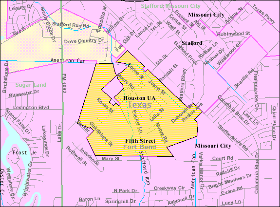
Fifth Street is in northeastern Fort Bend County, near the border with Harris County and between Missouri City and Stafford. Downtown Houston is 20 mi to the northeast.
Fifth Street is located at . According to the United States Census Bureau, the CDP has a total area of 2.1 km2, of which 0.04 sqkm, or 1.86%, is water.
Demographics
|align-fn=center 1850–1900 1910 1920 1930 1940
1950 1960 1970 1980 1990 2000 2010 2020
Fifth Street first appeared as a census designated place in the 2000 U.S. census.
2020 census
| Race / Ethnicity (NH = Non-Hispanic) | title=P004: Hispanic or Latino, and Not Hispanic or Latino by Race – 2000: DEC Summary File 1 – Fifth Street CDP, Texas | url=https://data.census.gov/table?g=160XX00US4825795&tid=DECENNIALSF12000.P004 | website=United States Census Bureau | access-date= }} | title=P2: Hispanic or Latino, and Not Hispanic or Latino by Race – 2010: DEC Redistricting Data (PL 94-171) – Fifth Street CDP, Texas | url=https://data.census.gov/cedsci/table?q=p2&g=160XX00US4825795&tid=DECENNIALPL2010.P2 | website=United States Census Bureau | access-date= }} | % 2000 | % 2010 |
|---|---|---|---|---|---|---|---|---|---|---|
| White alone (NH) | 90 | 61 | 42 | 4.37% | ||||||
| Black or African American alone (NH) | 104 | 48 | 42 | 5.05% | ||||||
| Native American or Alaska Native alone (NH) | 1 | 0 | 3 | 0.05% | ||||||
| Asian alone (NH) | 2 | 4 | 5 | 0.10% | ||||||
| Native Hawaiian or Pacific Islander alone (NH) | 0 | 0 | 0 | 0.00% | ||||||
| Other race alone (NH) | 0 | 11 | 4 | 0.00% | ||||||
| Mixed race or Multiracial (NH) | 2 | 5 | 6 | 0.10% | ||||||
| Hispanic or Latino (any race) | 1,860 | 2,357 | 2,182 | 90.34% | ||||||
| Total | 2,059 | 2,486 | 2,284 | 100.00% |
2000 census
As of the census of 2000, there were 2,059 people, 503 households, and 422 families residing in the CDP. The population density was 2,536.8 PD/sqmi. There were 537 housing units at an average density of 661.6 /sqmi. The racial makeup of the CDP was 50.90% White, 5.15% African American, 0.15% Native American, 0.10% Asian, 0.05% Pacific Islander, 41.23% from other races, and 2.43% from two or more races. Hispanic or Latino of any race were 90.34% of the population.
There were 503 households, out of which 46.3% had children under the age of 18 living with them, 57.3% were married couples living together, 15.7% had a female householder with no husband present, and 16.1% were non-families. 9.3% of all households were made up of individuals, and 2.4% had someone living alone who was 65 years of age or older. The average household size was 4.09 and the average family size was 4.29.
In the CDP, the population was spread out, with 34.0% under the age of 18, 13.1% from 18 to 24, 32.3% from 25 to 44, 15.6% from 45 to 64, and 5.0% who were 65 years of age or older. The median age was 26 years. For every 100 females, there were 129.5 males. For every 100 females age 18 and over, there were 137.4 males.
The median income for a household in the CDP was $29,773, and the median income for a family was $34,740. Males had a median income of $26,310 versus $17,500 for females. The per capita income for the CDP was $9,697. About 20.4% of families and 21.8% of the population were below the poverty line, including 19.6% of those under age 18 and 22.6% of those age 65 or over.
Government and infrastructure
Fort Bend County does not have a hospital district. OakBend Medical Center serves as the county's charity hospital which the county contracts with.
Education

Fifth Street is within the Fort Bend Independent School District.
Most residents are zoned to: while some are zoned to Edgar Glover Elementary School. Two secondary schools in Missouri City, Missouri City Middle School and Thurgood Marshall High School, serve Fifth Street.
Before Armstrong opened in August 2008, Fifth Street was divided between Glover Elementary School, E.A. Jones Elementary School, and Quail Valley Elementary School. In 2008 Armstrong took most of Fifth Street.
Prior to April 18, 1959 an elementary school in Missouri City, now E. A. Jones, existed. Quail Valley Elementary School had been occupied by August 1975. Missouri City Junior High School opened in October 1975. Glover opened on August 17, 1994. Marshall High School opened on August 15, 2002. The rebuilt E. A. Jones opened on August 27, 2007. Armstrong opened on August 25, 2008. The rebuilt Missouri City Middle School opened in August 2008.
The Texas Legislature specifies that the Houston Community College (HCC) boundary includes "the part of the Fort Bend Independent School District that is not located in the service area of the Wharton County Junior College District and that is adjacent to the Houston Community College System District." Wharton College's boundary within FBISD is defined only as the City of Sugar Land and the ETJ of Sugar Land, and Fifth Street is not in the Sugar Land ETJ (it is in the Stafford ETJ).
Parks and recreation
Fort Bend County operates the 5 acre Stafford Community Center in Fifth Street.
References
References
- "2020 CENSUS - CENSUS BLOCK MAP: Fifth Street CDP, TX". [[U.S. Census Bureau]].
- "Fort Bend County Cities & ETJs". Fort Bend County.
- "[https://tshaonline.org/handbook/online/articles/hjf09 Fifth Street, Texas]." ''[[Handbook of Texas]]''. Retrieved on September 12, 2011.
- (2011-02-12). "US Gazetteer files: 2010, 2000, and 1990". [[United States Census Bureau]].
- (April 2020}}{{cbignore). "Geographic Identifiers: 2010 Demographic Profile Data (G001): Fifth Street CDP, Texas". U.S. Census Bureau, American Factfinder}}{{dead link.
- "Decennial Census by Decade". [[US Census Bureau]].
- "1900 Census of Population - Population of Texas By Counties And Minor Civil Divisions".
- "1910 Census of Population - Supplement for Texas".
- "1920 Census of Population - Number of Inhabitants - Texas".
- "1930 Census of Population - Number of Inhabitants - Texas".
- "1940 Census of Population - Number of Inhabitants - Texas".
- "1950 Census of Population - Number of Inhabitants - Texas".
- "1960 Census of Population - Number of Inhabitants - Texas".
- "1970 Census of Population - Number of Inhabitants - Texas".
- "1980 Census of Population - Number of Inhabitants - Texas".
- "1990 Census of Population - Population and Housing Unit Counts - Texas".
- "2000 Census of Population - Population and Housing Unit Counts - Texas".
- "2010 Census of Population - Population and Housing Unit Counts - Texas".
- (May 2023). "Census Bureau profile: Fifth Street, Texas". [[United States Census Bureau]].
- "P004: Hispanic or Latino, and Not Hispanic or Latino by Race – 2000: DEC Summary File 1 – Fifth Street CDP, Texas".
- "P2: Hispanic or Latino, and Not Hispanic or Latino by Race – 2010: DEC Redistricting Data (PL 94-171) – Fifth Street CDP, Texas".
- "P2: Hispanic or Latino, and Not Hispanic or Latino by Race – 2020: DEC Redistricting Data (PL 94-171) – Fifth Street CDP, Texas".
- "U.S. Census website". [[United States Census Bureau]].
- Knipp, Bethany. (2016-11-02). "Fort Bend County lacks hospital district". [[Community Impact Newspaper]].
- "2020 CENSUS - SCHOOL DISTRICT REFERENCE MAP: Fort Bend County, TX". [[U.S. Census Bureau]].
- Armstrong Elementary School,"[http://www.fortbend.k12.tx.us/about/zoning/Campus%20Maps/Elementary/Armstrong.pdf Armstrong Elementary Attendance Zone]{{Dead link. (August 2025)
- "[http://www.fortbend.k12.tx.us/about/zoning/Campus%20Maps/Elementary/Glover.pdf Glover Elementary School Attendance Zone]{{Dead link. (August 2025)
- "[http://www.fortbend.k12.tx.us/about/zoning/Campus%20Maps/Middle%20School/Missouri%20City.pdf Missouri City Middle School Attendance Zone]{{Dead link. (August 2025)
- "[http://www.fortbend.k12.tx.us/about/zoning/Campus%20Maps/High%20School/Marshall.pdf Marshall High School Attendance Zone]{{Dead link. (August 2025)
- "[http://www.fortbend.k12.tx.us/about/history.cfm FBISD History] {{webarchive. link. (September 7, 2008 ." [[Fort Bend Independent School District]]. Retrieved on September 12, 2011.)
- "[https://web.archive.org/web/20051029052358/http://www.fortbend.k12.tx.us/cmf/var/tidbits/Tidbits_parentlinks_20050714_1026.pdf Elementary School Attendance Zones]." [[Fort Bend Independent School District]]. October 29, 2005. Retrieved on September 12, 2011.
- "[https://web.archive.org/web/20061006021602/http://www.fortbend.k12.tx.us/cmf/var/tidbits/Tidbits_parentlinks_20060628_0950.pdf 2006-2007 Elementary School Attendance Zones]." [[Fort Bend Independent School District]]. October 6, 2006. Retrieved on September 12, 2011.
- "[https://web.archive.org/web/20090227010808/http://www.fortbend.k12.tx.us/cmf/var/tidbits/Tidbits_parentlinks_20080818_1302.pdf Elementary School Attendance Zones]." [[Fort Bend Independent School District]]. February 27, 2009. Retrieved on September 12, 2011.
- "Sec. 130.182. HOUSTON COMMUNITY COLLEGE SYSTEM DISTRICT SERVICE AREA.".
- "Sec. 130.211. WHARTON COUNTY JUNIOR COLLEGE DISTRICT SERVICE AREA.".
- link. (2011-06-04 ." Fort Bend County. Retrieved on October 11, 2009.)
This article was imported from Wikipedia and is available under the Creative Commons Attribution-ShareAlike 4.0 License. Content has been adapted to SurfDoc format. Original contributors can be found on the article history page.
Ask Mako anything about Fifth Street, Texas — get instant answers, deeper analysis, and related topics.
Research with MakoFree with your Surf account
Create a free account to save articles, ask Mako questions, and organize your research.
Sign up freeThis content may have been generated or modified by AI. CloudSurf Software LLC is not responsible for the accuracy, completeness, or reliability of AI-generated content. Always verify important information from primary sources.
Report