From Surf Wiki (app.surf) — the open knowledge base
El Paso County, Colorado
County in Colorado, United States

County in Colorado, United States
| Field | Value | |
|---|---|---|
| county | El Paso County | |
| state | Colorado | |
| flag | El Paso County, CO Flag.gif | |
| seal | El Paso County, CO Seal.png | |
| founded date | November 1 | founded year = 1861 |
| seat wl | Colorado Springs | |
| largest city wl | Colorado Springs | |
| coordinates | ||
| area_total_sq_mi | 2130 | |
| area_land_sq_mi | 2127 | |
| area_water_sq_mi | 2.7 | |
| area percentage | 0.1% | |
| population_as_of | 2020 | |
| population_total | 730395 | |
| pop_est_as_of | 2024 | |
| population_est | 752772 | |
| density_sq_mi | auto | |
| time zone | Mountain | |
| web | www.elpasoco.com | |
| named for | Spanish name for The Pass | |
| ex image | El Paso County Justice Center by David Shankbone.jpg | |
| ex image cap | El Paso County Justice Center | |
| district | 4th | |
| district2 | 5th | |
| district3 | 7th |

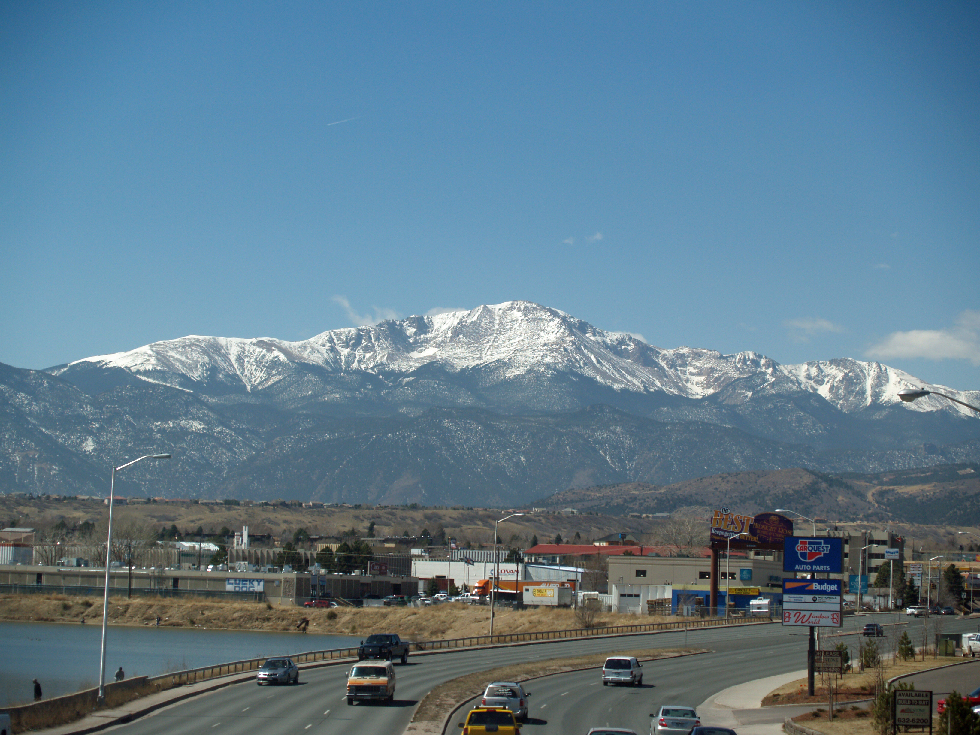
El Paso County is the most populous county in the U.S state of Colorado. As of the 2020 census, the population was 730,395, surpassing the city and county of Denver. The county seat is Colorado Springs, the second most populous city in Colorado. El Paso County is included in the Colorado Springs, Colorado, Metropolitan Statistical Area.
History
In July 1858, gold was discovered along the South Platte River in Arapahoe County, Kansas Territory. This discovery precipitated the Pike's Peak Gold Rush. Many residents of the mining region felt disconnected from the remote territorial governments of Kansas and Nebraska, so they voted to form their own Territory of Jefferson on October 24, 1859. The following month, the Jefferson Territorial Legislature organized 12 counties for the new territory including El Paso County. El Paso County was named for the Spanish language name for Ute Pass north of Pikes Peak. Colorado City served as the county seat of El Paso County.
The Jefferson Territory never received federal sanction, but on February 28, 1861, U.S. President James Buchanan signed an act organizing the Territory of Colorado. El Paso County was one of the original 17 counties created by the Colorado legislature on November 1, 1861. Part of its western territory was broken off to create Teller County in 1899. Originally based in Old Colorado City (now part of Colorado Springs, not today's Colorado City between Pueblo and Walsenburg), El Paso County's county seat was moved to Colorado Springs in 1873.
Geography

According to the United States Census Bureau, the county has a total area of 2130 sqmi, of which 2127 sqmi are land and 2.7 sqmi (0.1%) are covered by water.
Adjacent counties
- Douglas County - north
- Elbert County - northeast
- Lincoln County - east
- Crowley County - southeast
- Pueblo County - south
- Fremont County - southwest
- Teller County - west
Major highways
National protected area
- Pike National Forest
State protected area
- Cheyenne Mountain State Park
Historic sites
- Pikes Peak National Historic Landmark
- USAFA Cadet Area National Historic District
- Old Colorado City (National Register of Historic Districts)
- Manitou Springs (National Register of Historic Districts)
Trails
- American Discovery Trail
- Barr National Recreation Trail
- Bear Creek Cañon Park
- Bear Creek Regional Park and Nature Center
- Calhan Paint Mines
- Fountain Creek Nature Center
- The Incline
- New Santa Fe Trail
- Pikes Peak Greenway
- White House Ranch National Recreation Trail
Demographics
|align-fn=center 1790–1960 1900–1990 1990–2000 2010-2020
2020 census
As of the 2020 census, the county had a population of 730,395, distributed in 272,683 households and 185,830 families; the population density was 343.5 /mi2.
Of the residents, 23.5% were under the age of 18 and 13.7% were 65 years of age or older; the median age was 35.2 years. For every 100 females there were 100.7 males, and for every 100 females age 18 and over there were 99.3 males. 89.7% of residents lived in urban areas and 10.3% lived in rural areas.
The racial makeup of the county was 70.8% White, 6.0% Black or African American, 1.0% American Indian and Alaska Native, 3.1% Asian, 0.4% Native Hawaiian and Pacific Islander, 5.9% from some other race, and 12.8% from two or more races. Hispanic or Latino residents of any race comprised 17.8% of the population.
There were 272,683 households in the county, of which 32.4% had children under the age of 18 living with them and 23.6% had a female householder with no spouse or partner present. About 24.5% of all households were made up of individuals and 8.6% had someone living alone who was 65 years of age or older.
There were 287,459 housing units, of which 5.1% were vacant. Among occupied housing units, 65.6% were owner-occupied and 34.4% were renter-occupied. The homeowner vacancy rate was 0.9% and the rental vacancy rate was 6.2%.
The population pyramid for El Paso County shows a slight surplus of males aged between birth and 45 years, with a slight surplus of females over age 45, as is typical of most American populations. The greater than normal surplus of males between 18 and 35 is chiefly attributable to the presence of five military installations in the county.

Education
K-12 Education
El Paso County is home to 17 public school districts, in addition to several private schools.
School districts include:
- Academy School District 20
- Big Sandy School District 100J
- Calhan School District RJ-1
- Cheyenne Mountain School District 12
- Colorado Springs School District 11
- Edison School District 54-JT
- Ellicott School District 22
- Fremont RE-2 School District
- Fountain School District 8
- Hanover School District 28
- Harrison School District 2
- Manitou Springs School District 14
- Miami-Yoder School District 60-JT
- Lewis-Palmer School District 38
- Peyton School District 23-JT
- School District 49
- Widefield School District 3
Higher Education
El Paso County is home to several colleges and universities. The United States Air Force Academy is located immediately north of Colorado Springs, serving as both a university and a functional U.S. Air Force base. Also in the county are the University of Colorado–Colorado Springs, Colorado College, Pikes Peak State College, Colorado Technical University, and IntelliTec College, all located in Colorado Springs.
Government

El Paso County is located in Colorado's 5th congressional district, except for the far eastern extremities, which are located in the 4th. The county is governed by a board of county commissioners. Its current members are Holly Williams in district 1, Carrie Geitner in district 2, Bill Wysong in district 3, Cory Applegate in district 4, and Lauren Nelson in district 5.
In 2004, the voters of Colorado Springs and El Paso County established the Pikes Peak Rural Transportation Authority (PPRTA) and adopted a 1% sales tax dedicated to improving the region's transportation infrastructure. Together with state funding for COSMIX (2007 completion) and the I-25 interchange with Highway 16 (2008 completion), significant progress has been made since 2003 in addressing the transportation needs of the area. In 2012, the county voted to legalize marijuana. On March 12, 2019, the county commissioners unanimously passed a resolution to become a Second Amendment sanctuary.
The Colorado Department of Corrections has its headquarters in an unincorporated area in the county.
| Office | Name | |
|---|---|---|
| County Commissioner District 1 | Holly Williams (R) | |
| County Commissioner District 2 | Carrie Geitner (R) | |
| County Commissioner District 3 | Bill Wysong (R) | |
| County Commissioner District 4 | Cory Applegate (R) | |
| County Commissioner District 5 | Lauren Nelson (R) | |
| County Assessor | Mark Flutcher (R) | |
| County Clerk and Recorder | Steve Schleiker (R) | |
| County Coroner | Emily Russell-Kinsley (Unknown) | |
| Sheriff | Joe Roybal (R) | |
| County Surveyor | Richard Mariotti (R) | |
| County Treasurer | Chuck Broerman (R) |
El Paso County lies within the 4th Judicial District which is represented by District Attorney Michael Allen.
Top employers
According to its 2022 Comprehensive Annual Financial Report, El Paso County's largest employers are:
| # | Employer | # of Employees | Percentage |
|---|---|---|---|
| 1 | Fort Carson | 36,000 | 9.35% |
| 2 | Peterson Space Force Base | 10,650 | 2.77% |
| 3 | Schriever Space Force Base | 8,000 | 2.08% |
| 4 | United States Air Force Academy | 7,650 | 1.99% |
| 5 | UCHealth Memorial Health Services | 6,000 | 1.56% |
| 6 | The Charter Spectrum West Region | 4,900 | 1.27% |
| 7 | Amazon | 4,800 | 1.25% |
| 8 | Penrose Hospital | 3,560 | 0.92% |
| 9 | Colorado Springs School District 11 | 3,300 | 0.86% |
| 10 | Academy School District 20 | 3,150 | 0.82% |
| Total | 88,010 | 22.87% |
Politics
El Paso is quite conservative for a large urban county, although it has become less so since the 2010s. Its conservative bent predates the influence of its large military and Evangelical Christian populations. Since its creation in 1871, El Paso County has typically voted for the Republican presidential candidate in presidential elections; the last Democratic nominee to win the county was Lyndon B. Johnson in 1964. Even then, Barry Goldwater got nearly 46% of the county's vote. It has voted Republican in every presidential election since 1920, except for the Democratic landslides of 1936 and 1964.
After Johnson carried it in 1964, a Democrat would not win 40 percent of the county's vote again until Joe Biden in 2020. Kamala Harris also received above 40% of the county in 2024, with the county swinging to the left unlike the state and country. The county still remains a Republican stronghold, but less overwhelmingly so than in years past. The county also voted in favor of 2024 Colorado Amendment 79. Democratic strength is concentrated in the inner portion of Colorado Springs.
Dick Lamm in 1982 remains the last Democrat to win the county in a gubernatorial election. Eight years later, the county was one of only four in the state to back governor Roy Romer's opponent John Andrews. Jared Polis in 2022 came within 4% of winning the county. The last Democrat to win the county in a Senate election was Gary Hart in 1974.
Libraries
The Pikes Peak Library District provides library services through its 15 branches and bookmobiles to the residents of El Paso County, with the exception of Widefield School District 3. The mission of the District is "Providing resources and opportunities that impact individual lives and build community. Seek. Engage. Transform."
Military installations
El Paso County is home to Army, Air Force and Space Force bases. These military installations border Colorado Springs to the north, south, and east, aside from Schriever Space Force Base, which is located about 10 miles east of Peterson Space Force Base.
Fort Carson
Main article: Fort Carson
Fort Carson, "The Mountain Post", is located just south of Colorado Springs at the base of the Rocky Mountains. It was established in 1942, following Japan's attack on Pearl Harbor. The city of Colorado Springs purchased land south of the city and donated it to the War Department. Construction began immediately and the first building, the camp headquarters, was completed January 31, 1942. Camp Carson was named in honor of the legendary Army scout Gen. Christopher "Kit" Carson, who explored much of the West in the 1800s. Camp Carson became Fort Carson in 1954. An additional training area was purchased in September 1983 and is called Piñon Canyon Maneuver Site (PCMS).
Currently, Fort Carson is the home of 4th Infantry Division and several other units, including 10th Special Forces Group (Airborne), the Colorado National Guard Regional Training Institute and PCMS, which is a maneuver training site for Fort Carson located near Trinidad, Colorado. The installation totals about 137,000 acres and PCMS is roughly 236,000 acres. Fort Carson has around 3,000 family housing units and 66 soldier barracks with 8,132 rooms. Services on the installation include four elementary schools, one middle school, a commissary, an exchange, and Evans Army Community Hospital, as well as Army Community Service facilities to include child development centers and youth centers and family morale, welfare, and recreation facilities to include a bowling alley, golf course, and numerous parks.
Fort Carson's economic impact on Colorado Springs and the surrounding communities was approximately $2.3 billion during fiscal year 2014. Fort Carson has about 24,300 soldiers on the installation, with 44,700 family members. The installation also has around 8,000 veterans and 3,300 civilians.
Peterson Space Force Base
Main article: Peterson Space Force Base
The Space Force has critical aspects of their service based at Colorado Springs, which carry on missile defense operations and development. The Space Force bases a large section of its national missile defense operations here, with Peterson Space Force Base set to operate large sections of the program. The base is also home to Space Force's Space Operations Command, and to NORAD headquarters. Peterson SFB is currently the headquarters of the operations-half of Army Space and Missile Defense Command/Army Strategic Command.
Peterson is also headquarters for the United States Northern Command, one of the Unified Combatant Commands, which directs all branches of the U.S. military operations in their area of responsibility, which includes the continental United States, Alaska, Canada, and Mexico. In the event of national emergencies, the President or Secretary of Defense can call upon the command for any required military assistance. Service members from every branch of the US military are stationed at the command.
Peterson SFB is the current, possibly temporary home for US Space Command, another Unified Combatant Command, whose area of operations is global operations occurring 50 miles or greater above the Earth.
Schriever Space Force Base (formerly Schriever AFB and Falcon AFB)
Main article: Schriever Space Force Base
Schriever Space Force Base is home to several Space Force mission Deltas, responsible for the operation and support of 175 Department of Defense satellites and installation support to 16 major tenant units, with a workforce of more than 7,700 personnel. It is the location of the Global Positioning System (GPS) master control station and GPS Operations Center and the US Naval Observatory Alternate Master Clock, used to synchronize GPS satellite time. Schriever is also developing parts of national missile defense and runs parts of the annual wargames used by the nation's military. The base indirectly contributes an estimated $1 billion to the local Colorado Springs, CO area annually.
United States Air Force Academy
Main article: United States Air Force Academy

Bordering the northwestern side of the city are the grounds of the United States Air Force Academy, where cadets train to become officers in the Air Force and Space Force. The campus is famous for its unique chapel, and draws visitors year round. Most of the Air Force Academy's sports programs participate in the Mountain West Conference.
Cheyenne Mountain Space Force Station (formerly Air Force Station)
Main article: North American Aerospace Defense Command
The North American Aerospace Defense Command (NORAD), headquartered on Peterson SFB, has a presence in Cheyenne Mountain Space Force Station. When it was built at the height of the Cold War, NORAD caused some anxiety for the residents in and around Colorado Springs, who believed the installation would be a primary target during a nuclear attack. Although NORAD still operates today, it is primarily given the task of the tracking of ICBMs, and the military has recently decided to place Cheyenne Mountain's NORAD/NORTHCOM operations on warm standby and move operations to nearby Peterson Air Force Base.
Communities
Cities
- Colorado Springs (county seat)
- Fountain
- Manitou Springs
Towns
- Calhan
- Green Mountain Falls
- Monument
- Palmer Lake
- Ramah
Census-designated places
- Air Force Academy
- Black Forest
- Cascade-Chipita Park
- Cimarron Hills
- Ellicott
- Fort Carson
- Gleneagle
- Peyton
- Rock Creek Park
- Security-Widefield
- Stratmoor
- Woodmoor
Other unincorporated communities
- Crystola
- Eastonville
- Falcon
- La Foret
- Rush
- Truckton
- Yoder
References
References
- "State & County QuickFacts". United States Census Bureau.
- "Find a County". National Association of Counties.
- (February 28, 1861). "An Act to provide a temporary Government for the Territory of Colorado". [[Thirty-sixth United States Congress]].
- (February 12, 2011). "US Gazetteer files: 2010, 2000, and 1990". [[United States Census Bureau]].
- "Annual Estimates of the Resident Population for Counties: April 1, 2020 to July 1, 2024". United States Census Bureau.
- "U.S. Decennial Census". United States Census Bureau.
- "Historical Census Browser". University of Virginia Library.
- "Population of Counties by Decennial Census: 1900 to 1990". United States Census Bureau.
- "Census 2000 PHC-T-4. Ranking Tables for Counties: 1990 and 2000". United States Census Bureau.
- (2023). "2020 Decennial Census Demographic and Housing Characteristics (DHC)".
- (2021). "2020 Decennial Census Demographic Profile (DP1)".
- (2021). "2020 Decennial Census Redistricting Data (Public Law 94-171)".
- (July 5, 2019). "English: El Paso County Colorado Population Pyramid".
- Geography Division. (December 17, 2020). "2020 CENSUS - SCHOOL DISTRICT REFERENCE MAP: El Paso County, CO". [[U.S. Census Bureau]].
- Breathes, William. (November 23, 2012). "Marijuana: Amendment 64 passes in El Paso County by fewer than a dozen votes".
- Riley, Rachel. (March 12, 2019). "El Paso County declared '2nd Amendment preservation county' as legislature weighs red flag gun bill". Colorado Politics.
- "[http://exdoc.state.co.us/secure/comboweb/weblets/index.php/contacts/fulllist Contacts]".{{Dead link. (August 2019)
- link. (December 1, 2010 . [[Colorado Springs, Colorado). City of Colorado Springs]]. Retrieved on December 7, 2009.
- "About".
- (March 20, 2024). "County of El Paso 2022 Comprehensive Annual Financial Report".
- Leip, David. "Dave Leip's Atlas of U.S. Presidential Elections".
- Leip, David. "Dave Leip's Atlas of U.S. Presidential Elections".
- Leip, David. "Dave Leip's Atlas of U.S. Presidential Elections".
- Leip, David. "Dave Leip's Atlas of U.S. Presidential Elections".
- "About PPLD {{!}} PPLD.org".
- [[Schriever Air Force Base]]
- "Fort Carson".
- "Schriever Air Force Base 50th Space Wing".
- "GPS Operations Center". Air Force Space Command.
- Staff Sgt. Don Branum. (June 15, 2006). "23:59:60...Atomic clock takes quantum leap". Air Force Space Command.
- "Schriever Air Force Base".
- themwc.com
- Finley, Bruce. (July 27, 2006). "Military to put Cheyenne Mountain on standby". The Denver Post.
This article was imported from Wikipedia and is available under the Creative Commons Attribution-ShareAlike 4.0 License. Content has been adapted to SurfDoc format. Original contributors can be found on the article history page.
Ask Mako anything about El Paso County, Colorado — get instant answers, deeper analysis, and related topics.
Research with MakoFree with your Surf account
Create a free account to save articles, ask Mako questions, and organize your research.
Sign up freeThis content may have been generated or modified by AI. CloudSurf Software LLC is not responsible for the accuracy, completeness, or reliability of AI-generated content. Always verify important information from primary sources.
Report